

Blacksmiths On The Canal: Nathaniel Fitch, Jr.
Find-A-Grave # 47218593
By Carolyn Schmidt with photos by Bob Schmidt
One of the unsung heroes of canal building was the blacksmith. Although we have lots of history about the canal officials, canal contractors, canal diggers, those who built the structures on the canal, the Irish, etc., little has been written about the importance of the blacksmith in constructing and maintaining the canal. We usually think of him as shoeing the horses and mules, sharpening the axes, picks and shovels, and perhaps repairing the carts used to haul the dirt. However, since there was no Sears Roebuck catalog or other ways to obtain the iron fittings for the locks, waste weirs, bridges, etc. that were part of the canal, the job fell to the blacksmith to heat raw iron and wield his hammer to make the lock irons. Lock irons was the general term for the wrought iron nails, spikes, straps, goon necks, pivots, etc. used in canal construction.
The blacksmith often would follow the line of the canal as it was being built so that he’d be near where his services were needed. For his work he only received $11 a month in comparison to the canal carpenter, who made $21, or a man with a team, who made $40 a month according to Bill Oeter and Nancy Gulick’s Miami & Erie Canal published in 2014.
One blacksmith was Nathaniel Fitch, Jr., who, according to several county histories, forged all the lock iron for the Wabash & Erie Canal from Fort Wayne to the Wabash River. He was born on July 9, 1808 in Falls, Luzerne, Pennsylvania near the banks of the Susquehanna River to Nathaniel Fitch (1781-1839) and Sarah Keeler (1785-1856). There he was reared, educated and worked at blacksmithing and gunsmithing. He also served a pilot on the rapids of the Susquehanna, a very dangerous job.
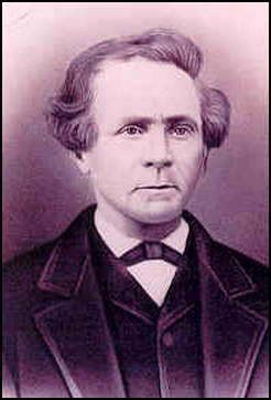
In 1832, as a young man of about 26, he left Pennsylvania with a rifle he had built for himself, a small bundle that held all his possessions that he thought he would need and 15 cents in his pocket. He traveled by lake and on foot to Allen county, Indiana by way of Michigan and stopped on the line of the Wabash & Erie Canal, which was then under construction between Fort Wayne and Logansport. His obituary says, “Here he found employment as a blacksmith, and worked on the locks and bridges, sharpening the picks and forging the lock irons.”
Nathaniel had not been in Indiana very long when he fell ill. His physician advised him to return to his home in Pennsylvania. He did so with great difficulty due to his illness making only three miles per day on foot.
He was not gone long before he returned to Indiana on horseback and began looking for a farm. In the fall of 1835 he obtained a homestead claim of 80 acres of government land in Perry township, two and one-half miles east of the village of Huntertown in Allen county where he lived for the rest of his life. He cleared the wilderness and succeeded in adding farm to farm over the years accumulating at one time twenty-three hundred acres. He also had land in Iowa. On his farm he established a blacksmith forge in 1837, the first set up in Perry township. He later owned and operated a saw-mill near the DeKalb county line and also developed a wool-carding business. He also served as a township trustee for a number of years.
On June 14, 1840 Nathaniel married Sarah Elizabeth DeLong (1818-Sept. 6, 1908) the daughter of George and Elizabeth DeLong. Several versions of their courtship can be found under Nathaniel Fitch in the Canal Biographies A-F found on this Canal Society of Indiana website. Over the years they had fifteen children of which thirteen were alive in 1877. They were:
Perry Fitch (Jan. 6, 1842-Apr. 18, 1900)
m. Sarah Elizabeth Gloyd, May 12, 1861
Jacob “Mathias” Fitch (Jan. 16, 1843-1923)
m. Francis Vandolah, Dec. 1, 1867
Mary Jane “Jennie” Fitch (Oct. 15, 1844-1925)
m. Levi Beers, Dec. 24, 1873
Charles Fitch (Mar. 29, 1846-1925)
m. Louisa N. Clubb, Apr. 12, 1868
Amos Fitch (Jun. 11, 1849-1935)
m. Nancy Elizabeth Hunter, Nov. 27, 1878
Francela “Frances” Fitch (Apr. 10, 1851-1925) twin
m.Christian Fair, Nov 26, 1874
Fitelia Fitch (Apr. 10,1851-1935) twin
m. Jerome Gloyd, Oct. 6, 1875
Harvey Fitch (Jul. 15, 1853-1948)
Sarah Elizabeth Fitch (1855-1958)
m. Irwin Stratton, Dec. 18, 1831
Allen Fitch (1857-1952)
m. Emeline Green , May 25, 1893
Ida Alice Fitch (1858-1945)
m. Melvin Arthur Mason, Oct. 8, 1891
Emmaline Fitch (1861-1949)
m. Allen Monroe Hartsell, Dec. 28, 1861
David Nathaniel Fitch (1865-1950)
m. Emma Belle Sterling (Stirlen), Jun. 1, 1878
Nancy Fitch died as a child on Sept. 1, 1848.
The name of the other child is unknown.
In 1856 Nathaniel, along with Jacdob Kell and George B. Gloyd, founded the Perry Centre Seminary. It gave a start to men and women during its five years of existence.
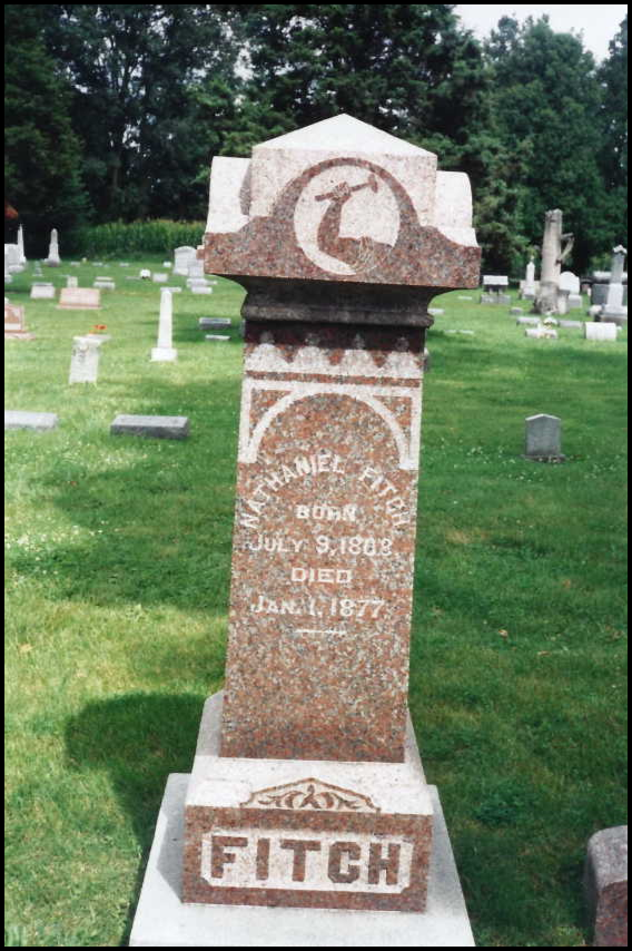
At the time of Nathaniel Fitch, Jr’s, death on January 1, 1877 in Fort Wayne, he was remembered for his well known ability to walk long distances. “He almost invariably made trips to and from his farm and Fort Wayne on foot,” according to The Pictorial History of Fort Wayne, Indiana. His obituary was in the January 4, 1877 issue of the Fort Wayne Daily Gazette. He was laid to rest in lot 244A of the Old Huntertown Cemetery in Huntertown, Indiana. His tombstone reflects his work as a blacksmith with an arm wielding a hammer at its top.
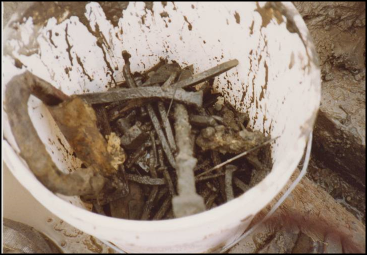
Did Nathaniel make any of the lock irons in the Gronauer Lock unearthed in 1991 or the Clear Creek Flood Gate unearthed in 1999? He may have done so for the Clear Creek Flood Gate since it was between Fort Wayne and the Wabash River, but probably not for the lock.
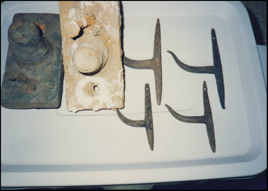
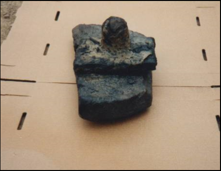
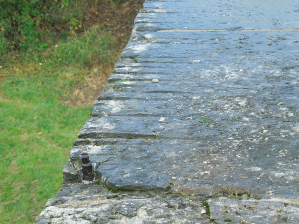
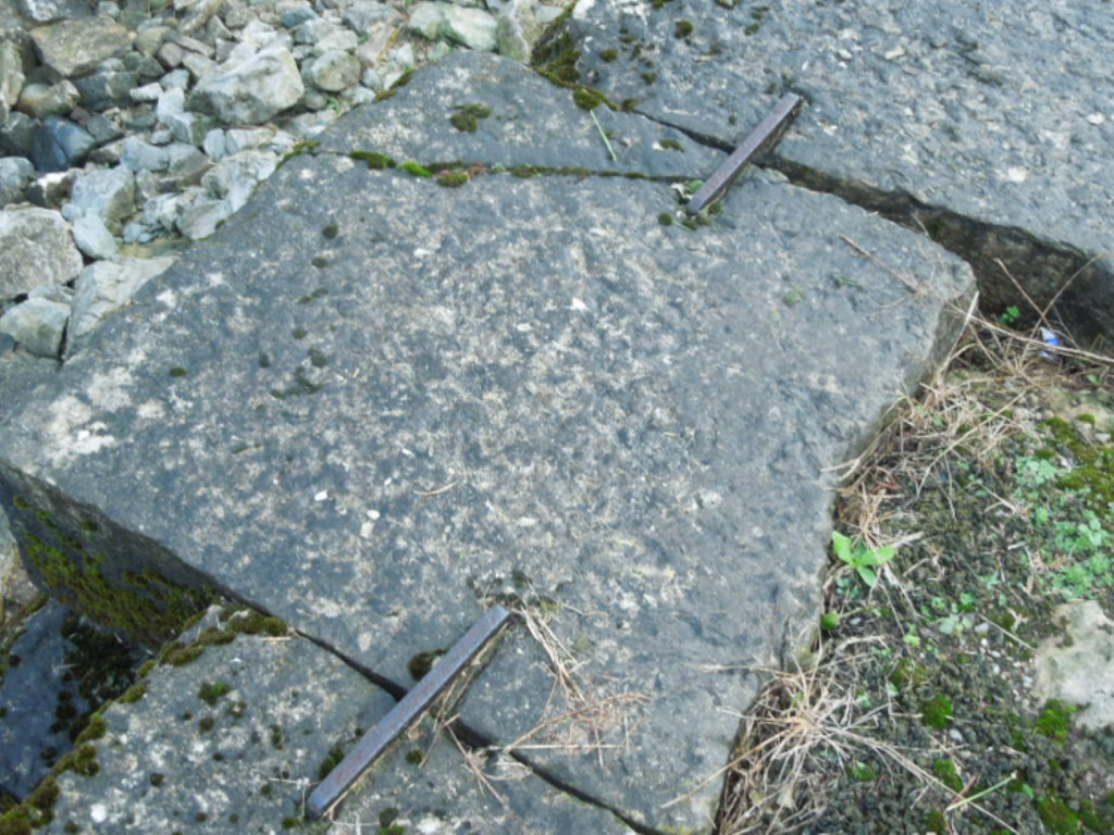
The Canal Society of Indiana learned a great deal about the construction of canal structures through the archaeological digs at both of these sites. Most common of the lock irons were the hand forged, square nails and large spikes. Other items included:
Gate collars made of a metal circular strap placed around the top part of a gate post to help hold the post in place.
Goon necks placed into the coping stones of a lock to hold the gate collar in place.
Pike pole tips that were at the end of a long pole and were used in steering or propelling a canal boat. They often had a hook on them to help pick up the towline.


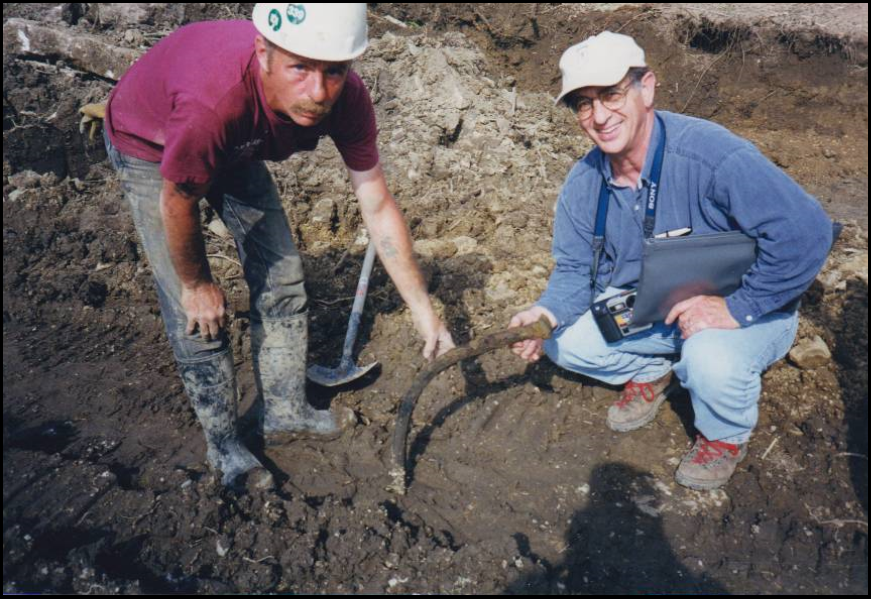

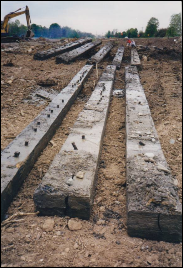
The timbers from the Clear Creek Flood Gate were fastened together with long wrought iron square nails and spikes as shown in these pictures:


Sources:
Ancestry.com, Public Member Trees – Nathaniel Fitch, Jr.
“Another Pioneer Gone,” Fort Wayne Daily Gazette. January 4, 1877.
Find-A-Grave Index, 1600s-Current – Nathaniel Fitch, Jr.
Griswold, B. J. The Pictorial History of Fort Wayne, Indiana. Chicago, IL: Robert O. Law Company, 1917.
Hahn, Thomas Swiftwater and Kemp Emory L. Canal Terminology of the United States. United States: West Virginia University Institute for the History of Technology and Industrial Archaeology, 1999.
“Nathaniel Fitch.” The Hoosier Packet. Ft. Wayne, IN: Canal Society of Indiana. March 2003.
Oeters, Bill and Gulick, Nancy. Miami & Erie Canal. United State: Arcadia Publishing. 2014.
U.S. Federal Census: 1850, 1860
Captain Pearl R. Nye (1872-1950)
Pearl R. Nye was born in 1872 on his family’s canal boat “Reform” on the Ohio and Eire Canal. His parents were Mr. & Mrs. William Nye, who eventually had eighteen children. Pearl was their fifteenth child. The family, like others who purchased boats as canal business waned, used the “Reform” as their home boat and school for their children. The children had to be home schooled since the boat was never in one place for a period of time. Books and the Bible were used by either parents or older siblings for lessons.
Other families, who lived on the boats would gather with the Nyes at various times along the canal to share a meal and play music. They often created their own songs or made instruments to accompany them. The songs and music were memorized and passed down. Although many of their songs were set to old English tunes, the lyrics told of the special life lived by the canawlers. Few were written down until young Pearl decided the lyrics needed to be saved for future generations.
After Pearl retired he was contacted by John A. Lomax, who had heard of Pearl’s collection of songs. Lomax was a folklorist, who worked for the American Folklife Center at the Library of Csngress. In 1937 he invited Pearl to Washington, D. C. to record thirty-three of his songs. The songs were so well liked that Pearl was asked to perform concerts for the National Folklife Festival the following year in Washington, D.C. and then again in 1942 in New York City.
Lomax continued to record Pearl’s songs as well as other folk music, words and stories for the Library of Congress American Folklife Center. The Pearl R. Nye collection consists of eighteen folders, twenty-two sound discs and seven black and white photos of the family canal boat, his family and Pearl at various times in his life. In total Pearl contributed 400 song lyrics to the Library of Congress. Some of the titles are “Working on a Push boat,” “The Mules Ran Off,” and “Buckeye Family.” After his death in 1950 additional songs were given to the Ohio State Historical Society.
Pearl spent his entire life on the Ohio and Erie Canal. After a lock at Roscoe, Ohio was closed, he built his house atop it with wood from an old canal boat. He called his home “Camp Charming.” There he spent hours taping together sheets of paper to form scrolls on which he wrote his song lyrics. One of these scrolls is 14 feet long.
Rebecca B. Schroeder wrote an essay about Pearl entitled “An Informant In Search of a Collector: Captain Pearl R. Nye of Ohio.” It tells the story of a man who longed for the glory of canal days.
To listen to the recordings or access letters and photos of Pearl R. Nye go to:
https://www.loc.gov/collections/captain-pearl-r-nye-life-on-the-erie-and-ohio-canal/
Linn Loomis, CSI member, Newcomerstown, Ohio
Hamilton, Barbara J. “Born on a Canal Boat, Captain Pearl R. Nye (1872-1950) Coshocton Tribune, 3-21-2018
Luxury Apartments on the Wabash and Erie Canal
By Sam and Jo Ligget
Construction to convert the ICON building on the edge of the Wabash River in Terre Haute, Indiana, uncovered a skull in the spring of 2018. Several weeks after the initial skull was discovered, five graves in a row were found. The site of the discovery has been the location of several industries throughout the years. This building is being converted into luxury river front apartments between the river and Indiana State University’s new track and field facilities. The new apartments are to be called Riverfront Lofts. Hudnut Hominy, American Hominy, Pillsbury, and ICON have occupied the property.
The Indian Orchard Cemetery or Old Burying Grounds was thought to have been located in the vicinity of the north end of the ICON building. Three different markers had been placed near the northwest corner of the building on a bluff above the river. One of the markers was placed by the DAR because at least one documented Revolutionary War veteran was thought to be buried there. Through the years the exact location of the cemetery had been forgotten. The newly uncovered graves were to the north end of the building but were on the east side away from the river. It has been reported that one wooden casket is in very good condition for being buried over 150 years.
Despite the name, no Native Americans are known to be buried in this graveyard. Blackford Condit, D.D., wrote the book History of Terre Haute, 1816-1840. Condit stated that a Wea village stood on the high bank of the river “on the spot now occupied by the Terre Haute Water Works. This locality is the same as that of the old Indian Orchard of our village days.” Thus the village was also called Orchard Town. Condit wrote that it was the habit of the French “to plant orchards and cultivate small gardens” where they established trading posts. The Water Works were just to the north of the ICON building. The Indiana American Water Company still occupies this location.
In 1848 the city of Terre Haute had the Wabash Express newspaper print notices telling local inhabitants that if they had relatives buried in the Old Indian Orchard Cemetery they should be moved to the east side of the cemetery, which would not be affected by the digging of the Wabash & Erie Canal, or to the new and nearby Woodlawn Cemetery. The Common Council even appointed a committee to look after disinterment and to act where no one took action on moving a grave. The cemetery had been closed for nine years prior to the canal coming through. It was estimated that fifteen to twenty graves were in the way of the canal and would have to be moved. This cemetery has turned out to be a lot larger than most people thought.
Terre Haute is thought to have sold the Old Burying Grounds for financial reasons. Hudnut Hominy was to the south of the present ICON building. It became the American Hominy Company. They wanted the land of the canal and graveyard to expand to the north. In 1918 the land was transferred to the American Hominy Company.
This part of the Wabash & Erie Canal is just north of where the canal leaves the Wabash River and becomes the Crosscut Canal. There were a number of canal features near this location—a turning basin, waste weir, several canal bridges, a canal dry dock, and a double lock. Several pork houses were located to the north and south of the cemetery and ran parallel to the river. When the canal was completed, the pork houses faced Water Street to the east and had the canal to their backs.

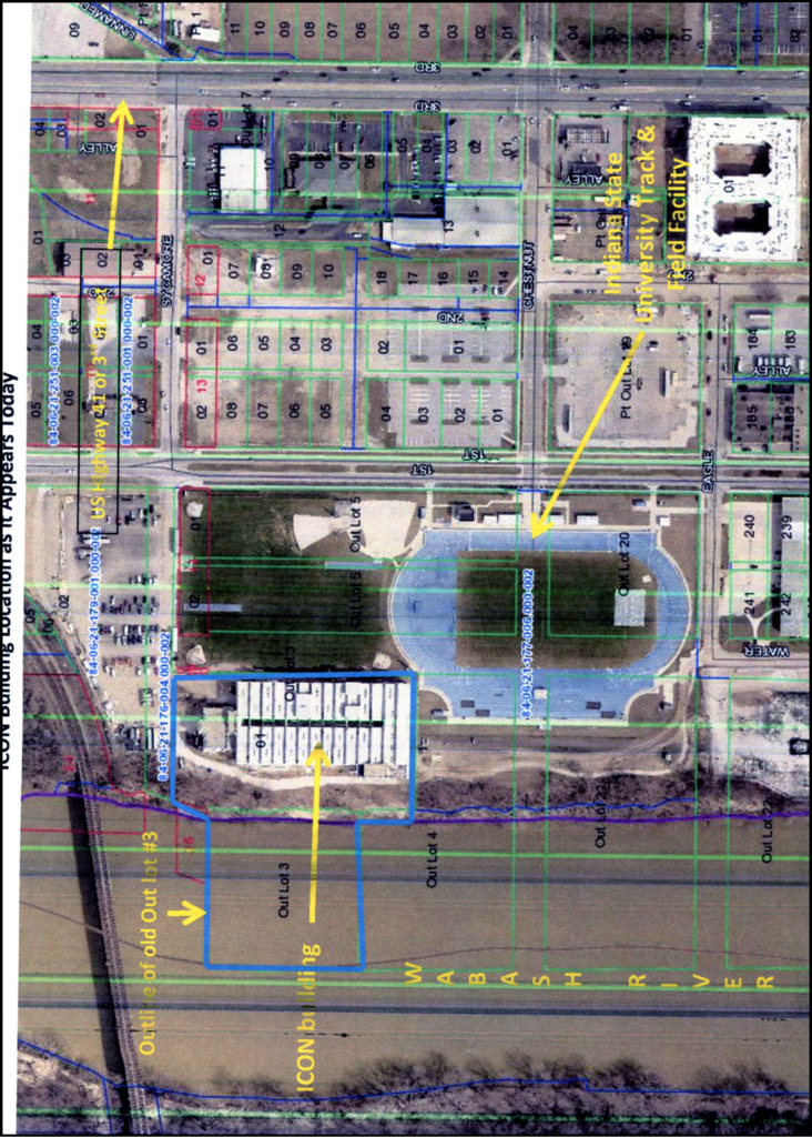
The ICON building is situated over the remains of the Wabash & Erie Canal and the Burying Grounds. Using an 1854 map of Terre Haute, the on-line Beacon site for Vigo County and knowing that the canal and cemetery were located in Out Lot # 3, it is possible to position them approximately in the middle of Out Lot # 3. The building covers most of that lot.
The ICON building is about 166 feet wide as measured on Beacon. The canal was approximately 60 feet wide counting the berm, towpath, and the canal water. That leaves 106 feet under the building that could have been part of the cemetery. No records have been found of how many people were buried there. Given that the ICON building covers most of Out Lot # 3 including the eastern half, there are probably more graves unaccounted for.
A short distance from the Old Indian Orchard Cemetery was a double lock on the canal. Locks # 41 and # 42 changed the water level of the canal 19.2 feet. The topography of the land today does not show nearly that much change in elevation except right on the bluff overlooking the Wabash River. Duke Energy has a substation about two blocks south of the ICON building on a remaining part of Water Street. It sits in a pit-like area that is about 12 feet lower than the surrounding land. This situation suggests that at one time the land here may have sloped more gently toward the river than it does today. Maybe when the canal was filled in, part of the sloping land was filled as well.
Information was contributed to the above article by Tamie Dehler (Terre Haute Tribune Star columnist), Lavonne Waldron (DAR), and Sam and Jo Ligget.
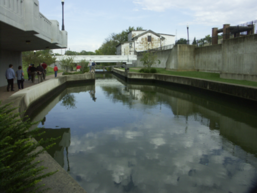
Canal Rewatered at Ottawa
By Bob Schmidt
As vestiges of the 19th Century canals continue to disappear under our 21st century urbanization, it is always refreshing to learn about restoration of the old canals. One of the latest actions is being led by one of our own CSI members from Illinois, Arnie Bandstra.
The Illinois & Michigan Canal connected Lake Michigan at Chicago with the Illinois River at Peru. Portions of this canal, completed in 1848, flowed through the town of Ottawa, Illinois. The canal ceased to function in 1933 once the Illinois River was improved for navigation. As time passed the portions of the remaining watered canal were drained. This occurred after World War II in Ottawa.
As early as 2003 Ottawa Mayor, Bob Eschbach, endorsed the concept of this project. An Ottawa Canal Association was formed in 2008. The portion of the canal that this group hoped to rewater for recreational use is about ½ mile in length. To fill it will take initially 400 million gallons of water with continued watering to replace evaporation and absorption. Water will be sourced from short depth aquifers.

The new watered canal will be used by paddle boats, canoes, kayaks and for fishing. Visitors will hike along the trails with signage to inform them about the canal and Illinois history. In the winter the canal can be used for ice skating. The city’s goal is education and recreation.
As President of the Ottawa Canal Association, Arnie Bandstra has worked with Mayor Eschbach to develop the canal plan and to obtain the necessary construction and finances for the project. Permits were required from the State of Illinois, which owns the canal bed. Construction is to be provided by Engineers from the U.S. Army and U. S. Marine Reserves, who are using this work as a two week training exercise this summer. Approval for this portion of the construction came all the way from the Pentagon.
Funding of the $600,000 project was a major hurdle. The city of Ottawa is providing $400,000 with the additional funds coming from community donations and fund raising. One money raising event was a 5k race by the nearby Starved Rock Country Marathon that raised $5,000. Banks, law firms , local merchants and individuals have been generously donating to this community project. Already $120,000 has been raised. Donations can be sent to the Ottawa Canal Association, PO Box 2194, Ottawa, IL 61350
Arnie talked about this project while we were on our trip to Panama in the Spring of 2017. He had high hopes of bringing all the pieces of the project together.
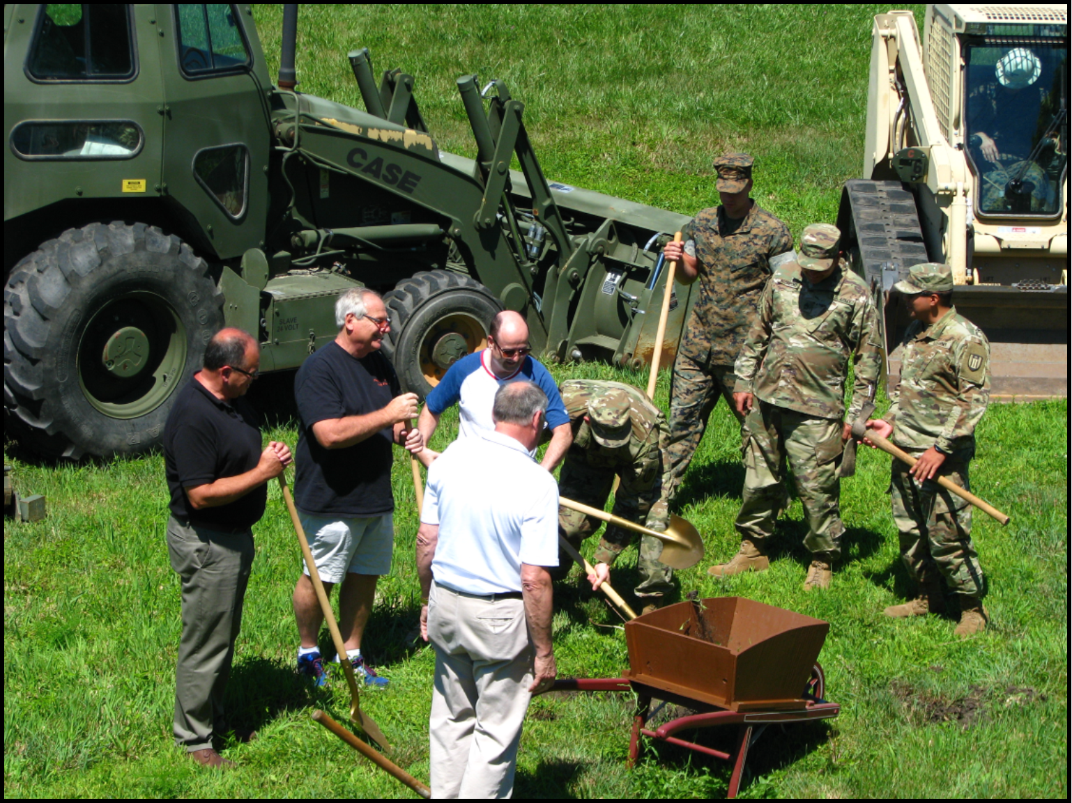
On July 8th at 2:00 P.M. groundbreaking took place. Arnie was the emcee for this historic event. There were brief remarks by Mayor Eschback, Ana Koval of the I&M Corridor Association and others. The crowd of about 100 included two dozen uniformed Reservists, who demonstrated with pick and shovel how the old canal was dug. They also displayed the modern equipment that they were going to use the next two weeks. Music was provided by a local musician and singer Steve Sharp.
The project is expected to be completed in October 2018. Currently there is a toll house and replica canal boat on the south bank of the canal. A nearby trail will be redirected along the south bank.
The actual construction and sculpturing of the canal prism includes the following: excavation to level the canal and restore it as closely as possible to its original contour, creation of concrete structures for water intake and outlet, digging a shallow well, creating “puddle” to line the canal prism to keep it from leaking, and finally some landscaping enhancements.
As Ana Koval stated in her remarks this was quite an undertaking. Other communities along the I&M have considered similar projects, but have been delayed by difficulties with environmental and regulatory concerns. She applauded the efforts at Ottawa. “The leadership here really figured out how to do it.”
The Canal Society of Indiana agrees that this is a wonderful project. We want to give Arnie Bandstra and Mayor Bob Eschbach a big “ Hip Hip Hurray.”
Information from Gerald Hulslander, CSI member from Marseilles, Illinois
Photos from Arnie Bandstra, CSI member from Ottawa, Illinois
“Lock 13” Short Book Review
By Cynthia Powers
I found the following book at the Aboite Library in Ft. Wayne. It is titled “Lock 13” by Peter Helton. It’s a “cozy” type mystery involving the search for a missing person, but the sleuth rides a “narrowboat” on the canals in England, rather incompetently. Lots of description of his mishaps trying to drive the boat, having no experience.
Published by Seven House Publishers, Ltd. In December 2017, “Lock 13” is the seventh mystery written by Helton. In this book Chris Honeysett, painter-turned detective, hunts for his missing model.
Member Milestones
CSI Director Stephen J. Williams of Roanoke, Indiana was one of several area lawyers named in the 2019 publication of “The Best Lawyers in America.” Edward Beck, of Steve’s firm Shambaugh, Kast, Beck & Williams was named Lawyer of the Year in his practice area. We send our congratulations to Steve and his firm. Hip Hip Hooray!
“Over the Summit” CSI Fall Tour
By Carolyn Schmidt, photos by Carl Bauer & Bob Schmidt
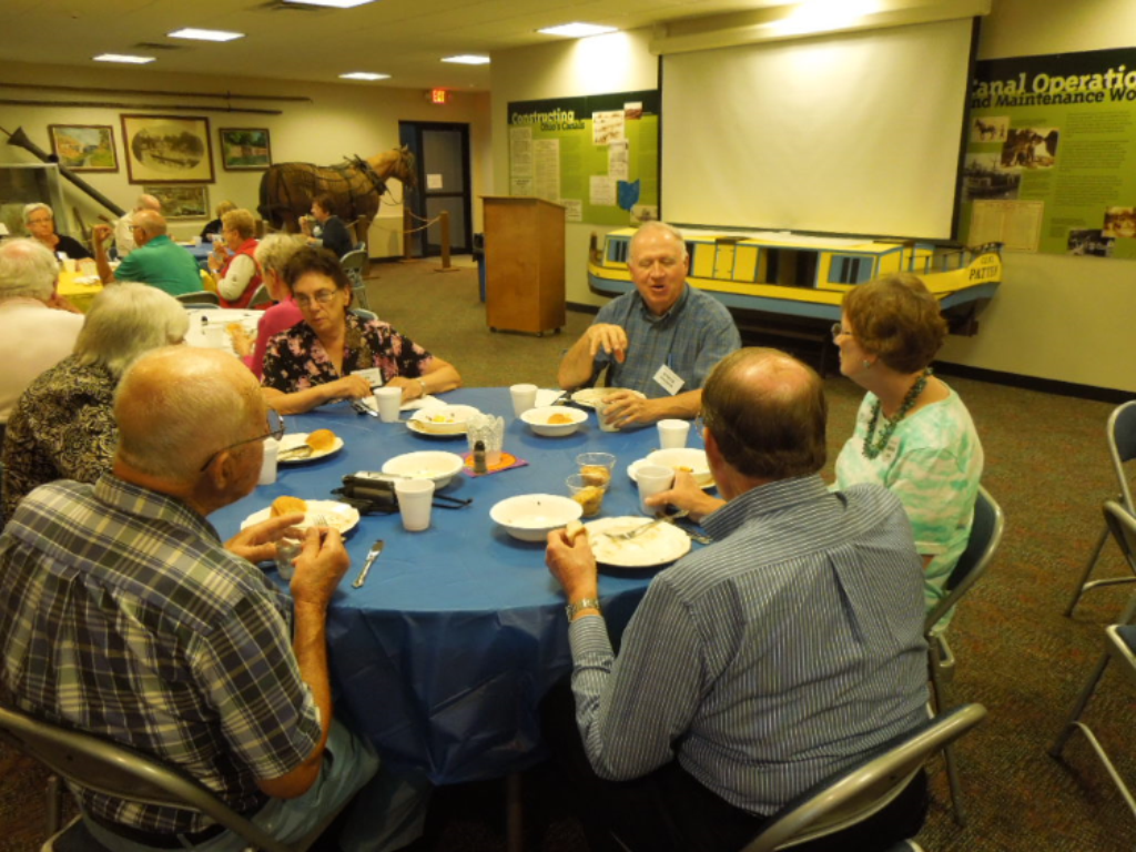
Twenty-five Canal Society of Indiana members met at 6:30 p.m. Friday night October 5, 2018 in the conference room of the Comfort Inn at Miami Valley Centre Mall in Piqua, Ohio for an evening preview of its fall tour, “Over the Summit,” by host Andy Hite. Andy is the Site Manager of the Johnston Farm and Indian Agency. He planned the tour, wrote an excellent 42-page tour book, compiled goodie bags with maps and brochures, acted as docent on one bus, and spoke at the tour banquet. Andy greeted members as they picked up their tour books, goodie bags, registered for door prizes and enjoyed refreshments of cookies, popcorn, iced tea and lemonade served by Phyllis Hess and Sue Jesse. After a short fellowship time, Bob Schmidt, CSI president, welcomed everyone and introduced Andy, who spoke about the Miami & Erie Canal and previewed what would be seen on the tour on Saturday.
The tour would follow a portion of the route of the 249-mile-long Miami & Erie Canal from Piqua to St. Marys, Ohio along its 23-mile-long summit level and return to Piqua. It was financed by bonds and the sale of federal lands for a total cost of $8 million. It was built in sections by Irish, French and German immigrants using picks, shovels and wheelbarrows for a daily wage of 31 cents and a jigger of whiskey. Construction started in 1825. It was completed in 1845 with 19 aqueducts, 3 guard locks, 103 lift locks, 3 major reservoirs (Lake Loramie, Indian Lake-Lewistown Reservoir, & Grand Lake St. Marys-Mercer County Reservoir), and a 6,600 feet long and 52-feet deep “Deep Cut.”
The tour group would see two of the reservoirs, feeder canals, a modern day aqueduct, a bulkhead guard lock, many lift locks, etc. The summit level of the canal was near the high point in Ohio. Lift locks were numbered from the north of the summit to Toledo as Lock 1 N, Lock 2 N, etc. and from the south of the summit to Cincinnati as Lock 1 S, Lock 2 S, etc.
Although railroads led to the decline of the canal’s use, the flood of 1913 destroyed it. Today some of its structures have been redone and trails placed along it to help tell the story of its importance in Ohio’s history.
Following Andy’s presentation, tour attendees were asked to tell something about themselves, how they became interested in canals, canals they had visited, or what was happening to canals in their area. Door prizes of canal books were won by Don Haack, Carl Bauer and Betty Haack thus concluding the evening.


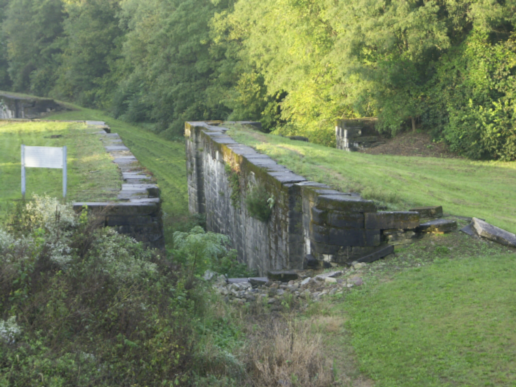
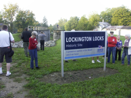
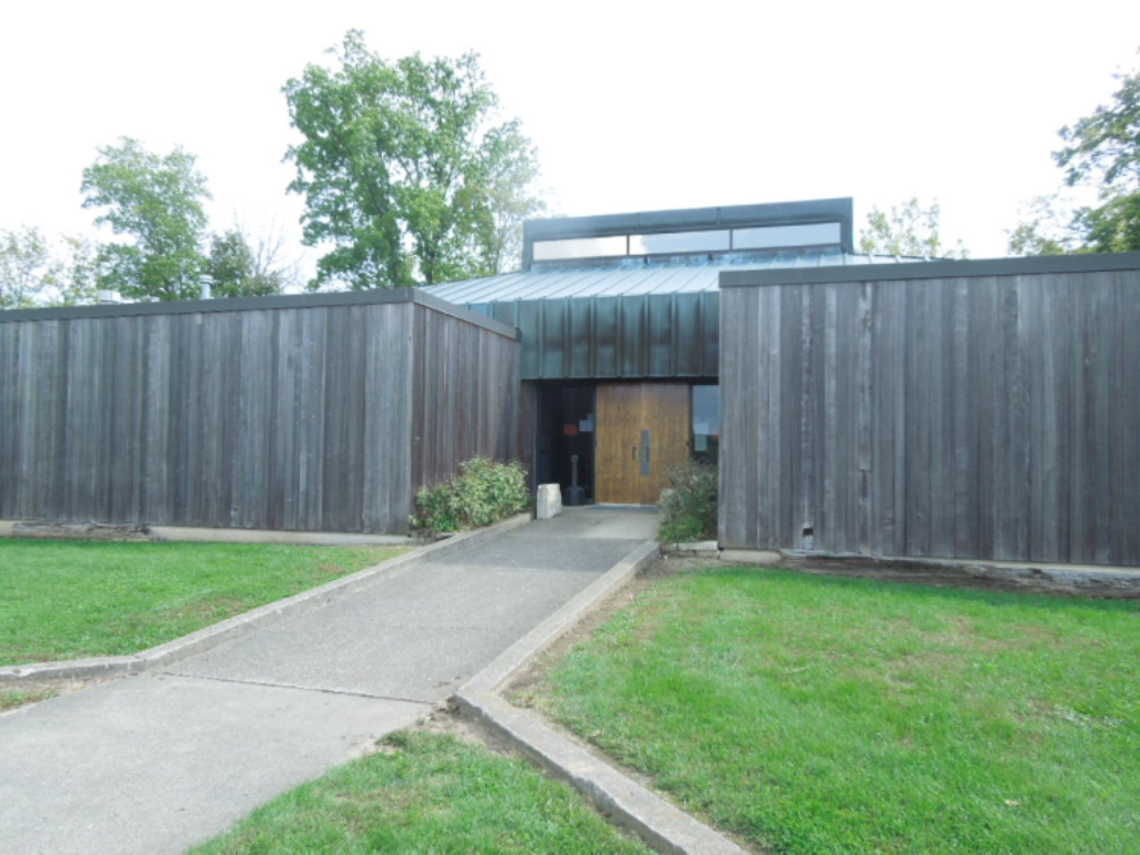
After breakfast Saturday at the Comfort Inn tour attendees boarded 2 mini-buses for a day’s adventure along the Miami & Erie Canal’s summit. Docents were Andy on the first bus and Mike Morthorst on the second bus. With Andy’s precise timing (his time was the ONLY time and attendees set their watches accordingly), the tour kept right on schedule. The buses followed the canal through Piqua, past the Johnston Farm, and up to Lockington Locks, which were put on the National Register of Historic Places in 1969.


At Lockington canawlers stood alongside “Big Lock” (Lock 1S) and looked down the curve of five locks, an aqueduct and a sixth lock on the other side of the creek. “Big Lock,” which lifted boats 12 feet, was completely disassembled, stones numbered and completely rebuilt in the past two years for a price tag of $1.5 million. This cascade of six locks 1S-6S lowered/raised canal boats for 67 feet ( Locks 1S & 2S -12 feet; 3S, 4S & 5S – 11 feet; 6S – 10 feet). Andy told them these locks were watered from the Lewistown Reservoir (Indian Lake), into the Great Miami River where a dam diverted the water into the Sydney Feeder Canal, which entered the mainline Miami & Erie Canal just north of the Lockington Locks to feed the summit level. He explained how the structures were built, how the boats were raised/lowered, pointed out groves in the cap stones where the ropes tied to the mules had worn away the stone, pointed out the locktenders home that they want to restore, told where the basin was located, showed where a mill had been located, and talked about the other locks in the cascade, which had been recently mowed by his crew for our tour.
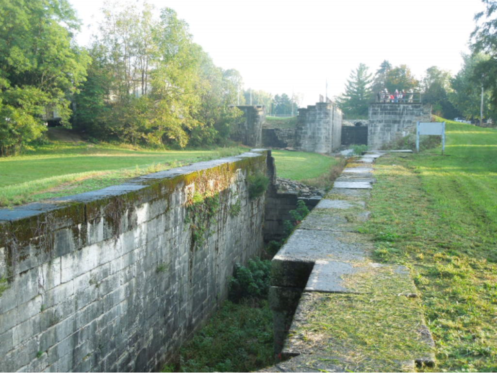

Lock 1S was near Lock 2S and had a large basin below the locktenders house, which is behind the trees on the left of Lock 1S. Below Lock 2S and around a curve was seen Lock 3S. They left Lockington Locks and the lock tenders house to the right of the sign to travel the Loramie Summit, pass the Loramie Reservoir and stop at Lock 1N (the first lock to the north of the summit) in New Bremen.
At New Bremen canawlers looked at the exhibits inside the Miami & Erie Canal Visitors Center (lock tenders house replica). Most of the group had their picture taken in front of it.
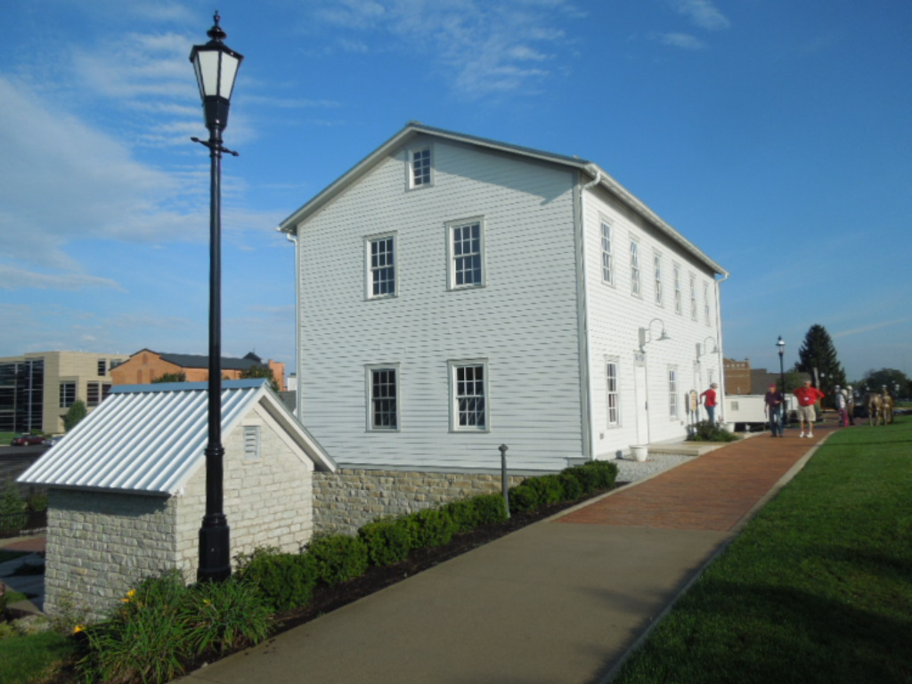


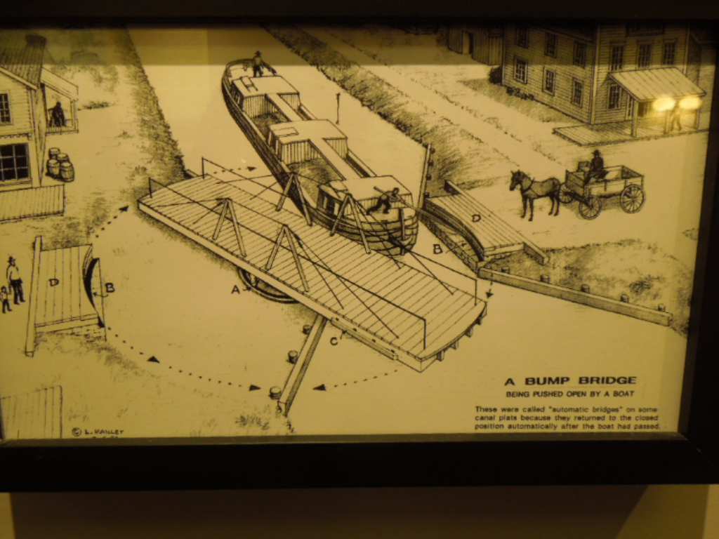
Two interesting exhibits were the turning mechanism for a bump bridge with a diagram of how it operated and two model canal boats (a packet for passengers and a freight boat).


Tom Fledderjohann then talked to them about Lock 1N being the first lock north of the summit, the reconstruction of the lock in the park with its operating gates, the importance of the canal to the area’s development, and the generous donations of sculptures, etc. to the park. Canawlers had a chance to operate the 7000 pound lock gate by placing their backs against the sweep (balance beam) and pushing it open.


After checking out the various sculptures and returning to the mini-buses, they crossed an 1864 bowstring girder bridge (the oldest in Ohio) that had first stood over the Auglaize River at Wapakoneta, Ohio.
The buses took them to St. Marys, Ohio following the canal and seeing sights along the way. While having a morning snack of crisp apples, Steve Dorsten, retiree from Ohio Department of Transportation, met them and talked about the two levels of canal in St. Marys using maps, diagrams, and pictures to illustrate his talk. He showed them the stationary boat “Belle of St. Marys” in the lower canal and pointed out that the doors in the building behind it let people step directly onto the boat during canal times. They also saw the site of Lock 12N and the reconstructed Lock 13N, an old grain mill, and the tumbles where many young boys learned to swim. He explained that during periods of flood the St. Marys River overflows through the park into the canal.


From St. Marys the buses drove past the Bulkhead Lock with cranes to raise or lower the gates and the Mercer County Reservoir (Grand Lake St. Marys) where everyone got a good look at the size of the reservoir. Its size varies at times depending on the season and rainfall (12,000 -17,500 acres). They then headed back to New Bremen for lunch at Speedway Lanes where hot cream of broccoli soup, ham/turkey/cheese sandwiches, tossed salad, and beverages we eaten eagerly.

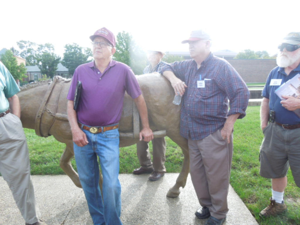
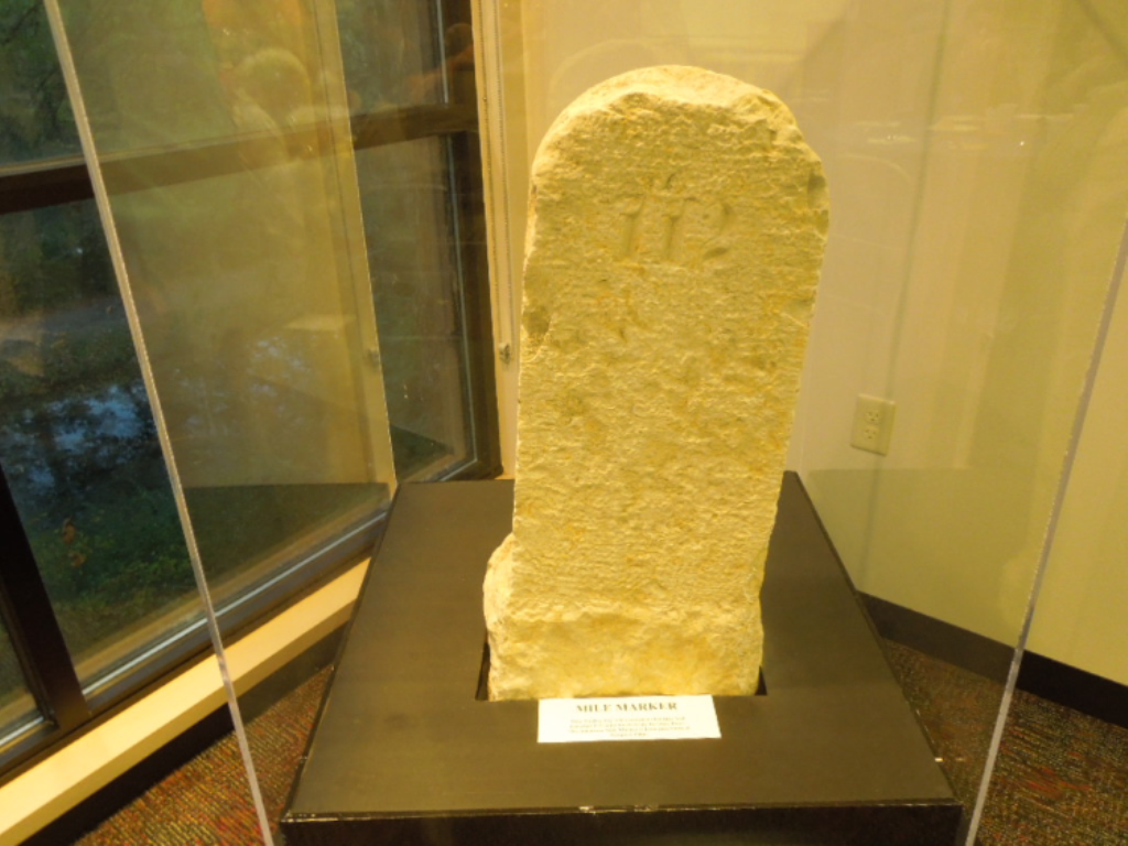
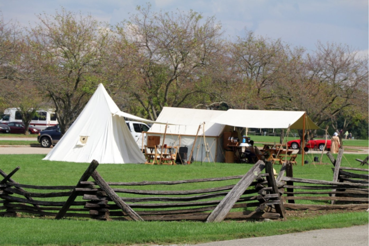
Returning to Piqua, canawlers went to the museum at Johnston Farm to view the exhibits about the Pickawillany Battle of 1752 at the Indian settlement and about the Miami & Erie Canal. There they saw a slip scoop used to build the canal, a horse with a fly net on its back, a canal mile marker, a model canal boat, charts, maps and pictures. They could also walk to the Johnston Farm homestead and barn where docents provided interpretation, look at exhibits in tents along the pathway, or watch a demonstration using Pawpaws and have a sample of a dessert.

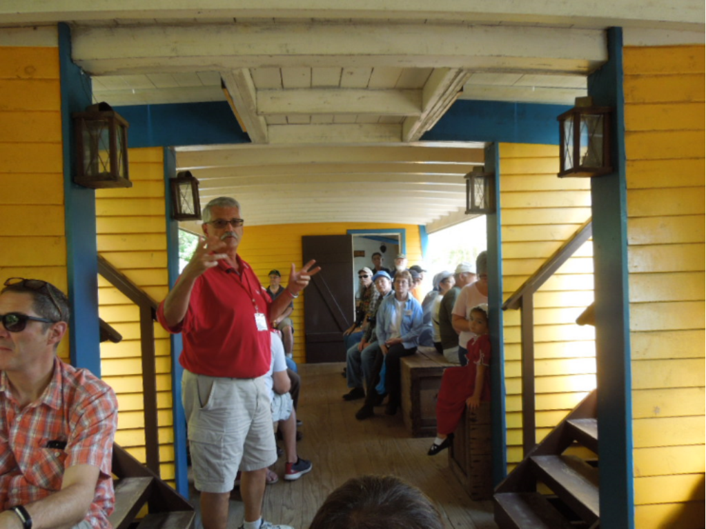
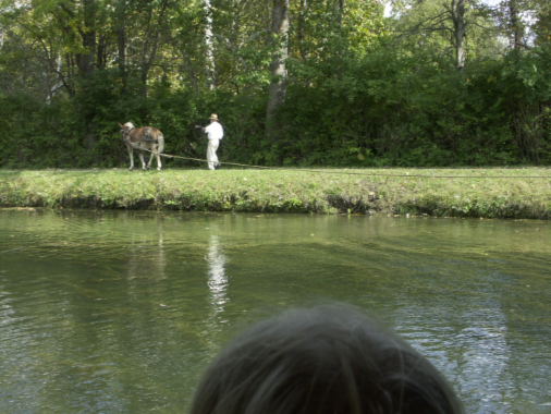
At 2:30 p.m. everyone gathered on the dock of the “General Harrison” for an hour ride on the replica canal boat that was built by Scarano Boat Building of New York, which also built the canal boats for Delphi and for Ft. Wayne. Andy Hite was the docent on the boat talking the entire trip and thoroughly describing how a boat was operated, the types of canal boats, what freight they carried, the rules of the canal, how it was funded, etc. Canawlers said the ride was very smooth. They did not even feel the first tug by Kit the mule (called a “hayburner” by Andy) that got the boat started. As the boat left the dock they were serenaded by a group of musicians playing period instruments. Children were roasting marshmallows and making Smores nearby.

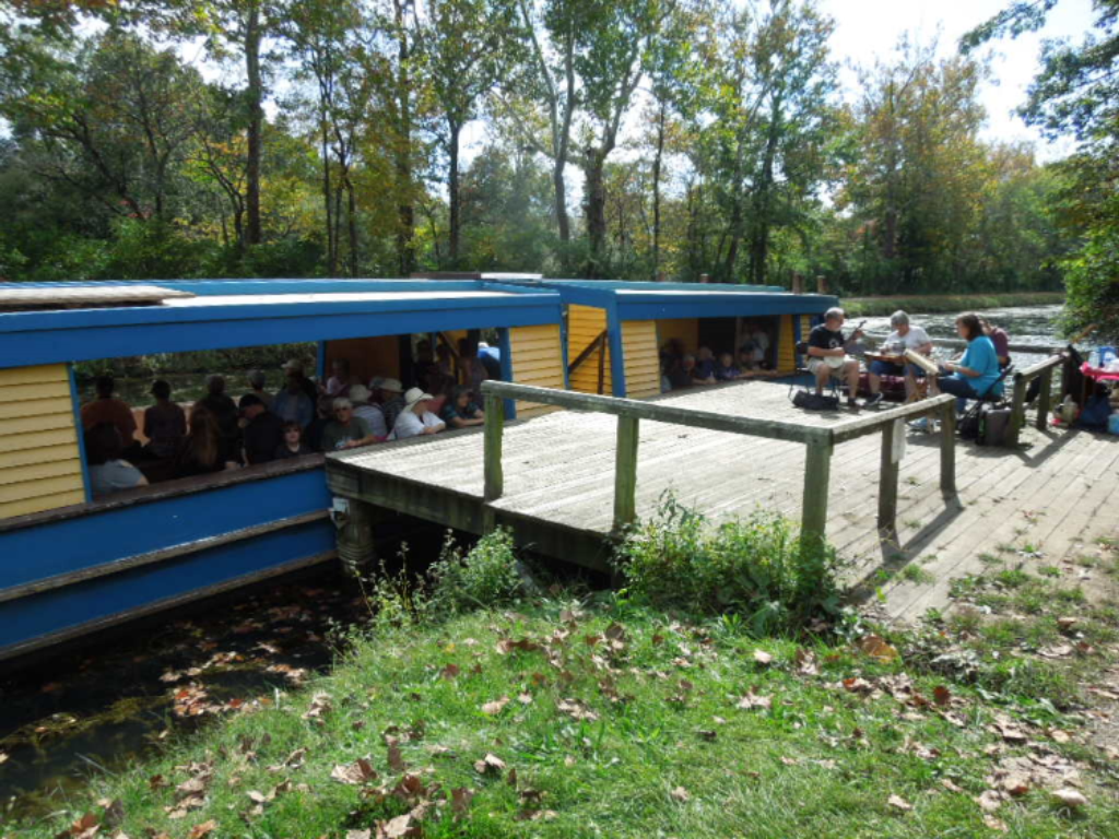

Watching the “hoggee” use the tow rope and Kit to turn the boat around was very interesting. We went as far as Lock 8S before turning back to the dock. The lock has narrowed over the years at the top and a boat won’t fit in it.

Richard Smith took the following two pictures as the boat docked and passengers got off. It started to drizzle and before they got back to the visitors center everyone was thoroughly drenched. When the rain stopped they were rewarded with a beautiful rainbow.


The mini-buses backed up to the museum entrance and were boarded quickly by wet and cold canawlers. The buses headed back to the Comfort Inn where everyone changed clothes for the evening banquet and program back at the Johnston Farm museum. That evening they were served salad, meatloaf, mashed potatoes, green beans, a roll and an apple dumpling. Tom Fledderjohann had been a docent at New Bremen. He and his wife joined us for dinner. Andy then presented a PowerPoint program on “Will the Real John Johnston Please Stand Up.” He pointed out that everyone knew Johnston was an Indian agent, but that his life encompassed many other things as well.

Other photos taken by Richard Smith, from the Johnston Farm site, follow showing the Johnston Farm, some of the activities that day, and a pawpaw dessert.


Thanks to Andy Hite and the Johnston Farm and Indian Agency site everyone had a terrific time and learned a lot. Andy’s 42-page tour guide “Across the Summit – Tipp City to Delphos” may be ordered from the museum shop at the Johnston Farm in Piqua, Ohio. This excellent book contains information on an even larger area than the one this tour covered and includes maps, diagrams, pictures, and a glossary of canal terminology.