Index:
John Orff – 1821-1897
By Bob & Carolyn Schmidt
John Orff was born in Bavaria, Germany on January 26, 1821. After receiving a common school education he immigrated to the US in June 1840 at age 19. First he came to Baltimore but immediately headed west to seek his fortune and arrived in Defiance, Ohio. He worked in northwest Ohio as a common laborer for a time on the Wabash & Erie Canal while it was under construction. By the spring of 1841 he found more agreeable work at a local country store in Defiance. He stayed at that job for about a year and a half, until June of 1843 when he decided to move on to the “Summit City”/ Fort Wayne.
John Orff married Johanna Soxosvsky on November 17, 1846 in Fort Wayne. She had come to Fort Wayne from Prussia in 1844. They eventually reared eight children, Amelia (Bedford), John R., Anna L. (Stanton). Charles E., Montgomery C., Flora B. (Rockhill), Louise Ella (Bond), and William R.
In the 19th century, most trade skills were acquired through a period of apprenticeships rather than attending a trade school. In Fort Wayne John learned the milling business from L.S. Chittenden. After a few years of apprenticeship he became Chittenden’s partner. When Chittenden died John continued as a partner with Harriet Chittenden, Chittenden’s wife, until she sold her interest in 1855.
During the mid 1840s Anna Elizabeth Orff, John’s mother came to the United States. She lived in Fort Wayne with her elder son, John until her death in 1875. She, along with many family members, is buried in Ft. Wayne’s Lindenwood Cemetery.

During the same period other members of John’s family came to America. His older sister Elizabeth was married to Julius Fuchs. They settled in Louisville in 1845. John died in 1849. Elizabeth moved to Fort Wayne and married a widower, Henry Schwartz. The Schwartz’s then moved to Huntington to rear their combined families.
John’s brother, Henry Orff, born in 1826, was a musician and music teacher. He arrived around 1846 and settled in Fort Wayne. He practiced his occupation as a music teacher. He married Martha McIntosh on December 27, 1853. During the early days of the Civil War he served as a musician for the 32nd Indiana Infantry, a German unit. He enlisted September 1, 1861 and was mustered out by April 28, 1962. Later he and his wife Martha moved to Richmond, Indiana, where he died in 1900.
John’s brother, Christian Orff, came to Fort Wayne in 1845/46 and became a business owner. In 1851 he married Esther Angeline Heller. Her father, Peter Heller was a physician and later postmaster along the Eel River northeast of Fort Wayne, known today as Heller’s Corner. In 1852 he headed for the gold fields of California. Failing to strike it rich in San Francisco, he returned in 1854 via Panama, then to New York and then back home. In 1855 he built a steam grist mill at Heller’s Corner. Peter died at the home of Christian Orff, his son-in-law, in October 1882.
Christian Orff became a prominent businessman in Fort Wayne. He served on the Fort Wayne School Board from 1863-65. He also became a Notary for the state of Indiana in Fort Wayne on Jan 7, 1882.
Christian and Esther’s son, Frank, who was born in Fort Wayne in 1859, became interested in the local newspaper business and then moved to St. Louis, Missouri. Christian and Esther moved to St. Louis during the mid-1880s to be with him. In the early 1900s Frank became the President of Columbia–Sterling Publications, owner of 5 magazines.
From St. Louis Christian’s daughter Martha “Mattie” married a Jackson County Arkansas respected physician and surgeon, Lemuel E. Willis. Christian Orff’s other daughter Addie married Frank McKinnie, who was the proprietor of the Anderson Hotel in Pittsburg, Pennsylvania.
John’s last brother, Gottlieb Orff, came with his wife Maria later than other family members. They arrived in Fort Wayne on August 17, 1874. Gottlieb was a carpenter. He died in March of 1888 and Maria died four years later in 1894. They both were buried in the Concordia Lutheran Cemetery east of Fort Wayne.
Many mills that relied on water to power their saws or turn the mill wheels to grind grain were built in Indiana during the early part of the 19th century. Most of them were built along rivers and streams where natural falls or dams were constructed to create a fall of water that could be harnessed for power. However, by using a canal only a few dams in a river or stream were required to direct water to a level where water could be let out at various points along the route, creating a fall of water. Although many mills could be built along a canal, each mill added to the water loss in the canal so water usage by the mills had to be regulated by canal authorities. See: The Hoosier Packet April 2008 Vol. 7, No. 4
 From 1827–1885 there were at least 35 mills in Allen County, Indiana. One of the finest of these mills was built on the banks of the St. Mary’s River where Main St. crosses the river today. The land in this area was owned by William Rockhill. In 1842 Rockhill, in partnership with Samuel Edsall, constructed a water powered saw mill on the north bank of the Wabash & Erie Canal at this point. In 1843 Samuel Edsall began construction of a large grist mill on the south bank of the canal near the river. Partnerships at this time transferred frequently. Edsall soon admitted Millford Smith as his milling partner.
Smith & Edsall operated the mill as the Empire Mill until about 1856 when the mill was offered for sale. John Orff, our subject, formed a 1/3rd partnership, with Armstrong and Lacy and purchased the mill. Lacy died shortly thereafter. By 1858 it became solely Orff Mill when Armstrong exited the partnership.
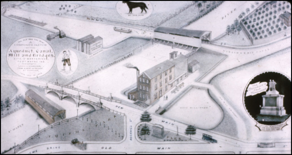
The Orff Mill stood 4½ stories high and had the capacity of grinding 175 barrels of grain per 24 hours. Water from the canal was taken into a mill pond just east of the St. Mary’s aqueduct and run across an overshot wheel. In 1862-63 John added a warehouse adjoining the mill to the east. This warehouse had six bins each capable of holding 5,000 bushels of grain. There were five stones turning 24 hrs. per day operated by 12 employees. His mill competed with the City Mills in downtown Fort Wayne, which also used canal water. At one time City Mills was owned by Pliny Hoagland, who was the engineer for the eastern division of the Wabash & Erie Canal in Ohio in 1838 and, along with Benjamin Tower, rebuilt Lock 2, the Gronauer Lock, in 1849 and Jesse Lynch Williams, Chief Engineer of all of Indiana’s canals.
By 1872 John Orff introduced steam operations to his mill. When the canal closed in the 1880s water was then drawn from the St. Marys river instead of the canal. John Orff’s three sons, John R., Charles E. and Montgomery C. eventually took over operating the business, but the mill closed in 1897.
John Orff was a public spirited but conservative businessman. He served his community as a member of the National Millers Association, was on the Board of Directors of the First National Bank when it organized in May of 1863 and assisted in organizing the first police force in the city that year. In 1865, when the 13th annual Indiana State Fair was held in Fort Wayne, John won a Silver metal for his Red Wheat Flour. In 1877 the merchants of Fort Wayne decided they needed a united organization that represented business interests so they formed the Fort Wayne Board of Trade. John Orff was a director on their Board. He also served several years on the Fort Wayne City Council. In 1897 he was elected a County Commissioner, receiving more votes than all other Democratic candidates for all offices. Unfortunately he died in October before the term began on December 1897.
John Orff was not the only family member in the milling business, Christian and his wife Esther A. Heller were also involved with mills in Fort Wayne. Marshall Wines owned property east of town and he built a saw mill and later another flour mill north of the canal and near the current Hosey Dam on the Maumee River. This flour mill was transferred among a variety of partnerships in the 1840s and 1850s, but in 1861 Christian Orff became a partner with Henry Volland in this mill. In 1863 the mill was again transferred to David Comparet and Washington Haskell. They rebuilt the old dam for about $5,000. A couple of years later Esther Orff, Christian’s wife, following in the family tradition, became the sole owner of the mill and dam. In 1871 the mill was completely destroyed by a huge fire and never rebuilt. The mill was 3 ½ stories high and could store about 20,000 bushels of grain. It employed about 4 people producing 50 barrels per day.
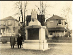
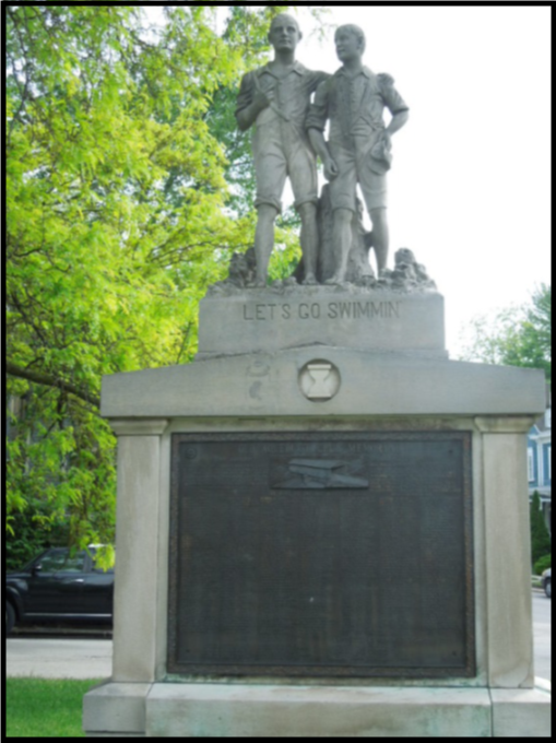
Today, only remnants of the John Orff’s mill site remain in Fort Wayne, where the current Main St. Bridge crosses the St. Mary’s river. In 1892 shortly before John’s death, the city of Fort Wayne decided to straighten the approach for a new Main St. Bridge and purchased the property from John. After using some of it to straighten the road there still remained a 0.2 acre site between the new and old streets.
On November 22, 1912 an “Old Aqueduct Club” was formed by men who, as young boys, swam in the old canal at the aqueduct. An agreement was then made in the 1920s with the city to place a statue called “Let’s Go Swimming” in Orff Park. It still stands there today. This statue was designed by local architect, Marshall S. Mahurin, and dedicated on July 16, 1927. The plaque on the statue lists 327 names of club members. Charles Edward Orff, John’s son is listed on this plaque. The park is the smallest of all Fort Wayne’s 86 parks and recreation areas.
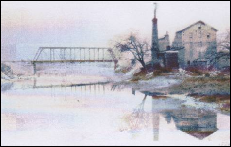
Courtesy of Allen County Public Library
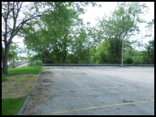
In the mid-19th Century Orff’s Mill, one of the most productive milling operations in Indiana, stood on the banks of the St. Mary’s River. Its power source came from the Wabash & Erie Canal with the waters that the St. Joseph Feeder Canal brought from 6 ½ miles to the north. Although the canal, aqueduct and associated mill structures are long gone, the general site is still undeveloped and remains a parking lot. There you can easily visualize how it once looked by looking at early drawings.
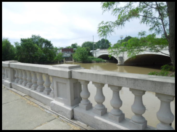
Photos by Bob Schmidt
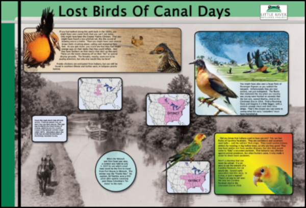
Did Canawlers Ever See Ivory-Billed Woodpeckers?
By Cynthia Powers
While working on the “Lost Birds of Canal Days” interpretive sign for the Towpath Trail in Fort Wayne, I kept wondering if Ivory-billed Woodpeckers might have occurred in Indiana during the canal era.
 Now I can answer that question with a definite “Maybe.”
A little background for non-birders: Ivory-billed Woodpeckers, long considered extinct, looked similar to the Pileated Woodpeckers which still nest in Indiana’s deep woods. For instance, there’s a pair at Fox Island County Park in Fort Wayne, Indiana, which come to the feeders occasionally to eat suet.
Then in 2004, an Ivory-bill was sighted (maybe) in Arkansas, in deep woods also inhabited by Pileateds. Imagine the excitement! Many attempts were made by expert teams to document this bombshell. A 4-second video was taken that surely looked like one to me! (But then, I get excited about Pileateds.) Unfortunately, no definite proof has yet been found, but not for lack of trying.
Maps of the former range of the Ivory-bill place them in the Deep South and up the Mississippi River tantalizingly close to the Ohio. But now the plot thickens.
John James Audubon lived for a time (1840’s) in Henderson, Kentucky, just across the Ohio River from Evansville, and he reported seeing Ivory-bills there. It’s tempting to think they may have crossed the Ohio into Indiana, near where the Wabash and Erie Canal ended near Evansville.
More light was shed by an article in the Indiana Audubon Quarterly of May 2016, by Benjamin E. Leese of Messiah College in Pennsylvania. He perused old references, mostly by Audubon (1842) and by S. F. Baird. Audubon said “In Kentucky and Indiana the Ivory-bills seldom raise more than one brood in the season.” Later authors, such as Indiana’s A. W. Butler, quoted these past references, without having seen the birds firsthand. More secondhand reports included sightings in Franklin, Jennings, Monroe, Posey, and Martin Counties. Of these I think Posey is the most believable, since it’s the very SW tip of Indiana, where the Wabash River joins the Ohio. Also, it’s just across from White County, Illinois, where there were still more “remembered” sightings from the past.
So where does that leave us now? I think it’s quite likely that a few Ivory-bills persisted in Indiana at the time the canal reached Evansville in 1853. We’ll probably never know for sure, and will have to be content with seeing Pileateds now and then. Meanwhile, my conclusion is “Interesting……..if true.”
If you’re interested in seeing the “Lost Birds of Canal Days” sign, which CSI funded, it’s on the Towpath Trail near the Coventry Meadows retirement community, along the north side of Eagle Marsh. (The Lost Birds are the Passenger Pigeon, Carolina Parakeet, and Greater Prairie Chicken.”)
Speakers Bureau – Terre Haute
On May 2, 2017 Sam Ligget, CSI director from Terre Haute, spoke about “The Wabash and Erie Canal in Vigo County, Indiana” to a meeting of Local Chapter 567 of the AARP. There were 18 members in attendance.
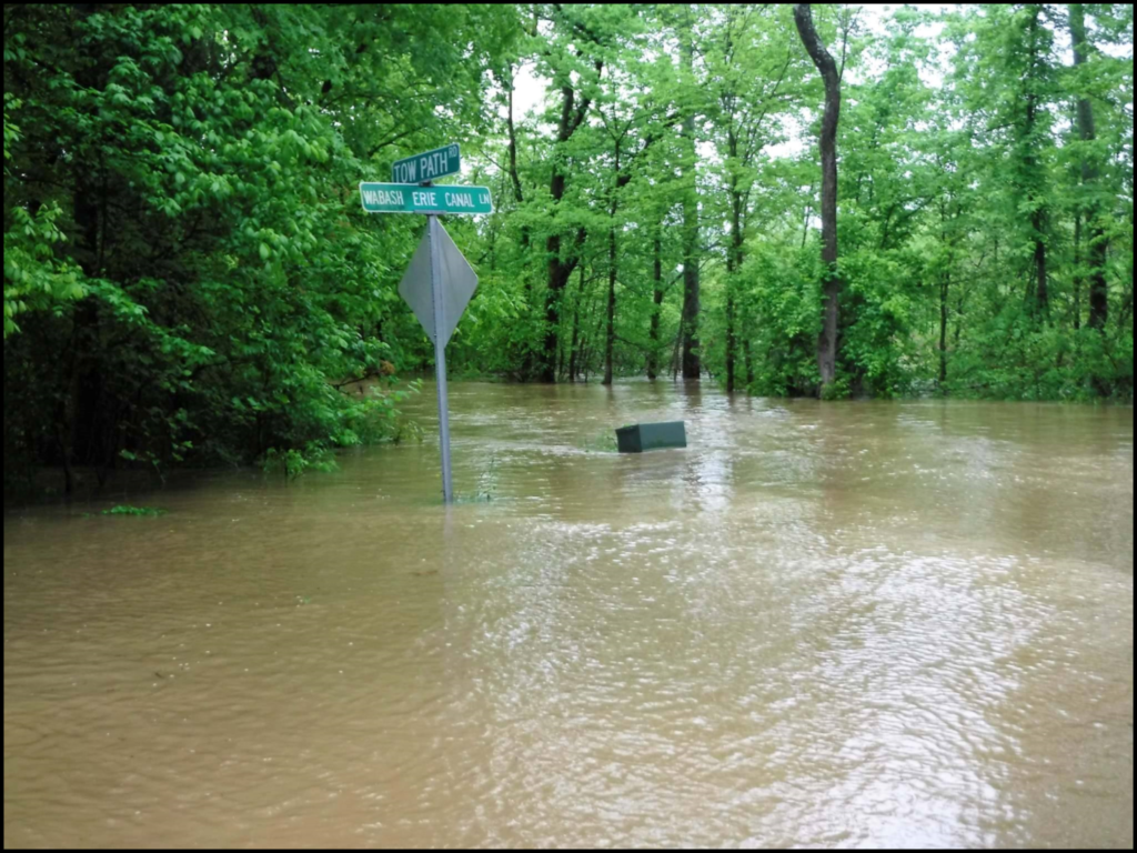
Towpath Road Flooded
On May 1, 2017 following a severe rain Elmer Brown, CSI member from Warrick County sent this picture of Pigeon Creek flooding the old towpath of the Wabash & Erie Canal, which is now a county road. Elmer lives on Wabash Erie Canal Lane.
Plan to Pave Trail Through Kerr Lock
In August 2016 work began in Lagro, Indiana, on building a portion of the purposed 33-mile-long Wabash River Trail running from Huntington county, through Wabash county to Miami county in Indiana. They are wanting to install asphalt over the bottom of the canal through the Kerr Lock and build bridges over the locks. Land owners along the trail have expressed concern to the Canal Society of Indiana.
Placing a trail through a lock is not unprecedented. Ohio built a trail through Lock 18s as seen in the following article by Terry K. Woods.
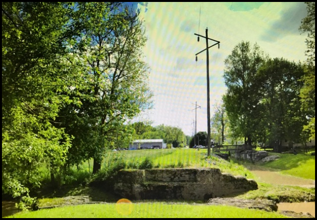
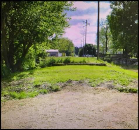
CSI has responded to the land owners that the next best opportunity to preserve a canal other than rewatering it is to find a use for it, its towpaths and structures. We believe in trails and have supported the concept in Allen county and elsewhere. The best way to preserve a canal is to find an economic use for it today. As an example, the Central Canal in Indianapolis that was an economic disaster in the 1840s eventually became the water source in Broad Ripple for the city of Indianapolis and receives a lot of attention and funding to keep it preserved.
Placing a pathway through the Kerr Lock may not be a bad idea. People passing through it will see the lock, ask questions, and learn more about the canal era and James Kerr, after whom the lock was named. Maintenance of the lock will need to be maintained to keep those passing through from being injured by the stones that today seem somewhat precarious.
Bridges have been built over the locks in Maumee Sidecut Park in Ohio and offer great views of the locks from above. As long as they do not damage the structure they work well.
Based on past experience with trails in Allen county and elsewhere, there have been few problems for property Owners. Most bikers and hikers are very aware of the environment and keep the trails clean.
Three Canal Locks in the Little Cuyahoga Valley
From CANAL COMMENTS No. 123 by Terry K. Woods
There were three locks, Nos. 18, 17 and 16, on the Ohio & Erie Canal between the crossing of the canal by Memorial Parkway and Mustill’s Store. Back in the late 60s and early 70s, when I first began exploring this area, it was grown up in a tangled mass of small trees, large sinewy vines, and heavy brush.
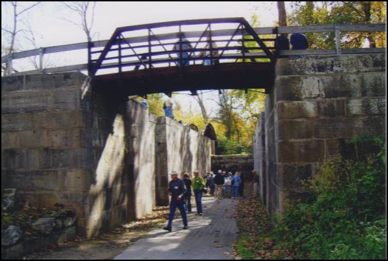
The first lock I attempted to locate was No. 18. There was a Rest Home for Senior Citizens on the south side of the Parkway. I parked there and walked east along the highway until I could get into the tangle of vegetation to the south. I remember struggling along for maybe 100 yards, putting the Little Cuyahoga to my back and forging through the mass to the west. After 80 yards or so, I came to a tall, wide concrete slab, just standing in that jungle. That was Lock 18. The concrete in that wall was badly spalled and chipped, and it was extremely strange that there was no earthen backing to it. After examining as much of that structure as I could, I struggled back to the car and home.
Many years later, when the Bike Trail was constructed south of Memorial Parkway, I walked along it and discovered that it passed through Lock 18’s chamber. I was astounded to see that the creek ran scant feet from the east side of the lock. I didn’t remember the creek being that close.
Then, in March of 1971 I was laid off from my engineering job at the Timken Company in Canton, Ohio. It took me four months to find another job, during which time I had a lot of ‘spare’ time to go canal looking. One of the areas I looked at was Lock 17 in the Little Cuyahoga Valley.
The towpath in that area, whether one started from the north or south, was completely impassible, even in the spring. I was working on my Master’s Degree at the University of Akron and while waiting for my car-pool companions, I poured over local county atlases and found the location of Lock 17. It appeared to be directly down a steep embankment from the intersection of Hickory Street and the Valley Railroad. So, on one rather sunny day in late March or early April 1971, I parked my car near that intersection, grabbed my 35mm camera, scrounged a sturdy walking stick from the terrain, and let myself gingerly down that very steep embankment. My efforts were rewarded. As I remember it, I came out just up-canal of the lock. The ‘jungle’ was clear enough around the lock for me to see quite a bit and take a number of slides.
Getting back up that embankment was something else again. I managed it, but was completely out-of-breath and exhausted when I did get there. Some ten years later, I duplicated my efforts and again examined and photographed Lock 17.
Lock 16 was harder to get to, though it was probably less than three hundred yards north of Mustill’s Store. Ted Kasper, a fine historian from The Falls, and I made a concerted effort one afternoon, but couldn’t pierce the tangle of foliage.
Mark Bonko, a friend at Goodyear where I had gotten a job, commented one day that he and Bruce Norton from the Cascade area of Akron had recently visited Lock 16. Naturally I was excited and I cajoled Mark to have both he and Bruce guide me to the site. So, on a very cold, snowy January day in the late 1980s, Bruce drove us out Hickory and down a dead end lane to the edge of the ‘jungle.’ A short walk through the snow led us to Lock 16. It wasn’t quite as impressive as Lock 17. I don’t remember the tumble being evident.
It would be great if I could end this column by suggesting that all who wish to see Locks 16, 17 and 18 just walk up the Towpath Trail from Mustill’s store. Unfortunately, the City of Akron has embarked on a multi-year project to build a modern waste and storm water system. As a result, Towpath Trail through the Little Cuyahoga Valley will be closed until at least late 2019! The canal prism in that area is probably destroyed. Lock 16 and 18 ‘appear’ to have been retained. The fate of Lock 17 is unknown. Many efforts have been made to get answers about the canal prism and Lock 17 from people in the history and government areas of Akron. Although most have not responded, those who have seem to be completely ignorant as to what a canal prism might be and were unable to intelligently answer the questions.
They were able to tell us that the Towpath Trail will be rebuilt to be “better than before.” The now denuded hillside will be replanted with trees. As far as the canal prism and Lock 17 – – let’s just keep our fingers crossed.
Fort Wayne’s Canal Boat Christened
The Friends of the River in Fort Wayne, Indiana, commissioned Scarano Boat Building of New York to build a canal boat, much like “The Delphi” in Delphi’s Canal Park, for use on Fort Wayne’s rivers as part of the city’s goal for the riverfront to be its playground. The group raised more than $600,000 to buy the boat and have it built handicap accessible. A contest among school children and community members was held to choose a name for it. The name finally selected was “Sweet Breeze.” Sweet Breeze was the oldest daughter of Miami Indian Chief Little Turtle, who is buried in Fort Wayne. She married a local soldier and Indian agent Captain William Wells.
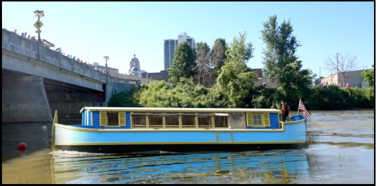
and Ft. Wayne Outfitters and Bike Depot website.
“Sweet Breeze” was christened in a ceremony at the city dock on the St. Marys River by Champagne bottles smashed against her hull. This was followed by boarding and touring of the boat by the public.
Two 45-minute-long river cruises were held on Father’s Day June 18 traveling to Portage Rock past Swinney Park before returning. These introductory cruises cost $20 per adult with longer 90 minute cruises scheduled in the future for $30 per adult, $10 for ages 6-12, and $5 for newborn to age 5. The first cruise on Father’s Day went off as planned. The second—not so good. It was a short “Breeze.” A mechanical problem forced the boat to turn back early. Debris clogged a screen and overheated the system after about 30 minutes out. Money was refunded the guests or they rebooked for another cruise.
The canal boat has a 55-horsepower motor instead of being pulled by horses or mules. It runs in the river instead of the Wabash & Erie Canal, which once followed closely alongside the river. It is 54 feet long and 11 feet wide. It can accommodate 40 people. Its dock is near the Harrison Street bridge south of the Pepsi bottling plant. It will be used to share Fort Wayne’s history and river points of interest.
Those aboard on Father’s Day saw marsh mallow plants (a Native American source of starch), a huge logjam, the site of Guildin Park (built in 1911 as Fort Wayne’s first public park then destroyed by flood waters in 1913) and learned how the Department of Natural Resources is attempting to prevent Canada geese eggs from hatching. Hopefully on future excursions information about the Wabash & Erie Canal will be given.
Information from Fort Wayne Newspapers received from Sue Jesse, CSI member, Fort Wayne
1838 Celebrated in Metamora
A first person presentation by Captain Thomas Fuller, a canal boat captain, was held at 12:30 and 2 p.m. on June 25 at the dock for the “Ben Franklin III” on the Whitewater Canal in Metamora, Indiana, as part of its 1838 Celebration. On that Friday, Saturday and Sunday weekend the town honored the Whitewater Canal that was finished in 1838. It was authorized and funded through the 1836 Mammoth Internal Improvement Act by the Indiana State legislature. Hoosier Songs and Stories were presented at the gazebo in Towpath Park next to Lock 25 and the grist mill. There were many other activities and lots of good food.
Erie Canal Celebrates 200 Year History
The Erie Canal, for which ground was broken on July 4, 1817 in Rome, New York, was an ambitious project to connect the Hudson River to the Great Lakes. It’s often called “Clinton’s Ditch” after its main proponent, DeWitt Clinton. The 363-mile-long canal that cost around $7 million at that time, created a direct water route to western New York and then to the mid-west opening up emigration to Ohio, Indiana, Michigan and Illinois with New York City as the port of entry. It made New York “The Empire State” and its great success led to other states building canals.
Scheduled events for this celebration included the opening ceremony on May 26, 2017 in Waterford with a dozen huge beer tanks beginning a 225-mile, six day journey to the Genesee Brewery in Rochester. Then Fairport held Canal Days on June 2-4. On July 2-8 the Albany Symphony performed concerts on a barge or canal-side from Brockport to Lockport featuring works by a young American composer. On July 29-30 Spencerport held Canal Days, and on July 5-October 12 the Lake Champlain Maritime Museum’s canal sailing boat, “Lois McClure” had a Legacy Tour visiting ports along the Champlain and Erie Canals.
On September 24-28 the 2017 World Canals Conference will be held in Syracuse, New York. This attracts canawlers from around the world.
The New York State Canal Corporation is the agency that oversees, administers and maintains the 524-mile-long New York State Canal System. It includes not only the Erie Canal with its 16 lift-bridges and 57 locks (in 1925 there were 83 locks), but also the Champlain, Oswego and Seneca-Cayuga canals. The Erie Canal ranges from 12 to 23 feet deep. In its 3rd and current widening it is from 120 to 200 feet wide.
Newspaper articles from Jo Ligget, CSI member from Terre Haute, Indiana and Web Hall, CSI member from Richmond, Indiana
CSI Directors Meeting
The Canal Society of Indiana Board of Directors will meet at the Fishers Library in Fishers, Indiana from 10 a.m. to 3 p.m. on Saturday October 28, 2017. Directions to the library may be found at: http://hepl.lib.in.us/ and click on Fishers library on the right.
Ohio Bans Drainage Pipes Into New Buckeye Lake Dam
Water drainage pipes that run through or over the recently started 4.1-mile-long dam at Buckeye Lake are banned by the state of Ohio. When the original dam, which was built to hold and supply water to the Ohio & Erie Canal nearly 200 years ago, showed signs of failure due to such storm water pipes running through it and homes built into it, a new $110 million dollar dam was planned in 2015 and should be completed by the fall of 2018. Ohio doesn’t want to risk failure of the new dam and will cap all current unauthorized pipes. The Ohio Department of Natural Resources has given the 371 residences affected by this ban a deadline for eliminating the pipes as of October 2017. This is too little time to design, build and fund a rerouted drainage system for about $100,000 according to the president of the West Bank Homeowners Association.
St. Helena II Restoration
The canal boat replica, “St. Helena II,” is being restored at Canal Fulton, Ohio. It is receiving repairs to a broken door, new paint, and a wheelchair accessible ramp to allow visitors to get inside the boat to do tours. The estimated cost of $52,000 is partially funded through a $10,000 grant from the Canal Society of Ohio and a $15,000 grant from the Ohio Erie Canal Association.
Largest Ship Through Panama Canal Reaches Savannah
When the largest ship ever to pass through the new Panama Locks reached Savannah in May, it seemed to take up the entire river. The 1,200-foot-long boat owned by China-based COSCO Shipping Lines can carry 13,000 20-foot-long cargo containers, which surpassed last years record-breaking ship at Savannah by 30 per cent.
Earlier the ship docked at the Port of Virginia, which is one of only four East Coast ports that meets the 50-foot depth at low tide requirement. Savannah started deepening its channel in 2015 and should complete it by 2020 for $973 million. The Port of Charleston, South Carolina, is starting its dredging this fall. Right now these huge ships must carry lighter loads and wait for higher tides to access U.S. East Coat ports.
The COSCO ship was 80-per cent full and had to arrive at high tide in the Savannah River. It took six cranes to unload the 5,600 containers (five times a typical ship’s cargo in Savannah).
These huge ships passing through the Panama Canal Expansion have exceeded expectations. Instead of passing two to three ships a day, they are averaging nearly six.
Information for above three articles from John Geyer, CSI member, Hamilton, Ohio
Cabrewing on the Central Canal
Floating for a Cause—A Canal Beautification Project. Downtown Indy, Inc. teamed up with Yelp Indy for “Cabrewing on the Canal,” a blow-out floating party Sunday, Aug. 20 from 1-5 p.m.
Attendees floated along the north end of the downtown portion of the Central Canal in Indianapolis in an inner tube provided by City Way for a $10 donation. Complimentary snacks, drinks and entertainment were enjoyed along the route.
Duck Creek Aqueduct Closed For Repair
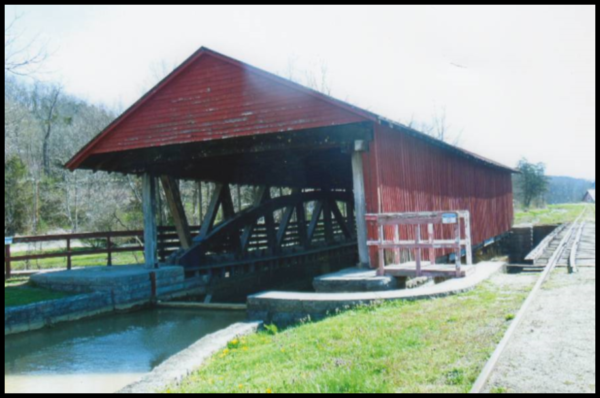
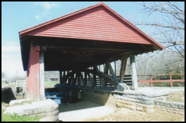
“Ben Franklin III,” a replica canal boat, rests quietly in the Whitewater Canal in Metamora, Indiana, while the American Belgian horses that usually pull it graze in a nearby field. There are no canal boat rides in Metamora this year.
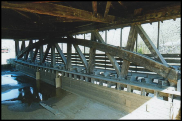
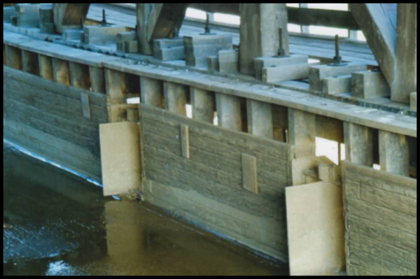
Metamora’s Duck Creek Aqueduct on the Whitewater Canal will be closed until the Spring of 2018. This rare National Historic and National Engineering Landmark, the only wooden aqueduct still in operation in the country, has been closed by the state of Indiana, which operates the Whitewater Canal Historic Site. Last year in September/October they found some structural problems and were afraid the weight of the water would destroy it. According to Jay Dishman, Site Manager, the cord sheared, moved the abutments when it failed and needs to have 35 beams/joists, the flume, and hanger beams replaced with white oak. A sign limits only 6 people to walk through it at a time.
The grist mill, which is powered by canal water and allows visitors to see grain being ground, will remain open. The mill will be improved by showing the process of milling on flat screens through a grant from the Indiana Office of Tourism. They will also add interpretive signage up and down the canal and build a pavilion in Mill Park with another type of lock display.
Information from Charles Whiting Jr., CSI director, Lawrenceburg, IN
Photos by Bob Schmidt, March 2017
News From Delphi
Text and photos from Dan McCain
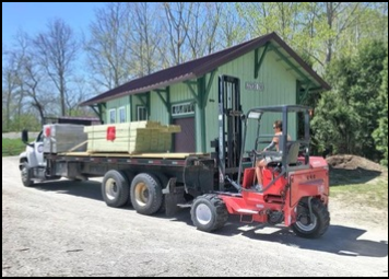
The Depot restoration located in the far back section of Canal Park in Delphi, Indiana, was completed in 2015 after the volunteer crew moved it 54 miles from Leiter’s Ford in Fulton County. The station house was an Erie Lackawanna facility built in the 1880s. Last fall the Tippecanoe Arts Federation (TAF) granted money for building decking onto the depot to make this historic transportation facility become more enlightening to visitors. The lumber was delivered this spring to begin the project.
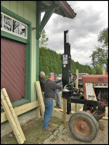
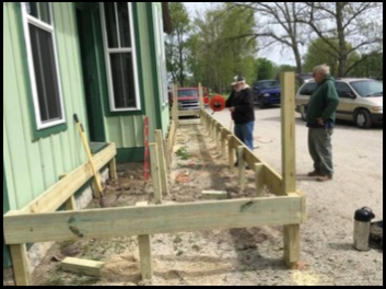 Although a contractor was employed to drive over forty treated lumber posts into the hard surface to support the deck, it was soon found that the height of the posts and difficulty in pounding them into the hard surface was not working in some sections. The M-W-F volunteers had to take on the job of boring the holes using manual post hole diggers and pry bars to make the holes deep enough.
Finally the posts were in the ground and the beginning of fastening them together with horizontal planking made the base for the deck. In time there will be paralleling historic iron rails placed just to the right and covered nearly to the top with crushed stone to illustrate the location of locomotives that would have been passing/stopping at the depot.
Lutheran Church Dedication
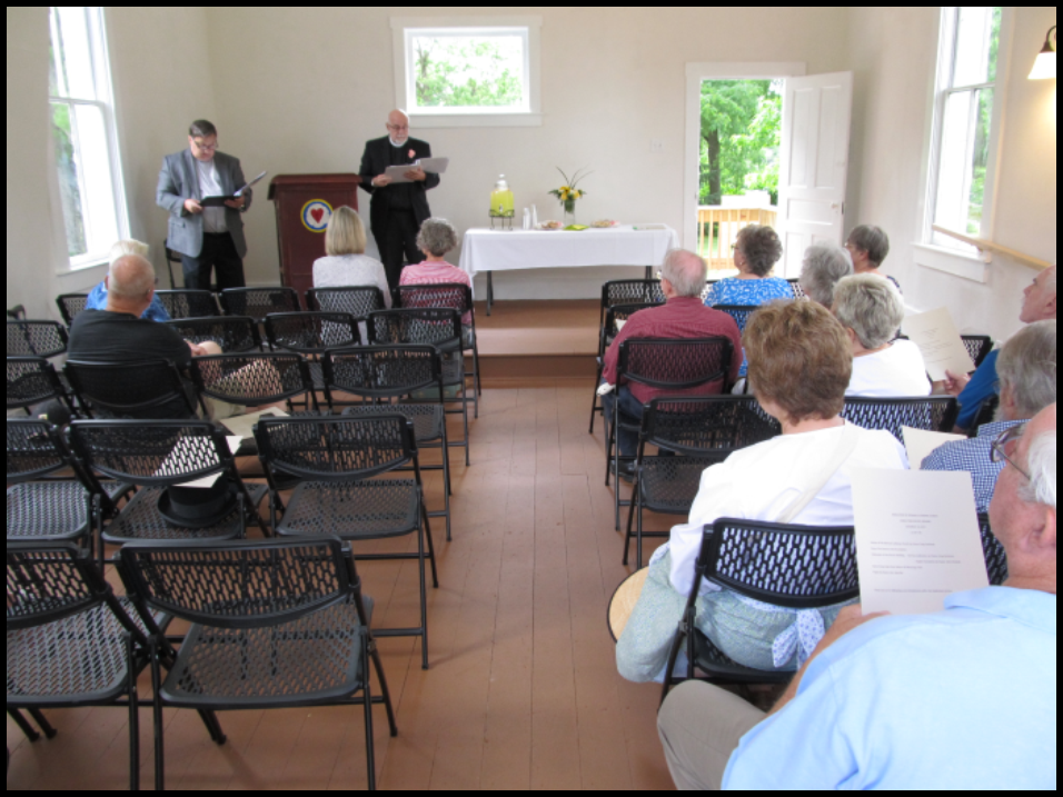 On Saturday June 24, 2017 the restored Lutheran Church across from Canal Park in Delphi was dedicated. A joint service was delivered in English by Pastor John Westfall on the left and in German by Pastor Greg Fiechtener on the right. Pastor Fiechtener also presented the history of the church that had been researched by Carroll County Historian, Mark A. Smith.
Canal Days Festival
From Dan McCain
Following the Lions Club parade in Delphi on Saturday morning July 1, Canal Days Festival activities were held at Canal Park and continued on Sunday. Forty-minute cruises on The Delphi were offered as well as narrated tours of the restored 1844 Reed Case House and Canal Museum. In Pioneer Village the blacksmith, paper maker, cooper, broom and basket maker, and weavers demonstrated their skills and sold products in their buildings while crafters set up displays of hand-made jewelry and wood crafts outside. There were crafts and activities for children at the Canal Center and around the park.
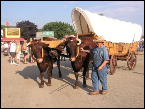
at Thorntown, were featured at
Canal Days Festival in Delphi July 1-2, 2017.
Percy and Carter, two oxen, attracted many festival attendee. Very few farmers use oxen today. Understanding how an ox is raised and its historical significance in both opening the frontier and early farming was a learning opportunity.
An ox is a steer, normally from one of the milking breeds, that has been trained from an early age to become a beast of burden. Most oxen are taken away from their mothers early in their life by their owner or trainer and bottle fed. This creates a bond with the steer that enables the trainer to teach them the moves necessary for their job. Oxen are normally seen in pairs. As their training increases the oxen are fitted for a yoke and they learn to pull workloads. In early pioneer days, the oxen were the preferred animal to pull covered wagons to the west. They were used because of their endurance and their ability to sustain themselves on grass alone. Farmers used oxen to do the tasks tractors are now doing. Although slower than horses they had the endurance to continue working all day without breaks. In fact, legends tell that the definition of an acre comes from the amount of land that an ox could plow in a day.
Additional exhibits included a restored 1918 Ford tractor, a detailed scale replica of a canal boat and a display of flags from the 1800-1850 era.
Delicious food was sold at the Summer Kitchen to benefit the Canal Association. Dulcimer and organ music filled the air. Kids played on the Playground Canal Boat. Narrated towpath trail walks were given. On Saturday the Delphi Airport held a “Fly-In” with planes and a hot air balloon. A trolley operated between these venues.

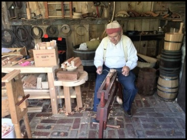 The Delphi, a replica canal boat, provided 40 minute tours during Canal Days to record numbers of passengers. Peter Cooper was one of many craftsmen performing demonstrations during Canal Days. Here he is shaving pieces of cedar to make stays for a water bucket.
Trail Markers Placed For Safety
Tenth Mile posts are being added to Delphi’s trail system for safety and security purposes. Vicki Sickler and Gary Stanley worked with the freshly routed posts to paint the number/letters on them and make them more visible before placement on the trails. Donations have made this possible. They also want to add kiosks, lighting and cameras at five primary trail access points.
Flood Control
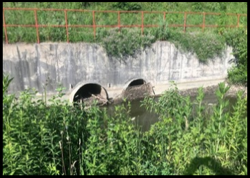
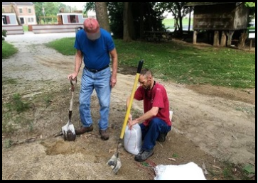 Pipes placed in the original canal channel to control flooding at U.S. 421/39 in the 1950s are ineffective due to age and degradation. Sticks and blockage keep them from working properly and often lead to water in the canal being too high to operate the canal boat. Volunteers filled sandbags to make a low dam in the canal’s mid-section so that the contractor could work on replacing the flood control device while maintaining a depth in the canal to float the boat.
Archaeologists At Work In Delphi
By Dr. Christopher Moore
The University of Indianapolis (UIndy) Department of Anthropology began its 8-week summer archaeological field school in Carroll County on June 5th. About a dozen students and faculty from the University began investigating early pioneer life in Carroll County in June and July, focusing their efforts on the excavation of the Baum’s Landing site.
Daniel Baum and family arrived in Carroll County in April of 1825 and established a farmstead in the Deer Creek bottoms below what eventually became the City of Delphi. Throughout the early decades of the county’s existence, the Baum’s hosted a number of early settlers and lent out their property for the county’s first court proceedings and first store. Today their farmstead is an overgrown forest sandwiched between the railroad tracks and the abandoned interurban line that make up a portion of Delphi’s historic trails.
UIndy began its work in Carroll County in 2001 when it began searching for the remains of a mastodon that had been discovered east of Flora. Between then and now, students, directed by Dr. Christopher Schmidt and later Dr. Christopher Moore (a Carroll County native), have been recording both Native American and early pioneer sites throughout the county. Additional students working under Dr. Moore are studying other collections made by Purdue University in the 1990s. The overriding goals of the project, titled the Wildcat Archaeological Research Project or WARP, are to better understand who the people were who lived in Carroll and adjacent counties before settlement and how early pioneers from different areas created a new community here. Many descendants of those pioneering families still call Carroll County their home.
Over the past 3 ½ years, our work at Baum’s Landing has resulted in the discovery of a portion of the old Baum farmstead and documentation of preserved portions of the later 19th and early 20th century Smith Dairy Farm site. Our excavations in May 2016 resulted in the discovery and partial excavation of a burned early 19th century structure.
Goals of this summer’s research were to better define the size and function of this structure and to collect a larger number of artifacts that will help us understand the daily lives of the Baum family (and, by extension, other founding pioneer families in the area). Our preliminary studies indicate that the Baums were a well-to-do family with ready access to high quality goods. Future studies should help us define the range of variation in pioneer consumption practices and how these practices were influenced by access to goods imported along the Wabash & Erie Canal and early railroads.
Trail Safety Program in Delphi
Security Federal Savings Bank contributed $10,000 toward the Delphi Trail Safety Task Force Fundraiser, pushing the total to over $20,000 by July 26, 2017. If the Trail Task Force can raise $50,000 by August 30, 2017, they will receive a matching $50,000 from the Indiana Housing and Community Development Authority (IHCDA) and be able to fully institute the planned improvements. The community thrives because of the commitment and support from community partners such as Security Federal Savings Bank.
Monument Stone Placed in Bicentennial Plaza Along the Monon High Bridge Trail
By David McCain
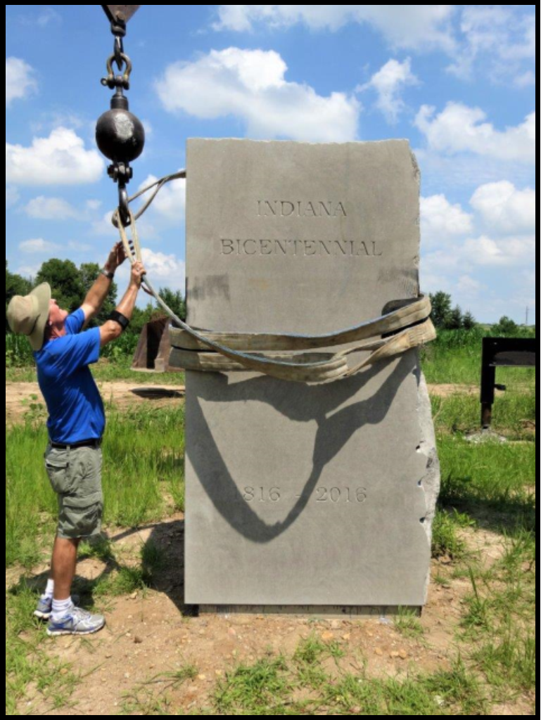 Volunteers with Heartland Heritage Inc., a nonprofit organization, celebrated the addition of a big, six ton stone commemorating Indiana’s Bicentennial that came from the Bybee Stone Company of Ellettsville, Indiana. It is near Bicentennial Plaza, which is part of the 150 acre Deer Creek Bicentennial Park, and sits across the Monon High Bridge Trail from the 1916 Centennial Monument, better known as the Milroy Monument. The stone will be finished when a bronze sculpture called Retaining the Past and Forging the Future is cast and attached by artist Ben Sutter.
Both monuments are on land settled by Samuel Milroy in 1826. Milroy was Carroll County’s most prominent pioneer settler. He served in the 1816 Indiana Constitutional Convention and chose the name Delphi for the first settlement in the county.
Members’ Milestones
 Tom Castaldi, CSI director from Fort Wayne, Indiana, was presented the Citizen of the Week Award by the city of Logansport for his work and volunteerism. He has set up an old fashioned grocery store in the Cass County Historical Museum and is currently working with the Castaldi Family Trust and the Logansport Parks and Recreation Department in restoring a cemetery where a general from Cass County is buried. He is featured in an article entitled “A County Historian’s Love for History” in the Indiana Historical Society’s website at indianahistory.org. He has served as Allen County’s historian for 15 years.
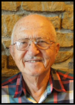 Jerry Lehman, CSI director from Terre Haute, Indiana, was featured in an article that appeared in the Tribune Star last fall that was picked up by Associated Press and appeared in many newspapers such as the News-Sentinel of Fort Wayne, Indiana, on May 23, 2017. Jerry grows 350 pawpaw and 1,000 persimmon trees that are indigenous to the United States. His pawpaws are being used by the Upland Brewing Company in Bloomington for a sour ale. Jerry spoke at a conference in Bucharest, Romania about growing and experimenting with these fruits.
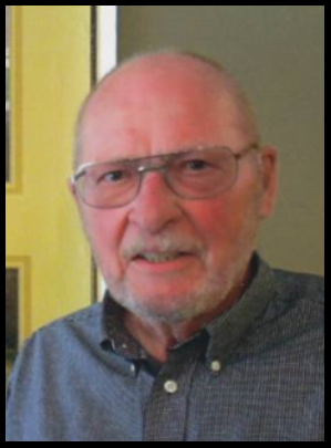 Dan McCain, CSI director from Delphi, Indiana, has received a distinguished alumni award from the Delphi Community School Corporation. His name will appear on the school’s inaugural Wall of Distinction honoring exceptional alumni for dedication and service.

