

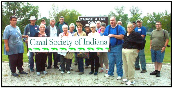
Photo by Carl Bauer
“Sites, Signs & Surprises” Tour Recap
By Carolyn Schmidt
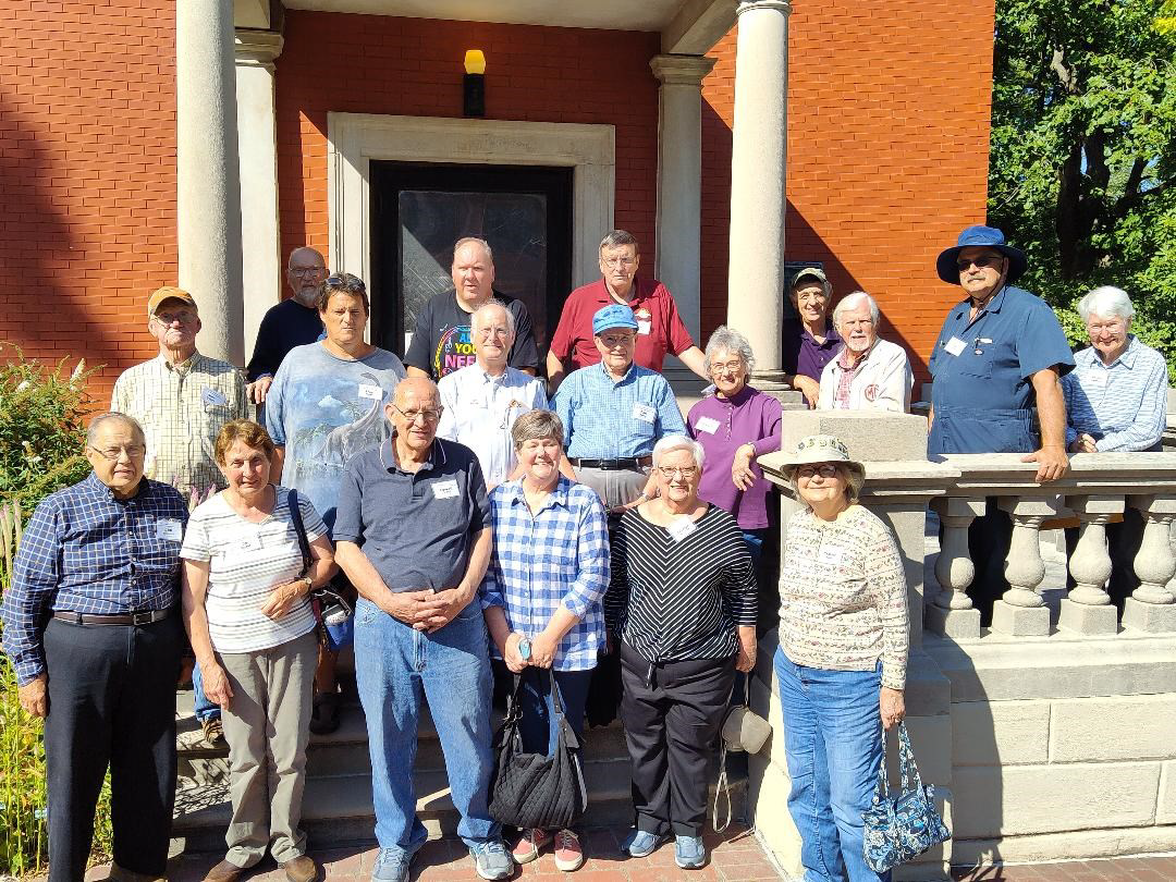
On Friday September 15 and Saturday September 16, 2023 the Canal Society of Indiana held its “Sites, Signs & Surprises” tour of the Wabash & Erie Canal from Montezuma-Covington, Indiana. The following 24 people attended various parts of the tour: Ron Achor, Carl & Barbara Bauer, Terry Bodine, Tom* & Linda Castaldi, Tom Frey, Lowell & Margaret* Griffin, Tod Herrli, Sue Jesse, Troy Jones, David* Kurvach, Sam* & Jo Ligget, Phyllis* Mattheis, Dr. Ron* Morris, Mike* Morthorst, John Muciarelli, Ed & Cynthia Powers, Preston* Richardt, Bob* & Carolyn* Schmidt, and Henry Schmitt. CSI directors are marked by asterisks.
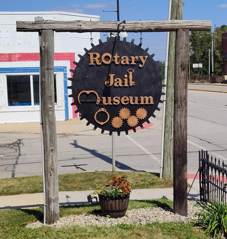
Rotary Jail Museum
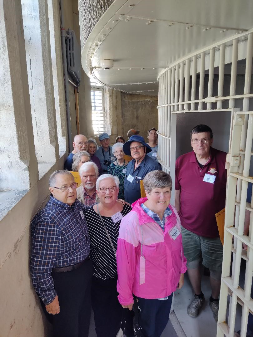
At 1:30 p.m. on Friday, 18 people met at the Rotary Jail Museum in Crawfordsville, Indiana. The jail entrance was originally located on the side of the sheriff’s residence. It was the first rotary jail built in the United States in 1882, used until 1973, opened as a museum restoration began in 1975, and listed on the National Register of Historic Places in 1975.
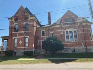

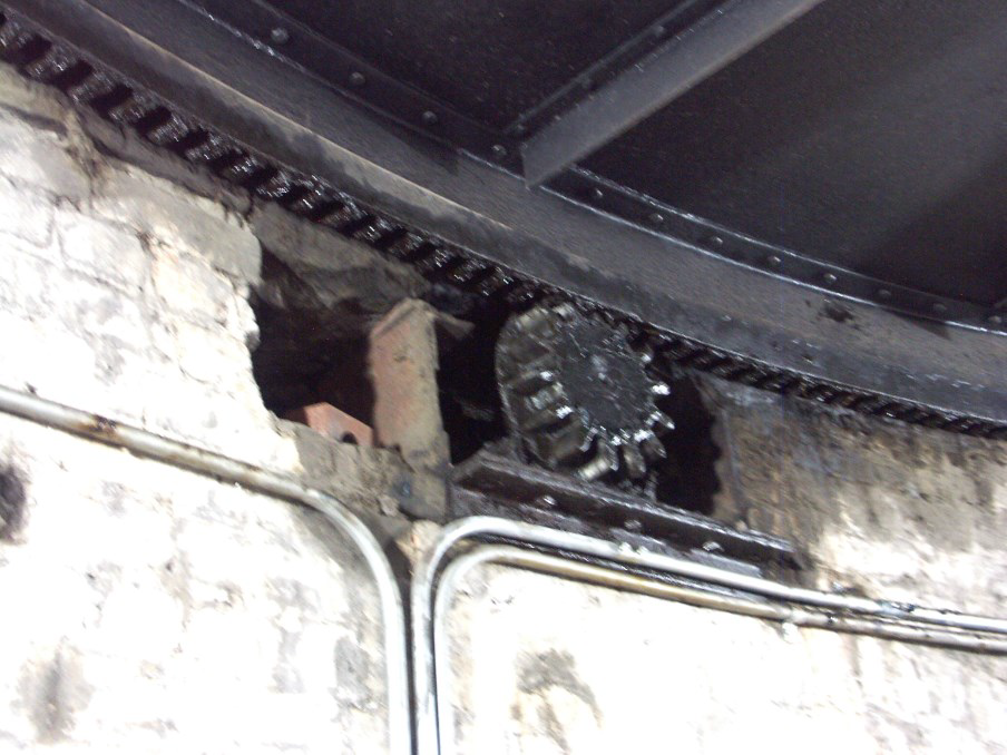
The circular cell block has sixteen wedge-shaped cells on a two-story turntable around a central shaft. This design promised better prisoner security and jailer safety. The cell block was immobilized in the 1930s as a hazard to prisoners. A gear in the basement turns the cell block when a lever is pulled.
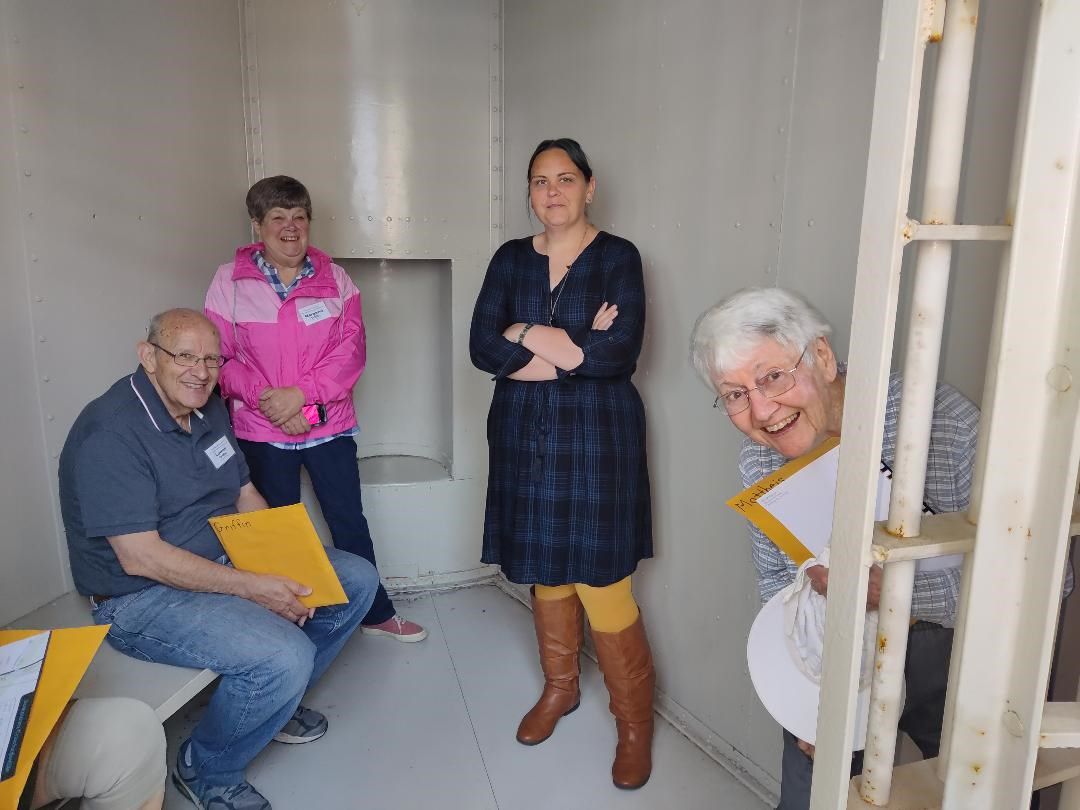
Brittany Turpin the museum director was our docent and got in a cell with Lowell & Margaret Griffin and Phyllis Mattheis. Tiffany also took a picture of our group standing on the outside of the cells.
The jail is heavily visited by paranormal groups with their ghost cams. A large group was coming that Friday night. Although prisoners were generally in jail for one to two days for minor misdemeanors, four prisoners were executed by hanging outside the kitchen door at different times. Are their ghosts haunting the jail? We noted that prisoners had to be careful to keep their hands and feet inside the bars when the cells turned or they would be cut off. It was a very creepy place.
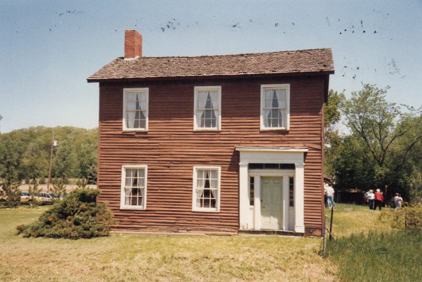
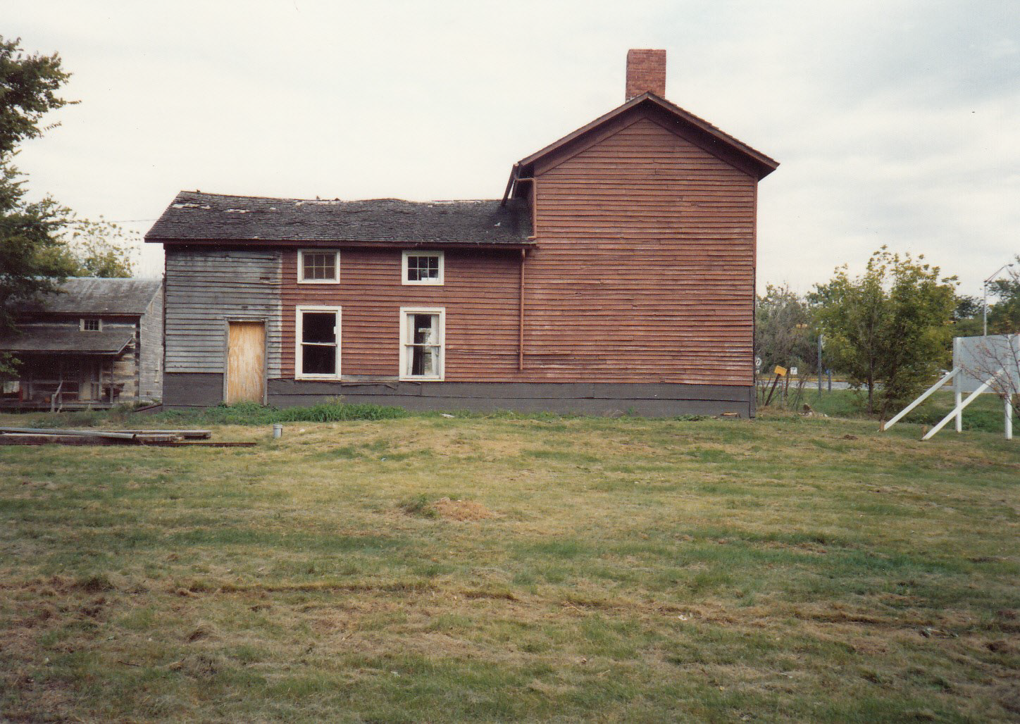
Lew Wallace’s Study

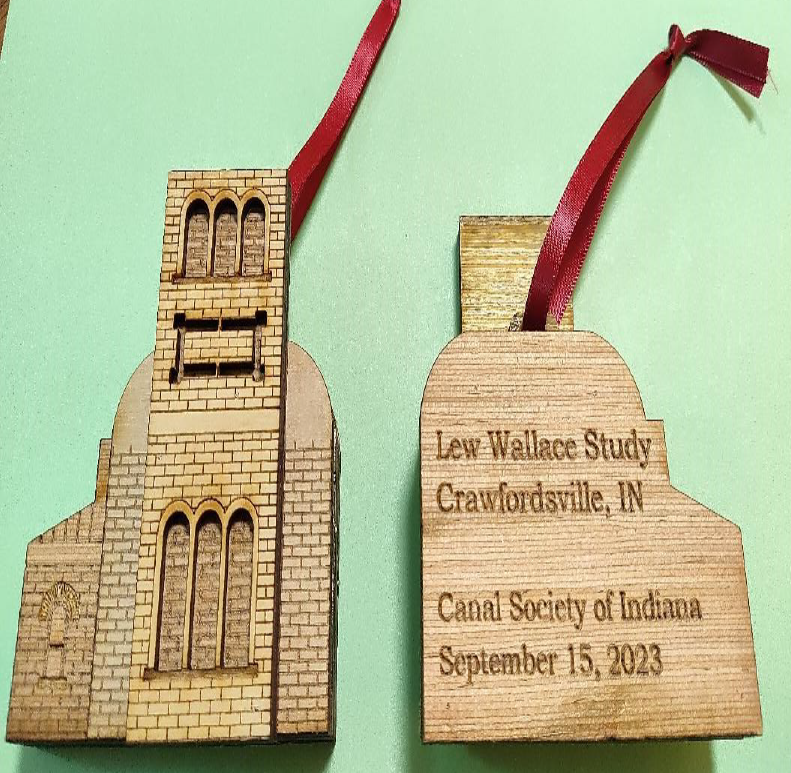
We then went to Governor Lew Wallace’s Study in Crawfordsville. As each person or couple entered the visitor center to view the video of Lew Wallace’s life, they were given an ornament of the Study that was made by CSI member Lowell Griffin as a keepsake of the tour.
Lew Wallace, son of Gov. David Wallace, was the youngest man (age 34) to hold the rank of Major General in the Civil War. He led troops at the battles of Fort Henry, Fort Donelson and Shiloh, Tennessee; Romney, Virginia; and Paducah, Kentucky. He fortified Cincinnati against Confederate attack and saved Washington, D. C. by holding off Rebel troops at the battle of Monocacy, Maryland.
After the war, Wallace served his country as a judge in the trials of the Lincoln conspirators (1865) and Andersonville Prison’s commander Henry Wirz (1865), and as the Territorial Governor of New Mexico (1881-1885). Just before his death he was painting a picture of the Lincoln conspirators that hangs in his Study.
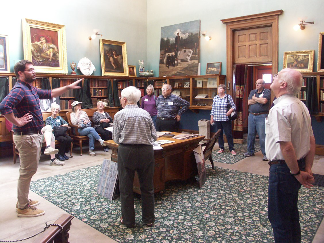
Tom Meeks, our docent, talked about the Study and the life of Wallace, who wrote seven books, including three novels. His masterwork Ben-Hur (1880) is the best-selling novel of the 19th century being published around the world in over 40 languages. It was made into a Broadway drama and three motion pictures, including the 1959 version starring Charlton Heston, which won 11 Academy Awards.
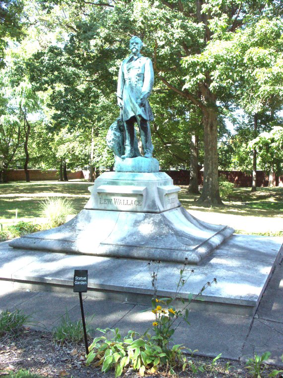
Wallace wrote his wife telling her that he dreamed of a study where he could “rest in and grow reminiscent, fighting the battles of youth over again.” He then designed and built it. It’s a monument to the man who lived many lives and accomplished so much for the United States during his 77 years. Later a statue of Lew Wallace was placed where a tree once stood under which he liked to write his books.
Twenty people attended this tour of this beautiful high ceilinged building that contained Wallace’s books, parts for making violins, paintings, gifts from foreign dignitaries, his desk and favorite chair, photographs, stained glass windows, guns, etc. The pools around it have been filled in and are planted with beautiful flowers.
Yountsville and the Yount’s Woolen Mill & Boarding House

We then drove to Yountsville to see Yount’s Woolen Mill and Boarding House owned by Alan White and Barbara Brooke. Dr. Ron Morris, CSI director, was our docent. He has studied Yount’s mill and written Yountsville: The Rise and Decline of an Indiana Mill Town that is available on Amazon. He walked us down a sloping path to the mill site on Sugar Creek explaining the tableland, the creek and why this was a good location for a mill.

Daniel Yount, an immigrant from Germany, built a series of mills along a small spring-fed-tributary of Sugar Creek. He employed workers from the area and from Great Britain. The mills and accompanying buildings provided work and supplies for the area in the 19th century. A small unincorporated community was formed and called Yountsville. Fleece from sheep was brought to the mill to be cleaned, carded, spun, dyed, woven and sewn into clothing and blankets. For three generations the mill prospered. Then the railroad diminished the importance of the mills and aging technology led to the village going into decline in the mid-1880s. The mill ceased operations in 1905.
Historic Yount’s Woolen Mill and Boarding House is located in Ripley township, Montgomery county, Indiana. The boarding house was built in 1851 and is a two-story, “L-shaped, late Federal style brick building. It has a gable-on-hip roof and two-story porch on the rear side.
The mill was built in 1864 and is a 2½-story brick building on a raised basement with Greek Revival style design elements. Also on the property are the remains of an 1849 frame mill, an 1867 brick building, dam and mill race. The Yount’s Mill was contracted by the U. S. Government to manufacture Army uniforms during the Spanish-American War. It was listed on the National Register of Historic Places in 1989.
Today the mill is so crammed with stored items that we could hardly walk through it. We entered on the second floor since the entrance to the first floor had been filled in by a previous owner. Stairs inside led to the second and third floors. It was damp and musty. Alan White had placed large signs outside the mill telling how it functioned, what it made, etc. He was thanked by Dr. Morris for hosting our tour.
Ending Day 1
Some canawlers expressed a desire to go to a restaurant and have a meal together that night. Bob Schmidt made reservations for 16 people at the Creekside Lodge overlooking Sugar Creek in Crawfordsville. Other canawlers ate elsewhere or, if they lived nearby, went home. Almost everyone was worn out and ready for bed by the time we reached the Best Western Plus hotel.
Good Morning, Montezuma to Covington WEC Canal Tour
Saturday morning those who spent the night at the Best Western had breakfast. The hotel was kind and opened their breakfast bar early just for us since we needed to leave by 7:30 to car pool to Montezuma, Indiana to meet others taking the tour at Benson’s Basin in Reeder Park. We actually arrived ahead of schedule. We had 24 people on Saturday’s tour.
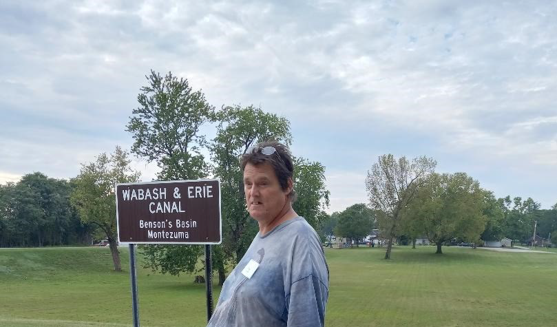
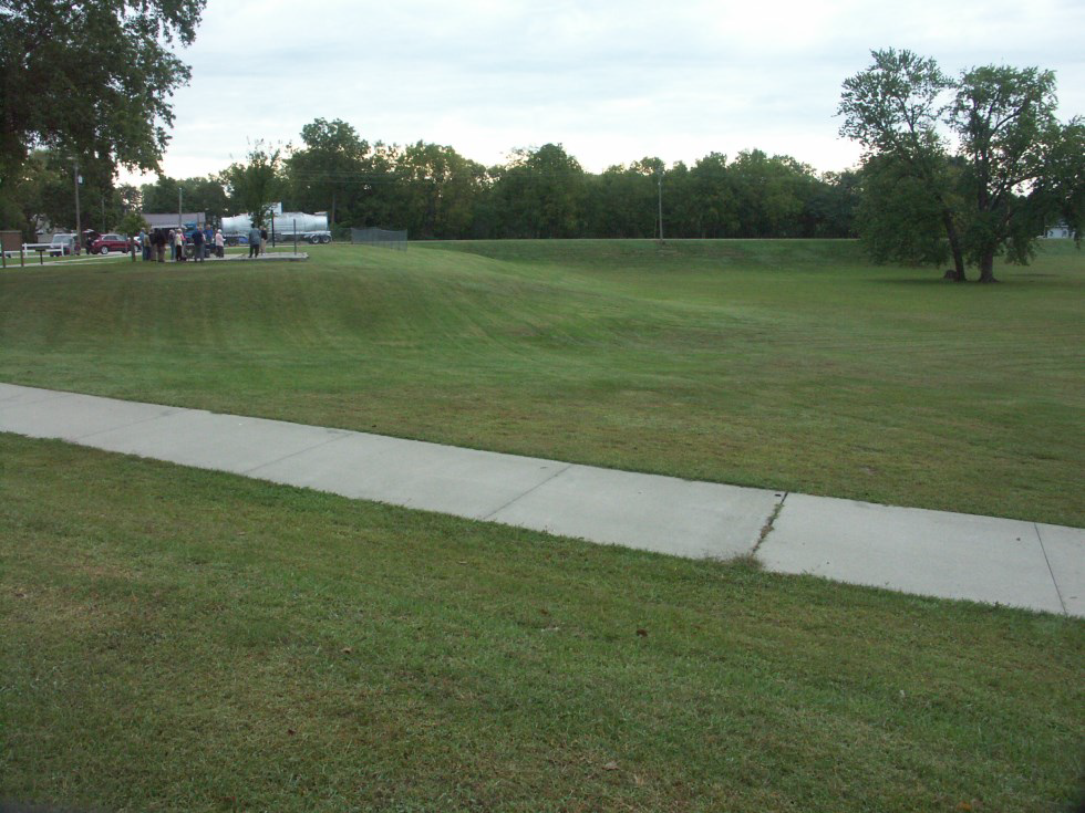
Our tour leader for the morning was Troy Jones, CSI member from Clinton, Indiana. He talked to us at the CSI sign that marked the basin. He pointed out that a road had been built through the basin and the basin continued on the other side of that road. This basin was highly used during the canal era. It had docks from which canal boats were loaded and unloaded with commodities and passengers. After the canal era a Sanatorium was built on its north side. People came to be cured by the mineral spring water at the sanatorium. The outdoor pool was used long after the building was torn down. (See the article about Montezuma and Benson’s Basin in the September 2023 issue of “The Tumble.”
Video by Preston Richardt
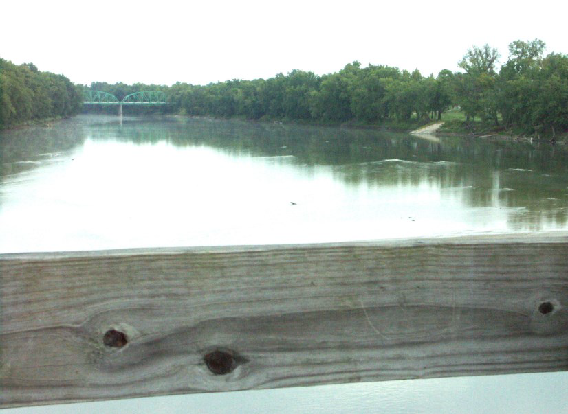
We then headed for Montezuma’s new B & O Walking Bridge located on the Wabash River south of Benson’s Basin. It crosses the Wabash River connecting Montezuma in Parke county to Hillsdale in Vermillion county. Through a grant from the Indiana Department of Natural Resources this abandoned railroad bridge underwent a revitalization project converting it into an 850-foot-long pedestrian bridge. The existing railroad rails and timber ties were removed, and Clark Dietz designed precast concrete deck panels, wooden handrails and abutment retrofits so that the concrete decking could be placed on the existing stringers. Due to tight constraints the one-ton, 3’-4.5’ long panels were designed to be moved with a small forklift so that the volunteers from Parke county could easily put them into place.


Video by Preston Richardt
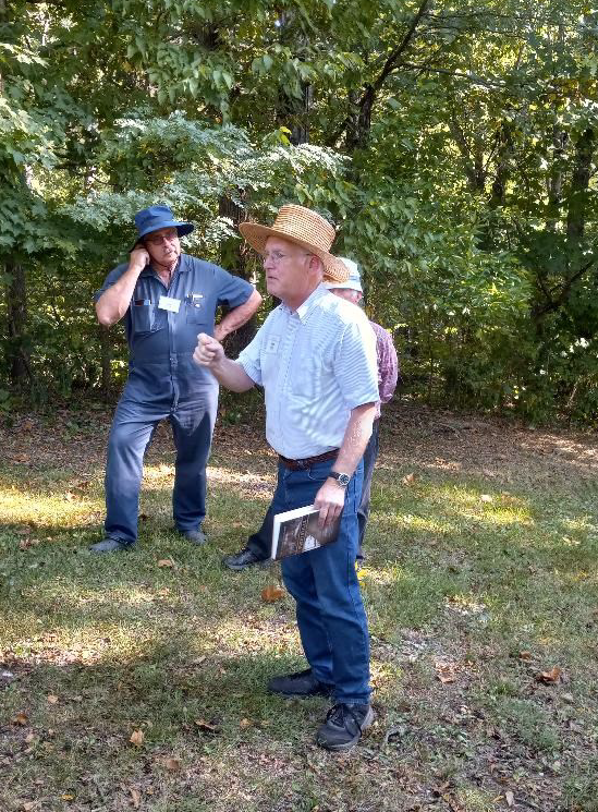
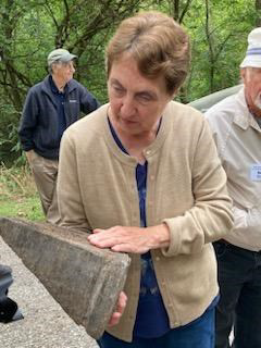
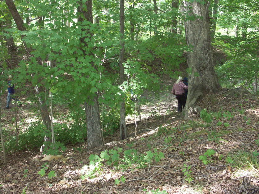
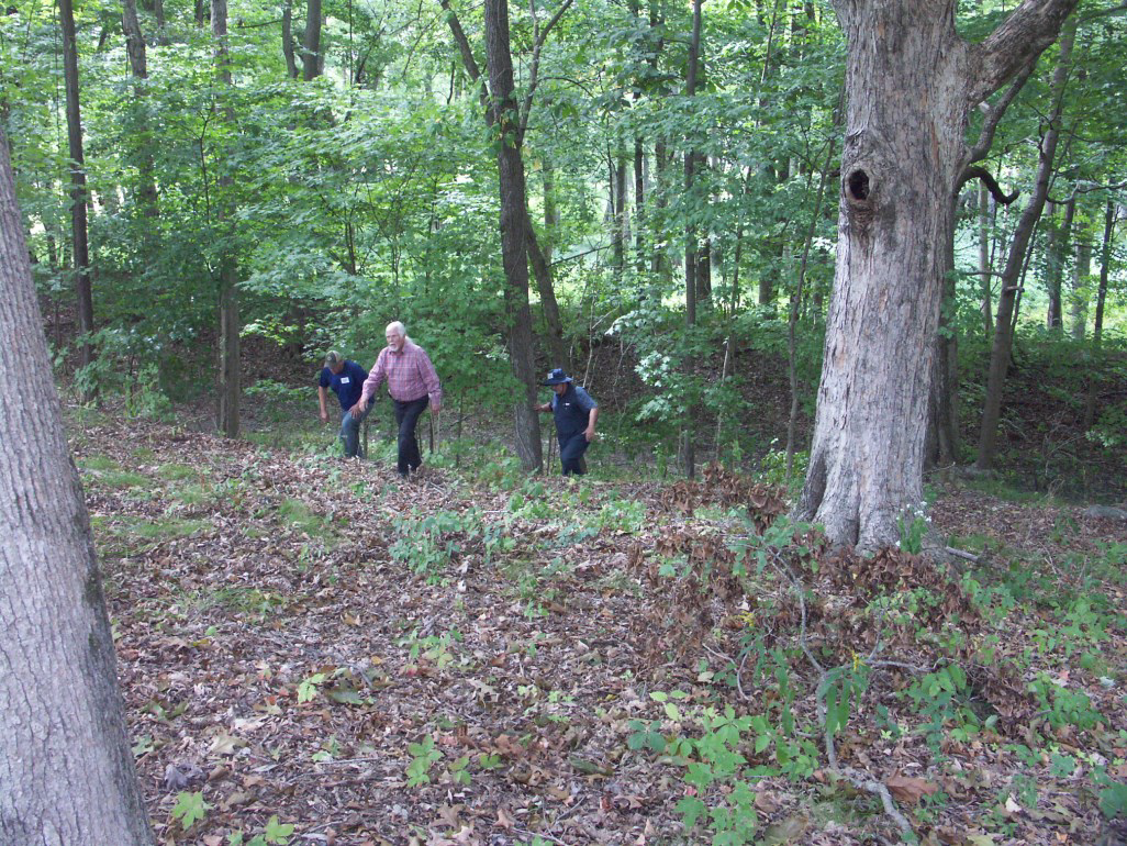
Our caravan then headed south of Montezuma following the route of the Wabash & Erie Canal to Raccoon Creek. Although the canal prism was filled with weeds it could be seen along the way. When we reached Raccoon Creek we stopped to see where the aqueduct had once stood that carried canal boats over the creek. Some of the old aqueduct’s south abutment was still in place and Troy told some canawlers how to get down to the creek to see the remains of the timbers on which the piers of the aqueduct once stood. He also showed everyone a piece of one of the timbers. It will have a plaque placed on it and be put into a museum.


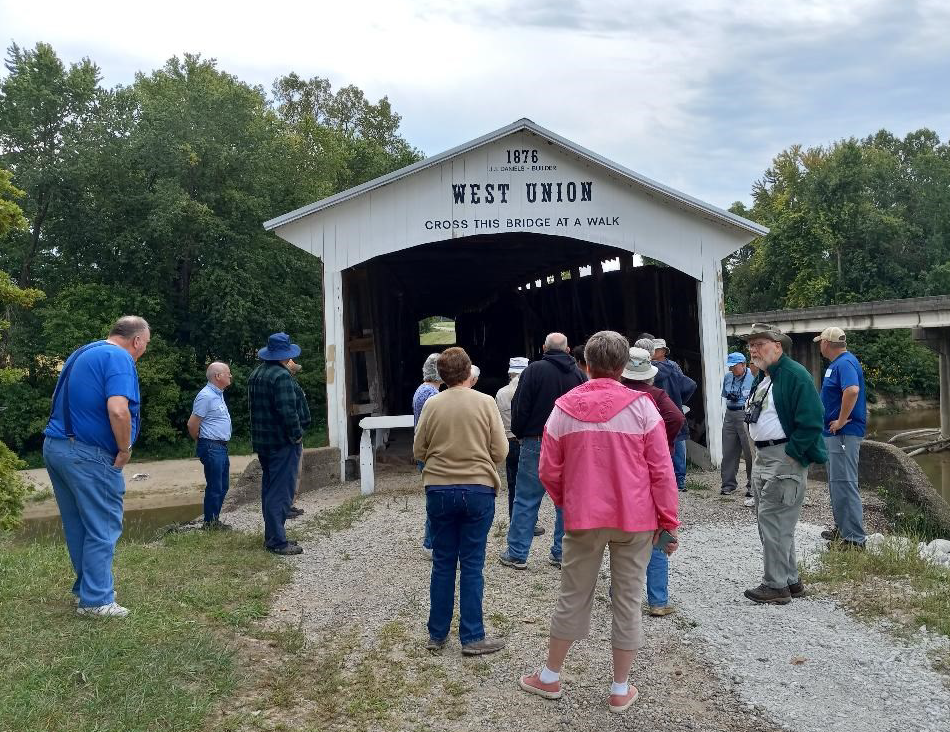
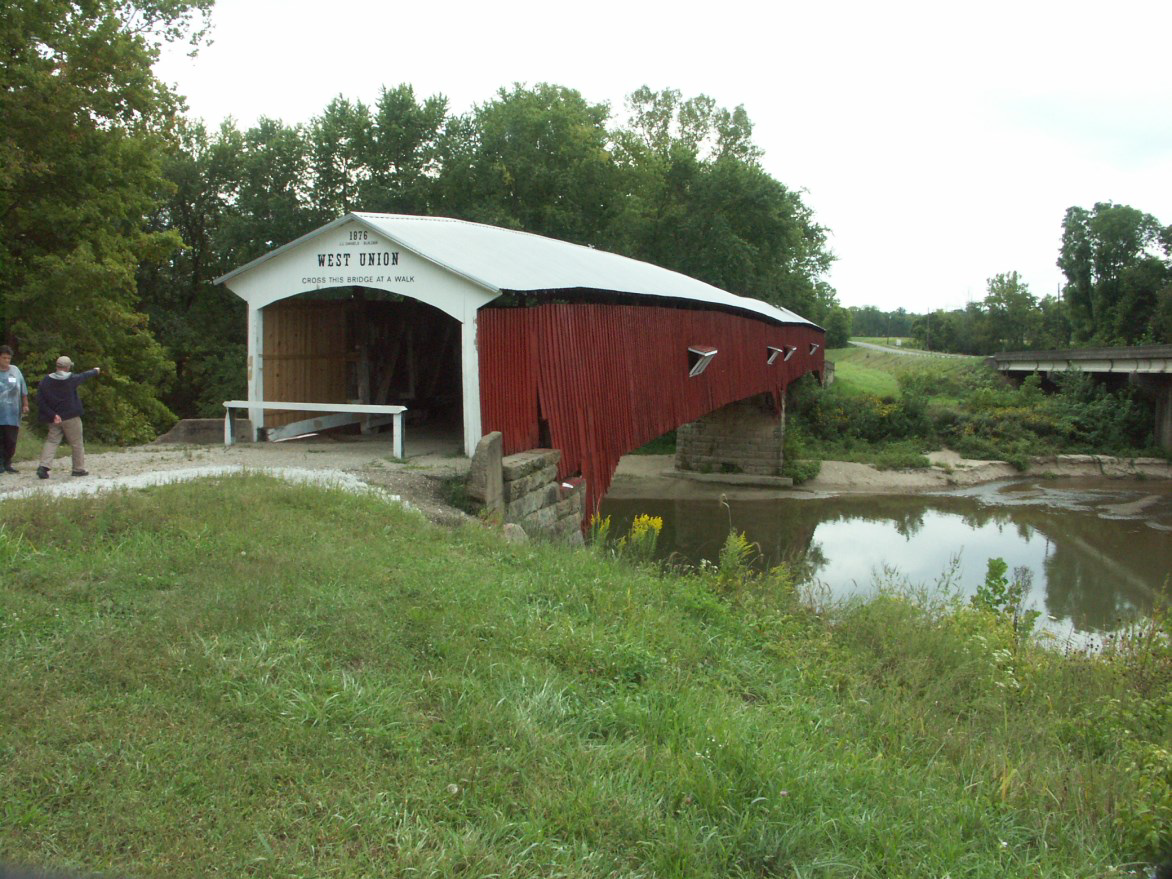
After leaving the aqueduct site we passed Wabash & Erie Lock #39. Heading back north we again crossed Raccoon Creek and passed through Armiesburg where navigation on the canal stopped in 1868 and never resumed, because the railroad put it out of business. We returned to Montezuma on State Road 36, had a restroom break, and made a detour heading north to again follow the canal. We finally turned onto Towpath Road until we reached the 337’-long West Union Covered Bridge. There Troy pointed out that the Manwarring Basin was to the west where canal boats had loaded and unloaded. Robert Manwaring Senior had a monopoly on trade and transportation in this area. He owned a mill, store, distillery, saw mill and the canal basin. The road to the basin was in poor shape so we had to see the depression of the basin from a distance.
The Sugar Creek Aqueduct followed by Lock #38 was located west, downstream from this covered bridge. A dam was built across Sugar Creek 3 miles east upstream to pool water for the feeder canal that entered the main canal just below Lock #38.
The West Union Covered Bridge, a two-span Burr Arch Truss bridge, was a good place to stop for morning refreshments of Gala apples and ZeeZees Berry Apple Crisp Bars donated by Ellison Bakery of Ft. Wayne. We learned that the flood of 1875 had swept the Harrison Bridge off its abutments so the Parke County commissioners instructed J. J. Daniels to draw up plans and specifications for a new bridge at West Union in December of 1875. He was instructed to widen and repair the abutments on the existing bridge for $600. He completed this bridge in September 1876. There is strong evidence that the north side stone abutment of Sugar Creek Aqueduct #11 of the W & E Canal was used in this new bridge. This would have been possible since the Circuit Court on December 4, 1875 ordered that the W & E Canal with its appurtenances and certain lands and lots and among others that certain tract and parcel of land be sold at public auction at the Court House door in Terre Haute, Indiana. At the sale Josephus Collett and J. J. Daniels purchased the property that was in Parke County for $1,999, including its banks, margins, tow-paths, side cuts, feeder basins, right-of-way, locks, dams, water ponds and structures. Therefore on April 13, 1876, Daniels owned the aqueduct. Also a study of the differences in the way the stone was cut on this bridge’s abutments supports this theory.
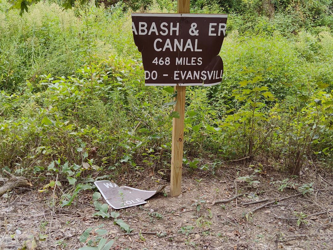
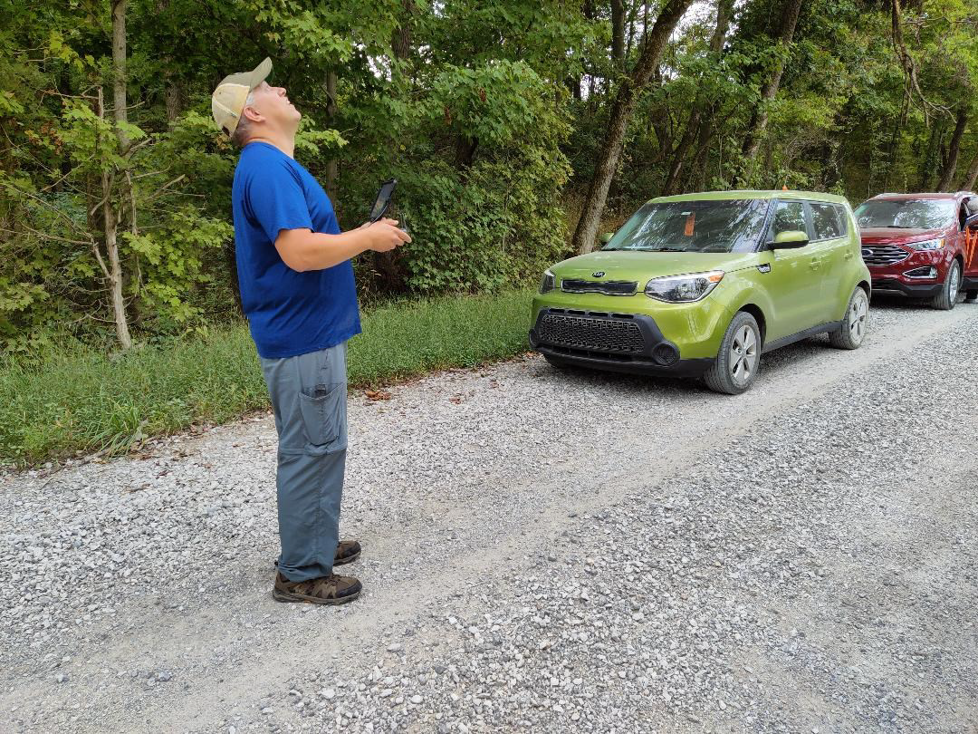
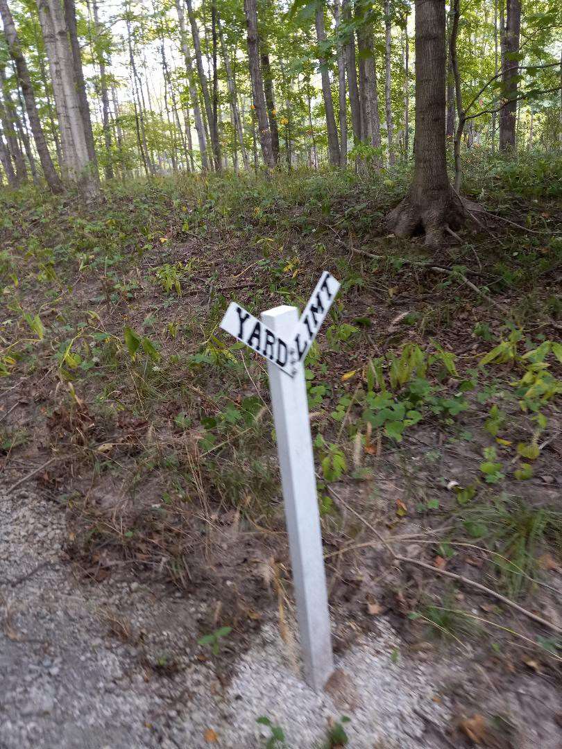
We continued to follow Towpath Road and stopped at a CSI sign that Troy Jones had erected by a newly dredged section of the Wabash & Erie Canal. It had been broken in half by strong winds and repaired by Troy and his brother. It was later vandalized. After seeing this damage Troy put up a camera and caught two boys trying to remove the post and sign a few days later. He found out the name of their father and the father agreed to replace the sign. Troy ordered a much larger sign that Duke Energy has agreed to erect on two posts placed in the middle of the canal after the leaves are off the trees.
While most of those on the tour were learning about the sign, Preston Richardt, CSI director from Elberfeld, flew a drone over the canal and made a video of it. His videos are included here.

Video by Preston Richardt
We drove very slowly through the Mill Creek Covered Bridge one car at a time on our way to Lodi. Troy pointed out that the road before the bridge at Lodi washes out almost every year when hard rains occur. The Rockville Republican of June 18, 1858 reported a similar incident back then saying “At Coal Creek a breech was made thro’ the guard bank, and the stream passed around the dam, causing heavy damage to the earth work, though the dam and its abutments, with the two guard locks and bridges, are uninjured.” Before the bridge to Lodi Troy had erected a CSI sign that says Coal Creek Dam.
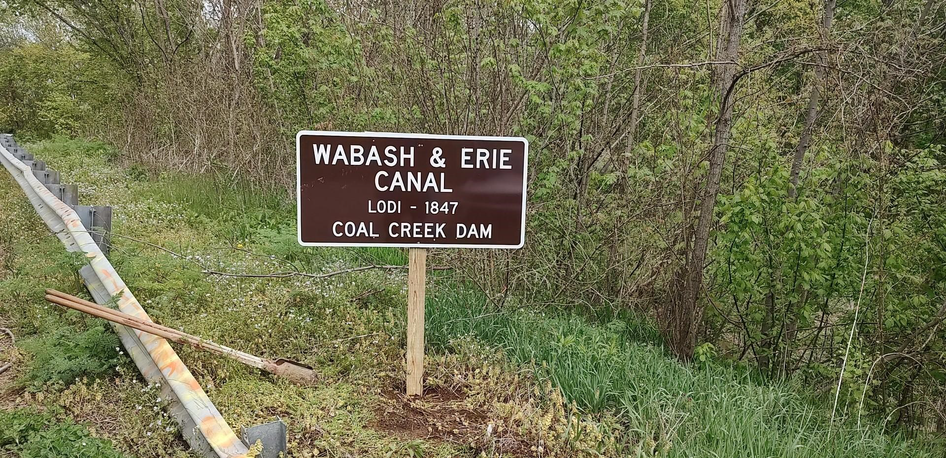
We stood on the bridge over Coal Creek and looked to the west to see if we could see where the dam was once located. However, it was about a half mile down the creek around a curve. Coal Creek was very low when we were there. It was hard to imagine a large pool of slackwater.

The Wabash & Erie Canal terminated at Lodi in 1847. When the stockholders took over the canal from the state they continued the canal south of Lodi. They had to get the canal across Coal Creek. Since is was costly to build an aqueduct they built a dam instead that created a slackwater pool on which to float canal boats. The boats passed through a guard lock into this slackwater pool, crossed the pool and entered back into the canal through another guard lock on the opposite side. The guard locks kept the canal from being damaged by creek water during freshets. The dam was built of hewn timbers and was 17½ feet high. Above Coal Creek the level of the canal was 5 or 6 feet higher than the level below. The towpath was on the west side of the canal so it became necessary for the horses to cross over the canal to the east side by means of a towpath bridge.
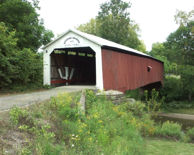
It was nearing lunch time so the caravan headed toward Cayuga, the Eugene Covered Bridge and the Eugene Covered Bridge Restaurant. When we arrived the tables were set and ready for us in a separate room. The server quickly took our orders and the hot and tasty food was delivered promptly. It is noted for its pie and it was very good. While waiting for the food Bob Schmidt had everyone introduce themselves and say where they lived. Terry Bodine gave us instructions for our afternoon tour. Others commented on what they had seen and would be seeing. Those who finished eating early took the opportunity to take pictures of the nearby covered bridge. This timber, burr arch, single span, covered bridge is 180 feet long and crosses the Vermilion River.
We returned to Lodi and headed north passing by the Coffing Brothers Orchard, one of Indiana’s largest apple orchards located on 1,400 acres of farm land. They harvest approximately 100,000 bushels of apples a year packed under the ABC brand. The older apple trees were loaded with apples and young trees of every size could also be seen as we passed by.

We stopped to see excellent canal prism on Duane Grubb’s property. There Terry Bodine had erected a CSI sign and added a canal boat on top. Some of the more agile canawlers climbed down the bank and into the canal. David Kurvach, CSI director from Newburgh, Indiana, found a huge stone with pick ax marks in the prism. Beyond the canal was swamp land that was dry at this time of year.
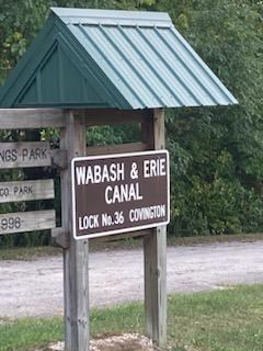
We then drove into Covington to see another sign under a kiosk built by Terre Bodine for Lock #36 of the Wabash & Erie Canal. The other side of this sign has diagrams of how a lock operates, etc.

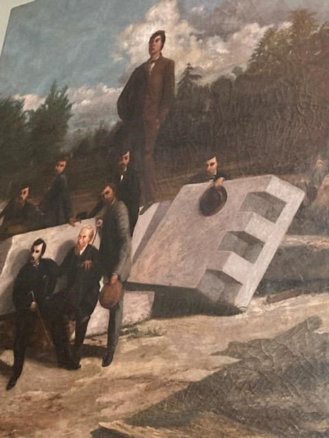
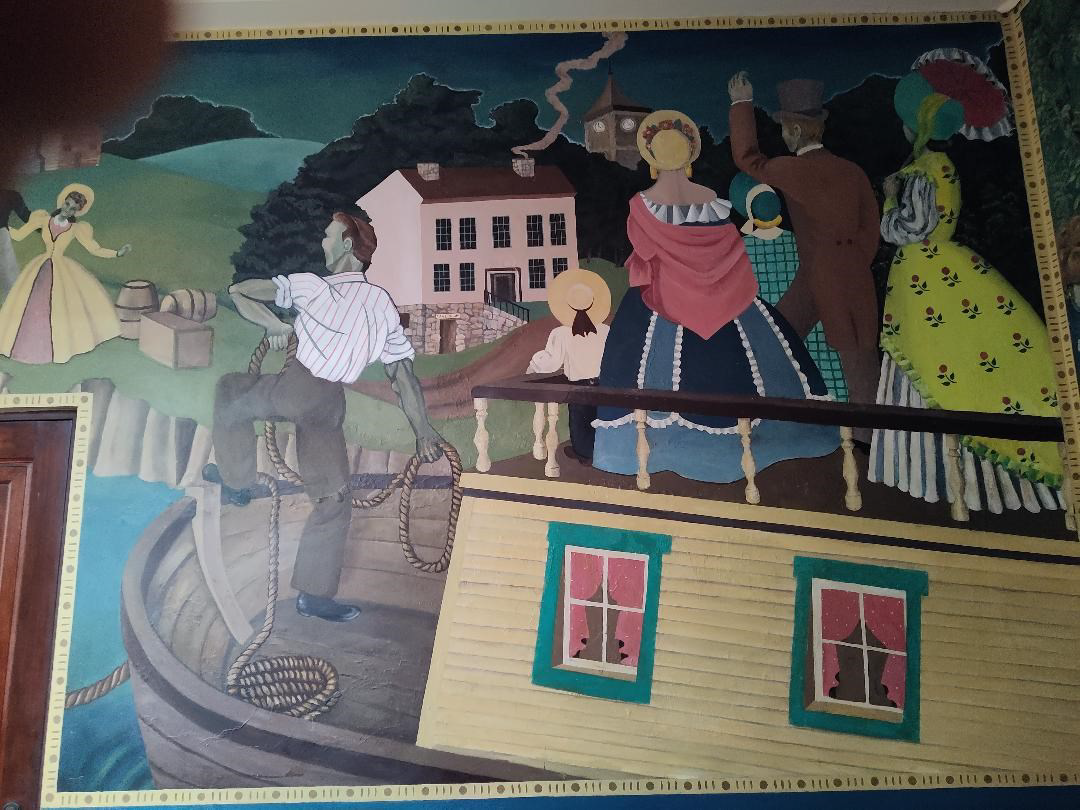
We then went to the Fountain County Court House to see Terry Bodine’s model of a timber canal lock like the one that had been in Covington and view the courthouse murals. One of the murals shows a group of men digging the Wabash and Erie Canal. A brochure given to us by CSI member Henry Schmitt of Covington, who had opened the building for us, said they were Scotch and Irish laborers. “Most of the work was done by horse and scoop. Following this group of men is the completed canal, showing a passenger packet on it. In the background is the old Hiigel House, a tavern which was patronized by the canal traffic.”

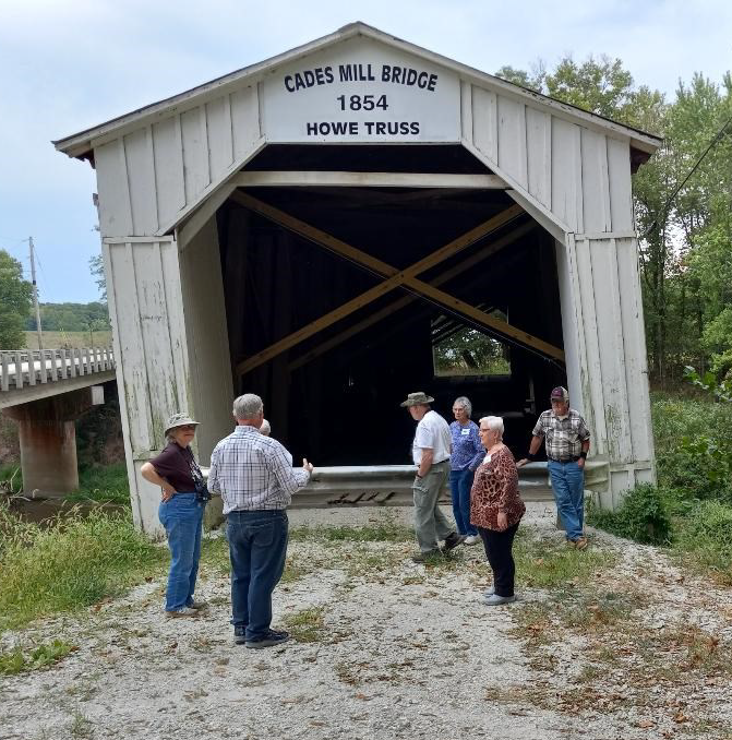
From the courthouse we crossed the street to “The House With The Lions” antique shop to see a model of the Cade’s Mill Covered Bridge built by Terry Bodine. Covington is raising funds to save the bridge.

Some of the group then went to Cades Mill Covered Bridge with Henry Schmitt, who is leading the fund raising campaign to save the bridge. Henry told us that the bridge was built in 1854 and is Indiana’s oldest covered bridge still in its original location. In 2019 a bridge contractor discovered a broken chord, a serious structural compromise that unless repaired could cause the 150-foot bridge to collapse.
A new concrete bridge was built to bypass the covered bridge in 1976. It is one of three covered bridges remaining in Fountain county and is a Howe Truss structure. Although cross timbers have been placed inside the bridge attempting to stabilize it. It is leaning badly and is unsafe. An estimated $800,000 is needed to make the necessary repairs. Of Indiana’s 600 covered bridges built between 1820 and 1922 approximately 90 remain.

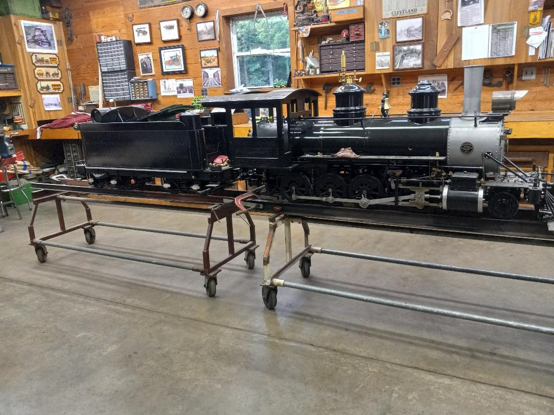
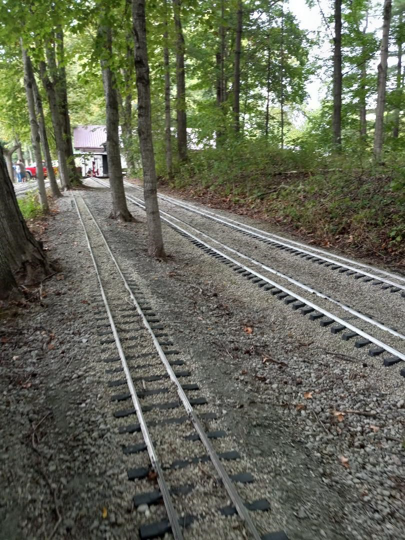
After learning about the bridge this group joined the rest of the group at the Bodine residence. There Terry, his son and grandson have put together a steam engine from old rusty parts of other pieces of machinery. It was built on a sled. They had it going as we drove in and blew the loud sharp whistle.

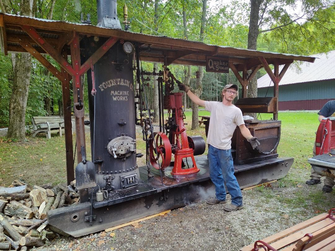
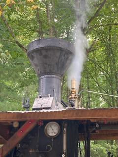
Inside the workshop they have built a steam locomotive from scratch, machining all the parts themselves. It is just about ready to pull their model train, which is currently pulled using a battery operated engine. They have built over a mile of track on their property and gave everyone a train ride. It was a cool and enjoyable ride.
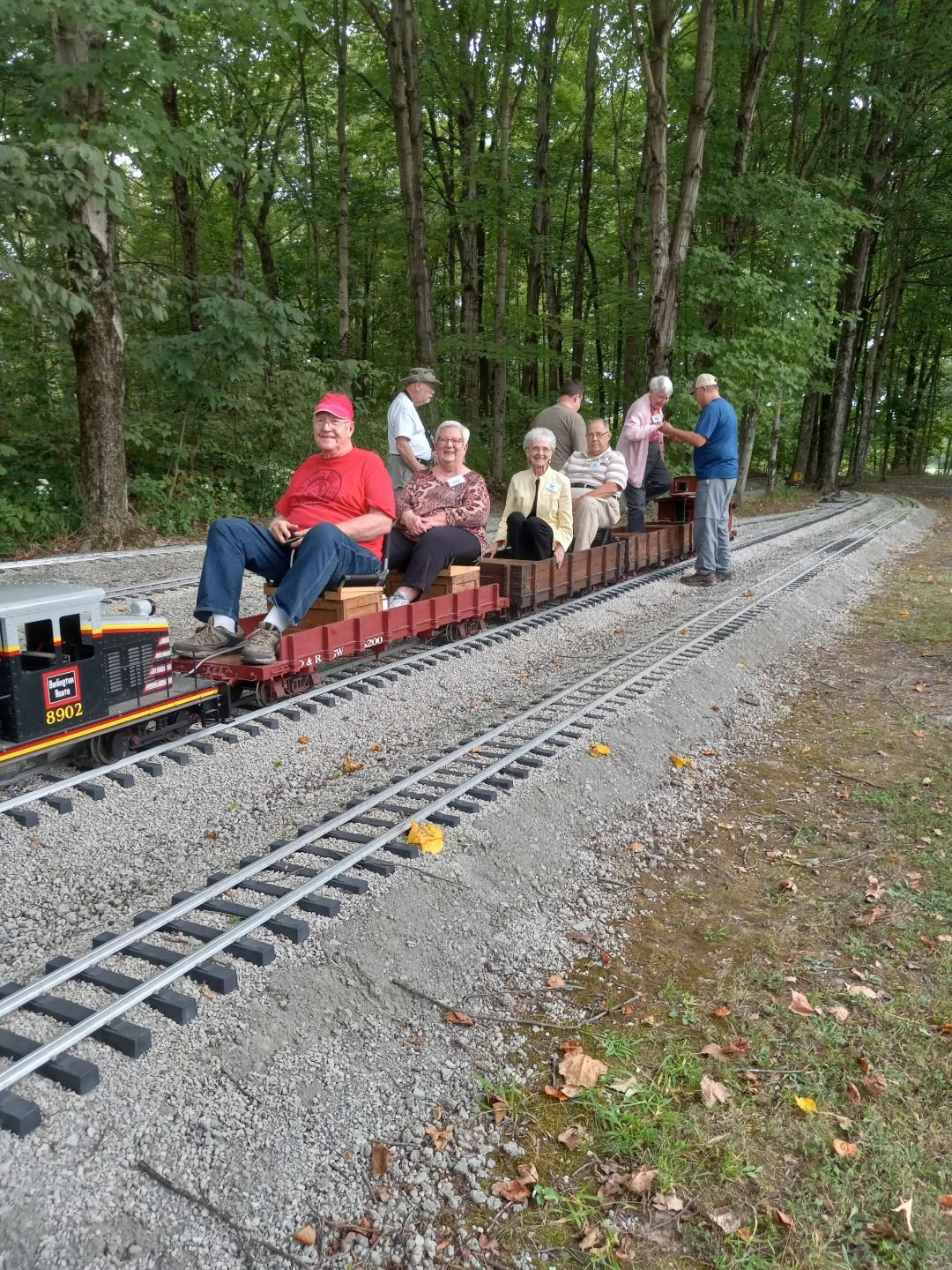
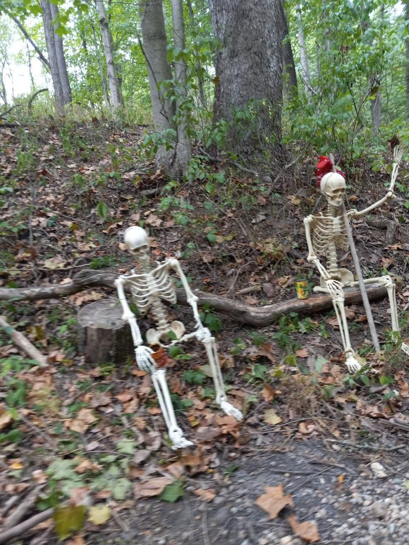
We passed by Kentucky coffee bean trees, a quarry, crossed a creek on a wooden bridge that had barrels of water on either side of it to put out a fire started by sparks from the locomotive, and were greeted by human skeletons and skeletons of snakes before returning back. What fun and a great way to end Saturday’s tour.

An Evansville Canal Family
By Stan Schmitt
During Evansville’s brief canal era one family played a major part in canal construction, navigation, regulation and maintenance. Between 1837 and 1864, Nathan Rowley and his son-in-law Thomas D. Smyth served in the capacities of contractor, boat builder, owner, captain, collector, repair superintendent, and manager. From start to finish, no other family in Southern Indiana had more interest in Indiana’s canals than the Rowleys.
Nathan Rowley was among the earliest settlers of Evansville. He was born in Shoram, Vermont on September 28th, 1788. About 1819 he left the family farm and came by way of Ohio River flatboat to the recently founded town of Evansville, Indiana. In 1820 he began the first of his many business ventures with a boot and shoe shop overlooking the Ohio River. During the next twenty years Rowley, with a number of partners, engaged successfully in the drug, grocery and dry goods businesses. With the money derived from these businesses, Rowley purchased the land on which he later platted the Northeastern Enlargement, or Rowleytown. Between 1823 and 1837 Rowley became involved in government, serving as Justice of the Peace, Evansville Trustee, and County Councilman.
In 1837, Rowley’s connection with Indiana’s canals began. In that year Rowley and his former business partner Marcus Sherwood contracted to build seven to ten half-mile sections of the Central Canal’s Southern Division. This Division consisted of the southernmost twenty miles of the canal intended to connect Evansville, Indianapolis and Peru. Among the sections completed by Rowley and Sherwood in 1839 was the half-mile stretch in downtown Evansville between Canal and Court Streets. By that time the Internal Improvements projects had brought Indiana to the point of collapse and all but the most essential work was deferred. In 1840 the completed Southern Division was turned over to a special agent and was intermittently filled with water from the Pigeon Creek Feeder Dam.
It was during this period that the future second member of this canal family arrived in Indiana. In 1838, the fourteen-year-old Thomas D. Smyth, along with the rest of the family, arrived in Indiana from Ireland. Whether or not they came to work on Indiana’s canal system has not yet been determined, but Thomas was said to have worked with Rowley in constructing the canal.
With the collapse of the Internal Improvements program both Rowley and Smyth became involved in other fields. The Smyth family took up farming and settled several miles from the future route of the Wabash and Erie Canal at Fort Branch. During the 1840s Nathan Rowley served as Probate Court Judge and ran the Indiana Flour Mill. It was also during this period that he platted the Northeastern Enlargement and opened the Salt Well Park on Pigeon Creek. Rowley and others in Evansville pushed hard during this time to find the means to both pay off the state debt and finish the canal to Evansville. As a result of their efforts a petition was drawn up to Congress for the donation of land in the Vincennes District to aid the state. Rowley contributed more liberally than any other to defray the expense of circulating this petition through 17 states. In 1846 Rowley bore a large share of the expense of lobbying for the passage of the Butler Bill to finish the canal and redeem the state’s credit.
In January 1848, as canal work was beginning again in Southern Indiana, Thomas D. Smyth (Smith) married Nathan’s daughter, Mary Louise Rowley. Two years later the entire family, consisting of Nathan, Thomas and Mary, their one-year-old son Henry, and Tom’s brother John, were living together at Thomas Smyth’s inn. As the prospect of the canal reaching Evansville became more apparent, Nathan again became involved with the canal by joining a stock company formed to build canal boats. With Rowley appointed as superintendent, experienced carpenters were brought to Evansville to construct two boats, the Rowley and the Evansville. In December 1852, the family’s formal connections with the Wabash & Erie Canal began with Nathan Rowley’s appointment as Collector of Tolls for the port of Evansville. For the next six years Nathan Rowley abandoned most of his other efforts in favor of the fifty-dollar-a-month position as collector. To show his confidence in the new canal, Rowley and his partner Joe Glasgow operated the canal boat Joe Rowley until early 1854, when it was sold to his son-in-law Thomas Smyth. From 1855 to the end of 1858, Rowley and Francis Amory operated a coal mine on the bank of the canal in Warrick County. The coal mined there was transported to Evansville in their canal boat, the Black Diamond.
During the same period Thomas Smyth operated, in turn, the canal boats Empress, Joe Rowley (which he renamed the Nathan Rowley), and Tobacco Plant. While captaining the Rowley, Smyth made a number of trips between Evansville and Toledo accompanied by his wife and son. As a result, it is thought that Henry B. Smyth, who died in February 1922, was probably the last living person who had travelled the entire length of the Wabash and Erie Canal. In June 1855, during the Clay County Reservoir War, Smyth joined the Evansville Guards, who were called out by the Governor to guard the canal structures and arrest the ringleaders. By 1858 Smyth had given up boating and was appointed Repair Superintendent for District Number 9 between Hosmer and Evansville. In 1859, Nathan Rowley was notified that the new canal managers had decided to appoint someone else as Collector.
After an unsuccessful run for Evansville Mayor, in which he obtained 39% of the vote, Nathan Rowley resumed his position as Justice of the Peace. Thomas D. Smyth was continued as Superintendent for District #9 by the managers of the Southern Canal Company and was later appointed Superintendent of the entire canal between Evansville and Newberry.
With the closing of the southern end of the canal at the end of 1860, Thomas D. Smyth went into the livery business. Three years later he signed a contract to maintain the canal between Pigeon Creek Reservoir and Evansville for local traffic. To assist him he had his father-in-law, Nathan Rowley appointed Collector.

In 1864 the canal was abandoned once more and Smyth moved to farm on the bank of the canal east of Evansville. The following year Rowley retired and moved in with the Smyths. It was there, on the banks of the canal which he had helped to build and maintain, Nathan Rowley died on December 1, 1873. He was buried in Evansville’s Oak Hill Cemetery overlooking the bed of the Central/Wabash & Erie Canal, which had been a great part of his life. Thomas Smyth went on to build a tile factory on the canal bank, which he ran with his son until his death on May 14, 1880. [Perhaps] He was also buried in Oak Hill Cemetery, a few hundred yards from the canal, which he had on numerous occasions sailed.

Nathan Rowley is buried in Sec. 7 Lot 4 Grave 3 of Oak Hill Cemetery in Evansville, Indiana. His unmarked grave is in the sunken area of the picture. The Wabash & Erie Canal ran just beyond the tree line at the top of the picture.
Although there is a Thomas Edward Smyth buried in this cemetery along with many other Smyths, his mid-dle name does not correspond to our Thomas D. Smyth. Could Thomas D. be buried in Kansas?
Because of the failure of the Wabash and Erie canal, neither Nathan Rowley nor Thomas D. Smyth (Smith) have received much recognition for their important part in Evansville’s history. It is hoped that this article will in some small way correct the omission.
Ferries Fed Wabash & Erie Canal Boats
By Carolyn Schmidt
With the opening of the Wabash and Erie Canal to Parke County in 1848, ports/towns along its route developed very rapidly and quickly reaped its benefits as they did in other counties. Due to cheap canal transportation the rate of exchange went up about 20 times allowing the famer to buy twenty times as much with the same amount of produce. Commerce grew by leaps and bounds, bringing greater prosperity than they had ever known.
Ports in Parke County (from north to south):
Lodi: Later named Waterman, the canal bordered two sides of the town of 9 city blocks making room for warehouses and docks. Some warehouses had docks on the canals making loading and unloading convenient.
Howard-West Port: Howard was actually the west port, had four to six city blocks, the canal and warehouses while West Port to its east was larger, had eight city blocks, and had the merchants. This great port served much of the north-central part of Parke County.
West Union and Rockport: West Union had a large canal turn around basin. Two and a half miles upstream a feeder dam was built across Sugar Creek. The feeder connected the main canal with the pool of water above the dam. A coke oven, an ore iron foundry and a pottery shop were located near this dam. The foundry cast the wickets for the lock gates and cast iron plows. Rockport was 5 miles upstream from the feeder dam and was the port for Annapolis. Many boats were built at Rockport.
Montezuma: The largest port had Benson’s Basin, a large turnaround basin for canal boats, and was also a good place to catch fish that came down from the north. Many of the canal boats were owned by individuals who paid toll for the use of the canal. During canal construction many Irish Catholics lived there or congregated there at night and on weekends. Liquor led to fatal fights and murders with victims being buried in the Catholic Cemetery.
Clinton Locks: This port was near the town of Clinton and the canal locks. Its name was changed to Hudnut in 1865 when some of its buildings were purchased by the Hudnut Company to manufacture hominy and meal. After the coal mines were established it became Lyford City, which was later shortened to Lyford. Much grain and other farm produce was shipped from this port.
Numa: During canal building Numa was an important business center. A farmer laid out a town of two or more blocks, sold lots and built an inn. There was even a promenade. However, it never became an important port.
All of the above ports are located to the east of the canal. What were the farmers who lived west of the canal to do to reach these ports?
During the canal era ferries were of great importance for farmers and others who lived west of the Wabash River to get their produce and themselves to the ports on the Wabash & Erie Canal. At these ports canal boats could be loaded to carry their produce either north east to the Great Lakes, transferred to steamers headed to Buffalo, reloaded onto canal boats on the Erie Canal and go on to the port of New York or they could carry them south to the Ohio, load them on riverboats, and take them down the Mississippi River to New Orleans.
Ferries were simple, flat, almost raft like boats that carried people and their animals and wagons over unfordable rivers where there were no bridges. Generally they were built so that the river current propelled them across the river. They had a large rudder beneath the boat, which could be angled about 45 degrees either way causing the boat to move at right angles to the current. On the return trip the rudder could be tilted the other way. The boat was attached to a cable strung from a tree top on one bank to a tree top on the opposite bank keeping the boat from floating downstream. At each end of the boat was a rope running up to and looped loosely around the greased overhead cable so it could slide. Boats without rudders crossed the river by lengthening or shortening the rope at one end causing the boat itself to swing at an angle and act as its own angled rudder. The return trip only required adjusting the one rope so that the boat would angle the other way.
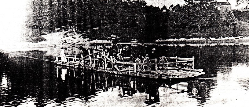
The cable being across the river sometimes presented a problem. If the water in the river was unusually high and the overhead cable sagged, steamboats could get caught by it. To alleviate this problem, where the river made a sharp bend the cable was fastened to one bank at the bend only a hundred or so feet up stream from the ferry allowing the ferry to swing like a pendulum back and forth across the river. The cable floated on small rafts or barrels to keep it on top of the water. When the ferry was on the same side of the river where the cable was attached, the cable was out of the way of any steamboats. Luckily there was only light steamboat traffic on the Wabash River due to rapids near Vincennes and shallow water north of Lafayette.
Ferrymen could only get a license to operate a ferry if they owned the land at the ferry. The question arose, did they have to own landings on both sides of the river? Apparently this law was loosely enforced. They were told what fees they could charge. Even with the low fees some operators did very well. They usually lived near the ferry landing on one or the other side of the river. Many of them were also farmers and were not at the landing when someone wished to cross the river. Therefore a ferryman was required to have a bell at each landing, which could be rung by anyone during the day or night to attract his attention to operate the ferry. Sometimes at night or in very bad weather the ferryman seemed to ignore the bell.
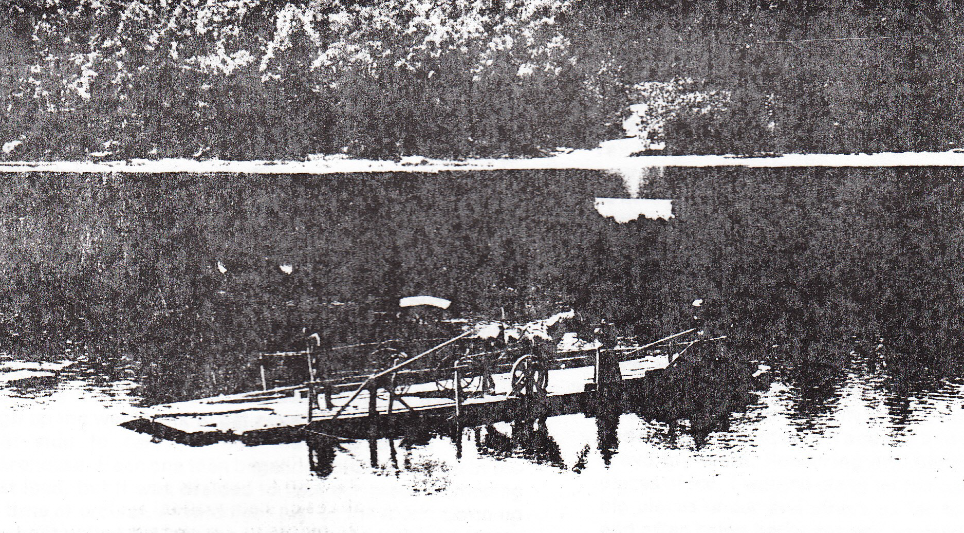
At each end of the ferry there was a folding ramp that was lowered to the shore to load and unload the boat. Usually, the ferry needed a hard shove to get it away from the bank and into the current.
There were at least five ferries crossing the Wabash River between Parke and Vermillion counties. The first ferry coming south of Fountain County was just below Lodi Then about 4 miles further southwest was a ferry crossing that originally was established by Thomas Filson in 1824. It then transferred to a Daniel Jones and then in 1856 to John C. Johnson. The ferry location was just upriver from Manhattan Island and about 2 miles north of Newport. This ferry connected with the roadway leading to Howard, which was located on the east side of the W&E Canal. The Johnson Ferry remained in that family after the canal ceased to operate and operated until 1908.
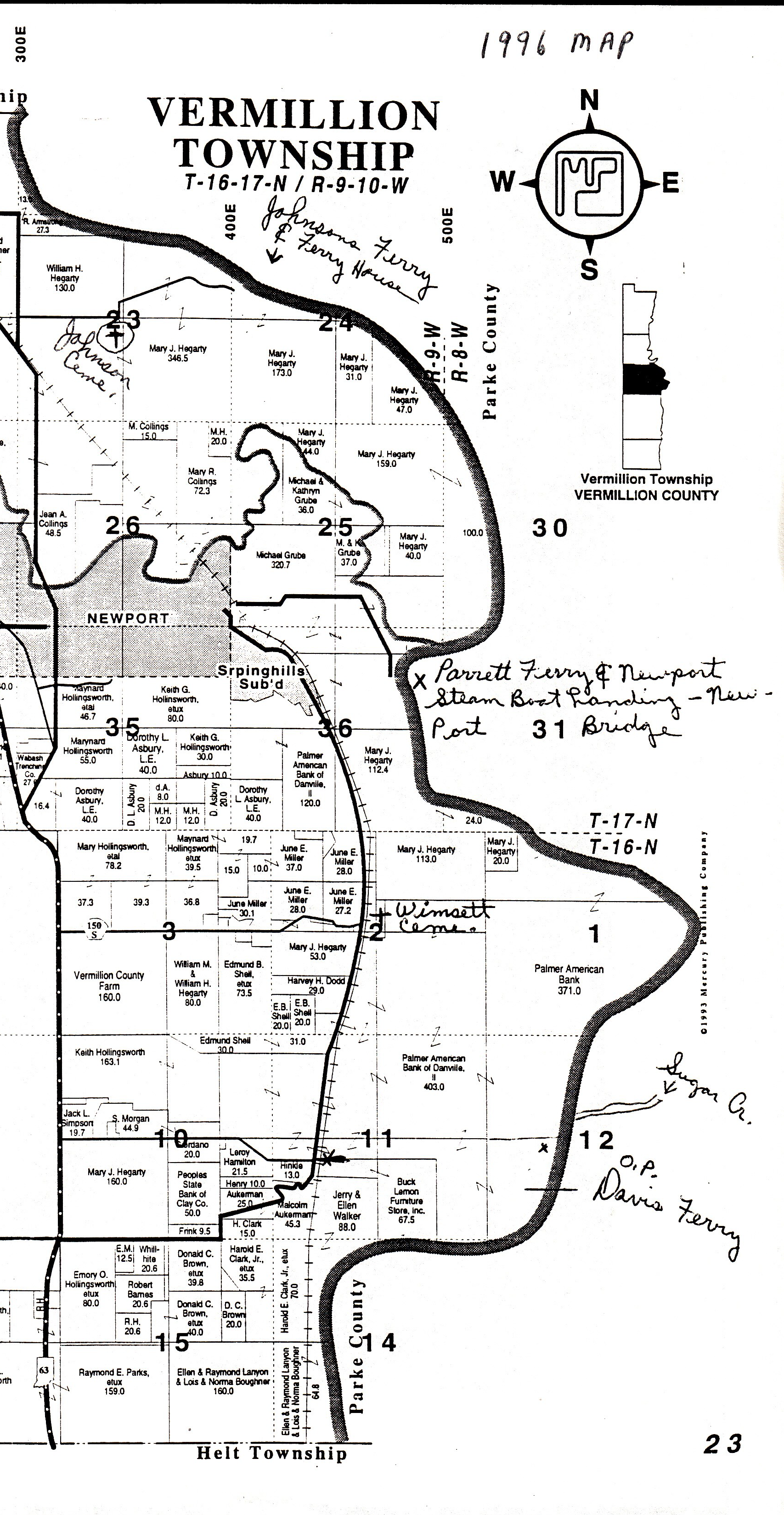
The next ferry south was just south of Newport and located just below where the Vermillion River coming from the west empties into the Wabash. It was called the Parrett Ferry and later the Reed Ferry.
Another ferry was located just below where Sugar Creek enters the Wabash. Originally established by the Wimsett family it was purchased by Oliver Perry Davis in 1845. Davis, originally a dentist from New Hampshire, came west and purchased farm land on both sides of the Wabash and operated the ferry landing until 1874. He became an important politician from Parke County. See his biography on the CSI website.
About 2 miles north of Montezuma was the John Collet Ferry, originally established in 1820, four years before Vermillion County was established. Later William Craig operated this ferry, but it ceased operation in the mid 1840’s.
On December 4, 1899 Daniel Nelson Morrison, who had been reared near Annapolis, Parke County, Indiana, wrote a letter reminiscing about two of his harrowing ferry adventures near Montezuma. He writes, “..in another generation the old style of ferry and its risks will be forgotten, and then later none will know that such ever existed. It used to be a mystery to the writer to see the boat tied to a tree or stump away up the river, and the cable formed of iron rods carried over a line of little ships from the boat to the tree, and what part the little ships had in swinging the boat from landing to the other side. A good many times crossing learned [taught] me how the current was used to force the boat across.
“In August ’51 (1851) Pearl Pearson and I ….. crossed to the (then) Illinois side of the Wabash at Montezuma. It rained every night for near a week and after hiring help to cross Brulett Creek several times and trying to head off some of the branches of the Vermillion about Vermillion Grove, I decided that Illinois was a lake and I had best get across the Wabash again. At the place where Ridge Farm is now, I found some old school mates among those Quakers, and also Alfred Hill, who was coming over home and proposed to carry me home in his buggy. We started at noon on Friday and at sunset came to the foot of the bluff at Highland and across toward Montezuma was a mile of turbulent, muddy Wabash and no crossing. It was the time of the Quaker August Quarterly at old Bloomfield [Bloomingdale] and proceeding us were a dozen loads of Quakers from Illinois waiting for a boat to carry them across. A messenger had been sent to the ferryman, and at dark we heard the boat coming along the road among the trees west of the river. There were 5 or 6 loads to be carried and the first one (2 wagons and a buggy) was carried across that wide, dark bottom to the main channel and dumped on an island near where an old pork-house used to stand. Another load from the bluff would be the first across. The boat would go from there high up the west bank to get advantage of the current on that side to carry it into the eddy above the old warehouse. Each one then began to hold back to be in the last load, but it was decided to take our place according to time of arrival. At midnight just as the moon came up the boat pulled out into the river with the last load from the bluff and left 5 loads of us on the island in the middle of the Wabash. It was rather a weird place to be at night and the water lashing the banks. Then to add to this the loads had to be divided to cross the main stream the strong current beating against the upper side of the boat was liable to fill and sink it if heavily loaded. We were in the load next of the last and got over near morning.
“but a rougher experience came to my lot… just before the cold New year in “64. The river was not ‘high’ as we used to term a ‘rise’ in it but was full of floating ice in large pieces. I had been making a farm at Tuscola and in December winter set in with 2 days of rain and then snow and then cold. Snow fell to a depth of 16 inches at Tuscola and under it water and mud of the 2 days of rain. I got to Cherry Point the night after starting home and stayed at Kizers. It turned severely cold in the night and blue frost was flying when I started for Montezuma next morning. All through that day the wagon wheels in lifting the mud and water from under the snow became clogged from the rim to the point of the hubs with frozen mud and ice so that I had to stop several times to cut it with an ax. When I got to Highland late in the afternoon I was told it would be impossible to cross the river. It was full of running ice. Dr. Edwards took my team to keep it until I found some way to get them home. About sundown someone came across in a skiff to bring a coffin to Highland and I crossed over to Montezuma to see about getting the team across. I remember it took expert dodging and watching to keep out of the way of the big patches of moving ice. The cold increased at night and the river froze over some place above town and the ice stopped running. Next morning we went to work to open a way in from each bank through the ice so that the [ferry] boat could go and come. Tom Millikin and 2 others …had been caught on the wrong side of the river and we all worked until about 3 o’clock to get to the west bank. Then while they returned for their horses I hustled to Highland for my team to be ready to go over when they crossed back. The boat came to the bank near 3 feet higher than the ice, and after they jumped their horses up that the ferryman declared he would not get me over. The way we had opened was full of ice again. Millikin ordered him to hold the boat up to the bank, ‘he’s worked with us all day and he’s got to go over if we stay here till midnight.’ So I jumped my horses and wagon down into the boat and they began polling across, the others looking after us until we were across.
“On the east side the way was full of ice and I was told it might stay until winter broke. I was 100 yards out in the river and I did not like the idea of staying there. I walked along the ice by the side of the sluice we had opened in the forenoon and ordered them to let down the apron at the end of the boat and onto it and out into the water and ice I drove my team, floundering and battling among the big pieces of ice. I walked along on the ice and pushed some big pieces under and others as far to one side as I could and after being badly cut and bruised my team climbed out onto the bar opposite the old warehouse.”
Being a ferryman or even taking a ferry across a river was very dangerous at times. People needed to cross the Wabash regardless of river and weather conditions. Sometimes the river was so swift the cable snapped and the ferry went wild and free. Skittish horses often tried to jump overboard with a wagon or buggy attached. They ended up tangled in their harnesses and drowned. The ferry operator had to have good judgment and steady nerves.
Canal Notes 12: Poor Rich Man
By Tom Castaldi
Poor Richardville had a house in Huntington at the Forks of the Wabash. When the Wabash & Erie Canal came along, the right-of-way came too near his buildings for comfort.
It would be difficult for the canal planners to avoid the powerful Miami chief’s buildings as the water route passed through the Maumee and Wabash Valley country. In treaties signed with the U.S. Government such as Paradise Springs, Richardville received over twenty sections of land.
The influential Richardville, however, wrote a pointed letter, in 1834, to his friend Lewis Cass the then Secretary of War and one of three U.S. Commissioners who had officiated at the 1826 Treaty of Paradise Springs that took place near the town of Wabash.
Cass saw to it that the canal route took a turn for the better as far as Richardville was concerned. Today, the old canal channel is lost after decades of development and little if anything of the old basin is visible. Generally, it lies hidden below the U.S. 24 and Indiana 9 highway intersection west of Huntington and extends through the parking lot to today’s Historic Forks of the Wabash Museum.
Richardville lived to see a canal line opened between Fort Wayne and Huntington in 1835. He died on August 13, 1841, and did not see the great opening ceremonies of the Wabash & Erie in 1843. He did not live to see his Miami people herded onto canal boats in 1845 passing through the lock at the Forks of the Wabash when they were removed by the U.S. Government to reservations in the Oklahoma Indian Territory.
For those saddened Miami souls, the turn in the canal near their chief’s proud house meant being turned away from their ancestral homes.
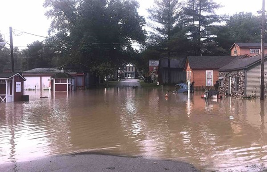
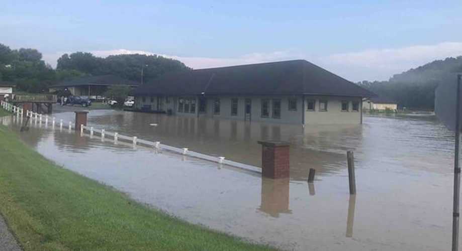
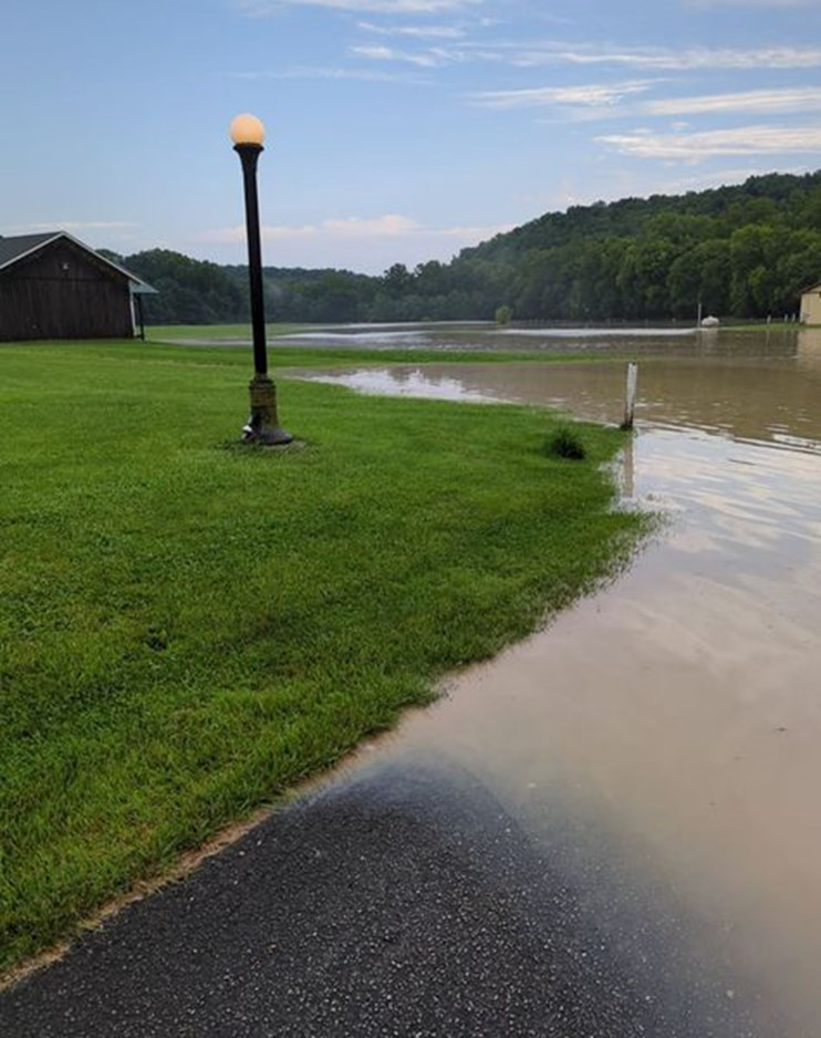
Extreme Flooding In Metamora
The following pictures by Nancy Main were posted on FaceBook showing the result of heavy storms on July 27-28, 2023 in Metamora, Indiana. The first shows the flooded buildings on Columbia Street. The second is at the historic railway depot building at Gateway Park. The worst flooding started at daybreak, according to a resident, and the muddy water was still rising when these photos were taken at 8 a.m.. The Depot is flooded by nearby Duck Creek.
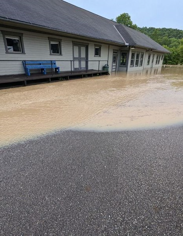
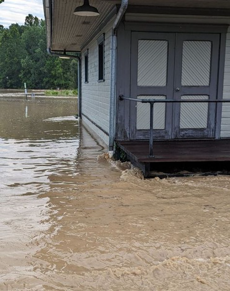
The following plea for help was sent out by the Whitewater Canal Byways Association:
“The Whitewater Canal Byway Association (“WCBA”) and the historic Train Depot needs your help. The downpours in the early hours this past Friday once again put the historic depot at Gateway Park in Metamora underwater with the worst flooding we have seen in the past four years. We are thankful for the hours that many volunteers and our vendors have contributed already to the clean-up of the depot and the surrounding campground. Yet so much work needs to be done. On Tuesday, August 1st, the WCBA is requesting a few hours of your time to help in the continued clean-up of the Depot. Our day will begin at 10:00 AM and end around 4:00 PM. Even if you can not help for the full day, any time you can contribute will be greatly appreciated. In addition to helping preserve a piece of our history and community, you will meet a great bunch of generous and kind people that love our valley and our communities. So, bring your rags and a little elbow grease, and we hope to see you on Tuesday. Thank you for all your support of the Whitewater Canal Byway Association and the Whitewater Valley.”
WCBA included the following pictures of the Depot and surrounding area:
Construction Waste Dumped Into W & E Canal
Jerett Godeke, CSI director from Paulding, Ohio reports that there was a scare that the last section of the Wabash & Erie Canal that holds water year-round in eastern Allen County, Ohio was going to be filled in. However somebody has illegally dumped construction waste in the old canal partially filling and damaging it. Jerett has heard that the EPA and other authorities were contacted by other individuals regarding this matter. He doesn’t know if anything has or will come of this. The good news is that there is no long-term threat to this extant portion of the canal.
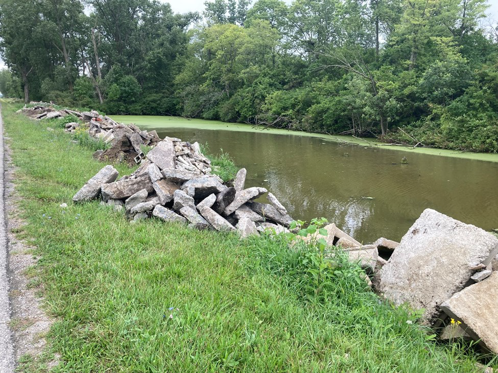
Photo by Jerett Godeke
Letter To Editor—Abbott Sanitarium
Robert – I read with great interest the article about Montezuma, IN – especially the Montezuma Sanatorium and Hotel. It parallels a short book I wrote in 2022, titled “The Abbott Magnetic Mineral Well”, and is an ACPL genealogy reference book, as well as online. I can’t recall if I’ve shared this with you before. The Abbott mineral well, located in Fort Wayne at the corner of Edsall and Raymond in the old Harvester neighborhood, had a grand design like the one in the Montezuma article, and was a resort utilizing the artesian well William Abbott struck in 1888, drilling for natural gas. It also burned down – in 1905. Today, there is still a building on the site, a successor sanitarium built in 1920, and operated as Abbott Sanitarium in the 1930’s (according to FW phonebooks), later as an apartment building. The well was capped in 1953.


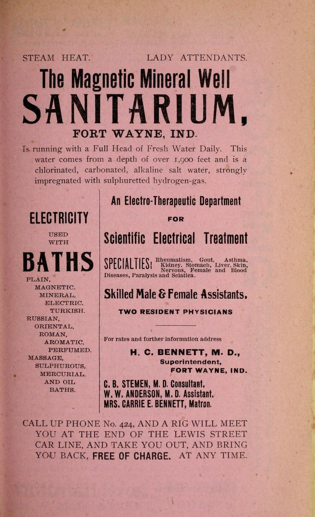
Advertisement from 1896 Fort Wayne City Directory, before the grand building was built
https://www.genealogycenter.info/search_abbottwell.php link to book
https://www.wpta21.com/2022/06/16/21country-abbott-magnetic-mineral-well/ link to 21 Country piece
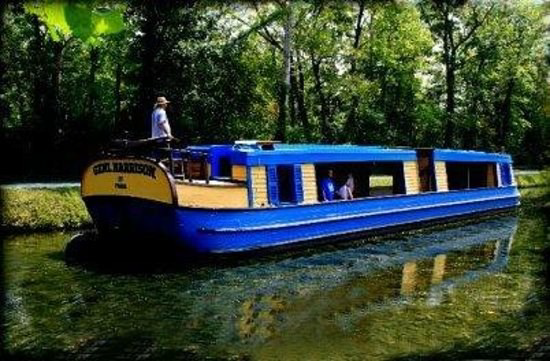
Historic Photo Of Ohio Canal Boat
The Cascade Locks Park Association posted this photo on FaceBook showing the canal boat The Benjamin Harrison. It said that there is no date for this photo, but Benjamin Harrison (born in North Bend, Ohio in 1833) was President of the United States from 1889-1893, so they surmised that it was taken during that period of time or after.
The Ben. Harrison is in a lock that looks to be made of stone or concrete. You can see that the boat is tied off to a post, called a snubbing post. The snubbing post kept the boat from drifting forward into the wooden “whaler gate” (lock gate) while waiting for the water level to be raised or lowered. The locks were 15 feet wide and 90 feet long. The standard size of a canal boat at the time was 14’x 80’. As you can see it was a pretty tight squeeze!
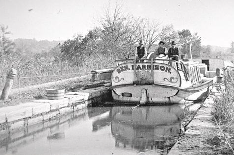
The Gen. Harrison is the name of the canal boat that currently operates on the Miami & Erie Canal at Piqua, Ohio. Photo Johnston Farm and Indiana Agency
Celebration Of Connersville Canal Signage
Photograph by Candy Yurcak
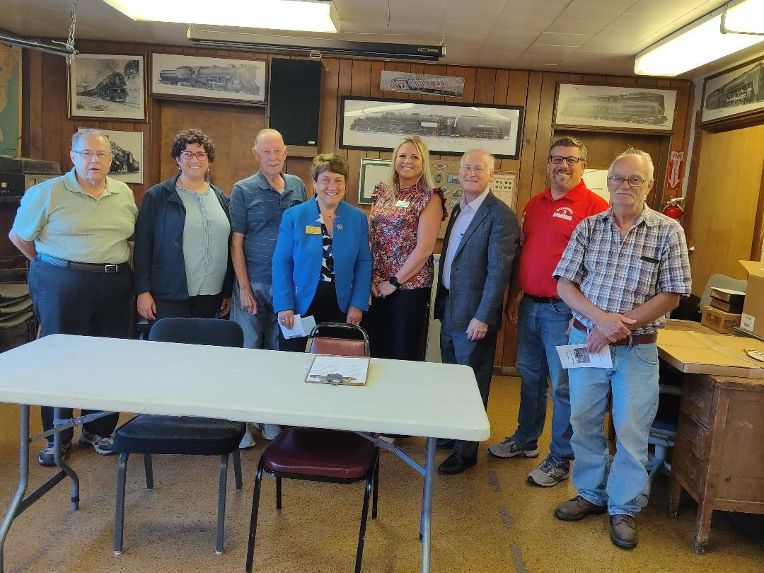
A dedication for 14 CSI signs at sites where locks, an aqueduct and a basin were once located on the Whitewater Canal in Connersville, Fayette county, Indiana was held Friday, September 8, 2023 at 5:15 p.m. at the Whitewater Valley Railroad Yard & Shops in Connersville. Dr. Ron Morris, CSI Director from Centerville, worked with the Connersville City and Fayette County Street and Roads Departments, who donated the posts and the time of their crews to erect these signs. Ron served as Master of Ceremony. Everyone was welcomed by Chad Frank, Mayor of Connersville. Special guests included Linsay Patterson, State Representative; Jean Leising, State Senator; Adelle DuSold, INDOT Stakeholder Services Director; and Dale Strong, County Commissioner. Most of the officials spoke about their canal and rail connections. Senator Leising talked at length about what she is trying to get the Indiana Senate to approve to help out Metamora and other state historic sites that have been left to decline. Robert Schmidt, President of the Canal Society of Indiana spoke about the importance of saving the Whitewater Canal, CSI’s signage program, and announced that the society will sponsor a Canal Symposium in Connersville on September 13, 2024 at the Fayette County Museum. John Hillman, President of the Whitewater Valley Railroad and CSI Director, spoke about the railroad, how it attracts tourists and said that some of the best preserved canal locks can be seen from the train. Kate Thurston represented the News-Examiner and reported the event.
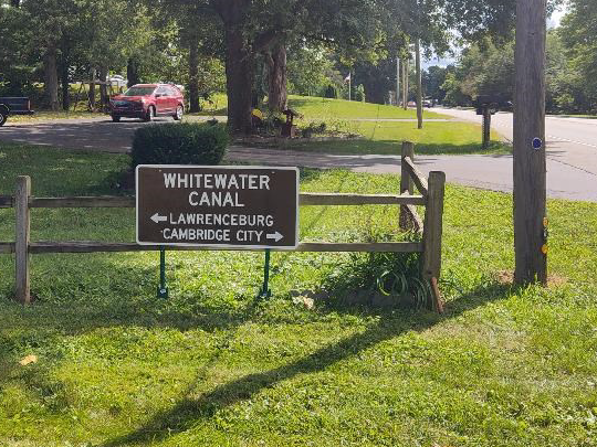
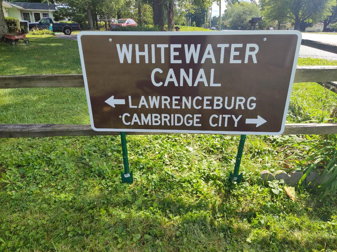
The program booklet explained that the White Water Canal as originally planned would extend 76 miles from Lawrenceburg, Indiana on the Ohio River to Hagerstown, Indiana. From 1836-1839 the State of Indiana completed this canal to Brookville. Work ceased in 1839 as the state ran into financial crisis. In 1842, the state chartered a private White Water Valley Canal Company with headquarters in Connersville to complete this canal. In the Fall of 1845, the first canal boat, the “Patriot,” reached this city. By 1846, the canal company terminated the canal at Cambridge City, having reached the National Road. In 1847 the disappointed Hagerstown merchants, completed their own 8-mile connection. The change in elevation of 491 feet in this 76-mile-long canal that ran beside the narrow and swift flowing Whitewater River spelled trouble. Flooding damage and lack of funds led to the sale of the canal in 1863 to the White Water Valley Railroad Company. Although canal boat traffic ceased the hydraulic use of waterpower continued into the 1920s.
Inside the city of Connersville, most of the locks and structures were buried beneath the railroad. Ironically, the best way to view good remains of lock structures today is to ride the Whitewater Railroad from Connersville to Metamora.
Fayette County Signage
Note: Structures are numbered south to north
Sign Description
Lock No. 46 Swamp Level
Lick Creek Aqueduct
Lock No. 45 Four Mile
Lock No. 44 Carmin’s
Lock No. 43 Claypool’s
Lock No. 42 Mill Lock
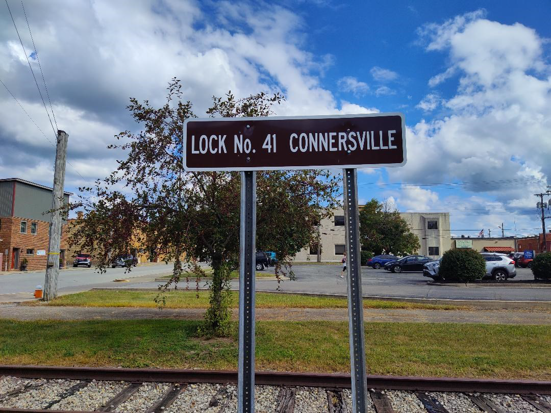
Lock No. 41 Connersville
Connersville Basin
Lock No. 40 Conwell
Lock No. 39 Pork House
Lock No. 38 Harron’s
Lock No. 37 Updegraft’s
Williams Creek Aqueduct
Lock No. 36 Nulltown
Lock No. 35 Berlin
Lock No. 34 Connell’s
Lock No. 33 Limpus
Locations – North to South
East Side – SR 1 before RR Crossing
SR 1 crossing of Lick Creek
31st & 32nd St in Connersville
22nd St
16 St & Illinois St
City Cemetery
N 5th St
W of Town Hall
S of 1st St.
S of 2nd St.
East of SR 121 – 1 mile south
East of SR 121 – north Williams Creek
Williams’s Creek
East of SR 121 south of Nulltown
East of SR 121 at CR 125
East of SR 121 at Alpine / aside RR
1 mile south -aside WW Valley RR
Whitewater Canal Structures
Counties
Dearborn
Franklin
Fayette
Wayne
Locks
8
21
14
10
Aqueducts
None
5
2
2
Feeders
1
3
1
3
The Canal Society of Indiana is a not-for profit organization dedicated to the preservation of Indiana’ canal heritage. CSI has placed over 95 signs at canal sites throughout the state through this signage program. For additional information access the website at indcanal.org. There you will find canal history, statistical information, maps and biographies of canal personalities.
CSI has worked with Whitewater Canal Scenic Byway, Whitewater Canal Trail and the Whitewater Valley Railroad in placing canal signage along their roads, trails and rails in the past. Each of these groups is represented by a director on the CSI board. We work with county historians and public officials to conduct canal symposiums and canal tours to keep canal history alive.
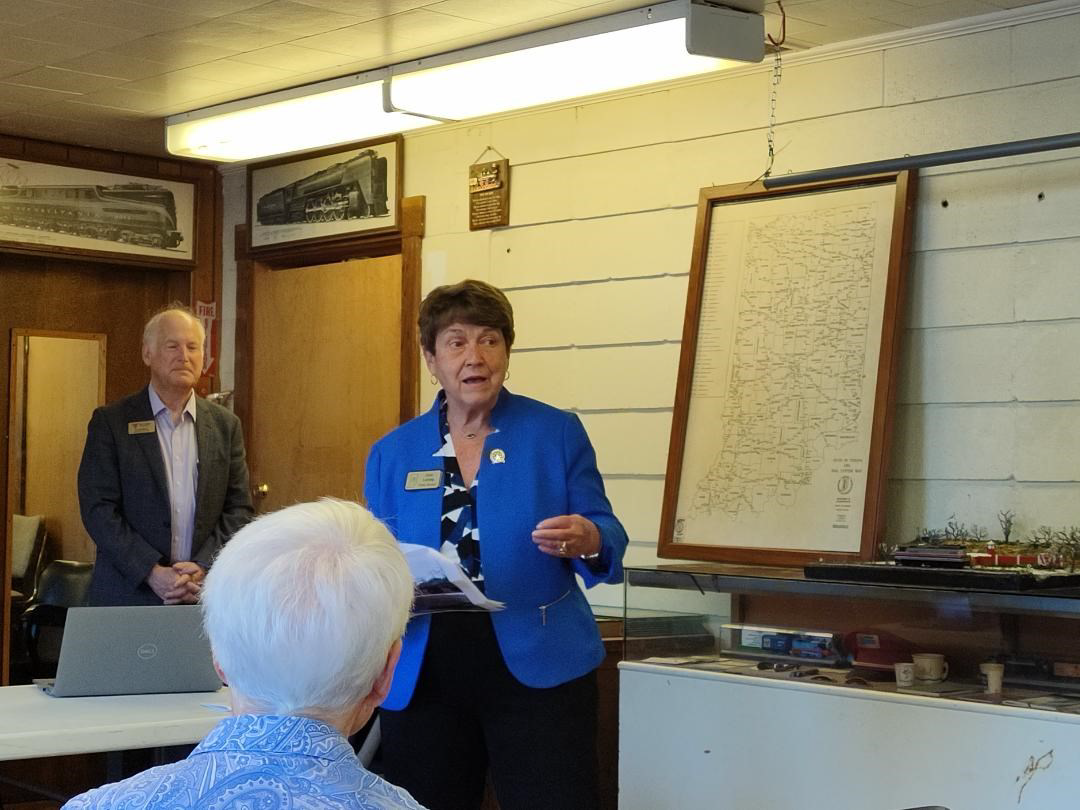
Photo by Bob Schmidt
This was a wonderful opportunity for all these officials to get to know each other, learn what each is doing toward historic preservation, and hopefully work together in the future.
CSI was well represented by its directors: John Hillman, Phyllis Mattheis, Dr. Ron Morris, Mike Morthorst, Bob & Carolyn Schmidt, Candy Yurcak. Other present were Chad Frank, Mayor of Connersville; Donna Schroeder, Historic Connersville; Ron Yurcak, Whitewater Canal Byways; Frank, Thompson, Leising’s husband; Adelle DuSold, INDOT; Ed Herrell, Whitewater Railroad, and Kate Thurston, News-Examiner.
It was suggested that everyone drive by all the new signs. Donna Schroeder invited everyone to come to the Fayette County Museum for a guided tour. Ten people met her at the museum and were especially impressed by the beautiful cars that had been produced in Connersville.
Prior to the program Bob & Carolyn Schmidt drove down the line of signs and noted how some of the locks were far apart and others were very close to one another. Bob took pictures of some of them:


Wayne County Canal Marked
On September 8, on their way to the Connersville sign dedication, Bob and Carolyn Schmidt stopped at the home of Gary Minton in Milton, Indiana to erect a directional sign showing the route of the Whitewater Canal between Cambridge City, Indiana and Lawrenceburg, Indiana. With Gary’s help, Bob hammered in the sign posts and attached the washers and bolts that hold the sign to the posts. The canal crossed the highway at Milton after leaving Cambridge City. Its route can be identified by electrical lines on the west side of the road and a good prism on the east side of the road. We thank the Minton’s for allowing CSI to post the sign on their property.
Attracting New Members
This year Troy Jones, CSI member from Clinton, Indiana, volunteered to set up a Canal Society of Indiana booth at festivals in southern Indiana to attract new members to the society and to educate the public about the canal that ran nearby over 150 years ago. Through his efforts he has found that many people know nothing about the Wabash & Erie Canal that passed through their town or nothing about Indiana’s canals in general. CSI headquarters supplied Troy with a CSI banner, membership forms and past tour guidebooks of the canal to be sold to those who were interested.
On Friday-Sunday August 11-13 Troy set up a booth at the Peru Circus Grounds as part of their festival. He displayed CSI materials and talked to visitors about the Wabash & Erie Canal. He passed out membership forms.
He set up a booth at Newberry, Indiana on Friday-Saturday, August 18-19, 2023 from 8 a.m. to 11 p.m. He offered to take anyone who would come back at 7 p.m. on a tour of the Newberry Dam location. Later over 20 people met him at the booth and he led them on a 45 minute tour before returning to the booth. Through his efforts CSI got 3 new members and others expressed interest in joining in the future.
Photo by John Muciarelli
On Friday-Sunday September 8-10, 2023 from 7 a.m.-7 p.m. he set up a booth at the old train station in Elnora, Indiana. This time his display also included trains and he told how trains displaced the canal. He has had the help of John Muciarelli at the booths. They placed a sign outside advertising their historical information.
Troy said that several thousand people attended the three day event. Three people joined CSI and others expressed great interest.
He has also been to a festival in Flora, Indiana and gotten a new member. He then went to Peru, Indiana for another festival.
Welcome New Members
The Canal Society of Indiana welcomes aboard the following members, some who have joined with a special six months trial membership that Troy Jones offered at festivals.
Name
Arthur, Becky
Barnett, Steve
Berrisford, David
Jones, Mike
Keith, Alan
McDermatt, Angel
Muciarelli, John
Seibert, Gary
Swartz, Samuel
York, James
Community/State
Newberry, IN
Montezuma, IN
Greencastle, IN
Plainville, IN
Newberry, IN
Clinton, IN
Ft. Branch, IN
Elnora, IN
Newberry, IN
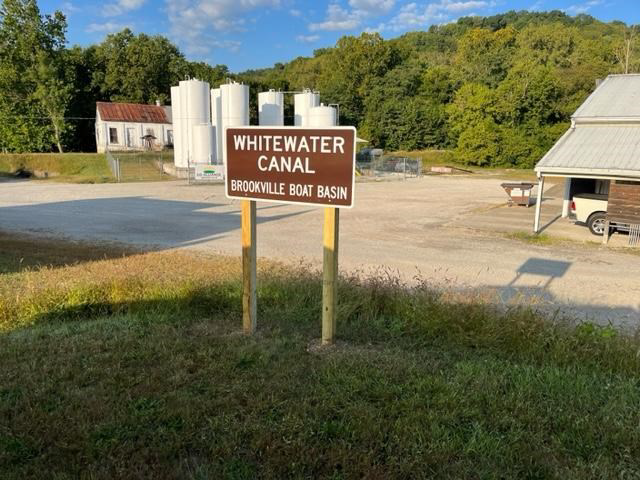
Franklin County Signs
Whitewater Canal Trail president Shirley Lamb has had two CSI signs installed for the Whitewater Canal in Franklin county during the week of September 11-15 by Don Vonder Meulen. She reports that they are waiting for permission from Pizza Hut to erect the Butler Run Culvert sign and are waiting for the leaves to fall before placing the Lock 30 sign by the railroad. There trails have recently been damaged by the heavy rains so they are working at repairing them.
The photos below show the signs for Lock 28 and the Brookville Canal Basin. (Note the building with the red roof. It is an old ice house by the canal towpath at the edge of the basin.)


Ellsworth Edward Smith

Ellsworth Smith of Leo, Indiana passed away on August 10, 2023, at age 88. He was born in 1934 to Amos and Priscilla Smith. Ellsworth was a precocious child, surprising many by getting his electricians license at a very young age and a FCC license to operate radio and television transmitters at 16 years old. Ellsworth attended Indiana University and then entered a 4-year, civil service apprentice program with the government. That led to working in a military lab, which then transitioned to teaching at Arsenal Tech and IUPUI. His involvement with radar and satellite technologies with the military led to his work as an engineer at Magnavox and Raytheon.
Ellsworth loved music, was passionate about theater pipe organs, and in the 1970s, when Fort Wayne’s Embassy Theater with its Grand Page Pipe organ was in peril of being torn down, he, and a handful of friends, formed the Embassy Theater Foundation that saved it from destruction. Also around this time he met Sherry, and her two children, Craig and Penny. They became a family in 1973. In 1975 their daughter Betsy was born.
Ellsworth weathered corporate layouts by working for Campus Net, Command Systems, and General Dynamics. He created the phone system for Sweetwater Sound’s original building and later worked in their security department for 15 years.
Until recently, Ellsworth was on the board of directors and volunteered at many organizations: Indiana Covered Bridge Society, Fort Wayne Engineers Club, The Little River Wetlands Project, ACRES Land Trust, Fox Island Alliance, Friends of the Limberlost and the Canal Society of Indiana.
Ellsworth served on the Canal Society of Indiana board of directors from 2011-2017 . He attended the society’s “Wait Til You Get To Wabash,” “Pilgrmage To Mecca,” and “Hoosiers On The Move,” canal tours where he was seen bending over and pulling Garlic Mustard, one of Indiana’s 100 most invasive plants. A group of 12 ACRES Land Trust volunteers even had a Garlic Mustard pull and pesto cook-off in Ft. Wayne. Ellsworth hosted the Canal Society’s board of directors meeting at Sweetwater Sound and gave the directors a behind the scenes tour of the recording studios, guitar testing and packaging department, etc. He was a great teacher on a variety of subjects and a friend to all.
In 2016 with friends, Bill Zabel and Robert Nickerson, he was awarded Arts United Outstanding Arts Advocate Award for his work for the Embassy Theater. Ellsworth was an Indiana Master Naturalist and Master Gardener who volunteered every week at the Lawton Greenhouse, which supplied the Botanical Conservatory and Fort Wayne Parks with their flowers and plants.
Ellsworth was preceded in death by his son-in-law Andrew Zabel and his daughter Penny Potter-Domurat. He lost his wife of nearly 50 years, Sharon Lou Smith, this past March. He is survived by his two remaining children Craig Skeens of Fremont, Indiana and Betsy (John) King of Los Gatos, California; 8 grand children; and 2 great-grand children; and one sister Anita Dalton of Virginia.
A memorial service was held on Sunday, September 17, 2023 at the Embassy Theater. Visitation was from 3-4 PM with a memorial service starting at 4:30 PM. In lieu of flowers, the family requests donations be made in Ellsworth’s name to either ACRES Land Trust, PO Box 665, Huntertown, Indiana, 46748 or the Embassy Theater, 125 W. Jefferson Blvd., Ft. Wayne, Indiana 46802.
Memorials in honor of Ellsworth Smith were given the Canal Society of Indiana by Steve & Sue Simerman and Bob & Carolyn Schmidt.
Thanksgiving and Abraham Lincoln’s 1863 Proclamation

In July 1863, the Battle of Gettysburg resulted in more than 50,000 American casualties. Despite these losses, the United States gained a great victory during these three days. On October 3, 1863, with this victory in mind, as well as its cost, President Lincoln issued a proclamation:
“I do therefore invite my fellow citizens in every part of the United States, …to set apart and observe the last Thursday of November next, as a day of Thanksgiving… And I recommend to them that while offering up the ascriptions justly due to Him …, they do also, with humble penitence for our national perverseness and disobedience, commend to his tender care all those who have become widows, orphans, mourners or sufferers in the lamentable civil strife in which we are unavoidably engaged, and fervently implore the interposition of the Almighty Hand to heal the wounds of the nation and to restore it as soon as may be consistent with Divine purposes to the full enjoyment of peace, harmony, tranquility and Union.”
This proclamation is viewed as the beginning of the national holiday of Thanksgiving Day. It was one of nine similar proclamations that Mr. Lincoln issued during the Civil War. Mr. Lincoln issued the proclamation, but he did not author it. Secretary of State William Seward penned the October 1863 proclamation.
Source: https://www.nps.gov/liho/learn/historyculture/lincoln-and-thanksgiving.htm
Picture Sources:
Abraham Lincoln: https://historycolored.com/photos/8530/abraham-lincoln-in-color/
William H. Seward: https://ebay.com
