Post Sites, Signs & Surprises Canal Tour
The Canal Society At Mini Pioneer Days
Post “Sites, Signs & Surprises Canal Tour”
By Preston Richardt
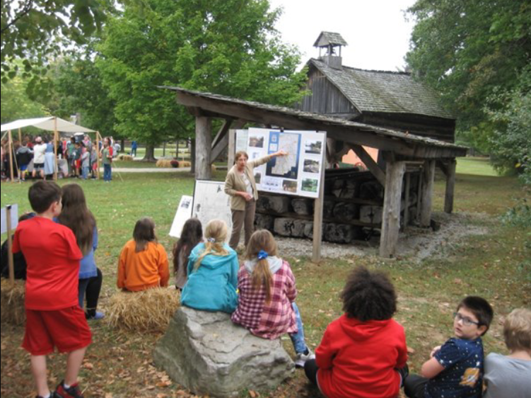
Let me start by saying that I will not be recapping the ‘Sites, Signs & Surprise” tour since that has already been done in the November 2023 issue of “The Tumble”; but rather, as we had done after the 2022 tour, Dave Kurvach (CSI director – Warrick Co.) and I retraced the route led by our tour guide Troy Jones (Clinton) in Fountain and Parke Counties. The purpose was not necessarily to revisit the sites we had seen on the tour, but rather to stop and visit those spots where we did not get to spend time, documenting these locations with photography and videography as well as marking these areas’ longitude and latitude coordinates. In some of the more remote or hard to get to locations I had a drone that was flown over these areas to obtain the pictures and videos we could not have gotten otherwise. In some areas where questions arise as to the location of the canal path, I began utilizing a new mapping tool to me to confirm or dismiss the location of the canal’s existence.
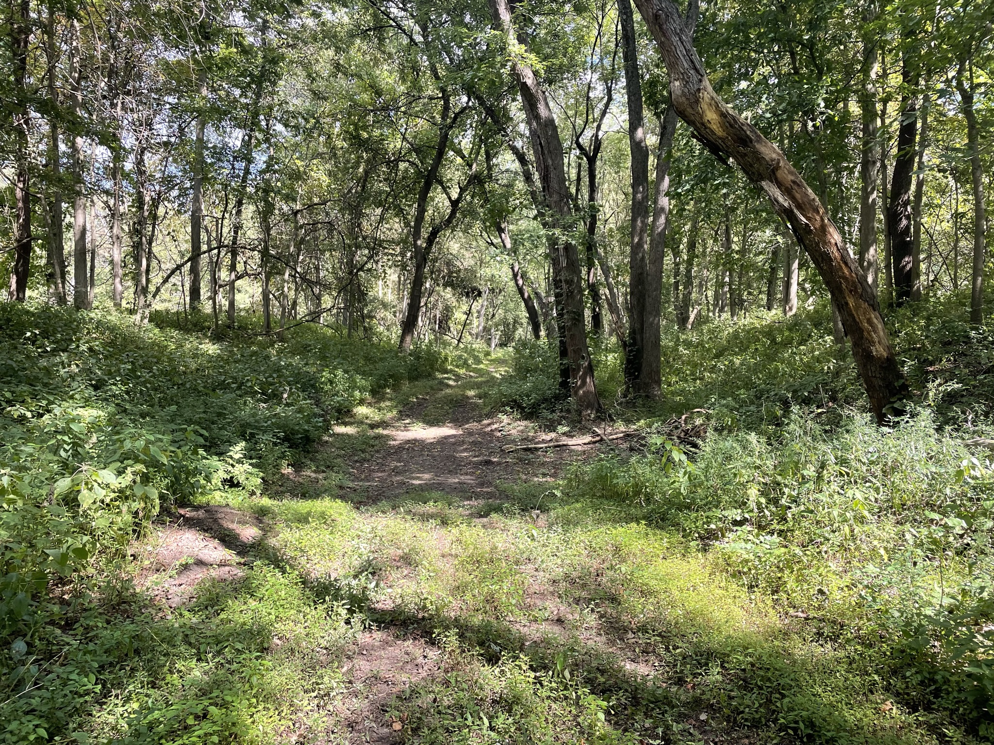
Fountain County – River Road:
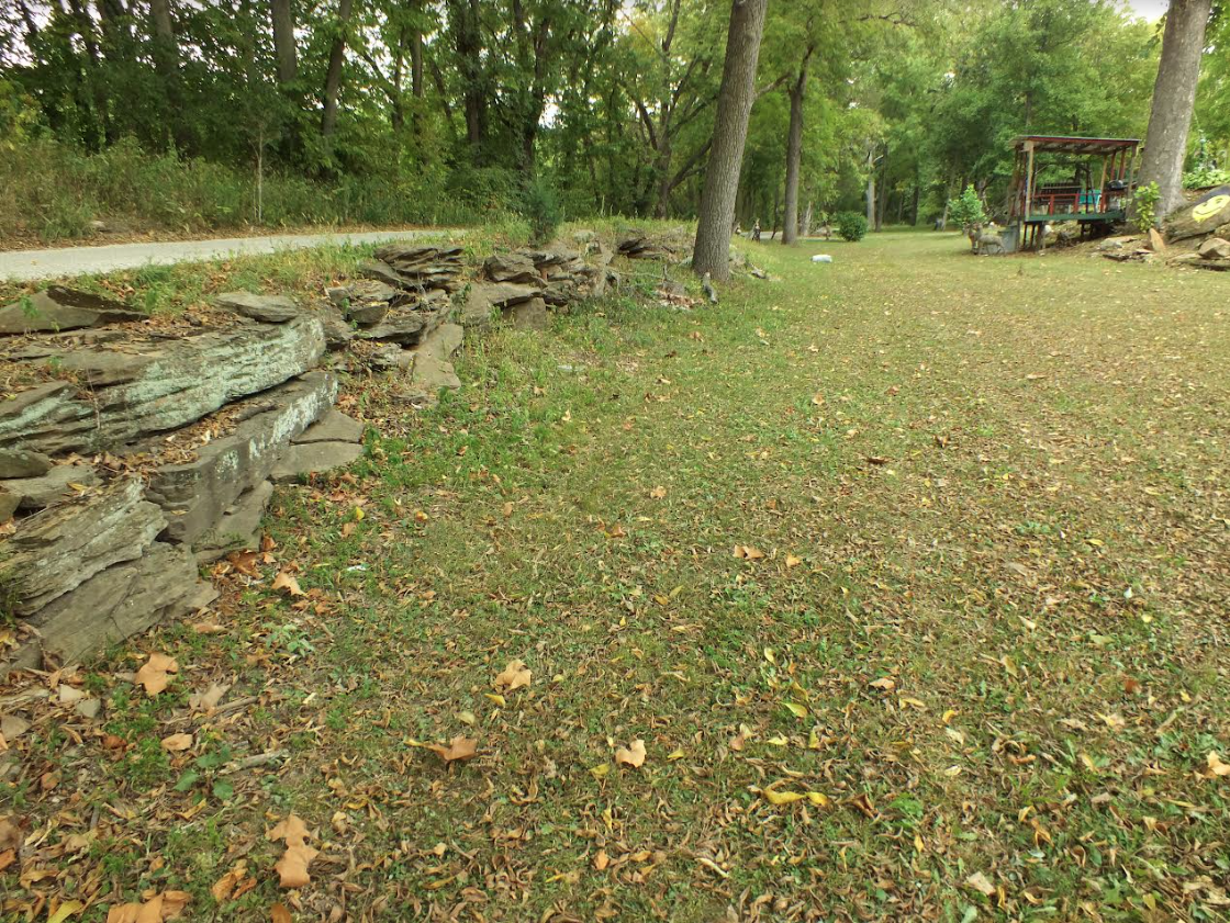
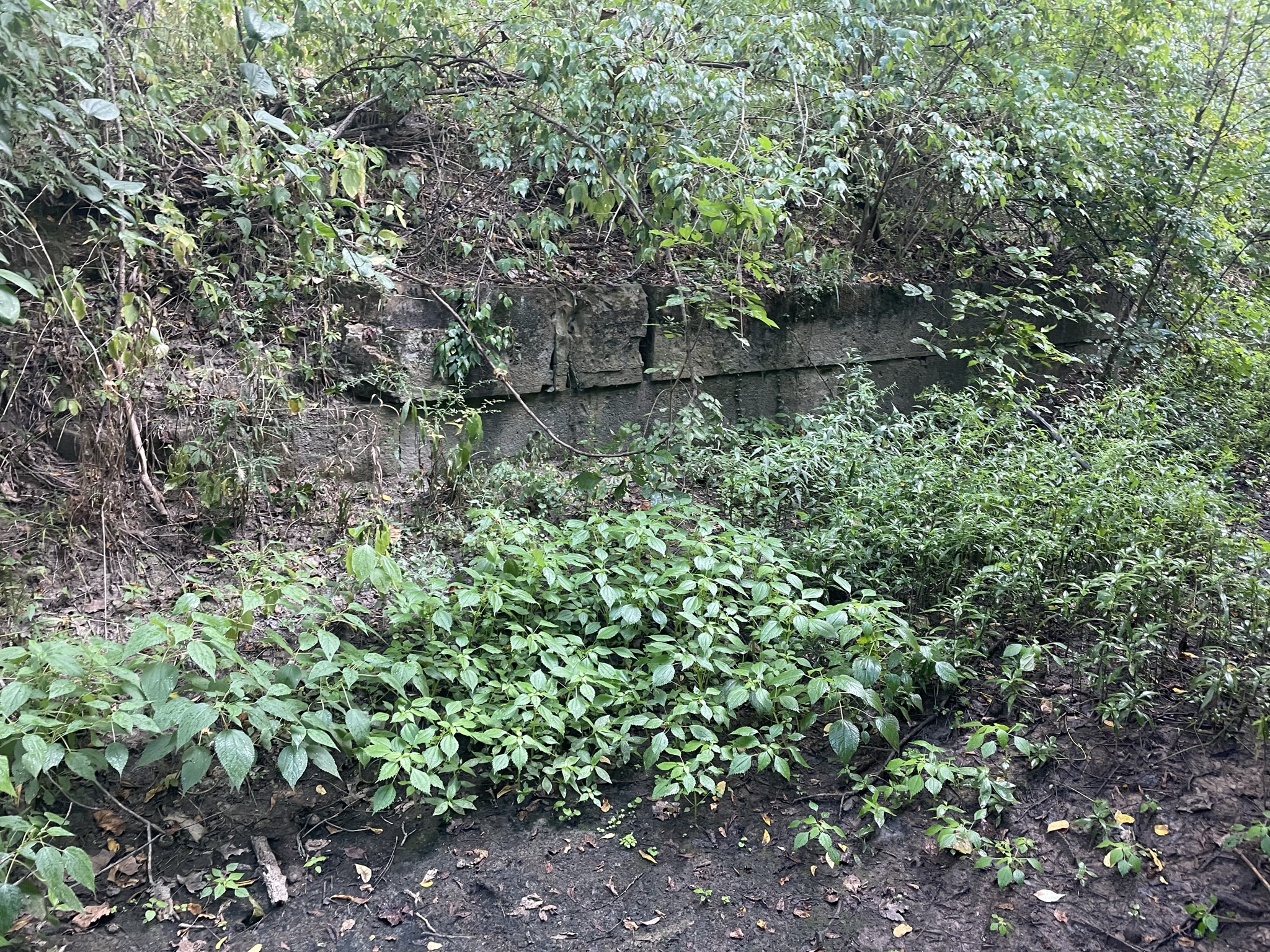
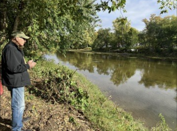
After leaving the Bodine residence, where we experienced a wonderful train ride through the property, Dave and I followed Troy as we made our way back to River Road south of I-74 just north of the Perrysville side-cut. It was at this location that the canal was cut through sandstone. We spent time there talking to the property owner in length about the canal and how it ran through his front yard.
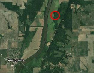
Fountain County – Silver Island Road Area:
Video by Preston Richardt
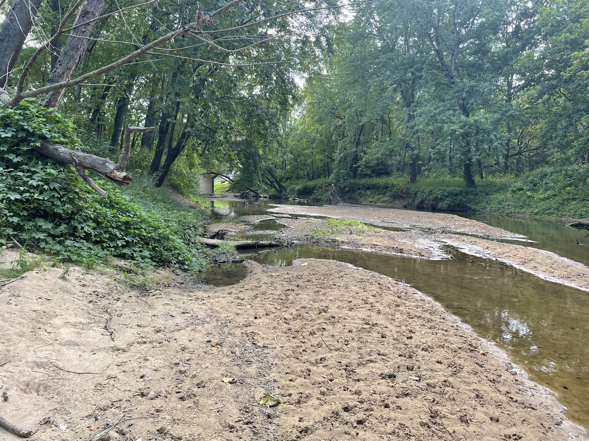
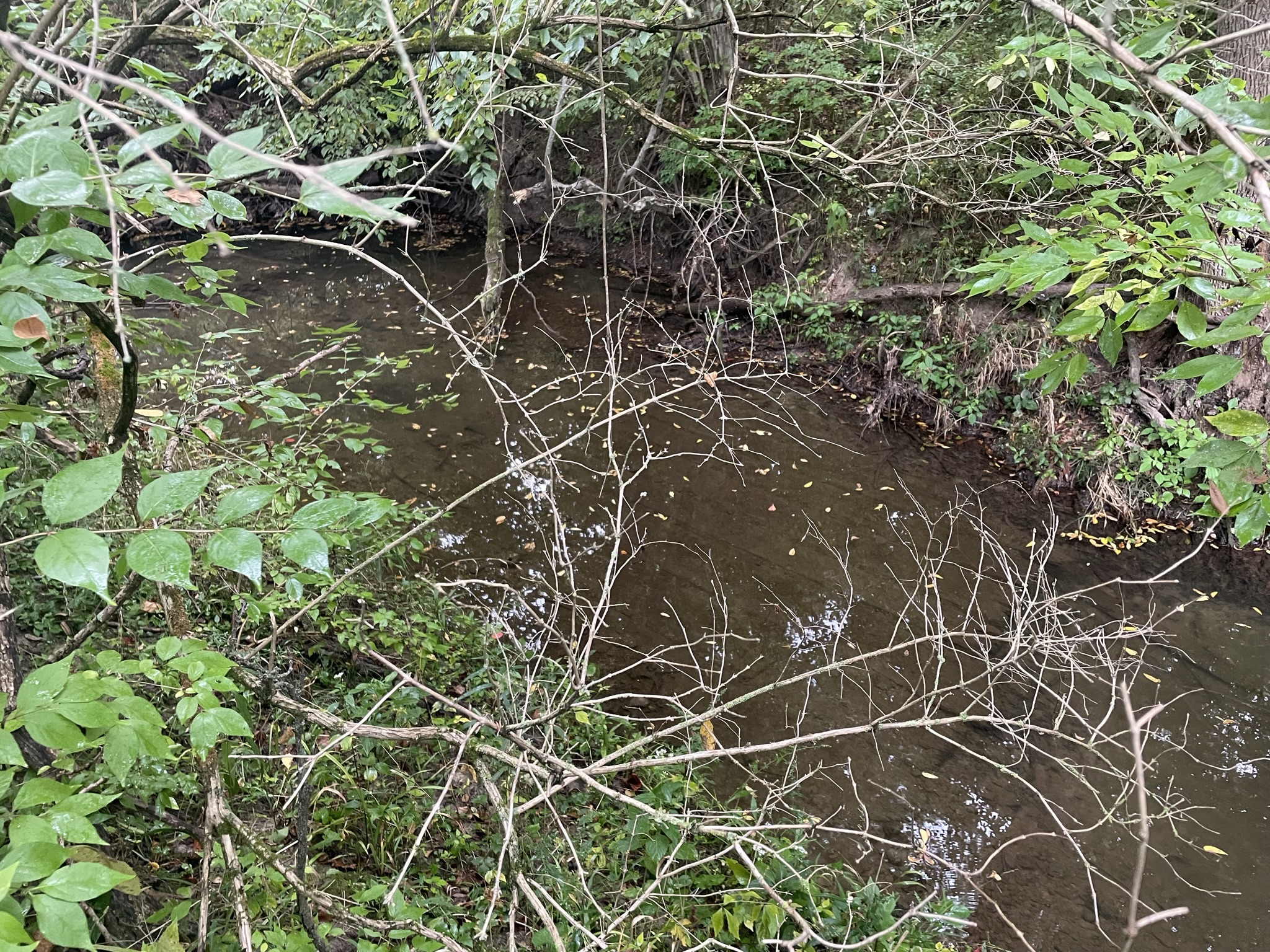
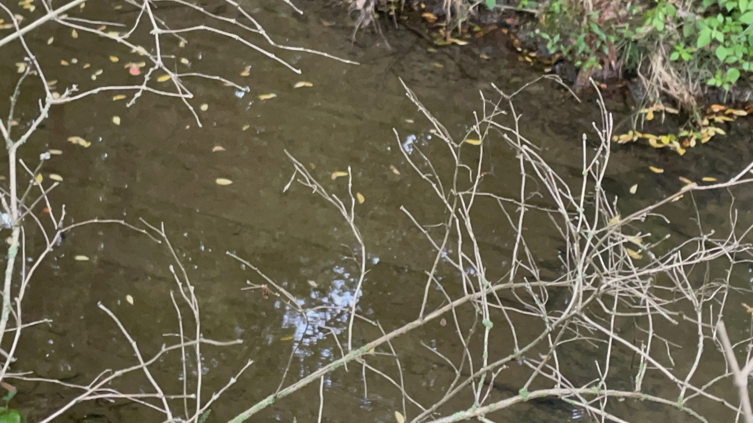
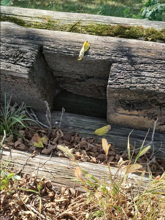
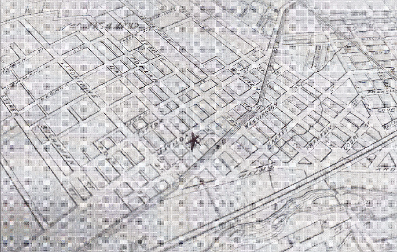
After leaving this location we intersected with Liberty Church Rd. at the Pecan-Basin: Cates Clawson Reserve, where it was stated on the tour that the canal ran along the west end of the reserve. Deciding that due to the over-growth of vegetation, sun setting in a couple of hours and with much area still to cover, we did not hike back to the canal but chose instead to continue south on Silver Island Road to where Troy pointed out the location of the canal as it turned southeast between two hills. This area is described in the 1847 audit as follows: “Road Bridge No. 69, at the head of “swail” – now in progress of construction – embankments finished and timber delivered.” I found the term “swail” interesting because it has quotes around it and is not capitalized. This got me to doing some investigation. A “swale” is defined as a low place in a tract of land, usually moister and often having ranker vegetation than the adjacent higher land. A second definition says it’s a valley like intersection of two slopes in a piece of land. Both definitions describe the bog area the canal enters at this point. We decided to go to 1000 South to fly the drone for aerial footage of the bog/canal because the canal prism is not easily seen in this area, it would require a watercraft to access much of it, and all of this is on private property.
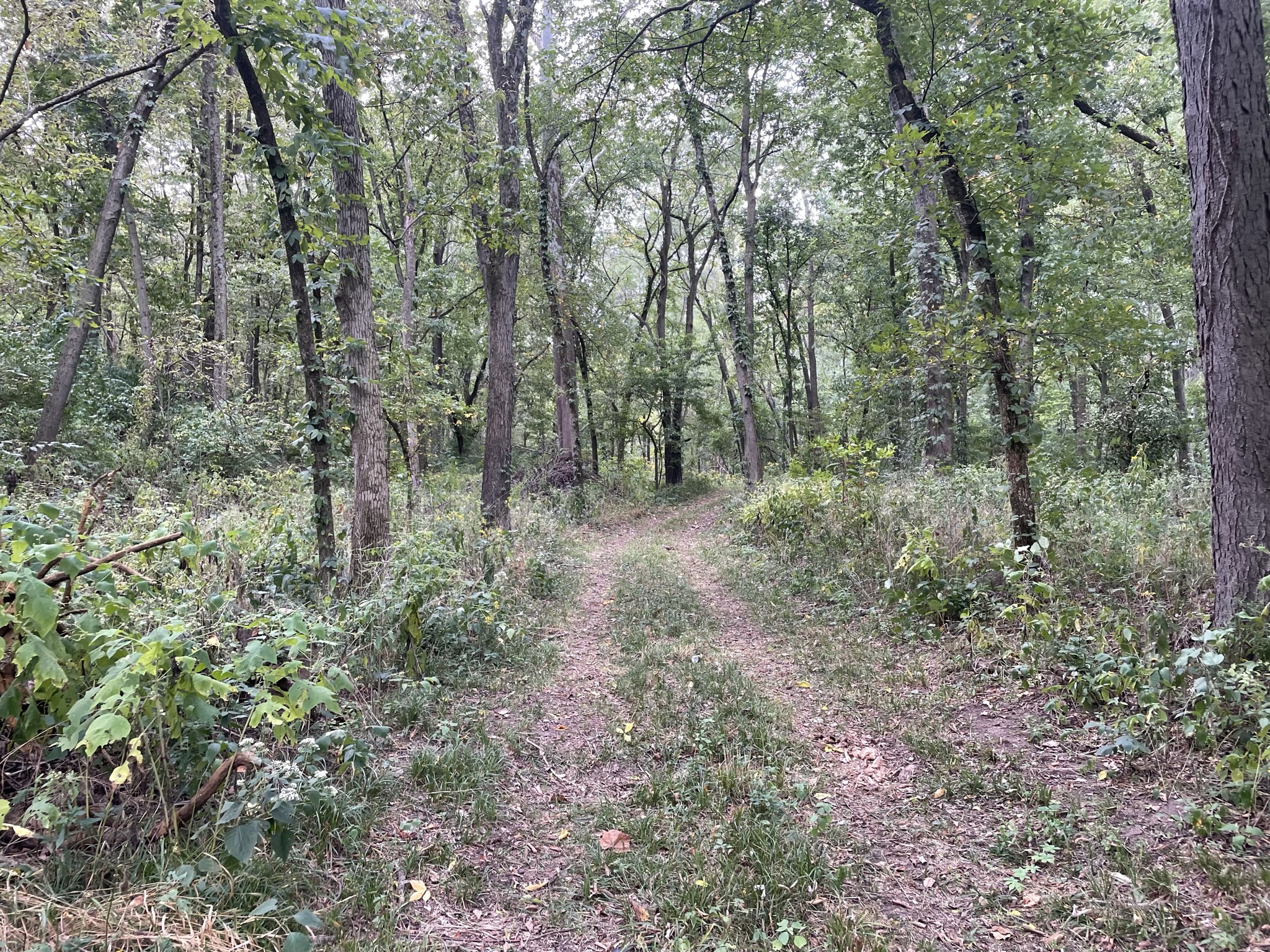
Parke County – Lodi Area:
Leaving the wet land behind us we returned to Lodi, parked along Indiana State Road 234 and proceeded to walk to where the canal crosses said highway on the western edge of town. It is here that the canal prism is very evident coming in from the north along and above the bottom land area, which is a continuation of the wetland previously mentioned in Fountain County. The highway is built over the canal. The canal continues south above the bottom land and is on the west edge of town. It was here that we talked to a homeowner, who owns the section north of the highway, and described what was in her side yard. Another neighbor stopped by as well to listen and be educated on the canal in their area.
This video shows where the canal ran along the west side of Lodi south of highway 324. Video taken by Preston Richardt
We returned to Coal Creek crossing and examined the area, which raised more questions for me than provided answers. How and where the slack water was located was not easy to follow while on the ground so we headed south of the creek area to obtain elevation readings from the next county road crossing the canal. This proved a folly as the canal prism was not visible from this road, 1150 North. We spent much time scouring the hillside looking for evidence of the canal without luck, so we left and proceeded further south to the community of Howard and County Road 1025N.
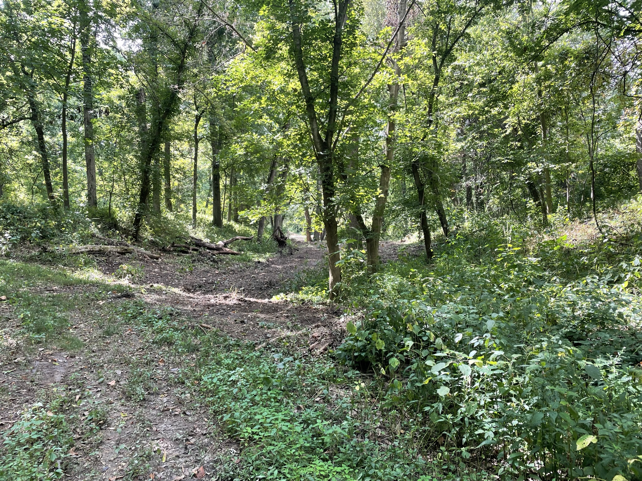
Parke County – Howard Area:
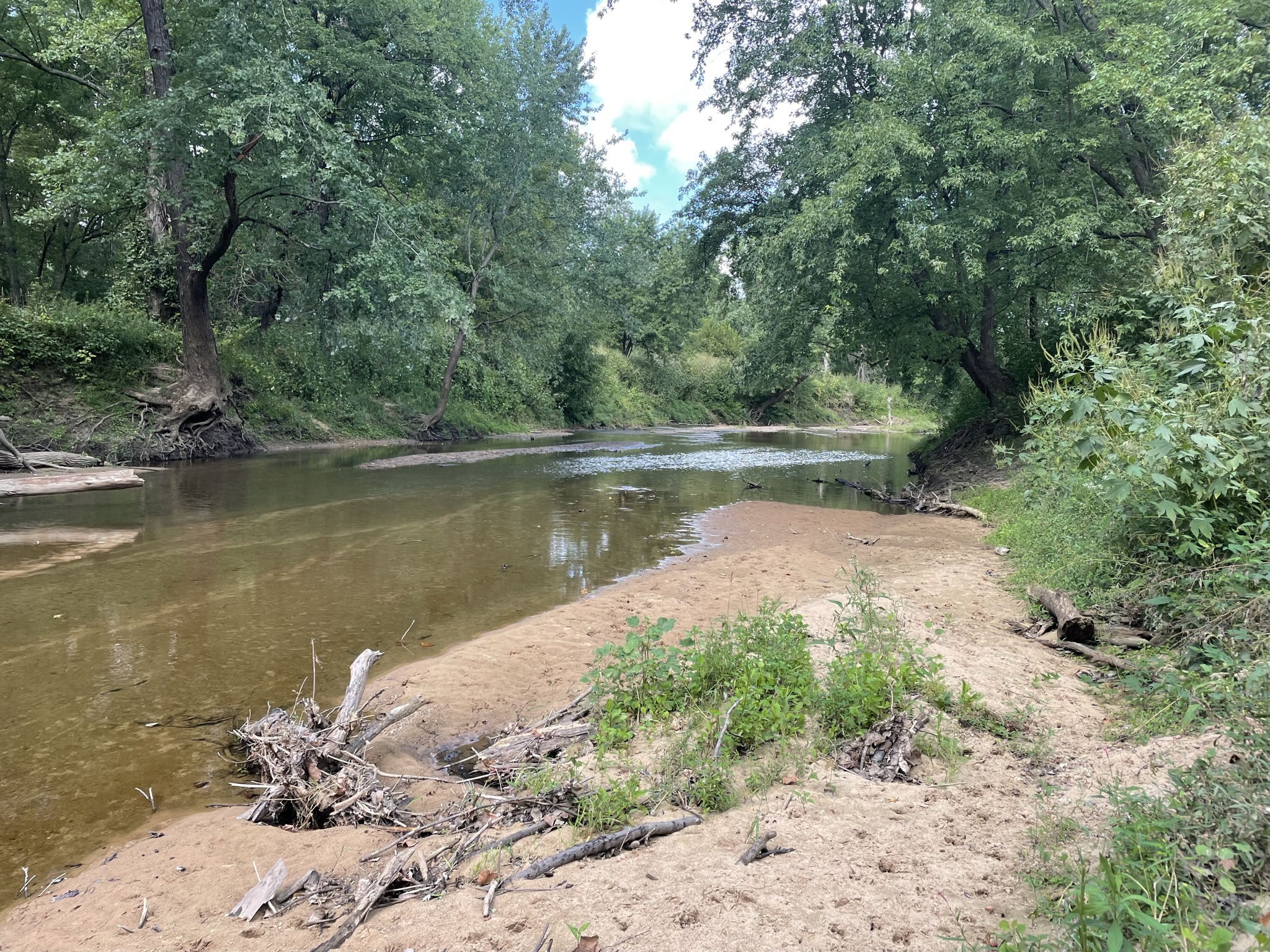
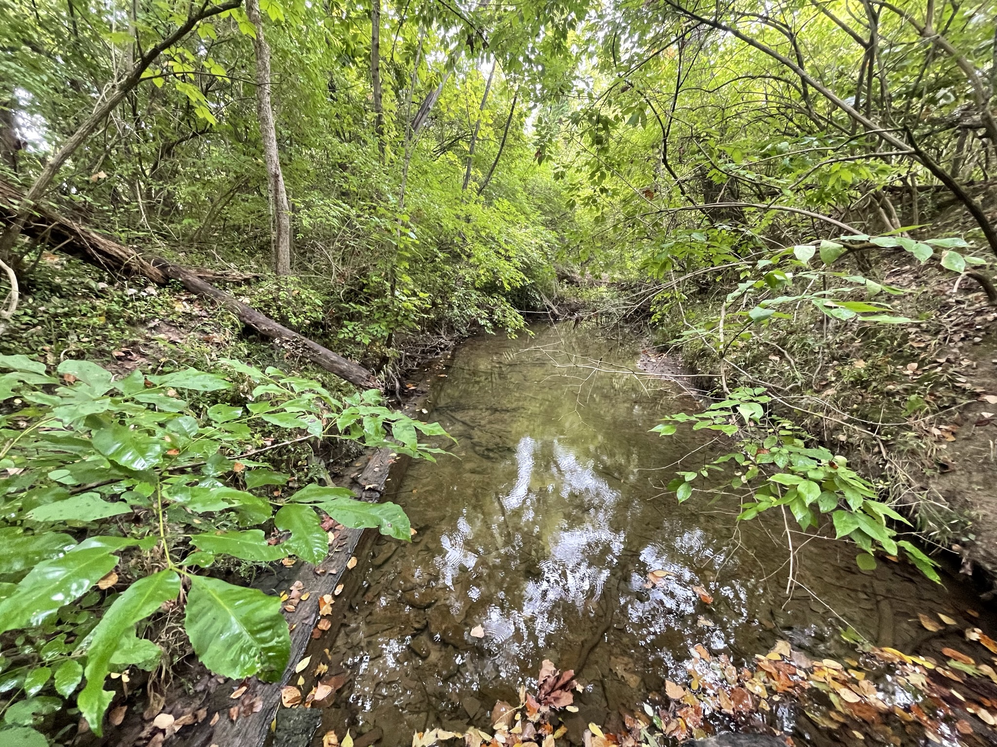
As we traveled west on CR 1025N the road split. Initially we went to the left and down into the flood plain of the river but found no evidence of the canal. We proceeded back up to the y-intersection and took the other route. Within seconds the canal became visible even through the heavy underbrush. It was in this area that we used the tour book information and found where the old silo was listed in the booklet as being a road bridge crossing of the canal; that silo still stands today just south of the y-intersection. This is where day 1 ended for us. Dave and I returned to Shades State Park with the understanding we would meet Troy again in the morning at Montezuma where the tour had begun the previous day.
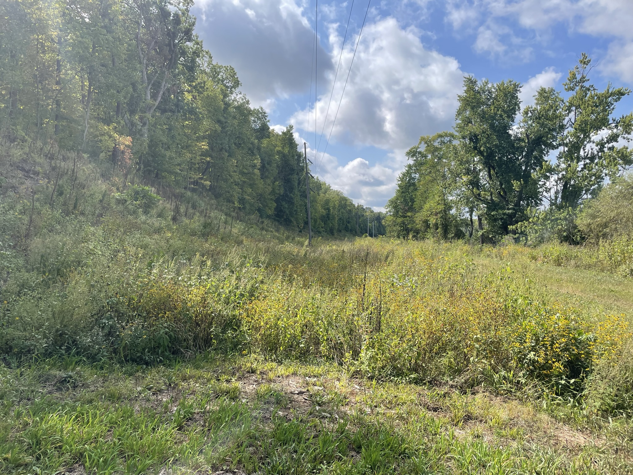
Parke County – Hudnut Area:
Video by Preston Richardt
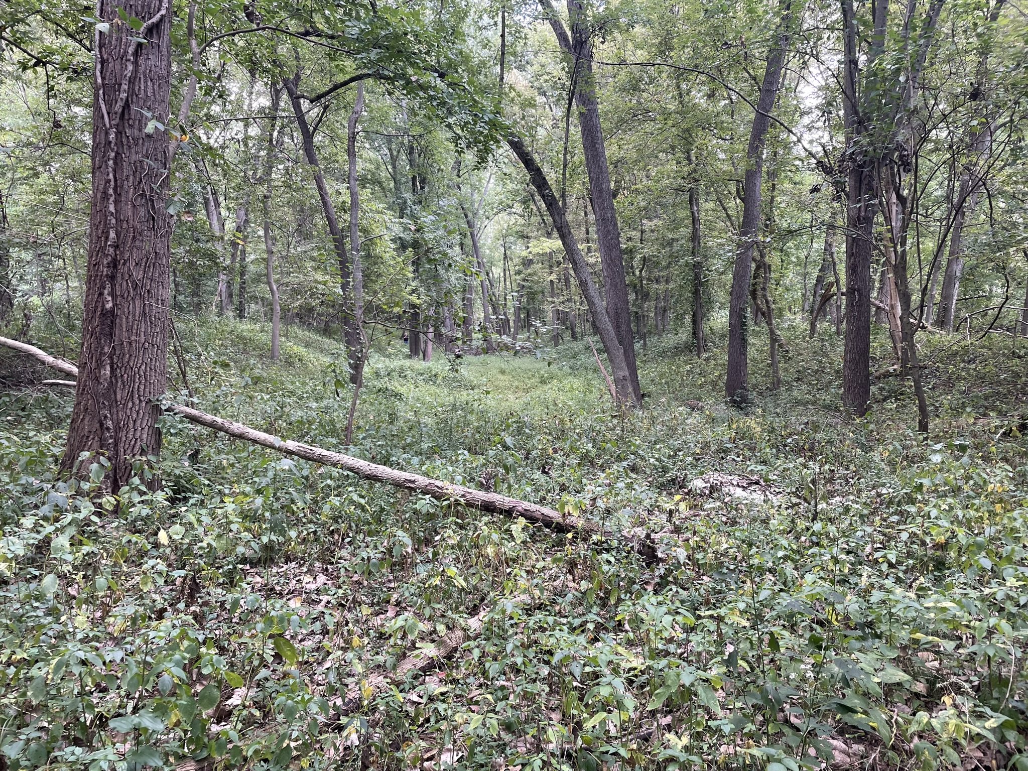
We started our second day of travels following the same route we had the previous day beyond the Raccoon Creek Aqueduct site down to County Road 610 South. Here Troy wanted to show us a section of watered canal and thought this would be a great location for the drone. On the ground there is not much evidence of the canal through this area as the farmers have filled it in for agricultural purposes. Even with the drone flying overhead it was still difficult to confirm the watered area was part of the canal, it wasn’t until I was able to study the satellite images and maps that I was truly able to confirm it is canal.
We drove south on US-41 to Hudnut where Lock 40 was located, nothing remains visible today, but we noticed that the canal prism does become visible on the west side of US-41 for some distance north of the community.
Site of Lock No. 40 at Hudnut, Parke Co., at the intersection of US 41 & SR 163. Video by Preston Richardt
Vigo County – Otter Creek Area:
We proceed down into Vigo County to the property of J. W. Dennis, who owns several miles of canal prism that is still in excellent condition. An attempt to fly the drone here was made, but the electrical lines passing through the area made it difficult and we determined it best not to fly. Mr. Dennis has cleared the towpath and we were able to drive north on it for about ½ mile before we had to turn around due to vegetation. We then drove south on the towpath mostly for about 1.3 miles along a dry but well-maintained section of canal before we parked our vehicles and continued on foot for 8/10 of a mile to the site of the Otter Creek Aqueduct. At the time of the visit there was nothing in the creek bed nor on the north bank that stood out; however, on the south bank there was an area of discussion that will require a revisit sometime in the future. Further investigation at this site was not able to be accomplished as we did not have the right attire to ford the stream and perform a more thorough investigation.
Vigo County – Riley Area:
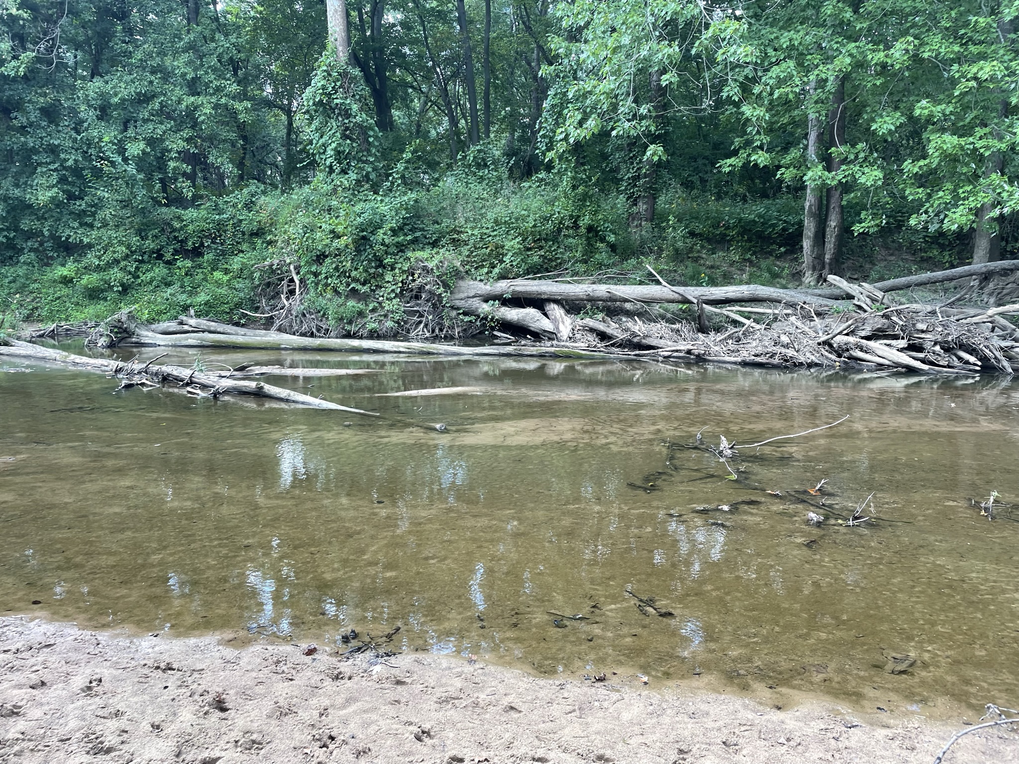
Our last major area to explore was around the community of Riley, formerly known as Lockport. Our first stop was Lock 47. The west wall is still in good condition, but it is showing signs of decay in the southern portion of it. The east wall has few stones remaining. Dave and I spent much time admiring the workmanship and photographing the lock before leaving.


Lock No. 47, stone with 8 1/2 feet lift. Town of Riley, Vigo Co. According to the 1853 audit, “This is the best lock in the State of Indiana, it was built by Robert Logan of Pike County. (Video by Preston Richardt)
Troy then took us to the location of Lock 48, a wooden lock. Only parts of the wooden crib exist in the canal, which is now only a small stream. Again, we spent considerable time at this location before moving on to our last stop of the day, the Canal Society sign along State Road 46. We were looking for evidence of Lock 49, but never found any. Again, we talked with a local individual and explained the canal and how it ran through the area.

Lock No. 48, wood crib design with an eight (8) feet lift. Riley, Vigo Co. (Photograph & Video by Preston Richardt)
This visit was very helpful for me in many ways as it allowed me to identify the canal location and some structures along its route through southern Fountain, Parke and Vigo counties. The maps on the website are constantly being updated as we learn where the path and structures were located. On the flip side there were some areas along this route that raised further questions and require me to do more investigation to determine how the canal ran. I look forward to visiting these areas again in the future.
The Fighting Irish
The Morning Press of Danville, Illinois ran the following article on November 6, 1919 as told by James M. Cunningham, the great grandfather of Freda Mae Allison Jarling of Rockville, Indiana, who sent the article to CSI headquarters:
“Hoosiers Licked Old Time Irish” – A Story of the Construction Days of the
Wabash and Erie Canal – Shilalah* Decision
“Nov. 6, 1919 Talking with a “Press” man of the earlier days along the Wabash valley, James Cunningham, of this place recently brought up the subject of the old Wabash and Erie Canal, that forgotten bit of engineering of more than half a century ago, paralleling the Wabash river. This great artery of commercial traffic—and for years it was the only freight-carrying route to this fertile region—was constructed more than four score years ago [1848-1850]. It was in use even after the Civil War. Today, sections of it may be seen in a succession of dips and pools beside which is a level pathway, once the towpath. That the canal has long been abandoned may be imagined when it is stated that large trees have in many places grown between the canal bed and the towpath.
“Mr. Cunningham, who remembers boating days on the canal, had often heard some of the workmen tell of the days when the work was under way. The construction gangs were made up of native Hoosiers and Irishmen. Those Irishmen were nothing like the sons of the Emerald Isle of today. They were a homely, rough and tumble lot who would rather fight than eat. They were hard workers, however, and put the canal through in record time when it is considered that they had none of the modern dredging machinery with which to work.
“A particularly interesting incident was often told by the Hoosier fireside, and Mr. Cunningham, then a boy, was impressed with it. It seemed that a gang of Hoosiers and a gang of Irishmen were stationed near each other on the canal work. The Irish were always quarreling and fighting among themselves and they held the more peaceable Hoosiers in contempt.
“Time after time the Irish made excursions into the Hoosier territory and tried to inveigle them into a rough and tumble scrap. The Hoosiers, knowing that when it came to rough and ready fighting they
would be no match for the Irish, held their peace. At last, however, the “monkey-faces” as the Indiana citizens called the immigrants, carried their encroachments a mite too far and the Hoosiers decided to give them a lesson.
The Hoosier foreman went to the Irish boss and told him that they had decided to put a stop to the trouble by fighting it out. By the light in the eyes of the boss it was evident that he relished the idea. It was decided that the fight should be carried out along the approved Irish shilalah style. The two gangs were sent into the woods along the river to cut their clubs. Following County Cork custom the Irish cut short clubs just long enough to protect their wrists and give a sharp, head-cracking smash. That lost them the day, for the Hoosiers cut clubs at least three feet long. The wood was of the firmest and there wasn’t a chance for it to break. It was like a man with a baseball bat, fighting a man with a billy. The Irish went into the battle with all the joy of the Celt in the noble pastime of head cracking. They never had a chance for before they could get within striking distance they were laid cold by the long shilalahs of the natives. It was a warm battle, but within a quarter of an hour the Celtic contingent was hors de combat.
“That was the end of the rivalry in that line. There was no ill feeling over it for the Irish are good losers.
“If the days were wild on the old canal, the nights were even wilder, especially when the workmen were able to get a good supply of whiskey. When a man was killed, either accidentally or with malice aforethought, there was a celebration which would make one of the famous Norwegian drinking bouts seem like a Willing Worker quilting bee. Mr. Cunningham vividly remembers one of these. An Irishman, unable to swim, was paddling across a saw mill lake standing upon two great logs. He grew careless and permitted the logs to drift apart. In trying to get them back together he fell into the water. Mr. Cunningham, then a boy, saw him struggling in the water and ran for help. The man had disappeared when help arrived and several hours were spent dragging for his body. At last a seine being used, the body was brought up. Before the body had been found, a man from the Irish came up the river, who had been sent to Covington for a four gallon jug of whiskey. The wake was one of the grandest ever held in the valley.”
A shillelagh is a wooden walking stick and club or cudgel, typically made from a stout knotty blackthorn stick with a large knob at the top. It is associated with Ireland and Irish folklore. Other spelling variants include shillelah, shillalah, and shillaly. The shillelagh was originally used for settling disputes in a gentlemanly manner — like a duel with pistols or swords.
The Canal Society At Mini Pioneer Days
Text and pictures by Sam and Jo Ligget
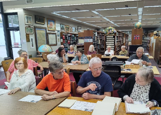
Sam and Jo Ligget, Canal Society members from Terre Haute, spent Sept. 26–29, 2023, educating Vigo County School Corporation 4th graders about the Wabash & Erie Canal. The event was held at Fowler Park in southern Vigo County. The Vigo County Parks & Recreation Department sponsors Mini Pioneer Days every year the last full week of September. This was the first time the canal was included in topics for the event.

Some timbers from Culvert #151 are housed in a nice-looking rustic lean-to shelter on this property. Others are submerged in the lake in the park. The Vigo County Parks & Recreation Department has erected a new sign for the timbers. Part of the sign is the profile map of the entire Wabash & Erie Canal. The other part of the sign is a map of Vigo County showing the route of the canal through the county. This map includes the part of Splunge Creek Reservoir that backed up into Vigo County. The timbers and sign make an interesting addition to the pioneer village in Fowler Park. This village is used as the backdrop for Mini Pioneer Days.

Other talks and/or demonstrations that were part of Mini Pioneer Days included blacksmithing, pioneer carpentry, candle making, soap making, and rope making. The grade schoolers also visited the pioneer school and church log cabins. Topics discussed in the canal presentation included where Indiana’s canals were located, what remains of the W & E Canal that can be found in Vigo County, and explanations of what are aqueducts, locks, and the canal prism. The students related to jobs kids could do on a canal boat. Reasons were given for the end of the canal era, and places in Indiana and Ohio were mentioned that have canal parks today. A handout prepared by Carolyn Schmidt and provided by the Canal Society of Indiana was provided for each teacher.
The Liggets talked to over 1000 students, 44 teachers, and a number of teacher aides, as well as many adult chaperones. Most of the students had no idea of what a canal was, let alone that one went through Vigo County sometimes just blocks from their schools. Jo Ligget would ask a group, “Does anyone know what a canal is?” Responses varied from a horse and carriage to a man-made waterway. The most common answers were “a river” and “a boat.”
The Vigo County Parks & Recreation Department uses Mini Pioneer Days as a lead-up to Pioneer Days the first full weekend in October each year. Pioneer Days includes activities for children, live time-period music, hands-on activities, demonstrations of pioneer skills, and more. The canal timbers and new signage about the canal are on display for everyone to see all year at the park. If you are in the area, it is worth the trip and you might see a canal sign or two on your way there!
Note: The Vigo County Parks Department asked CSI director Sam Ligget and his wife Jo for a 3-year commitment to man a station in Fowler Park for Mini Pioneer Days on October 26-29 from 10:00—11:55 a.m.. They talked about the canal at 15 minute intervals as each school group came by while other groups went to other stations. We thank them for the commitment of their time to keep canal interest alive.
Surprises Found After Tour
Troy Jones
Troy Jones, leader of the Saturday canal tour “Sites, Signs and Surprises” on September 16, 2023 found these timbers from the Sugar Creek Aqueduct of the Wabash & Erie Canal just a matter of feet from where the tour group stood while viewing the West Union Covered Bridge a day after the tour. One was notched. With them he also found this handmade wrought iron spike that was sometimes used to hold the timbers in place. The owner of the property had dragged them there and wondered if any museum would want them. Troy then contacted several local historical societies.

Logansport Sign Replaced By City
After vandals destroyed the CSI sign for Mill Lock No. 24 of the Wabash & Erie Canal on Erie Avenue in Logansport, the Mayor decided to replace it. Tom Castaldi, CSI director from Ft. Wayne who had originally given a CSI sign to the city to erect, was notified that the city would replace the damaged sign. Tom sent the following pictures of the newly replaced sign. Thank you Logansport for keeping canal history alive.

“The Reservoir War: A History of Ohio’s
Forgotten Riot in America ’s Gilded Age, 1874-1888”
By Bob Schmidt

Reservoirs were important to our canals as a means of storing water in the time of plenty (usually the Spring) to pour water into the canal in times of shortage. Even during canal times, reservoirs were unpopular due to the abundance of disease nearby. When the canal ceased to function, they really became unpopular and resulted in violence.
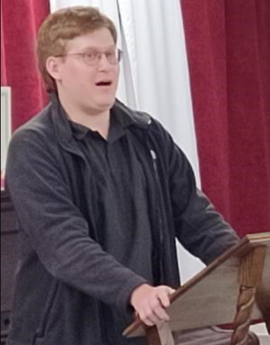
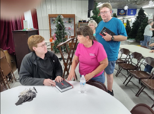
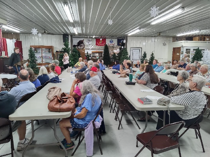
The Paulding County Reservoir on the old Wabash & Erie Canal was the center of a violent uproar in April 1887, when 400 local vigilantes stormed the reservoir. The details surrounding this event have just been published in a new book by one of our CSI directors, Jerett Godeke of Antwerp, Ohio.
Jerett, a history major from Bowling Green State University, presented his master thesis and book to an audience of over 50 people of the Paulding County Historical Society on Wednesday September 27 in Paulding, Ohio. At the conclusion of the program folks lined up for a book signing.
“The Reservoir War” has been published and marketed by Amazon. This book is available now on their website: The Reservoir War by Jerett W. Godeke 426 pages $29.99 hardback $19.99 paperback
I hope many of our CSI members will support Jerett and buy his book. This is a most comprehensive and well documented book written about this action of local vigilantes. Learn how a gold tooth revealed the identity of one of the regulators. The book also provides the background history of building the Wabash & Erie Canal in Ohio.
CSI members attending the book signing were Sue Jesse, Melinda Krick, and Bob & Carolyn Schmidt. Jerett will be leading the upcoming CSI tour on August 17, 2024 of six-mile reservoir and other canal sites in Paulding county, Ohio. Mark your calendar!
Whitewater Canal Trail Dedicated New Kiosk
On Friday evening September 29, 2023, Brookville residents were joined by representatives from the Whitewater Canal Trail (WCT) and the Cincinnati Cycle Club to dedicate a new information kiosk on Progress Street near 6th Street. The Kiosk is known as the “Wheel House” by the Canal Trail members who led the construction and installation rough-sawn cedar structure. It displays a 10-foot-wide part of an old gear wheel that was rescued from the middle of the Whitewater River a few years ago. The gear most likely came from one of the many mills that were built along the Whitewater Canal in the late 1800s and early 1900s. Detailed information about the gear wheel is included in the kiosk’s signs.

The kiosk was funded by a donation from the Cycle Club, who presented a check to Whitewater Canal Trail that day. It contains information about local bicycle routes and activities in addition to information about the Canal Trail. Bridget Hayes, Town Council President cut the ribbon.
The Cincinnati Cycle Club held its “Great Pumpkin Roll Grand Fondo,” a riding event that included 30, 48 or 61 mile rides on roads in Franklin County and northern Ripley County that started in Brookville. It’s the second year for the event in Brookville. Organizers said 500 participants had registered to ride.
The new Brookville kiosk features bike, trail and canal history information as well as benches on either side of the old mill gear.
Huntington’s Forks Lock 10 Signage
Lock No. 10 of the Wabash & Erie Canal located at the Forks of the Wabash park in Huntington, Indiana, has had a CSI sign erected by the lock site to call attention to it and a smaller sign that tells about it along a trail. Lowell Griffin, CSI member from Fort Wayne, placed the CSI sign on October 3, 2023. Lowell hopes to get a Boy Scout to clear the lock site as an Eagle Scout project. It would also be nice to plant a flower bed beneath the sign.
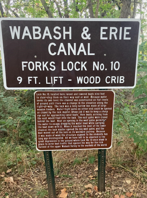
The smaller sign says: “Lock No. 10, located here, raised and lowered boats nine feet to stair-step them on their way east or west. Because water seeks its own level, the channel was constructed on flat levels of ground until there was a change in the elevations along the right-of-way. The lock was a long narrow box made of large wooden timbers. Water-tight gates on either end could be opened or closed by the lock master, whose job it was to keep a sharp eye out for approaching canal boats. Here boats, arriving from the east, would float into the lock. The east gates were closed behind the boat. Next an opening in the west gates permitted the water to escape, dropping the water level while carrying the boat down with it. When it reached the level of the lower channel, the lock master opened the big west gates, and the boat moved out of the lock on its westward journey. Because it was made of wood, the structure exposed to the elements has long ago disintegrated. All we have left to be observed is the great depression in the ground where Lock No. 10 once stood in place to serve boat traffic that opened the way for the rich harvest of the upper Wabash Valley to the markets of the world.”
Genealogists Learn About Indiana’s Canals
Bob Schmidt, CSI president, spoke to an audience of 21 people at the Huntington County Genealogical Society at the Huntington County Public Library on October 4, 2023 at 6:30 p.m.. He talked about how the Wabash & Erie Canal opened Indiana to eastern markets and the years it operated. He said that if any of their ancestors had come to Indiana by canal boat it would have been in the years 1840-1860s. It did not reach the Ohio/Indiana state line until 1843. Before then they had to take a stage coach from Defiance to the state line to reach the canal. He said it was unlikely that they came north on the canal from Terre Haute or Lafayette.

Bob pointed out that if the British had won the battle of New Orleans, the Treaty of Ghent might have been settled differently between the United States, Great Britain and Spain. This could have negatively impacted the transportation route to the south. Even though the United States won the Battle of New Orleans, if New York’s Erie Canal had been delayed 10-15 years or not even built, it might have resulted in the midwestern states aligning themselves with the southern Confederacy or even creating a third country. Economics played a key role in determining that the midwestern states remained in the Union.
The Ohio/Michigan Canal War at Toledo and locating the northern boundaries of Ohio and Indiana delayed the building of the Wabash & Erie Canal. The canal when finally completed was 468 miles long with 88 miles in Ohio and 380 miles in Indiana. It was built at a time when roads were limited and almost impassable. Railroads were in their infancy and were no more than a boiler on a wagon bed with the smoke stack.
Bob also talked about the Canal Society’s website and where they could find genealogical information in the biographies of canawlers from Huntington, etc. He also talked about our signage program and had two people interested in putting signage on their canal side properties.
CSI members in attendance were Lowell & Margaret Griffin, Carolyn & Bob Schmidt, and past member Don Mathias. Catherine Fitzgerald became a new CSI member that night.
Canal Era Store Revealed
By Carolyn Schmidt
Following Bob Schmidt’s presentation to the Huntington Genealogical Society, Catherine Fitzgerald said she was interested in a CSI sign for the canal era store on her property, which is along the Wabash & Erie Canal in Huntington, Indiana. To learn more about the store, Bob and Carolyn Schmidt visited her home at 347 W. Park Drive in Huntington three days later. There they learned that the store was built in 1848, the same year the city of Huntington was organized. Catherine then showed them her abstract and pointed out that the land was purchased from the U. S. government on October 12, 1830 by Elias Murray and Champion Helvey. In 1834 they sold it to John Tipton, an early Indian agent at Logansport, who later became an U.S. senator, who platted it. Tipton named one of the streets Tipton street for himself and another one Matilda, for his wife. Later Matilda Street became W. Park Drive.


The Wabash & Erie Canal reached Burke’s Lock in 1835 but was not completed through what would later become Huntington until the next year. It passed through John Tipton’s property. Tipton passed away in 1839 and his property was divided among his heirs.
In 1845 John Hendricks transferred the land to Hugh Hanna. At that time Tipton Trace started where Elizabeth’s garage now stands off of Oak Street.
In 1848 lot 20 was purchased by Samuel Purviance. That year the home was built on the property with the limestone canal store beneath it. Canal boat passengers and operators, as well as people who lived in the area, came to this early store. It had an oven to bake bread, notions and other necessary items to sell and also traded for animal pelts. It was located a short distance from the canal lock at Cherry Street.
The home on lot 20 was sold to its second owner Magnus in 1969. He made many changes to the 2-story house including making the 3rd story into an apartment and installed plumbing and electrical wires in the old store beneath the house.
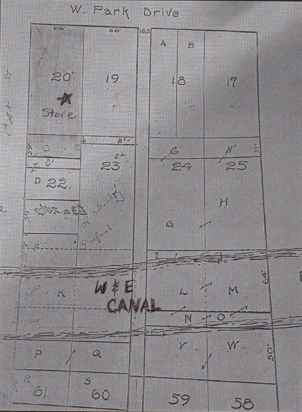
Catherine Fitzgerald and her husband purchased the home in 1974 becoming its third owners. She wants to place a CSI sign showing the route of the Wabash & Erie Canal near the lower end of her property and also have an arrow point to the old canal store entrance beneath her home.
The canal behind her home has been filled in. Other lots have been created where it and the towpath once ran. Crescent Street now runs along the canal route on the other side of Oak Street.
On Friday November 10, 2023 Bob and Carolyn Schmidt delivered a completed CSI sign to Catherine and her son-in-law. It will be erected in her back yard where they are standing in the picture.

Silver Creek Arch And Cheesbro Lock Marked
In the 1980s Clarence Hudson canoed the Wabash River and came upon the beautiful Silver Creek Arch Culvert No. 45 of the Wabash & Erie Canal. It so inspired him that it led to the formation of the Canal Society of Indiana in 1982 and Clarence became its first president. At that time the property through which Silver Creek ran was owned by the father of the current owner, Richard Ness.
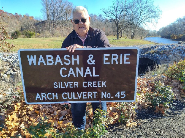
Richard said that he and his father had to put dirt on top of the culvert after severe flooding carried the soil away one year. Over the years they had to remove debris that threatened to destroy the culvert remains. Later the bridge for old highway U.S. 24 that passed by the culvert was replaced for the new U.S. 24 Hoosier Heart-land Highway and a new bridge was built that was further from the culvert.

Richard and his wife have made beautifying this property along the Wabash River their retirement project. Huge rocks have been removed from the river to make easier passage for canoes and placed nearby the culvert. Other large rocks have been moved and placed along the river bank and before and after the culvert to prevent erosion. Asphalt was placed over the dirt atop it to protect it. Beautiful plantings, a garden fence, a roadway, and a swing overlooking the river enhance the vista. When asked if they use the swing much, Richard said, “No.” He and his wife spend most of their time working to add something new to their “Park” or just in main-taining it. There are acres to mow, leaves to rake, plants to water, etc.
On November 10, 2023 the Schmidts delivered a sign to mark the culvert and a sign to mark the lock. Now Richard has another project —putting up the signs.
Welcome New Members
The Canal Society of Indiana welcomes aboard the following members, some who have joined with a special six months trial membership that Troy Jones offered at festivals.
- Carlile, Gary (Lafayette IN)
- Clinton Public Library (Clinton IN)
- Fitzgerald, Catherine (Huntington IN)
- Rhoads, Nick (Wabash IN)
- Slover, James (Clinton IN)
Postcards Of Other Canals
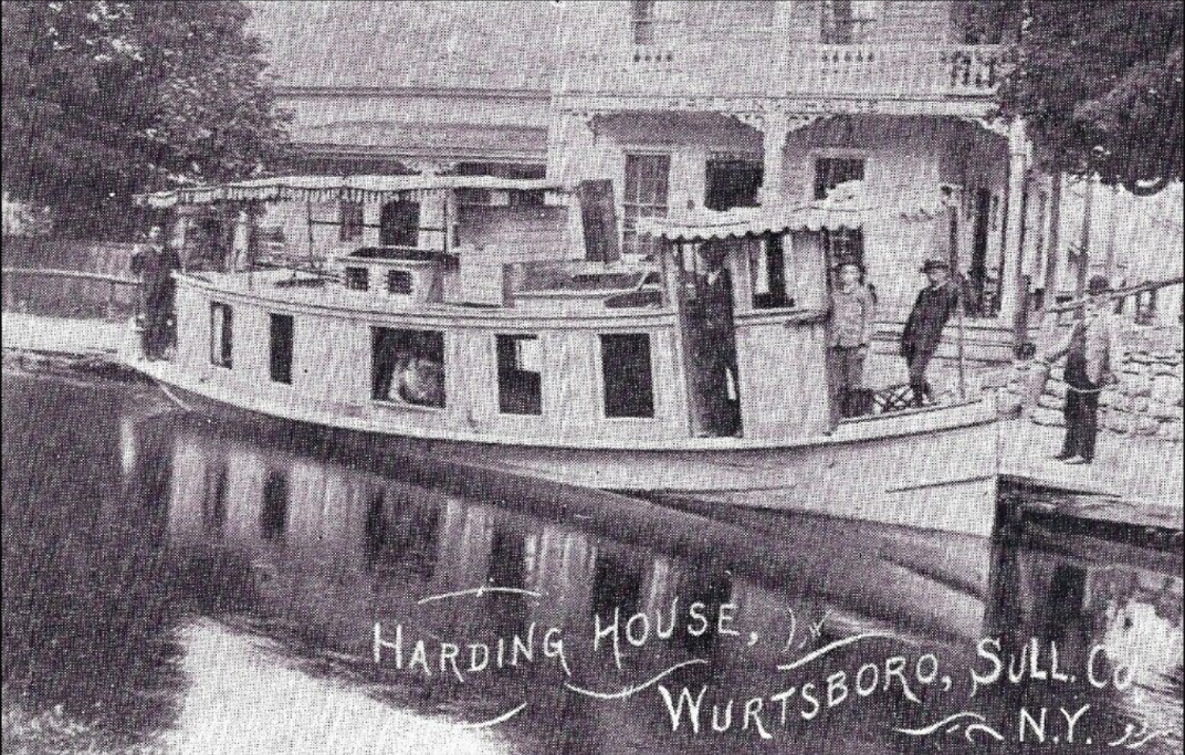
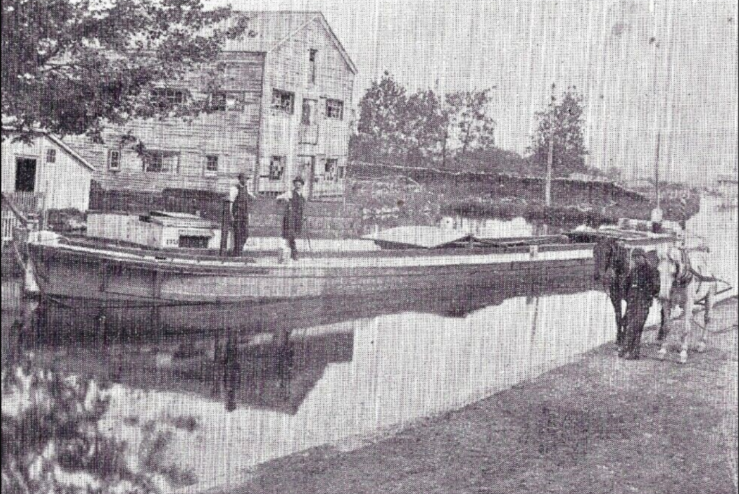
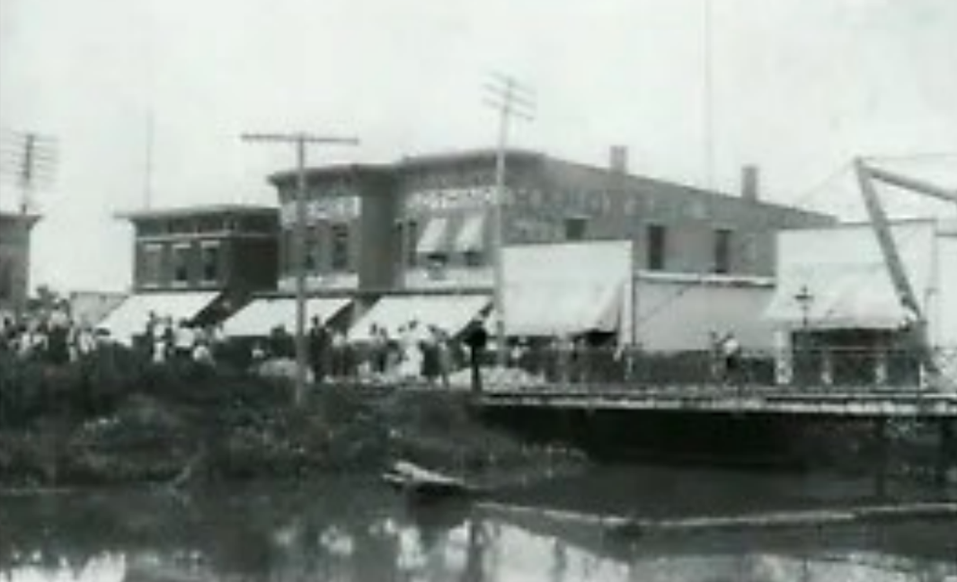
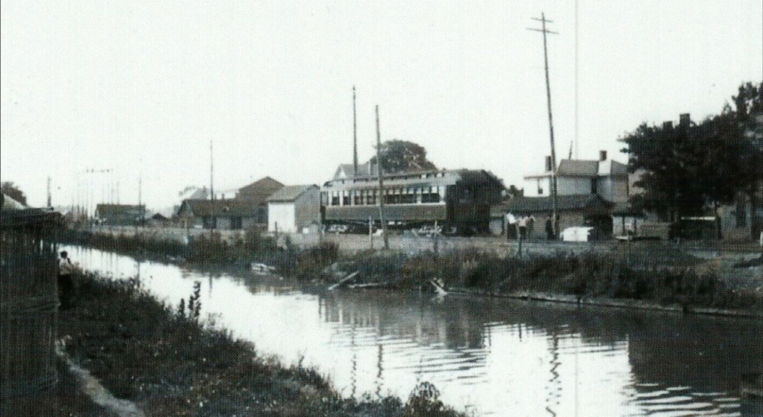
Neil Sowards, CSI member from Fort Wayne, found the following postcards of other canals and sent them to CSI headquarters. Since Indiana’s canals didn’t operate as long as some other canals, we have few pictures of them. These cards will show you similar sites and structures to those on Indiana’s canals.

NEWS FROM DELPHI
Pictures and information courtesy online “Currents”
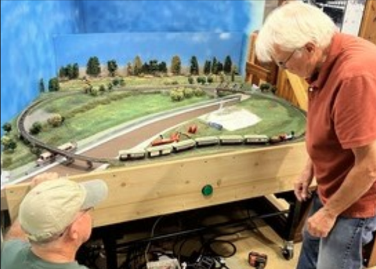
The Carroll County Wabash & Erie Canal’s “M-W-F Crew” restored the exterior front door of the Reed Case House. This included treatments of all the trim, the windows and resurfacing the door for an impressive entrance. They also completed a train exhibit in the Canal Interpretive Center. Children can activate the train and watch it and the canal boat circle through the canal village.
Their Carrollton Bridge Crew have restored and reclaimed the Carrollton Bridge site that had become overgrown. They cleared the banks so that the Wabash & Erie Canal channel could be seen and refurbished the the marker located there.
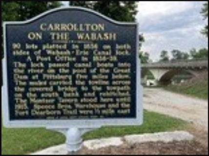
CARROLLTON ON THE WABASH
Site platted in 1854 on both sides of Wabash-Erie Canal lock.
A Post Office in 1814-32.
The lock passed canal boats into the river on the north of the Canal Dam at Pittsburg, five miles below. The mules carried the towline across the covered bridge to the towpath on the south bank and rehitched. The Mortimer Tavern stood here until 1915. Speece Bros. Warehouse and the Fort Dearborn Trail were 1/2 mile east.
In September Dan McCain, president emeritus of Carroll County Wabash & Erie Canal, cut the ribbon for the 1891 Monon High Bridge, which has been saved, preserved, and is open as part of a public trail. It has new decking and railing so the breathtaking views of Deer Creek can be safely enjoyed. The speaker at their annual meeting on October 17, 2023 talked about how the bridge was saved.

An article in the “Preservationist,” the magazine of Indiana Landmarks, said that the bridge was on the 10 most endangered places, but with the combined efforts of Indiana Landmarks, the city of Delphi, and the Indiana Department of Natural Resources a year long restoration project has saved the bridge.
Dan McCain said, “It was an honor to be at the dedication ceremony for High Bridge completion.
There are many years of efforts invested in this. Fortunately the W & E Canal Association led the
way from the early days when we opened a crude trail on the old RR ballast covered thinly with finer
stone we got free from the Stone Company and then quickly hosted the public with a trail walk. That preceded the choosing of the new Hoosier Heartland Highway route by the State much closer to Delphi than an original route nearer Camden.
“When the highway officials began their planning for the Hoosier Heartland Highway they didn’t recognize the existence of our trail until I showed them a news article about our public walk and confirmed the ownership in our non profit organization. Then they realized they had a commitment to provide a crossing where they were going to build the new lanes. One thing led to another until one engineer said “if you can find one long or two shorter bridges we will work with you” and we did locate the one that’s there now called the Freedom Bridge and got it donated by Conner Prairie as a pile of rusted metal. So the rest is history and ultimately it encouraged Historic Landmarks to tackle the next objective — finishing the restoration and decking of the Monon High Bridge a mile east. Then the City paved it with a state Next Level Trails grant.
Bravo to all — it’s finished !!”
How A Change Bridge Functioned
Article by Dan McCain, Diagram by Tom Castaldi
Five Miles north of Delphi, Indiana, the Wabash and Erie Canal crossed the Wabash River. Above this river crossing of the 7-mile-long slackwater created by the dam across the Wabash at Pittsburg, Indiana, the towpath was on the south side of the canal. Once the mules got through Lock 34 they exchanged and entered the external tramway alongside the long-covered bridge, which acted as an “exchange bridge” on both ends.
Then the mules pulled the boats 2.5 miles along the east side of the slackwater. When they arrived at Paragon the towpath left the slackwater and there was a Guard Lock leading to the miles on through the Delphi area. So at this Paragon Guard Lock there was another “exchange bridge,” which put the towpath on the west side of that section.
All the way south to Wildcat Creek the towpath stayed on the west side as it entered the slackwater and connection with the wagon road before entering that bridge crossing.
Change bridges were best placed where there was a Guard Lock because the canal was the narrowest (15 feet) at this point rather than the normal width of a constructed canal (30-40 feet wide). Only one boat at a time could use it anyway.

So there was a Guard Lock at the north end of the towpath crossing to prevent flooding of the above canal channel during high water events. That would be interesting to find the actual place where the Guard Lock was, but I suspect it was right near the entrance of the bridge itself in the widened space or thereabouts.
There too at that wider spot would be where the wagon road would have entered from the east to go on into Lafayette. That means the exiting towpath went to town for a mile or so on what would normally be thought to be “the wrong side” (towpaths were normally placed between the canal channel and the river thus becoming a long low dam).
My brother David and my parents visited England in 1985 and rented a canal boat for a week. Perhaps the most interesting canal structure we passed was an Exchange Bridge (shortened to “change” bridge) where the towpath was changed from one side to the other. It fascinated us because the mules could transit over the arching bridge and never have to be unhooked from the towrope. Yes, believe me it was possible! In 1985 we walked and held our arm out like we were holding onto a rope and could make the full “cloverleaf” without dropping the imaginary rope. Some change bridges were simpler but just as effective.
1,100+ Students Visited Delphi’s Canal Park

Each fall and spring students from in and around Delphi visit Wabash & Erie Canal Park where they have the opportunity to ride the canal boat, tour the interactive canal museum, explore Pioneer Village, etc. This would not be possible without the volunteers who are docents in the museum, artisans in Pioneer Village, crewmen on the boat, and many, many others. These visits allow students to experience Indiana history in an engaging and memorable way.

To help fund these trips for schools with financial hurdles, the Carroll County Wabash & Erie Canal Association has established a scholarship fund. To make a donation mail a check to Wabash & Erie Canal Park, Attn: Scholarships, 1030 N. Washington St., Delphi, IN 46923. Write “Scholarship” on the memo line as well.
How Did The W & E Canal Cross Wildcat Creek?
Ed Geswein, who owns the property where a dam and crossing bridge carried mules and canal boats across the large slackwater of Wildcat Creek northeast of Lafayette, Indiana, has uncovered artifacts and gotten local partners, historians, and Canal Society of Indiana members interested in finding the exact locations of these structures and how they operated. They know that a dam would have raised the water levels of the creek, created a large basin with a very slow current, and covered much of the area near the intersection of I-65 and Schuyler Avenue much like a lake. But it is not precisely known where all the structures were located, where the towpath ran or how the structures were built.
Vern Mesler, an iron and steel expert from Michigan, came to Wildcat Creek to examine the objects Ed had found on his property. After examination he said he believed Ed had found an iron brace that may have held timbers in place. Vern then operated a drone over the middle of the creek. New structures were revealed with the water in the creek being lower than usual. Iron remnants were photographed that were presumably part of the crossing bridge’s structure.
Canal Society of Indiana’s 2023 Year End Report
2023 President’s Review
In 2023, our historical organization has continued to move forward into our 41st year with canal activities throughout Indiana. Our membership remains at about 100+ despite the loss of long-time members. We have recruited new members through special events, speakers at meetings, and booths set up at festivals by Troy Jones. Several hundred children were reached through grade school pioneer programs in Huntington and Terre Haute by the Griffins and Liggets. Our outreach program is continually evolving with the changes in our economy and social environment.
In the early years of the Canal Society and through the Gronauer Lock Era, semi-annual tours were very popular, but as our membership ages and the economic and social climate changes, we adjusted our programs:
- The impact of the internet and the costs associated with the printed media caused us to switch to a bi-monthly, entirely electronic, news and journal, “The Tumble,” in 2017. This was well ahead of the decline in printed newspapers that we see today. We notify our members when the current issue is online. This has proved successful for most members and there are no paper issues to file. All past issues of “The Tumble” are available on our website. We are in the process of putting all prior publications (Indiana Waterways, Indiana Canals, and The Hoosier Packet) from 1982 to 2017 on the website. There is a wealth of information in these past publications that most of our members have never seen. Our webmaster, Preston Richardt, has worked diligently to make our website more user friendly.
- Attendance for canal site tours has steadily declined, due to aging and the costs associated with transportation – fuel, bus travel and hotel stays. To still provide an educational experience for our members we are conducting yearly symposiums. On March 25, 2023, we had 59 people in attendance at the Fort Wayne downtown Public Library. Craig Berndt and I presented Power Point programs on canals and interurban railroads. We are planning for a similar symposium in Connersville on Saturday April 13, 2024.
- A traditional Fall Tour was headquartered at Crawfordsville on September 15-16. 2023. On Friday, 20 members toured the Old Round Jail, the Lew Wallace Study Museum and the old Yount’s woolen mill property. The mill tour was led by Dr. Ron Morris, who has written a book on this Civil War Era clothing mill. On Saturday, Troy Jones, CSI member from Clinton, conducted a car caravan tour from the Montezuma Basin to Lodi and then on to Covington. At Covington, Henry Schmitt opened the County Courthouse for us to see Terry Bodine’s new lock model and the murals. Across the street we saw Terry’s model of the Cade’s Mill Covered Bridge. Henry then led part of the group to the original bridge over Coal Creek while the other half of our members took an adventurous miniature train ride on the Bodine’s track through the woods. Lowell Griffin created a wooden ornament of the Lew Wallace Study for each member/family that attended the Friday tour. In 2024 our Fall Tour will be in Paulding, Ohio on Saturday August 17, 2024.
- Our Signage program continues to be popular. Dr. Morris arranged for 14 signs to be installed in Fayette County and held a special dedication program on September 8, 2023 that was attended by several local politicians. Troy Jones installed 3 signs in Parke Co. and 2 more in Daviess County. Shirley Lamb had the Whitewater Canal Trails install 3 additional signs in Franklin County. Terry Bodine created a wooden canal boat cutout to place on top of the sign at Covington and Ed Powers made another similar cutout to be placed on a sign at Redding Road in Fort Wayne. Other signs were erected by Lowell Griffin and Bob Schmidt. Signs are underway for placement in Hagerstown and Huntington. We need our members to suggest and pursue additional sign placement for 2024.
- To spread some of our administrative work and to reduce postage costs, we have moved our PO Box from Fort Wayne to Terre Haute. Sam and Jo Ligget have agreed to access the PO Box occasionally and deposit any receipts into a new Old National Bank checking account. They will send details of this deposit and details of new members via E-mail to CSI headquarters in Fort Wayne.
- This tour led to more discoveries of canal sites through further research and field investigation by a group of CSI members. Their findings will be published in “The Tumble” in 2024.
I think that this past year we have had more CSI members working together on projects than ever before. CSI Headquarters has also received more phone calls about signage, research and discoveries than before. Thanks to all of you, CSI has had another very successful year.
Bob Schmidt, CSI President
Click Here to read the full Year End Report
A Winter Eden
By Robert Frost
A winter garden in an alder swamp,
Where conies now come out to sun and romp,
As near a paradise as it can be
And not melt snow or start a dormant tree.
It lifts existence on a plane of snow
One level higher than the earth below,
One level nearer heaven overhead,
And last year’s berries shinning scarlet red.
It lifts a gaunt luxuriating beast
Where he can stretch and hold his highest feast
On some wild apple tree’s young tender bark,
What well may prove the year’s high girdle mark.
So near to paradise all pairing ends:
Here loveless birds now flock as winter friends,
Content with bud-inspecting. They presume
To say which buds are leaf and which are bloom.
A feather-hammer gives a double knock
This Eden day is done at two o’clock.
An hour of winter day might seem too short
To make it worth life’s while to wake and sport.