

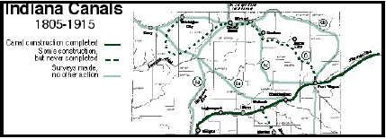
Index
Wm. J. Ball Responds to Critics
After the Indiana State Legislature ordered the completion of the Wabash & Erie Canal to Terre Haute in February 1842, it was Wm. J. Ball who estimated it would cost $83,160.84 to com-plete the work. He reported his findings to a committee of Terre Haute businessmen, who were promoting the completion of the canal.
When the plans to locate the extension of the Wabash and Erie Canal from Coal creek, at Lodi, Parke county, Indiana to Terre Haute, Vigo county, Indiana, were made known to the public, they were criticized for its levels being too low. Wm. J. Ball, the Engineer of this section of canal, sent the following response to the Wabash Express of Terre Haute justifying the levels planned. It shows many of the considerations that had to be taken into account when planning a canal route.
Wabash Express, Terre Haute, Indiana
March 8, 1843
THE WABASH AND ERIE CANAL.—IT’S LOCATION
As so much has been said in regard to the location of the canal from Coal creek to Terre Haute, tending to produce the impression that the levels adopted are quite too low, rendering the cross-ings of the streams hazardous, and the aqueducts liable to be taken away by every high freshet, I have felt myself called upon to make the following plain statements, with a view of disabusing the public mind in reference to this subject. I am the more willing to do this, from the convic-tion that the completion of our canal to Terre Haute is of the first importance to the country, and that it will require an energetic, harmonious and undivided effort to accomplish the object.
I apprehend much of the fear expressed in regard to the safety of the canal, on its present loca-tion and levels, arise from the fact, that erroneous impressions have been made in regard to the plans that are contemplated. I cannot well imagine how persons, riding along the line, but slightly acquainted with the subject in general, and wholly ignorant of the plans proposed or levels adopted can form any just conception of the eligibility of the location made. It does seem to me that if real apprehensions had been entertained that the plans adopted were injudicious, and it had been declared to know the facts in regard to the matter, some pains would have been taken, in the first place, to ascertain what was really proposed, and this could have been done at any time by reference to the field notes in the canal office. I have always taken pleasure in giv-ing any information, in regard to the location and plans that has been called for by the friends of the work—and have at all times been pleased to hear any suggestions made with a view to pro-mote its interest. If this course had been pursued in a spirit of candor and magnanimity, I am quite certain entire satisfaction would have been obtained, and the trouble saved of imputing motives, which no honorable man would be influenced by or charge another with, without knowing the facts would have justified him in so doing.
I will now, for the information of all whom it may concern, state that the present location con-templates a lock of nine feet lift nearly opposite Perrysville, from which the level is kept until after crossing Coal creek, immediately after which a lock of six feet is introduced, below which the feeder is taken in. From the lock at Coal creek the level is maintained until after the crossing of Raccoon Creek, immediately after which a lock of ten feet is dropped and the feeder intro-duced below. From Raccoon to Terre Haute the level is kept up. By this arrangement of the lev-els the bottom of the canal will be fifteen feet above low water of Coal creek, for which stream an aqueduct of two spans of eighty feet each, with stone masonry abutments and piers, is con-templated. The high water mark of the freshet of 1828 was found to be five feet above bottom of canal at this point, that of 1838 one foot above bottom, and the ordinary high freshet about three below bottom of canal, which last is probably the height to which the creek would raise at the time of its greatest discharge, if not influenced by back water from the Wabash.
For the lock at Coal creek to near Raccoon, the embankments will be raised to an extra height, to keep out the floods of the Wabash. They are intended in all cases to be kept above the high water mark of 1828, six feet above bottom of canal; that of 1838 two feet, and the ordinary high freshets about two feet below bottom of canal, which is probably the extreme high water of the creek, if uninfluenced by back water from the river.

It is intended to provide an aqueduct of two spans of eighty feet each (built 90’) for Raccoon creek, and to build two abutments and pier of cut stone masonry. The level of the bottom of the canal is 18½ feet above the low water of the creek: the freshet of 1828, two feet above bottom of canal; that of 1838, two feet below bottom and ordinary high freshets 6 feet below bottom of canal; but it is probable as the stream has much fall in it, and the floods would come down with great rapidity, its freshets uninfluenced by the river, would rise to within about three or four feet of bottom of canal. Now, it is asked, why the lock of six feet is dropped at Coal creek?—The answer is, that a feeder is required from that stream, and to leave this lock out would increase the length of the feeder from one to ten miles, enhancing its cost very much, and doing material injury to property on the creek. In addition to this, a feeder is required at Sugar creek, the dam for which will now have to be fifteen feet high, the feeder line being three-fourths of a mile long. Without this lock the dam would have to be 23 feet high; or, if the dam be preserved in its present height, the feeder must be lengthened about three miles, the cost very much increased, and all the important advantages of the present site of the dam lost—its rocky bottom, and rocky bluff on one side—as no other eligible site could be found above.
And again, as the embankments for a great portion of the distance would, upon the raised level, have to be much higher than is required to keep above high water of the Wabash, and the abut-ments and piers of all the aqueducts raised this additional height, the cost of the main line would be very materially increased.

Having stated what plans are really contemplated, and giving the reasons that induced their adoption, I will now endeavor to show that the fears entertained of a serious damage to the aq-ueducts at very high freshet in the streams, from the lowness of the levels to be groundless. Pre-liminary to this investigation, I will give a general description of the plan of the superstructures adopted for the Coal, Sugar, and Raccoon creek aqueducts; in plans we then have each span of our superstructure, consisting of four arches with posts and braces, and the same number of chords; the latter resting on top of the masonry of the abutments and piers, which will be raised (as is usual,) to 6 feet above bottom of canal. From the arches the trunk will be suspended by iron rods so as to leave 1½ feet between the chords (which are the lowest timers) of the main structure above, and the top of the trunk. The bottom of the trunk, or course, corresponds, or is the same level, with bottom of canal. Now, we have seen that low water of Sugar creek is 16 feet below bottom of canal; to this add 6 feet, and we have 22 feet, the height of the main struc-ture above low water, and this is on a level with the highest water ever known. At such a time, the whole valley of the Wabash would be covered with water and at Sugar creek it would be backed up several miles, checking the current in that stream so much as to render it almost en-tirely imperceptible. Let me ask what danger to the aqueduct is then to be apprehended? Drift logs may float slowly down and rest against the piers or abutments, or perhaps against the trunks of the aqueduct, but quite as likely against the long embankment; streaking [stretching] across the valley. And can any thing be easier than for two or three men to float these logs off to some point where no injury can be done by them when the flood subsides? In all ordinary freshets, when there is not much back-water, the drift wood can pass under the trunk of the aq-ueduct without doing it any injury whatever; for let it be borne in mind that ample water way is to be provided, and spans of unusual length adopted with that express view. But taking the most unfavorable and improbable view of the case: suppose the trunk of the aqueduct is carried en-tirely away. This is a very simple and cheap affair, costing not more than 4 of $5 per lineal foot, amounting to an entire loss of about $1,000. Would it be judicious to enhance the cost of con-structing the canal 40 or $50,000 to avoid this loss; which, if it occurred at all, will not in all human probability take place more than once in ten or twenty years?
If what I have said be satisfactory in reference to Sugar creek, much more so, must it be in re-gard to the crossing of Raccoon creek, the level there being much higher—for it will be seen that the main structure at the stream is no less than 24½ feet above low water—quite above the highest freshet (that of 1828) ever known in the country. To all this I may add, that Dr. WHIP-PO, an Engineer of great experience and skill in his profession, adopted levels lower than the present; that two other Engineers of high reputation, have examined the subject and unite with me in the opinion that the location and plans adopted are most eligible.— On this subject I hope enough has been said. But I will embrace the opportunity to say one word in reference to the plan of sustaining a high level from Perrysville to Terre Haute, with a view of increasing the water power at the latter place. We will commence then by taking out the lock at Coal creek, which we have seen will increase the length of the feeder from the stream from 1 to 2 miles, and at Sugar creek raise the dam 21 feet high, or increase the length of the feeder about 3 miles—thence we maintain the level by high and very expensive embankments 14 miles to Rac-coon creek. Here another lock, of 10 feet 1 ft. must be raised, which, with that at Coal creek, makes 16 feet lockage taken out, and as the dam at Raccoon will now have to be about 15 feet high, on the raised level, it must be 30 feet, or the feeder extended up the creek 8 or 9 miles to get the fall—leaving Raccoon creek and maintain a level 16 feet higher than the present to Terre Haute, at an enormous expense, and will find ourselves three feet below the level of the Cross Cut canal at the termination of the line. And if the increased length of the feeders be tak-en into consideration, the diminution of the quantity of water passed at the points where the dams would be located, the increased length of the main line, in consequence of the necessity on the high level of following more closely sinuosities of the hills—bounding the river valley, and the greater quantity of water required to feed a canal so much in embankment.—I think no one who is a judge of the matter will hesitate to agree with me, that the water power at Terre Haute would actually be diminished by raising the level in this manner.
It has been suggested that a high level could be maintained by following up the valley of Rac-coon creek and thence down Henrie’s Prairie to Otter creek and to Terre Haute. With a view to test the practicability of this route, as early as 1836, extensive explorations were made. An ex-perimental level was commenced at Terre Haute and continued to Roseville, on the most favor-able route that could be found. The levels on this line, for the distance of between four and five miles, range about 2 feet above the level of the canal at Terre Haute, as located by Dr. WHIP-PO. And the surface of low water of Raccoon creek was found to be 39 feet above bottom of canal. Now on Dr. WHIPPO’s line three locks of 10 feet lift each are located between Terre Haute and Sugar creek, of which place the present location does not materially differ from his, we should then, after taking out all the lockage from Sugar creek to Terre Haute, have a cut through Henrie’s Prairie for a distance of between 4 and 5 miles, ranging about 32 feet in depth. Besides, this line would be two or three miles longer, and a feeder from Raccoon, so far up the stream, would of course afford very much less water than at Armiesburg.
WM. J. BALL Engineer W. & E. Canal

Wm. J. Ball was recognized for his efforts. In 1847, when Indiana governor, James Whitcomb, officially turned over the Wabash and Erie Canal to Charles Butler, Thomas H. Blake, and Na-than B. Palmer, these trustees appointed Wm J. Ball the resident engineer of the southern divi-sion. Their other appointments included Jesse Lynch Williams, who was Ball’s brother-in-law, chief engineer; Chauncey Carter, superintendent of the western division; Stearns Fisher, super-intendent of the eastern division; and toll collectors for Fort Wayne, Lagro, Logansport, Lafa-yette, and Covington.


The artist drew the aqueduct crossing without cover in order to show the action of the crossing more clearly. However, Raccoon Creek and Sugar Creek had covered bridge style aqueducts.
Years later the stones of the abutment at the aqueduct site have been changed by erosion and encroaching timber. The water in the canal proper, at the time of its operation, was 26’ wide at the bottom; 4’deep; and 40’ wide at the top.
The water level was maintained by dams and locks—to raise or lower the water level as needed. The canal paralleled the Wabash River from north to south and was dropped accordingly as it traveled south to Terre Haute. This aqueduct was number 12 and when finally built consisted of two spans of 90’ clear, the top of the pier and abutment being 26½ feet above low water. The pier and abutments are of cut stone masonry, on foundations of timber, protected with stone and brush. The superstructure is similar to that of the Sugar Creek aqueduct, except that on top of the main chords there is a second chord, consisting of three thicknesses of 2 inch plank, 12 inches wide. The truss frame is 17½ feet high from the bottom of the chords to the top of the plate. All the aqueducts on this plan are roofed, weather-boarded and painted, to protect the main timbers from the weather; more or less like the covered bridges of Parke county, only they were made to carry water across the stream to float boats, both freight and passenger.
In 1854 spring rains damaged this aqueduct and stopped travel for about 4 months. In 1864 the Raccoon aqueduct superstructure gave way and both 90’ spans were destroyed. In 1868, feeders to Terre Haute were so poor that navigation was stopped at Armiesburg and never resumed.
Proposed Northern Canal for Indiana
In pursuit of material for Day In Indiana History, I, Bob Schmidt, uncovered this newspaper column about a proposed canal for Northern Indiana. Although the South Bend business com-munity championed this idea, it needs a little more explanation.
The South Bend News-Times of South Bend, Indiana carried the following article about a new northern canal on March 27, 1914.
“CANAL PROBABILITIES
“If the northern canal route is not feasible for lack of water or other physical conditions or if the improvement would not be a profitable investment for the government for lack of sufficient pat-ronage to justify the expenditure of a few million dollars it is likely South Bend will remain an inland city.
“If the canal is something we should not have or cannot have it will be easier to surrender than something we are in possession of, but we should not grow pessimistic over what the engineers may say in advance of their official report. Engineers are proverbially calculating machines which contemplate nothing short of finalities. They have no more imagination than adding ma-chines and nothing to compare with the temperament of a typewriter. They deal exclusively in facts until the resources of the fact factory are exhausted and then they stolidly draw their con-clusions.
“So far they have found these facts, that the canal will need a certain volume of water, that the network of railroads crossing northern Indiana present a problem in crossings and that the northern route is the shorter of the two under consideration. Eventually by the same cool calcu-lating process by which they have reached this point they will measure the available water gal-lon by gallon, decide upon the question of feasibility and know to a pound the amount of freight likely to pass through the canal.
“Then they will be ready to say “therefore” and “whereas” and “recommend” and a number of other words of vital significance to the project. In the summing up, doubtless, the difference in time, distance and risk between going around by the straits or taking the short cut across Indiana and Ohio will have a bearing, this being the primary purpose of the project.
“The additional business the vessels pick up in their voyage across country will be to the nature of velvet. Time is the vital element in modern affairs, particularly in transportation and espe-cially in competition between water and rail routes, if such a thing as competition does exist or even will exist, and we assume that additional business will be a small factor in deciding the fate of the enterprise.”
After the Wabash in Erie Canal ceased to exist in 1876, two attempts were made to build a new canal from Lake Erie to Lake Michigan. The first was 1880 when Congress authorized a study and survey. The survey was completed, but nothing more happened. In about 1909 Mayor Per-ry A. Randall of Fort Wayne and a few other businessmen agitated again for a ship or barge ca-nal similar to the New York Barge Canal, which was in progress in New York. In March 1914, the Erie and Michigan Deep Waterways Association was organized in Fort Wayne and area cit-ies. Congress again authorized a survey.
The Wabash & Erie Canal had been constructed on the dimensions of the original Erie canal, 40 feet wide, 4 feet deep, with locks 90 long and 15 feet wide. By the time the W&E was complet-ed the original Erie had been expanded to 70 feet wide, 7 feet deep, with double locks 110 feet x 18 feet and still followed the original channel of the old Erie. The canal that the Indiana busi-nessmen envisioned would have the dimensions of the New York Barge Canal so that traffic could flow from New York to Chicago through Ft Wayne. This involved channelizing the Maumee River and straightening out its many bends.
The 1914 survey was to consider two alternatives, a ship canal to use Great Lake Ships or a barge canal for smaller vessels. The advantage of the ship canal was that it eliminated the lengthy trip to and from Chicago around the Straits of Mackinac. The tradeoff of distance and time was largely offset by the time involved going through a series of 23 canal locks. The di-mensions were to be the same as the New York Barge Canal so that shipments could move be-tween the two systems without any transshipment. The channel was to be 110 feet wide, 12 feet deep, with locks 338 feet long and 45 feet wide. In some places concrete walls would line the banks. The present day junction of the “Three Rivers” in Fort Wayne would be gone.
From Fort Wayne there were two possible routes. The first— a southern route to Huntington then north to Rochester and Valparaiso. The second—a northern route of 133 miles was from Fort Wayne up Spy Run creek then west past South Whitney and then on to Warsaw to the Big Elkhorn River then to Goshen, Mishawaka, South Bend finally reaching Trail Creek in Michi-gan City and Lake Michigan.
The proposed route from Toledo involved channelizing the Maumee River using 9 locks with lifts of 14 to 25 feet. The total distance was 100.5 miles and total lift 170 feet. Fort Wayne and cities along the way would have to build lift bridges to cross the canal. Instead of the country beauty we have today, we would have been left here in Indiana, like New York, with an unprof-itable 150 miles of concrete canal. When the Wabash & Erie failed the structures just rotted away into the environment. The scenic free flowing Maumee would have been bottled up with concrete locks.
As a canal enthusiast and CSI President it may seem strange for me to say, but it was a “blessing” that this whole project collapsed. The water supply at the summit level would most likely have been insufficient as the traffic grew.
There was a wait and see attitude by the public on the project as the New York Barge Ca-nal. Larger ships and the opening of the Barge Canal was not even completed until 1918. The opening of the St Lawrence Seaway in 1959 for larger ships spelled the death of commercial traffic on the New York Barge Canal. In 2008 there were only 42 commercial shipments vs. 38,000 in 1855, its peak year.
Fort Wayne and northern Indiana certainly dodged a bullet on the proposed canal to Lake Mich-igan. Today there is talk for high speed rail traffic through Fort Wayne to Chicago. Is this a good idea?
Canal Notes #2
Water and Stone
By Tom Castaldi

Canal in Indiana
Map courtesy wikipedia
Build the longest canal in America without a source of water, no building stone and no surveyor’s tools?
That’s what the State of Indiana faced in 1827, before Sam Hanna, David Burr and surveyor John Smythe laid out a water route from the Saint Joseph River six miles north of Fort Wayne to make the Wabash & Erie Canal a reality.
Because Fort Wayne was the highest point on the proposed line, water had to be found to be poured in from the top to make it work.
Hanna then traveled from Indiana to New York, the only place surveyor in-struments could be found at the time. It’s said that he made the trip out and back in an unusually fast time. Pretty good when only horse, steamboat and stagecoach could hurry the pace.
To top it off, the three men worked so rigorously that Burr collapsed from exhaustion and Smythe actually died of the fever. Somehow Hanna persevered and delivered to the Indiana General Assembly the route for a feeder canal, ready to dig and the project was approved in 1827.
A dam on the Saint Joseph, at present-day Shoaff Park, was the answer but it had to be made of felled trees, brush, sand, sediment and wood because there is no building stone in the county.
Yet, with no water, no instruments and no building stone, this canal finally made possible an unbroken water connection from the Hudson river to Lake Erie and then via this canal to the Gulf of Mexico It pioneered the way for the railroads and highways we use today.
Early Evansville Transportation: River / Canal / Rail
By Bob & Carolyn Schmidt
Hugh McGary Jr., purchased about 441 acres in the Indiana Territory on March 27, 1812, and named it “McGary’s Landing”. The location was picked strategically as it was at the apex of a sharp horseshoe bend in the Ohio River. The river current flowing from the south to north at that point forced the current to the north side along the banks of Indiana Territory before turn-ing south at the bend. Thus any flatboat traveling along the river current was forced close to the banks at McGary’s Landing.

In order to attract more people, McGary renamed his village “Evansville” in 1814 to honor Colonel Robert Morgan Evans, a legislator from Knox county. Through Evans’ help the town was incorporated in 1817 and became the county seat on January 7, 1818. The county was named for Henry Vanderburgh, the deceased chief judge of the Indiana Territorial Supreme Court.

Steamboats on the Ohio
McGary’s pick of location and timing was perfect. The flatboats taking settlers west found Ev-ansville a great place to stop overnight and to pick up supplies. Even more strategic was the fact that Robert Fulton’s invention of the steamboat and his travels that began on the Hudson River in New York in 1807 were now being planned for the Ohio River.

Robert Fulton and his partner, Robert Livingston, worked with a boat builder, Nicholas Roose-velt, to create a steamboat with a side-wheel design. Roosevelt had explored the Ohio and Mis-sissippi by flatboat in 1809 to locate possible refueling points for future steamboats. He had even purchased land at Cannelton, Indiana as a fueling station.
In 1910, a partnership with Fulton and Livingston, Roosevelt began construction of a steamboat with 2 side wheels. The New Orleans was completed by March 1st,1811 and began its maiden voyage on October 20th toward its namesake. She reached Louisville on October 28th.

The Falls of the Ohio proved to be a major hurtle to steamboat operations. In fact, Fulton and Livingston planned to have 6 boats running between Louisville and New Orleans and 5 boats between Louisville and Pittsburg. In her initial voyage the New Orleans was delayed a month at the falls due to insufficient water. Finally a pilot was able to negotiate the rapids.
As the New Orleans proceeded into the Mississippi river she was caught in the middle of the New Madrid earthquake of December 16, 1811. Remaining undamaged the steamboat reached New Orleans on January 10, 1812. It plied the waters between New Orleans and Natchez for a couple of years until July 14, 1814, when, like so many later steamboats, she hit a snag and sank at Baton Rouge. An average steamboat usually only lasted a couple of years due to fire, boiler explosions and rivers hazards.
It is worth noting that only a few months after the New Orleans steamed down the Ohio that Hugh McGary established his landing. By 1826 there were 143 steamboats on the western wa-ters and Evansville became a major stop. In 1830 the 2-mile-long Louisville & Portland Canal was opened around the Falls of the Ohio. This increased traffic on the Ohio and created an eco-nomic boom in Evansville.

The Canal Era
Indiana’s Wabash & Erie Canal began at the Fort Wayne summit in 1832 and proceeded west, reaching Huntington by 1835. There was tremendous demand throughout the state for canal building elsewhere. This resulted in the Mammoth Internal Improvement Bill signed by Gover-nor Noah Noble in January 1836. Evansville was successful in securing the terminus for the Central Canal. The Wabash & Erie and Central Canals were designed to provide a link between New York and New Orleans.

Between 1836-1838 contractors constructed 18 miles of canal out of Evansville to the Pigeon Creek Dam near Millersburg in Warrick county. This stretch of canal prism contained no locks or other structures, other than box culverts and some road bridges. It soon became a canal to nowhere, remaining that until 1853 when the first canal boat finally arrived. The state had run into financial difficulties in 1839. The Central Canal had been abandoned. The debt was negoti-ated and the portions of Wabash & Erie Canal that had been completed had been turned over to a private trust in 1847. The Wabash & Erie Canal was then extended via the Cross-Cut, the un-constructed portion of the Central Canal and the part extending north from Evansville was re-named the Wabash & Erie Canal. The construction was assigned to the bond holders.
Although the canal had finally reached Evansville, the city was still a steamboat town. TheEvansville Daily Journal ran a daily column entitled “River Items” that listed all the steamboat arrivals and departures, what they carried, river conditions, new boats being built, etc. The town’s main focus was on river traffic. Most news about the canal concerned maintenance
Central Canal Evansville to Pigeon Dam later became part of Wabash & Erie Canal problems, lack of water, financial difficulties, etc.
Over the years canal structures failed and water levels were often too low. Revenue from the canal was insufficient to pay for the repairs. Thomas Dowling, the canal Trustee, decided to lease out portions of the canal to other investors who had a local interest in keeping it in repair and operating it.
In early 1859, the Southern Indiana Canal Company was established. Prominent citizens sub-scribed for shares in the new company, but as the cost estimates for repairs continued to rise some of these investors failed to pay further installments on their subscriptions. However, the Wabash & Erie was being made operational again from Toledo, Ohio to Evansville. People were hoping it would be a success. In September 1859 the Evansville Daily Journal began fo-cusing on the possibilities of canal travel as well as river travel. It finally began carrying “Canal Items” including the names of canal boats, their departures and arrivals, what they were carrying, etc. as follows:
Evansville Daily Journal, Evansville, Indiana
September 6, 1859
THE CANAL. – The canal boats Morgan and Princess both passed the Summit level [Pigeon Summit] on Saturday, and have arrived here [Evansville] with cargoes from Petersburg. The canal is now in good order from here to Toledo. We understand from Mr. Lawrents [Lawrence ?] that he has over 300 tons of freight on the way from the lake. Shippers might now, we think, order their heavy freights by the way of canal, without fear of any undue delay. The work is now in better condition than it has ever been. A new era in our canal navigation has, we trust, begun.
We understand that the calls of 50 per cent, on the subscriptions to the canal have been prompt-ly paid, except those on four persons in this city, whom obligations amount to about $1,100. The calls of 50 per cent, on this sum, with the water rents now due, would liquidate the balance due for the repairs, and leave the Board of Managers nearly free of debt. It is mortifying that some of our own citizens should be the only ones to repudiate a contract that has resulted in so much good to the city. The whole cost of repairs to the Lower Division of the canal has been about $12,000; most of the work has been done at nearly half the estimates made for it by the Trustees. The leaks along the whole line have been thoroughly and effectually stopped, and a heavy waste of water thereby prevented.
The City Council ask that right of filling the public cistern from the canal for a certain sum, with the power to grant certain privileges to citizens to tap them for private uses. As this would deprive the canal managers of a great many smaller water rents, they properly refused to com-ply, unless the city pay over to the canal a portion of what they collect on the sub-leases.
September 7, 1859
THE CANAL.—The canal boat Princess left yesterday with a heavy cargo of merchandise for Petersburg. The Morgan leaves this morning for the same place. Two other boats left here yes-terday with full freights for Millersburg. The water in the canal is still increasing, and in a few days boats will be able to pass the whole line with full loads. Two or three boats are on the way down loaded with flour.
September 10, 1859
CANAL ITEMS.—Boat Imperial left last night, loaded with merchandise for Worthington. Boat Fuller with a load of merchandise left for Newberry.
All the workmen, who were engaged in repairing the canal have been discharged, except the regular force of the repair boats. The latter are now employed in raising and strengthening the low and weak places in the banks. These improvements of the banks will enable the managers to raise the water and give a greater depth than it ever before contained. The improvements at Pigeon Summit have been completed and there is now a depth of full three feet there.
We saw yesterday a large canal boat traveling through the streets on trucks from the river to the canal, to take part in the increased trade that is opening on the canal.
September 17, 1859
THE CANAL.—The last Petersburg Reporter has the following paragraph in relation to the business on the canal.
Under the superintendence of the new managers, the canal is about to redeem itself from its past miserable reputation. There is now a better stage of water in the canal than has been enjoyed since it was constructed, and it is confidently believed that the prompt and energetic attention of the managers will preserve the canal in good repair, and make it a paying institution. Those who have the management of the canal now, are men who have a deep interest in it, and will do all in their power to maintain it in good order. Boats run regular[ly] between here and Evansville now, and notwithstanding, the water has only permitted the boats to run in the last few days, we notice a marked difference in the business of Petersburg already. If the canal will just keep in good order during the balance of the season, we believe there will be more business done here than in any other inland town in Southern Indiana.
September 21, 1859
CANAL ITEMS.—The boat Washington came in yesterday from Williamsburg? with 150 bbls. flour, a lot of wheat, and also some house goods. Left in the evening for Williamsburg?, with merchandise for that place.
The Princess left yesterday noon, for Petersburg heavily loaded for that point, with merchan-dise.
Considerable business is doing in the way of wood and staves. A small break occurred this week, near Dongola; but the State boat being near, navigation was not stopped but for a few hours.
September 22, 1859
CANAL ITEMS.—Business on the canal yesterday was rather dull, there being no arrivals or departure of boats, except wood or stave boats. Some two or three boats are expected to-day from Petersburg. Considerable freight is in store in the warehouses waiting for boats. In conse-quence of the low price of wheat there is less coming down the canal than usual at this season of the year.
September 30, 1859
CANAL ITEMS.—The Princess came in Wednesday morning from Petersburg, with 200 bush-els of wheat and 160 barrels of flour. She left in the evening from Petersburg with salt and mer-chandise for that point.
The Eureka came in on Wednesday evening from Newberry with 210 barrels flour, a lot of feathers, &C.
The Washington came in on Wednesday evening from Millersburg, with 50 barrels flour. She left yesterday for the same place, with merchandise.
The Transit came in yesterday from Newberry, with wheat and staves.
How exciting to have such good reports about the canal. There was about a month of these re-ports when earth shaking national events took over and the canal items columns stopped. Abo-litionist, John Brown, and 22 others captured Harpers Ferry and attempted to seize the arsenal on October 16-18, 1859. Brown hoped to ini-tiate a slave rebellion or at least die trying.

The southern end of the Wabash & Erie Canal soon failed to function south of the Newberry dam. The Cross-Cut portion of the W & E, operated by another leaser from the Newberry dam to Terre Haute, also closed in 1861. As late as 1866 the Evansville Canal Company sought to open the canal from the Pigeon Reservoir into the city by subscription. This effort also failed as citizens were more interested in filling the old channel than using the water.
The Railroad & the Civil War
Just as the Wabash & Erie Canal reached Evansville in 1853, a railroad line from Evansville to Terre Haute was being opened. Willard Carpenter, who was an early supporter of the canal, now was one of the main principals behind rail construction. During the early years of the Civil War 1861-63, Evansville was cut off from the southern markets at New Orleans when steam-boat traffic stopped. Once Vicksburg fell in July 1863, the steamboat traffic resumed.
Evansville & the Ohio River
Although the planned Central Canal was never completed to Evansville and the Wabash & Erie ceased to exist there after the 1860s, Evansville still has a canal. Its canal is the Ohio River, which has locks and dams. The United States Corps of Engineers operates the system without charging any tolls. Barge traffic is heavy carrying grain, coal, hydrocarbons and construction materials. The canal era in Evansville still remains.
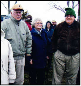
Whitewater Canal Trail Improved

The third Saturday volunteer group of the Whitewater Canal Trail met at Metamora, Indiana on November 20, 2021 to patch and repair the trail along the Whitewater Canal and walkways within the town. Duck Creek aqueduct can be seen in the distance. Photo courtesy WWCT
Koehler Presents Program At Wabash
Jeff Koehler, CSI director from Center Point, Indiana, presented a PowerPoint program about the Wabash & Erie Canal to the Wabash County Historical Society on November 23 at 7 p.m. There were 28 in attendance and Jeff said they overflowed the parlor of the home in Wabash, Indiana. He also talked about the mission of the Canal Society of Indiana and how we are erecting canal signage throughout the state. He had membership forms and brought in three new members.
Ligget Gets Sign Approved
Sam Ligget, CSI director from Terre Haute, and his wife Jo attended the Board of Public Works & Safety of Terre Haute on November 22, 2021 in Terre Haute, Indiana regarding the possibil-ity of placing a sign at 1st & Eagle Street where the Nadir level of the Wabash & Erie Canal was located. At that time Howard Greninger, Reporter of Terre Haute’s Tribune Star was pre-sent and wrote the following article for the paper’s November 23 issue, page 3. Sam asked Greninger’s permission to put it in “The Tumble” since it so well explains the purpose of the sign.
Board OKs historical marker for 1st & Eagle streets
Terre Haute has its own unique place in history of Wabash & Erie Canal.
City resident Sam Ligget wants everyone to know that Terre Haute holds a unique spot in the history of the Wabash & Erie Canal.
The city rests in the far south end of the lowest level of the canal between Fort Wayne and the town of Riley, known as the Nadir Level, which extends for 12 3/4 miles.(Riley to Terre Haute)
On Monday, the Terre Haute Board of Public Works and Safety approved a request from Lig-get, a board member of the Canal Society of Indiana, to erect a historical sign at First and Eagle streets.
“The Canal Society is out of Fort Wayne, but we are going around the state of Indiana to put up signs to mark historical places in the canal,” Ligget told the board. “The Canal Society will pay for the sign. Terre Haute was the lowest level between Fort Wayne and Lockport, which is now Riley.
“The water for the canal went downhill from Fort Wayne to Terre Haute and water flowed from Riley to Terre Haute, so when you have water coming from both directions, you have to do something with it, so it went out into the Wabash River by Eagle Street and First Street…near where [Indiana State University’s] track is located,” Ligget said.
The canal extended for 468 miles from Toledo, Ohio to Evansville and was completed in 1853. Terre Haute served as headquarters for the canal from 1847 to 1876. The first canal boats ar-rived in Terre Haute on Oct. 25, 1849.
“It was an important point, when you look at a map of the city in 1858,” Ligget said after the meeting. “There were a lot of pork packing plants on the canal. They faced First Street and had a back side on the canal. There was a turning basin there to turn around the canal boats. There was what canal people call a waste weir, which is a gate. So, when there was too much water in the canal they would open the gate and let water out into the Wabash River.”
That gate a First and Eagle, Ligget said, was near Lock No. 41 and Lock No. 42, “Which was the only double lock on the whole canal system It changed the level of the canal by 19 feet, which is easily the largest change in water level of any lock on the whole system, so the city of Terre Haute was 19 feet higher than this Nadir level,” Ligget said/
It was not far from a dry dock area at Chestnut and Second streets where canal boats could be repaired, Ligget said.
The Wabash & Erie Canal was 40 feet wide at the top, 26 feet wide at the bottom, and 4 feet deep. Canal boats were pulled by mules or horses along a 10-foot wide tow path at a speed of 3 to 5 m.p.h.
Indiana State University in 2016 also erected a marker for the canal near the corner of Second and Chestnut Streets in Terre Haute.
Welcome New Members
The Canal Society of Indiana welcomes the following new members who have joined at the sin-gle/family rate of $20 unless otherwise noted or who have been given gift memberships:
Tharp, Gregg/Becky Carmel, IN Gift of Ron Morris
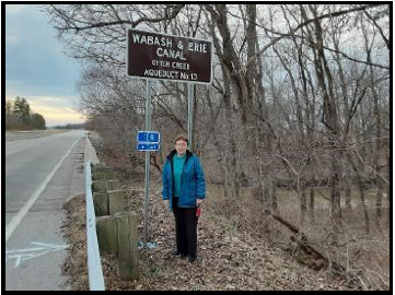
Otter Creek Sign Erected By INDOT
Sam Ligget, CSI Director from Terre Haute, contacted the Indiana Department of Transportation to place one of the Canal Society of Indiana’s signs at the location of Aqueduct 13 over Otter Creek in Vigo county. INDOT erected the sign around December 20. Sam’s wife, Jo, stands beneath the sign with the creek behind her.


In Memoriam: Frank A. Timmers

Frank A. Timmers, age 79, passed away on December 22, 2021 at his home in Carmel, Indiana. He was born October 15, 1942 in Victoria, Minnesota.
Frank loved American History. He belonged to the Civil War and World War II Round Tables, the Indiana Covered Bridge Society and was a life member of the Canal Society of Indiana.
Frank and Mary joined the Canal Society in 2007-2021. They took part in many of its tours in Indiana and nearby states including the 2007 tour of the Erie Canal aboard the “Emita II” from Syracuse to Albany, New York and 2009 tour of the upper Mississippi aboard “The Twilight” from LeClaire to Dubuque, Iowa. While on these tours he made many friends. He was on the CSI board of directors from 2010-2021 and served as vice-president of CSI from 2011-2013. He was on the committee to set up life membership in CSI and was one of the first to do so. He loved meeting with others and will be missed by our members.
Frank is survived by his wife Mary of 51 years and daughters Sarah Timmers of Atlanta, Georgia and Molly Timmers of Honolulu, Hawaii. Following his 10 o’clock funeral service at St. Elizabeth Seton Catholic Church in Carmel on the 30th of December, he was placed in Crown Hill Cemetery in Indi-anapolis, Indiana.

Memorials honoring Frank Timmers have been received by the Canal Society of Indiana from Steve & Sue Simerman and Bob & Carolyn Schmidt.
CSI Signs Delivered
The CSI signage program started off in 2022 by CSI president, Bob Schmidt, and Carolyn Schmidt going to Sharonville, Ohio to pick up seven signs to be placed at canal sites throughout the state. Af-ter picking up the signs at CDS signs they began delivering them. The first stop was at the Methodist Church in Brookville, Indiana where they were met by Shirley Lamb, a representative of the White-water Canal Trail. She was given three signs to mark locks on the Whitewater Canal that are seen while walking the trail. These signs are 1 foot x 4 feet and narrower than most CSI signs.


Two signs 2 feet x 4 feet were then delivered to Sam Ligget, CSI director in Terre Haute. One was for the Nadir level of the canal where it emptied into the Wabash River. The other was to be placed at the “Blue Hole,” which is 79 feet above Terre Haute and is still watered.
The last two signs were taken back to Fort Wayne that Wednesday. On the following Friday Tom Castaldi, CSI director and Allen County Historian, and Bob Schmidt met with Dawn Richey of Fort Wayne Greenways to decide where to place two signs along the old Wabash and Erie Canal towpath Trail n Fort Wayne.
CSI is preparing to order more signs. If you have any suggestions, please let us know. We are willing to place signs but have on occasion been turned down by property owners. Be sure to get permission from the property owner before asking for a sign. It is up to the property owner or the highway de-partment to erect the sign.
Excellent Article On Indiana’s Canals
CSI headquarters encourages all of its members to read the latest article on Indiana’s canals that ap-pears in the January-February issue of “Outdoor Indiana.” If you do not subscribe to the magazine you should be able to find it at your library.
Scott Roberts, from Outdoor Indiana’s staff, spent several months this past fall interviewing CSI di-rectors and others around Indiana about the impact the canals had on the state and what remains. He then wrote an article for the magazine entitled “From Mania to Memorialized” Indiana’s canals had a big impact on Hoosier landscape.”
This is the best comprehensive article about Indiana’s canals that has been seen for a long time. It covers the history of our canals from George Washington’s vision through headings of A Spirit Of Progress, Canal Works, Canal Construction, Mammoth Investment, Financial Failure, Canal Impact, and Canals Today. There are inserts entitled Ohio River Canal? and Hydraulic Canal which tell the history of the canal around the Falls of the Ohio and the attempted Hydraulic Canal at Anderson, In-diana.
CSI member Sam Ligget’s story of finding canal remains as a teenager is highlighted along with a picture of him standing before the timbers removed from Culvert 151 in Vigo county. Other CSI members mentioned are Bob and Carolyn Schmidt, Tom Castaldi, and Dan McCain. Stephen Jack-son, who spoke at the CSI Canal Symposium in Anderson tells about the Hydraulic Canal.
The 12-page article has beautiful pictures of Delphi’s Canal Park on the Wabash & Erie Canal, the Central Canal in Indianapolis, and the Whitewater Canal in Metamora, Indiana. It tells how these places have been developed to preserve what is left of Indiana’s canals. It also tells how the Canal Society of Indiana is attempting to mark remaining sites with signs. It says for more information about our society of see indcanal.org or search for its page on Facebook to learn more about our major canals and the various events our organization conducts.
New Murals At The Hamlets
The Hamlets, a subdivision along a section of the Wabash & Erie Canal southwest of Ft. Wayne, Indiana, had a stylized waste weir, which served as an overlook of the canal and housed the electrical system for the subdivision beneath the overlook. When the waste weir began showing signs on deterioration, CSI was consulted as to what could be done. Putting up one of CSI signs was suggested as one option.

The board of The Hamlets eventually decided to make a coloring book with historical information about this location. They removed the stylized wooden waste weir and erected a fence for overlooking the canal. Then they painted murals on the rear of the structure and put up panels telling the history of this area.
Beth Rickets, representative of The Hamlets, notified Tom Castaldi, Allen County Historian and CSI Director, that the murals were completed. On January 22, 2022 he went to the site, walked down the steps to view the murals and took the following pictures.

The Torrent
Over 10,000 years ago the great glacial Lake Maumee breached and unleashed a torrent of water that scoured out the Wabash River valley just to the south of this neighborhood.
What remains in the aftermath of this torrent is the Little River Val-ley, which extends down just south of US 24 to Huntington, where the Little River joins the Wabash River at the Forks of the Wabash.
The Portage
The Portage controlled a section of the Little River, which was the only navigable route from the Great Lakes to the country’s interior, connecting the St Marys River to the Wabash River. This portage var-ied from 9 to 24 miles depending on seasonal rainfall. Travelers on this route paid to have their goods carried, or “portaged” along this route between the rivers.
The family of Miami Female Chief Tahkamwa, mother of J. B. Richardville, became wealthy by controlling this portage until 1895.

The Wabash and Erie Canal
This panel superimposes a meander of the Little River along the side of the Wabash and Erie Canal
From 1835 into the 1870s, canal boats floated people and cargo on the Wabash and Erie Canal mere feet from our location.
Miami remember the canal with sadness, as canal boats were used to remove Miami from Indiana in 1846.
A slow path to the abandonment of the Wabash and Erie Canal began in the 1870s with the advent of steam railroads, which were more eco-nomical and could operate when the canals were frozen over.
In 1902, after the canal was abandoned, an electric “interurban” rail-road was built on the former canal towpath to transport people from Fort Wayne to Logansport, and was extended to Lafayette in 1907.
The interurban was made obsolete very quickly by the automobile, and was removed from the former towpath by 1938. US 24 followed very near the path of the canal between Fort Wayne and Huntington.
CSI 40th ANNIVERSARY TOUR
1982 — 2022
Plans are underway for a gathering of CSI members and friends on Saturday, August 27, 2022 at Logansport. We will meet at the new Cass County Historical Society for 1 day tour of area sites, see the new CSI signage and have an anniversary luncheon. Our luncheon speaker will be CSI member Craig Berndt of Fort Wayne. Mark your calendars. More details for the tour will be mailed out later.