
To print this newsletter, click here.
Index:
Captain’s Comments
Welcome to our 2nd issue of The Tumble online. Most of you by now have been able to read our January online issue. Some features are still under development as we strive to work with Ball State students in making improvements to The Tumble. One feature that many have commented about was the ability to print out a hard copy either in its entirety or by select pages.
Since many of our members prefer to read a hard copy printout, Ball State has added a “PDF version” just above these Captains Comments that you can now select. By hitting “here” a PDF file is created that you can then “Save” as a document on your computer. After the document is created and saved you should go to “Print” and you will be able to select either the entire issue or just certain pages.
Please note that the software being used, “WordPress,” creates a continuous file and does not have page numbers. Also the printed font size appears much larger than the online document and creates many pages of printed content. We are working with Ball State to address this problem. Prior issues of The Tumble will be maintained on the home page that is still under construction.
In the coming months we will work to enhance the website with mileage, maps and “Canawlers At Rest” articles. To follow this progress, just hit on “Home” on top of the first page.
From March 4-9th, some of our members will be going to Panama with other canal friends to view the old and new locks at the Isthmus of Panama as our spring tour. The next CSI canal outing will be from Sep. 1-3rd, 2017 in Dubuque, IA where we will take a Fall foliage tour by boat up the Mississippi River and then visit Galena, IL. Save the date and plan to attend this Labor Day weekend event.
An Aboite River Reservoir for the Wabash Erie Canal?
By Tom Castaldi
It was George Washington who suggested to Congress that a water passage connecting Lake Erie through the short portage between the Maumee and Wabash Rivers was worth consideration. As early as 1784 he urged Congress to explore the rivers, “as far westwardly as the miamies, running into the Ohio and Lake Erie…to see how the waters of these communicate with the River St. Joseph … and with the Wabash.” Later in 1823 a water route connection between these rivers received renewed interest when Fort Wayne pioneer Samuel Hanna and David Burr of Jackson County, Indiana, began petitioning the Indiana Legislature for a canal.
In 1824, the Indiana legislature approved the first surveys for a canal to be conducted, and by 1827 the U.S. government had granted Indiana alternate sections of land five miles on either side of a proposed 160 mile route. John Smythe was hired to locate a route from the high point of the project on the Saint Joseph River on which to build a dam, and through a feeder waterway would provide an adequate level of water to the summit level of the main channel in Fort Wayne. Two days into the project Smythe came down with fever and died.
Combining their energies David Burr as the rod man, and Sam Hanna as the axe man continued the task of completing the survey. For thirteen days Judge Hanna and Colonel Burr searched the Saint Joseph River area to locate a suitable site. They found a place to build a dam on the river roughly six miles north of the stream’s mouth at Fort Wayne. With the survey completed, Hanna, a member of the Indiana legislature, took the report to the State Senate with the news that a good route had been determined. This information, along with the argument that labor was available and building materials were a natural resource in the region, carried the legislature. On February 22, 1832, ground was broken for the commencement of the canal.
The efforts of Hanna, Barr and Smyth were legion. Eventually, the Saint Joseph River Reservoir proved successful sending water east to the Six Mile Reservoir near Antwerp, Ohio, and west to the Forks of the Wabash river west of Huntington, Indiana.
However, canal officials did speculate that the St. Joseph River feeder may in future years be presented with times of water deficiency necessary for the canal’s operation. The 1846 Documentary Journal suggested, “It is true that the water has occasionally been too low on the summit level during the past season, but it is believed that this could have been prevented by suspending the operation of the mills which are supplied from this level at an earlier period.”
Even so, it was the success of the canal itself that was the source of the concern. The Wabash & Erie Canal brought economic development to the Indiana wilderness, and the demand on the waterway increased as canal business increased. Also, there was the apprehension of the Saint Joseph River’s capacity to serve the canal at times of low level. Because along its course the river passed through wet prairies and some marshy areas across low grounds being recently reclaimed, rain water is channeled directly into the river. Now, rain water instead of being captured by the “occasional swamps” which served as small reservoirs releasing its waters throughout the whole season, the river’s “water will be higher and low water lower than at present.”
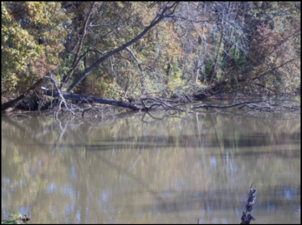
Presently in Allen County, the site of Lock No. 3 east of Fort Wayne is buried under the railroad bed east of Anthony Boulevard near Glasgow Avenue; the St. Mary’s aqueduct is destroyed; and the Saint Joseph River dam and feeder canal are gone. To the West not far from the Allen-Whitely county line, the Aboite River aqueduct has but a few timbers remaining in the bed of the stream, a rare canal site, one of Indiana’s most valuable archeological assets and a unique national treasure.
Sterns Fisher, General Superintendent commented on the notion that the supply of water to the canal might present a problem when he reported on December 15, 1846: “Should any additional supply be required, either now or hereafter, I would recommend the introduction of a feeder from the Aboite, which is one of the principal branches of Little (Wabash) river and crosses the canal eleven miles west of Fort Wayne. From a survey of this valley it is ascertained to be decidedly favorable for the formation of a reservoir of any size the future wants of the canal may require.
The feeder would be one mile long, at which distance from the canal a dam and embankment would be formed across the valley, in all six chains long, raising the water to a level of thirty feet above the canal. This would form a reservoir covering about three hundred and twenty acres, to a depth, varying from five to thirty feet… One important advantage of this site over others that might be found in the valley of the St. Joseph’s or Cedar creek, consists in its furnishing the additional supply of water near the west end of the summit level, where it is most needed. By introducing a feeder at this point the level of the canal will be kept more uniform during the low stage of water, when its passage is so much impeded by the growth of grass in the canal. The whole division could also be filled much sooner after it becomes empty from any cause, than if the whole supply were introduced at the east end. Another favorable circumstance is in the peculiar size of the streams which flow into it, being of an ample size to fill the reservoir, and yet not so large as to be uncontrollable or dangerous in its floods.”
Had an Aboite River Reservoir been constructed, how might its remnants appear today? Now instead of a rolling river valley with a home found here or there surrounded by many acres, it may look much the same. Other than the never-built lineal earthworks, which would have contained many acres of a treasured water supply, it was a reservoir that never happened.
Historic Reappointment: Castaldi to Continue as County Historian
By Rachel Hill Ponko
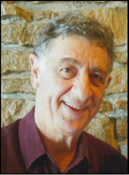
The Indiana Historical Society (HIS) and the Indiana Historical Bureau are pleased to announce Tom Castaldi of Fort Wayne has been reappointed as the official Allen County historian.
In this role, Castaldi answers questions from the public about Allen County’s traditions and legacy. He also acts as a liaison between statewide agencies and local organizations. It is a fitting role for a former business man and historic conservationist who continues to make his mark on Indiana and Allen County history.
Castaldi currently serves on the boards of the Allen County Fort Wayne Historical Society and the Canal Society of Indiana. He served as the first board president of the Indiana State Museum Foundation during the funding and building of the new museum, and he received its first Honorary Director position. Over the years Castaldi has participated in several other local and regional committees.
Castaldi has written or contributed to at least nine books, as well as magazine articles. In addition, he has taken part in radio and television programs and cd recordings. Castaldi was named a Sagamore of the Wabash in 1994 and was honored by HIS with the Eli Lilly Lifetime Achievement Award in 2009.
Entertainment at the Wabash & Erie Canal
By Sam Ligget
In the 1960s when I was in high school and college, we had a neighbor who would take me hunting and fishing at a location where he rented a cabin. The cabin was southeast of present day Riley (formerly Lockport), Indiana. We would go south out of Riley on the Old Louisville Road and turn east on Woodsmall Road. The main house on this property still fronts Woodsmall Road. The water that we fished in came out to the road next to the house. There were 3 small cabins way down a long lane that ran parallel to the waterway. Except around the main house and the cabins, the undergrowth was terrible. The trees and brush grew out over the water to the extent that it was almost like being in a tunnel. When fishing, we would take a jon boat right down the middle of this waterway. We could use a cane pole to get under the trees and brush, but we could not cast much with a rod and reel.
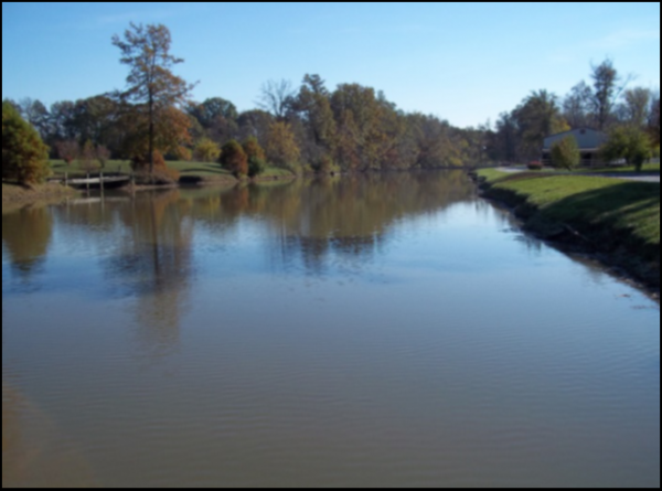
The waterway turned out to be the summit of the Wabash and Erie Canal, of course. The property is still there. The cabins are gone; the brush is gone; but the main house remains, and it has been well-maintained and the area beautifully landscaped. A few outbuildings have been added, and a new house has been constructed on the east side of the canal on Woodsmall Road.
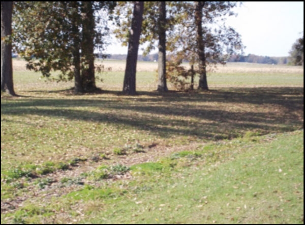
This still-watered part of the Wabash and Erie Canal would have been part of the 7 ¾ – mile-long summit from Lock 49 to Lock 50. The Eel River Feeder was near the east end of this stretch. I asked Mrs. Corthum, the present property owner, why this .382 mile section stays watered. She replied that there are several natural springs in the canal in this area.
In a conversation with Mrs. Corthum, I mentioned that this property at one time was called Ray Park (not to be confused with present-day Rea Park in Terre Haute). She was interested that I knew about this Ray Park. I related the following story about the property. As we were hunting one day, my neighbor Ed who took me there told me to be careful where I was walking in the brush and not to fall into the abandoned swimming pool. I thought, “Yeah, right.” I took 5 steps and had to grab brush to keep from falling in the swimming pool. The concrete was old and crumbled, and briars and brush were growing up through the cracks. After saving myself from falling in the pool, Ed told me to look out for the dance floor. Now I was a believer and soon found the dance floor. The pool and dance floor were located well off the road.
Mrs. Corthum asked me if I knew of any pictures of this Ray Park. I told her I didn’t know of any pictures and that I suspected this enterprise was operated during the prohibition era as a speakeasy. Finding pictures of such a business would be difficult.
Two people have told me about Ray Park. Both knew about the swimming pool and dance floor. They also told of bands providing the music for events at the park on weekends. Some of these bands were all black bands out of Indianapolis or Chicago. The musicians were taken to Terre Haute for overnight accommodations. The Wabash and Erie Canal served as a back drop for the entertainment provided.
Staple Bend Tunnel – Allegheny Portage Railroad National Historic Site
By Sue Simerman
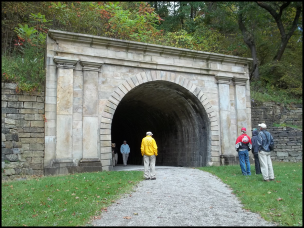
This tunnel is not a canal watered tunnel, but it still is an important part of the famous portage of the Pennsylvania Mainline Canal. It is the first railroad tunnel in the United States.
On Friday evening, October 7, 2016, during registration for the Canal Society of Ohio and the Pennsylvania Canal Society joint tour headquartered at Johnstown, Steve and I signed up to take the Sunday morning tour of the Cambria Iron Works Blacksmith Shop, in town, and then a visit to Staple Bend Tunnel. After viewing the restored blacksmith shop and a very quick lunch that Sunday we rode in a van driven by an APR ranger from the historic site. We were driven off to the northeast from Johnstown. We were in the rear seat and I quickly lost all sense of direction with all the twists and ups and downs on entering the Allegheny mountains.

We drove up a two mile simple drive that is closed to motorized traffic, but remains as a trail for hikers and bicyclists. This trail led uphill to this well preserved tunnel.
Work began on this 901-foot tunnel on November 21, 1831. It is the third tunnel of any kind built in the United States, the other two are canal related. Completion was in 1833. We approached the eastern entrance and two things were quickly noticed, the horseshoe shape and the concrete liner. We were told that the workers used black powder blasting to help loosen the solid rock to be mucked out and they advanced 18 inches per day. Ranger Nate said that the rock on this eastern side was not a solid as the west side. Also Bethlehem Steel put in water lines much later and helped with the preservation. Walkers can go through without any extra light, but the earthen floor is uneven so I would take a flashlight on a return visit. There is a trailhead at Mineral Point for the walking trail and it should approach the western side of the tunnel. I checked two internet sources and they both listed the portal entrances just the opposite of what I had assumed. When we left Johnstown I though the first side that we would see would be the western side since we were going northeast.

Photo by Sue Simmerman
The western entrance was a nice surprise. It was very decorative in Roman Revival with low relief linter supported by Doric pilasters. Both sides had originally been the same. At some period of time the impressive attributes on the eastern side were removed and thought to be included on a building somewhere else. The total cost was $37,498.85 and nearly half was for the entrances. When the tunnel was no longer used for the portage it became a carriage route and used until the reservoir dam broke and led to the flood of Johnstown in 1889.
Changes Along The Erie Canal
By Bob Schmidt
In June 2014 canal enthusiasts from Indiana and elsewhere toured the Erie Canal on the Emita II.
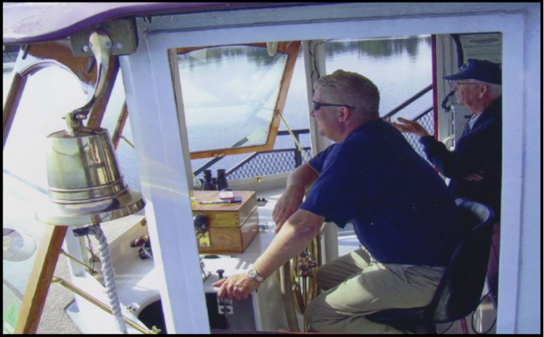
Photo by Bob Schmidt
Leaving from Lockport we toured the canal all the way to Syracuse, NY. Our tour guide on the ship was Captain Dan Wiles. On the 2nd night of our trip we were located in Newark, NY. Here Captain Dan told us about how the Erie Canal has proceeded in time from completion in 1825 to the present. The canal itself once a very profitable situation for the state was greatly impacted by the opening of the Saint Lawrence Seaway in 1959. Commercial traffic fell to almost zero but thru efforts like his father Peter Wiles and others the canal today remains primarily for recreational use.
To provide the $90 million required annually to offset the canal waterway expenses, the Canal Corporation was tucked inside the New York Transit Authority in 1992 using the surplus of tolls on the New York State Thruway to subsidize the canal. This arrangement became a political punching bag every time the Thruway sought to raise tolls. Trucking interest and others objected to using tolls to subsidize the recreational use of the Erie Canal.

In March of 2016 lawmakers approved a transfer of the Canal Corp. to the New York Power Authority.
Those on our canal tour will remember the visit to the Niagara Power Plant and Vista seeing firsthand the generation of hydro power at this location. This is only one of 16 power plants operated by the New York Power Authority. This shift between government agencies required some complicated transfer of systems and human resources but after 9 months the Canal Corporation was officially moved to the Power Authority on January 1, 2017.
How this all worked was interesting. The Transit Authority shifted $90 million of expense and in turn picked up $60 million in expense that the state had been spending for state police costs. The Power Authority picked up the $90 million Canal Corp expense but in turn is allowed to deduct this added expense from the surplus funds generated and paid to the State of New York.
The Canal Corporations sees this change as having very little impact on their operations other than now they have a new boss, one that processes lots of water and generates surplus funds for the state. Plans for the Corporation are still in place to expand the recreational use of the Erie Canal. As the Mayor of Fairport said “this shift will have a minimal impact, if anything there might be a benefit. There’s definitely a stronger financial base with the Power Authority than with the Thruway.”
Richard Howe Writes to Leander Ransom
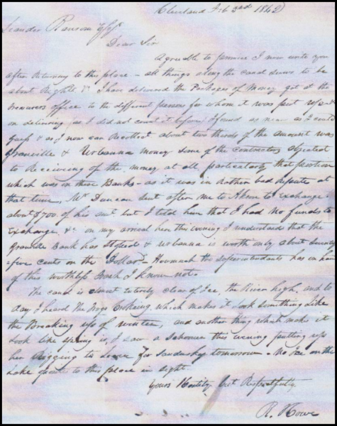
Recently Neil Soward, CSI member from Ft. Wayne, found on E-bay a 1 pg. letter, approx. 7-3/4″ x 10″, dated at Cleveland, Ohio, Feb. 3, 1842, from Richard Howe, (signed “R. Howe”, and identified as Capt. Richard Howe in recipient’s docketing on the back), to Leander Ransom, the Acting Canal Commissioner of Ohio, at Columbus, OH. This stampless folded letter has red “CLEVELAND/O.” cds postmark and manuscript “25” rate.
The writer of this letter, RICHARD HOWE, (1799-1872), was born in St. Mary’s County, Maryland, and came to Ohio with his parents in 1812. He was one of the first settlers of Akron, moving there in 1829. Richard Howe served as Engineer for the Ohio & Erie Canal from 1824 to 1850. He supervised the completion of the Ohio & Erie canal from Cleveland to Massillon; designed the canal prisms & locks between those two cities, including the fifteen-step lift locks built in the Cascade Locks Park. He also designed the configuration of Summit Lake & engineered the portage of the Ohio & Erie Canal over the Continental Divide. He facilitated the construction of Ohio & Erie Canal to the Pennsylvania & Ohio Canal – this connection transformed Akron into a manufacturing & transportation center. He was also active in a variety of civic activities, including the construction of the Summit County Court House & Jail, the Akron Rural Cemetery & the Akron Lyceum & Library Association. In 1850, he led a group of Akron residents to California to search for gold. His 1836 house in Akron is a historic landmark and is one of only two Federal style houses in Akron.
Howe writes of his distributing money received from the State Treasurer to the contractors along the Canal, and difficulties arising from some contractors who didn’t want to accept Banknotes from the Granville & Urbanna banks, which were in poor financial condition, and their currency worth less than their face value, describing the money from those banks as “worthless trash” – (fallout from the Financial Panic of 1837). He also writes of the condition of the Canal, and more as follows:
Photo by Bob Schmidt
“Agreeable to promise, I now write you after returning to this place. All things along the canal seem to be about right. I have delivered the packages of money got at the Treasurer’s office to the different persons for whom it was put up, &c. On delivering (as I did not count it before), I found as near as I could guess, & as I now can recollect, about two thirds of the amount was Granville & Urbanna money. Some of the contractors objected to receiving of the money at all, particularly that portion which was on these Banks, as it was in rather bad repute at that time. Mr. Duncan sent after me to Akron to exchange about $700 of his amt., but I told him that I had no funds to exchange, &c. On my arrival here this evening, I understand that the Granville Bank has stopped & Urbanna is worth only about seventy five cents on the Dollar. How much the superintendent has on hand of this worthless trash I know not.
The Canal is almost entirely clear of ice, the river high, and today I heard the dogs barking, which makes it look something like the breaking up of winter, and another thing which makes it look like spring is, I saw a Schooner this evening putting up her rigging to leave for Sandusky tomorrow. No ice on the Lake opposite to this place in sight.
Yours Hastily, but Respectfully,
R. Howe”
Questions & Answers
This feature in The Tumble is devoted to questions our readers submit and subject on which they want more information. E-mail your questions to incanal@aol.com
Sue Jesse – Fort Wayne IN
Q-I know that one side of the canal had a tow path and that the mules or horses going both directions walked along it, but how did that work out when two boats met going in opposite directions? Would the ropes get twisted or the mules confused?
A-People often wonder why only one side of a canal way was used as the towing path for the animals. The best answer is that building a tow path of 10 ft was more expensive that building a narrower berm path of 5 ft. Sometimes there really wasn’t a berm at all but the canal was built against the side of a hill or rise. The towpath also required some treatment of fine gravel or at least packed clay.
How did packet boats pass freight boats going the same direction? This one is fairly simple. The forward boat mules would turn to the right on the towpath and stop. This boat would be steered to the berm path and the momentum of the boat would move it forward and the rope tension of the tow rope would slacken allowing the tow rope to lie harmlessly on the towpath and the rope in the water would sink to the canal bottom. The passing boat would just have their mules walk over the rope on the towpath and proceed to pass the first boat. The freight boat would then just nudge the mules forward and they were on their way.
The process was similar when two boats met. The boat that was travelling with the current yielded to the boat pulling against the current. When the 1st boat’s mules stopped the boat would continue forward allowing slack to develop on the tow rope. Again the rope would fall on the towpath and the rope in the water would fall to the bottom of the canal. The boat pulling against the current would have its mules walk right over the slack rope and proceed on its way.
There were no twisted ropes as long as all boatmen followed this procedure. Packets were given priority over freight boats going in either direction. Freight boats were usually pulled by mules whereas packet boats usually were pulled by more colorful horses.
Linda Castaldi Fort Wayne IN
Q-One of our canal tours I heard that the canal was 40 feet wide and 4 feet deep. Was this true on all on of Indiana canals and why did they use these standard dimensions?
A-Canals in Indiana and Ohio were originally begun using a standard developed by New York for the Erie Canal which was 40 feet wide by 4 feet deep. This Erie standard was based on the cost of construction and the size of a canal boat required to carry about 100 tons of material. Water supply for a larger canal was not a problem in New York. Boat width could be about 14 feet therefore the locks could be built 90 feet long and 15 feet wide. The canal channel had to be just wide enough for two boats to pass. 2 feet between passing boats left 5 feet for each boat on their sides to clear the banks which sloped into the canal. A loaded boat needed at least 3 1/2 foot of depth so it couldn’t get too close to the banks. These dimensions required some fairly careful maneuvering when passing. Also note that this standard was the “minimum” dimension requirement and could be exceeded as necessary.
Remember the wider the canal the more earth that had to be removed adding to construction cost. Another consideration in Ohio and Indiana was the amount of water required to support a wider channel. Both Indiana and Ohio did use a wider and deeper canal in some areas.
The Whitewater and Central Canal were both built with the Erie standard as was most of the Wabash & Erie but a portion of the W&E was recommended to be larger. Engineer Lazarus Wilson who determined the route from Fort Wayne to the Ohio Line felt that increased traffic would require a larger channel. The canal size was thus increased to 60 feet wide and 6 feet deep with the assumption that Ohio would follow suit. Although boats couldn’t be made any larger due to lock dimensions 90’x15’, it did facilitate passage of boats along the route. Ohio did expand from the Erie standard dimensions for the Miami Extension Canal from Dayton to Junction using 50 wide and 5 feet deep and from Junction to Manhattan they again expanded the width to 60 feet wide and 6 feet deep for the anticipated heavier traffic. Unfortunately, they only built the canal from the Indiana state line to Junction at 50 feet wide and 5 feet deep. Apparently they didn’t want the segment into Indiana to be any larger than the Miami & Erie south of Junction.
New York engineers in their study on water requirements learned that the original Erie standard channel required a water flow of 13,755 cu feet per minute while an enlarged 70’x7’ channel would use about 25,147 cu feet per minute. Almost doubling the water requirements.
Water supply in Indiana at the Fort Wayne summit level of the canal, which was fed from the St Joseph River, was reaching a potential problem level by the early 1850s. Remember, that the St. Joseph feeder directed water both east and west from Fort Wayne. For the eastern portion the reservoir at Antwerp, OH was used to store excess water in the spring for a summer release. Consideration was underway for another summit level feeder on the St Mary’s River. As the canal traffic in the area was reduced after the late 1850s, this problem never had to be addressed.
It is also worth noting that by 1834-35 when Ohio and Indiana’s canals were well under construction or completed that plans were currently in progress in New York to expand the dimensions of their Erie Canal. Revenue from tolls on the Erie from 1826 – 1834 reached $8 ½ million. The cost of construction of the original canal was about $7.1 million. Traffic jams were occurring along the route especially at the locks. The 1st enlargement began in 1836 with a channel of 70 feet wide and 7 feet deep. Locks were built to be 110 feet x 18 feet and many locations had two locks side by side to eliminate bottlenecks and to improve traffic flow thus reducing transportation cost.
Pyle Family Donates Land for Bicentennial Monument
By David McCain
While the Hoosier Heartland Highway (State Road 25) was under construction near Delphi in early 2014, Ken Pyle went to the corner of his property, looked out over Deer Creek Valley and saw that this prominence at the edge of his corn field provided a marvelous view. He realized also that this location encapsulated a marvelous essence of Carroll County. Nature and history are deeply intertwined here.
His field was first cleared out of wilderness by Samuel Milroy in 1826. And now the county’s future economic development was opening up in front of him. This is an exceptional spot in Carroll County’s past, present and future—a nexus of interconnecting meanings.
Ken Pyle is very familiar with the whole of Carroll County. He worked as Carroll County’s district conservationist for the Soil Conservation Service (presently the NRCS agency) from 1951 to 1969, helping farmers throughout the county with their soil and drainage problems. While Ken did not grow up in Carroll County, his wife did. Julie Smith Pyle is the daughter of the late William B. Smith, judge of the Carroll Circuit Court from 1940 to 1970. Julie’s grandfather, William C. Smith, was mayor of Delphi from 1914 to 1918 and a prominent Carroll County historian and writer.
To honor Carroll County’s past and future during the bicentennial of Indiana statehood, Ken and Julie Pyle have donated the land at the corner of their property for the erection of a Bicentennial Monument. Heartland Heritage Inc. (HHI) received the nearly half acre plot and is currently developing the monument and the site. The Bicentennial Monument will become part of the much larger Deer Creek Bicentennial Park. Sculptor Ben Sutter’s plans for the Bicentennial Monument were revealed on the December 11, 2016 informative history walk which officially dedicated the park.
For Carroll County, the many historical connections at the site of the future Bicentennial Monument and nearby locations are almost too numerous to count. A few of the area’s people—past and present—come to mind, such as the early pioneer settlers, of course, but also Harry Milroy, Samuel’s grandson, who was an accomplished artist. James Whitcomb Riley frequented the area. There were the largely forgotten citizens who tried organizing a forest preserve and a state park in the area, including slate bluffs, after World War II but never succeeded. Then there are the Mears Family and others who did succeed in establishing the Deer Creek Rural Historic District less than twenty years ago. The whole area east of Delphi along Deer Creek is a beautiful area with many historical connections.
For the Pyle Family, the Bicentennial Monument will be a reminder of the family’s part in the developing history of Carroll County and a special connection to the county. Ken and Julie’s large family including grandchildren and great grandchildren is spread over several states, but they always come back to gather at traditional times, such as at Thanksgiving and Christmas.
“We will be pleased, if among our ancestors, William C. Smith is honored somehow in connection with the Bicentennial Monument. He was very civic minded and accomplished many things around Delphi and Carroll County,” said Mike Pyle earlier this year. Mike is the son of Ken and Julie Pyle and the great grandson of William C. Smith.
William Cadid Smith (1857-1946) was not just the distinguished mayor of Delphi during World War I, but he held at least three other public offices in an energetic and productive political life. He created separate careers in a variety of enterprises: attorney, scientific farmer, author, historian, businessman, as well as politician. He was the first President of the Carroll County Historical Society, President of the Indiana Canners Association (commercial food canning) and seriously considered for Secretary of Agriculture by President Woodrow Wilson.
Smith’s books and writings in progressive agricultural methods were known and valued in many parts of the world. His writings on Carroll County history are still read today. In 2012 the Delphi Preservation Society published a compilation of his writings, Up the River of Time: Stories of Carroll County’s Past. Written in a very readable style, this book is a great source of historical information. For example, in one historical account connected to the location of the future Bicentennial Monument, Smith describes “the first factory that was established in Carroll County, the ginseng factory operated by James Blake and erected in 1827” on the Milroy farm. Ginseng grew wild in great abundance and was one of the first cash crops for Carroll County pioneers.
Case House Celebrated 30th Anniversary Move To Delphi’s Canal Park
By Dan McCain
The 1844 Reed Case House in Delphi, Indiana has been in Canal Park for 30 years and is almost complete. It hosts visitors on special occasions or by appointment. During the old-fashioned Christmas celebration it was open along with the other cabins in the park and the craft show. At that time Mark Smith guided visitors through the home. He said, “This year is special because it marks the 30th anniversary of the year this historic house was moved from Front Street to Canal Park. Delphi citizens brought their lawn chairs out to enjoy the startling sight of this two-story house slowly making its way across town.”
Work Starts On Cooper Shop In Canal Park
By Dan McCain
Work started on the new Cooper Shop in Canal Park in the fall of 2016. With a grant from Tippecanoe Arts Foundation (TAF) and utilizing North Central Health Services (NCHS) funding the project has begun. The Monday-Wednesday-Friday volunteer construction crew laid the foundation for the post-beam wooden structure to be placed here.


In Remembrance

LAURA E. MIGLIORE, 64, passed away Saturday, Dec. 17, 2016 at Visiting Nurse Hospice in Fort Wayne. Born in Des Moines, Iowa on Sept. 25, 1952, Laura graduated in 1970 as Valedictorian of a class of 807, from Elston Senior High School, in Michigan City, Ind. and received her Bachelor’s degrees with a double major in Mathematics and Spanish in 1974 from Purdue University.
She moved to Fort Wayne in 1974 and was a Programmer Analyst with Lincoln Life and later IBM for a total of 39 years, retiring in 2013. She was an active member of Peace United Church of Christ as well as the accompanist for the church choir and organist for the church. Laura loved music, all things Christmas, and enjoyed traveling with her husband Brian and family.
As a member of the Canal Society of Indiana Laura often helped Brian write the comments for the “Kicks & Kapers” award given to members who did something funny on the earlier tours. Her last tour was the “Camaraderie” of the Erie Canal in 2014. We will miss her.
Surviving are her loving husband of 41 years, Brian L. Migliore, of Fort Wayne, Ind.; mother, Rosemarie Mae Long of Fort Wayne, Ind.; sisters, Mary Kathryn Skinnon of Meriden, Conn., Jennifer Woodward of Plymouth, Ind., Barbara Bryant-Inman of Vancouver, Wash.; brother, Craig Long of Michigan City, Ind. Laura was preceded in death by her father, Ralph B. Long.
Service was at 11 a.m. Thursday, Dec. 22, 2016 at Peace United Church of Christ, 9123 Aboite Center Rd., with calling one hour prior. Calling also from 2 to 6 and 7 to 9 p.m. Wednesday, Dec. 21, 2016 at D.O. McComb & Sons Covington Knolls Funeral Home, 8325 Covington Road. Burial in Lindenwood Cemetery, Fort Wayne, Ind. Memorials may be made to the Peace United Church of Christ, 9123 Aboite Center Rd., Fort Wayne (IN 46804).
ROBERT MACINTYRE of Columbia Station, Ohio, passed away on January 1, 2017. He was honored by Columbia Community Foundation for his service in the five mile square township and beyond. He restarted the defunct Columbia Historical Society in 1973, negotiated a 99-year building lease for the Bronson House Museum, was an officer for twenty years and a lifetime member.
Bob was an active member of the Columbia Homecoming Festival Committee for many years (a four day event). In 1976 he was asked by the Township Trustees to serve as “Encampment Coordinator” before and during the U.S.A. Bi-Centennial Wagon Train from Oregon spending overnight there on the way to Washington, D. C. Almost three dzen community groups participated.
He was an eight year member of the Lorain County Historical Society Board of Directors and a lifetime member. He was a founder of Erie Shores Girl Scout Council History and Archives Committee, and served six years writing the collections policy and helping develop preservation procedures. He was also chairman of the committee successful in getting a Lorain County Metro Park established in Columbia Station.
Bob served many years on the Lorain County Mental Health board. Since 1972 he belonged to and has held almost every volunteer position, including elected four year president in Recovery International, Inc., a non-denomination, self-help mental health organization.
Bob was a UPS driver, a lab technician ad machinist for Brush Beryllium, a toolroom machinist and chief inspector for Howard Dearborn, Inc., and a research laboratory machinist for Union Carbide. He was married 58 years to Dot with whom he had both a son and daughter.
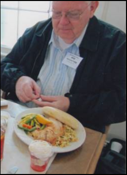
He had multiple interests: early air flight, architecture, explorers, writers, comedians, early people, geography, geology, ghost towns, canals and rivers, canning jars, cameras and photography, early cars to formula one racing, early sailing, paddle wheelers, early trains, quarries, pianos (12 year classical training), and history. At various times he owned a Stutz, an Austin Healy, and a Miata. He belonged to Columbia, Berea, Strongsville, Lorain County, and Ohio Historical Societies, the Canal Societies of Indiana and Ohio, and was a founding member of McCoy Pottery Collectors. He was an expert designer and woodworker.
Bob and his wife Dot attended several CSI and CSO tours one of which was aboard “The Twilight” on the upper Mississippi in 2009. Here he is seen at a meal aboard the boat.
Whitewater Canal Byway Association
By Candy Yurchak
The Whitewater Canal Byway Association (WCBA) was able to accomplish several great things as well as make strides towards improvements to the Whitewater region in 2016. We participated in celebrating Indiana’s bicentennial with two bicentennial legacy projects. We produced and directed a film that captured the true essence of who we are as Hoosiers. We received a grant for $3,500. from the Canal Society of Indiana to begin laying the groundwork for our future museum center where we hope to feature the transportation history of the Whitewater Valley.
Our E-Newsletters keep you up to date with all events and focuses for the WCBA. We have continued to reach out to the community through the sharing of information about our project at local festivities such as Brookville’s Annual Canoe Fest.
Fundraising events this past year included our other bicentennial legacy project “Murder on the Whitewater Canal.” Through ticket sales, our silent & live auction, and generous donations we were able to help raise funds to support our great project. We also continued partnerships with our community through hosting the boy scouts as well as the Metamora Fireman’s Festival.
Joseph J. Vessoso, Jr., Vice President of Resort Operations for French Lick & West Baden Spring Resort was our speaker at our Annual Dinner on Wednesday, February 15, 2017. We reviewed our accomplishments at that time.
Canal Misidentified
Cynthia Powers, treasurer of CSI, recently wrote the following to Fort Wayne’s Journal Gazette:
The Journal Gazette’s quiz accompanying Doug Masson’s interesting article about Indiana history on December 11 contained a rather common error. The canal referred to is not the Erie Canal. That’s in New York state, famous in the song “Erie Canal (Low Bridge, Everybody Down).”
Ours is the Wabash and Erie. Ohio had the Miami and Erie.
Please follow Cynthia’s example and correct your newspapers or radio/television reporters when they make this error.
Central Canal Flood Wall
The Army Corps of Engineers is finalizing plans for the flood wall and gate across the Indianapolis Central Canal in Broad Ripple that has been in contention for several years. It consists of a steel sheet pile I‐ wall measuring approximately 4,200 linear feet and gate structure. The wall will extend from the south end of the Riviera Club property, across the Citizens Water Canal (also known as the Indianapolis Central Canal) with a gate structure near the intersection of W. Westfield Boulevard and N. Capitol Avenue, then progress southward running parallel with W. Westfield Boulevard, across 52nd Street, and finally terminate on high ground belonging to Butler University. The height of the wall above the ground surface will vary across its length from 8 inches to 6.5 feet depending on its contour elevation. The height of the wall will be greatest for its first 700 linear feet immediately southwest of the gate‐structure near W. Westfield Boulevard, but will be sufficient to reach the required height of the required flood protection: 720 feet above mean sea level; and since this undertaking may directly or indirectly cause alterations in the use or character of a historic property determined eligible for, or listed on, the National Register of Historic Places (NRHP); they have thoroughly studied the adverse effects on the Holcomb Gardens segment of the Butler University Historic District and the Indianapolis Central Canal and consulted with them and other concerned parties; they now ask that the Memorandum of Agreement be signed by all of them with the Corp clearly defining that will be done in all cases.
Part of the agreement concerning the Central Canal says: The design for the trail will avoid existing trees and grading of the nearby Indianapolis Central Canal. The Corps will realign and connect the portion of the canal towpath affected by the gate structure. The ground disturbance created by the construction of the gate structure and canal tow path will be archaeologically monitored and documented by an archaeologist. The Corps will produce a book on the Indianapolis Central Canal and Holcomb Gardens. The book will contain, at minimum, the same level of information, photographs, descriptions, narratives, and historic analysis that would sufficient for a nomination to the National Register of Historic Places. The Corps will produce a pamphlet on the Indianapolis Central Canal. The pamphlet will be a condensed version of the contents of the book.