
In this issue of
THE TUMBLE
- “Dreams, Delays & Decisions” Tour A Huge Success
- Indiana’s 4th Canal
- Saint Joseph Church, Rev. Lalumiere, and Canal Diggers
- The Hoggee
- Ever Wonder Why Fort Wayne Is Called The Summit City?
- The Summit City—Fort Wayne.
- Pigtails
- Advertisement For Building a Weigh Lock
- Destructive Floods Rip Through Whitewater Valley
- Outreach Events & Programs
- Delphi News
- From the Whitewater Valley
- Canal Society of Indiana
“Dreams, Delays & Decisions” Tour A Huge Success

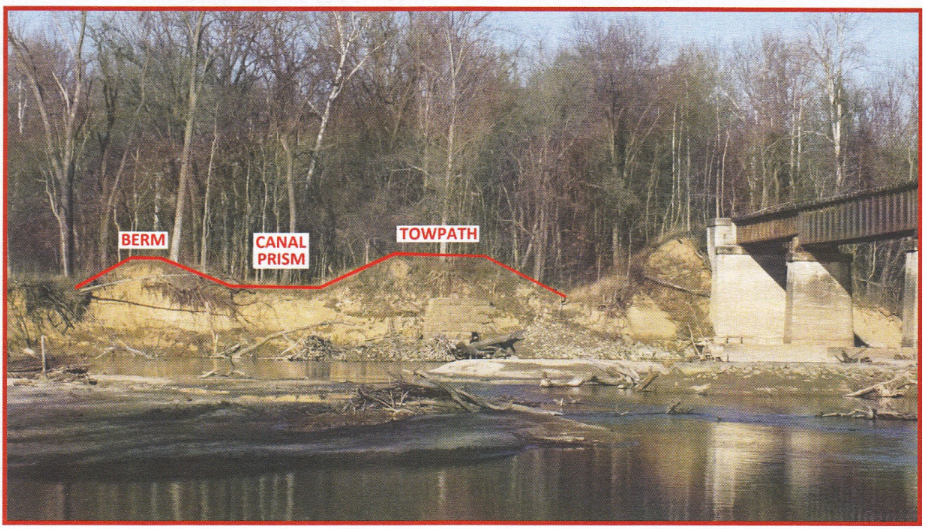
Photo by David Kurvach CSI Director 2010
Bloomfield Program of CSI – September 19, 2026
Margaret Griffin, CSI Secretary
Photos by: Priscilla Donkle, Jeff Koehler, Margaret Griffin, Bob Schmidt, Robin Schmidt & MacKenzie Smith
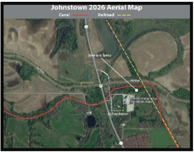
“Dreams, Delays and Decisions” was the theme of the September 19 fall tour of the Canal Society of Indiana in and near Bloomfield, Indiana. First, at 10:30 attendees were offered a hike to the remains of the prism of the Cross-Cut Canal, now on the Smith Farm north of town. It was led by Jeff Koehler, CSI Director and Clay County Historian.
(Jeff Koehler)
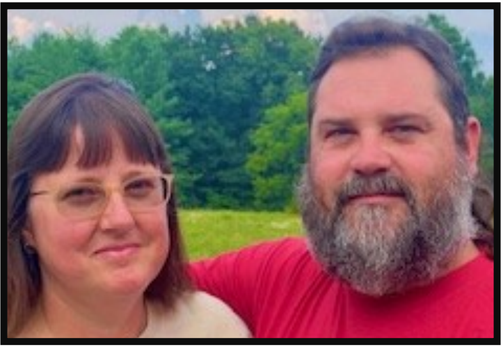
(MacKenzie Smith)
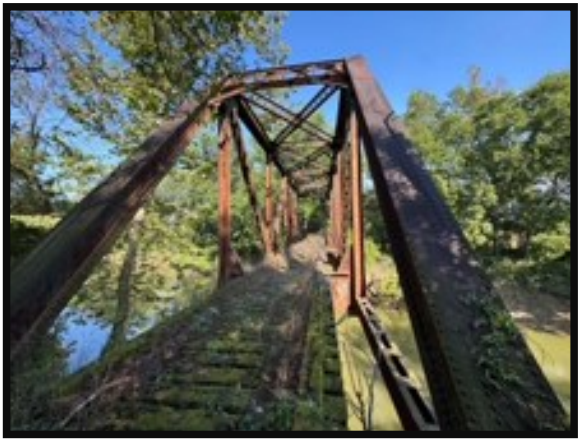
(Priscilla Donkle)
(Priscilla Donkle)
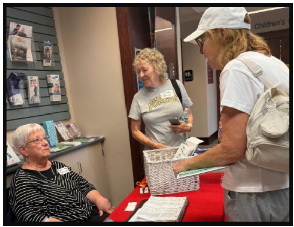
(Robin Schmidt)
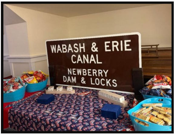
(Bob Schmidt)
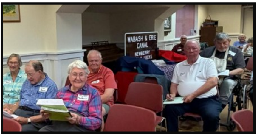
(Robin Schmidt)
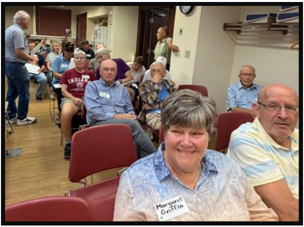
(Robin Schmidt)
At 12:30 CSI President Ron Morris welcomed the capacity group to the Bloomfield Public Library on Franklin Street. Guests were present from all parts of Indiana, including Evansville, Terre Haute, Fort Wayne, Valparaiso and Ohio. Dr. Morris thanked Johnny and MacKenzie Smith for access to the canal, which is on their property.
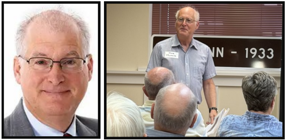
(Robin Schmidt)
Session 1 was presented by Ed Fujawa, attorney and Indianapolis Historian, “Casualty of the Collapse: the Central Canal from Indianapolis to Point Commerce.” He is the author of the blog www.class900indy.com. Fujawa explained that in 1835 the town of Indianapolis was planned to be a major part of the canal network in our state. It would connect Peru to Point Commerce, and also to the Whitewater Canal.
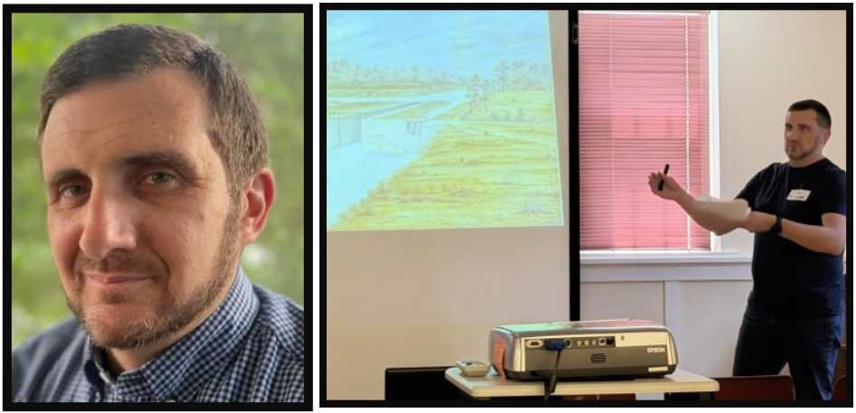
(Margaret Griffin)
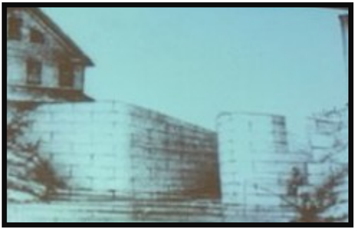
He discussed major individuals of the story, including Francis Cleveland, Calvin Fletcher and the Wishard family. The 1837 Panic put an end to the grand scheme with engineers publishing ads for people to fund it to Martinsville. Nothing came of their requests. Interestingly, the Central Canal was used for power and drinking water thereafter, much longer than the Whitewater and Wabash and Erie Canals lasted. Part of it is visually prominent in Indianapolis today.
(Margaret Griffin)
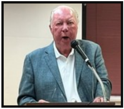
Session 2 was “Footprints: Early Settlers and Historic Businesses in Bloomfield,” given by retired Judge and Bloomfield Historian David Holt. Major goods produced and shipped from wagons to flatboats on the Ohio River were pig iron, coal, charcoal, limestone and wood. Grain and whiskey from a distillery were also transported. Andrew Downing was a prominent merchant during that time.
(Margaret Griffin)
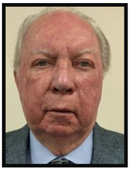
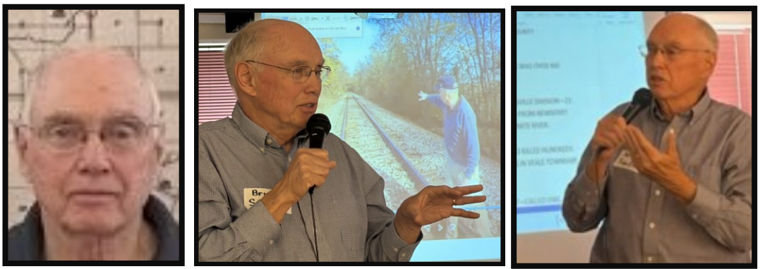
Session 3, “The Wabash and Erie’s Legacy in Daviess County” came from Attorney and County Historian Bruce A. Smith. He discussed multiple human remains that were found in Daviess County which were possible Irish immigrant victims of cholera during the building of the canal. The Indiana Historical Society recently published real estate records and census information that sheds light on how many Irishmen came here to work on the canal and railroad. Ellis Island was not opened before 1850 so official numbers are not recorded.
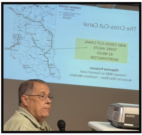
Bob Schmidt, CSI Treasurer, discussed the effect of the Splunge Creek and Birch Creek Reservoirs, which were unwelcome to residents of the county and sabotaged because of their size and link to cholera and other diseases.
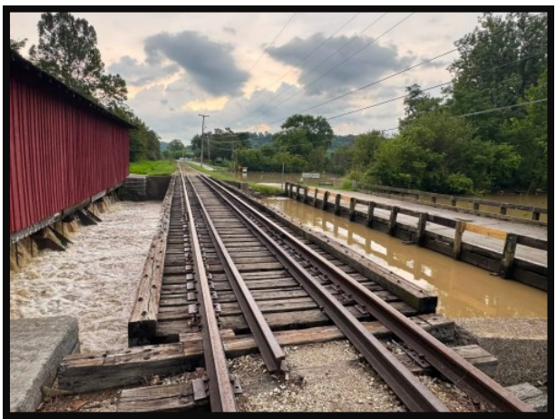
He gave an overview of the Canal Society of Indiana and its goals and activities, pointing out samples of historic markers we have had produced and then placed at many points on the W&E and Whitewater Canals. We provide seminars at different sites in the Spring and Fall. We have education programs for school children. Bob told about the devastating flood damage to the Whitewater Railroad this year, and challenged members and others to donate to its project. There are matching grants which will increase our contributions.
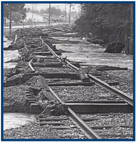
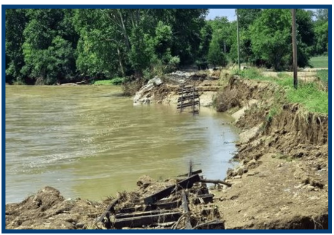
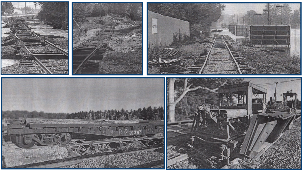
Flood damaged Whitewater Valley Railroad tracks, buildings, & machinery
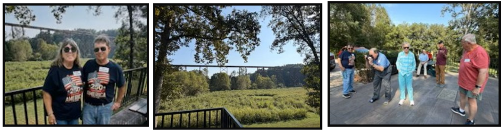
(Robin Schmidt)
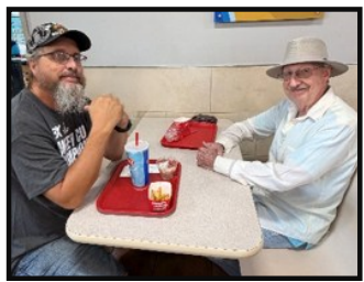
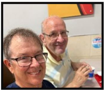
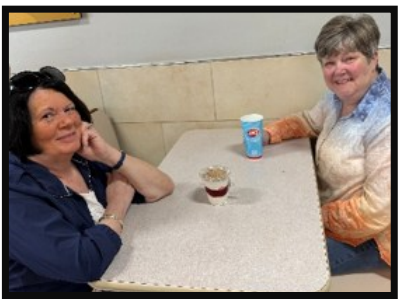
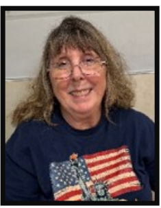
Some participants enjoyed talking with each other at Dairy Queen
(Robin Schmidt)
Press Release
Following this event, David Holt, the current president of the Greene County Historical Society and one of the presenters, wrote a press release for local papers in and around Greene County. Resides giving a history of the W & E Canal and a synopsis of the speakers and their programs, he gave more details about the CSI marker to be placed in Newberry and his presentation as follows:
Holly Johnson, the current owner of the Newberry River Side Tavern was recognized as granting permission for a CSI historical marker to be installed on land owned by her at the River Side Tavern next to the Newberry White River bridge. It will mark the important Newberry dam and locks on the Wabash & Erie Canal, the remnants of which are still visible. The Great Feeder Dam at Newberry backed water in White River up for many miles and fed the Wabash & Erie to the south. Canal boats locked in and out of White River at this location. Remains of Lock #59 remain visible at the rivers edge at Newberry.
The Wabash & Erie Canal was the longest canal ever built in the United States. It was 468 miles long and extended from Toledo, Ohio, to Evansville, Indiana. It was begun in 1832 and it was completed in 1853, twenty-one years and five months after ground was broken at Fort Wayne. The canal boat “Pennsylvania” made the first trip from Toledo, Ohio to Evansville, Indiana, on July 29, 1853, passing through Greene County.
The canal is still visible in different locations in Greene County, and historical markers are planned for west of Bloomfield which has a very visible portion of the canal and the towpath. Another visible portion of the Cross-Cut Canal is northwest of Worthington on land owned by MacKenzie and Johnny Smith of Worthington.
Several speakers described how the Cross-Cut Canal, a part of the Wabash & Erie Canal was dug by Irish from Terre Haute to Greene County. Point Commerce was on the wrong side of the canal, and the town was abandoned. Residents and merchants moved from Point Commerce to create a new town called Worthington on the west side of the canal.
The Irish dug the canal through Greene County using spades, shovels, picks, wheelbarrows, and one-horse carts. The Irish had a reputation for being “boisterous” and “hard drinking.” As an inducement, the construction bosses negotiated with the Irish diggers to provide shots of whiskey. A man called a “jigger boss” walked up and down carrying a tin pail of whiskey and ladling out jiggers to those in need of refreshment. This had the effect of keeping the shovelers pleasantly tipsy all day. As one of the jigger bosses later said, “You wouldn’t expect them to work on the canal if they were sober, would you?”
David Holt spoke about the economic impact that the canal had on Bloomfield. He also provided an unconfirmed report of the deaths of Irish workmen in Greene County. There is one report that about 200 Irish died in 1851 in Greene County from cholera. The report is that they were buried in a mass grave near an Indian mound south of Worthington. Other reports that are confirmed mention other unmarked graves of the Irish up and down the canal. A mass grave has been found west of Washington.
The canal was built about two or three miles west of Bloomfield, but local Bloomfield merchants sent their products across White River by ferry and bridges to the canal to be sent down the canal to White River. Several merchants owned canal boats.
Richland Furnace was successful because of being in part because of the Wabash & Erie Canal. In the early 1840s iron was discovered near the surface of land near Bloomfield, particularly near roads later named Ore Branch Road and Iron Mountain Road east of Bloomfield, and near Cincinnati. Bloomfield merchant Andrew Downing studied and acquired knowledge and capital to begin building the means to make iron products. He began manufacturing pig iron, stoves, plows, and al kinds of domestic hollow ware. At first the finished products were hauled by teamsters to Louisville for about $5.00 per ton. When the Wabash & Erie Canal was completed, Downing began shipping his products down the canal to Evansville, and then to New Orleans. He found markets for his products in England and France.
Richland Furnace village grew quickly. Downing established a general store to supply his workers. Soon there was a grist and a sawmill. In 1855 he opened a bank and began to issue currency to the extent of $5000 in denominations of $1.00 and $20.00 bills. The bank was called “Downing’s Bank of Indiana at Richland Furnace.” Downing then opened a distillery and several more stores. Nearby merchants marveled that Richland’s Furnace was becoming bigger than the town of Bloomfield.
Then the Wabash & Erie Canal began to fail. The competition of railroads made the canal impractical. When the Canal failed to the south of Greene County, then so too did Richland Furnace. Anticipating its closing Downing left Richland Furnace in 18578 and moved to Texas. He became a cattle ranchers and was elected to the Texas legislature. At the beginning of the Civil War he returned to Bloomfield. But after the war he returned to Texas. He became a U.S. Marshall and the Postmaster in Texas. He died in 1872 and his grave is unknown.
The Furnace closed in 1860. Today, nothing remains.
The Wabash & Erie canal remains an important part of Indiana history and Greene County was a key. To this day, many canal enthusiasts from all over Indiana come to Greene County to see its remains. I, David Holt, encourage all local citizens to see it. High School history teachers are also encouraged to teach students about the canal and take them on a short bus ride to see this important part of American history. Resources for teachers are available at www.indcanal.org.
Indiana’s 4th Canal
Robert F. Schmidt

The Cross-Cut Canal was originally planned as a separate 42-mile-long canal, connecting the Wabash & Erie (W&E) Canal, at a point just north of Terre Haute, with the Central Canal whenever that canal reached Point Commerce (Worthington) in Greene county, Indiana. This canal was funded as part of the Mammoth Internal Improvement Bill of 1836. Construction began in 1837 and continued until the state’s financial crisis in 1839. At that time all canal projects in the state were stopped except for the W&E, which struggled to maintain some activity and eventually reached Lodi in Parke county by 1846. The original Cross-Cut construction works in Clay & Vigo counties were abandoned and sat idle for the next 9 years.
Since the Cross-Cut Canal required some unique engineering at the summit level, it makes an interesting study as to how it evolved. When the Central Canal plans were terminated and the W&E resumed in 1847, the Cross-Cut was incorporated into the extended W&E Canal and thus lost its separate identity. Originally in the 1836 planning, little thought was given to the construction south of the summit. The only practical water source at the summit was the Eel River. Where the Cross-Cut would meet the Central really did not matter much at that time.
William J. Ball was the Resident Engineer. He had moved to Indiana in 1833 and was assigned in 1836 to review some earlier engineering work done to make the Cross-Cut connection between the other 2 canals. The high ridge of land southeast of Terre Haute presented a problem for Ball. It required an independent source of water to feed the canal. Its most convenient crossing point was 79 feet above the planned connection with the W&E in Terre Haute. Ball saw that the only possible spot to cross was at the Eel River west of the summit. A feeder dam at the river could supply the main canal with sufficient water to the west.
To reach the summit level required a 52/3 -mile, 40 foot wide, 4 feet deep feeder channel from the dam to the main canal. Birch Creek, which flows into Eel River a couple of miles south of the proposed feeder dam site, had to be crossed by the summit feeder by means of an aqueduct. Ball knew that this one feeder could not supply enough water for the entire canal north and south, so he suggested that the Eel River Dam could later either be raised another 2 feet or an additional feeder dam could be built a few miles south on the Eel River near Rawley’s Mill.
Ball’s plan recommended a deep-cut of 18 feet be made at the summit level to eliminate the requirement for 4 locks, two on each side of the 79 foot summit. Deep cuts at the summit reduced the need for more expensive lockage construction. Each 1 foot of the deep-cut reduced the need for 1 foot of lock lift by the locks on both sides of the cut. The summit level on the main channel was going to be 7½ miles long from north to south, but the maximum 18 foot cut tapered off after a 1½ miles to about 6 feet or less.
In 1836 Ball was mostly concerned about getting the canal to Terre Haute since the junction point with the Central Canal had not yet been determined. His construction plan to Terre Haute was to pass through the valleys’ of Honey and Little Honey Creeks, proceed along the east side of Terre Haute, continue northward, cross Lost Creek twice using arch culverts and then finally arrive south of old Ft. Harrison just north of Terre Haute. This was a proposed junction with the planned W&E not a continuation of it, therefore at this point the Cross-Cut was considered a separate canal. By 1839 neither of these two canals had been constructed in this area, but the W&E was planned to terminate in downtown Terre Haute.
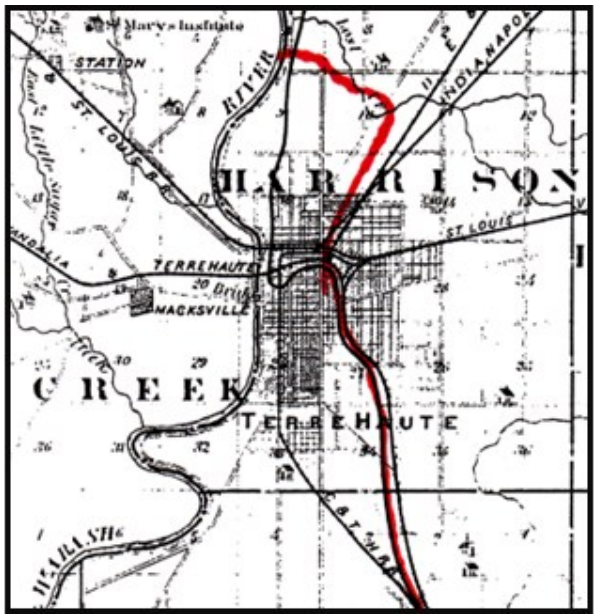
Original construction of the Cross-Cut Canal began in 1837. The Eel River Dam, an aqueduct over Birch Creek and the two cut stone locks at Riley (47) and Honey Creek (46) were constructed along the route even before the prism was dug. They planned to build all stone locks if quality stone could be located nearby. The stone was rough cut at a quarry near Greencastle and taken by wagon to Riley where stone carvers did the fine cutting required for the lock wall facings. Later Lock (47) built by Robert Logan of Highbanks, Pike county, was considered one of the finest locks on the entire W&E canal. For 9 years the timber elements on the dam and locks just deteriorated and needed to be rebuilt when construction resumed 1848.
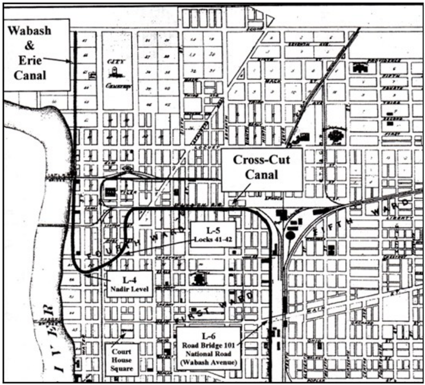
In July 1847, the W&E Canal was turned over to a Trust to be headquartered in Terre Haute. Per the terms of the Butler Bill, the W&E was to be extended from Lodi through Terre Haute to Evansville. The Cross-Cut was rerouted meeting up with the W&E in downtown Terre Haute at what would become the nadir (lowest) level. When finished, water flowed from north and south into a basin. From the basin, the water flowed through a culvert into the Wabash River.
William Ball now had to revise the original plan for the Cross-Cut portion of the works. His new plan reflected the changing environment of the times. He abandoned the concept of a deep-cut and added 2 locks on either side of the summit level. All new locks would be built of timber rather than stone reducing costs and speeding up the timeline for construction. The 7 timber locks being built along with the 2 earlier stone locks, now account for the 79.2 feet of lift from the summit level to Terre Haute. Locks 41 & 42 in the city shared a common gate in the center making them a unique structure on the W&E.
In 1849, rather than building the earlier proposed feeder dam at Rawley’s mill, it was decided to build a 4,000 acres reservoir. A one mile, 20-foot embankment was built along the reservoir’s east side blocking Splunge Creek. During periods of abundant water, a waste weir at the mouth of the 52/3
-mile Eel River feeder, could be adjusted to spill water into the reservoir. At the southeast corner of the reservoir there was a 40-foot-long culvert with wickets that fed water back into the main canal channel. This reservoir only furnished water south toward Worthington.
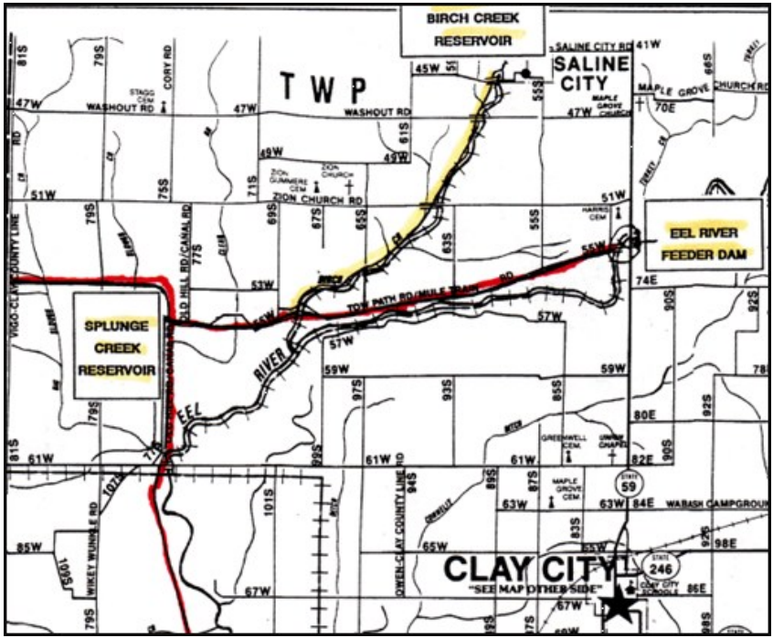
The Eel River feeder, that followed the original plan, required some rebuilding and was expanded to 264 feet wide and 16 ½ feet high. This feeder crossed over Birch Creek and continued to the Splunge Creek Reservoir where the water flowed in 3 directions. Water could flow north at the summit toward Terre Haute, could be directed to fill the reservoir, or flow toward the south to Locks 50 & 51. Even with the water stored in Splunge Reservoir there still was not sufficient water for the total needs.
Later, in 1853, a dam was built across Birch Creek creating a 1,000 acre reservoir. This dam was built 2 ½ miles up the creek to get the proper elevation to flow water into the Eel feeder. Then a feeder was built from the Birch Creek Reservoir to the Eel River feeder entering just a few feet west of the old aqueduct. This feeder flowed along the west side of Birch Creek. The water from Birch Creek thus fed the summit level both north and south and also helped in filling the Splunge Reservoir.
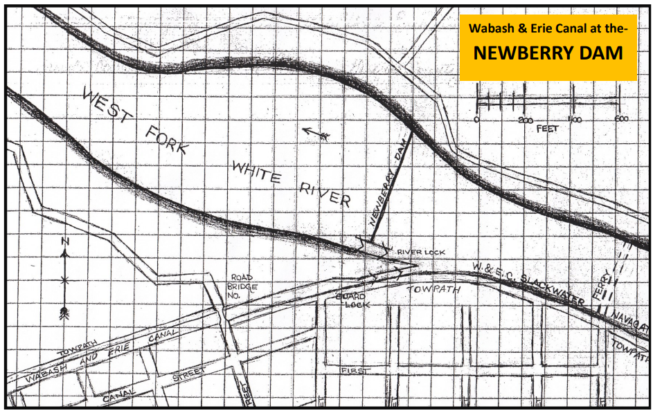
After 1839 construction on the Central Canal ceased and later permanently ended. The Cross-Cut that originally was to end in Greene County at Worthington, now under the new plans for the W&E had to be extended along the west side of the White River to the slackwater crossing of the Newberry Dam. This dam was necessary to feed the canal south of Newberry. Canal boats could utilize this slackwater to cross the river so that an aqueduct was not required. Canal boats exited the 4 miles of slackwater just before reaching the dam. The dam was 444 feet wide and 12 feet high. A river lock was built in it that was 105 feet long and 21 feet wide so that river traffic could still navigate through it. One of the river lock’s primary uses was for shipping the pig iron from the Richland Furnace to the Ohio river.
On the south side of the White River and just before the dam, a guard lock allowed canal boats to reenter the main canal channel and resume their journey on the canal. Since this was to be a major feeder as well as a lift lock, the upper gates had 4 iron paddles on each door for a total of 8. Each paddle was 2 ft. x 3 ft. This allowed for a rapid water flow when the lock was not being used as a lift lock.
The next major structure in Greene county was located 1½ miles south at the crossing of Slinkard’s Creek. Again the engineers utilized a slackwater crossing by damming the creek and having the canal boats pulled across it by mules using a tow-path bridge. The Newberry Dam and Slinkard’s creek fed the W&E for 64 miles until it reached the Pigeon Reservoir in Gibson county.
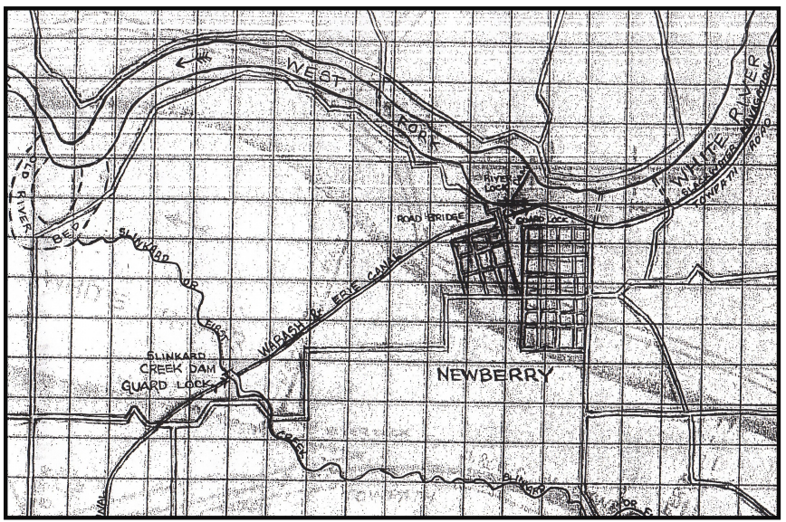
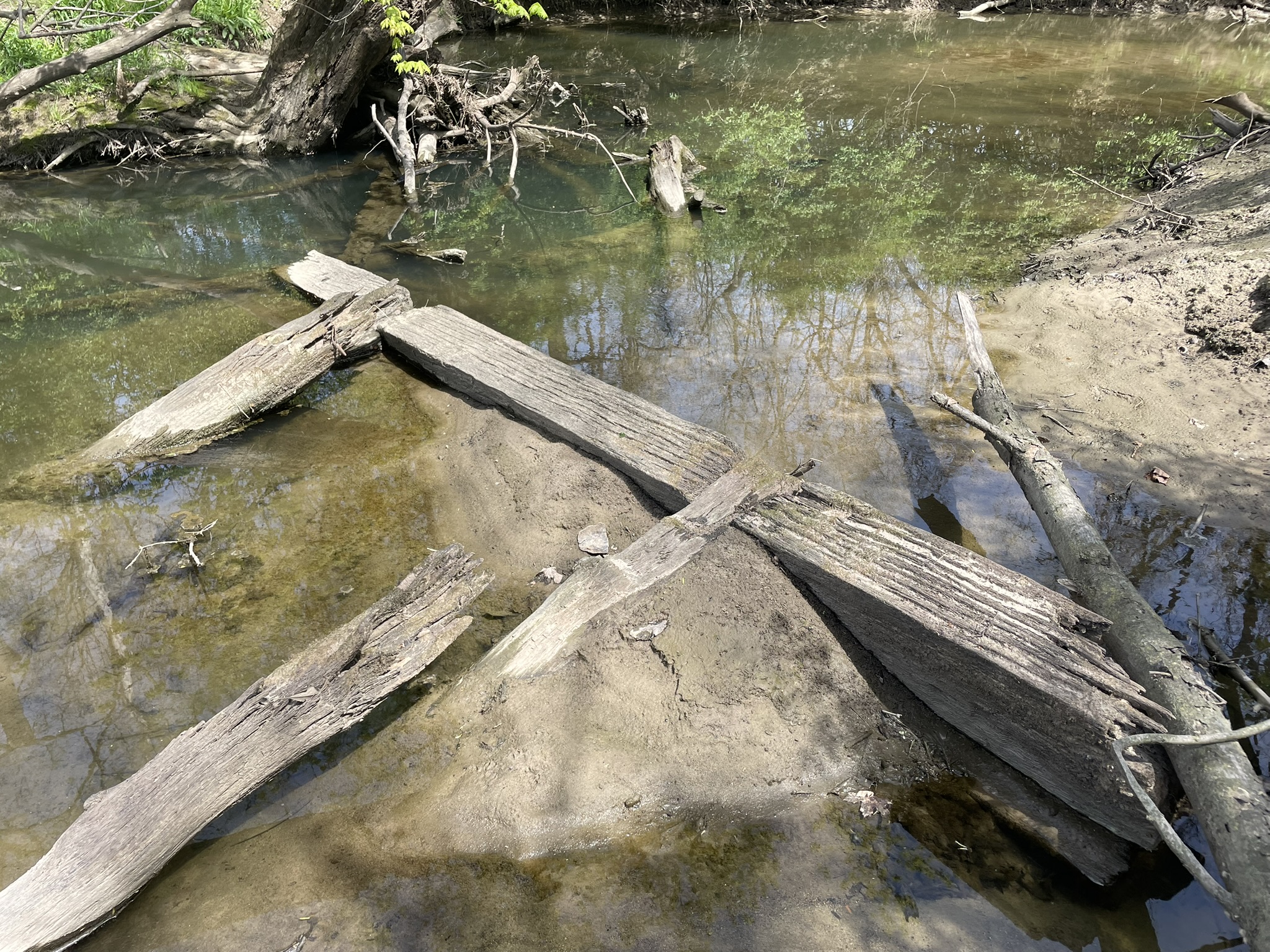
Photo: Preston Richardt
About 2 ½ miles south of Slinkard’s Creek the canal entered Daviess County. The county’s major creeks are Grindstone, Smothers, Prairie, Palmers and Veale. Only Prairie creek is crossed with a 4-span, 116 ft. aqueduct. Palmers and Veal are crossed by timber arch culverts, the other two creeks used box culverts. In the county there are 6 timber locks Nos. 60-65. The W&E enters Pike County at the White River Aqueduct. This massive 510 ft. structure was built 42 feet above the river and was the longest aqueduct along the W&E Canal.
Saint Joseph Church, Rev. Lalumiere, and Canal Diggers
Sam Ligget, CSI Director from Terre Haute, Indiana
The first mass Irish immigration in the 1820s and 1830s occurred after the collapse of the Irish textile and iron industries. Many in this wave to the United States found work on the early canals. The Irish famine in the 1840s caused a second wave of Irish immigration. This second wave included men, women, and children whereas the first wave was mostly men. Many of these people found work on later-built canals including the Wabash & Erie Canal.
Devout Irish Catholic canal workers around Terre Haute would make Saint Joseph Roman Catholic Church their home for spiritual care. There were a few German Catholic immigrant canal workers that joined Saint Joseph at this time also as it was the only Catholic church in the vicinity.
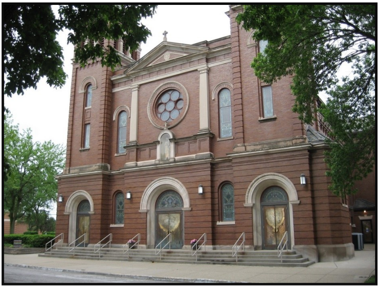
According to The Catholic Telegraph and Recorder, a Catholic newspaper published in Cincinnati, OH, in an article dated August 22, 1840, “in the thriving town of Terre Haute, in the center of one of the most fertile and healthful regions in the west, a Catholic Church [Saint Joseph], is now dedicated, and within four miles northwest of Terre Haute, another Catholic Church and Seminary [St. Mary-of-the-Woods] are being built….” All of the buildings were brick. Saint Joseph Church was located on Fifth Street between Ohio and Walnut and still occupies this location. The dedication sermon was given by The Very Rev. S. P. Lalumiere, who was destined to play a major role in Saint Joseph’s history and the lives of Irish and German canal workers.
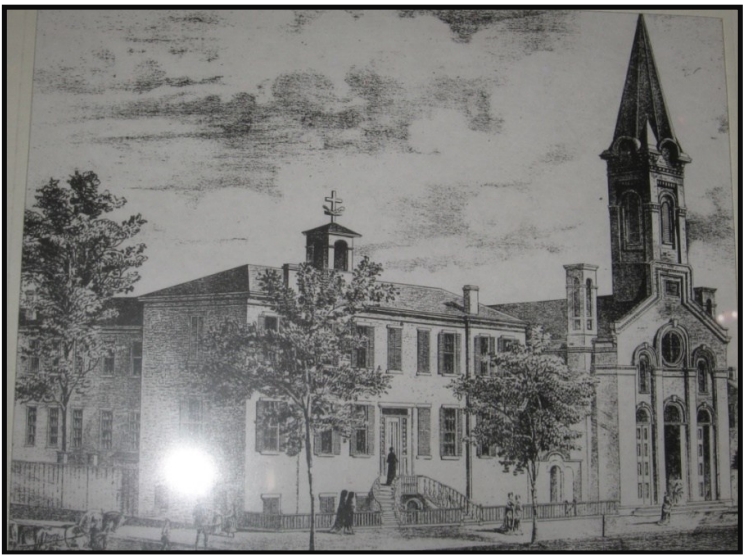
In December 1842, Rev. Simon Petit Lalumiere was appointed pastor of Saint Joseph. He was born in Vincennes, IN, in 1804 to a French immigrant family. He was ordained in Bardstown, KY, in 1828. The last church he served before coming to Terre Haute was St. Simon Catholic Church (founded 1837) in Washington, IN. Washington and Saint Simon Church would also become canal communities.
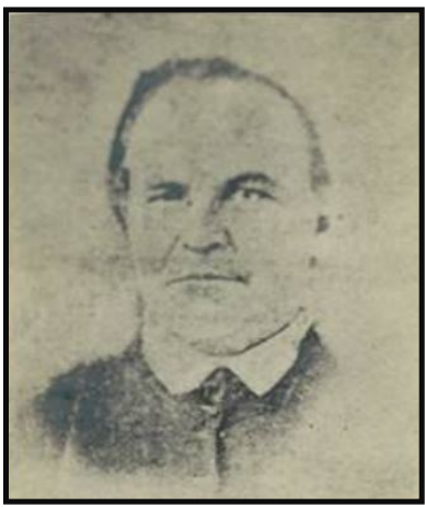
St. Joseph Church 1842-1857. He was buried beneath the church alter at St. Joseph.
Rev. Lalumiere was esteemed and respected in every church and community he served. One of his attributes was the ability to speak English. Many of the priests in what was the Northwest Territory were from France and knew very little English. When appointed to Saint Joseph Church, Rev. Lalumiere’s pastoral duties were to serve the church and along the canal as well as surrounding areas. He served from 1842 until his death in 1857.
Rev. Lalumiere would play a big role as priest to the Irish and German canal workers on the Wabash & Erie Canal. “Because of the scarcity of laborers for the Wabash-Erie Canal construction, agents were sent to New York to procure men to work in Indiana. These agents offered thirteen dollars per month with an advance to pay passage to Indiana,” wrote The Catholic Church [Schroeder, pp. 26, 106]. According to the Journal of the House of Representatives of the State of Indiana, being the 18th Session of the Indiana General Assembly begun and held at Indianapolis in said State on Monday the second Day of December A. D. 1833, there were “580 immigrants working on the Wabash-Erie Canal between Huntington and Lafayette….” [Richardson, p. 94]
“I have much trouble with my Irish boys on the canal, they will drink,” remarked Rev. Lalumiere in a letter to the Very Rev. A. Martin in March 1848. To counter the Irish boys drinking, Rev. Lalumiere founded the Temperance Society in Terre Haute. Extensions of this Temperance Society were formed along the canal route from Terre Haute to Lafayette and survived into the 1870s. The Rev. Lalumiere was known to walk this section of the canal administering to the needs of canal workers.
Colonel Richard “Dick” Thompson and Rev. Lalumiere became great friends even though the colonel was a member of the Know-Nothings. The Know-Nothing movement was largely anti-foreigner and anti-Catholic. Colonel Dick Thompson had served in the Indiana House of Representatives (1834-1836), the Indiana Senate (1836-1838), the United States Congress (two terms), and Secretary of the Navy under President Hayes. He would serve as Provost for Vigo County through the Civil War. This was a period of unusual political associations, and Colonel Thompson’s relationship with Rev. Lalumiere certainly exemplified that. A flood control ditch on the south edge of Terre Haute is named Thompson’s Ditch after the colonel. Many people confuse it with the remains of the Wabash & Erie Canal.
Colonel Richard “Dick” Thompson and Rev. Lalumiere became great friends even though the colonel was a member of the Know-Nothings. The Know-Nothing movement was largely anti-foreigner and anti-Catholic. Colonel Dick Thompson had served in the Indiana House of Representatives (1834-1836), the Indiana Senate (1836-1838), the United States Congress (two terms), and Secretary of the Navy under President Hayes. He would serve as Provost for Vigo County through the Civil War. This was a period of unusual political associations, and Colonel Thompson’s relationship with Rev. Lalumiere certainly exemplified that. A flood control ditch on the south edge of Terre Haute is named Thompson’s Ditch after the colonel. Many people confuse it with the remains of the Wabash & Erie Canal.
Rev. Simon Lalumiere died on May 25, 1857. He had been having health issues and was told he needed to rest. But he insisted on ministering to his Irish boys working on the canal as well as to small congregations he had started in Merom, Clinton, and Montezuma, IN. Many thought this contributed to his death. Years later, Colonel Thompson recalled, “When the good man died . . . there was universal sorrow all over the community.”
I am indebted to Christina Ridgway, the secretary of St. Joseph University Parish Church, for her assistance with finding A Narrative History of Saint Joseph Church, Terre Haute, Indiana 1838-1872 by Rev. J. Lawrence Richardt (Master’s Thesis, Indiana State University, 1969) and the old drawing of Saint Joseph Church. And I also thank Michael Widner who maintains the website Indiana Catholic History and posted the article “Simon Petit Lalumiere begins his ministry” (indianacatholic.mwweb.org/?p=6728).
The Hoggee
Carolyn I. Schmidt
Hoggee (hoggie, hoggy) was a term used for a “mule driver” or “mule skinner.” A “mule skinner” also tended to the care of the mules, thus he was also known as a “mule tender” as was a “mule boy.” Canals often had different terminology from each other. A hoggee drove or led mules [sometimes horses or even oxen] that pulled canal boats along canals primarily in the 18th and 19th centuries. This role was crucial during the peak of canal transportation, which was a primary means of goods and passenger transport before railroads.
The hoggee was usually a young boy or girl, often the son or daughter of the boat’s owner/captain, who started working at an early age, commonly around 8 or 9, to drive the animals along the towpath. Driving was usually done by walking behind the team, though a driver would occasionally ride the swing animal.**[The tailing mule (or horse) in a tandem hitched team of two or three].
“We all took turns driving. My sister would drive maybe one level [from one lock to the next lock], my brother would drive a level and I’d drive a level. Once in a while my father would throw out a plank, and my sister or my brother would run in and one would run out [while the boat was underway], but mostly we’d go to the next lock. I never slept on the mule’s back but my sister and brother used to. They’d stick their feet up in the harness and lay back on the mule and go to sleep. (Hahn, C & O Canal Boatmen, 62.)
In tandem hitching, the towing animals walked one behind the other. This was done because most towpaths were not wide enough for teams of two or three animals hitched abreast.
Sources differ on where the term hoggee came from. One says it might be from the Hindi word “hoji,” meaning boatman or water carrier, and was adapted into English to describe canal transportation workers. Another says it was originally used in Great Britain to describe the lower class of workmen who dug the canals and later used on some eastern U. S. canals as the name for the driver.
Sources:
Hahn, Thomas Swiftwater and Kemp, Emory L. Canal Terminology of the United States. Morgantown, W. Virginia: West Virginia University, Institute for the History of Technology and Industrial Archaeology, 1998, pgs. 56, 85-87.
Woods, Terry K. The Ohio & Erie Canal: A Glossary of Terms. Kent, Ohio: The Kent State University Press, 1995, pgs. 11, 18, 19.
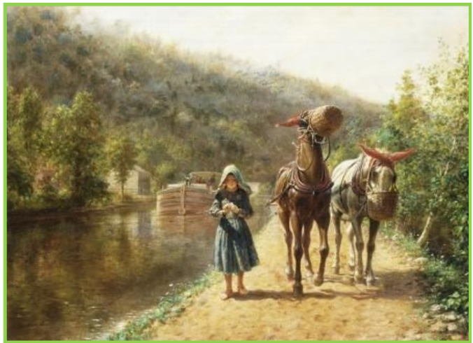
The oil painting above shows a young girl walking on the towpath and driving a team of mules that are pulling a canal boat down the canal on a beautiful summer’s day. Unfortunately being a hoggee was not that idyllic.
Boating on canal usually started after the ice broke up early in the spring and continued until the canal froze over in the late fall. Hoggees experienced all kinds of weather—rain, sleet, hail, snow, burning sun, freezing cold, high winds, etc.. At night it could be very dark. Most times they were barefoot because they couldn’t afford shoes. In order to withstand walking on a burning towpath or a freezing one, their bare feet had to become tough as leather.
According to Susan Yoder’s “Mule Shoes” column in the Canal Society of Indiana Newsletter, September 2000. pg.8, “The boats ran ‘rain or shine.’ When Frank Zimmerman’s brother Harry was in a hurry to make port, he armed his brother with an umbrella and set him atop the mule. Frank wedged the umbrella in the harness and let the rhythm rock him off to sleep. Working in hot sun and driving rain, long hours seemed endless.
“John Swaim explained, ‘No matter whether it was a thunderstorm, a pourin’ down rain, or what, you had to stay and drive them mules in a thunderstorm, because it was thought the lightening ‘followed animals.’
“A Mr. Crandal related a shocking experience while riding a mule. During a summer storm, a lightening bolt connect with a black elm, which was close to both mule teams. While the rider felt an electrical charge, he was unscathed. All of the mules, however, dropped to the ground as if struck dead. Momentarily, the mules’ eyes began to open and one got up on its legs, ready to face whatever the Almighty had in store next.”
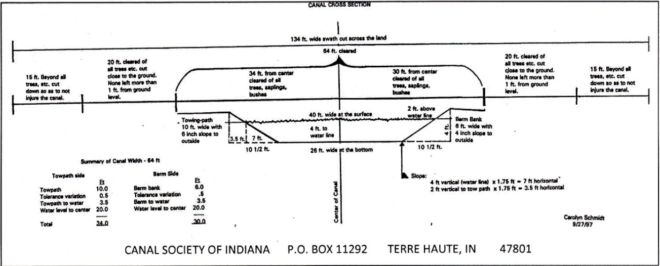
If the canal had recently been built, a large swath of land 134 feet wide had been cleared and no trees were close enough to the towpath to offer any shade or cover from inclement weather.
The hoggees also had to watch where they stepped to avoid the mule or horse droppings on the towpath. There were always more of these the closer they came to a canal basin or larger city. They smelled terrible and attracted gnats, biting flies and other stinging insects. The mules had fly nets put on their backs, which had long fringe on either side. It swayed as the mule walked and scared away the flies, but the poor hoggees had to bat them away with their hands.
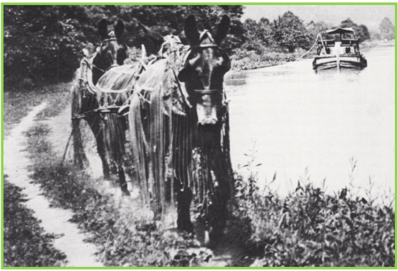
Courtesy of Jack Gieck’s A Photo Album of Ohio’s Canal Era. p. 128
The level between locks differed in length depending on the terrain. If it was flat, a level could be very long like the 17 3/4-mile summit level on the Wabash & Erie Canal in Fort Wayne, Indiana. The children could have walked between 30-40 miles day.
“Many a youthful driver felt he always got the long tricks [levels] to drive and longed for a rest ride that the mule’s strong back offered. James Eaton’s father didn’t want the children to ride the mules and add that extra burden to his valuable animals. He felt that the animals had enough to do without carrying additional weight. But the minute the lock gates opened and the boat came out, James and his sister would bolt for the mule’s back for a moment’s stolen rest for their tired feet. Too soon, their father would catch them and make them dismount.” Yoder, August 2000. p. 10.
The canal season was so long it did not leave much time for hoggees to attend school. If their parents were lucky enough to stay in town during the winter months, the children might have had some formal education, but most generally it was left to their parents. If their parents didn’t speak English, they were at a distinct disadvantage in their adult life.
In her book Wabash and Erie Canal in Carroll County, and Pre-history of the Wabash River. Dora Thomas Mayhill, [Knightstown, IN: Banner Publishing Co., 1953] says, “Many of the boys riding mules and horses and doing chores on the canal boats had been orphans. They worked at the mercy of their captains and were sometimes cheated out of their wages, it was said. They were mistreated by the old drivers, too, who were often cruel and tyrannical. In order to stay on a boat a boy had to be quick, and able to take his own part and soon to become hardened to the life…[These orphans were older boys in their early to late teens.]. Some of the boys took jobs on the canal for the adventure it afforded.”
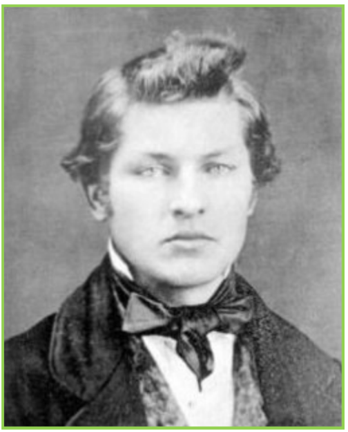
James Abram Garfield was one of the adventure seekers before eventually becoming the President of the United States. His father, Abram Garfield, had been one of the thousands who built the Ohio Canal [Ohio & Erie]. He eventually became the superintendent of the canal. Later contracts were let to build other smaller canals in Ohio and he took several of these. Unfortunately the depression of 1839 was so bad that he could not afford to complete his contracts, construction stopped and he became bankrupt. At the same time all of the canals in Indiana, other than the Wabash & Erie, were faced with the same problems and construction stopped on all of them. When Abram died at a young age, James’ mother Eliza guided him to read books and thus he learned about life on the ocean.
James dreamed of one day being able to make a career on a ship. Being a long way from the ocean he decided that he needed to work his way there by beginning life on Lake Erie. From his home in northern Ohio he worked his way to Cleveland. He was only 15 years old in early 1837 having been born on November 10, 1813. At Cleveland he approached a lake steamer captain and asked for a job. The captain laughed and sent the young boy away.
Not giving up, James developed another plan—to work as a “sailor” on a canal boat. He approached the captain of the Evening Star, who was looking for a young boy to drive his mules. The boat picked up copper ore at Cleveland that had been brought there by lake steamer from Lake Superior. The Evening Star transported the copper ore to Pittsburg via the Ohio & Erie Canal to Akron, Ohio, and then on the Pennsylvania & Ohio Canal to Beaver, Pennsylvania, where the canal boat was towed on the Ohio River to Pittsburgh. The return trip was with coal for Cleveland.
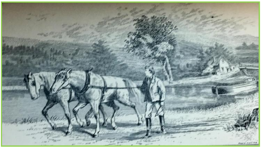
In R. H. Conwell’s James A Garfield
Portland, ME: George Stinson & Company, 1881. p. 74.
For four months in the summer of 1847 young Garfield walked with the mules on the towpath. Life on the canal was rough and tumble, especially when crews of two boats came to a lock from opposite directions and the best fighting crew got to pass through the lock first. The crews actually loved to have a rumble. James felt this conduct was unnecessary and the situation could be resolved without fisticuffs. The rest of the crew felt he was a coward. He later showed his mettle by decking one of the bullies on the boat.
An opportunity came for him to become steersman and he did the job until the late Fall. He had developed a fever and in a delirium slipped overboard one night while trying to affix a rope to the bow of the boat. He could not swim and almost drowned. This experience and his fever ended his canal experience. He returned home where his mother over the next four months nursed him back to good health. In 1848 he gave up his plans for the sea and entered Geauga Seminary in Chester, Ohio.
Traveling on the canal towpath on a very dark night was scarry. Yoder says, “Raleigh Bender was afraid on the towpath at night. The captain couldn’t see me riding the mule after night,’ he divulged. There was card playing going on at both ends of the canal boat and the boatmen didn’t appreciate distracting children aboard. “ They’d run us off and tell us all kinds of tales about meetin’ someone with no head or something’ on the level. I never met one, but I was always ready for him. I was always on the mule. The mule was protection. After a thumping’ from the captain, who had noticed the lad had dry shoes, a lock-tender offered a piece of friendly advice. ‘I always dipped my feet in the canal after so the captain would think I had been walking in the wet grass along the towpath.’ admitted Raleigh.”
During one summer, Ray Bender, an older hoggee on the C & O Canal said he spent more time on the towpath—from early morning to after dark—than he did in bed.
Susan Yoder ended he “Mule Shoes” column in the October 2000, CSI Newsletter as follows:
“Cargo carriers were a world apart from the packet’s floating luxury. ‘If mules were carelessly curried, the driver an undersized bandy-legged fellow, coatless, his pants held up by one gallus crosswise, nobody complained.’ The popular ‘Indiana’ of Fort Wayne was a source of pride, but the misnamed ‘Superior of the Wabash’ disgraced the town, said the Wabash Gazette, because it was the most inferior looking boat on the canal…drawn by two of the most dilapidated, jaded, ruined horses mortal man ever set eyes upon. Given a fair opportunity they could gladly have drowned themselves,’ one record details. A canal boat, by virtue of its utilitarian design, was not intended to be a sleek and graceful craft. ‘Flat bottomed, blunt and straight of bow and stern, she had no more rakish sheer or curving contour than a tub, and her boxlike superstructure made her look like a floating packing case, somewhat flattened as if squashed down by a heavy weight…’Hawthorn observed, it was ‘as if it had two sterns, and were fated always to advance backward.” Hahn, Thomas F. The Chesapeake and Ohio Canal: Pathway to the Nation’s Capitol. Matuchen, N. J.: The Scarecrow Press, Inc. 1984. pg. 86-71.
A hoggee’s life was difficult, but those who managed to make it through learned a lot and many of them advanced to very high position during their lifetime. Not giving-up and making the right choices does pay off.
Ever Wonder Why Fort Wayne Is Called The Summit City?
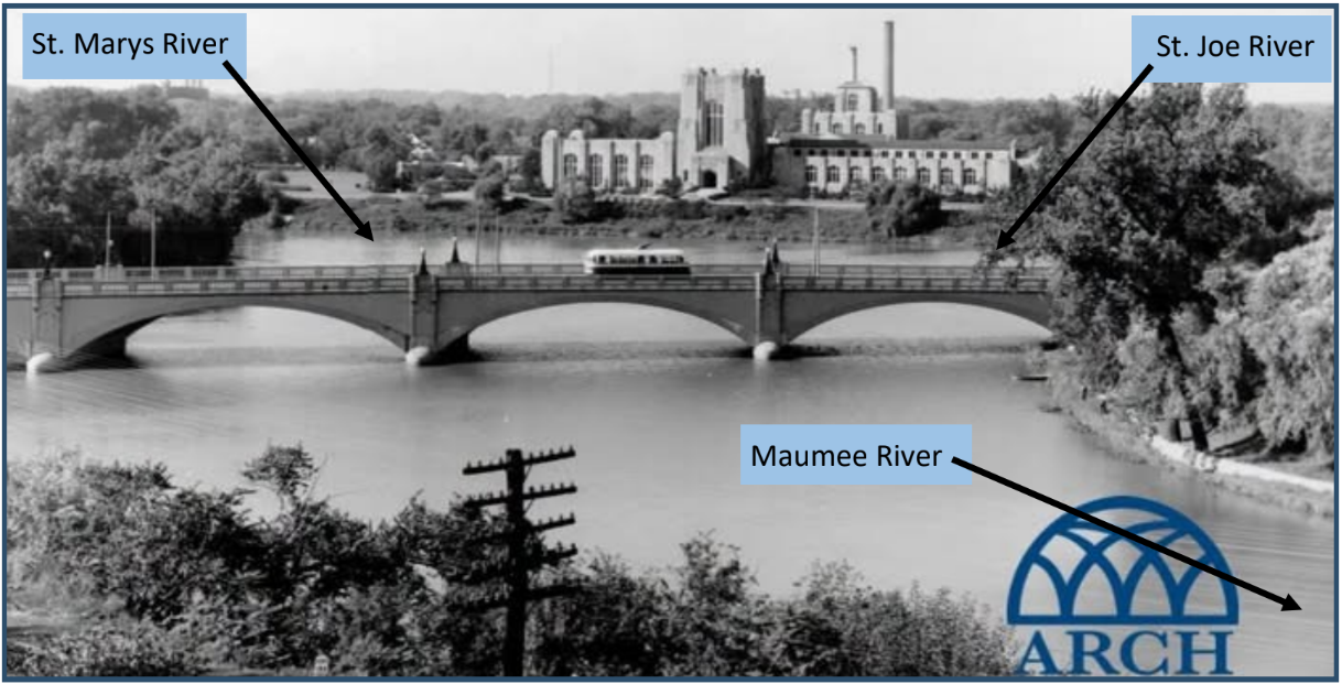
from south-eastern Michigan to form the Maumee River that goes to Toledo, Ohio and into Lake
Erie. The feeder for the Wabash & Erie Canal is about 7 miles up the St. Joe River.
It all goes back to the Wabash & Erie Canal! Fort Wayne sits at the highest point along the canal’s route, earning the city its well-known nickname.
Construction on the canal began in 1832, and for more than 40 years it connected the Great Lakes to the Ohio River, passing right through Fort Wayne. What was once considered “marshy and undesirable” became one of the most important links in the entire canal system.
Built in 1852, the Canal House at 114 E. Superior Street is one of the few remaining reminders of that time. It served as a hub for trade and warehousing and was even home to families who worked on the canal.
The canal did more than move boats, it brought people, businesses, and new opportunities to Fort Wayne, helping shape the city we know today.
Courtesy ARCH Inc. on FaceBook
The Summit City—Fort Wayne.
As all cities of any note are assuming names to distinguish them from the hacknied and worn out name by which they were christened, we suggest that Summit City will be very appropriate for Fort Wayne, its altitude indicating their appropriateness of the name.
Perrysburg Journal, Perrysburg, Ohio, Sat. Apr 15, 1854, page 1 This was attributed to an undated report provided by the Fort Wayne Times. Found by Craig Berndt, CSI member, Fort Wayne
Pigtails
By Susan Yoder

This is the third of a series of articles originally published in the Canal Society of Indiana Newsletter between March 2001-April 2002.
Squeal Estate Agents…
Loran Esarey paid homage to the humble porcine race, in writing “We may sing the praises of all the heroes of Indiana from LaSalle or George Rogers Clark to the present, but the prosperity of our state through the century has depended upon Mr. Hog. In fat years and lean years, until his late unmerited humiliation…he has come up with his part, even though he does grunt about it considerably.”
Carmony, Donald F. Indiana 1816-1850 The Pioneer Era. Indianapolis, IN: Indiana Historical Society, 1998, pg. 58-59.
Timing then, as now, was everything, as evidenced by the following correspondence from Alexander Wilson, dated November 25, 1844, “A few days since I have made a Contract With William Conner & John Stephenson of Hamilton Co., for from 8 to 15 hundred head of hogs Which Will be Delivered to me at Peru the 1st week in Dec., Which Makes it Necessary for me to ask an accommodation of twenty or twenty-five hundred dollars from your Bank…The men I Contracted With for the Pork Commenced feeding so early that their Pork is now fat and I could not prevail on them to keep it Longer Which makes the Pork season open sooner on us, than I would have wished it…”
A Biographical Directory of the Indiana General Assembly, Vol. 1 1816-1899. Indianapolis, IN: Indiana Historical Bureau. 1980, pg.420.
April 13, 1846, a beleaguered Wilson writes, …”Your request to know whether My note to Wm Conner Will be paid When due I can only say that it will be paid if the Pork will Bring the money & I Can get it to markette in time…I have shipped my Lard & some of my Bacon East…My Barrell Pork I have intended to Ship by way of New Orleans & have had my boats ready waiting for a raise ten days I will Decline sending south and take my chances with the Canida markette at this time…If I Could have got off Early I Could have made sale South, in time to meet all my Obligations for pork and I may do so yet Will if Possible But the River not raising Will Delay me Longer Than I should have been There is so much produce to send off on the Canal that it is very Difficult to get any thing sent that way at any thing like a fair price…I feel very anxious to see the end of it and I asshure you I have got a good lesson in the Pork Trade This Time.”
On Wednesday, December 8, of 1860, the Delphi Journal carried the copy that “Messrs. Spears, Case & Co., commenced packing pork on Monday last. The prices range from $4.50, per hundred according to the weight and quality.” In the same publication nine year later, “Spears, Case & Co. have slaughtered about 10,000 hogs up to the present date; they may possibly, slaughter as many more, but hogs are rather scarce this season. At any rate they are prepared to slaughter all they can get.”
During the Civil War, Delphi’s James P. Dugan made $65,000 in one day because of the rise in pork prices, only to see his fortune swept away during the financial panic of the 1870s.
Smith, William C. The Benefactors of the Delphi United Methodist Church. pg. 3. Available at the Carroll County Historical Museum.
“My grandfather, my father, and I raised hogs. They’d drive them (hence a “drove” of hogs) down the county roads right to the stockyard or slaughterhouse. Sometimes, they’d haul them in a wagon. Bigger was better, when they were sold per pound. It was common to see hogs weighing between 300 and 350 pounds heading toward the stockyard. It was not uncommon for a hog to be farrowed in the Spring and fit for sale or the plate the following year. They didn’t have the supplements, the antibiotics, or the breeding, which has shortened the time the swine spend as feeder stock. Hogs were fed ear corn and whatever nuts (mast) and edibles they found on the forest floor.”
Interview with Bill Kearns, first President of Carroll County Pork Producers.
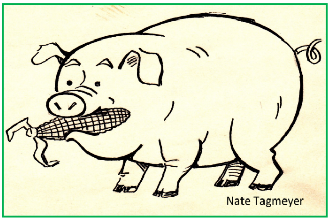
From a January 1871 issue of the Delphi Journal, we have the proclamation: “Spears, Case & Co. bought of Mr. Andrew Burntrager, a lot of 24 hogs averaging 595 pounds. This we believe is the finest lot of hogs ever fattened in the State.” As lard had encroached on the whale oil market and essentially replaced bear grease, fat was beautiful.
Diversified Porkfolio
Ancillary industries made a tidy sum off the pig killing business. Salt and sugar were used for curing pork. Wagons, boats, barrels, and butchering tables got plenty of use. Knife, hooks, and grinders had to be cast metal to withstand heavy use during the meat packing season. Meat packing created its own thriving economy. “In those days about every merchant had at the rear of his place of business or at some convenient building, a “pork-house,” and would buy the pork of his customers and of such others as would sell to him, and cut and pack pork al winter. The hauling of all this to the river would also give employment to a large number of teams, and the manufacture of pork barrels would keep many coopers employed. “
A History of Henry County. Juton: State Publishing, 1884. pg. 274-275.
The collection of large mills and the pork-packing establishment of Fayette County created quite the market for barrels. In 1845, Valentine Michael plied the barrel-making trade and continued the manufacture of barrels until 1864. John Uhl succeeded him, making upwards of 18,000 barrels per annum, until 1870, when Henry Weitsel became proprietor at the same location. Valentine Michael’s son, Florentine, started his barrel business in 1865 and made about 12, 000 barrels a year.
The History of Fayette County. Chicago, IL: Warner Beers & Co., 1885. pg. 150.
“I think (my father) charged $1.50 a piece for a pork barrel.
Bash, Henry C. Mitchell. 4-19-1930.
A Cast of Sow-sands
In the early eighteen hundreds, Cincinnati was Porkopolis, and the last step for many Hoosier-raised cloven hooves. Mrs. Trollope was an Englishwoman, who resided in Cincinnati from 1827 to 1831. She left us with the following observations regarding the muddy-nosed “children of the street.” “I am sure I should have liked Cincinnati much better if the people had not dealt so very largely in hogs! The immense quantity of business done in this line would hardly be believed by those who had not witnessed it. I never saw a newspaper without remarking such advertisements as the following: ‘Wanted immediately, 400 fat hogs;” “For sale, 2000 barrels of prime pork.’ But the annoyance came nearer than this. If I determined upon a walk up Main Street, the chances were five hundred to one against my reaching the shady side without brushing by a snout or two, fresh dripping from the kennel. That we had screwed up our courage to the enterprise of mounting a certain noble-looking sugar-loaf hill, that promised pure air and a fine view, we found the brook we had to cross at its foot, red with the blood from a pig slaughter-house; while our noses,…were greeted by odors that I will not describe, and which I heartily hope my reader cannot imagine; our feet, that on leaving the city had expected to press the flowery sod, literally got entangled in pigs’ tails and jaw-bones:…”
The Indiana Historian. Indianapolis, IN: Indiana Historical Bureau. August 1994, vol. 7027, pg. 11.
And On This Farm He Had A Pig…
As settlers moved into Indiana, virtually every family farmed. Those who came as professionals were not immune to earning a portion of their subsistence from the virgin farm ground and animal husbandry. The main ingredient for harvesting a plentiful crop was manual labor. The soils were rich with organic matter. Only the well-worn trails exhibited the artificially compacted clay that would haunt later generations.
As the crops and tilled acres increased, the inherent richness of the native soils waned. The theory of adding back minerals and organic matter to replace what was stripped from the soil began to take root between the 1840s and the 1880s. Stockmen began to notice and appreciate the practice of “hogging off corn” to restore soil fertility.
Thornbrough, Gayle and Dorothy Riker. Readings in Indiana History. Indianapolis, IN: Indiana Historical Bureau. 1956. pg. 381
Having had a couple hundred years from the first soils tilled in America to ground breaking in Indiana, Eastern farmers understood from experience the infinite limitations of unamended soil. As they reaped the rewards of previous consumptive farming practices, careful observation led to application of a more scientific approach to agriculture. Rotation of crops and selective breeding of plants and livestock proved their worth. The Hoosier farmer became the beneficiary of the Easterners’ agricultural trial and error.
The Indiana Historian. Indianapolis, IN: The Indiana Historical Bureau. August 1994. Vol. 7027, Pg. 12.
Agricultural societies, fairs, demonstrations and publications popped up with mushroom-like spontaneity and, in many cases, longevity. With blessings from the state legislature of 1829 and 1835, Indiana promoted the formation of these efforts to make educational inroads in agriculture. Recognized in 1851, the State Board of Agriculture renewed its commitment to promote local agricultural societies and scientific land use. Thirty thousand people attended the inaugural State Fair in Indianapolis, in 1852. From Readings in Indiana History. pg. 386) we have the account of the swine show at the first Marion County Fair. “At the first county fair the board offered cash prizes for the ten best fat hogs. While most of the hogs of the early days was more of a razor back or elm-peeler type, two new breeds called the Shaker and the Slifer had been brought in by eastern settlers. (Pap) put a bunch of em up in a rail pen and shoved the corn to em until they was good and fat. They was all white and weighed about three hundred pounds apiece… I had the joy of driving ten of them hogs the five miles to the courthouse square. I started the day before they was to be judged, so I could go slow and not get em hot or drive any of the weight off…The second day I made the square only to find the fair board had no pens ready. I had to herd them until they made some.” And we complain about Purdue traffic!
Help For Those Who Don’t Know Beans About Swine…
From an early edition of The Northwestern Farmer, we have the useful information that “A bushel of unground corn fed to swine will make from five to eight pounds of pork, the same quantity ground and fed will make from nine to twelve pounds, when ground and cooked it will make from twelve to fifteen pounds. From this estimate the profit of feeding pork may be calculated and when corn is worth a high price, it should always be ground and, if possible, cooked before being fed to swine.”
The Northwestern Farmer, Vol. 2, No. 11, November 1, 1867. pg. 209.
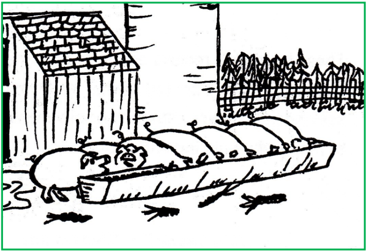
By the 1860s, farmers throughout the region were clamoring for a federally established and funded departments of agriculture and federal land grants for agricultural schools. The quantity of product and contribution to the wealth of the nation spoke volumes in favor of a national investment in agriculture. In 1862, the United States Department of Agriculture was formed. The Morrill Act, granting federal lands for centers for higher learning in agriculture was passed. As a result, Purdue University opened its doors in September of 1874.
The Indiana Historian. Pg. 12.
Advertisement For Building a Weigh Lock
Jerett Godeke, CSI Director
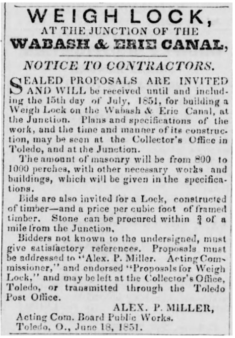
Jerett Godeke found this advertisement in the Defiance Democrat of July 12, 1851 wanting proposals from contractors to build a Weigh Lock in the Wabash & Erie Canal where it joined the Miami & Erie Canal at Junction, Ohio. He sent it to CSI headquarters asking if it was ever built. We have no record of it being built. Does anyone have any further information?
Note: A weigh lock allows loaded canal boats to be weighed and the weight of the boat subtracted to determine the toll it should be charged to use the canal. It can be built of stone or wood. The number of perches refers to the amount of stone they anticipate they will need to build this lock. It also asks for an estimate of the amount timber it might require if built of wood.
If this type of lock was ever built it probably wasn’t used very long. It had been found that most weigh locks were more costly to operate than the tolls they received. If built it would have been by Ohio. They did build one in Toledo. Indiana never built one.
Destructive Floods Rip Through Whitewater Valley
Carolyn I. Schmidt
Just after a celebration was held in the Whitewater Valley canal town of Metamora, Indiana after just receiving plans for a $14.4 million restoration of the Duck Creek Aqueduct, Laurel Feeder Dam and Lock 24 (note the exclusion of a new canal boat), roaring flood waters inundated the older portion of the town that is south of the Whitewater Canal damaging over 40 businesses and 40 homes. Several areas of the town had flooded as many as five times during recent years, but nothing in the past 100 years compared to this flood.
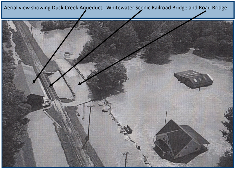
Heavy rains upstream from the town quickly surged down the West Fork of the Whitewater River with its rapidly descending elevation and down Duck Creek on August 12-13, 2026. Although water in Duck Creek reached just below the aqueduct, railroad tracks and road bridge over it, they were not washed away.
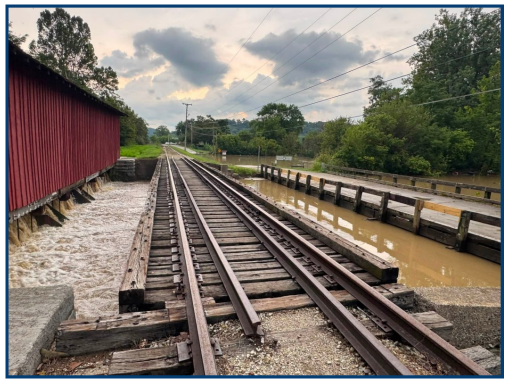
Posted August 13, 2026 on Facebook by
Cassie Garrett
Flood waters from the West Fork of the Whitewater River also destroyed areas of:
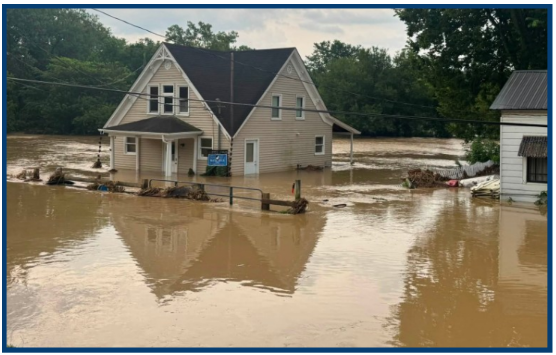
August 13, 2026
Cassie Garrett
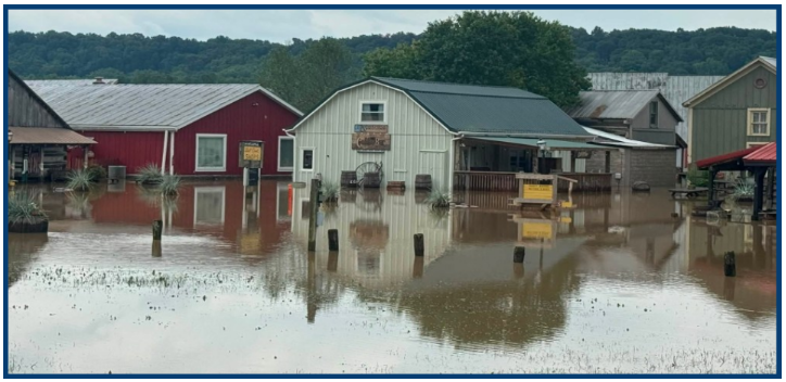
August 13, 2026
Cassie Garrett
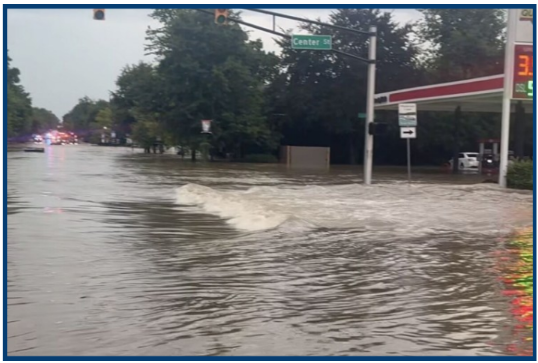
Hagerstown: Multiple people were trapped inside a store and had to be rescued by a front loader as the river rose. Houses and vehicles were underwater. Indiana 38/ Main Street was open only to local traffic.
The 765
August 13, 2026 Cassie Garrett
Cambridge City: The Town Hall was a complete loss. 175 homes had major damage. The city was under a boil water advisory for 48 hours until the water lines could be flushed. Once huge piles of curbside debris were cleared, dumpsters for debris cleanup were made available or debris could be taken to the Hagerstown transfer station. A structural engineer was sent to check homes and businesses that had excessive damage. Supplies were available for flood victims including food, clothing, cleaning supplies, and bottled water.
Milton: We do not know the status of the culvert or the lock located near this small town.
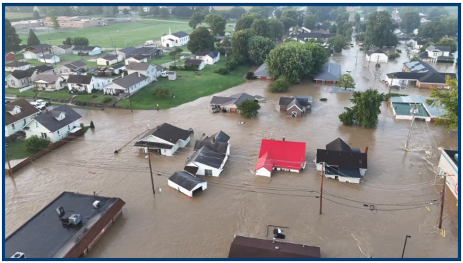
Connersville: The West Fork of the Whitewater River crested over the flood stage of 21 feet. Small fish swam down Vine Street. 250 residents were evacuated from their homes. Vehicles, businesses and homes were damaged or destroyed. Its wastewater treatment facility was damaged. CVS donated a truckload of supplies and food and later sent another truckload. The Whitewater Valley Scenic Railroad yard and tracks were so damaged that makes restoring it a challenge.
Laurel: The street leading across the railroad tracks and across the West Fork of the Whitewater River was flooded. After crossing the river a road to the right in the distance takes you to the Laurel Feeder Dam. It was impassable.
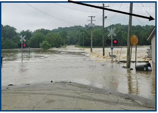
On September 4, Laurel residents were notified that the American Red Cross would provide Disaster Assistance with the registration process of those eligible for aid. Those affected by the flood were to go to the Community Center. On September 5 they could register for FEMA assistance at the Laurel Library. On September 7 the US Small Business Administration would provide assistance in the library parking lot.
Null Town: W County Road 480 S that goes east towards Everton had to be repaired. Homes in the area sustained damage.
Alpine: The West Fork of the Whitewater River crested at 21.78 feet. Residents had the same problems as elsewhere.
The East Fork of the Whitewater River also flooded at this time, but not as bad as the 1913 flood in Brookville, which had a 39-foot floodmark on March 25 of that year. This time the river was controlled by the dam, which had been built across it and had become operational in January 1974. At the time of the current flood, Brookville Lake, which has a normal surface area of about 5,260 acres and is located about a half-mile above Brookville, had the capacity to temporarily store some of the flood water and release it later thus reducing downstream flooding. This time the river crested at 25.29 feet in Brookville, the third highest crest on record. Eighteen residents had to take shelter in the Harrison Community Center and several were rescued by boat.
Indiana’s governor Mike Braun had previously announced that a State Disaster Relief Fund had been established, which offered up to $5,000 in state emergency aid to certain eligible residents. He also asked for help from the Federal Government prior to the following:
On August 25 President Trump approved a major disaster declaration for 21 counties in Indiana. FEMA would receive applications for Individual Assistance. Franklin County was also approved for Public Assistance for emergency work and repair or replacement of disaster-damaged public facilities.
As flood water receded homes and businesses could remove the building’s contents, tear out soggy drywall, pull up flooring and carpets, etc.. But they were told not to start making improvements until FEMA representatives could assess their damage, decide if they were historic buildings, etc. If owners tried to make improvements without the proper forms or assessments, they might have to take down everything they had newly built.
On August 25 cleaning supplies, masks, fans, dehumidifiers were available at the Metamora Grist Mill; food assistance, personal hygiene items, diapers were available at the Metamora Community Building; meals were provided at 9 a.m., noon, and 5 p.m.; clothing was available at Gateway Park; and well-water testing kits were available through the Franklin County Health Department. Residents were cautioned to stay out of the Whitewater River, due to contamination from the Connersville wastewater treatment facility, and also out of the Whitewater Canal. Temporary housing was going to be provided. Later restrooms were available at Gateway Park and, even later, camping was allowed in parts of the park.
Residents of Metamora don’t give up. They held a flood benefit show raising $2,720 for the Franklin County Community Foundation. They worked hard to get the town ready for business on Labor Day weekend with many of the old shops open and held a music festival on September 5 –6 with live performances throughout town. There were Bluegrass, folk and old-time musicians, and spontaneous jam sessions and pickin’ circles. They planned to hold “Canal Days” on October 2nd-4th.
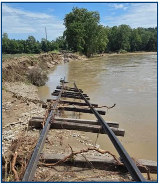
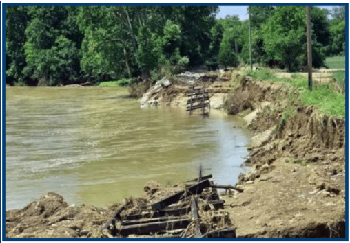
The Whitewater Valley Scenic Railroad had this major washout of its tracks and thousands of other ones that need to be filled in and the tracks replaced.
Whitewater Valley Scenic Railroad This 19-mile-long, volunteer operated, railroad that runs between Connersville to a short distance past Metamora passing on its “Canal Route” many of the old cut-stone locks of the Whitewater Canal, sustained millions of dollars of damage to its museum, shops, and historic railcars. It had thousands of washouts beneath its tracks. Floodwaters rose to about 40 inches within its engine shop thus damaging or contaminating toolboxes, parts storage areas and equipment. Their bunk house and kitchen were lost. Water that rose to 36 inches within its South Connersville base of operations destroyed everything below that level. Water rushed in its operating locomotives, reached the side sills of coaches and cabooses in its miles of rolling stock and submerged every traction motor in its inventory (22 active motors and 26 spares.) Luckily the railroad bridge over the Whitewater River at Laurel was not knocked out of alignment by the flood waters. Their historic structures were high enough that there was only minimal water of the floor of the restored Dearborn Tower and the water stopped less than an inch below the door of the old Rushville Depot.
They produced a 36 minute video on August 14 showing the damage to all the areas, the engines, tracks, etc. and asking for volunteers or donations. To view it search for: 2026 Flood Connersville Indiana video and click on “The Great Flood of 2026 / We Need Your Help.” See it on You Tube. Restoration looks impossible, but they are not giving up. Skip the advertisement if one appears.
Railroad volunteers from other groups soon began offering help. The Wabash Valley Railroad was just one group that held a fundraiser to match the $1 for $1 challenge up to the $40,000 offered by the Eccles family. They raised $577 dollars in ticket and gift shop sales on August 29. Thus, along with the Eccles match, the Whitewater Valley Scenic Railroad received $1,154 dollars for flood recovery at that time.
Locals and others began pitching in since there were jobs for everyone. The cub scouts cleaned tools stored in cabinet drawers filled with mud in the railroad shop. The Glenwood Volunteer Fire Department helped clean the railroad’s coaches using 15,000 gallons of water to wash away the mud.
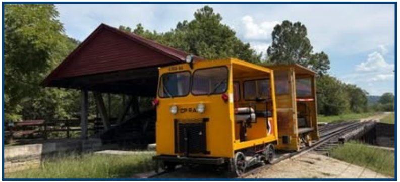
The Whitewater Valley Scenic Railroad volunteers started repairing the first four miles of track out of Connersville. They held a fund raiser Saturday and Sunday of Labor Day weekend in Metamora, Visitors could ride motoecars up and down the tracks for a suggested $10 donation per rider.
Outreach Events & Programs
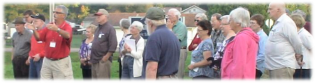
OLLI Members Learn About W & E Canal And visit Lock 47
Sam & Jo Ligget
Photos courtesy of Parker Ligget
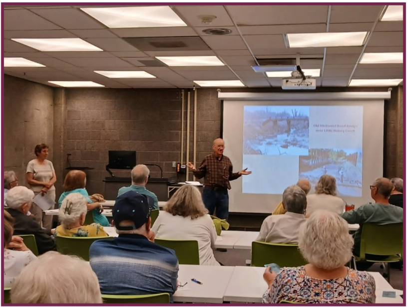
In July, Sam and Jo Ligget presented 2 sessions entitled “The Wabash & Erie Canal – The Story of Lock 47” for the Osher Lifelong Learning Institute at Indiana State University. Sessions were 1 1⁄2 hours in length, and there were 35 – 40 OLLI members who attended each. The first session was held on July 13 at ISU’s Cunningham Memorial Library and discussed canal routes of Indiana in general as well as the specific path the Wabash & Erie took through Vigo County. Attendees were given a packet with the Indiana canal route map, an explanation of lock operation, an article on why canals were built, and a list of locations of canal sites in Vigo County along with a map of the Riley area. Much of the information was provided by the Canal Society of Indiana as well as a replica of the Blue Dog canal scrip for each person.
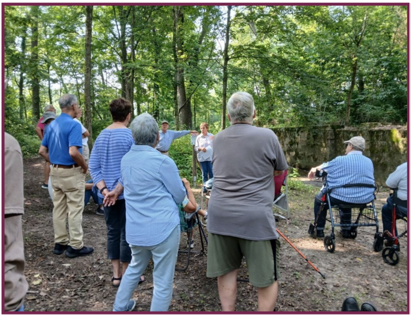
The new Lock 47 Park at Riley was the site of the second session on July 30. Participants toured the park and learned about Lock 47, other nearby canal structures, and John Logan and other people involved with the lock. Adam Grossman, Superintendent of the Vigo County Parks Department, and Natural Resource Programmer, Tavia Hedrick also attended, and Adam gave a few remarks about the park.
CSO Tour of Canals in Paulding County, OH
Carolyn I. Schmidt
On July 11, 2026 at 10 A.M. the Trustees of the Canal Society of Ohio met at the Paulding County History Museum. Members of the John Paulding Historical Society greeted them and served fresh fruit, donuts, coffee, etc. while they gathered before the meeting. Later in the day Neapolitan ice cream was also served.
Prior to the meeting of Trustees there was a tour of portions of the Wabash & Erie Canal and the Miami & Erie Canal led by CSI and CSO Director Jerett Godeke entitled “The Moribund Branch:” Antwerp, Ohio to Junction, Ohio following the Wabash & Erie Canal. Jerett had prepared an outstanding 23 page handout of the auto tour route, maps of the canals to be seen, pictures of the signs the J.P. Historical Society had erected where locks had been located and descriptions of them, pictures of the Six-Mile Reservoir complete with information about it, a description of the Reservoir War, etc. Since other CSO members were invited to attend this tour, we, Bob and Carolyn Schmidt, who live in Ft. Wayne, IN that is only an hour away, joined them.
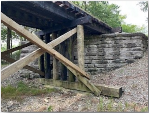
Jerett had led the Canal Society of Indiana on a similar tour, “Towpath to Warpath,” in 2024, but had not been able to take our larger group to the site of the railroad trestle. This was entirely new to Bob and myself. When the Wabash Railroad bridge was built across the Wabash & Erie Canal west of Antwerp, OH it impacted the watershed of the Six Mile Reservoir. Because of the height required for this bridge over the canal, the railroad grade to the east and west had to be built higher blocking off the normal water flow into Six Mile Creek, which fed the reservoir. Thus 1/2 of the water supply that previously went into the reservoir was then diverted into a culvert that went under the canal and ultimately into the Maumee River. In 1855 this left only the canal water coming from the St. Joseph River near Fort Wayne, IN via the canal to feed the reservoir. Jerett said, “This was the beginning of the end of the Wabash & Erie Canal.”
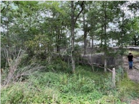
The other site new to us was Vial’s Lock on the Miami & Erie Canal. On our CSI tour we had missed it by taking a wrong turn. This time when we reached it Jerett noted that the sign the historical society had put there was missing. The tumble for the lock was near the road and a trail that had tree roots, tripping hazards and lots of chiggers led to the lock itself. The concrete structures were badly crumbling. Bob walked the trail to take pictures but I remained by the tumble.
Returning to Paulding a restaurant was chosen and we all went to lunch. We then returned to the museum for the meeting of the Trustees.
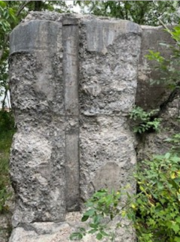
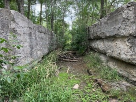
Sign Replaced Paulding County Ohio
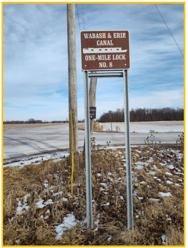
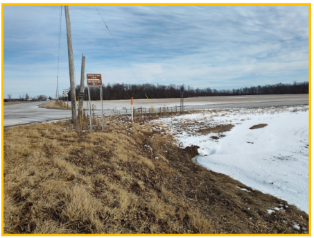
Prior to the Ohio Trustees meeting tour the sign at the Wabash & Erie Canal One-Mile Lock at the corner of OH-111 E & Road 143, Emmett, in Paulding County, Ohio had been replaced. Six of these very attractive signs featuring a canal boat had been placed by the John Paulding Historical Society shortly before CSI held its “Towpath & Warpath” tour there on August 17, 2024. These signs were purchased using money from the county’s windfarm mitigation funds.
Delphi News

New Hires
Although most of the Carroll County Wabash & Erie Canal Association is made up of wonderful volunteers, the past few years it has hired a director, Mike Tetrault. With Mike’s resignation, they now have two paid positions. CSI looks forward to working with these ladies.
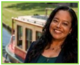
Miriam Castillo-Tovar has been hired as the new Executive Director of Wabash & Erie Canal, Inc. She has over 15 years of experience in leadership, business operations and development, community engagement, marketing, communications and creative development.
Yolanda Castillo-Tovar has been hired to work at the front desk in the Interpretive Center, schedule events, and support the Archives team. She has experience in Human Resources, has worked with WorkOne, and has a background in business management.
Park Improvements
The parking lot by the Canal Interpretive Center has been repaved and lined by Wetli Sealcoating. The project was made possible by the Community Foundation-Serving Howard, Clinton, and Carroll Counties.
Canal T-shirts Available
Four differently designed t-shirts in a variety of colors and sizes are not being sold in the museum gift shop. You have a choice of:
- Life’s Better On The Towpath: Wabash & Erie Canal Delphi, Indiana
- I’m Digging It Wabash & Erie Canal Delphi, Indiana
- 468 Miles Shovel By Shovel Wabash & Erie Canal
- Future Canal Engineer Wabash & Erie Canal
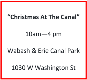
Upcoming Event
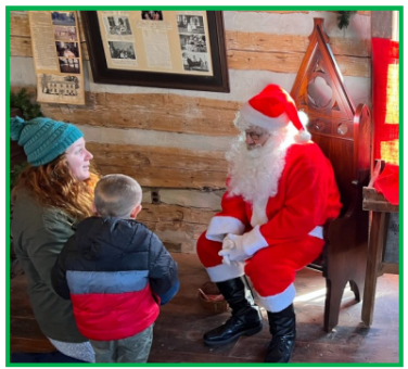
December 5, 2026
From the Whitewater Valley
Was Cedar Grove’s Odd Little Building Flooded?
“The Tumble,” CSI’s news and journal, was put on line at about the time of the disastrous floods in the Whitewater Valley. After reading the article about Cedar Grove’s Odd Little Building several readers wondered if the building had survived the floods. Julie Schlesselman was contacted and she said, “I don’t think the house was damaged in any way. I believe it was just the wooded areas around Cedar Grove and the campgrounds on the outskirts that were devastated.”
Plans For Whitewater Canal Celebrated
Prior to the destructive flooding in the Whitewater Valley, Cassie Garrett reported on Facebook about a meeting held on Monday July 27, 2026 in celebration of receiving funds and plans for the Whitewater Canal restoration. Little did she know that mother nature would soon intervene.
“Coming together is a beginning; keeping together is progress; working together is success.” — Henry Ford
A huge thank you to the Whitewater Canal State Historic Site for hosting such a wonderful celebration. Monday evening and for providing beautiful photos from the event.
What an incredible turnout! It was inspiring to see so many community members, state leaders, preservation partners and friends come together to celebrate the next chapter in Metamora’s story.
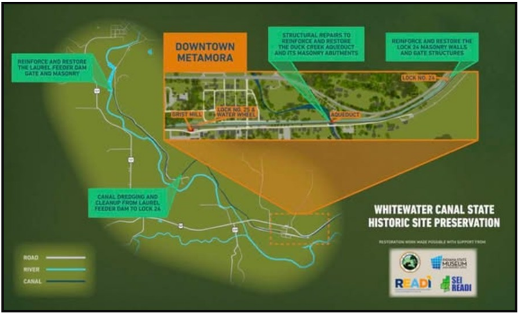
As shown in the site plan, the project will include:
Reinforcing and restoring the Laurel Feeder Dam gate and masonry
- Canal dredging and cleanup from the feeder dam to Lock 24
- Structural repairs and restoration of the historic Duck Creek Aqueduct and its masonry abutments
- Reinforcing and restoring the masonry walls and gate structures at Lock 24
As exciting as this restoration is, I’m just as excited about the opportunity it gives all of us. While this work is underway over the next couple years, we can continue making our own little corners of Metamora shine, supporting local businesses, improving our properties, welcoming visitors and working together to make this special place even better.
I’m so grateful to everyone who has helped make this once-in-a-generation investment possible, and I can’t wait to watch the work begin.
You can read more about Monday’s celebration and the restoration project in this week’s edition of the Brookville American.
(Site plan courtesy of the Whitewater Canal State Historic Site)
Canal Society of Indiana
News and Programs
Members’ Milestones
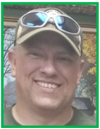
Preston Richardt, CSI’s webmaster, left for Georgia on July 17, 2026 to take on the position of Asset Protection Manager for Aurubis Richmond, in Augusta-Richmond, Georgia. Copper recycling is this company’s main product. Congratulations and best wishes Preston!
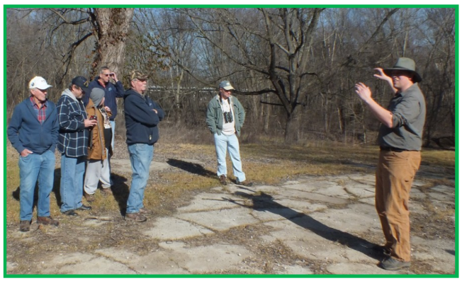
Besides being CSI’s webmaster, Preston has led tours of the Wabash & Erie Canal at Dongola and the Patoka Aqueduct for both CSI and the local community, written articles for “The Tumble,” built a model of an aqueduct, brought a drone to CSI tours to take pictures of the canal, and done many hikes locating canal sites.
Luckily for the Canal Society of Indiana, Preston has agreed to continue as our webmaster keeping it updated and putting “The Tumble” on line. We wish him luck in his new job. We will miss him in Indiana.
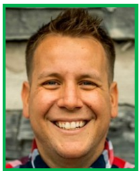
Mike Tetrault, CSI Director, formerly Executive Director of Carroll County Wabash & Erie Canal,
Inc. in Delphi, IN, recently accepted an offer for a job with Salesforce in Indianapolis and began
this new role in July. Mike supplied all the information about what was happening in this
Delphi association, Canal Park, etc. for our CSI on-line publication, “The Tumble.” We will need
our members help to notify Carolyn Schmidt at indcanal@aol.com of this organization’s news.
Mike will continue to be a CSI member. We congratulate Mike on his new position and wish him well. We’re sure everyone in Delphi and throughout Indiana will miss him, his ability to post videos and history of the canal on their website, his reprint of Indiana Canals and his innovative ideas at Canal Park.

Memoriam
Don Haack

Don Haack of Fort Wayne, Indiana passed away on September 26, 2026 at the age of 86. He was born on November 30, 1939, in Milwaukee, Wisconsin. By the age of 10 he had lost both of his parents and grew up at the Norris Foundation Boys School in Mukwonago, Wisconsin. While there the nuns noticed that he was smart and a leader. They gave him many responsibilities and prepared him to be accepted by a college before he graduated from high school in 1957. He went on to earn his Bachelor of Science in Civil Engineering from the University of Wisconsin in 1962. Through ROTC he was commissioned and proudly served two years with the U. S. Army Corps of Engineers in Korea, Thailand and Norfolk, Virginia, and later completed his Active Reserve duty as a Captain in Milwaukee.
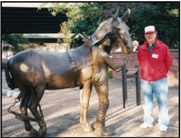
on CSI’s tours of the Erie Canal in 2003.
Don married Betty Jean Christman on February 19, 1966 at St. Jude’s Catholic Church in Fort Wayne, IN. They made a home for their two children in Wauwatosa, Wisconsin. Don devoted his entire 34-year-career to the Wisconsin Department of Transportation as a Highway and Bridge Construction Project Engineer in the Milwaukee area, retiring in 1996. Don and Betty moved to the Christman Family Farm in Pleasant Township, south of Fort Wayne in 1998.
Don had many lifelong interests. He was a Boy Scout and a member of the Order of the Arrow at Norris, belonged to the American Society of Civil Engineers, and served on the Canal Society of Indiana’s Board of Directors for 16 years (2004-2019). He and Betty not only attended many CSI events, but also could be counted on every 4th of July to work at Delphi’s Canal Park for the Carroll County Wabash & Erie Canal, Association.
He was also a members of the Indiana Covered Bridge Society and several collecting and historical societies. He enjoyed mowing his yard and the farm’s roadsides, cheering on the Wisconsin Badgers and Green Bay Packers, rooting for the Wauwatosa East High School Raiders, tracing his genealogical history, going to auctions, and collecting thousands of postcards.
Don was preceded in death by his parents, Esther (Brandenburg) Haack in 1949 and Paul Irvin Haack in 1950, and by his brother, Orville Arthur Haack, in 1935. He is survived by his wife, Betty; his daughter, Cheryl Fluhr of South Carolina; his son, Bradley Haack, and Bradley’s partner, Christine Wember, of Wauwatosa, Wisconsin; his granddaughter, Parker Fluhr; his grandson, Gabriel Haack; his brother-in-law, Thomas Christman of Fort Wayne; and many cousins in Wisconsin and New Zealand.
Elzey-Patterson-Rodak Funeral Home in Fort Wayne, IN was in charge of arrangements. A celebration of Don’s life will be held at a later date, when his ashes will be laid to rest beside his brother at Valhalla Cemetery in Milwaukee, Wisconsin.