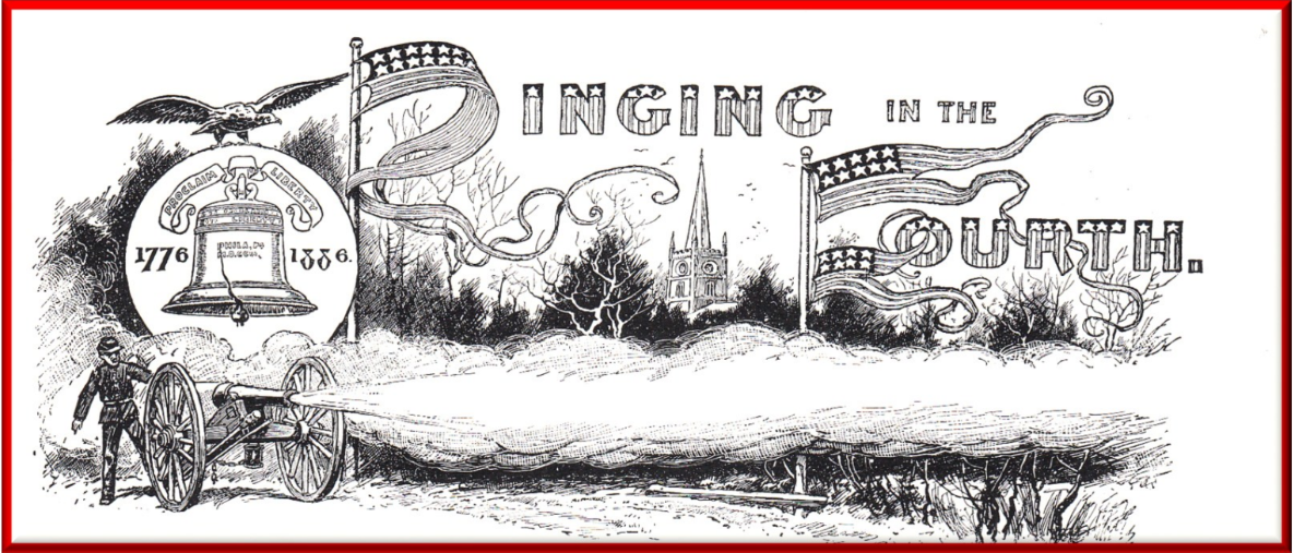
This year we celebrate the 250th anniversary of the signing of the Declaration of Independence on July 4, Since that day it has been celebrated annually as a special day to commemorate the founding of our country. During the canal era July 4th became a traditional time to celebrate special events such as ground breaking or opening of new canal sections.
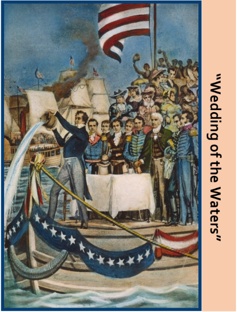
The Erie Canal set the tradition by breaking ground at Rome, New York on July 4, 1817. In the fall of 1825 the canal was finally completed after 8 years of struggle. New York Governor DeWitt Clinton did not want to wait another 9 months to celebrate so he selected October, 1825 as the time of final commemoration. A flotilla of boats with Clinton aboard the “Seneca Chief” worked its way on a 10 day journey from Buffalo to New York harbor, where the “wedding of the waters” ceremony was held on October 26.
Neighboring Ohio, brought Governor Clinton to Newark, Ohio on July 4, 1825 to break ground on the Ohio & Erie Canal that was planned to cross the middle of the state from Cleveland to Portsmouth on the Ohio River. A little over two weeks later on July 24th, Governor Clinton was at Middletown, Ohio to again break ground for the Miami Canal from Dayton to Cincinnati.
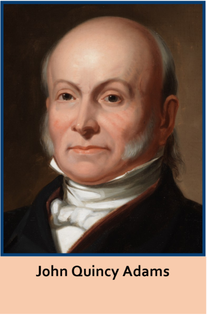
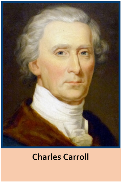
The precedent had now been set for a ground breaking date. On July 4, 1828 President John Quincy Adams dug the first shovel of dirt for the Chesapeake & Ohio Canal near Georgetown in Washington City. Not to be preempted by a canal, the Baltimore & Ohio Railroad had its ground breaking on the very same day in Baltimore, Maryland. There, 91 year old Charles Carroll who was the last living signer of the Declaration of Independence, did the honors. So with all this precedent of celebration for canal ground breaking, why did Indiana choose February 22, 1832 to break ground in Fort Wayne for the Wabash & Erie Canal?
The federal legislation enabling the Wabash & Erie Canal was established by law on March 2, 1827. One of the provisions of the law stated that work on the canal needed to begin in 5 years from the date of enactment. Indiana had taken-up most of the 5 years just debating on accepting the land grant. Some felt a railroad should be built versus a canal. George Washington had suggested a canal connecting the waters of the Wabash and the Maumee rivers years earlier, so what better day than the 100th anniversary of his birth in Virginia in 1732.
Jordan Vigus, a canal commissioner from Logansport, was selected to break ground in Fort Wayne for the Wabash & Erie Canal. He was the first mayor of Logansport.
Indiana did not give up on canal celebrations for the 4th of July. The first time that date was used was on July 4, 1835 when the “Indiana” and two other boats brought citizens from Huntington to celebrate the opening of the first 32 miles of canal. The celebration proceeded to the Wabash & Erie’s Canal’s St. Joseph Feeder Dam, where a picnic was held and the Declaration of Independence read. Also, later on, a grand celebration was held in Fort Wayne on July 4, 1843 on the grounds of today’s Swinney Homestead.
Soon the 4th of July had really caught on as a canal celebration day. In 1837 a celebration was part of a race between the “Prairie Hen” and the “Indiana” as to who could be the first to reach the town of Wabash.
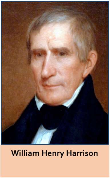
Indiana was not alone in celebrating canal accomplishments. At Piqua, Ohio on July 4, 1837 a parade was held, led by a unit of cavalry. There were political speeches and fireworks. The next day William Henry Harrison arrived from Troy, Ohio with 50 more “buckeyes” on the “Emigrant.” This was the first packet boat to arrive at Piqua from Dayton.
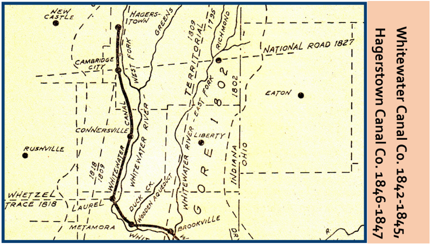
The citizens of Cambridge City, Indiana really got caught up in canal celebration mania. A Whitewater Canal company had just been formed with the promise to extend the Whitewater Canal from Brookville to the National Road. Although a few days late, on July 28, 1842 the locals had a grand party even before they had started to build the canal extension. Ten thousand people attended the barbeque.
Today, we celebrate the 4th of July with parades and picnics. I don’t believe the Declaration of Independence is read aloud anywhere at these events. We don’t associate the day with either canals, railroads, or even interstate highways. It was different in the 19th Century when “Huzzah! Huzzah! Huzzah!” was a frequent cry on these occasions.
A “string-town” is a number of dwellings, which provide shelter, arranged in a linear way along a river, canal, road, railroad, etc. During canal days it was basically a fancy name given to a shanty town.
Stringtown Along The Wabash & Erie Canal
In 2013 Nancy R. Heller published a book entitled Historic Preservation in Indiana; Essays from the Field. On pages 113-114 she tells about building the Wabash & Erie Canal during the cholera epidemic and the poor housing conditions for the workers between Hosmer and Francisco, across the Patoka Bottoms, and through Dongola, Indiana as follows:
“Housing was crowded and unsanitary. Laborers mostly lived in flimsy “boarding shanties,” ranged together “like string towns” along the canal. The largest of these shanties were eighty feet long, with bunks for fifty or more. One source estimates there were at least a hundred boarding shanties in the Patoka watershed between Hosmer and Francisco. Shanty towns were serviced by “doggerys,” where local entrepreneurs “supplied the thirst with Patoka water and whiskey mixed.” The section of the canal that ran across the Bottoms and through Dongola was an especially busy one, employing a larger than average number of men and resulting in a larger than average concentration of “drinking dens” along the river.
“After three years, three cholera epidemics, and hundreds of lives lost constructing it, the Wabash and Erie Canal through the Patoka Bottoms entered into its fitful seven-year run of “full operation.” The canal was opened for navigation through to Evansville in late September 1852. From the very start, the southern division of the canal more than fulfilled its detractors’ worst predictions. It was a stunning investment failure. During its first two years of operation shipments of merchandise on the canal as a whole decreased by over 50 percent due to railroad competition. North of the Patoka, vandalism at the Birch Creek reservoir in Clay County disrupted navigation southward for the summer and fall in both 1854 and 1855. By 1856, expenses for repairs and maintenance of the canal were exceeding revenues. In the same year, the trustees undertook the labor of clearing the offending Clay County reservoir of timber, which put the southern division out of commission for another year. In November 1858, a year in which navigation south of Petersburg had been suspended more than 113 days due to breaches in the line above Petersburg, the bondholders resolved to “stop the working of the Canal south of Terre Haute.” In the same report, the list of structures requiring repair includes the Patoka aqueduct with its guard gates, newly completed only six years before.”
The contractors provided these shanties to house the laborers. As the canal line progressed, I , Carolyn Schmidt, presume it was the laborers who took them down and rebuilt them along the extended line under the orders of the contractors before resuming the task of building the canal prism or structures.
Stringtown Along An Old Indian Ridgeline Trail
Stringtown was also mentioned by Joseph Peter Elliott on page 19 of his 1897 book A History of Evansville and Vanderburgh County, Indiana as follows:
[David M. Schnee went as far as Evansville with his father, where his father was to take a steamboat up the river and David was to lead the horse back home.]
“We started out on what at that time was called the New Harmony and Boonville road. The Blairsville road was not then laid off. We struck the old Vincennes road near what was called Stringtown, about five or six miles from Evansville, where we stopped about an hour talking with one of father’s old friends by the name of Stacer, the father of Clint and Conrad. We then went on to town, where we arrived toward evening and put up at a tavern on the corner of First and Locust streets, where the People’s Theater now stands. I believe it was the only tavern in the town at that time. The first man father met on arrival whom he knew was General Evans, who was on the tavern porch with a pipe in his mouth, talking politics with half a dozen or more loungers. The subjects were Henry Clay, his favorite, the Whig leader, and Andrew Jackson, the popular president of the Democratic party—these were the ones mostly talked about. Father and the General appeared to be well acquainted. Uncle John Schnee, father’s oldest brother, had married the General’s sister, Miss Nancy Evans, about the year 1828. He died I think in 1829. My father died in the year 1838.
“I did not see very much of a city on that trip, as there was not much of a town to see. A block of one-story frame store rooms on Locust, between First and Water streets, appeared to be the principal business part of the town. They were painted a brown red.
“A few years after this—in the years 1836-7-8—the town had quite a boom, when the terminus of the Wabash and Erie canal was located there and a branch of the State Bank was established in its limits.
“In the fall of 1839, at the age of nineteen, after my father died and I had become a permanent cripple, I, with my brother Luther, (who was my guardian) visited Evansville for the purpose of getting me into some saddlery shop to learn that business, for I had taken a liking to it. That was the time which brought you, Mr. Joseph P. Elliott, and me, David M. Schnee, into more intimate relations. We then and there made a contract, which was that I was to serve or work for you in the saddlery shop for three years and you were to teach me the trade and furnish me with board and clothing during the time—all of which was carried out fully and satisfactorily on the part of both of us. This, of course gave me residence in Evansville in the years 1839, 1840, 1841, 1842, and part of 1843. This also puts me in mind that the other day I was looking over some of my old papers, and I came across my indenture, which was the contract between us.”
Stringtown Road in Jackson Township, White County, Indiana
Stringtown was again mentioned in W. H. Hamelle’s A Standard History of White County published in 1915 on page 479 in the biography of Robert McWilliams as follows:
Robert McWilliams, son of David and Martha Hamilton McWilliams, was born in Knox County, Ohio, October 1, 1819, and died on his farm near Idaville in 1892. In 1840 [1845+] he came on a canal boat from Dayton, Ohio, to Logansport [Indiana] to visit Robert Ginn, on which occasion he bought a farm northeast of Idaville, but returned to Ohio and pursued his trade of wagonmaker for fourteen years, when he came back to Jackson Township, lived for a year on the Stringtown Road, and in 1855 located on the farm which he owned until his death. He was married three times, first to Emily Jones on July 1, 1847, who died June 4, They had one son which died in infancy. On December 26, 1850, he married Mary Jane Jacoby, and to this union was born seven children, Emily, wife of Daniel S. McCall; John, who died at the age of twelve; Martha, who married David Hess; Peter, who died in his youth; David, a farmer in Illinois; Henry and Robert, Jr., of California. His second wife died January 17, 1870, and on September 5, 1871, he married Elizabeth McCall, who died childless, about 1898. Mr. McWilliams was a republican, but no office-seeker. In 1874 he was the republican candidate for trustee of Jackson Township, being defeated by one vote in that democratic stronghold. About the year 1868 he united with the United Presbyterian Church at Idaville, of which he was an active member until his death. He was a man of deep and positive religious convictions and active in upholding all that was for the good of the community in which he lived.” Jackson Township is on the eastern side of White County. He lived along the road that goes from Logansport to Monticello, Indiana U.S.24. I do not know why it was called the stringtown road —Railroad related? The Toledo, Peoria, and Warsaw railroad passed through Idaville. He then moved to his farm near Idaville.
Stringtown Mines Were Near Snoddy’s Mill At Coal Creek
Coal was a major commodity hauled on eastern canals and also on the Wabash and Erie until the railroads took over. Elmer Griffith Sulzer in Ghost Railroads in Indiana published in 1998 under the title “Pioneer Collieries on the Wabash” talked about two railroads—Coal Creek to Bismarck Junction (Illinois) and (Chicago & Eastern Illinois Railroad) as follows:
Sources: Collett, John. Indiana Department of Geology and Natural History: 11th Annual Report. Indianapolis, IN: Wm B. Buford, State Printer, 1881.
Broen, R. T. Map of Fountain County, Indiana. 1881
“The first large scale attempt to mine coal in Indiana north of the Wabash River took place in Fountain County shortly after the Wabash and Erie Canal was finished in 1846. Near Snoddy’s Mill adjacent to Coal Creek a sizeable coal mining operation developed, known as the “Stringtown Mines”.
“The Chicago, Danville & Vincennes Railroad was interested in building to Brazil [Indiana] in order to tap the coal resources enroute. Rail laying on the Fountain County Branch (or Indiana Division) started the second week in June, 1872, and by August ten miles of line had been completed from Covington to the Coal Creek area. In July, 1878, the entire 24 mile branch from Bismarck Junction, Illinois, to Coal Creek was completed and opened to traffic.
“The Chicago & Eastern Illinois Railroad succeeded the CD&V, and decided that the 15.62 mile portion of the Indiana Division between Covington and Bismarck had become a sort of white elephant. Hence, operations over this segment were discontinued June 15, 1879, and the following years the track was taken up.
“Trackage rights between Danville, Illinois, and Covington were secured over the Indiana, Bloomington & Western Railway (now the Peoria & Eastern Railway) so as to provide a connection for the remaining 8.38 miles of the Branch between Covington and Coal Creek.
“However, shipments from the Snoddy’s Mill mines progressively declined and labor troubles added to the woes of the mine owners. Finally, in 1888, the tracks between Covington and the Coal Creek area were removed, thus spelling the end of the Indiana Branch.”
Here “stringtown” refers to the dwellings along the railroad and W & E canal that took the coal from the mines.
Stringtown Is Visited Near Snoddy’s Mill Mines
CSI past director, Terry Bodine, wrote the following article about Stringtown and Snoddy’s Mill mines in 2011:
“In 1881 it was estimated that there were fifty-one miles of railroads in Fountain County. The estimated cost of construction of these was $2,780,585.00.
“For a great many years Fountain County citizens were almost wholly dependent upon the Wabash & Erie Canal for transportation, but with the building of the railroads, the canal began to decline and finally was entirely abandoned as a line for transportation (1875). And, at this time, a railway was constructed upon its towpath from Attica southward to Covington (1881). This railroad was called the Attica & Covington and was owned by the Wabash Railroad.
“It was estimated that 300,000 tons of coal was mined annually in the area surrounding Snoddy’s Mill in Stringtown, Indiana before 1872. The only major way of transporting this coal was to haul it down to Vicksburg on a wooden tramway pulled by horses or mules and load it on canal boats. After 1872 it could be shipped on the new railroad called the Chicago, Danville & Vincennes.
“About 1842 excavation for the Wabash & Erie Canal began in Lafayette and by 1846 was finished to Covington. The Indianapolis, Bloomington & Western Railroad was built through Covington in 1869 and like the above-mentioned CD&V Railroad, it also had a bridge above the canal both having to clear the water channel and the towpath without obstructing the activity on the canal. Each intersection of these required the railroads to bridge or span the clearance needed by the canal. The portion of the CD&V Railroad that crossed the canal became obsolete in about 1875 with the loss of the trestle bridge over the Wabash River. The line was relocated south of Covington by using the IB&W track to Danville, IL. And north to Chicago, IL.
“On 3-17-11 Guy (Finny) Filchak, Don & Clayton Bodine and I, Terry Bodine along with John Grubbs (who owns the property), visited the site where the CD&V Railroad and the Wabash & Erie Canal crossed. The site is very much the same as when the railroads and canal ended operation. The Attica & Covington Railroad ran on the towpath until the 1930s and due to the automobile, it went out of business. The canal and railroad grade is very well preserved. Nothing has changed the profile of either the canal or the railroad. We measured the distance that the CD&V would have to span the canal and took several pictures. We also visited the location where the IB&W Railroad crossed the canal. This area is hard to locate as the canal is in swampy ground and the grade is filled in where the span crossed the canal. This is located on the southwest edge of Covington.”
Photos by CSI member Guy (Finny) Filchak (1942-2020)Looking s at CD&V Grade with W&E Canal on rightLooking S toward Covington, concrete post likely put up by A&C RRLooking NW with Terry standing on towpathStanding in W&E Canal looking NW at Grade remains behind towpath that later carried A&C RailroadLooking SE from top of CD&V GradeLooking SE from berm with CD&V Grade on left with water in the pit that furnished soil for the GradeStanding in field looking SE at CD&V GradeStanding on towpath looking South towards CovingtonOn berm looking NW at CD&V GradeStanding in Canal looking N with CD&V Grade on rightStanding in W&E bed looking N with CD&V Grade on rightLooking South down W&E Canal prismLooking E toward elevated GradeLooking S down Canal prismW & E Canal prismTelegraph cross armWabash & Erie Canal prismWabash & Erie Canal prism
Stringtown Is On The West Side Of White River In Indianapolis
David J. Bodenhamer and Robert G. Barrows mention Stringtown on page 133 in their 1994 book The Encyclopedia of Indianapolis as follows:
Today, Stringtown is a westside Indianapolis neighborhood roughly bounded by Michigan, White River Parkway, Washington and Belmont streets.
“Transportation improvements provided the stimulus for the growth of Indianapolis. After 1825, when legislators attempted to travel to the new town, they realized the need for improved overland transportation and approved funding for a network of new roads in central Indiana. New roads attracted new settlements, Augusta and New Bethel (now Wanamaker) began as way stations on the Michigan Road. Even prior to its completion through central Indiana in 1838, the National Road contributed to the development of Marion County. When the survey route was announced in 1830 entrepreneurs established a number of towns and villages along the right of way, including Cumberland in Warren Township, Bridgeport in Wayne Township and Stringtown on the west bank of the White River.
“More ambitious transportation projects in the 1830s and the 1840s promoted new settlements in rural Marion County and spurred new connections with Indianapolis. Construction on the Central Canal, abandoned after 1839, led to establishment of Broad Ripple at the canal’s northern terminus and the development of an industrial district on the near west side that was home for many immigrants and African-American citizens. The growth of railroads after 1847 prompted the establishment of new depot towns in rural Marion County. Acton, Castleton, Lawrence, Oaklandon, and New Augusta appeared even as the tracks were extended through the county in the 1850s. Other railroad towns, among them Nora and Malott Park, developed later in the 19th century.”
Steven R. Barnett reports on August 26, 2021 in an article entitled “From Cottontown to Vinegar Hill-Indy’s Old Neighborhoods” that:
“The coming of the National Road through the city [Indianapolis] and a bridge across White River, stimulated development along the road west of the river. One early platted area was called Indianola, but because houses were ‘strung out on both sides’ of the National Road, the neighborhood was given the nickname Stringtown. Despite the efforts of residents to have their community recognized by its platted name, the nickname stuck and Stringtown remains the name of the near west side Indianapolis neighborhood. [The Central Canal is on the east side of the White River.]
Cathleen F. Donnelly in a February 2021 article entitled “Stringtown: Westside neighborhood” said that:
“In 1833, the National Road and bridge were extended to the west bank of the White River. Reportedly, a string of homes sprang up along the road giving the area its name. Stringtown was an agricultural community until the railroads located shops and rail lines there in the 1870s. Then German and Irish immigrants who worked for the railroads built modest, single-family cottages…on the narrow lots.”
The community was annexed by Indianapolis in 1897. Unfortunately, in 1913 the levee broke and a huge flood devastated Stringtown, the Germans and Irish moved out, white Protestants from the American South found work in the Evans Flour Mill and moved in to purchase or rent what homes were left.
Other industries arose and provided more jobs for awhile. They eventually shut down and by the 1970s only about 4,500 people lived there. These folks were replaced by White River State Park and the Indianapolis Zoo. By the year 2000 only 2,000 people lived there. There have been proposals for developing the area with apartments, townhomes condominiums and retail shops.
The route of the Wabash and Erie Canal was changed to run to Evansville, Indiana. Since it had been completed from the Indiana/Ohio state line to Terre Haute and a 20 mile portion of the Central Canal has been completed northeast from Evansville, it was decided that these two portion of canal could be made into one great canal by joining them together with a 42-mile-long Cross-Cut from Terre Haute to Worthington.
Prior to 1849 Point Commerce was a thriving town on the northwest side of the White River. Rumors were heard that it was the proposed junction of the Central Canal and a planned Cross-Cut Canal. Two of its influential business men, William C. Andrews and Christian J. Barrackman, purchased several hundred acres of land just west of it. They were ready for the announcement on April 1849 that siad the Wabash and Erie Canal was to be completed and rerouted. They hire a surveyor and platted out 94 lots on both sides of the canal’s route. Since Mr. Andrews had come from Worthington, Ohio, he named his new town Worthington in its honor.
The new route of the Wabash and Erie Canal passed through Greene county where Worthington now stands. It was completed through the county during the years of 1849-1850. It ran north to south as described in the History of Greene & Sullivan Counties published in 1888 as follows: “Entering the county at Johnstown, thence down to Worthington; thence along the west side of the river to Newberry, where a dam was built and the river crossed; thence southwestwardly into Daviess County.”
The canal was dug in the standard way of the time. Men with money contracted to build sections of the canal. Irishmen provided the labor using spades, shovels, picks, wheelbarrows, one-horse carts, and sometimes scrapers.
The citizens of th county awaited the opening of the Wabash and Erie (Cross-Cut) portion of the canal. There was a great celebration in 1850 when the first canal boat the “Aeolus” arrived carrying passengers from Terre Haute. Quite a few of the citizens from Greene county went to Terre Haute to ride the boat to Worthington. Others took a “grand excursion” up the canal to Terre Haute from Worthington when regular canal boat traffic was opened to the north in 1850.
By 1853 the Wabash and Erie Canal was opened all the way to Evansville. The owner of the iron furnace, Andrew Downing, owned two canal boats on which he shipped his iron products to Evansville. He was also a merchant in Bloomfield. His canal boats captains were Paul Thompson and his brother, Alexander Thompson. One of Downing’s boats was wrecked at the Richland cut-off where its remains were imbedded in the canal bank.
Other boats were owned by Start & Co., Worthington flour merchants, and by Peter C. Vanslyke, Bloomfield shipper of grain and other products. Vanslyke started his small horse mill in Bloomfield to supply meal to his Distillery, which had a production capacity of twenty gallons a day. He had two canal boats named the “John H. Eller” and the “H. T. Ford”. The “Ford” was said to be a very rapid sailer.
Even though there were six locks on the Wabash and Erie Canal in Greene county to control the water levels, heavily loaded boats could not use the canal in this area. There simply wasn’t enough water available to maintain the proper depth of water to float them.
From 1851 to 1859 business on the canal was fairly good. The canal system operated from Worthington south to Evansville for about 6 years and from Worthington to the north for about 10 years. Then it was almost abandoned. At various times they tried to revive it. It did some business until about 1863, but it could not be depended on. It soon became an eyesore and was regarded as a nuisance. The upkeep on the canal was too expensive. But it must be remembered that the canal is why Worthington was originally built.
The 1850 Census for Greene county contains the names of many of the canal laborers and others associated with the canal and their ages. They are either working in Cass or Jefferson townships at that time. Some are listed as Canaling, Canal Labor, and Laborer. The spelling of the names my have been spelled incorrectly by the census takers and they are to difficult to read. The ages may help genealogist find their ancestors.
Note: Workers’ Ages 15-25 (38), 26-35 (60), 37-47 (21), 48-59 (5), 60-75 (2) Use of first names: Patrick-18, John-17, James-11, Michael-9, William-9
Canal Superintendent
Callahan, Lawrence (24)
Havalin, John (34)
Superintendent of Hands
Callahan, Lawrence (24)
Canal Contractor
Aydelott, James R (38) Ferrell, Patrick (29) Parker, David (39) Ragan, Matthew J. (29)
Canal Clerk
Rouss, Smith (28)
Canaling
Craig, Aaron (24) Parker, Samuel (36) McAndre, Patrick (60) Miller, Issac (29) Tomlin, George (35)
Canal Labor/Laborer
Adam, Patrick (33) Ahlore, Patrick (20) Alvor, John (35) Arty, Patrick (30) Ash, Thomas (25) Bany, John (35) Barret, John (30) Berlin, Andrew (20) Blackburn, Robert (21) Braedy, Cornelius (27) Bresmahan, Cornelius (36) Burke, Michael (35) Burns, Thomas (30) Cain, John (30) Cain, Michael (30) Calagh, Daniel (40) Callahan, Patrick (30) Calay, James (45) Campbell, Thomas (15) Cannon, Patrick (75) Casey, Thomas (25) Cochran, Patrick (30) Collins, James (35) Collono, James (35) Colamal, James (16) Cooke, Lawrence (52) Cooper, William (32) Cox, Absolom (22) Craft, Bejamin (18) Craft, John R (43) Cray, Aaron (24)
Croluk, David (29) Crossley, Robert (33) Dean, Herald (30) Durgan, Jeremiah (35) Eads, Pleasant (16) Eads, Seth (23) Eriny, John (35) Fahee, John (26) Fleming, James (40) Flinn, Michael (37) Foltz, Adam (26) Force, Henry (35) Frier, Thomas (24) Fritz, Samuel (16) Fuller, Barton (35) Gadberry, Wilson (33) Galagan, Daniel (40) Galloway, James (33) Galsher, Patrick (20) Golden, Timothy (32) Greer, Thomas (24) Hamerly, John (44) Hamilton, Andrew (48) Hartley, Barton (16) Hartley, John (27) Hayes, James (18) Hayes, Philip (43) Hemin, Moses (30) Henry, David (32) Hogans, Charles (50) Hulohan, Cornelius (35) Jemel, Jefferson (22)
Jemel, William (41) Karler, Patrick (32) Kelly, Matthew (30) Kennedy, Marlin (28) Langton, Michael (30) Long, Michael (?) McAndre, Anthony (19) McAndre, Edward (20) McAndre, Patrick (60) & (19) McCain, Michael (30) McCarty, William (21) McClery, Johathon (31) McDonald, Henr;y (40) McHalley, Patrick (21) McHenry, Patrick (23) McKenny, Patrick (23) McLaughlin, Patrick (35) McMahon, Terrence (24) Maloney, William (45) Marelhay, Andrew (28) Miller, Issac (24) Monaham, Patrick (31) Muligan, John (32) Muligan, Thomas (22) Mullin, John (40) Muir, William (24) Murphy, Joshua (36) Narland, Dennis (50) Nugent, Michael (22) Pool, Oliver (22) Prindelbble, John (40) Proctor, Joshua (19)
Purday, Daniel (25) Purdy, William (25) Ragan, Thomas (39) Riam, Michael (40) Rider, Samuel (33) Riley, James (27) Riley, John (52) Riley, William (15) Risler, Samuel (33) Rollands, Edward (30) Ryan, James (40) Ryan, Michael (45) Sheek, Cornelius (56) Shemebau, William (?) Sherman, William (32) Stewart, Daniel (38) Stewart, John (16) Tarbor, Josiah (43) Thompson, John (18) Thompson, Robert (32) Tohay, Patrick (25) Tomlin, George W. (35) Toree, Henry (35) Tracy, William (18) Trussey, Martin (25) Welch, James (28) Welch, Steven (25) Whalen, James (31) White, Andrew (37) Zoohry, Patrick (25)
At age 80, George H. Denny decided to write a book about growing up in Indiana and included his adventures on the Central Canal in Indianapolis. It is entitled The Dread Fishwish and Other Tales and was published January 1, 1975. In it he gives a young boys perspective of living near and playing on the Central Canal and how it changed from 1915 to 1947.
George’s family lived in southern Indiana before it became a state. He roamed the woods from early childhood. His father was a lawyer and avid sportsman. He instilled a respect for wildlife, the camaraderie of sportsmen, and the ethical standards of the sport into George.
The Denny family moved to Indianapolis and lived only a five minutes walk from the Central Canal. In one of his stories simply entitled “Canal” he recalls fishing and skinny dipping with his friends in the canal on a pleasant day in 1915. The water company owned the canal from Broad Ripple dam, north of the city, down to the settling and purification ponds near the heart of the town. The youth of the area enjoyed skinny dipping in the canal. To enforce a no swimming rule the water company hired a guard to walk the towpath. George said the boys could spot the guard coming down the towpath in plenty of time to dress and scatter.
One summer George’s father gave him a fly rod. On Sunday he hurried down to the canal to try it out. While attempting to learn how to use the weight-forward fly lines, which were new at that time, he rigged up a small hair frog and worked it just outside the weeds along the canal bank. He was excited when a small mouth bass took the bait. The fish was just under fifteen inches long and fought hard. At the height of this struggle, services were ending at the church just across the street from the canal. Soon he had an audience.
One man came out and told him to stop fooling around with that fish and pull it in. George assured him that he was doing his very best. It took several more minutes before the bass gave up. George later said it was the best fish he ever hooked in the canal.
George said that “jugging” was the best fishing sport he and the other boys had on the canal. They would rig up a dozen or so glass jars with weighted lines and hooks, bait them, throw them in the water, and follow them as they floated down the canal. They worked from the banks on both sides of the canal watching until a fish took the bait and was trapped. Then they retrieved the bottled fish. Unfortunately the water company guard discovered what they were doing and marched them home by the ear.
The water company crews kept the towpath bank clear of weeds and bushes prior to World War II. However, during the manpower shortage caused by the war, the banks were not trimmed. When he went back to the canal in 1947, the towpath and banks were nearly impassable. The vegetation was shoulder high in some places and hung out two or three feet over the water.
Today fishing is allowed on the Central Canal, but it is important to check the latest regulations and guidelines before out. You can find detailed fishing regulations and information on the Indiana DNR website. Additionally, you can explore specific fishing spots and reports related to the Central Canal through fishing apps. Always ensure you have the necessary fishing license and adhere to local regulations for a safe and enjoyable fishing experience.
George H. Denny was born and raised in Indiana. He attended Wabash College in Crawfordsville, Indiana where he majored in Zoology and English. He began his outdoor career at the age of ten and was a devoted sportsman. He was the outdoor columnist for the “Indianapolis Star” for many years and during the “Thirties” was a frequent contributor to Field and Stream magazine. Later his articles appeared in The Fly Fisherman magazine. After retirement he lived in his hometown of Indianapolis.
This is the first of a series of articles originally published in the Canal Society of Indiana Newsletter between March 2001-April 2002.
In The Pig-inning…
Several sow-sand years ago, between 750 and 1000 A. D. the first domestic swine were introduced to Hawaii by Poly-nesian settlers.
Introduction: “So you’re new here, what tribe are you from?” (loosely translated)
“Grunt.”
“Oh, I have a neighbor from that tribe.”
Columbus brought the first Old World pigs to the “New World.” a lame moniker we are still trying to live down in the “new Age,” which came long after the “New Deal.” At the dawn of the seventeenth century, which is the early 1600s regardless of what your commissioners call it, European colonists began arriving on American shores in droves with, you guessed it—their livestock!
The Indiana Historian, Indianapolis, IN: Indiana Historical Bureau. August 1994, vol. 7027 p. 3
Carmony, Donald F. Indiana 1816-1850 The Pioneer Era. Indianapolis, IN: Indiana Historical Society, 1998 pg 58-59
The 1767 French census of Vincennes included 295 hogs among the inhabitants. “Hogs of the “Razorback” variety could be obtained from the Indians, or sometimes be found wild in the woods.” They were known as “elm-peelers,” “wind splitters,” or “tonawandas.” Hogs efficiently and effectively adapted to their inhospitable environment. A mature hog was a formidable opponent. In a pack, they would attack and kill a bear. “They could do almost any thing except climb trees.”
Carmony, Donald F. Indiana 1816-1850 The Pioneer Era. Indianapolis, IN: Indiana Historical Society, 1998 pg 58-59
(The swine) “were long and slim, long-snouted and long-legged, with an arched back, and bristles erect from the back of the head to the tail, slab-sided, active and healthy…He was capable of making a heavy hog, but required two years or more to mature, and until a short time before butchering or marketing, was suffered to run at large subsisting mainly as a forager, and in the fall fattening on the mast.” What a contrast between the hogs of that period and those of 1884. Probably no change wrought in the stock of the farmer is so marked as in this animal. Those of today mature early and are almost the reverse of the “razor back,” having a small head, small ear, short neck, with a long body and hams, and in general shape are almost square, and are capable of taking on 250 pounds of flesh in eight or ten months.”
History of Fayette County, Indiana. Chicago, IL: Warner, Beers & Col, 1885 pg 80-83
Hog wild…
“Many hogs ran wild, and even the tame ones were extremely fierce. Thomas Holder Sr., had a large lot of hogs, and one day a powerful panther attacked some of the pigs, when the older hogs, including several fierce boars, treed the “varmit” onto a large log, where he thought he was safely out of reach of his porcine foes, but he had made no calculations for his tail, which being, like old Grimes’ coat, was very long and hung down upon the ground, so one of the old and experienced porkers just closed his mouth on the beautiful caudal appendage, and yanked Mr. Panther off that log in Jay-Eye-See time, after which he was cut into mince meat so quickly that it made his head swim. The hog parenthetically, permit us to say – the much abused hog, sneered by the Jew and Mohammendan – tabooed by the French and insulted by Bismark – the hog is the only animal that will rush to the rescue of this fellow – will band themselves together and attack the common enemy. Man will do this sometimes, the hog always.”
The History of Greene & Sullivan Counties, State of Indiana. Chicago, IL: Goodspeed Bros. & Co. Publishers, 1884.
The southern part of the state was a veritable paradise for wild hogs and the woods were full of them. One old sow “went wild” and would populate the woods with her offspring. They fed and fattened on the nuts found on the forest floor. Each sow was marked with her owner’s mark, and registered on the official county records. The following is representative of the listing. “John Jones. Slit in right ear. Wm. Jones. Slit in left ear. W. Wilson. Crop on right, underbit on left…when pork was brought in to the city, the question would be asked, “What is it? Corn fed or mast fed?” As with venison, the diet affected the flavor of the meat. You are what you eat.
Gilbert, Frank M. History of the City of Evansville and Vanderburgh County, Indiana. Chicago, IL: The Pioneer Publishing Company. 1910, vol. 1 pg 17.
Tracking the butcher-weight hogs during summer months was useless. The best time to tackle the tangled undergrowth and the wild vines was in the winter, when a cover of snow made the roaming swine tracks apparent. The young hogs were easily killed on the spot, but the fierce boars were a power to be reckoned with. They could rip into a dog or slash open a fellow’s leg with their vicious tusks. Most wild animals would avoid humans, but the wild boat would come out into the open to fight an intruder. As one old pioneer told it, “I once had a narrow escape from one. He was in a “bed,” hid by tangled vines that grew all around the unturned roots of an enormous tree that had blown down. I had two heavy deer loads and both hammers. I cocked, and whirled around just as I heard a heavy animal rush out. All I could see was a great black body, and I took a snap shot, not ten feet away, at where I knew the head must be. I heard a fall and a continued struggling, but I slipped in another shell and waited till all was quiet…It was an enormous black boar with not an ear mark on him, and the whole load had gone right into his neck, one of the buckshot having broken it.”
Gilbert, p.17
“Another time I was … hunting and saw a drove coming. I stood very still hoping they would pass by, but they saw me and started slowly forward. Some Good Samaritan had sawed a tree high up…and I blessed him as I made run for it and quickly clambered up. Here I stayed for fully two hours, while the herd walked around and around the stump champing their teeth till great clots of foam hung from their mouths…the young ones only a third grown were just as bad as the old ones. Someone will say, “Why didn’t you shoot?”…One shot and one squealing hog and the rest would have spent the night and perhaps all next day trying to get at me.”
Gilbert, p 18
One of the wild hogs’ greatest service was to rid the state of snakes. “While a deer would kill any rattlesnake that it found coiled up, by jumping into its coil and spreading its four feet like a flash, then cutting it to pieces, the hogs would keep after them all the time. Any kind of a snake was fair prey of the hogs, and they were immune from poison. Many a hunter has seen fights between wild hogs and rattlesnakes in which the latter always fell victims and were eating up by the victors.”
Gilbert, p. 18
“As rugged as the hog became in the Old Northwest in its unbroken state, the settlers who raised them often exemplified the same characteristics. Before the first land sales of the Whitewater Valley, there was a swarthy, little woman named Betty Frazier, who earned a remarkable place in local history. Betty and her crippled husband, George, and their children settled on a small tract of government land with the intent of purchasing it at the ensuing land sales. Betty had the season ahead of her to raise the money to buy her land. She tended her corn crop and drove her hogs to the best mast for them to fatten before the corn was mature. One day, the sheriff, Gen. Hanna, arrived at her meager farm in full uniform to execute an eviction of Betty and family. Betty willingly led the officer to her only horse and told the general to take it as payment. Once inside the stable, Betty shut and locked the door from without on Gen. Hanna. Through the night, the general had time to consider his options. In the morning, he promised Betty that he would return the execution “no Property found.” Betty showed the general where to ford the river and the released prisoner entered the water at that spot. At the second step into the water, both rider and mount found themselves swimming to shore and the general’s hat a casualty. As the season progressed, Betty and her little boys drove their fattened hogs to Cincinnati, which was seventy miles away. They had ten days to get the hogs driven to market and sold before the land sales. The little band arrived at New Trenton and there was a storm that night. The next morning, through the deep snow came Betty at the usual appointed hour, carrying her hours-old newborn babe with her on her bosom. She arrived in Cincinnati the day before the land sales, sold her hogs for cash, and bid off her land with the newborn babe still in her arms.” Where was Oprah then?
History of Fayette County, Indiana. pg 80-81.
Hey, boar-tender
“In 1816 John Wallace, then a Trustee of the Shaker Society, visited Philadelphia on business and was shown what was called the Big China hogs. He was pleased with them and purchased four hogs, and brought them the same season to Union Village. (Ohio) These four hogs were entirely white except one, upon which were some sandy spots, in which appeared small black spots. They were represented to be either imported or the immediate descendants of imported stock, and are believed to have been the first China hogs in southwestern Ohio. Subsequently, other China hogs were introduced. They were extensively raised and crossed with the best breeds then existing, and the product of these crosses constituted a breed of fine qualities, which was generally known as the “Warren County hog,” sometimes as the “Shaker hog.”
History of Fayette County, Indiana. pg 80-81
Many Breeds followed a path to acceptance similar to the Poland China. “The Poland-China is the result of years of crossing of many different breeds, including the China, Berkshire, etc.. The name “Poland” is a misnomer so far as the hog is concerned and was the result of an unusual bit of early history. A farmer in Butler County (Ohio) bought a hog from a Pole living near West Chester, a few miles away. He afterward referred to it and its progeny as the “Polander’s Hog.” When the day came to write the pedigree this name officially was assigned – Emerson Robinson, Butler County, Ohio.” The Illinois Swine Breeders decided in 1870 that this breed should rightly be called the Magic (pronounced Magee) to honor one of the most successful early stockbreeders. (from Butler County, Ohio). The national Convention of Swine Breeders of 1872 retained the misnomer for the reason that the great mass of breeders so called the breed, and to change a name generally used is difficult.” Seems pig-headed, doesn’t it?
History of Fayette County, Indiana. pg. 80-81.
The people of Warren County, Ohio felt compelled to erect a monument to the everlasting memory of that breed on the old Hankison farm at Lebanon, Ohio. The inscription on bronze describing the marble statue states, “The first pedigree of Poland China hog was written on this farm in August, 1875, by Wiliam C. Hankinson, owner of the farm. This strictly American breed of swine originated within a radius of a few miles of this place and in the making occupied a period from 1815 to 1850. This monument was erected by the Poland China Breeders’ Association and unveiled June 15, 1922.”
From an article provided by Myra Snook.
“The Irish Grazier breed of hogs was imported direct into southwestern Ohio, by William Neff, Esq., of Cincinnati, about 1839. The Graziers were white with only an occasional sandy spot which appeared about the eyes. Pre-1850, the Irish Grazier, Byfield, Woburn, Suffolk, and Warren County were popular breeds of hogs in the Old Northwest.
“The Berkshires were introduced into Warren County in 1835 and 1836, by Mr. Munson Beach, who operated in connection with his brother, Louis Beach, then a prominent merchant in the city of New York….The Berkshires introduced by the Messrs Beach were generally black, with occasional marks of white either on the feet, the tip of the tail or the face. They were muscular, active and round bodied hogs, and in most cases had sharp pointed, upright ears.” ”
History of Fayette County, Indiana. Pg. 80-81.
The Chester White, and Essex came ito popularity in the 1850s. By the 1860s, the Mule-foot and the Duroc-Jersey made their entrance onto the swine scene.
The Indiana Historian. pg. 3.
The metal object in the center of this pork display at the Middletown Canal Museum was put over the hog’s snout to help guide him. Photo by Bob Schmidt
Cassie Garrett (permission to reprint this article has been given by Cassie Garrett)
Whitewater
THE BEN FRANKLIN
Marvin Schwartz on the ladder, Marvin Manley on top of the hull, Mike Schwartz left and Dave Gingerich right standing on the floor assemble the hull of Ben Franklin II in Berne , Indiana in 1980 for the Whitewater Canal State Memorial in Metamora. Photo courtesy of Marvin Schwartz
After the Valley Belle retired, the Ben Franklin (often referred to as the Ben Franklin II) became the next boat to grace the waters of the Whitewater Canal, bringing the experience one step closer to historical authenticity. Unlike its predecessor, the Ben Franklin was a genuine horse-drawn canal boat with a wooden hull, closely mirroring the vessels of the past. Its name was especially fitting, as the original Ben Franklin was the first boat to reach Brookville from Lawrenceburg in 1839. The name was chosen by Walter Johnson, the superintendent at the Whitewater Canal State Memorial (now known as the Whitewater Canal State Historic Site).
The 44-foot, 14-ton vessel, built by Amos Schwartz and Sons of Alexandria, was modeled after the passenger “packet boats” of the 1840s and 1850s. Crafted in Berne, Indiana, from more than 9,600 board feet of white oak and redwood, it offered travelers a glimpse into canal life as it existed a century and a half earlier. Its arrival in Metamora was quite the spectacle. On October 13, 1980, escorted by police, the Ben Franklin departed Berne at 7 a.m. for its five-hour journey to Metamora along U.S. 27. The trip continued down Highway 101 to Brookville and then west on U.S. 52 to town, transported on a trailer typically used for mobile homes. During a brief stop in Richmond, the vessel was displayed at the Promenade Mall from 10 to 11 a.m., drawing curious onlookers. Around 1 p.m., the Ben Franklin reached Metamora, where a crowd eagerly awaited its arrival, much as they had in 1839 when the original Ben Franklin arrived in Brookville.
The Ben Franklin II is lowered in the Whitewater Canal in Metamora and then makes its first voyage down the canal. Photos by Paul Baudendistel
The new boat was lifted into the canal by a 35-ton crane at Metamora Landing and, like the Valley Belle, quickly became the centerpiece of the Whitewater Canal State Memorial. The boat carried up to 70 passengers, drawn steadily along the towpath by a team of Belgian Draft horses at about four miles per hour, while interpreters recounted the canal’s heyday and its lasting impact on early Indiana commerce.
The Ben Franklin also afforded visitors the opportunity to experience another of Metamora’s engineering marvels. While the Valley Belle motored down the canal and locked through Lock 24 near the rest area on U.S. 52, the Ben Franklin departed from Main Street and embarked on leisurely tours through town. Horses were unhitched so the boat could glide silently through the nation’s only remaining wooden aqueduct, just as travelers had done in 1843, before being re-hitched on the opposite side to continue down the canal. This remarkable structure still carries the canal over Duck Creek, suspended sixteen feet above the water below.
Five years after the Ben Franklin was placed in the canal, an article in the Whitewater Valley Explorer described a historic Canal Boat Reenactment held between the boat landing and the Duck Creek Aqueduct. The event was presented as an educational activity by Metamora Performing Arts of Franklin County, in cooperation with the State Historic Site and the local community. Local historian and Metamora resident Paul Baudendistel served as director.
The purpose of the reenactment, the article explained, was not to religiously recreate history but to evoke the illusion of the past, to capture the spirit of canal life and the colorful assortment of characters who might once have lined the towpath to greet the first boat arriving in Metamora. The story previewed scenes from the performance:
“Folk music and dance entertain the gathering crowd of local residents and merchants as neighboring farmers come drifting in from the surrounding countryside. The newly opened shipping agent’s office attracts numerous shopkeepers with golden opportunities at having shipping connections with New Orleans right at their doorsteps. Other scenes noted were a Yankee Peddler, early on the scene to take sales advantage of the growing crowd, who just happens to be accompanied by the gypsy fortune teller who offers some shocking news; the local ladies on the gabby bench; and a pioneer family in a covered wagon, just passing through on their way westward, who stop to observe the excitement of the canal boat.”
Despite its charm and craftsmanship, the Ben Franklin faced challenges from the start. Its wooden hull required careful maintenance and regular pumping before operation, a common requirement for boats of that design, as the wood naturally absorbed water when it swelled and sealed. Baudendistel explained that neither the state nor residents at the time were very knowledgeable about how to properly store a canal boat through the winter. As a result, the Ben Franklin would always leak a bit, and the state would routinely pump water from its hull before each run.
After eight years in service, the Ben Franklin was deemed unsafe for further operation. On July 26, 1988, the State of Indiana issued a letter announcing, “Due to factors beyond our control, it is necessary to close the canal boat until further repairs can be made. We sincerely regret any inconvenience this may cause.” Ultimately, the boat’s fate was to be dismantled with chainsaws and sledgehammers before being hauled up the railroad tracks and burned. For Baudendistel, the moment was, as he describes, “painful.”
“What hurt my soul the very deepest was that we could not encourage the State to save the Ben Franklin as a docked boat at the mill falls,” Baudendistel said. “Before the dedication of the new boat, Ben Franklin III, it was determined that the old boat had to be dismantled and destroyed.”
Baudendistel explained by the time they had sent their proposal with seven possible plans for saving the boat, there was hardly any boat left to save.
Paul Baudendistel took these photos of the Ben Franklin II as it was being dismantled.
Armed with determination and respect for the craft, Baudendistel spent evenings salvaging reusable pieces and pattern parts from what remained of the boat, left to be burned along the tracks. These pieces would soon find new life in a project of his own.
THE NATIVE SUN
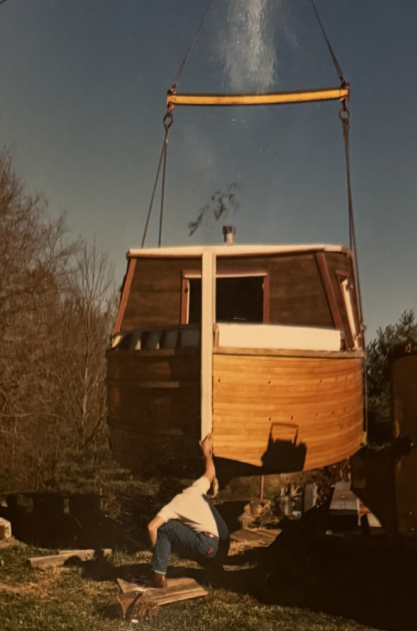
Paul Baudendistel began constructing a new boat from the materials he managed to salvage by the rail tracks. He used flooring from an old gymnasium to cover the hull of the boat. A crane lifted his “Native Sun” when finished to take it to the canal. Photos by Paulk Baudendistel
Following the destruction of the Ben Franklin, Baudendistel began the painstaking work of constructing a new vessel, not for tourism, but as a lasting tribute to the town’s canal heritage. His project, the Native Sun, was both a reconstruction and a reinterpretation, built from the salvaged materials and inspired by the first boat built in the Whitewater Valley, the Native of 1843. When asked why he built the boat, Baudendistel replied, “Passion? Obsession? Insanity? A work of love.”
Baudendistel began his work quietly, constructing nearly two-thirds of the Native Sun at the Haytown Hill Road home of his friends Pat and Lyell Kepple, outside the Metamora town limits, with a little help from his friends Tracy Porter and Scott Hunsinger. The state didn’t want to see any part of the project in town until after the dedication of the new boat, the Ben Franklin III. With only a few pieces of the Ben Franklin salvageable and the expense of building a new boat daunting, Baudendistel got creative. “I got a free house trailer roof,” he explained. “My hull was a salvaged basketball gym floor. Parts of the boat took extra time to do because I had to look for free boards to salvage.”
Once the hull and framework were complete, a crane was used to move the 50-foot-long, 10.5-foot-wide boat to Metamora for its final assembly at the “boat yard,” where Baudendistel’s barn, which he also built by himself, stood. “It may be said that the Native Sun was the first canal boat in the history of our State to require a building permit,” he said. “And the interesting part of that was that it was determined that a permit could be issued because I wasn’t building this boat in the flood plain.”
After a year of construction and more than twenty years of prior research, the Native Sun opened to the public on April 1, 1991, as an interpretive exhibit for canal boat education.
“I am often criticized for having a canal boat in my barn lot,” Baudendistel said. “Their thinking, I guess, is that it should be sitting in or near the water. I assure you they did not build boats in the water, and boats were periodically taken up out of the canal and put into a boatyard for hull maintenance.”
In this proposed exhibit, the boat had been “drawn up into the boat yard for the winter” to demonstrate how a packet passenger boat could be converted into a line boat for both freight and passengers. “The whole happening seemed pretty unreal. There was a spiritual magic in the creation of that boat,” Baudendistel reflected. “I don’t really consider it my accomplishment.”
However, Baudendistel didn’t feel that many people truly understood the purpose of the boatyard exhibit, and said few came to see it. “I was not successful at making my reality for ‘others,’” Baudendistel said. “Disappointed that it was primarily for my own spirit. But I went with that and still am, 30 years later. Half a dozen little notebooks, how to draw boats, a coloring book, photo archives of canal boat artifacts, and all the feelings for me that were in my memory. As if now I had built, worked on, and lived on a canal boat on the Whitewater Canal.”
Today, the Native Sun, which was rechristened “The Native” in 2000, still sits in Baudendistel’s boatyard, weathered and no longer open to the public, but standing as a quiet testament to one man’s devotion to craftsmanship and to Metamora’s enduring canal history. It’s further proof that Metamora’s story is written not only in state records but in the determination of its people. The boats may have ceased to run, but the dream of keeping history afloat has never fully left the valley.
Photos by Paul Baudendistel
Next in this series, we’ll step aboard the Ben Franklin III, the last boat to carry passengers through the aqueduct, and look ahead to what it will take to see a canal boat glide through Metamora once again.
For a short time after the new Ben Franklin III arrived in April 1990, it sat in the Whitewater Canal in Metamora behind the old Ben Franklin II. Photo by Paul Baudendistel
Canal Society of Indiana member, Carl Bauer of Fort Wayne, found an old November 22, 1987 Cincinnati Enquirer newspaper article “Stalking The Legend Of Blue-eyed Indians” in an old book. It contained a bit of Cincinnati & Whitewater Canal superstition. CSI published it in the Canal Society of Indiana Newsletter in July 1998. The pictures were of poor quality and I have colored them for this issue of “The Tumble” to make them easier to see.
The article was about Prince Madoc, a sailor who was angry when his 16 brothers and he could not decide on the division of their inheritance from their father Owain, Prince of Gwyned (North Wales) and set sail landing at Mobile Bay, Alabama in 1170. This was three full centuries before Columbus discovered America. Madoc returned to Wales, bragged about his find, and brought seven ships loaded with settlers, armaments and provisions to the new land.
A legend about a wandering tribe of Welsh-speaking Indians with blue eyes and fair skin has been handed down by word of mouth over the centuries. They reportedly hunted and fished on the Ohio River near the Falls of the Ohio and in Kentucky and Tennessee. They were Christians. They might have come into the Whitewater River valley.
At the time of the article there was standing on the bank of Dry Fork Creek in Ohio, a tributary of the Great Whitewater River, two large sycamore trees that shared a branch, which looked like the Welsh rune “ur,” an Old English letter. This is a symbol for a pyramid (an Indian burial mound is shaped like a pyramid). The joined trees could have been a warning that burial grounds were ahead. Some foresters say joining of trees occurs naturally. However, true believers claim the trees were bound two centuries ago by the Mohicans because another set, bound by Welsh-Indian hands in the 14th century, were dying.
The trees are located about 1⁄2 mile from where a pyramid shaped Indian burial mound once stood. The mound at Kilby Road and Dry Fork Creek was destroyed in the 1830s to build the aqueduct across the creek for the Cincinnati & Whitewater Canal. At that time four men on the canal work crew died in the quicksand. From then on the aqueduct crossing has been believed to be haunted by spirits who rule the land.
The article goes on with more lore about Madoc. Some swear to it and others call it bunk. Bur Reuben T. Durrett of the Filson Society said, “It is impossible to believe that so many witnesses as have testified in this case should have been plain liars about a matter in which they seem to have had no personal interest.” Is the Cincinnati & Whitewater Canal aqueduct crossing at Dry Fork haunted by the spirits of Madoc’s blue eyed tribe?
Robison Park 1896-1919: Fort Wayne’s Pleasure Resort
Carolyn I. Schmidt
Randy Harter, newly elected Allen County Historian, presented a PowerPoint program about Robison Park, the sixth program this year of the George Mather Lecture series at the Fort Wayne History Center, located in the 1893 Old City Hall building and jail, at 302 E. Berry Street. The program was scheduled for 2 p.m. Sunday April 12, but attendees began arriving at 1:30 to get a seat. With an attendance of 164 persons, this was the largest crowd ever in the 30+ years of the lecture series. It surpassed the record set 21 years ago at a program about Anthony Wayne, which had an attendance of 151.
The outstanding program showed many pictures, postcards and newspaper clippings that I, Carolyn Schmidt, had never seen before. CSI had toured the remains of Robison park and the St. Joseph feeder dam location led by CSI member Casey Drudge in April 1997 as one event of our 3 day “The Beginnings” tour. Later in the year 2000 Casey drew the accompanying map that shows the locations of the park’s key structures.
Randy wrote an article in 2018 for the Fort Wayne Reader that gives much of the information about Robison Park as follows:
“Construction of the 468-mile-long Wabash & Erie Canal also gave rise to the construction of Robison Park. Due to breaks in the canal, evaporation and other water loss reasons, the waterway at a number of points along its path had to have a controlled source of additional water. Therefore, feeder canals were integrated into the canal design. One of these was here in Fort Wayne, and ran from downtown (about two blocks behind Paula’s where the feeder joined with the main canal) off West Main to six miles north of the city on the St. Joseph River where a lock tender regulated the water sent to the main canal. It was at this river location that a large dam, approximately 230-foot-long and 17-foot-high, was built across the St. Joe causing it to back up creating a lake and lagoons behind it. The next closest feeder canals to Fort Wayne were to the east near Antwerp, OH and to the west, near Lagro. IN.
“While the main canal (1843-1876) was closed by the time Robison Park was built, the deep backed up river behind the dam with the high bluffs along the river in that area made a natural location for an amusement park. The area the park occupied is the back-half of today’s North Pointe Woods housing addition (off North Clinton), which would have then also made the park directly across the river from today’s Riverbend Golf Course on St. Joe Road. In fact, most of today’s Riverbend Golf Course, due to the dam, was at the time under 10 feet of water.
“The park was developed by the Fort Wayne Consolidated Railway Company, which was also how it was accessed, via their trolley line from downtown.
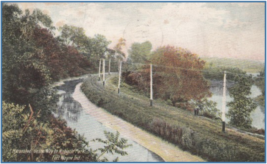
“They began laying the trolley tracks in early 1896 down Spy Run from Superior to Centlivre Brewery and then turning slightly right and adjacent to the old feeder canal down today’s Spy Run Extended and through Johnny Appleseed Park. They then crossed today’s Coliseum Blvd. and followed the riverbank opposite Canterbury Green Apartments, behind Concordia Theological Seminary and on to a point just past where the dam stood.
“On opening day July 4, 1889 an estimated 8,000 revelers [more like 3,000 to 3,500 revelers] rode trolleys from downtown to the park and back for 20 cents, which included admission to the park and all its amusements.
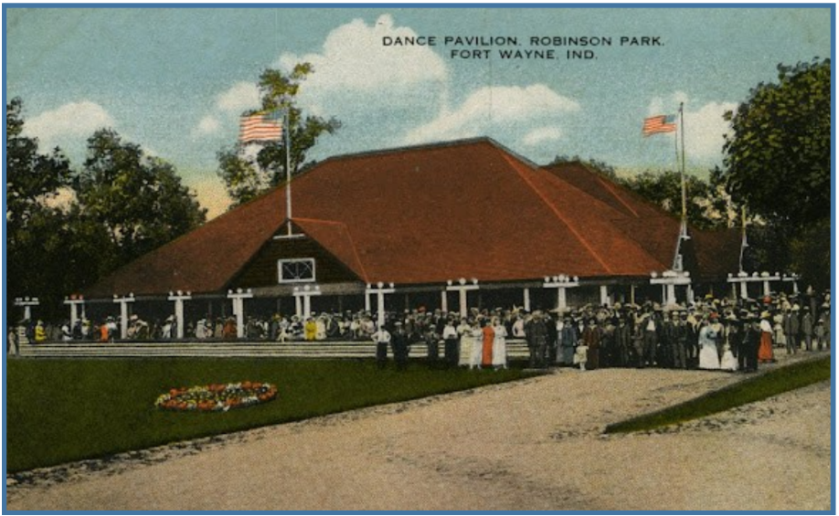
“A book could be written about the comings, goings, events, parties, reunions, weddings, company picnics, entertainers, orators, amusements and other happenings that took place at Robison during its 24-year existence. But we’ll need to close with just listing some of the amusements that were located there: Miniature Railway Rides, a Carrousel (now in Logansport, IN), Bowling Alley, Circle Swing, Balloon ascensions, Dance Hall, Shoot the Chute Water Slide, Photography Studio, Rowboats for rent, Naphtha Powered Launches, a Steamboat, Ice Cream Stand, Roller Coaster (the Blue Streak), Bicycle Race Track, Band Stand, Ferris Wheel, Enclosed Children’s Playground, Souvenir Shop, Wishing Well, Movie Theater, Main Pavilion with Ballroom and German Orchestrion, Baseball Diamond with Bleachers, Restaurant, Zoological Garden, Hall of Mirrors, Shooting Gallery, Pony Track, Picnic Groves and Fireworks.”
The Entrance and Main Pavilion at Robison ParkThe Dance Pavilion at Robison ParkThe Shoot the Chute at Robison ParkThe Circle Swing at Robison ParkReturning Home after a wonderful day at Robinson ParkSt. Joseph Feeder Canal along the St. Joe River with trolley tracks on old towpath to Robison Park, Ft. Wayne, IN
One of the pictures shown in the presentation was of the feeder dam that had sustained damage during the 3 major floods of 1904. The dam was watched closely during the significant floods from January-March. One Fort Wayne newspaper reported “The Waters Falling” seen here. The May 1905 flood apparently finished off the weakened dam.
Randy answered questions following a rousing applause from the audience. He said that with the few exceptions of concrete pads from the various buildings, nothing remains within the old park. The stone that once marked the entrance to the park has been moved and placed outside the North Pointe Woods club house. The only known large attraction from Robison Park that is still in existence today is the Dentzel Carousel, which has been restored and reincarnated as the Cass County Carousel in Riverside Park near downtown Logansport, Indiana.
Note: For more information about Robison Park see “The Beginnings” tour guide for Apr. 1997 that can be found on the CSI website under Tours and Events, Summary of CSI Tours 1982-Current, Tours by Years, 1990s, 1997 Apr. The Beginnings-15th, pages 34-48 by Casey Drudge.
In a display case on the first floor of the History Center an old Wabash & Erie Canal Toll Book that was used as a scrap book by Peter Kiser was exhibited with information as follows:
This event provided a wonderful learning experience about the St. Joe Feeder Canal to the Wabash & Erie Canal and Robison Park for those who attended. We hope to have Randy Harter present this program at a future CSI Symposium.
On a beautiful spring day Saturday, April 25, 2026, canallers and friends met at the Historic Forks of the Wabash Park, 3011 W. Park Drive in Huntington, Indiana for CSI’s free Spring Symposium. There were 48 in attendance from the following cities/towns:
Center Point–1, Centerville–1, Delphi–2, Ft. Wayne–19, Hartford City–1, Huntington–6, LaFontaine–2, Logansport–2, Marion–2, Monticello–2, Richmond–1, Roanoke–1, Terre Haute–4, Wabash–3, and Antwerp, OH–1.
The morning event from 10-12 a.m. was a self-guided tour of historic buildings in the park with docents, who gave a wonderful presentation in each building. Forks volunteer Liz Sanders was in the 1834 Chief Richardville house near the 1840 Treaty Rock, Marlene Johnston was in the school house, Mary Reust was in the Nuck family log home, and Ashley Herzog was in the canal room in the Forks Museum.
1834 Chief Richardville’s House1840 Treaty RockLiz Sanders in Chief Richardville’s HouseMarlene Johnston in the log school house
Registration was at the blue table in the back.
After lunch on their own at nearby restaurants, participants registered in the Chief Richardville Room in the museum where the tables were decorated with centerpieces and had programs and literature at each place.
They were then welcomed by Dr. Ron Morris, President of CSI and Chair of the Department of History at Ball State University. Since this was CSI’s annual meeting, a slate of directors was presented by Bob Schmidt and voted on by the CSI members in attendance.
Each year CSI elects one third of its directors, who then serve for a three-year term unless they are filling a vacated term. The directors are carefully selected to represent different areas and canals around Indiana and into Ohio. This year’s electees were:
Name
City/Town (State)
Suzy Dunning
Terre Haute
Jerett Godeke
Antwerp (OH)
Preston Richardt
Buckskin
Mike Tetrault
Delphi
Mick Wilz
Brookville
Lowell Griffin
Fort Wayne
Lowell will fill the last year of deceased member Steve Williams’ term.
This was followed by the directors re-electing CSI’s current officers:
Position
Name
City/Town
President
Dr. Ron Morris
Centerville
Vice-President
Sam Ligget
Terre Haute
Secretary
Margaret Griffin
Fort Wayne
Financial Secretary
Jo Ligget
Terre Haute
Treasurer
Bob Schmidt
Fort Wayne
Dr. Jeffrey Webb
Ron Morris then introduced Dr. Jeffrey Webb, Chairman of the History and Political Science Department at Huntington University, who presented a PowerPoint program entitled “The Western Waters: Nature, Culture and Improvement of the Upper Wabash River Watershed.” He traced the beginnings of the canal movement in America in a unique way by using letters from George Wahington, James Monroe, and Indiana Governor James B. Ray. These letters showed how Washington influenced the surveying and development of the Wabash & Erie Canal to open the west to development and to cause the “glorious gate” between the Maumee River and the Wabash River to “yield to human enter-prize.” He also showed early maps which tagged the Indiana area as “Metropotamia.”
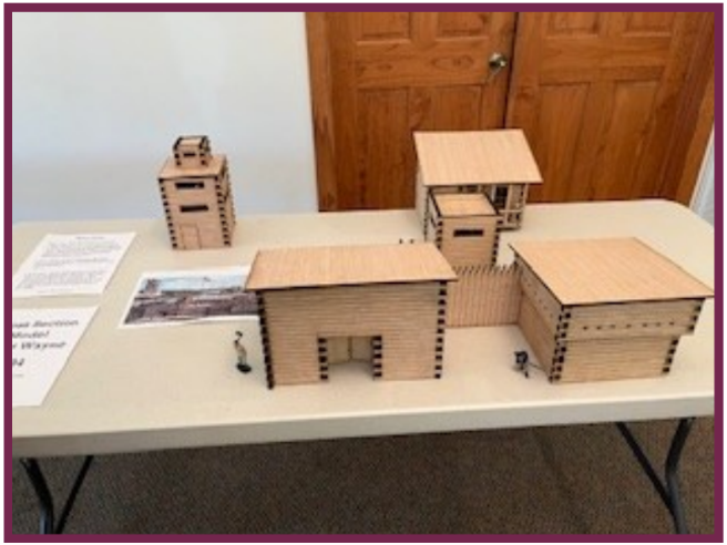
First fort in Fort Wayne model by L. Griffin
Snacks and drinks were served during the first break while getting ready for the next speaker. Everyone was encouraged to look at the replica of the first fort in Fort Wayne that Lowell Griffin had built and see the exhibits brought by Dan McCain from Delphi’s Canal Park during the break.
Alec Guenin, Wabash County Historian
Alec Guenin, Wabash County Historian, was then introduced by Ron Morris. Alec then gave a PowerPoint presentation on “The Irish War at Lagro.” It was very interesting to learn more about the background of the Corkonians and Fardowners than we had heard before. In our canal histories we usually find that the Fardowners were said to be Protestant and the Corkonians Catholic, which would seem to make the “War” at Lagro a religious one. However, Alec’s research appears to show that it was more gang related due to their previous affiliations in Ireland. Alec said that the question that needed to be answered was “Who will build the Wabash & Erie Canal?” Young, single Irish men from the eastern states answered the call. They were intentionally placed at opposite ends of the canal project in Wabash County to prevent conflict. Since they represented different gangs from Ireland they decided to fight in July 1835 near Lagro. Their weapons were their shovels and one small cannon loaded with gravel. There were no casualties because 100-armed militia from Fort Wayne and elsewhere headed off the main instigators, took them prisoners and sent them to jail in Indianapolis so that canal work could resume.
Trivia questions about canals with several choices of answers were placed on each table for attendees to discuss during breaks between speakers. After the second break Margaret Griffin read the questions and asked the audience for their answers while members of the upcoming panel discussion took their places.
McCain, Ligget, Koehler, Morris, Berndt and Schmidt
The panel members were Craig Berndt, Jeff Koehler, Sam Ligget, Dan McCain, and Ron Morris. Bob Schmidt was the moderator. For Round 1 Bob asked each of them to state their name, where they lived, give a brief biography and tell how they became interested in Indiana’s canals. Round 2 was to state the actions being taken in their area to promote Indiana’s canal heritage, and Round 3 was to give their suggestions for future CSI actions or programs to promote preservation. It was interesting to learn what was happening in the different areas of the canals. This was followed by audience participation and those who were on the ZOOM call. From this we learned a lot through the questions and suggestions from our other members, guests and ZOOM participants. We were surprised by the number of those who wanted to participate.
Before and after the meeting those who could not walk the towpath for about 1⁄4 mile to Lock #10 were offered a golf cart ride to the site by Don Mathias, a Forks volunteer. At the lock site Lowell Griffin explained how a lock operated. He hopes to have Dr. Jeffrey Webb’s scout troop help clear it out as an Eagle Scout project.
Everyone seemed to enjoy the day. Many thanks were extended to Margaret and Lowell Griffin for planning the entire event.
Pictures by: Bob Schmidt and his sister-in-law Robin Schmidt.
Vanderburgh
On Thursday May 7, 2026 the sun shone brightly and fluffy clouds filled the bright blue sky, but loud noise from jack hammers and construction work on a new building in downtown Evansville destroyed the ambiance. The dedication ceremony that was to be held at the northwest corner of 5th and Main Streets had to be moved two blocks east to SE 5th Street and Bob Jones Way in order for anyone, including the reporter from Evansville’s Channel 14, to hear or record what was being said.
CSI double-sided sign at SE 5th St. and Bob Jones Way
At 11 a.m. CDT Timothy Miller, Historic Preservation Officer for the City of Evansville’s Department of Metropolitan Development welcomed everyone and gave a brief history of the Wabash & Erie Canal running through the middle of the town. It came into Evansville’s east side, then cut over to 5th street and proceeded to Indiana Avenue where it doglegged and continued to the canal terminus at Pigeon Creek. Along 5th street all of the road bridges crossing the canal have been marked with signs donated by the Canal Society of Indiana. At the corner of 5th and Main a two-sided sign purchased by the City for Road Bridge 165 will be hung once the mounting supplies arrive. He then unveiled the City’s sign and the two-sided CSI sign.
The Wabash and Erie Canal extended 468 miles from Toledo, Ohio to Evansville, Indiana. Construction began in July 1832 in Fort Wayne, Indiana, and by 1853 canal boats began navigating cargo at all point from Lake Erie to Evansville, terminating at Pigeon Creek. As Indiana’s first “super highway”, the Wabash and Erie Canal was credited for helping develop and prosper Indiana and points west. The southern portion of the canal was only open from 1853-1860 and was plagued with continued lack of water and break downs. In 1874 the canal was ordered to close and eventually sold in 1876.
The Wabash & Erie Canal in Evansville, Indiana: The canal in Evansville included a basin used for turning boats for return trips and docking facilities for loading and unloading passengers and cargo. The canal was also a major source of water power during the1850s, and several businesses were built along its route. Bridges were built over the canal on several downtown streets.
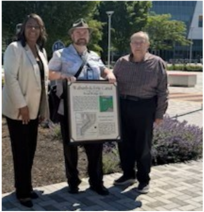
Mayor Stephanie Terry, Tim Miller & Bob Schmidt are shown with the City’s two-sided sign that will soon be mounted at the corner of 5th & Main. It highlights the route of the Wabash & Erie Canal through the City.
Mayor Stephanie Terry presented a proclamation to recognize the canal’s impact on Evansville’s early development. She recognized the work done by Tim Miller and thanked CSI for donating the signs. She said the Wabash & Erie Canal was an important part of Evansville’s history. The markers will help preserve Evansville’s history for future generations.
Mayor Terry & Bob Schmidt at the dedication program.
Bob Schmidt then said, “The Canal Society of Indiana was very excited to get to work with the city of Evansville to create and place signs along the route of the Wabash and Erie Canal. Thank you for this opportunity. “Our society works to mark canal related locations across the state of Indiana. We have had success with marking the Whitewater Canal in southeast Indiana. We are pleased to continue marking the Wabash and Erie Canal, and we look forward to marking the Central Canal. Evansville now has more canal markers than any other Indiana city. “Several communities have created community multi-use trails along the right-of-way of the old canal which we support for good healthy recreation, and educational purposes. Evansville is one of them with its Pigeon Creek Greenway Passage.
“If you wish to learn more about your canal or other canals across the state please visit our website, join us on a canal tour, or come to one of our symposiums. We enjoy history and challenge you to learn with us about the monumental engineering that was the canal system of Indiana.”
Many pictures were taken by the reporters and others in attendance. Mayor Terry was then interviewed by Channel 14 for its nightly news. Later the news desk at Channel 14 showed clips from the dedication program and highlighted the Canal Society of Indiana’s donation of signs even getting the name of our organization correct.
CSI was represented by Dr. Ron Morris, CSI president; Bob Schmidt, CSI Treasurer; Preston Richardt, CSI Webmaster, and Carolyn Schmidt, CSI “The Tumble” coordinator. Also in attendance was Phil McCullough, the owner of the Canal House on Indiana Avenue. In total 15 persons were at the dedication.
After the ceremony Ron, Bob, Preston, Carolyn and others proceeded to Willard Library and turned left onto Indiana Avenue to drive by the Canal House and see its new sign. Phil McCullough purchased this sign for his home on the canal at CSI’s request.
The sign next to the Canal House’s front door says:
Wabash & Erie Canal Canal House 1119 W. Indiana Street
In the 1850’s the Wabash & Erie Canal, which ran through Evansville, spurred the construction of businesses and residences along its path. Few physical traces of the canal remain, but the most notable surviving structure from Evansville’s canal era is the Canal House which stands as a significant landmark.
Evansville lithograph 1856 showing the location of the canal house.
Below the house description is the 1856 map with an arrow pointing to the location of the house.
Today the Pigeon Creek Greenway Passage is seen in front of the terminus sign along Pigeon Creek.
Just beyond the Canal House the CSI double-sided sign on Fulton Avenue was seen. Then the group went to the terminus of the Wabash & Erie Canal at the canal basin by Pigeon Creek. The canal basin at that point overflowed by a waste weir into the creek, but boats could go no further. They had to be unloaded and reloaded onto Ohio River boats to continue their shipments.
Carolyn Schmidt, Bob Schmidt, Ron Morris and Preston Richardt are pictured where the Wabash & Erie Canal terminus basin was once located.
On Monday April 6, 2026 canawlers met at 5:30 p.m. in the Lawrenceburg Public Library at 150 Mary Street in Lawrenceburg, Indiana to dedicate the 6 signs donated by the Canal Society of Indiana and erected by highway officials in West Harrison and Greendale. Upon arrival they registered and were given handouts with a map showing four of the signs in the northern portion of the county. They also picked up a CSI QR card showing website access to available canal information, and four pages on Why Build A Canal, a map of Indiana and Ohio’s canals, diagrams of a lock gate and canal freight boat. Before sitting down for the meeting they also picked up cookies and a bottle of water from an Easter themed table setting.
Dr. Ron Morris, CSI president, Bob Schmidt, CSI treasurer and Carolyn Schmidt, “The Tumble” coordinator, greeted everyone and were excited to meet Indiana State Senator Randy Maxwell and Laura Hobson who will write an article about the dedication for the Brookville American.
Senator Maxwell represents the 42nd district of Indiana and is also CEO of Maxwell Construction Company. He became extremely interested in canals after taking his family on a boat ride on the “Ben Franklin III” in Metamora and learning more about the importance of canals from the docent on the boat. His wife, Robin, a history teacher also shares his enthusiasm. Together they have traveled to many canal sites throughout the country and have biked along the C&O canal including the PawPaw tunnel.
Laura A. Hobson is a freelance writer and a staff reporter for Register Publications in southeast Indiana. She took pictures at the event and interviewed Dr. Morris and Bob Schmidt for the article she is writing.
Dr, Morris talked about CSI’s signage program and the signs in Greendale, Indiana in the southern portion of Dearborn County. These two pictures taken by Bob Schmidt in 2026 show the signage on the southeast corner where Indiana 1 intersects U.S. 50 in Greendale and the lock that is on the other side of the wall and berm—access at the Circle K service station. The other sign in Greendale reads Possum Hollow Run Culvert.
Ron also talked about the four signs at West Harrison, Indiana for Godley’s Lock # 6, Harrison Guard Lock, Harrison Feeder Dam # 1, and Harrison Lock #5. Participants could look at the map and signs in northern Dearborn County but were told that they would only be able to see three of them.
On March 27, 2026 we received the following request from Mindy Bryant, Tri Township Utility Manager:
“Tri Township Water owns property on the corner of Jamison Road & Lawrenceburg Road in Dearborn County, where this sign pictured was installed late last year. Now that it is grass mowing season, we have realized that our mower does not fit between the sign and the culvert/creek dam. We have land on both sides of this creek dam that needs mowed & this is the only place where a mower can get through. Can this sign be moved about 10 feet backward or 30 feet forward, so we can get our mower through?”
By the time of the dedication program the sign had been removed. However, it had not been reinstalled.
Following the dedication program, which lasted a half hour over the planned hour long program, we adjourned. Some of the attendees drove around the county to see the new signs.
The Canal Society of Indiana received an invitation from Kathryn Angelica, Assistant Professor of History at Purdue University Fort Wayne, to participate in an event titled “America 250 Time Machine” on April 20th from 10:00 a.m. to 3:00 p.m. in the Walb Student Union Classic Ballroom on campus. CSI Directors Margaret and Lowell Griffin saw this as an opportunity to showcase Fort Wayne’s canal era history and advertise CSI’s programming and events with an exhibit and they decided to participate.
The event, in collaboration with Historic Fort Wayne, featured costumed interpretation, historical demonstrations including 18th century games, museum style exhibits, a colonial era ‘coffee house’ with moderated debates, the reading of documents like the ‘Declaration of Independence’ and much more. It was designed to provide a space to reflect on the 250th anniversary of our nation by ’time traveling’ back to the 1770s to engage in its history, politics, and culture.
The Griffins asked for help with displays, flyers, QR cards, etc. from CSI headquarters. Margaret also created a chart showing how the Wabash & Erie Canal influenced the population growth of Fort Wayne through the canal era. They set up the table and wore period dress.
Photographs below were taken by the Griffins.
There were roughly 200 students, professors and members of the public in attendance at the America 250 Time Machine event. About 35-40 stopped by the canal exhibit and picked up information about CSI and our symposium on the 25th. About 25 actually stopped long enough to interact with the Griffins, who explained how the Wabash & Erie Canal influenced Fort Wayne’s growth and ran through 1835-1874.
In addition to Historic Fort Wayne, others represented at the event were PBS Fort Wayne, the Fort Wayne 250th Commission, Daughters of the American Revolution, Sons of the American Revolution, and Children of the American Revolution, PFW Library and Archives as well as several student organizations. Guests learned more from exhibits about woodworking weaving, archery and the life of a soldier.
Thanks to Cassie Garrett for information and photos
Metamora celebrated its roots as Indiana’s canal town during “1838 Days” on May 2, 2026 marking the year the town was officially platted and kicking off another season along the Whitewater Canal. A series of short historical playlets written and directed by Cassie Garrett, CSI Director Candy Yurcak’s daughter, were performed throughout the day along Main Street. To help create a safe and immersive experience and allow visitors to explore the town on foot, the county commissioners allowed the closing of Main street from Banes Street to Basin Street and Columbia Street from Clayborn Street to Main Street. Each scene lasted 5-7 minutes and took place near the location where it had happened. This brought to life key moments from the town’s early history, founding, canal-era growth and coming of the railroad.
April 17, 2026: Lindsay Patterson, State Representative District 55, posted the following on the Whitewater Canal Trail’s Facebook page:
I am incredibly proud to have helped deliver a transformational $14.4 million investment into the Whitewater Canal and the future of Franklin County.
This funding—$7 million from the 2023 General Fund (officially approved through the state budget committee today for release), $460,000 from the State Construction Fund, and another $7 million from the Lilly Foundation through READI 2.0—represents one of the most significant commitments our community has seen in years.
This is more than funding. This is about protecting our history, strengthening our infrastructure, and standing up for the people who call this community home.
Metamora holds a special place in my heart. It is not just a canal town—it is the heartbeat of a proud, hardworking small business community. The people of Metamora have poured their time, energy, and passion into preserving something truly unique, and they deserve this investment.
These dollars will restore critical infrastructure, preserve historic landmarks, and create real economic opportunity through tourism and small business growth. Just as importantly, it sends a clear message: rural communities matter, and we are fighting to ensure they have a strong and sustainable future.
I will continue working to make sure Franklin County receives the attention, investment, and support it deserves. This is a proud day for Metamora. An even brighter future lies ahead.
April 18, 2026: Cassie Garrett posted pictures on the Whitewater Canal’s Facebook page with a message saying the Whitewater Canal Trail, which had been damaged by severe flooding due to heavy rains in March, have been repaired. They are now open for use.
April 18, 2026: The Whitewater Canal Facebook page had a video about bluebird studies being made in valley. It said that scientists and students from Miami University in Ohio were doing bluebird studies. They were going to the bluebird boxes, recording its temperature, weighing and collecting fecal matter, and removing baby bluebirds from the nest one at time to weigh. Before the baby was put back into the nest if was given a slight haircut at its neck on the right side. This enabled those removing the babies from picking up a baby twice.
April 19, 2026: The Metamora Facebook page said that when these little guys show up in Metamora we know its time for the season to begin. They stopped by for a few hours on Sunday.
April 23, 2026: Metamora’s Facebook page announced that May 2 was the opening day for Metamora shops, etc. and the first Whitewater Valley Scenic Railroad train of the year would come in from Connersville.
April 26, 2026: Metamora’s Facebook page said that the Whitewater Valley Scenic Railroad train full of Boy Scouts arrived from Connersville. The train will bring visitors from Connersville every weekend through October.
April 28, 2026: Metamora’s Facebook page had a video showing the Whitewater Canal Trail from Metamora towards Brookville. It gave the following directions of how to get to the trail:. Go all the way through Metamora on Main Street headed West. You will go past the aqueduct. Keep going and you will see the red barn on the right and there is the trailhead. This section of trail goes on several miles. It meets up with the Yellow Bank tailhead and will eventually lead to Brookville. It’s a very nice trail—level, wide and is gravel.
The following persons joined the Canal Society of Indiana at the $20 membership level or received a gift membership unless otherwise noted. Welcome aboard!
Katherine “Kay” Sheldon, age 84, passed away peacefully on Thursday, April 9, 2026. She was the wife of the late Bruce Sheldon. Kay was the sister of Bill (Chris) Cowan; stepmother to Greg (Tami) and Cindy Sheldon; step-grandmother to Nicole Kazmer; aunt to Leia (Gary) and Bryan (Jen); and great-aunt—affectionately known as “Aunt Kitty”—to Billy, Veronica, Emma, and Olivia.
Kay, a dedicated professional, spent many years working as an accountant for Mr. Harry Valley. She also generously gave her time and talents as CFO and Treasurer of the Canal Society of Ohio, where she was known for her reliability, integrity, and warm spirit.
Akron – Bruce & Kay right front
Kay was also a member of the Canal Society of Indiana. She and Bruce could be found on many of its tours: Chattanooga, Tennessee aboard the Blue Moon in 2011; CSI and CSO’s joint tour at Akron, Ohio in the Spring of 2014; and New York’s Erie Canal in June 2014 where we celebrated Bruce’s 89th birthday aboard the Emita II. Kay was also on our tour of the Panama Canal in 2017 after Bruce had passed.
In her free time, Kay enjoyed working puzzles, playing cards, and reading. She had a special fondness for anything and everything related to cats. She also treasured time spent with her girlfriends, enjoying meals out and attending shows together.
Erie Canal -Kay in center
Kay will be remembered for her kindness, her quiet devotion to those she loved, and the warmth she brought into the lives of her family and friends. She will be deeply missed by all who knew her.
Friends could call from 11:00 a.m. until the time of the memorial service, which was held on Friday, April 17, at 12:00 p.m. at Jenkins Funeral Chapel, 2914 Dover Center Road, Westlake, Ohio.
Suggested memorials:
Friendship APK, 8303 Murray Ridge Rd., Elyria, Ohio 44035 Canal Society of Ohio, P.O. Box 2250, Akron, Ohio 44032