Index:
Canawlers At Rest
ELIAS CRANE WILCOX
February 4, 1822– September 15, 1891
Find-A-Grave #54223544
 Our subject Elias Crane Wilcox’s great great grandfather was Peter Willcockse, who was an officer in the English army, a man of great force of character. He finally resigned his position, and was subsequently engaged in a duel on the ocean with a Frenchman. Peter arrived from England in 1736 and shortened his last name to Willcox. The Elizabethtown Association surveyed 424 acres of land in New Jersey for him. He settled on this land between Blue and Green Brooks. The farm was known as Peter Hill Farm. This is shown by the records in the Presbyterian Church at Westfield, New Jersey. He had five children.
Elias’ great grandfather was William Willcox, who was born in New Jersey, and died at the age of sixty-six years after having lived on the same tract of land as that occupied by his family. He had seven daughters and four sons, one of whom followed Daniel Boone to Kentucky, and soon lost his life there.
Elias’ grandfather was Levi Wilcox, who was born in New Jersey about the year 1760 and died in 1843, age about eighty-three. He was the person responsible for dropping one “l” from the family’s last name. He was a farmer in Essex (now Union) County, and belonged to Capt. Wood’s minute men. He married Esther Valentine. They had four children: Daniel M. Wilcox; Rachel Wilcox, who married William Van Blarkam, of Paterson, New Jersey; Betsey Wilcox, who married Capt. Joseph Doly, also of Peterson, and for her second husband Joseph Wilson, of Morristown, New Jersey; and Levi V. Wilcox, the father of our subject.
Elias’ father was Levi Valentine Wilcox, who was born about the year 1797 at New Providence, Essex County, New Jersey, fifteen miles from New York City. There he received a common-school education. He served for a time as the Deputy Sheriff, after which he moved to Ohio, settling near New Lebanon. About 1816 he married Huldah Crane, of New Jersey.
Huldah was the daughter of John Crane (1762-March 4, 1844), of New Jersey, a farmer whose land was along the Passaic River one mile from New Providence. John, like Levi Wilcox, belonged to Capt Wood’s minute men of Revolutionary War fame. His wife was Betsey Mulford, who died in 1828.
Levi V. and Hulda Wilcox had nine children: David B., Annie, Elias C., Orpha, Albert, Frank, Mulford, John and Mary. One died at age 14, another at age 19, and two after the age of 21. Those who survived were Col. Frank Wilcox, of Champaign, Illinois, Mrs. Annie Adkison, of Winterset, Iowa; John Wilcox, a farmer at Storm Lake, and our subject, Elias. For two years Levi V. was engaged in filling a contract on the Miami and Erie Canal, building several sections, his part of it being in the vicinity known as Shaker Swamps. Huldah Crane Wilcox died in 1836-37 in Indiana at about thirty-seven years of age. Shortly before or after her death, when he was about forty years old, Levi V. moved to Fountain County, Indiana, on the Wabash River, in which place he bought a farm and spent some time in making improvements on it. Then selling this land, he crossed the Wabash River into Warren County, and there improved 400 acres of land, on which he resided until the time of his death in 1854 at age 57.
Elias Crane Wilcox, our subject, was born on the 4th of February, 1822, in Essex County, New Jersey. He received a good common-school education, after which he worked on the farm of his grandfather, living with him until seventeen years of age. He then clerked for two years for Woodruff & Co., of Elizabethtown, and in 1841 went to Indiana to join his parents. For a time he worked on a farm and then clerked in a store until 1847, when he was appointed Collector of Tolls on the Wabash & Erie Canal, at Covington, Indiana (1847-1854). He received his appointment from Stearns Fisher, well known as the Superintendent of the State Public Works.
On February 8, 1848, Elias married Rachael Virginia Fields, at Covington, Indiana. Rachel was born at Clarksburg, Virginia in 1828. She was the daughter of John Fields, who was born in Pennsylvania about 1802; lived for a while in Clarksburg, Virginia; and then moved to Covington, Indiana, where he was Postmaster and Justice of the Peace. Her mother was Miss Harris, a native of Virginia, who died about 1856. Her father, John, died in 1876 in Covington, Indiana. Elias and Rachel had four children all born in Covington, Indiana.
In the fall of 1854 Elias was elected Clerk of the Court for Fountain County on the Whig/Republican ticket. (The Republican party had hardly been born.) In 1856 a case came to the court in Covington, Fountain County, Indiana concerning canal land scrip. As part of his duties Elias swore in Robert Hetfield and John Bodley. Hetfield and Bodley’s testimonies as recorded by Elias in the 1857 Journal of the Indiana House of Representatives gives us insight into the value of canal scrip and canal construction.
“Covington, Ind., Dec. 31, 1856
“At the clerk’s office of Fountain county, Robert Hetfield, a competent witness, being duly sworn in by Elias C. Wilcox, Esq., clerk of Fountain county, and being examined on behalf of the claimant, testified as follows:
“I was selling goods during the spring and fore part of the summer of 1842, in Covington, Fountain county, and was engaged in packing pork at said place the fall and winter of 1842-3, and was handling a good deal of canal land scrip. In my dealings and in collecting debts during the summer of 1842, when the scrip first issued, I took it for goods and on debts, from slow men, at its face; but, in money transactions, it was not worth more than 80 cents to the dollar. It depreciated after the land sales in the fall of 1842, and its general range during that fall and the winter following was from 50 to 60 cents to the dollar. In the summer of 1843 it went down still lower, and I should say the average value of scrip from the 15th day of May, 1842, to the 25th day of August, 1843, was about 50 cents to the dollar.
R. HETFIELD”
———————
“John Bodley, a competent witness, being duly sworn by said Elias Wilcox, Clerk as aforesaid, and examined on behalf of said claimant, testified as follows:
“During the period from May 19, 1842, to August 25, 1843, I was engaged in general trading in Fountain county, and was also sheriff of the county. I was connected with canaling operations. When the scrip first issued in the spring or summer of 1842, it passed, among the friends of the canal, at par—it passed in ordinary business transactions; but in cash transactions it was not worth more than 80 cents to the dollar. After the land sales, which I think took place in October, 1842, the scrip depreciated quite rapidly. It ranged at 50 to 60 cents to the dollar, and even less, and, during the summer of 1843, it went as low as 40 cents to the dollar; and I should think that an average of its value from May 19, 1842, to August 25, 1843, would be about 50 cents to the dollar. I have examined the contract made by Wright & Barcus, on the one part, and Thomas H. Blake, commissioner, on behalf of the State of Indiana, of the other part, and referred to in the deposition of James Blair. I was well acquainted with the character of the work embraced in that contract—have been repeatedly on it and examined it during its progress. I was also engaged on it quite extensively in doing work of that kind during its progress, and have a knowledge of the cost of performing such a work. If the work embraced in that contract had been paid for in par funds, at the contract price, the contractor would have realized a profit of from 30 to 40 per cent, on the whole amount of work embraced in the contract. Labor and provisions were higher during the years of 1838-9 than in the former years. I think the price of labor in the years 1838-9 was about 70 to 75 cents per day, and in the years 1842-3, we commenced by paying 62 cents per day and boarding, and went from that up to $1.25 in scrip. There was no other kind of money paid out during these latter years that I know of. I was one of the commissioners to assess the damages on the contract of Nichols, under the act of the General Assembly of the State of Indiana, entitled “An act for the immediate relief of contractors and others engaged on public works,” passed in February, 1840. The contract of Nichols joined that of Wright & Barcus on the North, and while I was engaged in making the assessment on the Nichols contract, I had good opportunities of knowing the condition of the Wright & Barcus contract, and the amount of money invested in shanties and implements. From my knowledge of other assessments, and from my knowledge of the amount and value of the implements and shanties owned by Wright and Barcus on their work, I think that their loss, by the suspension of the work, independent of the loss of profits on the work must have been in the neighborhood of $2,000. I frequently saw them at work on the contract of Wright & Barcus before the suspension of the work. The number of hands I should think was 40, on an average. Most of the work was done with scrapers. The scrapers furnished by Wright & Barcus. I think there were about 25 scrapers. I think they had some forty or fifty wheelbarrows, and at least from ten to fifteen shanties on the work. I don’t know by whom the shanties were built. They also had some teams of their own—at least three teams—including wagons and horses; also shovels and picks sufficient to carry on a work of that kind; and were as well or better stocked, with all the implements to carry it on, than jobs of that kind usually are. I don’t know to whom the shanties belonged; they were on the work and used by Wright & Barcus.
J. BODLEY”
———————
Elias was re-elected in 1858 as Fountain County’s Clerk of the Court. He held this position until November, 1862 serving a total of two terms.
From that date until the close of the war Elias occupied the position of Provost Marshal for Fountain County, a perilous one at that time, having his headquarters in Covington, his home. He continued as Marshal until the close of the Civil War. He spent the summer of 1866 traveling over the State of Arkansas in behalf of the Western Stage Company. He was there opening mail routes and appointing Postmasters, for which he had a commission from the Government already signed, Elias taking bond and returning to the Government. The next year he moved to Champaign County, Illinois, where he raised a very large crop of grain plus 160 acres of corn, the latter selling at eighty cents per bushel.
In the spring of 1868 Elias moved to Union County, Iowa, near where Creston is located today. There he bought a new farm of 160 acres, and improved it with a house, barn, and other farm buildings. He remained there two years. In the fall of 1869 he was selected by the people, without any effort on his part, and was nominated for County Auditor. The nomination resulted in his election. After occupying the position for two years he was re-elected in 1871 and held the office until 1873. To the end of the year during this term he lived at Afton, Iowa. In 1874 he moved to Sheridan, Iowa and engaged in the lumber business, which he continued for three years. In 1877 he moved to Fremont County and located at Farragut, Iowa, where he had charge of a stock of goods until 1881, afterward selling, and moving to Wymore, Gage County, Nebraska when the city had just been platted.
In June, 1882, the Blue Valley Bank was organized, and Elias became its cashier, serving in that capacity for five years. In the meantime he was elected City Treasurer, to which position he was successively elected. He was also the Treasurer of the School Board and was engaged in the real-estate and insurance business. He attended the convention held a Philadelphia in 1856, which nominated John C. Fremont, and from then on he was a Republican. He was also a Chapter member and Master of the Blue Lodge, of Wymore.
Elias and Rachel Wilcox’s four children were: Edward Bartine Wilcox, who was born on December 21, 1849 and passed away in 1851, at the age of two; Albert Coleman Wilcox, who was born on July 19, 1852, and died December 10, 1934. Albert married Carrie Wallace, of Sheridan, Iowa, and they were the parents of two children: Anna and Laird E. They lived in McPherson County, Kansas, where Albert had charge of the McKinley Hellicker Investment Company for the State of Kansas; Katherine Lillias Wilcox, who was born on February 25, 1855, and died December 12, 1927; and Frank Fields Wilcox, who was born on July 21, 1864, and died October 25, 1925. He was in the loan business in Horace, Greeley County, Kansas.

The 1860 Federal Census shows Elias at age thirty-eight a county clerk, with real estate valued at $12,200, a personal estate of $3,000, and living in Covington, Indiana. By 1870 he is listed as a farmer in Afton, Union County, Iowa, with real estate of $700 and a personal estate of $1,000. The 1880 Census shows him living in Farragut, Fremont County, Iowa where he is a merchant.
Elias Crane Wilcox died on September 15, 1891 in McPherson, Kansas where his son Albert lived. He was 69 years old. He was laid to rest in McPherson Cemetery in McPherson, Kansas. Find-A-Grave # 54223544
Rachel Wilcox, his wife, died on April 28, 1906 in New Rochelle, New York. She was 77 years old.
Sources:
Ancestry.com
http://person, ancestry.com/tree/82331523/person/36461225969/facts
http://person.ancestry.com/tree/80916032/person/34429092221/story
U.S. Federal Census: 1850, 1860, 1870, 1880
Find-A-Grave: #54223544 E. C. Wilcox
History of Fremont County, Iowa. Des Moines, IA: Iowa Historical Company, 1881.
Journal of the House of Representatives, of the State of Indiana, During the Thirty-ninth Session of the General Assembly, Commencing Thursday, January 8, 1857. Indianapolis, IN: Joseph J. Bingham, State Printer, 1857.
Portrait and Biographical Album of Champaign County, Illinois. Chicago, IL: Chapman Brothers, 1887.
Portrait and Biographical Album of Gage County, Nebraska. Chicago, IL: Chapman Brothers, 1888.
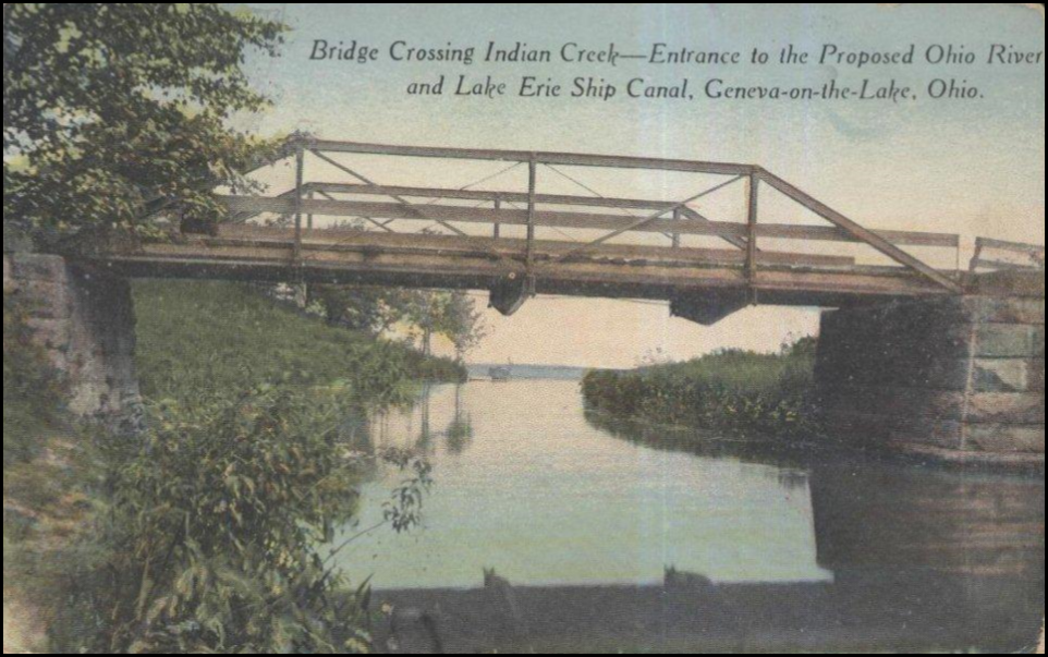
Entrance to Proposed Ohio River and Lake Erie Ship Canal Was Where Bridge Crossed Indian Creek at Geneva-on-the-Lake, Ohio.
From Neil Sowards
Peddle’s Recollections of Over 150 Years Ago
By Mike McCormick

On February 14, 1852—over 150 years ago—the Terre Haute & Richmond (TH&R) Railroad made its first 73-mile voyage to Indianapolis.
For nearly a century, railroads were Vigo County’s premier industry.
Chartered in 1847 by Chauncey Rose, Samuel Crawford, James Farrington, Elisha Mills Huntington and James H. Turner, the TH&R—soon to be known as the Terre Haute & Indianapolis Railroad—provided the primary western terminal for eastbound rail traffic until late 1857.
Crucial to the railroad’s initial success was Charles R. Peddle.
Rose and Peddle, a resident of Philadelphia, began communicating in early 1851. Their first meeting occurred in the Astor House at New York City on April 1 of that year.
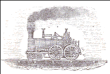 During that meeting Rose hired Peddle as “master mechanic” for the TH&R and authorized him to supervise the shipment of four Hinkley steam locomotives from Hinkley & Drury Locomotive Works in Boston to Indiana.
Two engines were shipped to Terre Haute, the other two went to Indianapolis.
Rose was a master of detail. During his return trip to Terre Haute, he stopped at Albany and Greenbush (N.Y.), Buffalo (N.Y.), and Toledo and Cincinnati (Ohio) to make precise arrangements. He outlines his instructions in a letter to Peddle dated April 7.
“On their (the engines) arrival in Terre Haute (on June 6, 1851) Miller picked up a few hands and unloaded them on the canal bank near the projected track. He put one of them in running order, assisted by Constant W. Mancourt, his fireman, and held himself in readiness for whatever service should be requested.
“I took the other two engines (from Toledo) to Cincinnati by canal, where the canal boat—a staunch one—was locked down into the Ohio River and provided with a pair of sweeps and a steering oar.
“The captain of the boat, named Cooney, was an old Ohio River man and, under his guidance, we shoved out from the shore into the swift and turbid current and floated down to Madison, It was a rather perilous trip as every swell caused by passing steamboats swept over the gunwales of the craft and made frequent use of the pump necessary.
“John Brough, president of the Madison and Indianapolis Railroad, gave me all the assistance necessary to unload the engines, haul them up to the levee to the railroad track, and tow them to the shops in North Madison.
“Here I put them together and run them separately under steam to Indianapolis. One of them was turned over to William Baugh, now known as ‘Uncle Billy’ Baugh, at the request of Thomas A. Norris, the late constructing engineer of the TH&R Railroad.
“The other engine was held in reserve for ballasting the road when needed.
“Accompanied by my wife and baby I took my passage on the stagecoach on Saturday.”
Forty years later Peddle recalled that first meeting and the subsequent events:
“I accompanied Mr. Rose to Boston the next day (April 2) to look after the engines, which were nearly completed, and hired a man named W. E. Miller, father of a well-known Vandalia engineer by the same name, to test one of them when they were put into service.
“The engines, when completed, were towed to Buffalo by rail, and there they were hauled through the streets by horses to the docks in the harbor about three-quarters of a mile away.
“Some of the streets were unpaved and were axle deep in mud. Two of the engines were loaded on a sailing vessel and I went with them over the lake (Lake Erie) to Toledo.
“There they were unloaded, hauled to another dock and let down on skids into a canal boat, a rather ticklish operation as the swell from the lake and from passing steamboats kept the canal boat in constant motion.
“The two engines were forwarded to Terre Haute by the Wabash and Erie Canal as directed by Mr. Rose and consigned to Samuel Crawford.
“I had to wait several days for the two remaining engines left in charge of Miler on account of the difficulty in getting a suitable vessel in Buffalo and I sent Miller, on arrival, in a packet boat to overtake the two engines en route to Terre Haute.
“I reached Terre Haute a little after sunrise on Sunday morning, where we were welcomed by the genial host of the Prairie House, Touissant C. Buntin, and provided with a first class breakfast.”
Though a 10-mile stretch between Fillmore and Greencastle was still unfinished, the Terre Haute & Richmond transported westbound passengers from Indianapolis to Terre Haute as early as December 5, 1851. Patrons were required to use a stagecoach to commute the intervening distance.
By the end of 1851, the railroad owned seven locomotives, three passenger cars, 40 boxcars, 30 platform cars, 70 gravel cars, a baggage car and a mail car.
Rose and Peddle accompanied engineer Baugh on the maiden trip to Indianapolis on Saturday, February 14, (1852). Passengers were charged 5 cents a mile or $3.65.
Peddle, who became the superintendent, continued to work for the Terre Haute & Indianapolis, known as “The Vandalia Line,” until retirement.
He remained Rose’s close confidante in other matters, as well, serving on the board of managers at Rose Polytechnic Institute from 1874 until his death in 1893.
From Sam Ligget, CSI director, Terre Haute, IN
Note that: “Two of the locomotives came to Terre Haute via the Wabash & Erie Canal, and the other two came via the Miami & Erie Canal, the Ohio River, and the Madison & Indianapolis Railroad to Indianapolis, then finally by the Terre Haute & Richmond Railroad to Terre Haute.”
Unique Canal Boat Race
From Arnie Bandstra
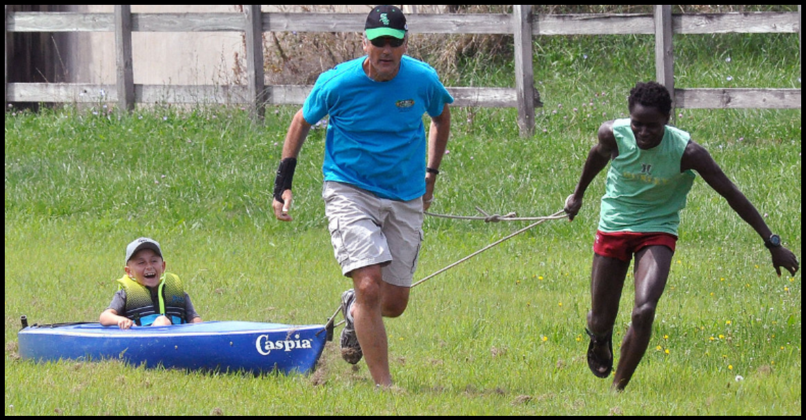 An unusual boat race was held on the Illinois & Michigan Canal in Ottawa, Illinois on Saturday August 6, 2017 to draw attention to the Ottawa Canal Association’s plan to re-water a section of the old canal. Starting next year an Illinois National Guard engineering unit will excavate the race course from La Salle to Columbus streets and beyond. They plan to re-water it to provide a recreational resource.
The dry grass covered bed of the canal made pulling the boats harder than if it had been watered. Held as part of Ottawa’s Riverfest, there were two races. In the first race two-person crews pulled a canoe with a child aboard about 40 yards down the canal bed and back. Individuals pulled kayaks in the second race. A great time was had by all.
Photo courtesy Ottawa Times
A Canal Forgotten
By Preston Richardt
History of the Canal
In 1827 the United States Congress authorized the purchasing of land by the state of Indiana (only 11 years since statehood) to improve travel and transport within the young state, then the Indiana General Assembly passed legislation authorizing the construction to begin in 1831. (History of Gibson County Indiana, Gil R. Stormont, 1915) Beginning at Fort Wayne Indiana in 1832, work began digging the canal that ran from Toledo, Ohio to Lamasco, Indiana (now part of Evansville). After 20 years of work and combining sections from three different canals the 468- mile-long Wabash and Erie Canal was completed making it the longest canal ever dug in the Western Hemisphere and the second only to the Grand Canal in China. (Vincennes, IN: The Final Link. Fort Wayne, IN: Canal Society of Indiana, 1998).
Why did it take so long to build? The Story of Three Canals: W&E, Central, Cross-Cut
In 1836 the Indiana General Assembly passed the Internal Improvements Act. which authorized the state to start many major projects including improved roadways, railroads and canals. Within this bill, the state legislature authorized the construction of 6 canals. The largest project was the Wabash and Erie Canal.
As part of the Act of 1836, the Central Canal was sanctioned for construction. It was to connect the Wabash River at Peru, IN to the Ohio River at Evansville, IN. Construction of the Central Canal began in Indianapolis and Evansville simultaneously; remnants of the Central Canal are still visible and a portion of it is a vital waterway through Indianapolis today.
On April 22, 1837, shortly after passage of the Internal Improvements Act, the Panic of 1837 started. It was the longest and most severe depression to hit the United States until the Great Depression of the late 1920s & 1930s. Because of the financial crisis of ’37, all construction that had begun on all projects of the Internal Improvements Act was stopped except for the work on the Wabash and Erie Canal. By the time of the work stoppage in 1839 sections of the Central Canal in Indianapolis and points going east were completed along with the works through Evansville and some 20 miles to the north. Additionally, many of the earthworks along its route toward Indianapolis were started. (Annual Reports to the State of Indiana, 1851)
The 1841 the state legislature decided they could not pay for the construction of the canal and thus placed it into the hands of private bond holders by 1847 to see to its completion. By 1849 the originally sanctioned Wabash and Erie Canal was finished from Toledo, OH to Terre Haute, IN but the Board of Trustees wanted to extend it south to the Ohio River thus the Cross-Cut Canal was created. This canal was to connect the Wabash and Erie Canal to the proposed and incomplete Central Canal then proceed south to the completed section of the Central Canal that was abandoned in 1839. This short 47-mile section proved to be extremely challenging as it had to rise over a large summit then fall again to connect with the Central Canal at Worthington, IN. On September 22, 1853, the canal boat Pennsylvania made the first full trip along the recently expanded and completed 468 mile Wabash and Erie Canal. (www.historicevansville.com)
The Canal in Pike and Gibson Counties on the Refuge
The canal enters the Patoka River National Wildlife Refuge south and west of Glezen (a canal town originally named Hosmer), now SR 57 runs atop of it to just south of Houchins Ditch (modern Patoka River) where it turns more westerly toward the ghost town of Dongola. The canal crossed the Patoka River (modern South Fork of the Patoka River) via aqueduct number 17. The earthworks to the north of this point were started in 1838/39 and works completed between 1850-1852. These earthworks continue to run south-westerly from this point for several miles along the high terrain on the south side of the original Patoka River for about 5 ½ miles until it turns south toward the town of Francisco. The canal dances in and out of the Refuge along this route.
The Canal Around Dongola
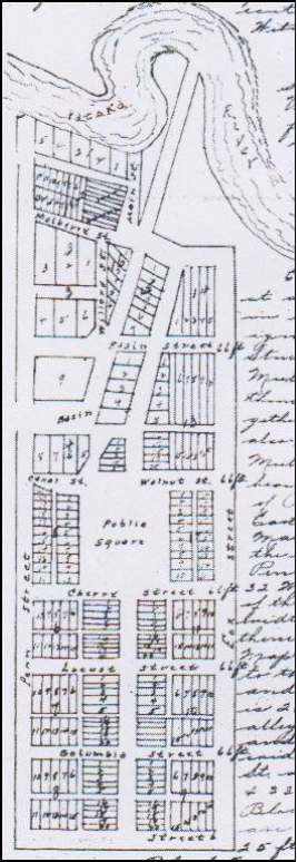
The canal approached Dongola from the Northeast at approximately 33° and passed through the north half of the town.
Dongola
(Plat Description 1851)
The town of Dongola was platted in 1851 and was expected to be a major port town along the canal. Many locally known persons, mostly from the Evansville area, were key in getting the town platted or laid out. Some of their names are Willard Carpenter and Thomas Garvin. Col. James W. Cockrum owned a warehouse in the village as reported by his son Col. William M. Cockrum in G.L. Stormonts book the History of Gibson County.
The town was laid out in such manner that the State Road coming up from the south ran along its western border and would eventually cross the Patoka River via the old bridge in the approximate location of the later iron bridge. The canal entered town from the north east and traveled at a 33° angle from North to the southwest for several blocks until turning due west at the basin approximately one block east of the western most road of the town. The town was configured to have 17 blocks laid out to conform with the canal bed to the north and traditional blocks to the south around a large common area in the center of town.
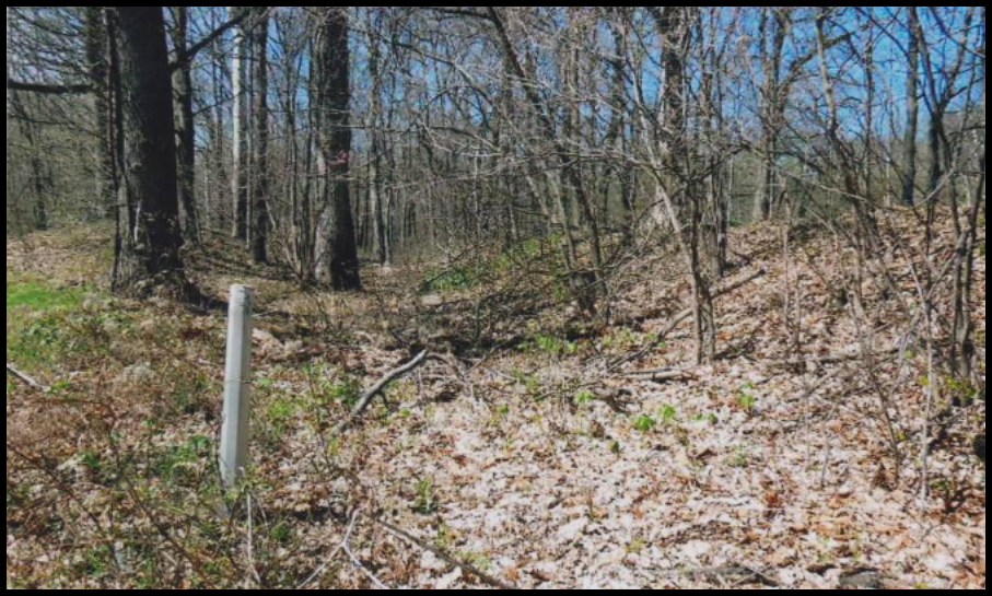
The town extended all the way to the Patoka River and had a sawmill along the river bank. Just east of the intersection of Main Street and Mulberry Street there was a bridge crossing over the canal, which served as a towpath change as well as a city street; this was the last towpath change along the canal going south to Evansville.
The extent to which the town grew is not completely clear. It was short lived. Like so many other canal towns it grew in prominence with the canal but was eventually abandoned when the canal was shut down in the area in the mid to late 1860s.
Canal Abandonment
The Wabash and Erie Canal began being abandoned in sections starting around the mid-1860s. The story is that the canal’s demise was due to the invention of the railroad, while this is partially true, the railroad was already being used when they began construction in 1832. The ultimate reason for its shutdown was sabotage along the earth works in the Cross-Cut canal section between Terre Haute and Point Commerce (Indiana State Reports of 1853, 1859-60, 1863, 1871-72) and the upkeep of the wooden structures to the south.
Even though the canal was no longer being used in certain sections; those sections that were still viable were used by local farmers and merchants. Starting around 1870 the Wabash & Erie Canal Company began selling the canal and its lands with complete closure occurring in 1874.
Canal Today
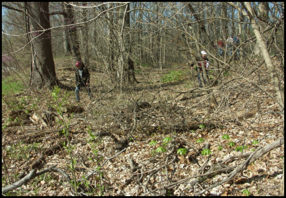
There are many areas throughout the state where you will find remnants of the canal, such as the earthworks in the Dongola area and the deep cuts west of Francisco and south of Petersburg. Some structures were converted for rail use, such as the piers for White River aqueduct (#16) northeast of Petersburg. Other intact wooden structures along the canal such as Culvert 203 in Gibson County are still working as designed. In the northern part of the state there are stone structures such as locks and culverts that are still intact. Structures long forgotten are being found when construction is being performed. Through the use of satellite photographs one can follow the canal’s path for the most part. Lastly one with a trained eye can go out to a known canal location and see the canal bed as little more than a sunken path through a woods or field.
This canal had such profound impact in the state and the country that it should not be forgotten. Despite man’s best efforts to destroy it, the canal is still there and able to be seen.
Northwest Ohio Tourist Gems
By Don Haack

Each summer my wife Betty and I have invited our two grandchildren to spend a week visiting us on our farm on the far south side of Fort Wayne, Indiana. These visits have usually included an overnight visit to a tourist location in Indiana or Ohio, but, due to our age and health condition, we have decided to do daytrips. Our granddaughter, Parker age 10, recently joined us on this trip. Our grandson, Gabe age 13, went last year. We try to emphasize the history of our area as we travel and like to include canal locations and highways crossings, such as the watered section of the Miami and Erie Canal crossing U.S. 33 just north of St. Marys, Ohio on our way to Wapakoneta. Since they both live in suburbs of Milwaukee, Wisconsin, they do not get the same canal education exposure as Indiana and Ohio students.
NEIL ARMSTRONG AIR & SPACE MUSEUM – WAPAKONETA, OHIO

Neil Armstrong (1930-2012), who became the first person to walk on the moon on July 20, 1969, was born in Wapakoneta. The museum includes the dome shaped Astro Theater, which features a movie about the Apollo Space Mission and the first Moon landing and walks. The entrance to the theater goes thru the Infinity Room, an 18-foot-square room lined with mirrors, giving the illusion of walking in space. One of the exhibits allows a person to lie on his back with a lot of forced air jets lifting him off the floor, giving the feeling of weightlessness. Parker’s favorite—many turns.
Exhibits in the museum follow the history of flight from the dreams of science fiction to the reality of the space exploration missions. On view are full size airplanes, the Gemini VIII capsule in which Neil Armstrong completed the first spacecraft docking in orbit and a Moon Rock. Time lines show the history of man’s travel in air and space and include a complete photo roster of the Astronauts.
THE BICYCLE MUSEUM OF AMERICA – NEW BREMEN, OHIO

The museum features a very large selection of antique bicycles from the 1816 Draisenne wooden scooter type without pedals to the late 1800’s large front wheel and small back wheel type and includes numerous bicycles for the ladies on the first floor. The second floor features the military bicycles of World Wars 1 and 2. The large third floor includes the early 1900’s racing bicycles, children’s bikes and tricycles, the balloon tire models of the 1940’s and the newer styles of the late 1900’s. Many of the bicycles in the museum are from the collection of James Dicke II of Crown Equipment Corp., a manufacturer of electric lift trucks in New Bremen.

The majority of the bicycles came from the extensive Schwinn Bicycle Collection. In 1997 Dicke purchased the bicycles, memorabilia and advertising items at the Schwinn Auction in Chicago and moved the collection to New Bremen, which required an addition to his building area on the third floor. Also on the second floor is his wife’s gem and rock collection and the Crown Corp. display of the TV antenna electronics they developed and made in the 1940’s and 1950’s.
As you enter the museum they have displayed on a wall a copy of the plan and profile views of the Miami and Erie Canal. They have copies of it for sale for $10.00 as a canal fund raising item. Next to their building is the Miami and Erie Canal Lock 1 North and the north end of the Stone Walk Path on the west side of the watered canal to Minster, Ohio.
MARIA STEIN SHRINE OF THE HOLY RELICS – MARIA STEIN, OHIO

The Maria Stein Shrine of the Holy Relics is part of what was the original Motherhouse of the Sisters of the Precious Blood founded in 1846. The Maria Stein Shrine of the Holy Relics was founded in 1875 when Father J. M. Gartner entrusted his collection of relics to the Sisters at Maria Stein. A very high percentage of Low German Catholic Heritage farmers live in the Maria Stein area. The security of the area was very important, as the European Catholic Churches and the Vatican itself, were experiencing a great deal of pilferage of Catholic icons, treasures and especially relics.
The relic collection is housed in a beautiful chapel built in 1892, featuring extensive hand carved woodwork and statuary figures. Over 1,000 relics of all sizes are on display, making the collection the second largest of its type in the United States. St. Anthony’s Chapel in Pittsburg is the largest. The Shrine was placed on the National Register of Historic Places in 1976. The primary display of relics is in a large altar that was hand carved especially for this purpose. Four beautiful stained glass windows imported from Munich, Germany also adorn the Relic Chapel.
The Shrine is a non-denominational attraction with many interesting facts of history for all ages. The 1,400 sq. ft. Heritage Museum reopened in June 2015 after an extensive renovation that created six distinct galleries, featuring historical artifacts from the Sisters of the Precious Blood as well as the German Heritage from this area of many Church Steeples. They also have a very large Gift Shop, a larger Adoration Chapel for programs and services, lots of art work mounted on the walls, gardens, Stations of the Cross and large outdoor spaces. 90 minute tours at 10:00 a.m. are available for a nominal charge or self guided tours at your own pace and convenience.
FORT RECOVERY – FORT RECOVERY, OHIO
 Reconstructed Fort Recovery is downtown and contains two blockhouses and a connecting stockade. The 9-acre-site is where Gen. Arthur St. Clair was defeated by the Miami Indians in 1791. More lives were lost here than at Custer’s Last Stand at the Battle of the Little Big Horn in 1876.
The site also recognizes General “Mad” Anthony Wayne’s victory over 2,000 Native Americans in December 1793 who attacked his troops nearby. The Museum’s displays depict the battles and include artifacts from prehistoric times. A monument honoring those who fought stands 5 blocks east at State Roads 49 and 119 (Butler St.).
CSI Elects New Directors to Board
2017-2020
Canal Society of Indiana directors serve three year terms and one third of the board is elected/reelected every three years. This year Ellsworth Smith, who served on the board from 2011—2017, and Charles (Chuck) Whiting Jr., who served from 1998-200 and 2004-2017, asked to be replaced due to health and other commitments. We truly thank these gentlemen for their long service to CSI.
Our annual meeting was held on the CSI fall tour headquartered in Dubuque, Iowa on Labor Day weekend. At that meeting we elected the following two gentlemen to replace Ellsworth and Chuck.
Steve Williams
Roanoke, Indiana
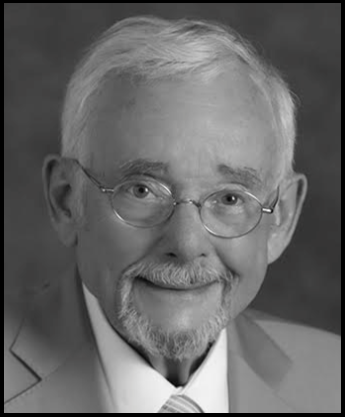
Lawyer: Shambaugh, Kast, Beck & Williams; LLP-Board Certified
Trust & Estate Specialist (Indiana Trust & Estate Specialty Board)
Indiana University-School of Business; Law School (Bloomington)
Wife: Sharon, 4 adult children, 8 grandchildren
Interest: Local history; Abraham Lincoln; American Civil War
Other boards: Roanoke Heritage Center; Baker Street Station Community Assoc.; M.E. Raker Foundation
Canal activity: Long time member of Canal Society of Indiana, interested in the significant, and generally under appreciated, role which the Wabash & Erie Canal played in pioneer settlement and economic development of the state.
Organizations: American College of Trust and Estate Counsel; Sons of Union Veterans; Roanoke Lodge No. 195, F & AM; Scottish Rite; numerous historical organizations.
David Kurvach
Newburgh, Indiana
 Moved to Warrick County, Indiana from Pennsylvania
Graduated from Warrick County high school three years later
Contractor at a very large southern Indiana factory reopening a large section of factory that has been idle
Married 1 1/2 years
Currently working with Preston Richardt on preserving a large section of the Wabash & Erie Canal through the Patoka National Wildlife Refuge hoping to create an interpretive trail with several historic markers showing the locations of several culverts, the Patoka River aqueduct and the Dongola town site and is organizing a collection of photographs taken over the last ten years of canal sites visited.
“My love of history developed around the age of eleven when I was bedridden with pneumonia and bronchitis. My mother gave me a copy of the Chronicles of America, an encyclopedia sized history book that held my interest for my three week recovery. I was especially drawn to the colonial period of American history possibly because the French and Indian War started around my backyard of Pittsburg. The Pennsylvania schools I attended weren’t the best in the world and I had a lot of bad history teachers. I distinctly remember receiving detention twice for correcting my American history teacher in ninth grade. I was also alarmed as to how much dedication was given to historic preservation of Pittsburgh’s sports teams over its colonial heritage. I see something similar in southern Indiana as an engineering marvel such as the Wabash and Erie Canal is largely forgotten. I was never taught anything about it in any history class I took here nor do I see it mentioned other than a footnote in local museums. We should be celebrating this marvel link to our past in the same manner the western states do with the transcontinental railroad.
We thank Sue Simerman for heading the nominating committee. Steve’s and David’s terms will run from the 2017 CSI annual meeting until our 2020 annual meeting. Welcome aboard!
CSI Announces “Up and Over Tour”
Spring April 13, 14 & 15, 2018
Hotel: Best Western, 5501 Coventry Lane
Fort Wayne, Indiana 46804
Coventry Village is located in the northwest quadrant of the I-69 and U,.S. 24 intersection. For reservations call 1.800.780.7234 or call direct at 260.436.0242 to request the CSI Group rate. Mention Canal Society of Indiana/Bob Schmidt. Act now. Only 15 rooms available at the special rate for April 13 and 14, 2018.
Features:
Friday Program: Steve Williams, President, Roanoke Area Heritage Center presentation of Lambdin P. Milligan, attorney convicted of treason during the Civil War. Aboite Trustees Office complex.
Saturday Tour: By motor coach beginning at Continental Divide, the water shed separating the all-water route of the St. Lawrence River/Great Lakes and the Mississippi River system, we’ll explore why the aborigine Indians, French Explorers, British and Americans valued this land bridge that was first the Great Marsh, then the Portage and the route of the Wabash & Erie Canal, which was later followed by rails and highways.
Saturday Tour Highlights: Experience the path of the Canal from Allen County, through Whitley and across Huntington counties while traveling over the Hoosier Heartland Corridor, which is the modern-day legacy of the Wabash Erie Canal route. Visit the Roanoke Area Heritage Center; site of ghost town of Port Mahon; Huntington County Historical Society; Forks of the Wabash Park; and Vice Presidential Learning Center Museum (with artifacts from every Federal VP that has served). Drive by famed LaFontaine Hotel, sunken Gardens, Lambdin P. Milligan house (the pro-Confederate whose reprieve from the hangman’s noose protects certain Civil Rights to this day); site where Clear Creek Flood Gate was removed; the extant Silver Creek Arch; Grave of Civil War veteran Lessel Long author of Twelve Months in Andersonville Prison, return on the Hoosier Heartland Corridor the most recent transportation across the Great Swamp.
Saturday Evening Program: Bob Schmidt, CSI’s Panama Canal tour Power Point presentation.
Sunday Morning: Events are in the planning stage
Tour committee: Tom Castaldi, route planner and docent, Bob & Carolyn Schmidt details
CSI members will receive tour registration forms via E-mail closer to tour time and final instructions about two weeks before the tour. Non-members may call 260-432-0279 to register for the tour.
Laurel Feeder Dam Trail
The Franklin County Observer announced on September 5, 2017 that a 2-mile-long trail will be built from Metamora, Indiana on the Pennington Road (Rte 52) along the Feeder Canal to the Feeder Dam for the Whitewater Canal located in Laurel, Indiana. It will pass two historic locks. The Mark Dunevant family will match up to $35,000 in donations to Phase 1 of the project.
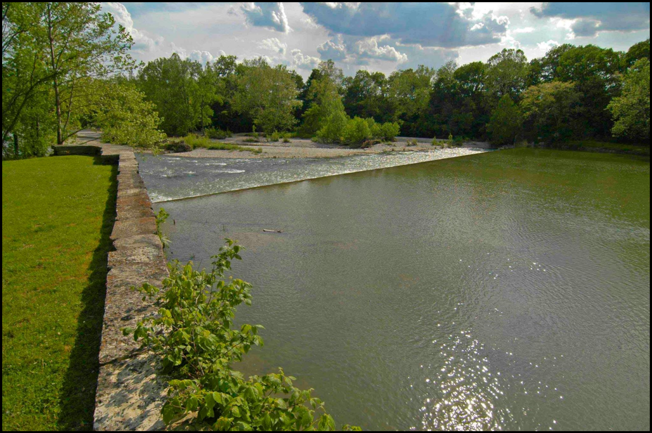
This rough-in phase is estimated to cost $78,000. To date matching funds have been received from Franklin County Tourism and in kind contributions from Zimmer Tractor. The Indiana Department of Natural Resources will fund Phase 2.
Whitewater Canal Trail has established the Laurel Feeder Dam Trail Pass-Through Fund to receive donations. Make checks payable to FRCCF (Franklin County Community Foundation), 527 Main Street, Brookville, IN 47012. On your check’s memo line write Laurel Feeder Dam.
Fort Wayne’s Canal Boat Update
After reading the article “Fort Wayne’s Canal Boat Christened” in the September 2017 issue of The Tumble, Mark Smith, Carroll County Historian, found more information about “Sweet Breeze,” the name given to the new boat to be used on Fort Wayne’s rivers as part of the city’s goal for the riverfront to be its playground. Sweet Breeze was the oldest daughter of Miami Indian Chief Little Turtle, who is buried in Fort Wayne. She married a local soldier and Indian agent Captain William Wells. Mark writes, “There is a Carroll County sequel to that: the Mary Wells Reserve, which was granted to Little Turtle’s granddaughter Mary in the Treaty of St. Mary’s. Mary later was married to James Wolcott, who took offense that her land was sold to settlers and made that a matter of Congressional Record to see that his wife was recompensed for her loss. This area was the focus of the recent dig by University of Indianapolis students at Baum’s Landing in Delphi, Indiana.”
CSI Fall Tour: “Twilight” in Iowa
By Bob & Carolyn Schmidt
Photos by Bob Schmidt (BS) or Sue Simerman (SS)
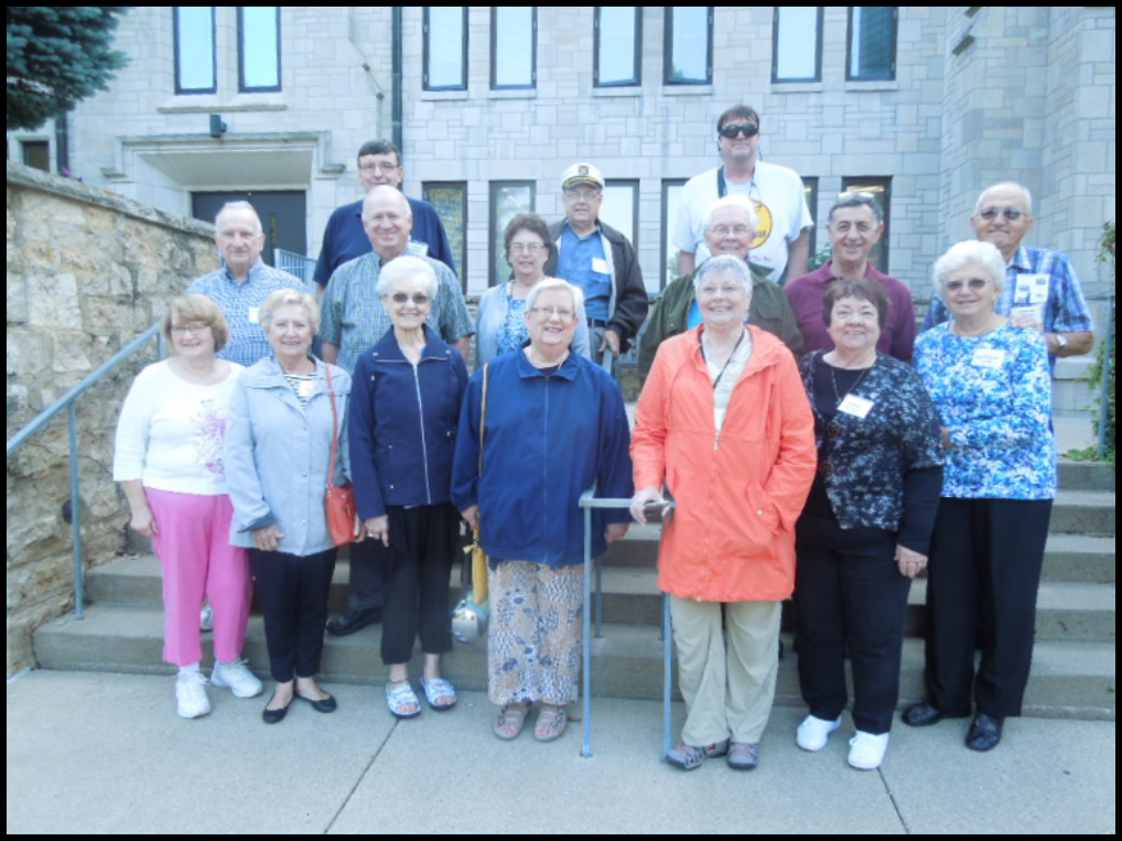
2 Illinois, 12 Indiana, 2 Ohio
* 7 CSI directors
Sixteen members of the Canal Society of Indiana explored the area around Dubuque, Iowa and cruised up the Mississippi River aboard the “Twilight” to Guttenberg, Iowa on Labor Day weekend. Some had previously been on a 2-day cruise in June 2009, when CSI traveled from Le Claire to Dubuque and wanted to experience the bluffs along the canalized river beyond Dubuque.
Dubuque was named for Julien Dubuque, a Frenchman who arrived in 1785 to mine lead. This area was part of the Louisiana Purchase in 1803.

On Friday morning we had a car caravan drive 15 miles south of Dubuque to the town of Peosta, the location of the New Melleray Abby. At 9:15 a.m. we attended the Chapel service for morning prayers by the Monks. They sang the Psalms from the Bible. This service was one of seven that they have each day. The first prayer service begins at 3:30 a.m. and the last is at 7:30 p.m. This monastery/abbey was established in July 1849 when 6 monks arrived from the Mount Melleray Abby in Ireland. The stone Abby we visited was constructed by the monks after the Civil War. This Catholic order follows the rules of St. Benedict, was originally called the order of Cistercians of the Strictest Order, but today they are best known as Trappists.
The monks are vegetarians and they raise their own vegetables. Years ago they raised grain crops and sold them commercially to sustain the Abby. The physical requirements of farming required them to find other means of support so they decided to use their forests lands to provide lumber for caskets.
Following the prayer service we were provided with a wonderful factory tour where we saw the various steps in woodworking and casket making. Trappist Caskets was established in 1999.
The Abby owns some 1300 acres of timberland that are managed by a professional timber man. Walnut, red oak and pine are the principal trees that are used in casket making. These simple and beautiful caskets range in price from $1,200- $3,500. Their caskets may be ordered in advance or near the time of death and shipped throughout the United States and Canada.
Each of us were given a video about the workings of the Abby. Visit the New Melleray Abby website or Trappist Casket website to learn more. U-Tube has videos that explain the monks life and work at the Abbey.
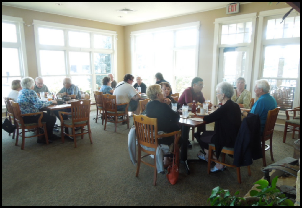
Our next stop was lunch at Catfish Charlies, one of the best seafood restaurants in Dubuque. We were seated in a private dining room with windows all around and could look right out at the Mississippi to see birds and boats. While we waited for our lunch we had a brief CSI business meeting where we elected two new board members, talked about accessing the CSI website and discussed our next tour in Huntington / Fort Wayne in April 2018.
After lunch we drove across the river to Galena, Illinois. Galena, which is the ore in which lead is found, could be sourced on either side of the Galena River in this region, thus the town and river were named Galena. This town was once a thriving riverboat town. The downtown was loaded with many shops and old buildings, which we were given about 45 minutes to explore after finding a parking place. Parking was a challenge as this is a tourist destination.
At 2:00 p.m. we boarded the Galena Trolley to visit three historic homes. The first stop was the Dowling House, the oldest home in the city built in 1826-27. John Dowling was a trader, who was the largest iron dealer on the Upper Mississippi. Inside were various artifacts of the period.
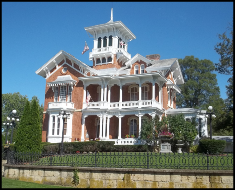
Next we went to the Belvedere Mansion. This Italianate structure was built in 1857 by J. Russell Jones, a prominent businessman and part owner of the Galena and Minnesota Packet Steamboat line. He was a friend of Lincoln and Grant, who appointed him Minister to Belgium after the Civil War. This beautiful home was loaded with antiques and pictures that the current owners have acquired over the years.
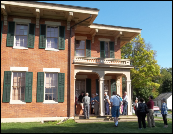
Our final stop was at the home given to Ulysses S. Grant after the Civil War by the citizens of Galena in appreciation for his service. When asked what he would like to see in Galena, Grant said if he were mayor he would “just like to see a sidewalk from his home to the Post Office.” This home is decorated for the period with some artifacts that were in the Grant Home when he occupied it.
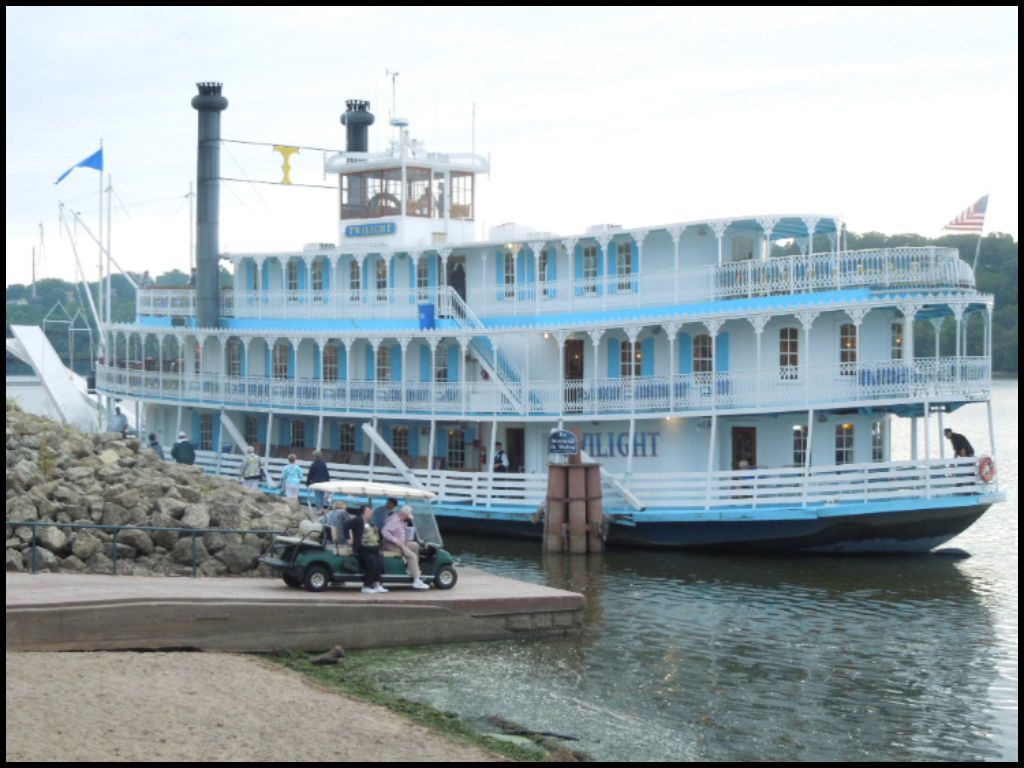
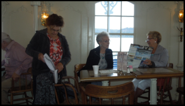
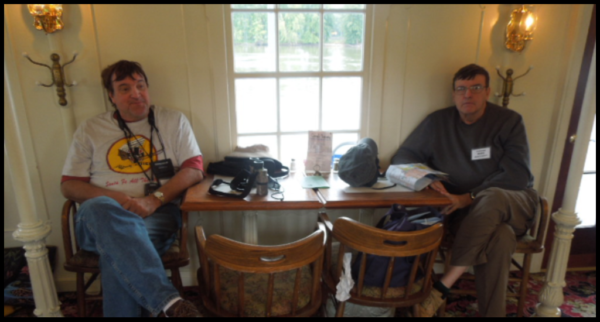
Saturday morning we headed for Rivers Edge Plaza in Dubuque where the “Twilight” docks. Parking was free and available. We quickly boarded the boat for the cruise, which was completely sold out, to learn more about a canalized river. A continental breakfast awaited us and our members lost no time digging in.
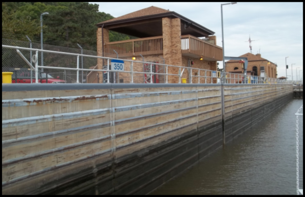
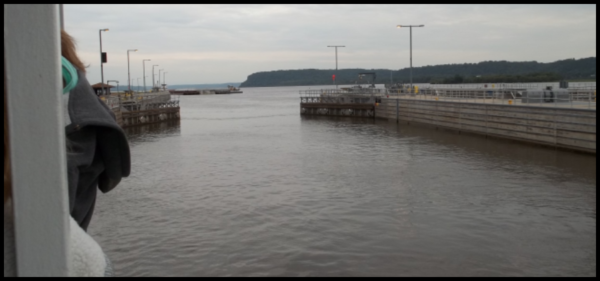
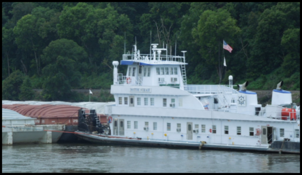
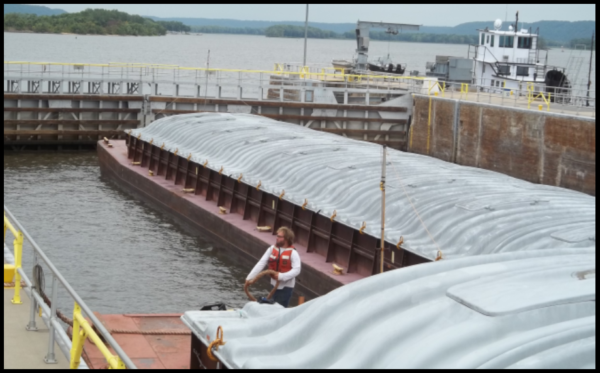
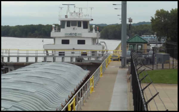
At 8:00 a.m. we promptly pulled away from shore as the calliope piped a tune. Soon we reached Lock 11 and saw a great many cormorants gathered to catch fish turned up by the turbulence in the lock. Our captain rushed to the lock to beat a tow of 12 barges. It had to breakdown its tow into two groups to go through the lock and would have delayed our cruise up the river.
Along the route we saw many bald eagles. These birds love to gather near the locks, which are kept open for river traffic giving the eagles an opportunity to fish.
As the 140 passenger boat, owned by Captain Kevin Steir and his wife Carrie, traveled north, our Captain explained various features on the land and in the river and pointed out abandoned towns, railroads and wildlife. The “Twilight” only runs this route to Guttenburg in September and November. Her normal route takes 2 days to travel from Le Claire to Dubuque and back. She brings about 5800 passengers a year to Dubuque. Since 2005 some 50,000 passengers have traveled this route. She was constructed in 1986-87 in a shipyard in Louisiana. She is designed like a steamboat, but is powered by a diesel engine.
By noontime we arrived at Guttenberg and the passengers walked down a wobbly gang plank to go ashore. Some visited shops in the small village while others walked to the overview of Lock 10 and saw another barge locking through.
When the whistle blew we headed back aboard the “Twilight” for a exceptionally good lunch that was served by a crew of young people. Some of us played Bridge and Euchre on the return trip but there was still plenty to see. An entertainer was aboard who played songs about the river, etc. We docked in Dubuque promptly at 5:00 p.m.
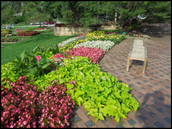
Sunday morning some of our members began their separate trips back home but some lingered in Dubuque to visit other attractions. Our group visited the Dubuque Arboretum and Botanical Garden. This 56-acre landscape is open daily and free to the public. We enjoyed walking the paths and especially seeing the Hosta Garden with all its varieties. A Japanese garden featured a waterfall and an arched bridge for picture taking. Volunteers were busy on this Sunday morning pruning bushes and plants. It was nice to have a quiet time with birds singing among the lush blooming flowers and plants.
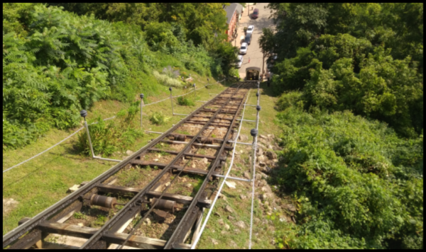
We rode the Fenelon Place Elevator in downtown Dubuque. A local banker, J. K. Graves, who lived on top of the bluff, wanted to go home for lunch and take a slight rest before returning to work. The horse and buggy ride up the bluff consumed too much of his time so, in 1882, he had a incline cable car built just for his personal use. The original car burned in a fire in 1884, but a local group formed the Fenelon Place Elevator Company as a tourist attraction. A later fire in 1962 required some additional changes, and the whole system was finally rebuilt in 1977 with a modern gear box and DC motor. The movie F.I.S.T. included a scene at this location. Today for $3 you can take a 296-feet-long ride up the side of a 189 foot bluff. It takes about 2 minutes each way. From the top balcony you can observe the town of Dubuque and the Mississippi River below.
One of the city’s main attractions is the National Mississippi River Museum & Aquarium where we viewed two 4D movies, “Prehistoric Sea Monsters” and “Extreme Weather.” This was quite relaxing. We wore 3D glasses and were shaken and sprayed with water at various times throughout the movies. Being a holiday weekend the place was packed with families. The aquarium displayed the types of fish that can be found in the Mississippi basin. The museum is filled with information and hands on exhibits about the river. Snakes, gars, paddle fish and even an alligator were seen behind plexi-glass.
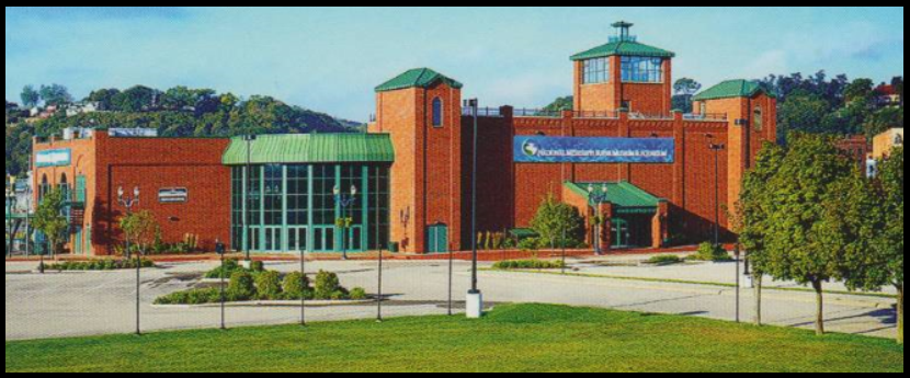
The William M. Black, a dredge boat that maintained the channel in 1934, is on the premises to explore from top to bottom.
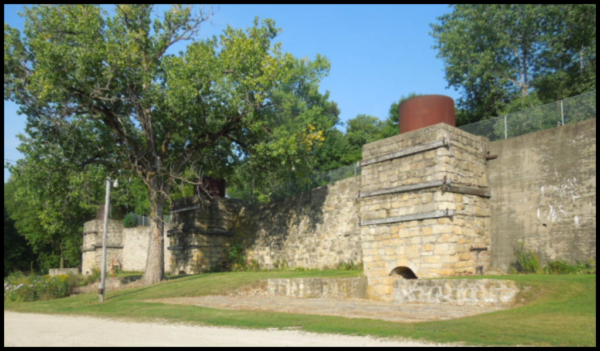
By 4:30 p.m. we headed for Le Claire, Iowa. Along US Highway 61 we came upon the Hurstville Lime Kilns. You will recall that in Delphi, Indiana they have reconstructed the lime kilns that operated along the Wabash & Erie Canal. In Iowa we found real kilns still standing. In 1870 when Alfred Hurst came to the area, he found the limestone and timber fuel needed to produce lime for cement making.
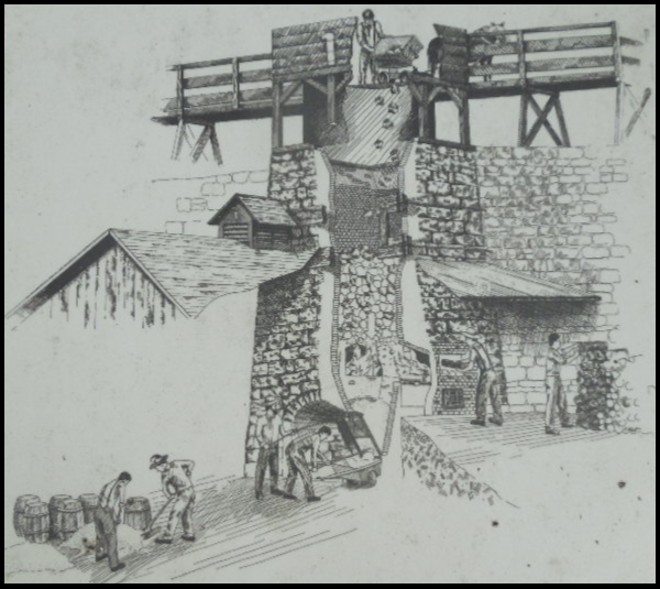
By 4:30 p.m. we headed for Le Claire, Iowa. Along US Highway 61 we came upon the Hurstville Lime Kilns. You will recall that in Delphi, Indiana they have reconstructed the lime kilns that operated along the Wabash & Erie Canal. In Iowa we found real kilns still standing. In 1870 when Alfred Hurst came to the area, he found the limestone and timber fuel needed to produce lime for cement making.
The Hurstville kilns were constructed over the following years and produced at their peak 8,000 barrels of lime per day. The 4 kilns did not operate in the Winter as the 1650 degree temperature required could not be maintained. Hurst died in 1915 but his son William kept some of the kilns going until 1930. Today the site and a nearby interpretative center is maintained by the Jackson County Historical Society. The site is on the National Register of Historic Places.
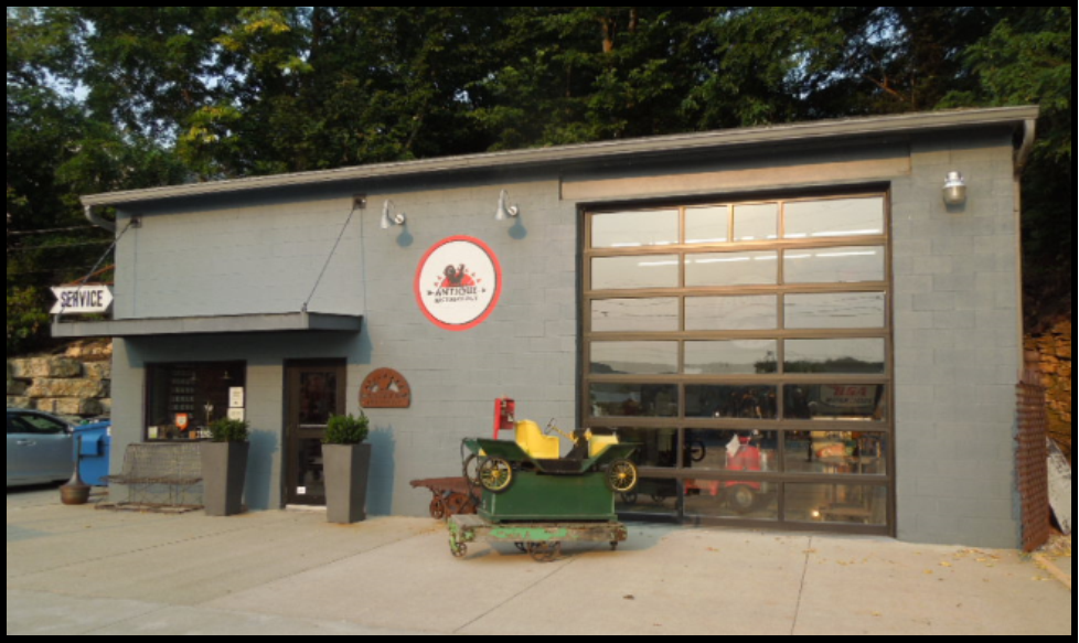
At LeClaire we wanted to see Antique Archeology, the home of American Pickers, a History Channel show with Mike, Frank and Danielle. The store is there but they are basically now headquartered in Nashville, Tennessee.
We had a very eventful weekend. If you haven’t been on a Canal Society weekend before we encourage you to join us on a future tour. Meet friends with common interests and learn about historic canals, waterways and other historical points of interest.


