
Side-cut Canals
Robert F. Schmidt
Throughout history canals were built for 3 major reasons. Probably the first was to direct water sources for crop growing or other basic human needs. In the next phase of development, canals were used as a power source turning a grinding wheel for processing grains and later for other mechanical uses such as sawing lumber. Finally, canals were used to transport goods, livestock, people, and mail (or other types of earlier communications).
When constructing a canal, earth and other obstacles needed to be removed along the route so that the canal would be a gentle sloping waterway. The water needed to flow from higher elevations to lower levels, but not so fast that it would erode the earthen banks of the canal. Another consideration was to build the canal in as straight of a line as possible to reduce the amount of earth that needed to be removed and prevent bank erosion by a meandering route. Finally, the canal needed to connect as many human settlements as possible without violating some of the considerations above.
When constructing a canal, earth and other obstacles needed to be removed along the route so that the canal would be a gentle sloping waterway. The water needed to flow from higher elevations to lower levels, but not so fast that it would erode the earthen banks of the canal. Another consideration was to build the canal in as straight of a line as possible to reduce the amount of earth that needed to be removed and prevent bank erosion by a meandering route. Finally, the canal needed to connect as many human settlements as possible without violating some of the considerations above.
A canal of any great distance soon faced another obstacle as the change in land elevation worked against the need to maintain a gradual change in the canal level. Even ancient canal builders quickly learned that land elevation changes would only allow a limited distance to keep the canal at a reasonable level. The canal lock was invented by Leonardo da Vinci to solve this problem. A lock acted as a stopper in the canal that could be manipulated to move a boat between levels.
When the canal reached a river or steam canal builders faced another challenge—how to get across it. They could carry their boats down to the lower river level, pole across the river, carry their boat up to the canal level on the other side and resume their travel. Later, as boats got larger and heavier, they built aqueducts over rivers or culverts across smaller streams to carry the canal above these obstacles.
Another major consideration was the water supply. The dimensions of all canals are limited by the availability of water that can be obtained at the various sources along their route. There were many communities that wanted to be on a canal, but faced the limiting factors of distance and water supply.
Communities that were bypassed by a canal had to decide what they would do. They could accept the fact that the canal would not reach them and, if they wanted to use the canal, they would have to carry goods by wagon or on foot to the nearest canal location. If the distance was too far from the canal, they could organize their own canal company and dig a lateral or side-cut canal from their place to the mainline canal. (One of the best known examples of this situation in Indiana was the Hagerstown Canal. It was an eight-mile-long, privately financed canal between Hagerstown and Cambridge City where it connected with the Whitewater Canal. It was more of an extension than a side-cut or lateral canal.)
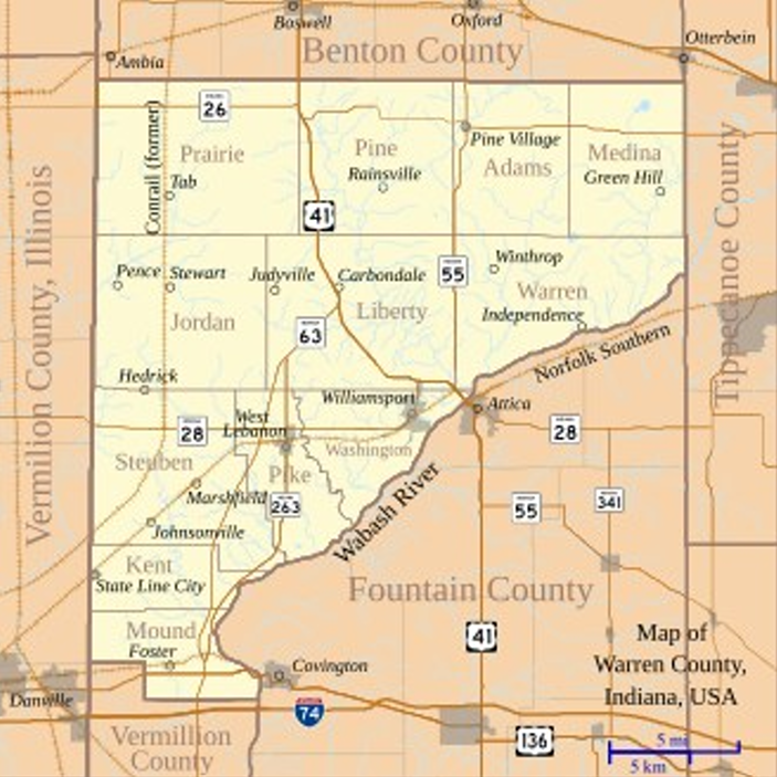
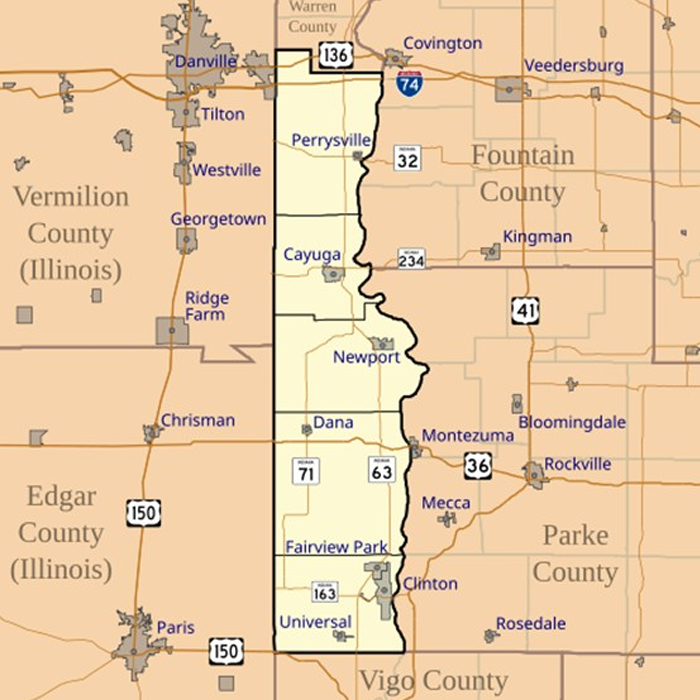
The Wabash & Erie Canal ran along the east side of the Wabash River from Lafayette to Terre Haute. There were considerable farmlands in Indiana and Illinois on the west side of the Wabash River that needed a transportation outlet. Some of this need was fulfilled by steamboats that could arrive in the Spring, but water levels in the Summer and late Fall were often too low for river navigation. Access to the Wabash & Erie was very desirable. West of the river from Lafayette to Terre Haute there were four towns: Independence, Williamsport, Perrysville and Clinton.
Note: Indiana spells Vermillion with 2- Ls – French version vs. Illinois uses only 1 -L
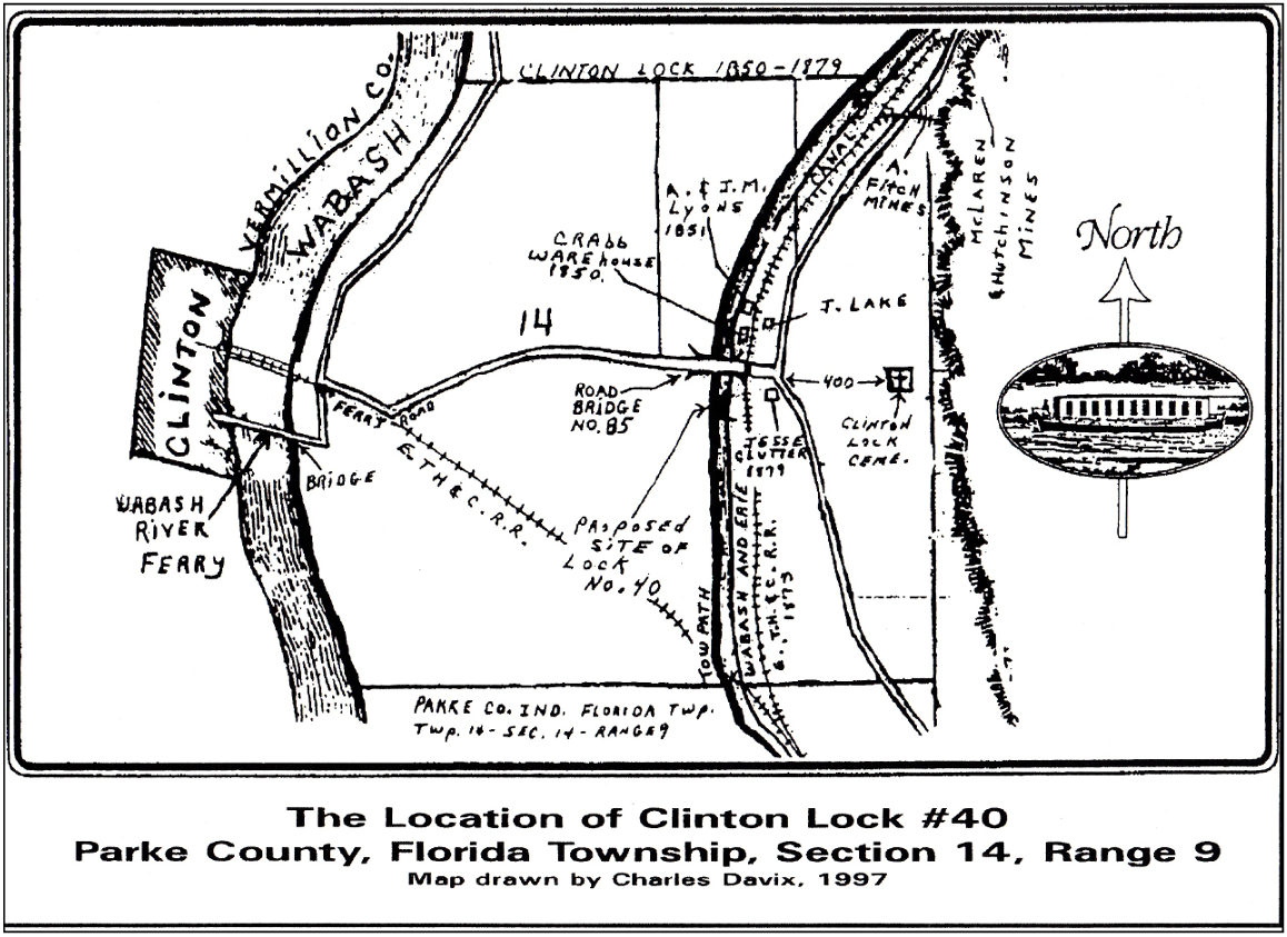
Clinton, Indiana, chose not to build a side-cut canal but to utilize the ferry to cross the Wabash and follow the existing ferry road to Hudnut (Lyford) where John Crab had built a warehouse beside the mainline canal. Here the canal boats could be loaded and unloaded. To the south of Crabb’s warehouse was Lock No. 40 that was appropriately called Clinton Locks.
On the Wabash & Erie Canal there were two side-cuts completed, both that were originally authorized in 1843 by the Indiana General Assembly—Perrysville in Vermillion County and Williamsport in Warren County. Independence in Warren County, seven miles north of Williamsport, was too lightly populated and no side-cut was ever attempted.
The Perrysville Canal Lock Company was chartered in 1843. The construction of this canal was done in 1845-46 before the Wabash & Erie reached beyond Lodi, so by 1849 when the Wabash & Erie reached Terre Haute, the Perrysville side-cut was fully operational. Boats were poled across the Wabash River into a 1-mile-long canal channel and then lifted by a lock into the main canal.
In the Chief Engineers report of 1848, it was noted that the Wabash & Erie was watered to Coal Creek (Lodi) but that the water supply south of Lafayette was not sufficient. Boats carrying grain could only operate at 1/2 to 2/3 of a normal capacity during the summer months. The dams at Pittsburgh and Wea Creek were each raised 1 foot to increase the water supply. How did this water supply insufficiency develop?
Placing a feeder dam on the Wabash River south of Lafayette was not considered feasible as there already was steamboat traffic to that point and a dam would hamper traffic. Also the wide flood plain of the Wabash south of Lafayette made building a dam more difficult. A steamboat lock had already been built at Pittsburgh, but it became unnecessary as steamboats could not pass further up the Wabash. Dams built across the upper Wabash were fine since there wasn’t any steamboat or flat boat traffic.
In 1840 the Wabash & Erie reached Lafayette. At that time there was plenty of water coming from the Delphi / Pittsburgh Dam so the Trustees offered water leases for the construction of mills in the town rather than just waste the water into the Wabash. Remember the canal flowed into town and had to be allowed to be directed somewhere.
For the next six years, due to the Indiana’s financial crisis, construction was slowed south of Lafayette and the canal wasn’t completely watered to Lodi until 1847. Now there wasn’t enough water supply and the canal Trustees did not want to shut down the Lafayette mills that still relied on the water to turn the mill wheels. The creeks south of Lafayette proved insufficient for this purpose until the canal reached Sugar Creek. The Perrysville Lock had been poorly constructed and leaked as much water as was being added by raising the Pittsburgh and Wea dams. In order to keep the main canal operating, the Trustees had to oppose side-cuts that wasted water despite the need for more boat traffic from the west side of the Wabash.
Although the Williamsport side-cut had been authorized by the Legislature in 1843, the town members hadn’t really pursued this effort for several years. On May 25, 1850, William R Boyer*, the Secretary of the Williamsport Canal Lock Company, wrote a letter to the Trustees of the Wabash & Erie Canal requesting financial aid in their effort to construct a side-cut. With 150 stockholders, they had raised about $15,000 to build the lock and side-cut. Illinois farmers as far as 20 miles away supported this effort.
Resident Engineer, Thomas Dowling replied to Boyer’s letter on June 8, 1850, for the Board stating: “You are therefore hereby notified, that we shall resist any attempt on your part to divert any water from the Canal for the purpose of supplying your side-cut, as it will seriously affect the navigation on the main-line canal.”
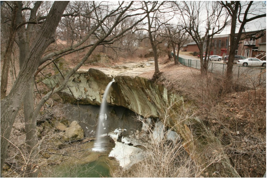
Despite this discouraging reply, the folks of Williamsport proceeded to dig the side-cut and lock, which was completed by 1852. The town was incorporated in March 1854 with a population of 552. This side-cut operated for just a couple of years as the railroad crossed the Wabash River from the east and then arrived in Williamsport in 1856. The railroad provided a permanent year-round outlet for their agricultural products. The so called “Old Town” at the river now shifted to “New Town” up the bluff beside the new railroad. Today the town’s total population is only 1,950 and Warren County has a very small population of 8,440.
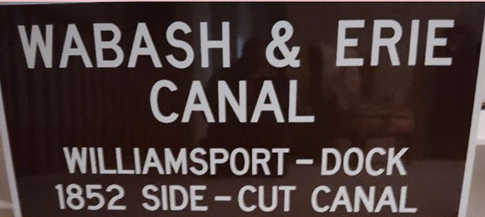
In 2025 the Canal Society of Indiana recognized the efforts of Williamsport to access the Wabash & Erie Canal by placing a sign in Old Town Park along the banks of the Wabash River.
*Besides being the Secretary of the Williamsport Canal Lock Company, William R. Boyer was the Clerk for the Associate Judge of Warren County (June 22, 1841), later the Judge of the Common Pleas Court, and when his brother Dr. Conrad Richards Boyer became ill William insisted he move to Indiana instead of going to South America. After William died Conrad and his sister contributed $125.00 for the large double window in the front of the new Williamsport Presbyterian Church in memory of William.