
Index:
The Proposed Canal That Will Not Die
By Michael E. Morthorst, Cincinnati, Ohio
As most canalers know, the Panama Canal opened a third lane of larger locks in the summer of 2016. Discussions of Central American canals inevitably include the subject of Nicaragua. Nicaragua has always been a significant factor in determining what canal eventually gets built, even if nothing ever ends up there. Nicaragua, after all, was originally the preferred route of the U. S. Congress for a trans-isthmian canal. Separate members of Congress, one from the House and one from the Senate vied to earn the title “Father of the Nicaragua Canal.” When the final revised survey was released recommending the Panama route, there were demands for a congressional investigation into why the better (Nicaraguan) route was not chosen. However, when the final vote of Congress was taken, Nicaragua lost. What happened? The reality is that a Nicaragua Canal is a proposal that may never die, and ironically may never get built.
The Land
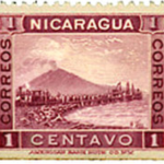
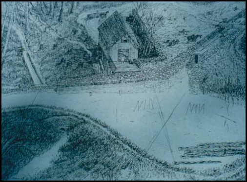
Nicaragua has had a special appeal to American engineers since the time it was first considered as a possible canal route. Although as many as six separate routes have been proposed at one time or another, only three alignments have ever been seriously considered. The southern, most historical route has been along the Rio San Juan, connecting Lake Nicaragua to the Atlantic Ocean along the border of Costa Rica. The big problem with the route has been that the mouth of the river is in Costa Rica, a country with historically poor relations with Nicaragua and which has not been interested in such a canal project. To finesse that Costa Rica problem and keep the canal in Nicaragua, a diversion down the Rio El Desendo to the town of San Juan del Norte has always been part of the plan. The San Juan and the Rio El Desendo would be connected by a canal or an artificial lake.
In the 1900’s a northern route following the Rio Escondido was proposed, beginning near the town of Bluefields and following the river inland and connecting to Lake Nicaragua by a short canal. In 2013 a new route along the Rio Punta Gorda was proposed for the Chinese financed Nicaragua Grand Canal.
For all proposals, Lake Nicaragua, located in the western third of the country, would provide an endless supply of water for canal operations. The distance from the western shore of the lake to the Pacific Ocean is only twelve miles. A short canal with the requisite Pacific locks would complete the connection between lake and ocean. Every plan advanced to date featured three or four locks on each end of the canal. The total length of all the canal proposals has been between 170 to 180 miles. The section immediately east of the lake and extending to the locks on the Atlantic end would be situated at 120 feet above sea level. Many engineers consider this route easier to dig than the competing Panama route.
Early Proposals
The idea of a canal to connect the oceans in Central America dates back to the time of Spanish colonization. Originally, a canal was to be a method of efficient transport of gold and other valuables looted from Peru to the mother country. Crossings were considered in Mexico, the Columbian province of Panama, and Nicaragua. Technological problems and hostile local jungle climates doomed these plans.
When the Central American countries broke off from Spain in 1825 and merged into a “Federal Republic of Central America” a canal was regarded as a means to create prosperity for the region. Fatefully, the new government contacted the United States of America for expertise and funding. Feasibility studies were commissioned. At the time, the United States was experiencing its own canal era and the Secretary of State, Henry Clay, was a major proponent of canals. Clay embraced the idea. A route along the Rio San Juan was proposed, with a series of locks and tunnels to connect the two oceans. Congress declined to approve the plan. A complication at that time was that Great Britain had seized and occupied British Honduras (modern Belize) as well as part of the Caribbean coast in present day Honduras and Nicaragua (the Mosquito Coast). These activities of Britain were part of that country’s ambitions to build a canal in the area. The continuing foreign activity led the United States to promulgate the Monroe Doctrine. Since the question of control of the Caribbean end was in doubt both projects died.
The next initiative for a canal was in 1849 when the government of Nicaragua signed a contract with Commodore Vanderbuilt (of the New York Central Railroad) granting him a twelve year concession to build a canal in Nicaragua, again on the Rio San Juan route. A railroad to aid those going to the California Gold Rush was constructed and proved to be very profitable. The canal construction part of the plan was disrupted when a civil war broke out in 1854. A U.S. citizen, William Walker, was recruited by one of the factions as a mercenary. Shortly after arriving in Nicaragua in 1855, Walker took over the country. He then invaded Costa Rica in order to secure the northern part of that country and its San Juan River for an inter-oceanic canal. Costa Rican troops supplemented by those from other Central American countries rose up and ousted the invader in 1856. Once Walker was defeated and executed in 1860, a U.S. sponsored canal in the area was no longer a very popular idea.
During his presidency (1869-1877) Ulysses S. Grant commissioned seven canal studies throughout Central America. He had become a strong believer in a Central American canal after his military unit made a painful crossing of the jungles of the Isthmus of Panama in 1852. Efforts to negotiate a lease with Columbia to build a canal through its province of Panama were not successful. Nothing further took place during President Grant’s term.
The failed French attempt at sea level canal in the Columbian province of Panama from 1880-1888, followed by its bankruptcy in 1889 finally motivated the Americans to begin getting serious about building their town canal in Central America. The Americans and British had resolved their problems over the Nicaragua coast in the Clayton Bulwer Treaty of 1850, in which join the two countries agreed to build a canal in Central America jointly. The hard feelings over the Walker affair had finally abated in Nicaragua and Central America. The privately owned Nicaragua Canal Construction Company was granted a charter by the U. S. Congress in 1888 to be financed by J. P. Morgan. The company bought digging machines from the failed French project in Panama. Success was not to be had as Morgan had to cut his losses the next year, when the venture went bankrupt. It was immediately followed by the Maritime Canal Company of Nicaragua, which lasted until 1893 before also failing. The result of these two projects in different places was many miles of cleared brush, twelve miles of railroad, one mile of canal, and many sick people.
The United States Government Becomes Involved
In 1897 the U.S. Government finally became directly involved in the process of creating a trans-isthmian canal. Those promoting a canal had realized that its construction was a task beyond the capabilities of a private company. The renewed interest was also a result of the U.S. Navy deciding to deploy war ships on both oceans. In early 1898 when the Maine exploded in Havana Harbor, the Navy’s newest battleship, Oregon, was docked at San Francisco. It was dispatched to Florida. The trip from San Francisco to Florida around Cape Horn took 66 days. The long trip opened eyes regarding the need for a shorter route. A transit through a Central American canal would have taken only 21 days. The need was further reinforced later in 1898 as the aftermath of the Spanish American War saw the United States acquire overseas possessions in both the Pacific and the Caribbean.
In 1899 most politicians in the United States favored the Nicaraguan route. It was close to the United States and thus “shorter.” The fact that Lake Nicaragua was along the projected canal was considered an asset as it would provide a plentiful water supply. The depiction of the Panama option was that of a disease ridden deathtrap. The French enterprise had proven a canal could not be built there because of topography, landslides, disease and dense jungles.
The Nicaragua Canal’s greatest proponent in the Senate was John Tyler Morgan. He was a Democrat from Alabama and saw a canal through Nicaragua as a way to restore prosperity to southern seaports. Morgan believed the only drawbacks to the route were that a sea level canal would not be possible due to the need to drain Lake Nicaragua, and the remote possibility of volcanic eruptions in the area. In late 1898 Senator Morgan introduced a bill in the Senate to authorize construction of a fortified Nicaragua Canal by the United States. It passed the Senate handily with the support of President McKinley. In the House it encountered Representative William Peters Hepburn; a Republican from Iowa. Rather than sign on as a cosponsor of the Morgan Bill from the Senate and enact that piece of legislation as it was passed in the Senate, Hepburn chose to write and introduce his own bill with himself as the only sponsor for the Nicaragua route. Both legislators desired that they and their respective party get credit for passage of this legislation and be the “father” of the project. The introduction of the second Hepburn bill complicated matters immensely. When the House finally passed the measure in 1899, it included an amendment that required new studies of the feasibility of all relevant routes. This amendment effectively killed any pro-Nicaragua legislation, and created the Isthmian Commission. This proved to be the first crack in the position of Nicaragua Canal advocates.
The Canal Commission conducted hydrological surveys of Nicaragua, which recommended a canal be built there along the Rio San Juan route for an estimated cost of $138 million. However, an additional provision was included authorizing building a canal in Panama if the assets and Colombian concession owned by the surviving French company could be purchased for no more than $40 million. At the time the French company was asking $ 109 million. Some of those in high places in America were beginning to realize that the assets of the French failure in Panama presented possible lucrative opportunities to a successor enterprise.
A Choice is Finally Made
Two individuals came on the scene at the turn of the twentieth century who were to have a profound effect on the ultimate direction of where to build a canal. One was William Nelson Cromwell, a lawyer and Congressional lobbyist, who was hired to represent the interests of the successor French canal company. The other was Philippe Bunau-Varilla, the former Chief Engineer (briefly) of the French Canal, who had financially invested in the French project. Both men were passionately devoted to promoting a canal in Panama, although they could not stand each other and worked independently. Cromwell began a slow and deliberate process of wooing members of Congress in general and Marcus Hanna in particular. Hanna was the Senator from Ohio and confidant of President McKinley and was deemed the political heavyweight in America. Cromwell worked diligently through the passage of the Spooner Amendment in 1902. Bunau-Varilla concentrated in visiting movers and shakers of American industry, as well as members of Congress to espouse the merits of Panama. A series of meetings hosted by Buena-Varilla, which began in Cincinnati and then moved to Cleveland, Boston, New York, Chicago and other cities, were influential in changing the minds of many people as to the benefits of the Panama route.
Another significant event that affected the Panama bid occurred on September 6, 1901 when Theodore Roosevelt became President. President McKinley had been fatally wounded while attending the Pan-American Exposition in Buffalo, New York. Roosevelt was a naval historian and former Assistant Secretary of the Navy. He was a friend of Albert Thayer Mahan, author of The Influence of Sea Power on History. Both Roosevelt and Mahan were firm believers that an Isthmian Canal was vital for military and strategic reasons. Over the next nine months Roosevelt was to conclude Panama was the preferable route.
A modification of the Clayton Bulwer Treaty was signed on November 18, 1901 which allowed the United States to build a canal alone. In December of 1901 Rep Hepburn again introduced a bill to authorize construction of a Nicaragua Canal. It sailed through committee that month and was passed by the full House by a near unanimous vote on January 9, 1902 and was sent to the Senate.
A few days earlier, on January 4, 1902, the surviving French company had finally agreed to reduce the price of its assets and the Colombian concession to the US dictated price of $40 million. At that point President Roosevelt publicly endorsed the Panama route, causing great consternation in the press. He then interviewed the members of the Isthmian Commission seeking to persuade them to endorse Panama. On January 18th their revised report did endorse the Panama route, triggering demands for an investigation into what happened. An amendment, later known as the Spooner Amendment, was drafted authorizing the President to purchase the French Panama Canal Company and concessions for $40 million. It was sponsored by John Coit Spooner, considered a master of Senate legislation at the time.
Four months later, while the various legislations were still under consideration in the Senate, a violent eruption of the Mt. Pelee volcano (believed to be long dormant) took place on the Caribbean Island of Martinique. The eruption killed 30,000 people in a matter of minutes and rendered the northern half of the island uninhabitable. The news of this disaster electrified the American public. Volcanoes suddenly were on everyone’s mind. On May 14th Mt. Momotombo, located on the north shore of Lake Nicaragua, one hundred miles north of the proposed canal area, erupted briefly. The Nicaraguan government initially denied the eruption had taken place. When the truth came out the Nicaraguan cause was further damaged. A second eruption of Mt. Pelee on May 20th raised emotions even higher. Nicaragua had a total of fourteen volcanoes, of which eight were active. The nearest active volcano was only 13 miles away from the proposed route of the waterway over Lake Nicaragua. The Panama forces stated there were no volcanoes within 180 miles of their route (although there was one 200 miles away on the Costa Rica border). Additionally, Nicaragua had had fourteen earthquakes since the arrival of the Spaniards in the sixteenth century; Panama on the other hand had had only a few such minor events.
Returning to the Senate, an event took place on June 5th which was to influence the outcome. Senator Hanna spoke up in support of the Panama route and the Spooner Amendment. He listed many reasons for that decision, including a shorter route, easier curves, better harbors, shorter transit, less locks, and the elimination of the threat of another power acquiring the French properties and building a competing canal in Panama, which would supersede an American Nicaragua Canal.
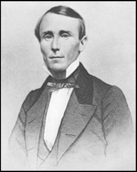
On June 6th, Bunau-Varilla circulated to every member of Congress a Nicaraguan postage stamp from 1900 depicting an eruption of Mt. Momotombo. This was offered not only as “proof” of volcanic activity there, but that the local government celebrated that fact. It was also pointed out that Nicaragua featured a volcano on its coat of arms.
The pro-Nicaraguan forces fought forcefully for their route throughout the legislative process, but the momentum continued to slowly shift against them. During the debate in Congress over the best route, a rumor originating with Colombia implicated Germany in a plan to secretly finish the French diggings in their Panama province. That rumor did help to change some minds regarding the final choice.
Six weeks later, on June 19, 1902 the Canal Bill as modified by the Spooner Amendment passed the Senate by eight votes. The house subsequently backed the legislation as well. It was then signed by President Roosevelt. Panama had won. Nicaragua had lost. The change of decision was apparently not the result of one momentous event, but rather due to an accumulation of many smaller ones.
After Panama
In the aftermath of the Nicaragua defeat, an infuriated President Jose Zelaya of Nicaragua tried to get Germany and Japan to finance a canal in his country. When the United States objected to the major powers approached, any interest in the proposal dissipated. However, once the Panama Canal was successfully built, American interest in a Nicaraguan Canal revived.
In 1916 the United States paid Nicaragua $3 million for an option in perpetuity free of taxation to build a canal there. In 1929 a two year study of a ship canal was authorized. The Sultan Report, authored by US Army Colonel Daniel Sultan, was the result. Three hundred men surveyed the route for a future canal along the Rio San Juan route, dubbed the Forty-Niners Route, in honor of those who used Commodore Vanderbilt’s railroad in the California Gold Rush. Sultan estimated the canal would be three times longer with locks twice as large at double the cost of the Panama Canal. He saw the main problems as heavy rainfall and poisonous wildlife. Cartographic depictions of the Nicaragua Canal began to again appear on maps and atlases printed in America. In the aftermath of the Sultan Report, Costa Rica protested that its rights to the Rio San Juan had been infringed by the study. El Salvador protested to the United States building military bases in the area. Both complaints were upheld by the Central American Court of Justice, which the United States and Nicaragua then ignored.
In 1938 and 1939 another study was made for construction of either a barge or ship canal. Three variants were considered with different channel depths. The largest proposal featured canal locks slightly smaller than those of the fourth Welland Canal (the one still used today).
A canal dug with atomic weapons was advanced in the 1960’s as part as Operation Plowshare. Due to the controversial nature of the digging method, the proposal went nowhere. The United States and Nicaragua ended the option in perpetuity on July 14, 1970. After a lengthy hiatus due to political problems in Nicaragua between the Sandinista government and the United States, proposals began to be made again.
In the 1990’s a more northerly route centering on the Rio Escondido was proposed. Possible beginning points were at four different locations near the town of Bluefields on the Caribbean coast. The route then would follow the river inland to the end of navigation and connect to Lake Nicaragua by a short canal. The proposal went nowhere.
In 1999 Nicaragua approved an exploration concession to build a shallow draft canal along the Rio San Juan to be known as the Eurocanal. This proposal would connect the Atlantic Ocean with Lake Nicaragua, but not the Pacific Ocean. The project was loosely based on the 1939-40 barge study. Nothing came of the concession.
In 2000 a concession was granted to a company headed by New York attorney Don Mario Bosco as head of Canal Interoceanico de Nicaragua SA to build a railway “dry” canal connecting the Atlantic and Pacific coasts. The proposal failed to get financing.
In 2004 the non-Sandinista Nicaraguan President Enrique Bolanos proposed a canal to handle ships up to 250,000 tons. The cost of the scheme was to be $25 billion. The route was to follow the Rio San Juan. When foreign investors failed to materialize the United States was proposed to buy the land for the investors. Environmental groups violently objected. There was no response from the United States. As a result of this proposal the Panama Canal authorities embarked on their expansion plans, which saw the much larger third set of locks open in 2016. The 2004 Nicaragua Canal proposal has continued to be raised repeatedly in the next decade, as different financing plans and routes were advanced.
In 2006 President Bolanos reiterated that Nicaragua would pursue a canal at a cost of $18 billion over 12 years. At this point six routes were possibilities. The President stated there was enough demand for two canals in Central America, and justified the project as an economic boon for Nicaragua and Central America. Bolanos was subsequently defeated in the November, 2006 election by Sandinista candidate Daniel Ortega.
In 2009 President Dmitri Medvedev of Russia stated his country would be interested in pursuing the waterway. That same year the United Arab Emirates expressed interest in sponsoring the project. The progress of the Panama Canal expansion dampened the interest of both these countries.
In 2010 Korean developers Dongmyeong Engineering and Architecture Consultants contracted with the Nicaraguan government to construct a deepwater port at Monkey Point on the Caribbean Coast.
In July of 2012 a new feasibility study was conducted by Royal Haskoning DHV and Ecorys to evaluate the Rio San Juan route. It determined the route would be cheaper to build and would be less environmentally damaging than other routes. This plan would not require the construction of an artificial lake for water supply purposes.
In June, 2013 Nicaragua’s National assembly approved a fifty year concession to finance and manage a canal to the Hong Kong Nicaragua Canal Development Investment Company (HKND). HKND is controlled by Wang Jing, a Chinese billionaire. He claimed to have nearly unlimited financial resources available for the project. The waterway was named The Nicaragua Grand Canal. If the waterway is operational at the end of the first fifty year period, the concession will be extended another fifty years. The canal was claimed to be able to handle the largest ships afloat. The route was more centrally located, along the Rio Punta Gorda to Lake Nicaragua, then to the Pacific Ocean at Brito. It was to be 173 miles long and would cost $40 billion. This route would eliminate any problems with Costa Rica. It was to feature two lock complexes of three consecutive chambers located at either end of the canal. A one hundred fifty square mile artificial lake was to be constructed to supply water to the locks.
The Nicaraguan government announced that construction had begun on December 29, 2014 at the town of Rivas. It was to be completed by 2019. The subsequent Chinese stock market crash of 2015-16 resulted in Wang losing eighty per cent of his net worth. Reportedly Wang is welcome in Nicaragua only if he brings money—lots and lots of it. Despite reports that Russian interests might become involved; no construction was taking place in mid-2016. The Nicaraguan government has had no comment about the situation.
One upshot of the HKND project is that a competing Chinese company, China Harbor Engineering, made an offer to Panama in late 2014 to build a fourth set of locks on the Panama Canal to handle the largest ships at a cost of only $10 billion. It may yet happen again that what begins as an idea in Nicaragua, may become a reality in Panama.
BIBLIOGRAPHY
- McCullough, David; The Path Between the Seas; New York, Simon & Schuster 1977.
- Parker, Matthew; Panama Fever; New York, Doubleday 2007.
- de Banville, Marc; French Canal; Panama R.P., Canal Valley 2004-12.
- James, George & Burgoyne, Alan; New Pictorial Atlas of the World; New York, Thomas 1928.
- Rand McNally Co.; World Atlas International Edition; Chicago, Rand McNally 1939.
- Reynolds, Francis, Ed., New World Atlas and Gazetteer, New York, P. Collier & Son 1926
- Molina, Ivan & Palmer, Steven; The History of Costa Rica 2d Rev Ed., San Jose C.R., UCR 2014.
- Rogers, David; The American search for a canal in Mexico, Nicaragua or Panama, University of Missouri.
- Nicaragua Canal and the History of the Nicaragua Canal, Wikipedia 2017.
- Considine, Bob; The Panama Canal. New York Landmark Books Random House 1951.
Landsford Canal: A South Carolina State Park
Article and photos by Sue Simerman. Ossian, IN
Located in the far northern area of South Carolina is a state park along the Catawba River that includes a canal at the crossing near the rocky shoals. It is on Park Drive off Highway 21 near Catawba, So. Carolina and ten miles from Rock Hill.
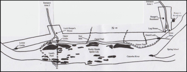
In the 1740’s settlers from the north made their way into this river basin. Thomas Land opened a trading post in 1754 at this ford. Thus the name Landsford.
This important crossing was used by troops under Thomas Sumter on the way to the Battle of Hanging Rock, by the British army under Lord Cornwallis. During the Civil War it was thought that Sherman crossed here.
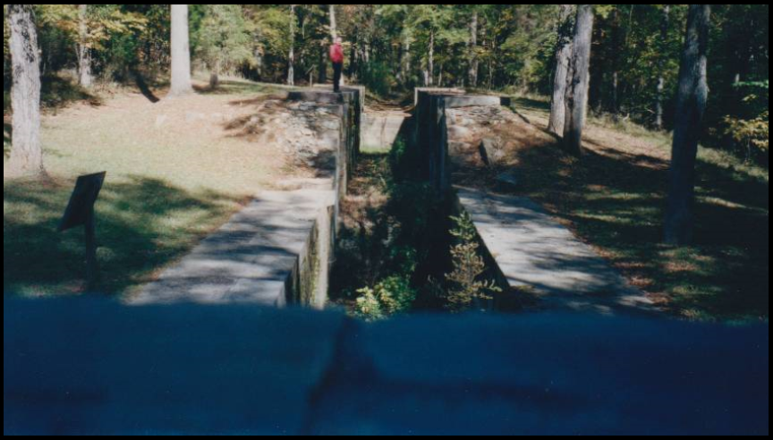
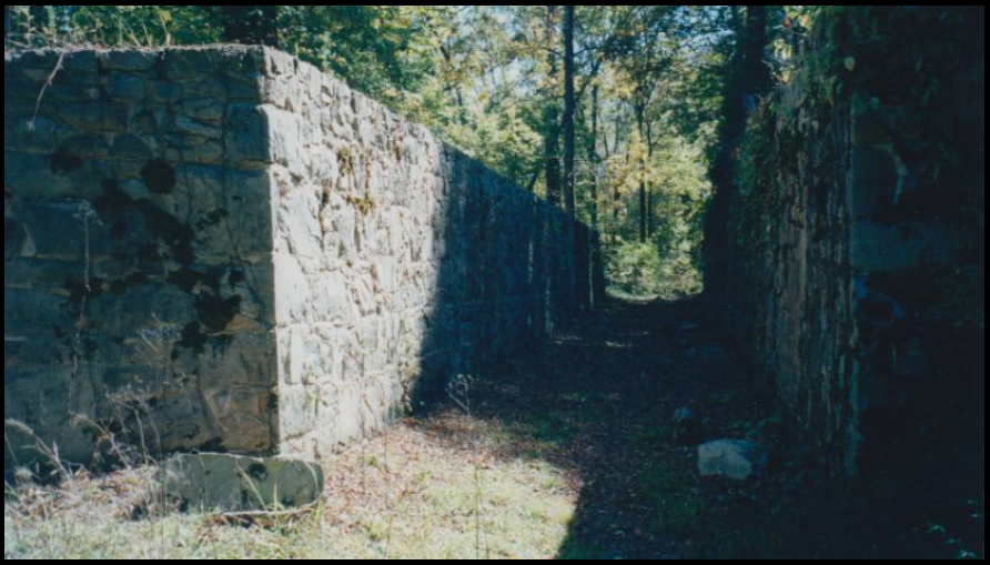
The river is wide and shallow and talk began of digging a canal to move crops, mainly cotton, down to Charleston. The construction of the canal was begun in 1820 and labor was done by slaves and white laborers. Completed in 1823, the granite used for the five locks and buildings was quarried locally. It was abandoned in 1837.
Landsford Canal was designed by architect Robert Mills. He and Robert Leckie, an engineer, built the two-mile-long canal.
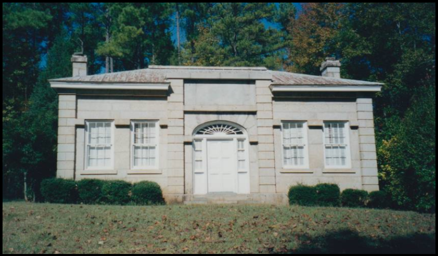
The canal has a diversion dam, a guard lock, footbridge, lifting locks and the ruins of a mill complex. I think the lockkeeper’s house is interesting because it is built of stone and quite different than what we have in the Midwest. It still exists as a museum. The lock on the upper end had a drop of ten feet. The lock has an immediate second lock and it had a stone arch foot bridge at the far end that took travelers to the ford. At a little more than a half mile is a second similar set of locks to lower the boats to the river. These locks and canal are very narrow by the standards that we of Indiana are used to seeing. The locks were 100 feet long by 12 feet wide. The river boats used poles in the river but were not allowed to use them in the clay lined canal.
The canal runs parallel to the Canawba River and the towpath is a three-mile walking trail for the state park. Dogs are allowed on leash and when we visited a number of years ago this was the main activity. The trail to the lower locks is not maintained, but there is a beaten foot path.
Landsford Canal is the only remaining canal in its entirety in South Carolina.
The park area has camping, picnic grounds and a ranger station. The heaviest visitation time is mid-May to mid-June. This is when Rocky Shoals Spider Lilies bloom in the shoals of the river. Around Memorial Day weekend the state park has a “Lilyfest” with live music and canal tours.
To be sure that the museum is open call (803-789-5800). When we were there the museum was open only by appointment.


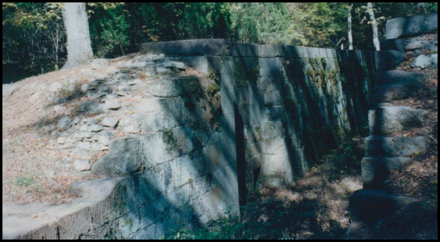

At the north end of the complex is a waste weir constructed on top of a culvert. The culvert allowed a small stream, which has now found a course around the downstream arch, to flow safely under the canal.
Letter Concerning W & E Canal and Fur Trading
The following letter was found on E-Bay by Neil Sowards, CSI member, Ft. Wayne, Indiana. Mr. C. L. Noble, who is living in Defiance, Ohio, tries to induce others to come west. He says that the Wabash & Erie Canal is to be completed in 1841. He knew it would increase property values. However, the canal was not completed from the Indiana state line to Junction, Ohio until the spring of 1843. The Black Swamp delayed its construction. On May 8, 1843 the “Albert S. White” was the first canal boat to go from Lafayette, Indiana to Toledo, Ohio. Also note the huge amounts of furs being traded.
Defiance, June 15th, 1840
Dear Brother,
Yours was rec’d by due course of mail, and I was glad to hear from you, and to hear that you were all well, &c.
I have left the goods business with Mr. Bunbacher, and engage my time to Messrs. Ewing, Edsall & Co. of Fort Wayne, Ia. at 50$ per Month and expenses found, for the Indian trade, and the purchase of Furs & Skins for this section of country. My agency is located at Defiance, and will not interfere with the duties of my office. I have, since in this country, devoted a good part of my time to that business, and am now quite conversant with that kind of trade, and since I saw you last, have purchased about 12,000 Coon Skins, 2,000 Deer Skins, which has enabled me to handle a large amt. of money, and the coming season shall deal much larger in the same business, and that while this trade continues in this region, I shall devote my capital to it. I want you to tell Nelson to come out here and see me, if he cannot be suited in this country, the cost of coming to see it will never hurt him, and why will he not come? The fact is, I begin to feel as if I wanted some friend or brother to come along and take the world beside me. As I am, I have no one to council with, no matter how important the matter under consideration may be. My own judgment is my only guide, and I do feel the want of some friend in the family to be my neighbor, but if I am doomed to try the world alone through life, I take up the task cheerfully, and without a murmur. My circumstances are such, that if good health attends me, I can be independent as to want in future, and in a few years, obtain in a measure the great object of my ambitions in this world, that is, a competent property. I have this year 7 acres of good Timothy meadow, and 5 acres of Oats, and a good garden, which all looks fine for this season. The trees I brought from home last fall mostly lived, and are doing fine. My rose bush died, and likewise the Snow Ball twigs, of which I very much regretted.
The Harrison Celebration at Fort Meigs took place last Thursday. It is estimated that 30,000 persons was on the ground, but ‘Old Tip can’t commit’. He is not the man to be President of these United States, but it is of no use for you and me to argue the Politics of the day by letter. We are both true to our principles, and for one, I must show an honesty of purpose by my firmness to the Democratic cause.
The Great Wabash & Erie Canal will be completed next season, and if you have a disposition to locate in a new country, now is your time, while land is cheap, in order that you may take the rise of property.
I am not yet married, nor any prospect of being so, but have pretty much made up my mind never to try my luck in that way. If ever this notion should change, it will be a strong inducement that does it. If David is out of business, what would you think of advising him to come to a new country. I shall not pass my opinion to him, but if you, and the rest of the family will give such advice, and he will come, and be steady, and has any business tact about him, he shall never want for employment, and I can put him in good condition to do well for himself. If you feel disposed to advise him to come to this country, do so, and he will not be biased by any opinions of mine, which you well know are much prejudiced in favor of this valley.
Give my respects to all the family, and tell all to write to me, brothers & sisters, I would like [to] hear from you all.
With respect, I am, Your Brother,
C.L. Noble
In Remembrance

Daniel E. Schuster , 78, of North Royalton, Ohio passed away on Thursday, October 5, 2017. He was born on January 30, 1939 to Edward and Florence (nee Hancox) Schuster, both deceased.
Dan graduated from Parma Senior High School in Parma, Ohio. He furthered his education at Case Western Reserve, School of Engineering, in Cleveland, Ohio.
He worked for Goodyear Tire and Rubber Company as an engineer and was an S.A.E. member. He also belonged to the Canal Society of Ohio where he led several canal tours and the Canal Society of Indiana. He attended many CSI tours. He was interested in exploring the local canal systems and was an avid car racing fan.
Dan resided at Danbury Senior Living and enjoyed gardening there. He leaves behind numerous cousins and friends. He will be missed.
Visitation was held at the Babitt-Busch Funeral Home in North Royalton, Ohio, on Sunday October 10 from 3-7 p.m. His funeral service was held on Monday at 11 a.m. at the funeral home followed by interment at North Royalton Cemetery, 6170 Royalton Rd.
John R. (“Dick/J.R.”) Winchell, 80, passed away at Kesslerwood Place in Indianapolis, IN on October 25, 2017 having struggled with health issues over the last 11 years.
He was born on December 11, 1936 in Tell City, IN to Richard L. and Edith (Keller) Winchell.
He is survived by his wife Linda (Steurer) of Indianapolis, his brother Joe (Jan) of Newburgh, IN, sisters-in-law and brothers-in-law Sally and Tom Reeve of Lopez Island, WA and Alan and Ruth Steurer of Newburgh, IN.
Dick was a 1964 graduate of Purdue University’s School of Civil Engineering. He practiced as a licensed Professional Engineer in the State of Indiana. He worked for the Indiana State Highway Department in addition to several construction firms such as P. R. Duke. In 1978, he began his own engineering firm of Home Inspection Consultants of Indiana (later known as Criterium-Winchell Engineers).
As a member of the Canal Society of Indiana he attended many tours. He was especially interested in following canal routes on maps.
Visitation was on Thursday, November 2 from 4-7:00 p.m. at Ziemer Funeral Home Central Chapel, 626 First Ave., Evansville, Indiana and Friday, November 3 from 4-7:00 p.m. at the Conkle Funeral Home Speedway Chapel in Indianapolis. Interment was at Oak Hill Cemetery, Evansville, Indiana.
In lieu of flowers/plants, a contribution may be made to the Canal Locator Project c/o Canal Society of Indiana, P.O. Box 10808, Ft. Wayne, IN 46854-0808 as locating the Wabash-Erie Canal was a hobby of his for years.
Donations to CSI
The following donations have been made to the Canal Society of Indiana and will be sent to Carroll County Wabash & Erie Canal, Inc.’s Canal Park in Delphi, Indiana:
Jerry and Mary Ann Getty have donated canal period dress for both men and women that will be used by docents in Canal Park.
Suzanne Moffett has donated 14 V8 tapes of CSI tours and speakers that were taken by her husband, Paul Moffett. They will be placed in the Canal Park archives.
Oswego Canal Rehabilitation
Work began in November 2017 on Lock O-7 of the Oswego Canal at its entrance from Lake Ontario. The project includes: Construction of a new lock house and lock operator shelters; Installation of a cofferdam and rock anchors; Refacing lock walls and approach walls; and Refurbishing operating machinery. Governor Andrew Cuomo announced the $25 million project in October. It is to be completed by 2020.
The lock, originally built in 1914 and overhauled in 1970, is being rehabilitated for stability, operational consistency and the safety of visitors and those using the canal. It is a part of the 524 miles of the New York State Canal System, which includes the Erie , Champlain and Cayuga-Senecca canals.
Fairfield Home Demolished
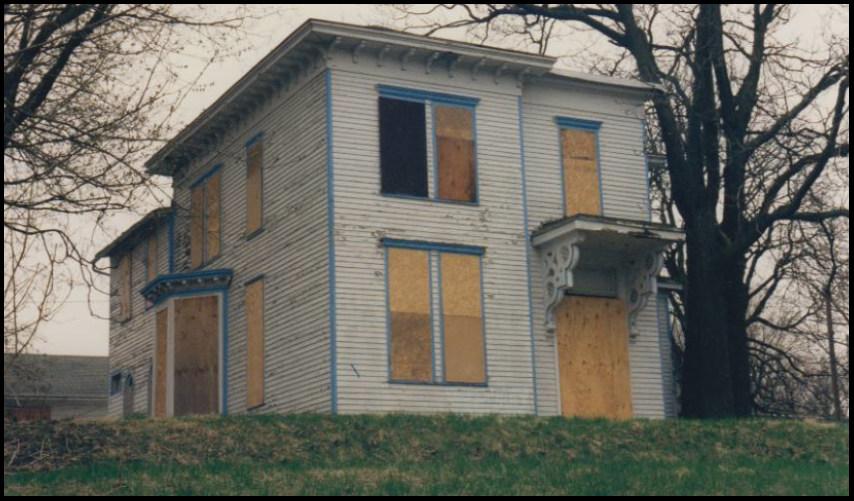
Captain Asa Fairfield’s 1859 Italianate style home on West Creighton Street in Ft. Wayne, Indiana has been demolished after years of court cases and several attempts to save it. Even the concrete steps up the steep bank have been removed. All that remains is the empty lot.
Fairfield moved to the rough and tumble town of Fort Wayne to become one of its founding fathers after being a sea captain in Maine and participating in the War of 1812. He brought with him $30,000. The wife of Dr. L. G. Thompson said he should be careful with the money and convinced him to let her sew it into one of her mattresses until he could find a good place to invest it. Some of it was used to purchase 240 acres of land at $12 an acre on which he established a farm south of Fort Wayne and raised hogs, sheep and garden crops. He then invested in a soap and candle factory. He bought the first grist mill, which had been established in 1827 by Samuel Hanna and James Barnett. He operated a boat on the Wabash & Erie Canal. He also served as one of the first directors of the Fort Wayne Branch of the State Bank of Indiana. He died in this two-story house.
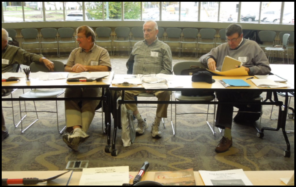
CSI Annual Directors’ Meeting
Fourteen directors of the Canal Society of Indiana and six spouses met at Hamilton East Public Library in Fishers, Indiana on October 28, 2017 for the board meeting. Frank Timmers, CSI director from Carmel, was the host. Refreshments of donuts and coffee were provided by Bob & Carolyn Schmidt.

Bob Schmidt, CSI president, welcomed everyone. Sue Simerman, nominating chair, said all officers had agreed to continue serving in their position for another year. Re-elected were Bob Schmidt, president; Mike Morthorst, vice-president; Sue Simerman, secretary; and Cynthia Powers, treasurer. Bob asked for a moment of silence in respect for members who died the past year: Tim Doyle, Laura Migliore, Bob MacIntyre and Dan Schuster. He wished Jerry Mattheis a happy 85th birthday from the board.
After the president’s 2016-2017 review of the past year’s tours, Panama Canal: “Grit and Glory” and the “Twilight in Iowa,” and an overview of the new website and “The Tumble,” the Secretary’s and treasurer’s reports were given. Bob announced that Dick and Linda Winchell had donated money to start a fund for the Canal Locator project. This is the online map showing canal sites in Indiana that is being created by Ball State students in Dr. Ron Morris’ class.

Carolyn Schmidt, coordinator for “The Tumble” thanked the directors for the articles they had submitted. Bob Schmidt appointed Sue Simerman the nominating chairman for 2018 and Jerry Mattheis and Carolyn Schmidt to the membership committee. Tom Castaldi will lead the “Up & Over” tour of the Wabash & Erie Canal from Huntington to Wabash, Indiana on April 13-15, 2018. Andy Hite will lead the “Miami & Erie Canal” at Piqua, Ohio on August 17-19, 2018.
The main object of the meeting was to get the directors’ opinions about and ideas for the new website being developed by Ball State University students. QR cards were given each director to share with others on how to access the new website and “The Tumble,” CSI’s online news and journal. This was followed by each director telling about canal related activities in his/her area.

After the meeting was adjourned lunch was at the Nickel Plate Bar & Grill in Fishers. Then almost everyone went to tour the huge new IKEA store. It was a huge maze of rooms furnished with inexpensive “dorm style” furniture. It had a restaurant, a marketplace and warehouse. Some people had to park a quarter of a mile away because the crowd was so large. Some of us found that it is easier to hike on uneven ground to canal sites than to walk on the store’s concrete floor.
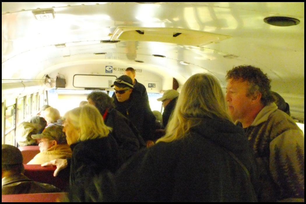
Gibson County Wabash & Erie Canal Tour
Article and photos by David Kurvach, CSI Director, Newburgh, IN
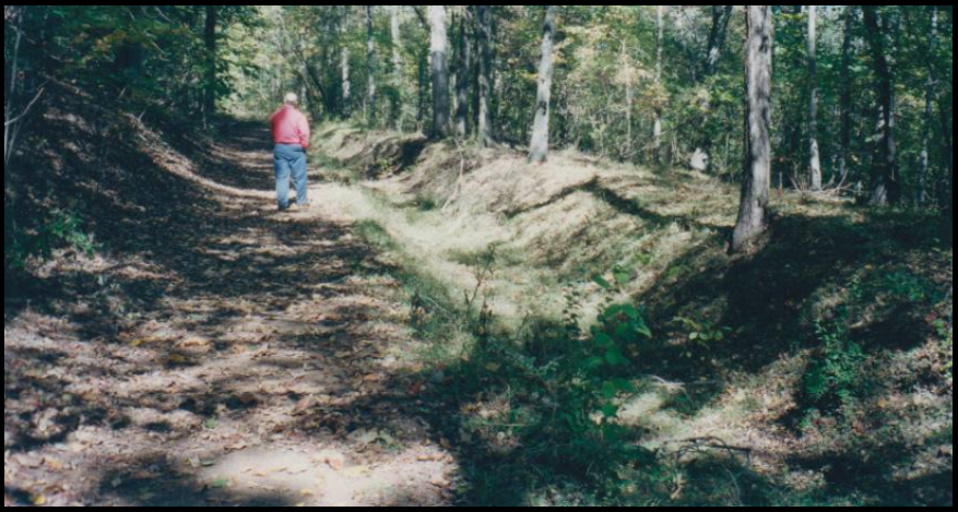
On October 28, 2017, the Friends of the Patoka National Wildlife Refuge held their annual festival in Wirth Park, Oakland City, Indiana. Among the events were various exhibits of wildlife, botany, hunting and photography. At noon, Friends member Preston Richardt presented a forty-five minute visual and lecture on the history of the Wabash and Erie Canal, with a special focus on its existing structures within or near the refuge and their importance to Gibson County.
Through Mr. Richardt’s research, he was able to illustrate a reconstruction of both the Patoka River Aqueduct (No. 17), the still functioning Buck Creek Culvert (No. 203) and unearth a newly discovered photograph of the construction of the canal in Gibson County. He peaked the interest of the forty attendees, many of whom had grown up in Gibson County and had heard of the canal but neither knew much about it nor the location of the nineteenth-century waterway.
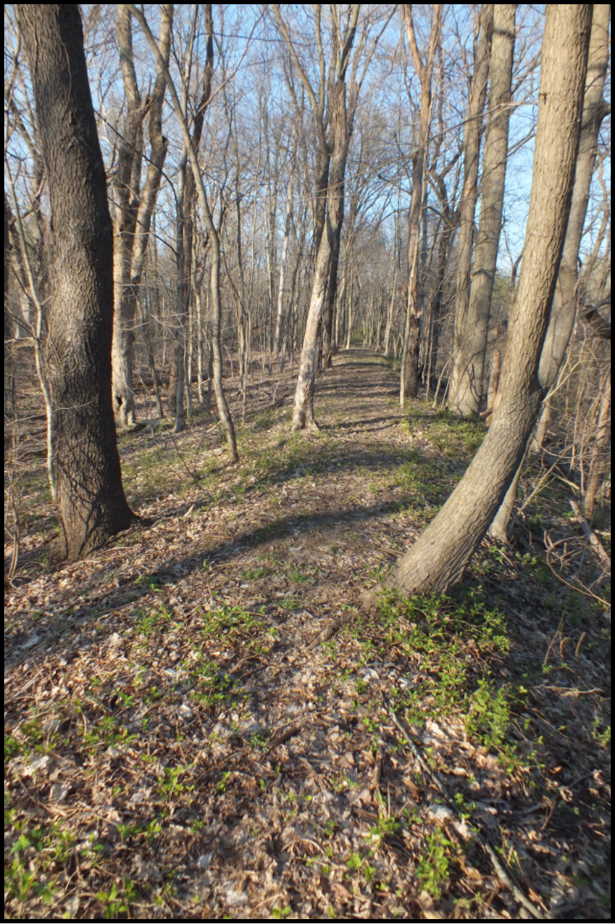
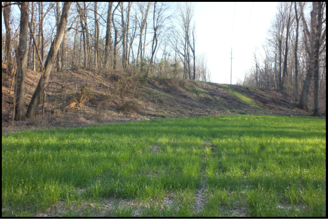
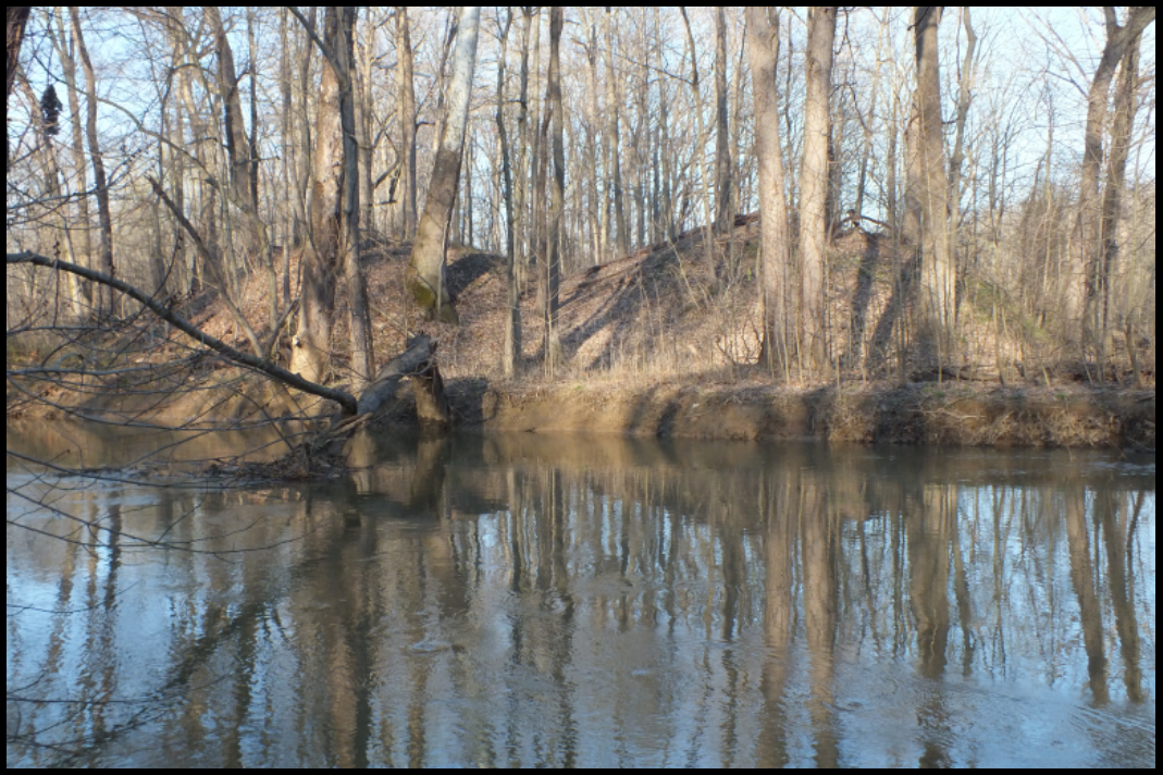
Following the lecture, the refuge provided a bus tour of the structures in and adjacent to the refuge. After navigating a school bus through the narrow back roads of Gibson County, the tour was treated to views of the preserved earthworks of the Keg Creek Culvert (No. 204) and the fully functioning Buck Creek Culvert (No. 203). With the hot button issue of replacing the latter historic structure, people were especially interested in seeing the last known wooden box culvert on the Wabash and Erie Canal. The trip came to a halt at the Dongola Station kiosk on the northern end of what used to be the canal town of Dongola. Mr. Richardt led the tour to Dongola’s Mulberry Street where it crossed the canal at Road Bridge 149. At this location the towpath changed from one side to the other of the canal.
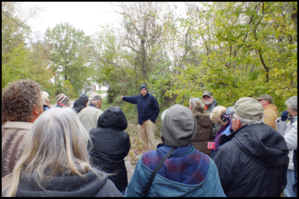
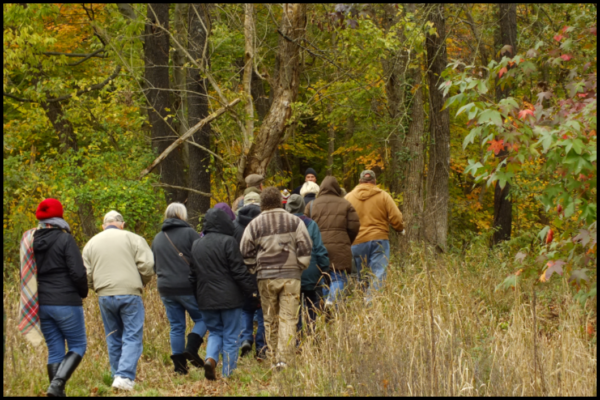
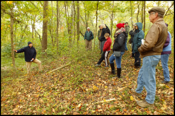
From there, the tour followed the towpath from the town site, into the woods and onto the preserved earthworks. The earthworks run about 750 feet to the original bed of the Patoka River, the site of Aqueduct No. 17. These earthworks sit about twenty feet above the Patoka bottom lands and the tour was amazed at both the quality of construction (this section of canal is so well preserved, very little would need to be done to it to put it back to its intended use) and the labor involved in what it took to construct the canal to avoid the spring floods. The towpath finally ended at the foot of the southern end of the aqueduct. There, Mr. Richardt shared several colorful accounts of the canal written by longtime Oakland City resident Col. James Washington Cockrum and fielded questions about the canal and its impact on Gibson County.

Among those who attended the tour was Rachel Starkey, an archaeologist with the Indiana DNR Division of Historic Preservation and Archaeology, who had presented a program on archaeology in Indiana earlier that morning. Mr. Richardt has made her aware of the historic importance of Buck Creek Culvert (No. 203) and potential danger modern construction and encroachment pose to the structure. I personally feel that through his work and community outreach the culvert will be preserved for years to come.
The Patoka National Wildlife Refuge has long term plans to preserve the earthworks north of Dongola with the existing towpath serving as a trail. Mr. Richardt has maintained this trail, cutting through what once was a labyrinth of briers and making it accessible to the aqueduct site. We would encourage anyone passing through to stop at Dongola and take a short hike through history.

To access the trail, take Interstate 69 to exit 33. Upon exiting, follow Indiana Route 64 east about 1.33 miles to the traffic signal and junction of Indiana Route 57. Hang a left and follow Indiana Route 57 for four miles to County Road (CR) 150 E. Turn left onto CR 150 E and travel about three hundred feet to a wooden kiosk on the right side of the road. Park your vehicle and walk west on CR 150 E another 250 feet. There will be a trail on the north side of the road blocked by several large boulders. Follow this trail to the tree line. Upon entering the woods, you will be able to view the preserved canal bed. The trail ends at the Patoka River, which marks the southern end of Patoka River Aqueduct (No. 17). The trail has some rough spots and the bottom land floods easy with a hard rain and spring thaws, so hikers are encouraged to use caution. Please carry your trash and leave no trace. There are no facilities at Dongola, but Oakland City (four miles to the south) has several restaurants and gas stations. The site is open year round and there is no admission fee.
During the hike the weather was cloudy and the leaves were still on the trees. The following photos taken on April 20, 2015, a sunny day before the leaves came out, show the trail much better.
News From Delphi
Organ for Restored Lutheran Church
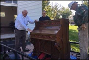
Photo by Dan McCain
Last March Melissa Rodkey-Skalicky saw a picture of the German Lutheran Church restored in Delphi in lecture presented by Dan McCain in Ft. Wayne. Once a native of Carroll County, she decided that she should donate the beautiful pump organ in her home that was originally in a Lutheran Church to Canal Park. Two of McCain’s friends in Ft. Wayne helped move the organ to Delphi. Joe Newling, has volunteered to repair the organ. The church has historic lighting, a pulpit, 60 chairs and may be rented for weddings, church services, or meetings.
Canal Association Receives Grant
North Central Health Services have given a grant that will be administered by the Tippecanoe Arts Federation to the Carroll County Wabash & Erie Canal, Inc. It will allow volunteers to restore and place the old Sleeth Post Office building in Canal Park and create a child’s size water powered mill model. Some of the funds will be used to develop eight new outdoor interpretive signs highlighting craft shops in Pioneer Village, reconnect the flood worn trail near Deer Creek and the Wabash River, and fund Phase II of their surveillance camera system to protect the boat house and the interior of the Canal Center.
New to the Canal Interpretive Center

Jami Ade is the new Business Manager for the Center. She will do the bookings for space and market the Canal through the website and social media.
Larry and Jeanene Scowden have been hired as Events Monitor to oversee meetings, reunions and wedding receptions.

Chuck Crary will become the janitor and indoor/outdoor coordinator keeping facilities clean and ready for rental events.
Mary Crary has donated her services for the latter 2 positions for the past 12 years and is retiring. Thank you so much for all you have done Mary!
Hadley Visits Loom House

When Reverend Arthur Hadley saw an article in the Fort Wayne News Sentinel about a loom house being completed in Canal Park two years ago he knew he’d found a home for the dismantled loom that had been in his possession for decades. He recently visited the loom house in Canal Park and displayed fabric he personally had woven on the loom years ago.
468 Mile Club
The past year the Carroll County Wabash & Erie Canal Association created the “468 Mile Club.” The Wabash & Erie Canal was 468 miles long. You may join the club for am ongoing pledge of $468 per year to support the association’s General Budget. They have 26 charter members so far and have raised nearly $12,000. A special reception for the club was hosted by the association in the Reed Case house in October with a canal boat ride on “The Delphi.”
Heavy Rains Fill Kerr Lock
On Saturday November 18 over 3 inches of rain fell in the northeastern region of Indiana. Passing through Lagro, Indiana on his way home from the Wabash County Historical Museum, CSI director, Tom Castaldi, took the following photos of Lock #14 (Kerr Lock) of the Wabash & Erie Canal in Lagro. He said it was the first time in over 40 years passing by this site that the canal bed and lock appeared much like it would have during canal days.

“Kerr” Lock, Lagro, Indiana
Looking to the west. Note that most of the lock’s cap stones are missing.
“Kerr Lock” Lagro, Indiana
Looking to the east with the creek and towpath trail construction in the background.
CANAL SOCIETY OF INDIANA
2016-2017 Year End Report
EXECUTIVE COMMITTEE / OFFICERS
PRESIDENT Bob Schmidt Ft. Wayne, IN (260) 432-0279
VICE-PRESIDENT Mike Morthorst Cincinnati, OH
SECRETARY Sue Simerman Ossian, IN
TREASURER Cynthia Powers Roanoke, IN
“THE TUMBLE” Carolyn Schmidt Ft. Wayne, IN
BOARD OF DIRECTORS
2017
| Terry Bodine | Covington |
| Jerry Lehman | Terre Haute |
| Phyllis Mattheis | Cambridge City |
| Cynthia Powers | Roanoke |
| Sue Simerman | Ossian |
| Brian Stirm | Delphi |
2018
| Tom Castaldi | Ft. Wayne |
| Don Haack | Ft. Wayne |
| Jeff Koehler | Center Point |
| Sam Ligget | Terre Haute |
| Mike Morthorst | Cincinnati |
| Bob Schmidt | Ft. Wayne |
2019
| Dan McCain | Delphi |
| Jerry Mattheis | Cambridge City |
| David Kurvach | Newburgh |
| Carolyn Schmidt | Ft. Wayne |
| Frank Timmers | Carmel |
| Steve Williams | Roanoke |
PRESIDENT’S ADVISORY COUNCIL
| Kreig Adkins | Peru |
| Frances French | Lafayette |
| Ralph Gray | Indianapolis |
| Chuck Huppert | Silver Spring MD |
| Jim Hicks | Brazil |
| Craig Leonard | Bluffton |
| Mike McCormick | Terre Haute |
| Stan Schmitt | Evansville |
| Ellsworth Smith | Leo |
| Chuck Whiting | Lawrenceburg |
MAJOR CSI EVENTS/ ACTIONS
- Assisted students, authors and genealogists in canal research
- Board meeting: October 28 Hamilton County East Public Library
- Host: Frank Timmers Refreshments: Schmidts 14 Directors, 6 Guests
- On-line: Canal Society of Indiana website: indcanal.org
- Worked with Ball State students of Dr. Ron Morris on CSI website and “The Tumble”
- Canal Society of Indiana Facebook page
- Subscribed to Ancestry.com
COUNTY HISTORIANS
These men received and answered numerous phone, E-mail and posted messages from persons seeking information that involved canal business or those who built Indiana’s canals.
Allen Co. Thomas Castaldi
Carroll Co. Mark Smith
Clay Co. Jeffrey Koehler
Miami Co. Kreig Adkins
Wells Co. Craig Leonard
Vigo Co. Mike McCormick
IN MEMORIUM
Tim Doyle 70 Nov 6, 2016 New Haven, Indiana
Laura Migliore 64 Dec 17, 2016 Ft. Wayne, Indiana
Robert MacIntyre Jan 1, 2017 Columbia Station, Ohio
Dan Schuster 78 Oct 5, 2017 North Royalton, Ohio
Dick Winchell 80 Oct 25, 2017 Indianapolis, Indiana
SPEAKERS BUREAU
(talking about Indiana’s canals and promoting CSI)
Date # People Event Presenter/s
Mar. 25, 2017 50+ ARCH at Ft. Wayne/Allen Co. Library Dan McCain
May 17, 2017 18 Local Chapter 567 of AARP, Terre Haute Sam Ligget
Oct. 29, 2017 Metamora Opry Barn: Life Along Canal Liza Hyatt
Nov. 5, 2017 Covington United Methodist Church Terry Bodine
Nov. 19, 2017 100+ Wabash County Genealogy Society Jeff Koehler
TOURS
Spring: “Grit and Glory: the Panama Canal”
March 4-9, 2017
Hotels: Scheduled by Roads Scholar
Tour Attendees: 18 Illinois 2, Indiana 7, Massachusetts 2, New Jersey 2, Ohio 5,
Tour attendees: Dave & Audrey Barber, Bob & Linda Barth, Sally Bancroft, Carl & Barbara Bauer, Tom & Diane Fledderjohann, Jerry & Barbara Lehman, Mike & Tom Morthorst, Bob & Carolyn Schmidt, and Kay Sheldon
Fall: “Twilight in Iowa” Upper Mississippi River Dubuque to Guttenburg and Galena, Iowa,
Trappists Caskets
September 1-3, 2017
Hotel: Best Western Plus Dubuque, 3100 Dodge St., Dubuque, Iowa
Friday Tour: New Melleray Abbey and Trappists Caskets, Peosta, Iowa
Lunch at Catfish Charlies, Dubuque, Iowa
Trolley tour of Galena’s Dowling House, Belvedere Mansion, U.S. Grant’s home
Saturday: “Twilight” tour of upper Mississippi from Dubuque to Guttenberg
Tour route planners & Docents: Bob Schmidt
Saturday Breakfast, Snack, Lunch and Snack aboard “The Twilight”
Sunday: Options given for venues in Dubuque area
Registration/confirmation, Goodie bags, Name tags, Refreshments: Carolyn Schmidt
Budget, Hotel arrangements, Maps: Bob Schmidt River maps courtesy Karl Black
Tour Attendees: 16 Illinois 2, Indiana 12, Ohio 2
Tour attendees: Karl & Demi Black, Tom & Linda Castaldi, Don & Betty Haack, Phyllis Hess, Sue Jesse, Jerry & Barbara Lehman, Mike & Tom Morthorst, Bob & Carolyn Schmidt, Steve & Sue Simerman
DONATIONS TO CSI ARCHIVES, LIBRARY, MEMORIALS, ETC.
Jerry & Mary Ann Getty: donated period dress to be used at Delphi’s Canal Park
Suzanne Moffett: donated 14 V8 tapes her husband Paul took of CSI meetings/tours to be sent to Delphi
Dr. Ron Morris: $5,000 in kind service for guiding Ball State students in creating CSI website and The Tumble
- Robert Treichler: donated his book A History of Northeast Ohio Stoneware to the CSI library
Terry Bodine: donated his model freight boat, “General Grant,” to Delphi Canal Park
Memorials to J. R. “Dick” Winchell for Canal Locator Fund: Sandra Altheide, Marjorie Berry, Margaret Booth, Jeffrey & Pamela Bourff, Clark Byrum, Albert & Jennie Lee Chastain, Joyce Cravens, David & Nancy Doedens, Rodney & Mary Beth Draving, Margaret Finney, Roberta Goodnow & Daniel Lipkie, Norma & Andrea Hoberty, James & Lavern Jones, Michael & Melissa Mates, Marion & Diane Meier, Garrett & Barbara Pardekooper, Larry & Carol Peckenpaugh, Dennis & Dee Dea Pekinpaugh, Thomas & Sally Reeve, Melissa Rhodes, Bob & Carolyn Schmidt, Carolyn Ann Stevens, Mary Ann Streich, David & Diana Steurer, Donald & Ann Swaney, Gilbert & Patricia Vorhoff, Jr., Linda Winchell, Joseph & Janice Winchell, Robert & Karon Wingard, Anonymous