
Whitewater Canal Trail & Survey
From Summit to Nadir: Exploring Ohio’s Nadir Level
Canal Notes #7—The Landings
Placing Canal Signs
Three More Canal Signs In Ft. Wayne
“Blue Hole” Summit Level Of W & E Canal Cross Cut Marked
CSI Directors Met
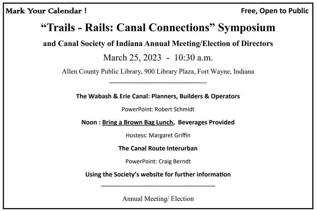
“Trails—Rails: Canal Connections: Symposium
A Visit To the Champlain Canal
Newberry Dam Remains
Curly Hayes Lock Cleared In Lagro
Old Canal Way Bill Found
Whitewater Canal Trail and Survey
Kurt Garner presented his recent survey of the Whitewater Canal between Brookville and Laurel, Indiana to 43 people at Historic Metamora’s meeting in the Opry Barn on November 5, 2022. CSI members attending were John Hillman, Phyllis Mattheis, Dr. Ron Morris, Bob and Carolyn Schmidt and past CSI directors Gail Ginther and Mick Wiltz.
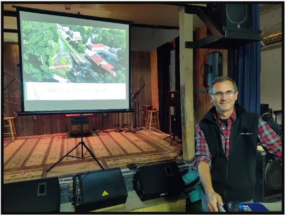
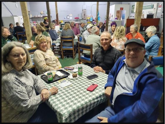
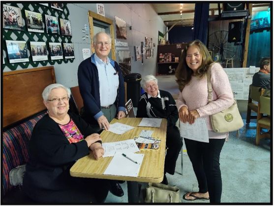
Kurt was hired by Whitewater Canal Trails to resurvey the Whitewater Canal Historic District that is to be submitted to the National Park Service. Once accepted this survey should help protect these canal sites and also attract tourism. Gail Ginther took his results and put together the following guide for the trail side sites.
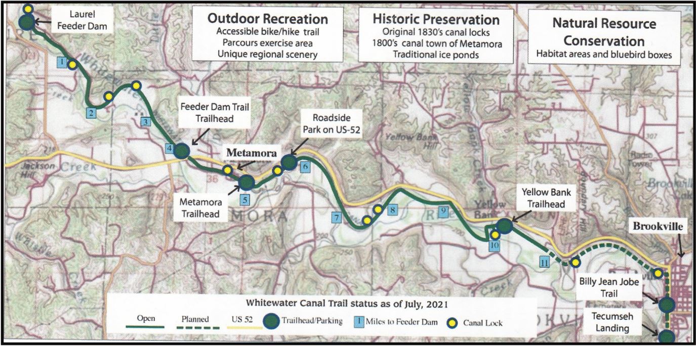
Whitewater Canal Historic District
The Whitewater Canal Historic District is approximately 13 miles of the original Whitewater Canal corridor between Brookville and Laurel, Indiana, constructed between 1836 and 1847. The entire length of the Whitewater Canal stretched from north to southeast between Hagerstown and Lawrenceburg with a fork that flowed to Cincinnati, Ohio. [Cincinnati & Whitewater Canal]
By 1865, an agreement was reached with the Indianapolis & Cincinnati Railroad to purchase the canal corridor after which railroad tracks were placed on the general plateau of the towpath. The canal was to remain active to create hydraulic power for the many mills that operated along the watercourse. An active rail line remains as an operating scenic railroad museum in the north half of the district to Metamora.
During the 1940s-1950s, the state of Indiana undertook preservation/restoration of several canal features including the Laurel Dam and structures in and near Metamora. The intent was for recreational use by tourists interested in canal history. A wayside park off of U.S. 52, the Metamora Rest Park, was also created in the district during this time.
A complete list of resources follows, beginning at the south/east end of the district, on the northwest edge of Brookville, then following upstream to the west/north:
Butler Run Culvert, c. 1842 (structure)
The Butler Run Culvert is a wide, filled-stone arch composed of cut limestone that carried the Whitewater Canal over Butler Run, a wide creek that empties into the West Fork of the Whitewater River.
Boundary Hill Lock 20, c. 1842 (structure)
Lock 20 is a dry combination lock of cut stone portals and rough-cut stone interior chamber walls. This lock is the most deteriorated of the ten locks located in the historic district.
Holding Pond, C. 1842 (structure)
This irregularly arch-shaped area is on the north side of the Whitewater Canal. It is located between the canal and a northward bow in U.S. 52 just east of the Yellow Bank Trailhead parking area.
Railroad Bridge (with trail), c. 1913 (structure)
Yellow Bank Lock 21, c. 1842 (structure)
Lock 21 is a dry combination lock of cut stone portals and rough-cut stone interior chamber walls. This lock has been developed as an interpretive feature on the Whitewater Canal Trail, with a spur leading from the trail back to the lock area.
Yellow Bank Twin-Arch Aqueduct Ruins, C. 1842 (structure)
A short section of stacked stone, approximately seven courses above grade that was a portion of the aqueduct is all that remains of the structure other than the spoil pile at the mouth of Lock 21.
Railroad Bridge (with trail), c. 1913 (structure)
Railroad Bridge (with road), c. 1913 (structure)
Aqueduct, c. 1913 (structure)
The narrow aqueduct carries the Whitewater Canal over Goose Creek just south of U.S. 52, north of the former railroad bed.
Railroad Bridge (with trail), c. 1913 (structure)
Cincinnati Ice Company Pond, c. 1875 (structure)
Similar to the pond near Yellow Bank, this irregular triangular-shaped area on the north side of the Whitewater Canal extends north outside of the boundaries of the district just northeast of Lock 22.
Twin Lock 22, c. 1842 (structure)
Lock 22 is a combination lock of cut stone portals and rough-cut stone interior chamber walls.
Twin Lock 23, c. 1842 (structure)
Lock 23 is fully-composed of cut stone portals and interior chamber walls.
Metamora Rest Park, c. 1940 (site) Picnic Pavilion, Stone Oven, Information Kiosk
Millville Lock 24, c. 1842/1953 (structure)
Lock 24 is fully-composed of cut stone portals and interior chamber walls and was one of the structures restored by the State of Indiana during preservation efforts along the canal in the 1940s-1950s.
Duck Creek Aqueduct, c. 1846/1949 (structure),
National Historic Landmark, 2014, HAER No. IN-108, HABS No. IN-24-20
The Duck Creek Aqueduct is a wood structure that spans Duck Creek on the east edge of Metamora.
Metamora Lock 25, c. 1842 (structure)
Lock 25 is fully-composed of cut stone portals and interior chamber walls and was one of the structures restored by the State of Indiana during preservation efforts along the canal in the 1940s-1950s. Part of the lock’s restoration included restoring/adding the top course of stones to the chamber walls and spillway reconstruction.
Metamora Roller Mill, 19073 Main Street, 1893 (building)
This brick building has a raised basement and two stories with a gabled roof. The mil was restored by the State of Indiana during the 1940s-1950s.
Railroad Bridge (south), c. 1913 (structure)
Railroad Bridge (north), c. 1913 (structure)
Murrays Lock 26, c. 1842 (structure)
Lock 26, a relatively short lock, is a combination lock of cut stone portals and rough-cut stone interior chamber walls.
Cincinnati Ice Company Pond, c. 1875 (structure)
This irregular tear-drop-shaped area between the existing railroad berm and Whitewater Canal extends south outside of the boundaries of the district. The low area, about 60 acres and now tilled, is clearly defined by berms including that of the railroad bed along its long south edge.
Ferris Lock 27, c. 1842 (structure)
Lock 27 is fully-composed of cut stone portals and interior chamber walls.
Railroad Culvert (south), c. 1913 (structure)
Railroad Culvert (north), c. 1913 (structure)
Simonton Lock 28, c. 1842 (structure)
Lock 28, a relatively short lock, is a combination lock of cut stone portals and rough-cut stone interior chamber walls.
Laurel Feeder Dam, c. 1842/1944 (structure)
The Laurel Feeder Dam spans the full-width of the Whitewater River and is named for the town of Laurel to the northwest.
Railroad Bridge, c. 1913 (structure)
Power House Base, c. 1842/1913 (structure)
The power house ruins are composed of, essentially, the gateway from the feeder dam to the diversion channel to feed the Whitewater Canal.
Jinks Lock 29, c. 1842 (structure)
Lock 29 is a relatively short lock, which is dry. It is a combination lock of cut stone portals and rough-cut stone interior chamber walls.
From Summit To Nadir: Exploring Ohio’s Nadir Level
Robert F. Schmidt
In November I sent out an E-mail concerning the wonderful Fall Tour conducted by the Canal Society
of Ohio just east of Columbus. This tour was led by Mike Morthorst and Andy Hite. The tour followed the Ohio & Erie Canal from (Heath) Newark to Dresden, Ohio. The original 12-mile Licking summit level ended at Heath and descended approximately 160 feet in 30 miles with 19 locks to the “nadir level” 21⁄2miles north of Dresden. I discussed how the “nadir” level of Ohio’s canal compared with that of our Wabash & Erie. Water approaches a nadir level from two opposite directions and soon fills the level. Like your bath tub, if the water level rises too high the level or your tub will overflow so you need an overflow outlet.
This tour started at Lock No. 1 in Heath, where Governor Dewitt Clinton of New York broke ground
at the Licking summit for the Ohio & Erie Canal on July 4, 1825.

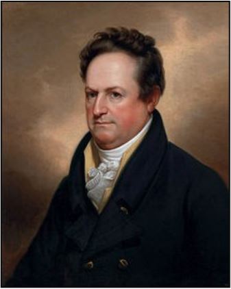
1769 -1828
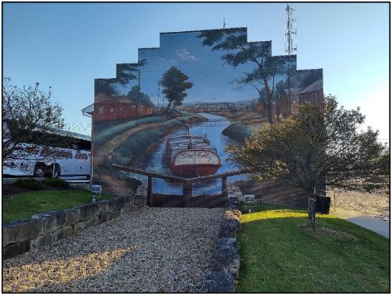
We continued to the east following the descent of the canal to Newark. In a just a few miles we passed by Locks No. 2-8, which carried us off the summit through the west end of town. Next we stopped at Lock No. 9 that was partially restored in 2009 and enhanced with a mural on the side of a building.
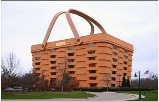
Although it seemed we were traveling on level ground, our bus and the canal were rapidly descending about 80
feet to Lock No. 10 and before long we arrived near Locks No. 11 & 12. Although we did not see these three locks, we did see the “World’s Largest Basket.” It stood 7 stories high and its handles extended another 75 feet in the air. It had been the headquarters of the Longenberger Basket Company. It now sits empty and is for sale for $6.5 Million.
Our tour continued eastward to the spectacular Black Hand Gorge. This 1,200 acre Ohio Nature Preserve was established in 1975 and has about 4 miles of trails along the Licking River. This narrow gorge presented a problem for the Ohio canal builders. Remember the canal from the Licking Summit was fed by water from Buckeye Lake and other feeders until it reached the Licking River at these narrow sandstone cliffs called Black Hand Gorge. Here at Lock 15, the canal water flowing eastward spilled into the Licking River and canal boats entered a 2 mile, low current, “slackwater” pool created by a 17 1⁄2 foot dam across the east end of the river at the former town of Toboso.
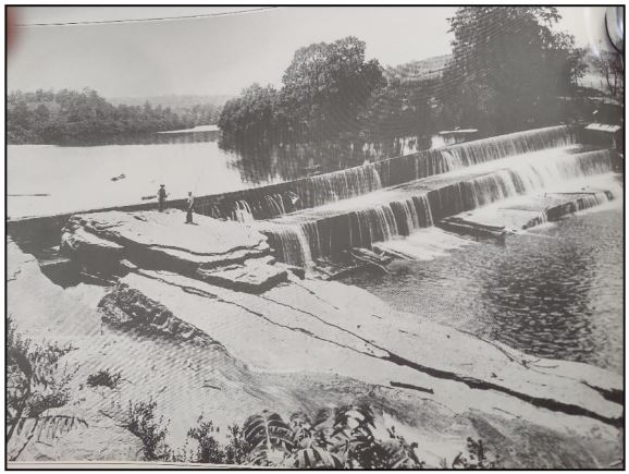

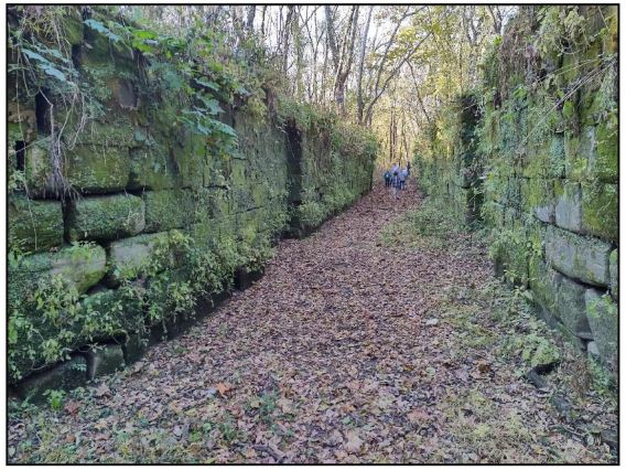
A guard lock (lower lock) slightly up river of the dam allowed water from the Licking River pool to flow directly into the canal as canal water continued in an easterly direction. The gates of the guard lock could be closed to protect the canal from receiving any high flood waters from the river. From this point to Lock 19 the canal was fed by the Licking River.

blocks below the cut
Approaching the lock from the east, the towpath was on the south side of the canal, but it was necessary to change to the north side at the guard lock via a towpath bridge. The reason for this change was very evident. The gorge becomes very narrow at a point where a black hand had been carved into the sandstone cliff. Unfortunately the black hand was lost when they had to cut into the cliff to make the towpath on which the mules could walk while pulling canal boats through the river slackwater. Additional sandstone blocks were used to shore up the towpath from the river’s current.
We had trouble getting all of the tour members rounded up from their walk along the gorge. Hunger soon became a factor and the group reassembled to proceed to Rocky Fork Culvert. The Postle family, owners of the culvert property, had arranged for a wonderful sack lunch for us facing this culvert.
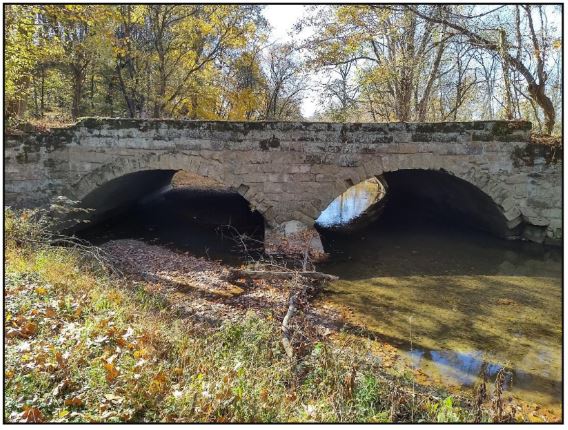
This beautiful double arch culvert is located just one mile west of the Black Hand Gorge entrance. This site provoked a lively discussion. Should this structure really be called an aqueduct or a culvert? Culvert wins in my mind. The culvert carries the Postle’s farm lane to their fields on the other side of the creek.
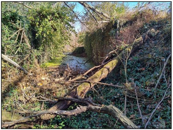
After lunch our tour proceeded about 11 miles to the town of Frazeyburgh, the site of Lock No. 17. We worked our way across a bed of weeds that Dave Gschwind had cleared to see some water in the old stone lock. The waters here were still flowing toward the east coming from the Guard Lock in Black Hand Gorge.
We did not stop at Lock No. 19, but there the canal water finally spilled into the nadir level, which stretched about 3 miles to Lock 30 at Adams Mills. Note the difference of the lock numbers. The water coming into this lock is from the Akron summit.*
* Like the Acropolis in Greece, Akron was named for the Greek word meaning summit or highpoint. Ohio numbered their locks north and south from this summit. Akron is 506 feet above Lake Erie and it took 44 locks in 38 miles to reach this summit. Coming off this summit to the south, it took 30 locks in 100 miles to reach the nadir level at Adams Mills. Coming from the opposite direction, the Licking Summit descended to the nadir level in about 160 feet with 19 locks in about 32 miles.
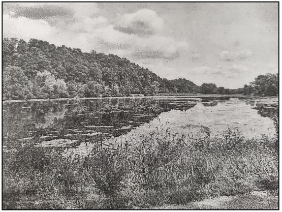
Photo from the west side with the towpath off to the right
The water at Lock 30 was now flowing toward the west. Where did these combined waters go? Initially in 1831, the excess spilled into a marshland to the south of the canal. This excess created a small lake called Munroe (Monroe) basin and is located about .4 of a mile west of Lock 30 at Adams Mills. When the water level reached higher than 4 feet in the canal it was fed into the basin via a waste weir. The pond was later used for harvesting ice. The towpath of the canal skirted around the south edge of the pond.
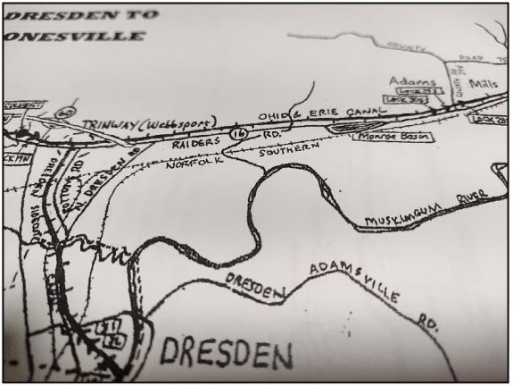
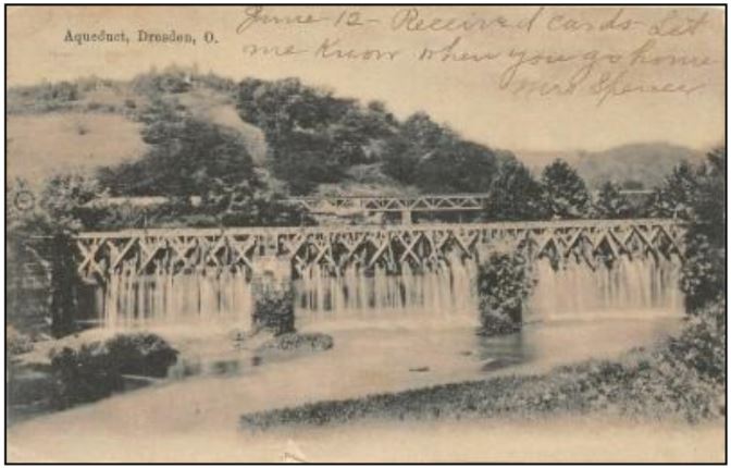
The planning for a sidecut to the Muskingum River was begun in 1829 just as the mainline canal was being completed. A sidecut solved the problem of where to drain off the nadir level excess water. The nadir level was about 21⁄2 miles from the Muskingum River. This sidecut was completed in 1831 by constructing a 120- foot-long aqueduct across Wakatomika Creek and 3 stone locks at the river that dropped the excess water 28 feet into the river.
The Muskingum River was navigable by steamboat in the spring, but at other times the water level was too low. This river flows into Zanesville where is merges with the Licking River at the famous Y bridge. There, still called the Muskingum River, it enters the Ohio River at Marietta, Ohio. This route using the Dresden Sidecut was 55 canal miles closer to the Ohio River than crossing the Licking Summit and proceeding to the Ohio River at Portsmouth, Ohio.
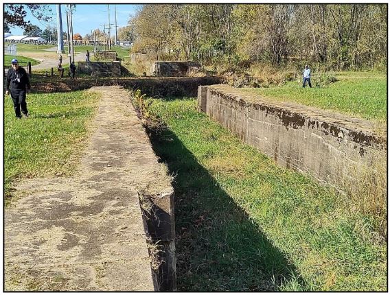
3 Dresden Locks & Basins
To solve the low water navigational problems at the Licking Summit, a plan was developed in 1831 for a series of dams and slackwater pools on the Muskingum River. This plan was finally authorized in 1836 and the first boat operated on the canal in 1841. The Canal Society of Ohio’s Spring Tour May 13, 2023 will be of the Muskingum River Improvement.
The CSO tour ended at Adams Mills where two brothers once operated a mill, store and warehouse. This site,
on the east end of the Nadir level as shown on the map, had 3 stone locks No. 28-30.
Canal Notes 7: The Landings
Tom Castaldi
When an airplane approaches an airport, all on board get prepared for a landing before rolling up to the terminal. When a Wabash & Erie Canal boat reached a port, it docked at what was called a landing.

railroad was built over the canal route.
Normally wider than the forty-foot canal channel, the canal here was broad allowing boats to turn around for the loading and unloading process.

Photos by Bob Schmidt
In Fort Wayne, the landing was near Columbia Street, in Huntington it was today’s Washington Street and in Logansport it was on Fifth Street.
Stops along the way flourished and became familiar names of towns up and down the Wabash & Erie route. Today, a drive on U.S. 24 and Indiana 25 to Lafayette, the towns seem to be evenly spaced along the way. Some historians believe the spacing is about as far as a canal boat traveled in ten or twelve hours.
Airplanes land then taxi up to a terminal where passengers oftentimes transfer to other flights to reach their final destination. Perhaps “Terminals” should be called “Landings” just as canal boats arrived and departed at Landings.
There was nothing terminal for the canal, until the railroads came along and put them out of business for good in 1876.
Placing Canal Signs
Three More Canal Signs In Ft. Wayne

Three more of CSI’s canal signs have been erected in Ft. Wayne by the city of Ft. Wayne’s sign shop through the efforts of Dawn Ritchie. The first is located off Smith Rd. on Towpath Trail where both the towpath and berm side of the Wabash & Erie Canal have been paved with a partial canal prism (grassy area in photo) between them.
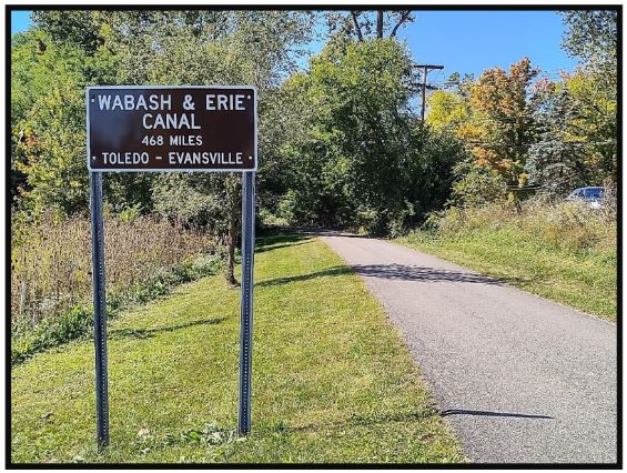
The second is located off Covington Road where Towpath Trail follows a good section of Wabash & Erie Canal prism. It faces east so that only west bound trail users and drivers going west on Covington can view it. We may later put another sign on the back of this one so east bound traffic can read it.

The third is behind Concordia Gardens, a subdivision north of Ft. Wayne, and is along Beckett’s Run Trail. The trail follows the St. Joe Feeder Canal, which fed the mainline Wabash & Erie Canal from the summit. Dawn has had favorable responses to this signage. We thank Dawn and her crew for placing them for us.
“Blue Hole” Summit Level Of W & E Canal Cross Cut Marked
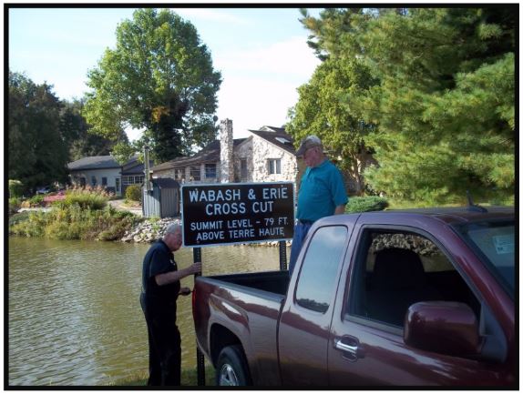
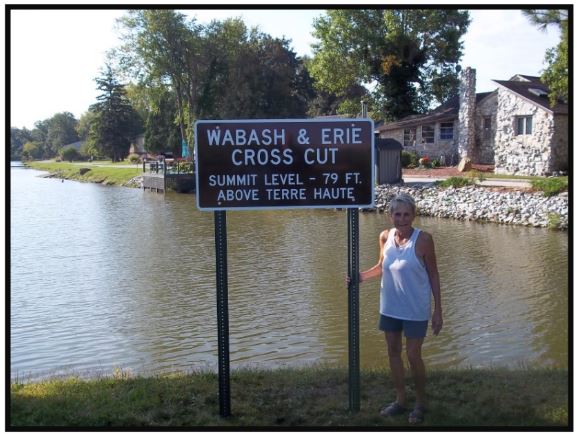
On the morning of September 20, 2022, Leon Billing, CSI member from Terre Haute and Sam, CSI director, and his wife Jo Ligget, also from Terre Haute, met at what is currently known as the “Blue Hole,” a beautiful section of watered canal bed, to erect the sign for the Wabash & Erie Cross Cut summit level.

Following the sign’s placement Jo sent the photos and wrote: “ Leon Billing and the two of us got the sign up this morning. There was no blood shed with this one, but Leon* did fall in the canal! It looks good. And Mrs. Corthum, property owner shown in one picture, was very pleased. She reminded us the Cory Apple Festival is this weekend, and a lot of traffic goes by there on the way to Cory. Good publicity!” (*Note: When erecting an earlier sign Leon was hit in the forehead by the post driver and bled profusely. This time he fell into the canal and was soaked. Erecting signs in not for the faint of heart.)
CSI thanks Sam and Jo Ligget, Leon Billing and Mrs. Corthum for their parts in marking this site.
Whitewater Canal Basin Signs Are Up
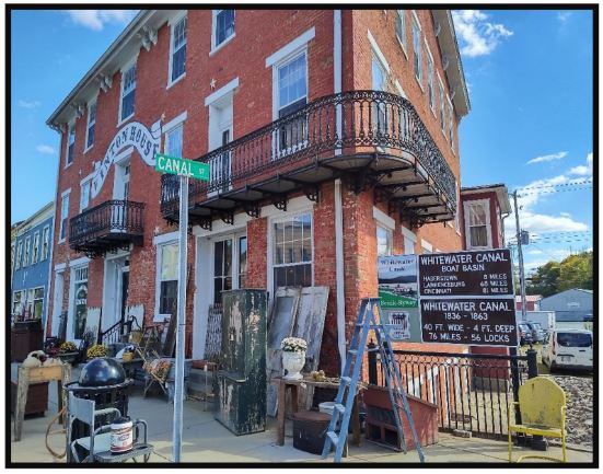
Jerry and Phyllis Mattheis, CSI directors from Cambridge City, worked hard to get the two signs for the Whitewater Canal Boat Basin and the Whitewater Canal erected on U.S. 40 beside the Vinton House in time for our CSI annual board of directors meeting in Centerville. All directors were encouraged to pass through Cambridge City on their way home from the meeting to view the signs.
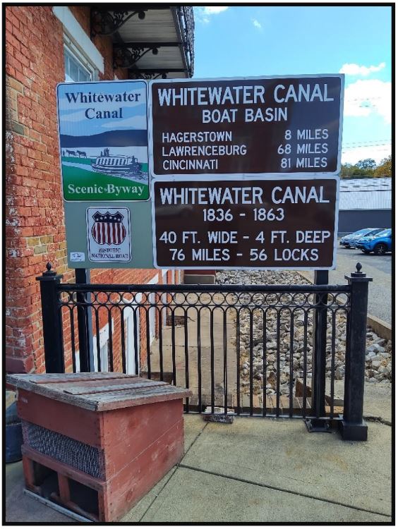
The pictures were taken later that afternoon by Bob Schmidt, CSI president. The basin was adjacent to the Vinton House, an old Whitewater Canal and National Road inn. You can see that the basin was below the level of U.S. 40 by the building’s doors beneath the current iron railing. Not shown is a mural of the basin on a nearby wall along the highway.
We thank the Mattheis’ for selecting such an outstanding site and informative display along the National Road. This road is heavily traveled and the signs are highly visible.
CSI Directors Met
The Canal Society of Indiana’s directors met for their annual meeting in the restored Oliver P. Morton home in Centerville, Indiana on October 8, 2022 from 10:30 a.m. to 3:30 p.m.. Our host and newly elected CSI director, Dr. Ron Morris, spent nine years in having this early residence of Indiana’s 14th governor, Oliver P. Morton, restored. He had arranged the meeting room and set the tables in advance.
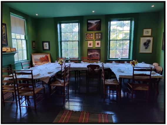
As directors and guests arrived they were treated to cookies baked my another newly elected director, Margaret Griffin of Ft. Wayne. While enjoying the cookies, coffee and ice tea, they walked around the house. Everyone was very impressed of not only the restoration, but of use of reproduction wall paper that was originally on the home’s wall, the woodwork, etc. They were so excited to see everything that they had to be corralled to start the meeting.
Bob Schmidt, CSI president, called the meeting to order, welcomed everyone and asked them to introduce themselves to the new directors. He then gave a review of the organization’s activities during the past year and noted the passing of CSI director Frank Timmers of Carmel. Sue Simerman’s minutes of last year’s directors meeting and the “Celebrating Anniversaries” tour and annual meeting were discussed and approved. The treasurers report was discussed and approved.
Our old business included a a recap of the Anniversaries tour by Tom Castaldi, CSI director from Ft. Wayne. A report on publications was given by Carolyn Schmidt. She thanked all directors who have contributed to “The Tumble,” our CSI on-line news and journal, with a CSI 40th anniversary canal ornament made by Lowell Griffin. The Griffins then presented CSI with a plaque celebrating our 40th anniversary, which Lowell had made. Preston Richardt, CSI director from Elberfeld, has volunteered to become CSI’s new web master. Reports were given by Sue Simerman, nominating chair, and Tom Castaldi, membership, chair.
Our new business included signing up for articles for “The Tumble,” suggesting sites for further canal signage, a discussion about getting higher visibility for our organization, including activities for younger adults, making presentations to youth in schools or on field trips, etc. Nominating chair and Membership chair were appointed. CSI dues will remain at the basic single/family membership rate of $20, but we encourage joining at higher levels to help fund the placing of signs.
The planned events for the upcoming year are:
March 25, 2023
Symposium “Trail-Rails: Canal Connections” at the Allen County Public Library with Margaret Griffin in charge of refreshments, bring-your-own brown bag lunch, and having presentations about why Indiana’s canals were needed, those who built them, and how the towpaths eventually were used by the interurbans.
September 15-16, 2023
Tour around Covington, Indiana, Yount’s Mill, Crawfordsville Jail, Lew Wallace Museum, Fountain Co.
Courthouse murals and canal log books, covered bridges, train rides, antique farm equipment – Terry Bodine, CSI director from Covington and Troy Jones, CSI member from Clinton.
October 7, 2023
Directors Meeting at Terre Haute, Indiana, Sam and Jo Ligget hosts A luncheon prepared by Bob and Carolyn Schmidt was served with the help of Sue Jesse. This was followed by each director giving a report of what he or she had done concerning canals or what was happening in their area to the canal. These brought some lively discussions and gave others ideas, which they might also use.
The meeting was adjourned. Dr. Ron Morris gave the history of the Morton house, told about Oliver P. Morton and how he eventually became a Senator, and talked about the house’s restoration. Those who wished to further explore the house were invited to do so before returning home.
Save the Date
A Visit To The Champlain Canal
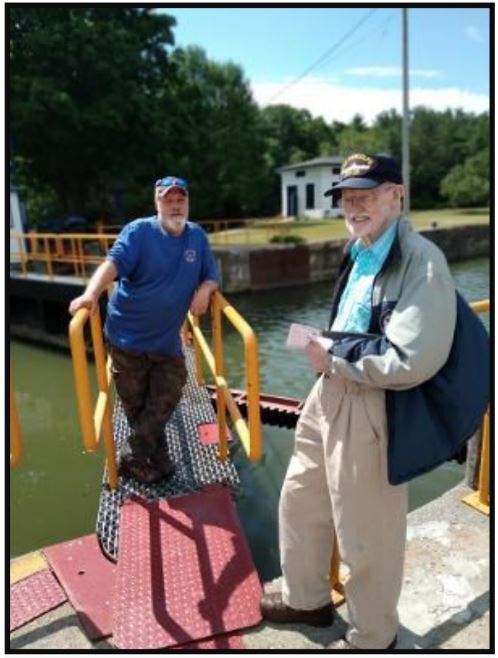
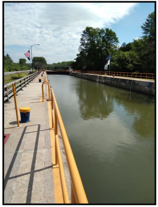
In July 2022 Jerry and Phyllis Mattheis, CSI directors from Cambridge City, visited New York’s Champlain Canal with their son Mark. Mark took the following pictures of Jerry chatting with the man in charge on one of the locks on the canal and the lock full of water.
Newberry Dam Remains
On the rainy Saturday morning of September 10, 2022, CSI member Troy Jones of Clinton, Indiana, visited the site of the Newberry Dam. The dam was built to back up a pool of water in the White River at Newberry, Indiana, so that canal boats could cross the slack-water pool and continue along the way on the Wabash and Erie Canal. The canal was so close to the level of the river that an aqueduct could not be used. Instead the canal boats were lowered and raised from the pool by locks. They would enter the pool through Lock 59 (8 ft. lift) on the north end, traverse the pool for four miles to the dam, and then leave the pool on the south end through a guard lock to continue their journey, or vice versa. The mules crossed the river via a towpath bridge.
Troy took the following photos in the rain of what remains of the dam today.
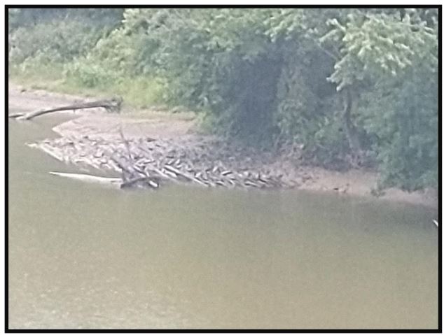
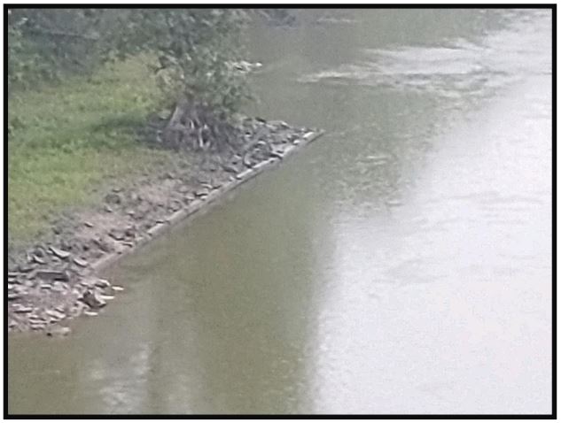
For a good explanation of how this operated see the videos made by CSI member David Kurvach of
Newburgh, Indiana, on the CSI website titled:
White River Slackwater Locks
Newberry Dam (White River) and Lock.
Curly Hayes Lock Cleared In Lagro

The Curly Hayes Lock # 13, located 1.3 miles east of Lagro and named for its gatekeeper, was used for years by the owner of the house in front of it as a place to burn his trash. Its walls were blackened by fires. It has been cleared of trash and some of its stones removed to be used in the James Kerr Lock #14 nearby. The following photo was found on Facebook on the Wabash County Historian’s page. The lock’s total length is 120 feet. It raised and lowered canal boats seven feet from one level in the Wabash & Erie Canal to another. Chisel marks can be seen in the stone as well as cuts for the gate hinges.
Old Canal Way Bill Found
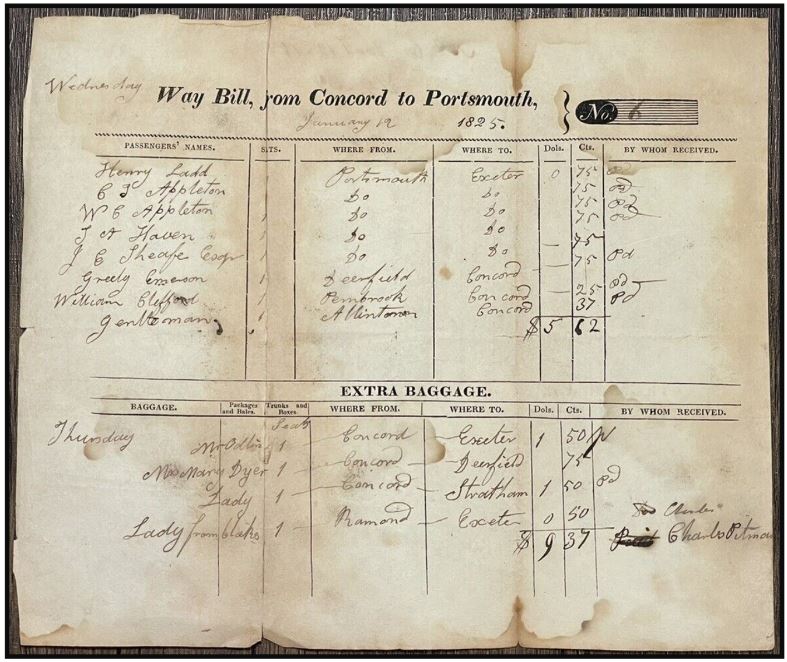
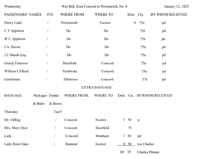
Neil Sowards, CSI member from Fort Wayne, recently found on e-Bay the following way bill for the Ohio Canal. He writes: “Way bills are quite scarce as most were thrown away or used for scrap paper. I once got a book of way bills on Marietta. It survived because it had been reused as a scrapbook with new clippings glued on top of the way bills. It even had way bills for boats that were being poled up the Muskingum River. Keelboats, I believe they were called.”
The following way bill was offered for sale for $90 dollars. It was 8 inches high by 9 inches wide and in good condition. On the back it read No. 6 Jany 12 1825 and had two folds.
$20 Note For Work On Miami Extension Canal At Piqua, OH
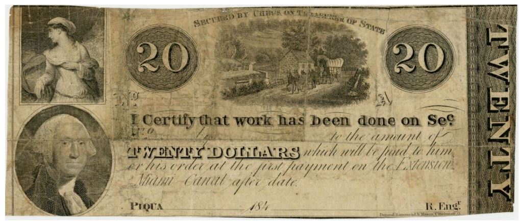
This 1840’s $20 note was recently found on e-Bay by Neil Sowards. Bidding started at $198.00. The note says:
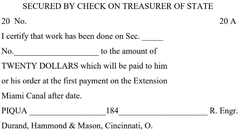
If you view the note at a higher percentage you will see a little canal boat in the center picture.
Canal Boat Post Card
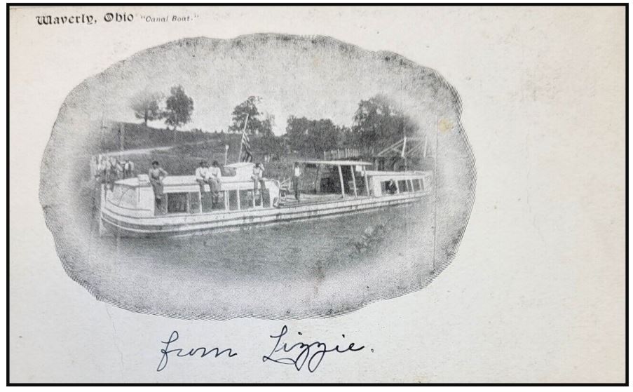
Neil Sowards also found this old postcard on e-Bay. It says Waverly, Ohio “Canal Boat” and is signed “from Lizzie.” It has a place for a one cent stamp. It has never been mailed. Neil says, “This seems to be a combination freight and passenger boat. Surprising for such a late date when passenger boats disappeared with the coming of the railroad.”
The boat is ready to pass beneath a bridge that carried the road over the canal. The U. S. flag will have to be lowered if this is a stationary bridge. A group of about seven people are standing on the canal bank perhaps ready to board. Four men are sitting on top of a passenger cabin, One man is standing on the freight platform and another is in the window of a passenger or the captain’s cabin.
News From Delphi
Following pictures courtesy “Currents,” newsletter of W&C Canal, Delphi, Indiana
Delphi’s Canal Park & Trails Readied For Winter
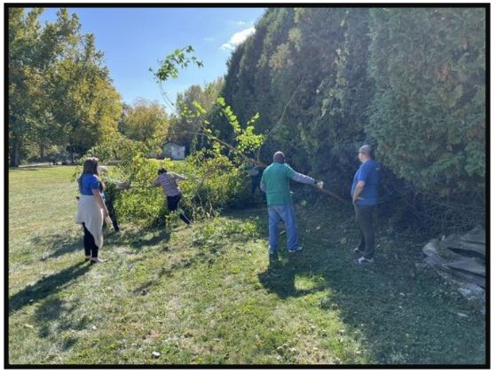
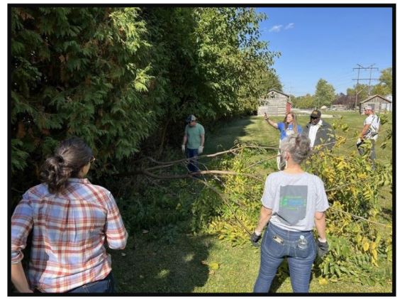
Over 80 volunteers from the Security Federal Savings Bank met at the Carroll County Wabash & Erie Canal Park in Delphi on October 8, 2022 to clear trails and clean the canal boat house getting ready for winter. They came prepared with their own equipment and made great progress. The following photos show them working and their accomplishments.


2022 Tour Season
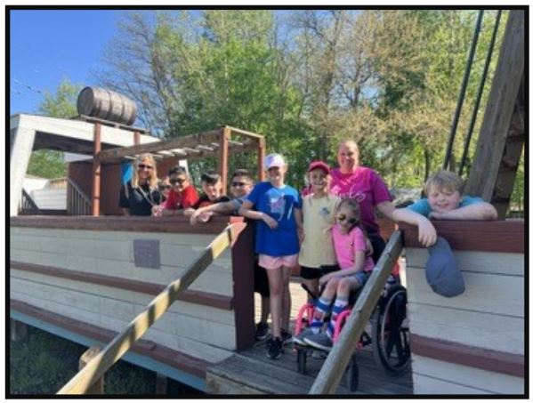
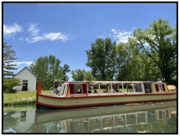
School groups of over 1,000 students visited Canal Park and the Interpretive Center in 2022. There volunteers were engaged with the students answering questions and telling the early history of Indiana and the part canals played in it. The children had time to play with the exhibits in the museum, watch crafters at work, learn about the buildings in the pioneer village, play on the stationary canal boat, and ride “The Delphi” down a portion of the Wabash & Erie Canal.

Interpretive Center Renovated
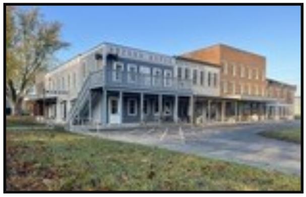
Crumbling cement board siding on the exterior of the Canal Interpretive Center has been replaced by Action Exteriors. Had this issue not have been attended to, the damage may have gone beyond the surface level. The contractor was able to replicate the beautiful original design of the building while fortifying it for decades to come.
Quarry Furnishes Crystal Water
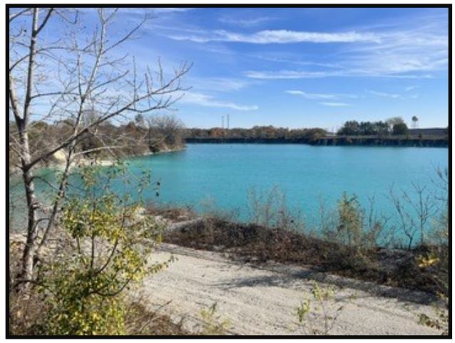
The restored portion of the Wabash & Erie Canal in Delphi has noticeably aquamarine, crystal clear water unlike most canal water. It is extremely clean and even wards off mosquitoes due to its composition.
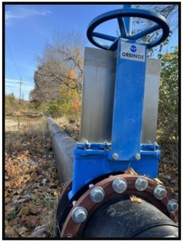
The water for this section of canal is supplied by the U.S. Aggregates limestone quarry located north of the canal. A 16-inch pile line, powered by a 200-horsepower pump, supplies about three million gallons of water to the canal every day. A value in the pipeline controls the amount of water supplied. To open or close the valve takes about fifteen minutes of walking around and around it with a four-foot pipe wrench.
When Dan McCain and Mike Tetrault, executive director, visited the quarry, U.S. Aggregates volunteered to donate stone products for future use on Delphi’s historic trail system.
Christmas At The Canal
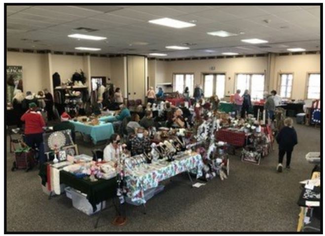
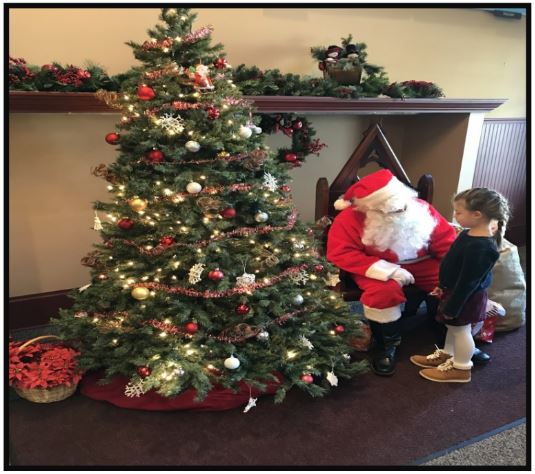
On December 3, 2022 the Interpretive Center and Pioneer Village were decked out in holiday style to welcome visitors to “Christmas at the Canal.” A Christmas Bazaar was held in the reception hall with a variety of vendors where wonderful gifts for Christmas could be purchased while the children visited with Santa. The one-room schoolhouse featured story time with help from the Delphi Public Library. Live music filled the White Chapel from 10a.m.-4p.m. The Reed Case House and Interpretive Museum were open for touring.
Montezuma Canal Basin Silhouette
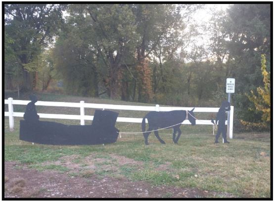
While travelling to various W & E Canal sites Troy Jones stopped at Montezuma, Indiana. There near
Benson’s Basin he found this canal boat, mule and driver silhouette. The sign says “no motorized vehicles” are allowed on the trail between the basin and the Wabash river.

Mary Ann Getty
(Find –A-Grave #245008259)
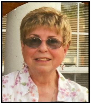
Mary Ann Getty, 85, passed away Monday, October 17, 2022 at Coventry Meadows
Nursing Home in Fort Wayne, IN. She was born March 10, 1937 in Rochester, IN,
the daughter of the late, Paul J. and Naomi Whitcomb.
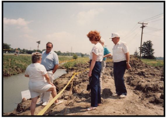
She graduated from Rochester, IN High School 1955 and earned her Bachelors and Masters in Education from Indiana University 1967. She was a teacher with Fort
Wayne Community Schools for 29 years and retired in 1992.

Mary Ann was very interested in canals and used her experience as a teacher to teach others about them. As a member of the Canal Society of Indiana, she represented the society on the Mayor of New Haven’s canal committee after the 1992 uncovering of the Gronauer Lock of the Wabash & Erie Canal located just east of New Haven. She spent many days and evenings at the lock site talking to those interested in the archaeology that was taking place. She and her husband, Gerry, also covered the lock timbers with wet tarps before they were shipped to South Carolina for preservation. Her canal interest went beyond local organizations. She belonged to Carroll County Wabash & Erie Canal Association, American Canal Society, and International Canal Society.
She also belonged to the Indiana Historical Society, Allen County Historical Society, Indiana Covered Bridge Society, Order of the Eastern Star Trinity Chapter 576, and St. Elizabeth Ann Seton Catholic Church.

Mary Ann was survived by her husband of 37 years, Gerald Getty of Fort Wayne, IN, step-children, Karl F. Getty of Nashville, TN: Katrina Lynn Sneed of Fort Wayne, IN; nephew Mark Whitcomb, step-grandchildren, Jamie, Shayee, Kasey, Aly and 2 step-great grandchildren. She was preceded in death by her brother Robert J. Whitcomb and nephew, Steven Whitcomb.
Funeral Service were held at 1:30 pm Tuesday, November 1, 2022 at D.O. McComb and Sons Lakeside Park Funeral Home, 1140 Lake Ave., Fort Wayne, IN, with visitation from 11 am until service time at 1:30 pm.. Burial in Highland Park Cemetery. Memorials may be made to St. Elizabeth Ann
Seton Catholic Church or St. Rose Catholic Church in Monroeville. Her service could be viewed virtually.
Gerald Edward Getty
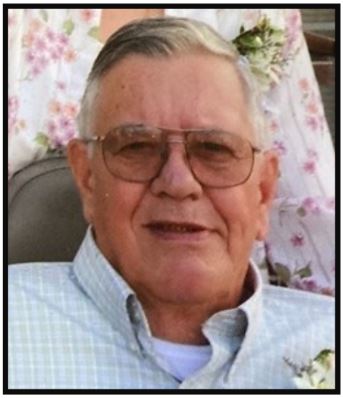
Gerald Edward Getty, 87, passed away November 1, 2022 at Coventry Meadows Senior Care, in Fort Wayne, Indiana. Born December 27, 1934 in Fort Wayne to Reynold R. and Helena Getty, he later was graduated from Central Catholic High school in 1953.
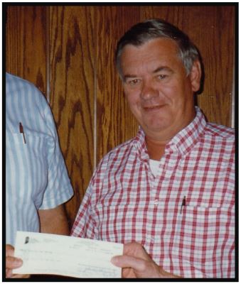
He was an aircraft weapons mechanic with the Air National Guard for 34 years retiring in 1988. He also served with the Air National Guard and retired as a Master Sergeant.
Like his late wife, Mary Ann, he was very interested in canals and was a member of the Canal Society of Indiana, Carroll County Wabash and Erie Canal Association, American Canal Society, and the International Canal Society. He served as CSI vice -president and then became CSI’s secretary for many years. He was active with the uncovering of the Gronauer Lock #1 of the Wabash & Erie Canal spending countless hours at the site talking with visitors about how the lock operated and readying the lock timbers to be transported to South Carolina for preservation.
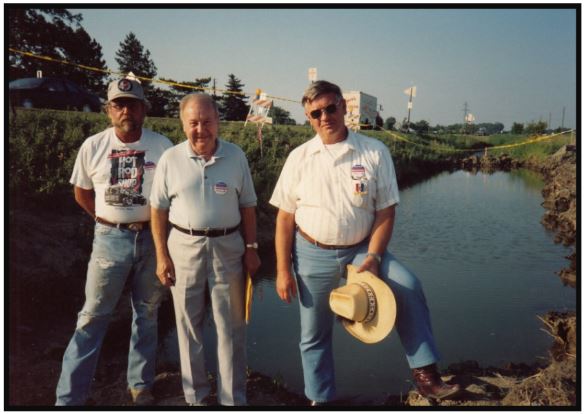
He was also a member of the Indiana Covered Bridge Society, Indiana Historical Society, Allen County Historical Society, Indiana Boy Scout Council and St. Elizabeth Ann Seton Catholic
Church.
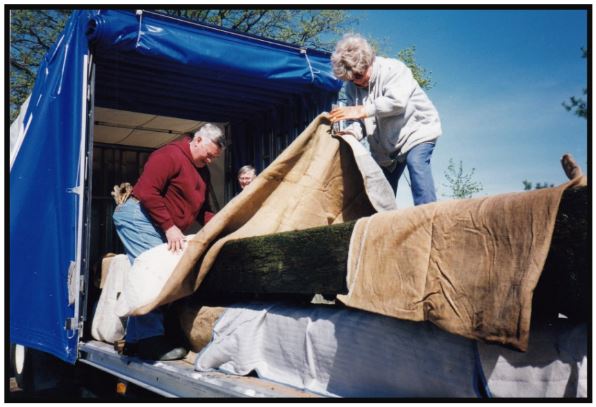
Gerald was preceded in death by his wife Mary Ann, and brothers Arthur R. and Steven J. Getty. He died on the day of Mary Ann’s funeral.
He is survived by his children, Karl F. Getty of Nashville, Tennessee, Katrina Lynn Sneed of Fort Wayne, Indiana; grandchildren, Jamie, Shayee, Kasey, Aly and 2 great-grandchildren.
Visitation at D. O. McComb & Sons Lakeside Park Funeral Home began at 11:30 a.m. on Saturday November 12, 2022 followed by a service to honor his life and legacy at 1:30 p.m. He was laid to rest at Highland Park Cemetery in Fort Wayne.
Canal Society of Indiana 2022 Year End Report
2021-2022 — PRESIDENT’S REVIEW
The past two years have required the Canal Society of Indiana to make adjustments in our programs. Even before the virus, we had switched to a completely electronic media, so we were in a good position to respond to the new environment. “The Tumble” has been successful in bringing timely news and articles to our membership, which has grown to over 100. By notifying the membership of each bi-monthly issue, most of our people are keeping up-to-date and are getting accustomed to this format.
In January/February we received a wonderful boost from an article in Outdoor Indiana written by Scott Roberts. Some of us worked with Scott to prepare the article. It included a great photo of CSI Board member Sam Ligget of Terre Haute, shots of the Delphi Canal Park, and sites along the Central Canal and Whitewater Canal.
The Canal Society of Indiana was founded in Fort Wayne in May of 1982. Due to the lingering virus, we postponed our 40th Anniversary celebration until August, wrote a 40th Anniversary booklet, and sent it to members in May. On August 27th twenty-nine people met at the newly located Cass County Historical Museum in Logansport for the 40th Anniversary celebration and tour. Tom Castaldi laid out a tour route, which included the W & E Canal, scenic views of the Wabash River and a ride on the Dentzel Carousel. Carolyn Schmidt had the tables covered in multi-colors and decorated with canal boats and 40th celebration hats.
This year we continued to add canal signage on all of our canals. We have installed or are in the process of installing 10-15 signs this year. We want to continue this program and need input from our membership to locate and work with property owners to get their approval.
CSI members continued to pursue research into all of our canals. Lowell Griffin analyzed the Covington, Indiana toll records putting names of boats, commodities, destinations, etc. into a computer format for study. Troy Jones, David Kurvach and Preston Richardt uncovered more canal sites and information in the field. Future issues of “The Tumble” will cover their results.
We were greatly disappointed in April to learn of the demise of the “Ben Franklin III” in Metamora. As the boat had become water logged it was removed from the canal and, while in storage, broke into 2 parts. This attraction was lost at the Whitewater site. The State appears to be planning to improve the whole site: the aqueduct, mill and a new boat.
Ball State University students have successfully maintained our website indcanal.org since 2017. Due to the economic disruption related to the pandemic, nationally there has been a contraction in the labor force. The shortage we see in local businesses looking for workers has now filtered into the universities. Dr Ron Morris has been unable to recruit students to work on our website. Fortunately, CSI Board Member, Preston Richardt agreed to do this work. In conjunction with becoming CSI’s webmaster, he added 6 outstanding videos to our website about the W & E Canal in Gibson County.
For 2023 we are planning a brown bag symposium at the Fort Wayne Library on Saturday March 25. Another canal tour is being planned in September. We will headquarter at Crawfordsville on Friday. Saturday we will tour the Covington area in Fountain County.
Thanks to all of you, CSI has had another successful year.
Bob Schmidt, CSI President
Click here to read the full End of Year Report

