
In this issue of
- Spring Is Here: Great Time To See Canals
- What’s Left Of The St. Joe Feeder Canal And Dam
- Michigan Road Crossed The W & E Canal In Logansport
- Here Sooie Sooie
- Recollections Of An Unknown Canal Boat Owner
- Central Canal’s Fall Creek Aqueduct
- Whitewater Canal Passes Under Cambridge City Railroad Bridge
- White-Water Canal Aqueduct Masonry Specifications
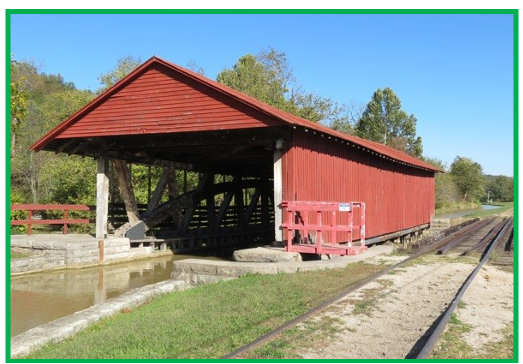
- What Makes Metamora’s Duck Creek Aqueduct So Special?
- Outreach Events & Programs
- Delphi News
- From the Whitewater Valley
- Canal Society of Indiana
Spring Is Here: Great Time To See Canals
Carolyn I. Schmidt

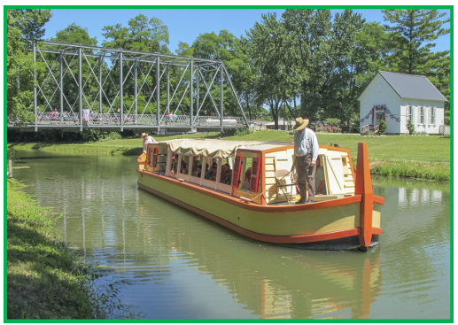
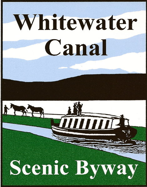
Get out your walking/hiking shoes and hit the trails along Indiana’s Central, Wabash & Erie and Whitewater Canals and their feeders. As you walk along the watered portions of the canals fill your senses with the sight of spring wild flowers, listen to the birds singing high in the trees or the hums of the insects, feel the breeze, watch the ducks on the water, see turtles basking in the sun, listen to the plop of frogs as they jump into the water as you pass by, and take in the scents of everything coming back to life again after a long hard winter. Visit Canal Park in Delphi where you can take a ride of the canal boat, tour Pioneer Village, or learn about canals in the Interpretive Center. Visit the shops along the canal in old Metamora, watch the milling of grain at the mill, and see beautiful cut stone locks. See the sparkling fountains as sun light hits them along the downtown Central Canal Walk in Indianapolis and go to the Indiana State Museum to see the Gronauer Lock Display. Drive along the Whitewater Canal and see the signage CSI has donated to mark the locations of the locks and other canal structures. Also check out the CSI signage along the Wabash & Erie Canal.
CANAL EXHIBITS AND MARKERS TO VISIT
CANAL EXHIBITS
WABASH & ERIE CANAL
Evansville Museum of Arts, History & Science
411 S.E. Riverside Dr., Evansville, IN
812-425-2406
Www.emuseum.org
Some canal information, School tours
Historic Forks of the Wabash
3011 W. Park Dr., Huntington, IN 260-356-1903
Www.historicforks.org
Canal exhibit, Trail along W&E Canal and Wabash River
Miami County Museum
51 N. Broadway, Peru, IN 765-473-9183
Www.miamicountymuseum.com
Some canal information, School tours, Walk along Wabash River, W&E signage
Riehle Plaza
Amtrack Station, Big Four Depot
Second St., Lafayette, IN 800-872-7245
Canal exhibit, Railroad track on top of canal bed
Roanoke Heritage Center
102 W. 1st St., Roanoke, IN 260-672-2773
W&E Exhibit, Marker for Dickey Lock nearby
The History Center
302 E. Berry St., Fort Wayne, IN 260-426-2882
Www.fwhistorycenter.com
Canal exhibit, School tours
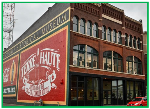
Vigo County History Center
929 Wabash Ave., Terre Haute, IN 812-235-9717
Www.vchsmuseum.org
CSI Canal exhibit, School tours
Wabash & Erie Canal Park
Canal Conference/Interpretive Center
1030 N. Washington St., Delphi, IN 765-564-6572
Www.wabashanderiecanal.org
Huge canal museum, Canal era village, Canal boat ride, School tours,
Over 7 miles of trails
Wabash County Historical Museum
36 E. Market St., Wabash, IN 260-563-9070
Www.wabashmuseum.org
Canal exhibit, School tours
WHITEWATER CANAL
Cambridge City Public Library History Room
600 W. Main St., Cambridge City, IN 765-478-3335
Www.cambridgecitylibrary.com
Canal artifacts exhibits, Vinton House canal inn and exhibits nearby, Yearly canal festival
Canal House
11 E. 4th St., Connersville, IN 765-825-0946
Canal exhibit, Tours
Fayette County Historical Museum
103 Vine St., Connersville, IN 765-825-0946
Canal exhibit
Morrisson-Reeves Library
80 N. 6th St., Richmond, IN 765-966-8291
E-mail library@mrinfo.org
Nettle Creek Valley Museum
96½ E. Main St., Hagerstown, IN 765-489-4005
Www.waynet.org
Canal exhibit, Tours, Canal marker on St. Rd. 38
Whitewater Canal State Historical Site
19083 Clayborn St., Metamora, IN 765-647-6512
Www.in.gov/ism/statehistoricsites/whitewater canal
Canal exhibit in operating grist mill, Duck Creek aqueduct, Cut stone locks,
Canal trail, Canal Days festival
Whitewater Valley Railroad Museum
P.O. Box 406, Connersville, IN 765-825-2054
Www.whitewatervalleyrr.org/main.php
Train ride along canal route from Connersville to Metamora seeing canal, stone locks and signage
CENTRAL CANAL
Indiana State Museum
650 W. Washington St., Indianapolis, IN 317-232-1637
Www.in.gov/ism/
Canal exhibit, Walk along revitalized canal, Paddle boats on canal, School tours
INDIANA STATE HISTORICAL SIGNAGE
- W&E Ground Breaking—Ft. Wayne
- 1716 W. Main St. at Growth Ave., Ft. Wayne, IN (Allen County)
- Gronauer Lock No. 2—New Haven
- Harper Rd. cul-de-sac, southeast of US 24, just beyond east interchange of I-469 bypass, New Haven (Allen County)
- W&E Canal—Delphi
- Bicycle Bridge Road, 0.1 mile north of US 421 & SR 25 intersection at the trailhead access & parking for Historic Delphi Trails, west edge of Delphi (Carroll County)
- W&E Canal—Lognasport
- SE corner of High & Fifth Streets, Logansport. (Cass County)
- Cross-Cut Canal/Eel River Feeder Dam—Clay County
- 4 miles north of Clay City on SR 59 at Eel River bridge, northwest corner. (Clay County)
- W&E Canal—Elnora
- State Highway 58 and State Highway 57, Elnora (Daviess County)
- Canal Junction—West Harrison
- NW corner of Whitewater River bridge at Campbell & State Streets across railroad tracks, south side of West Harrison. (Dearborn County)
- The Whitewater Canal—Connersville
- S. Grand Avenue/SR 121 at Eastern Avenue, NE corner between railroad track and highway, south Connersville. (Fayette County)
- Attica & Covington Canal Skirmish—Attica
- 200 W. Washington Street at entrance to Potawatomi Park, Attica. (Fountain County)
- Whitewater Canal—Metamora
- US 52, north side of highway at Gordon’s Lock #24, east Metamora. (Franklin County)
- The Central Canal—Noblesville
- SR 37 & 191st Street, Noblesville. (Hamilton County)
- Canal Landing on Washington Street—Huntington
- Washington & N. Jefferson Streets, Huntington. (Huntington County)
- W&E Canal Lock 4—Roanoke
- 339 E. First Street & US 24, Roanoke. (Huntington County)
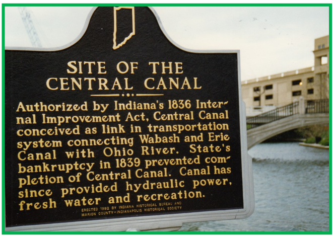
- The Central Canal—Indianapolis
- Illinois Street & Westfield Boulevard, Indianapolis. (Marion County)
- Site of Central Canal—Indianapolis
- At Central Canal, behind North State Office Building at 100 N. Senate Avenue, Indianapolis. (Marion County)
- Sylvan Lake—Rome City
- SR 9, Sycamore Park, Sylvan Lake dam & outlet site, Rome City. (Noble County)
- W&E Canal—Montezuma
- Median between US 36 & Crawford Street near Wabash River bridge, Montezuma. (Parke County)
- W&E Canal Completed 1853—Dongola
- SR 57, west side of highway between Patoka River & South Fork of Patoka River bridges, 3.5 miles north of Oakland City. (Pike County). MARKER IS MISSING.
- W&E Canal—Petersburg
- North side, 108 W. Main Street, Petersburg. (Pike County)
- W&E Canal—Evansville
- SE corner of Vanderburgh Courthouse lawn, 5th & Vine Streets, Evansville. (Vanderburgh County)
What’s Left Of The St. Joe Feeder Canal And Dam
Craig Berndt
I visited the St. Joe Feeder canal and dam in Ft. Wayne, Indiana yesterday March 8, 2026. There was too much wind to fly my drone, so I didn’t take any aerial photos.
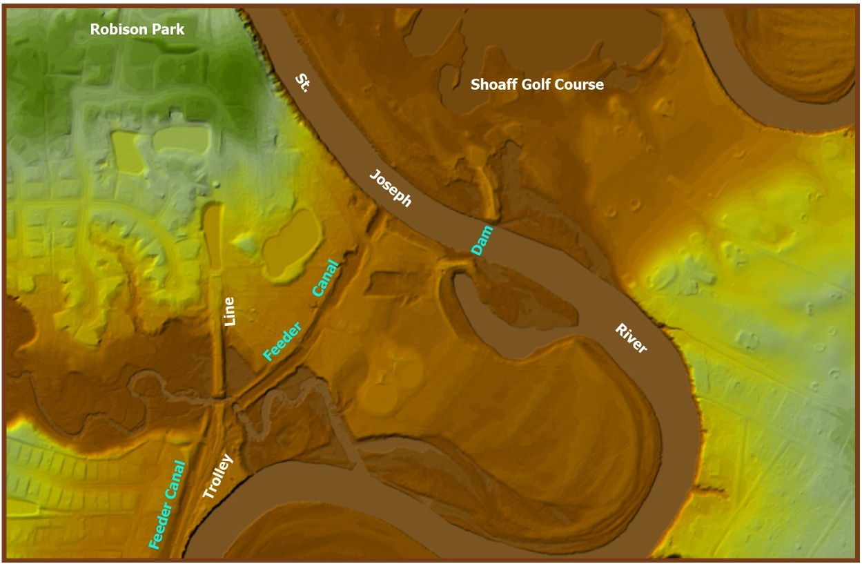
The LiDAR image shows the dam remains on both sides of the St. Joseph River. It also shows the feeder canal with the trolley line to Robison Park to the right of it.
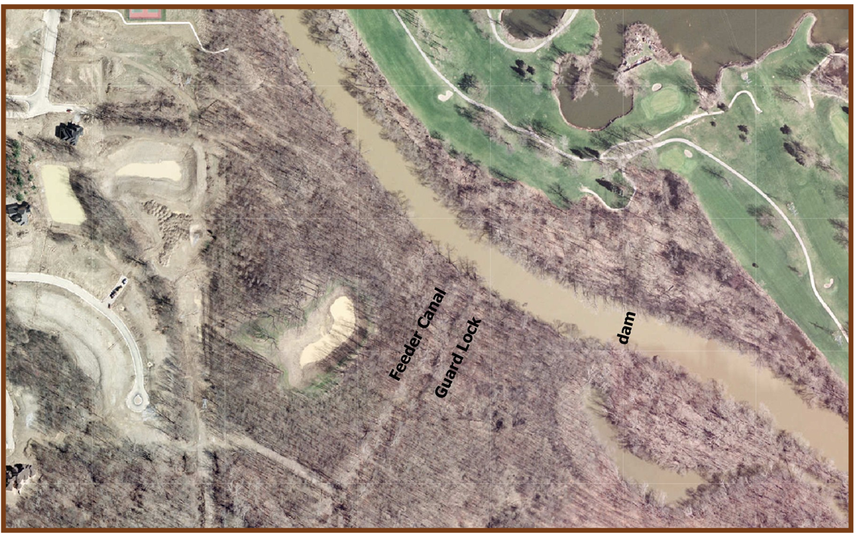
This aerial photo from the internet shows the St. Joe Feeder, Guard Lock & Dam. Shoaff Park Golf Course is to the right of the dam and Robison Park was to the left of the feeder canal.
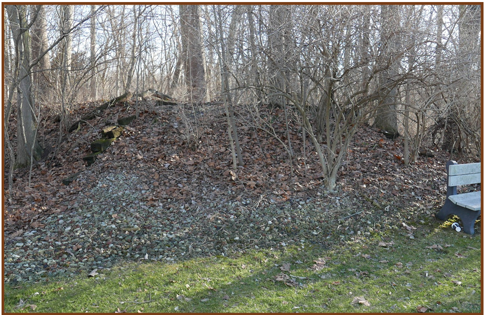
I walked on the dam on the left bank from Shoaff Park golf course to the river. There’s a well-worn path atop it. I was 15 +/- feet above the water at the river.
The dam ends in the golf course next to the bench seat in the photo, and the end of the embankment is formed by the wood railroad crossties. The dam is about 6 feet above grade here and originally extended further northeast.
The dam on the right bank is also accessible by a 1/3 mile walk, and it, too, has a well-worn path atop it.
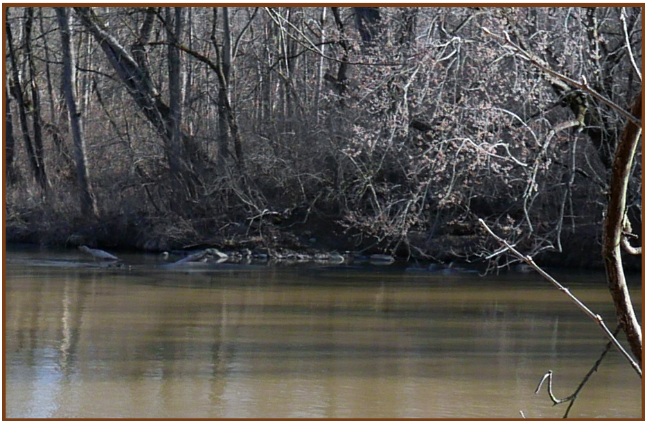
The second photo shows the stones for the dam at the end of the right bank, as seen from the left bank.
Tom Castaldi and I visited the guard lock a couple times about 10 years ago looking for remnants of the lock house but found very little if anything.
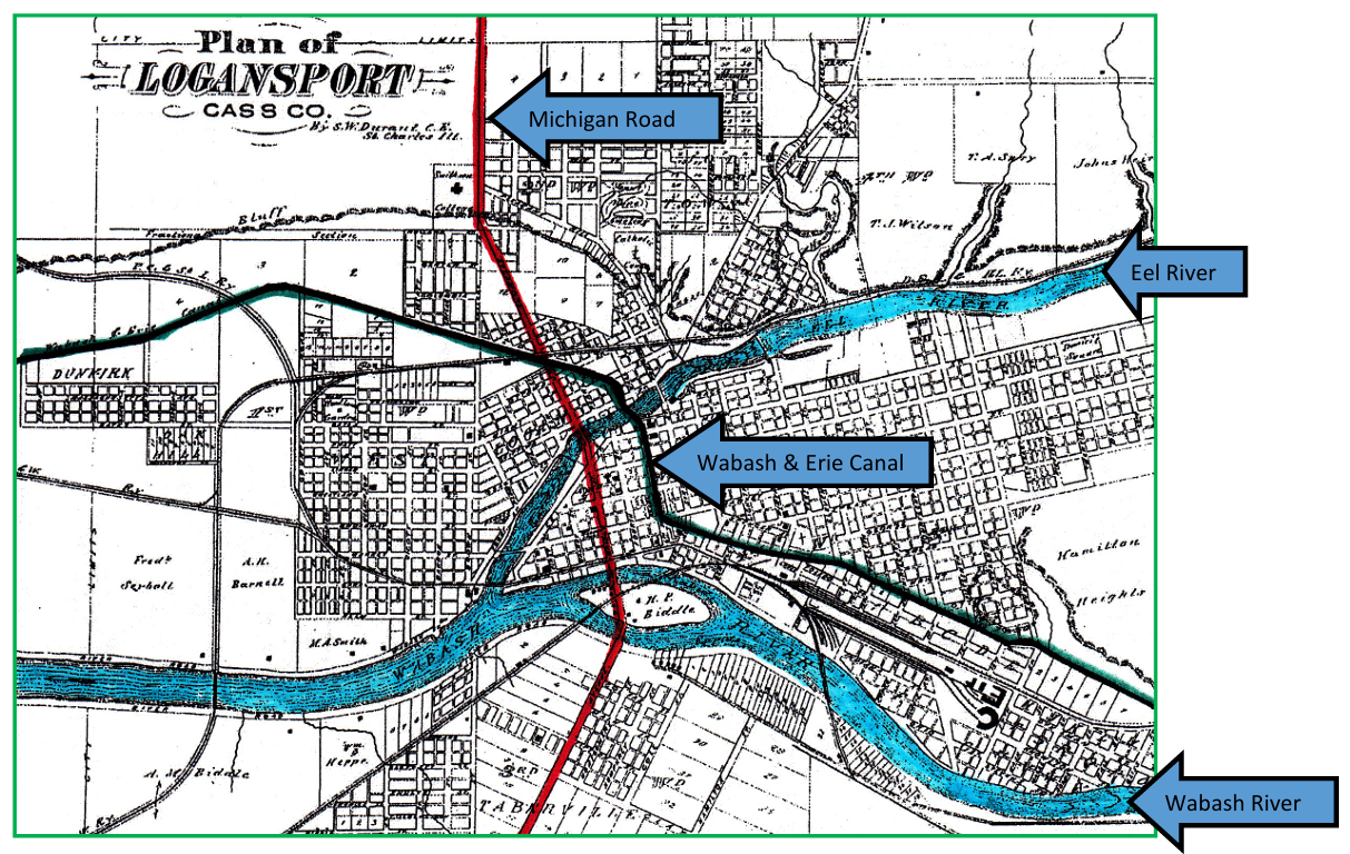
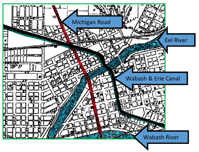
Michigan Road Crossed The W & E Canal In Logansport
Robert F. Schmidt

As Indiana’s first North to South “super-highway, ” the Michigan Road, made its way from the Ohio River at Madison, through Indianapolis, and on to Michigan City at Lake Michigan. It was intersected by the Wabash & Erie Canal that was being built shortly thereafter. Thus both of these major projects led to the development of Logansport.
In A History of Indiana From Its Exploration to 1850, Logan Esarey wrote the following about the Michigan Road in 1915.
“ARTICLE two of the treaty between the Pottawatomie Indians and United States commissioners, made October 16, 1826, ceded to the State of Indiana what was considered a sufficient amount of land to build a public highway from Lake Michigan to the Ohio. [This same treaty also included land for the Wabash & Erie Canal.] This road was to be one hundred feet wide, and to this right of way the Indians added a further gift of a section of contiguous land for every mile. Where the contiguous land did not belong to the Indians—all south of the Wabash—Indiana was to select a section of unsold Indian land for every mile of road. The United States confirmed the treaty February 7, 1827, and confirmed to the State the gift made by the Indians by act of March 2, 1827.
“In 1828 John I. Neely, Chester Elliott, and John McDonald were appointed commissioners to lay down the road from Lake Michigan to Indianapolis. They were instructed to select the best natural harbor on the lake; or, in the absence of a good one, the best place to construct an artificial one. The route from Logansport to the lake offered considerable difficulty. The terms of the grant were for a direct road which would necessarily lead through the Kankakee swamps, where nobody lived, and where it would be very costly to build a road. To avoid this, the road would have to run due north from Logansport to the South Bend of the St. Joseph, thence west to Lake Michigan. The point where Michigan City now stands—the mouth of Trail creek—was selected for the northern terminus. Then two complete sets of field notes and plats were made, one for a road by South Bend, the other direct through the Kankakee flats.
“The choice of routes was thrown back on the General Assembly and caused much angry discussion. The commissioners, it was asserted, had been unduly influenced by the citizens of South Bend. January 13, 1830, the route of the second survey by the way of South Bend was chosen. The act of January 29, 1830, established the road from Logansport via Indianapolis, and Greensburg to Madison. A new board, consisting of Samuel Hanna of Wayne county, William Polke of Knox, and Abraham McClellan of Sullivan county, was named. This board served only one year and was abolished by act of January 4, 1831. From this time on the whole work was entrusted to William Polke. The road was expected to be cleared and grubbed from Madison to the Wabash by November 30, 1831.
Three surveying parties, headed by Commissioners Hanna, McClellan, and Polke, spent the summer of 1830 selecting and surveying Indian lands. They had not made their final report until they were notified that Congress had refused to ratify their choice and had demanded that the road be laid down and then “contiguous” sections be chosen. Further, the sections must be selected from land not yet ceded by the Indians. The construction of the road went steadily on, however, scrip being used instead of money. This scrip was based on ceded lands and almost the whole road was financed with it. Noah Noble, who had the southern end in charge, laid off the road in sections of four miles each. By act of February 4, 1831, Polke opened the sale of land at Logansport. No land was to be sold under $1.25 per acre. The part of the road from Logansport to St. Joseph county was ordered under contract at a price not exceeding $1.50 per mile. The road was divided into three sections. The first, from Madison to Indianapolis, was under the immediate supervision of Daniel Kelso; the second reached to Logansport and was under Horace Bassett; the last was under Polke himself. Contracts for building the road were let during the year 1832. Beginning at Madison, the road was laid off into sections of from ten to twenty miles each and the grading let to the lowest bidder. Bridges were let under separate contracts. The whole road, 265 miles long, was put under contract by June 30. During 1832 lands were placed on sale at Laporte. Scrip was accepted in payment for all lands. The road was cleared one hundred feet wide, thirty feet of which was grubbed and graded. By 1836 it was clearly ascertained that this made a poor road. In the worst stretches logs were laid crosswise and covered with sand. Many bridges were washed away every year by the streams. Although the road was used enormously north of Indianapolis, it was anything but satisfactory. It passed through fourteen counties, and was used by the inhabitants of thirty-five in going to the capital. The General Assembly at almost every session had to make an appropriation for repairs.
“By 1837 the State was not able to give further aid to it, the State’s resources being completely prostrated. By act of February 2, 1837, the various county boards, through whose jurisdiction the road ran, were required to divide it into suitable sections, over each of which a supervisor was to be placed with power to call out the hands to keep it in repair. The hands were liable for two days’ work a year. By act of February 13, 1841, and January 31, 1842, the road was classed with all other State roads and brought entirely within the compass of the general road law of 1838.
“The Michigan road began at Madison, ran almost due north through Jefferson and Ripley counties to Greensburg in Decatur [county]. Thence by a direct line, it led across Shelby county to the capital. The important sections of the road were those from Indianapolis across Hamilton, Boone, Clinton, and Carroll counties to Logansport, and from that place due north again across Cass, Fulton, and Marshall, to South Bend, and thence west to Michigan City. During eight months of the year it was an open passable highway, but during the winter it was an endless stream of black mud and almost useless. Its importance may be estimated from the fact that one-half the pioneers of the northwest quarter of Indiana reached their homes over it as a road it was not comparable to the National [Road], but it was an available means of reaching a very attractive country when there was none other. “
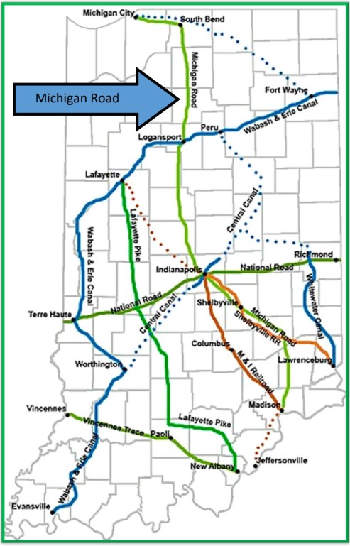
Map courtesy of Wikipedia
Funding for both the Michigan Road and the Wabash & Erie Canal came from proceeds from Michigan Road land sales. As I mentioned earlier both transportation networks came out of the Treaty of Paradise Springs in Wabash, Indiana in October 1826 and the Federal land grants of March 2,
Transportation of its products, receiving products from beyond its borders, and giving settlers a way to move westward were of concern to frontier Indianians. The Ohio River provided southern Indiana with access to steamboat and river transportation. Central Indiana was provided with an east –west transportation route by the rough and rugged National Road that was completed in 1834. North to South transportation would be provided by the Michigan Road and northern Indiana was soon to have the Wabash & Erie Canal, which reached Lafayette in 1840.
Maintenance issues plagued both the Michigan Road and the W&E Canal. The roadway became muddy and almost impassable in winter and the canal structures and prism were always in need of repair. Flooding and drought were major concerns for the canal as well.
Completed by 1833-34 the Michigan Road was basically operable. Even though the W&E canal was begun in 1832 it only reached Huntington in 1835. It didn’t reach Logansport until around 1837.
Length of the Michigan Road from Madison to Michigan City was 265 miles. The W&E Canal from the State Line to Terre Haute was 226 miles. The extension of the W&E to Evansville by 1853 totaled 380 miles in Indiana with another 88 miles in Ohio. By the 1850s most of the state was being served by various railroads as well.
Although little is ever mentioned about the Michigan Road crossing the Wabash & Erie Canal, in the 1840s this intersection influenced the growth and importance of Logansport.
I highly recommend viewing the two excellent videos about the Michigan Road listed below.
To view the videos click the play button:
Michigan Road: Indiana’s Pioneer Toad
by Gloria June Grief
(18 minutes)
Old Michigan Road Holton Indiana
by History in Your Own Backyard
(3.51 minutes)
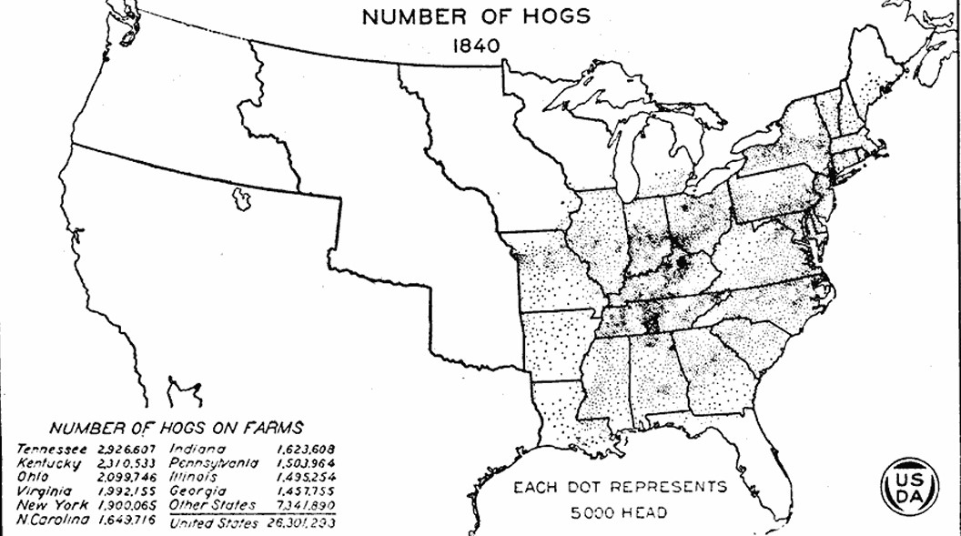
Here Sooie Sooie


The Wabash & Erie Canal reached Huntington, Indiana by 1835 from Fort Wayne, its summit. It was first built to the southwest reaching Logansport in 1839, Lafayette in 1840, Lodi in 1847, and Terre Haute, its nadir level, in 1849. The Whitewater Canal extended from Brookville to Lawrenceburg in 1839, Cambridge City in 1845, and Hagerstown in 1847. Thus, along with other articles about hog raising in the 1840s, I, Carolyn Schmidt, have chosen to use 1840 as the basis of this article.
In 1840, a significant part in Indiana’s agricultural economy was raising hogs. The region’s fertile soil and temperate climate made it an ideal location for pigs. The following map created by the United States Department of Agriculture in 1922, shows the number of hogs raised on farms in 1840. Each dot represents 5,000 head. At that time Indiana raised 1,623,608 hogs on farms.
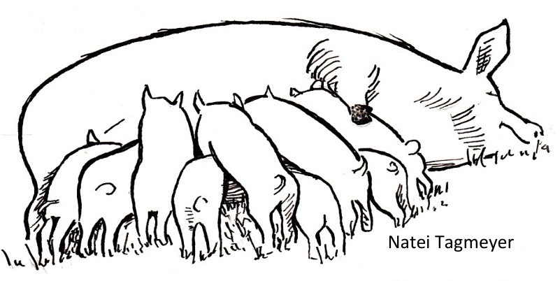
Hogs were not only a source of meat, but also played a crucial role in clearing brush and land for cultivation. Hoosier farmers harnessed their natural behavior of rooting through the soil to create new fields for planting. Without the early American pigs Indiana would not have become the crossroads of America, since Indiana marked the western edge on maps and almost nobody ever ventured beyond the Mississippi River.
Pioneers coming to Indiana had to choose what kind of livestock to bring with them. The obvious choice was the pig, which was the first domestic livestock in Indiana. Pigs are hardy, tough, capable, and can live in many harsh environments and remain healthy. They can forage for food routing through the soil with their snouts and feed themselves on grass, nuts, roots, insects, berries, food scraps, etc. . Later as the population of Indiana grew, this trait of rooting and turning over the soil became a problem and farmers put rings in their noses or put them on a concrete floor in a pen.
Pigs also produce large litters on their own not needing help with their births like cows do. Typically a sow will have at least a dozen piglets each pregnancy. This quickly increases the hog population.
Hogs grown in the corn-growing regions of Kentucky, Ohio, Indiana and other western States were fed corn. It required little of the farmer’s time to turn the hogs into a field of standing corn and allow them to do their own harvesting, especially in the alluvial districts like that of the Wabash River. Known as “Hogging down” this practice also returned their manure to the soil.
Although hogs in the West were usually raised and fattened on the same farm, in some of the best corn growing districts feeders purchased lean hogs from farmers living back from the river and fattened them along with their cattle They would follow the feeding cattle in the winter—two hogs for each full-fed steer or 1 hog for each half-fed steer.
Cincinnati, Ohio was located in a large corn-growing and hog-raising region. It became known as “Hog-opolis” after becoming the great hog-packing market of the country. It was known in the East, South, and in foreign markets for its hams.
Hogs were driven to Cincinnati in droves with as many as thirty-thousand. These were often joined by others along the way to market. “… on one road leading to Cincinnati from Indiana, about 70,000 hogs crossed the Miamitown bridge. Other bridges crossed the Miami River on roads leading from Indiana. Compare the 1840 capacity to increase the number of hogs and corn brought to market with that of 1847 on the tables below:
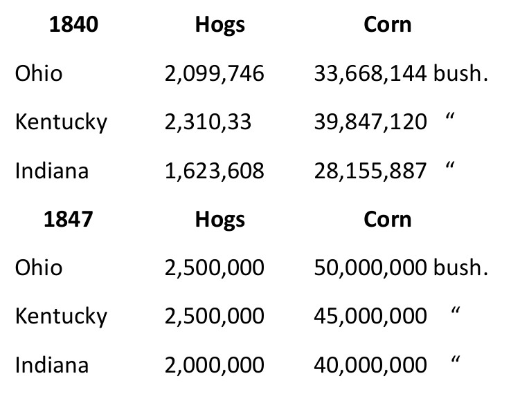
It takes about 2 years for a hog to grow to full size. Cultivating Indian corn, which is the best food for fattening pigs, makes hog raising a profitable business.
The Indiana Quarterly Magazine of History, Volumes 19-20, 1923 says, “The price for a hog on foot was never higher than two cents per pound” in Cincinnati. The pork packed there came exclusively from Ohio, Kentucky and Indiana according to A New and Popular Pictorial Description of the United States by Robert Sears, 1848..
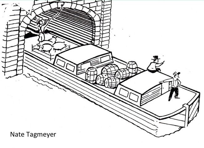
Once the Whitewater Canal was intersected by the Cincinnati & Whitewater Canal, pork could be shipped to Cincinnati by canal boat. Live pork and pork in barrels then could be shipped back to Indiana through the Cleves-North Bend tunnel.
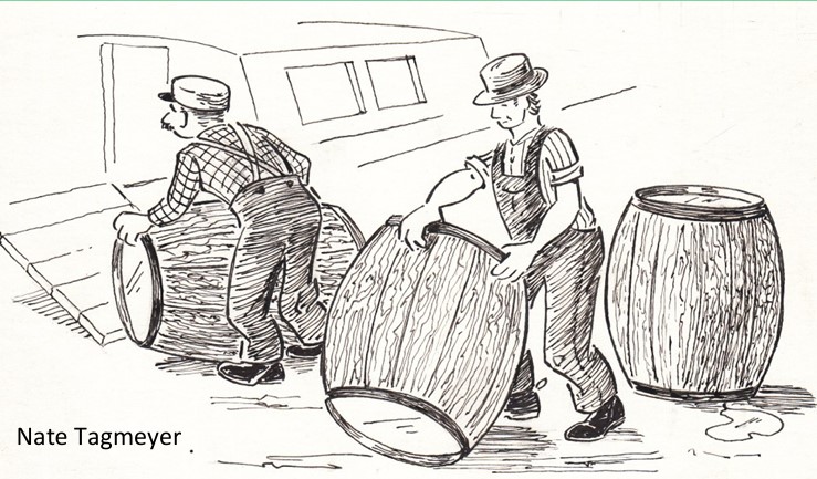
The Wabash & Erie Canal also provided a transportation route for moving live pigs, barreled pork, hams, and corn from towns along its way. Loading the live animals aboard the boat could be challenging. Loading the barrels was much easier. The live animals rode on the deck of the boat and the barrels often were placed inside it.
Transporting pork, corn, and much more by canal boat suddenly opened up Indiana to East coast and even world markets. It was like turning on a faucet. More money could be made than ever before and people poured into sites along the canals. Towns grew up with blacksmiths, bridge builders, carpenters, churches, coopers, doctors, general stores, grain mills, inns, lawyers, livery stables, packing plants, saw mills, shops of all kinds, slaughter houses, teamsters, warehouses, and almost anything a thriving town might need. Early Ft. Wayne even had glass blowers and stained glass. By 1850 the canals were in their hey-days. Life was good.
Farmers now had a market for their products both in the new towns along the canals as well as the East coast. They could bring in new machinery by canal boat. At first, when the swine ran almost wild feeding themselves, parts of the hog had been discarded as unusable, but now all of its parts were used except its “squeal.” Intestines became casings for sausage. Sausage was made from all the scraps of meat and fat. Fat was melted down. Blood was made into blood sausage. There was head-cheese, liver sausage, pickled pigs feet, ribs, backbone meat salted down in crocks, and many other items.
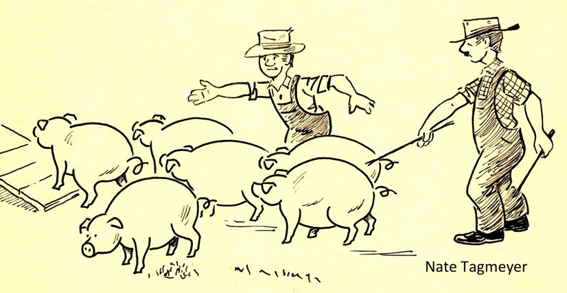
Later, when the pigs were fenced in, they became somewhat tame. Pigs are smart and the farmers developed a variety of calls to get them to come and be fed or to be rounded up. A common call used was “Here Sooie Sooie” or some other combination of words. Over the years, hog calling became an art. Contests are still held today to see who is the best hog caller. The internet has calling contests from Iowa on it. What fun!
This article is written as an introduction to five articles entitled “Pigtails” that are about hogs. They were written by Susan Yoder in 2001-2002 for the Canal Society of Indiana Newsletter. These will appear bi-monthly in “The Tumble,” the Canal Society of Indiana’s News and Journal.
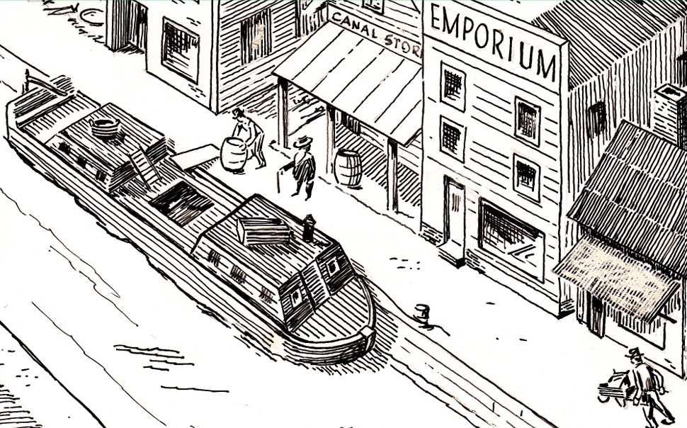
Recollections Of An Unknown Canal Boat Owner
Attica Daily Ledger (August 12, 1902)
In 1853 I was engaged in canal boating on the old Wabash and Erie Canal, and held the distinguished position of captain of a line, or freight boat called the Albert Ross. It belonged to Messrs. Standard and Currier of Attica, a firm that did business then in the room now occupied by the McDermond dry goods store, which at that time consisted of a brick room of only one story height. This firm also owned a large distillery that stood near the Wabash Depot where a pottery now stands. The canal boat, which was a large one, was used to convey the project of the distillery to Lafayette and to haul back hops, empty barrels, merchandise, or anything of the kind—we always had a load going or returning. The crew consisted of four persons, captain, bowman, steersman and driver. Some boats carried a cook in addition, but we generally ate breakfast at whichever town we started from and supper at our place of destination. Dinner [lunch] consisted of hot coffee made in the kitchen of the boat and a cold lunch eaten in the cabin. We had a very nice cabin, kitchen and places to sleep, and the boat was not a bad place in which to travel by any means.
It was the custom to allow any one we met along the tow path who wished to do so to board the boat and ride a mile or two, and it they were acquaintances and happened to be on board at noon when we lunched, we would invite them to join us.
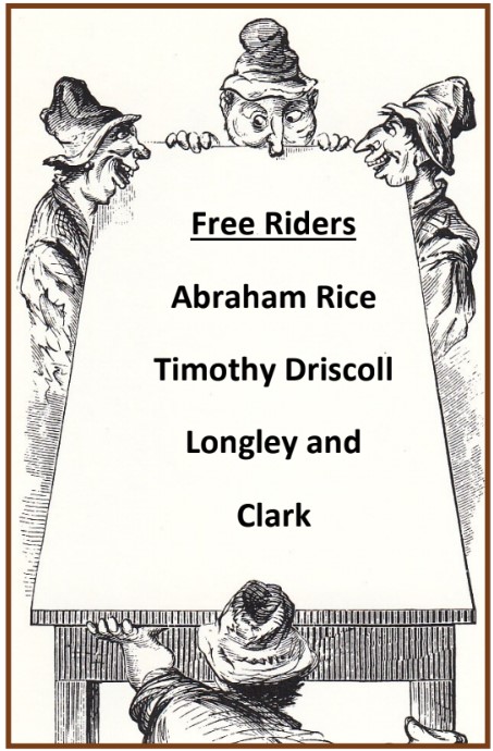
There were four fellows who made a practice of boarding us near Granville. Their names were Abraham Rice, Timothy Driscoll and two other young men named Longley and Clark.
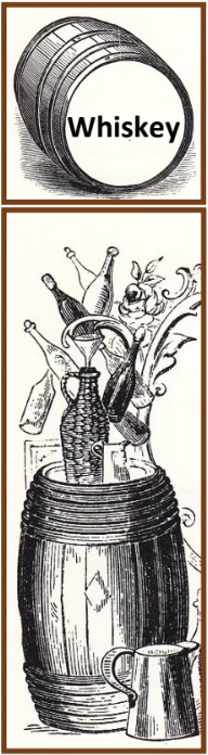
The first time, three fellows came aboard. They had been fishing and were very polite and asked permission to ride a mile or two, which was granted. They were invited to lunch with us, and every thing went on all right until they discovered a whiskey barrel with a loose bung and pried it out. They had a narrow bottle, to the neck of which they tied a string, and this was lowered into the whiskey barrel, filled, pulled out and drank by one of the crowd. The process was repeated until they all became more or less intoxicated. The hands were all busy and did not observe that our guests were making free with the cargo until their rude, offensive manners revealed the fact. So when they came to their stopping place and wished to get off, their request was cheerfully complied with.
On our next trip it was the same thing over again. On the third voyage they found things so congenial that they stayed with us until we got to Lafayette.
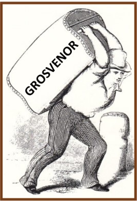
As soon as we landed there and got the boat tied up and the horses stabled, I met a friend named Cy Grosvenor, who was at that time engaged in the marble business in Lafayette. I had a very pleasant evening with Mr. and Mrs. Grosvenor. They were both old acquaintances and we had much of mutual interest to talk about. During the conversation I learned that Mrs. Grosvenor was going down on the packet next day to visit friends in Attica. I told Cy to put her trunk and a baby carriage on the line boat, and I would take them to Attica for her, and she would thus have no baggage to bother with on the packet.
This offer was accepted and the next morning Mrs. Grosvenor and her infant daughter Belle departed on the packet. Cy and myself loaded the trunk and baby carriage on the line boat and I began to look around for my crew. Our load for Attica was strung along the dock waiting for the hands to place it in the packet, but they had failed to put in an appearance. After some inquiry, I learned that they had been drinking with the gang from Granville, and the whole crowd had been locked up for drunkenness and disorderly conduct. The team had been seized to pay the fines and costs.
The team belonged to me and I could not understand how it could be made liable under the circumstances. I felt that I needed counsel, so I went to Mr. John Rose, the owner of the warehouse and the one to whom all our cargoes were consigned, and stated the case.
Mr. Rose was a man of wealth and importance and had a great deal of business to look after. I felt some timidity about troubling him with such matters, but I could think of no other way. He was so genial and pleasant, however, that I thought I had never met a nicer old gentleman. As soon as he understood what was the matter, he called his office boy, and sent him with a note to Judge Samuel Huff, a legal friend, requesting his attendance. The Judge returned and they sent for the city marshal, Jefferson Chizum, and soon satisfied him that none of the boat hands had any interest in the horses, so he turned them over to me. An arrangement was also made with the marshal, that Mr. Rose guarantee the fine and cost which I was authorized to keep out of the men’s wages. So they were set free and proceeded to load the boat. The gentlemen from Granville were permitted to remain in the calaboose, and Mr. Rose told me they were a very tough set and advised me not to allow them on the boat in the future.
Without further difficulty we proceeded to Attica, and the three hands in course of time paid the fines. They felt so bad about paying our hard earned money so uselessly that they decided to let whiskey alone from that time forth.
We made regular trips with the Albert Ross until 1854 when I decided to abandon boating. I removed to Fulton County, near Kewanna, and engaged in farming.
While I was located in Fulton County, I was a subscriber to the Attica Ledger, then edited by Isaac A. Rice, and in its columns I read of a fearful tragedy that occurred at Lafayette. In 1855, a warehouse stood on the canal a little below the Earl & Hatcher block, as it was then called, and on the same side of the street. This warehouse was owned and operated by John Rose & Son. It was burned by an incendiary who had murdered Mr. Rose with a hammer, robbed his safe and set fire to the building to remove all traces of the crime.
Where the warehouse fronted upon the street, he had partitioned off an office and bedroom adjoining where he lodged. The office windows were large and faced the street. The building was of wood and the largest and best, at the time, in the city. Being wood it burned rapidly and a horrible feature of the affair was the fact that when the large front window fell in, the body of Mr. Rose could be plainly seen through the bedroom door, lying on his bed. The sight was witnessed by Mr. Rose’s son, the junior partner of the firm, who was almost frantic at seeing his father’s remains consumed by fire. Yet the heat was too intense to admit of any Mr. John Rose attempt at recovering them.
A man named Stockings, who was an ex-saloon keeper and proprietor of a house of ill repute, was accused of the crime and hanged for it on the courthouse square at Lafayette.
When Stockings was executed, two other condemned criminals were hanged with him. They had been tried and convicted of the murder of a German named Farinbaugh, who lived at Wild Cat, a short distance from Lafayette. Farinbaugh had sold some land and it was thought had a large sum of money in the house. Robbery was the object of the crime. Rice was the only one that would talk of the affair. He contended that he had been drinking heavily and accompanied Driscoll to the German’s home where he understood they were having a dance. They got to the house and were admitted. Rice fell into a drunken stupor and was awakened by a terrific fight between Driscoll, two comrades and Fairinbaugh and his two sons. Farinbaugh and one of his sons were killed. The other son had a corn knife with which he succeeded in driving them from the room, Driscoll and two other men who were aiding him. Rice was also thrown out with the others.
The evidence of this son convicted Rice and Driscoll. A bowie knife with Driscoll’s name carved on the handle was also found in the room where the murders occurred and was used in evidence.
The citizen’s of Tippecanoe County were so enraged at these crimes that they demanded a public execution. The authorities had a scaffold built, and a high board fence was erected around the scaffold. After the trap had been sprung a mob hitched a team of horses to the fence and tore it away. The criminals were dead. The crowd examined the bodies, and convinced that the sentence of the law had been fully carried out, went home satisfied.
Central Canal’s Fall Creek Aqueduct
(Wininger, Livia. “Fall Creek Aqueduct,” Indianapolis Monthly January 2026: 72.)

Susie Gooch, CSI member from Fishers, Indiana, found a short article about the Fall Creek Aqueduct that carried Indiana’s Central Canal over the creek.
Wininger said Fall Creek Aqueduct was a “mark of early Indianapolis’ determination.” Begun in 1836 the Central Canal was constructed to join the Wabash & Erie Canal to the Ohio River. When the canal prism reached Fall Creek the engineers, led by Jesse Lynch Williams, had to decide how to cross this major obstacle. Their solution was to build an aqueduct, located at 16th and Aqueduct streets in Indianapolis, with three 32-foot spans that Jesse promised would be completed by 1838. It was built of timber since no good building stone could be found nearby.
However, plans went awry due to the financial collapse throughout the U.S. [in1839]. It halted all the projects funded by the Indiana Mammoth Internal Improvement Act. The Central Canal, which had only 9 miles completed, was never finished and the heavy flooding ten years later caused the original aqueduct to collapse.
Photo courtesy of Tony Valainis
In 1881 the Indianapolis Water Company took over ownership of the canal and used it to turn turbines that drove pumps to supply [ground] water throughout the city. Over the years they had to rebuild the aqueduct five times due to damage. The 1904 flood was their limit, so a more durable structure was designed and completed in 1905. It had a concrete foundation, high arches and was 330 feet long. It still stands today and supplies about 200 million gallons of water to the filtration plant where it is treated and then sent to portions of the city.
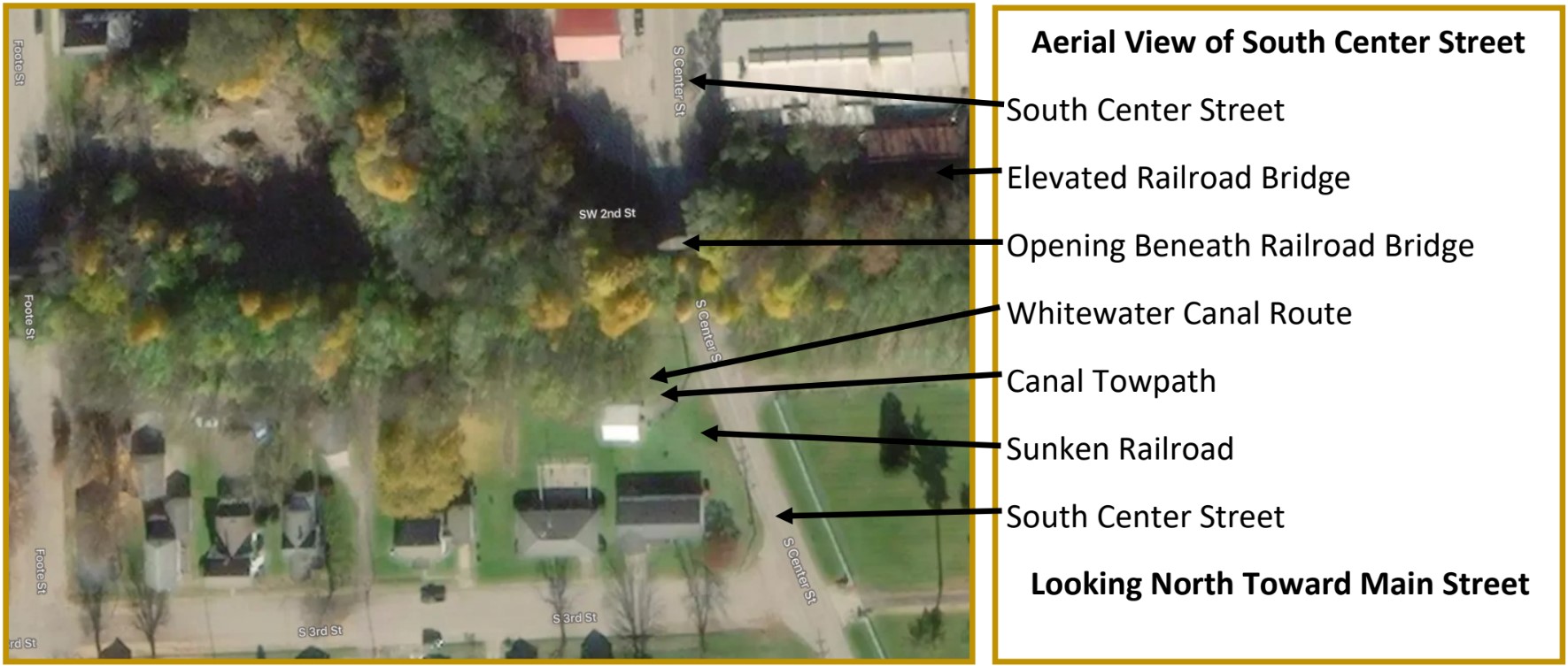
Whitewater Canal Passes Under Cambridge City Railroad Bridge
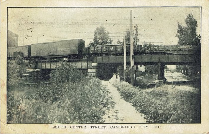
Found on FaceBook February 24, 2026
Old Postcard of South Center Street in Cambridge City, Indiana
The Whitewater Canal passed beneath this railroad bridge on the left, Canal towpath is in the center, another railroad passes beneath the upper railroad bridge, and South Center Street is on the right The picture was taken looking north toward Main Street in Cambridge City.
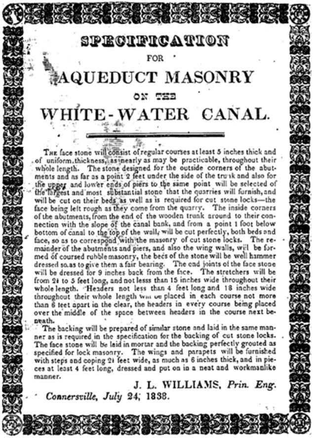
White-Water Canal Aqueduct Masonry Specifications
On July 24, 1838 at Connersville, Indiana, Jesse Lynch Williams, the Principal Engineer of the White-Water Canal, specified how the masonry for the aqueducts should be built. This would include the Duck Creek Aqueduct in Metamora, which is currently endangered by erosion around these stone abutments and piers.
What Makes Metamora’s Duck Creek Aqueduct So Special?
Cassie Garrett (permission to reprint article from Cassie)
The answer is simple: it’s one of the rarest and most important historic structures in the entire United States. The Duck Creek Aqueduct is the heart of Indiana’s last functioning canal town. It has been designated a National Historic Landmark, a National Historic Civil Engineering Landmark, and is the only remaining covered wooden canal aqueduct in the United States. Based on extensive research, it is also the only surviving example of timber-framed water-bridge engineering in the world.
The very first Duck Creek aqueduct was built in 1843. It was a simple open-trough wooden aqueduct, no roof, fully exposed timbers, and little protection from the elements. Like many early frontier structures, it was practical but fragile.
When heavy rains struck the Whitewater Valley in 1846, the original aqueduct was no match. It washed out completely, severing a crucial section of the canal and halting boat traffic through Metamora. To restore transportation quickly, engineers and builders did something remarkable: They repurposed a partially constructed covered bridge, adapting its heavy timber trusses into a brand-new aqueduct. Using the bridge frame allowed workers to rebuild the aqueduct in a matter of months, an astonishing turnaround for the 1840s. Covering the structure protected the timber trough from rain, snow, and sun, dramatically extending its lifespan.
The result was a completely unique hybrid: a covered bridge turned canal aqueduct, a fusion of American craftsmanship and canal engineering existing nowhere else.
Across the world, aqueducts were typically built of stone, brick, cast iron, or masonry, materials meant to survive centuries. Even among those, very few remain functioning today.
Examples like the Pontcysyllte Aqueduct in Wales (cast iron, 1805), the Espada Aqueduct in Texas (stone, 1740s), and the Roebling Delaware Aqueduct on the New York–Pennsylvania border (iron suspension, 1848) represent some of the only major historic aqueducts still carrying water or traffic in their original form. Metamora’s aqueduct, by contrast, is made entirely of wood, a material never meant to endure this long, making its survival not only remarkable, but unmatched.
For generations, this aqueduct carried boats over Duck Creek and connected communities across the Whitewater Valley. It stands today as a fragile, irreplaceable link to Indiana’s past and to America’s canal era. But time is catching up. Its condition is rapidly deteriorating, and without funding from the State of Indiana, this last-of-its-kind structure will be lost.
When the final surviving example disappears, it disappears forever.
Outreach Events & Programs

Canawling Adventures, Speaker’s Bureau, Program Summaries
Roscoe Village Canal Town
Ronald V. Morris
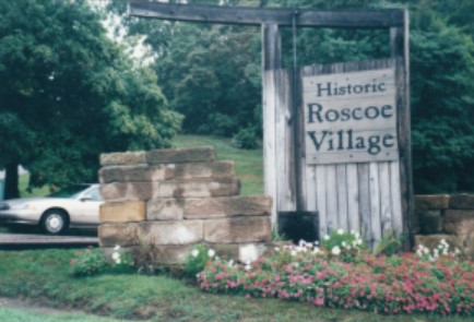
Roscoe Village in Eastern Ohio seemed to be a town with a blueprint for success, and it had a lot to offer. The seventeen shops of Roscoe Village and the Visitor Center gift shop all followed the same formula: clean, brightly illuminated, well displayed, and unique merchandise. Much of it was handmade and reflected a craftsman’s feel. Roscoe made me both wish to return to experience more and to stay longer to explore other parts of the community.
There were multiple attractions in Roscoe, Ohio. There was a six-building craft village with an automatic admission pass that unlocked the door to let paying customers in and did not require additional staff to take tickets. There was a local history museum with objects and interpretation. There was also a visitor center with an orientation film that explained the history of the community.
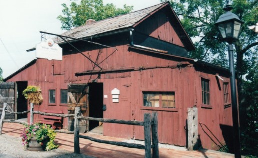
Photo by Lynette Kross (2003)
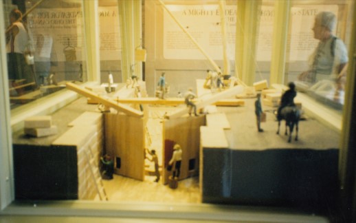
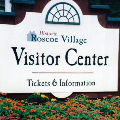
Photo by Lynette Kross (2003)
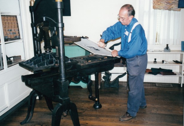
how the printing press operated.
Photo by Lynette Kross (2003)
There was a canal boat ride with a team of horses, but it was not close to the town. It had limited hours and a finite number of trips. The canal boat superstructure was aged, but plans for its refurbishing were trumpeted. The spring fed water supply made the boat drag in one section. These were all detriments to the success of the town, but they did not seem to impede the community.
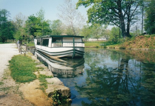
Photo by Bob Schmidt (2000)
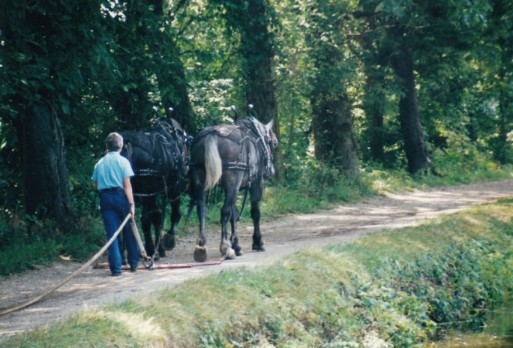
Photo by Lynette Kross (2003)
The town looked like a place you would want to be. There were six pocket landscaped gardens with plantings to give the space an outdoor feel. There was quality local food service, but lodging was not visible in the town. Most importantly, historic preservation was valued. The historic buildings were restored and well maintained, and signage was both limited and sympathetic to the structures. Of course, there were restrooms and parking.
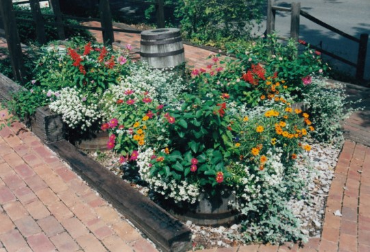
Photo by Lynette Kross (2003)
Just reading this description of the town sounds like the outline of a strategic plan. There were many canal towns scattered from New York to Ohio that were not as successful in gathering tourists today. For one reason or another they missed the mark of providing an experience that resonated with visitors. Roscoe Village did not just happen; it took years of work and planning to get the correct mix of attractions and services to interest visitors to come once and then return to town.
Koehler Leads Tour In Vigo County
Jeff Koehler, Clay County Historian

I conducted a small canal tour on Friday, February 27, 2026. I have been talking with Tom Kleckner and Noah Nobbe of Indiana Landmarks about doing something educational in the Clay/Vigo county areas. Noah has not looked at the canal route in our area before. I invited Vigo County Historian, Suzy Dunning to go since she has not been on a local tour before as well. Due to their time constraints, we were only able to spend an afternoon on the tour. We started on the north side of Terre Haute and finished at the Splunge Creek Reservoir.
Schmidt Speaks At Logansport
Carolyn I. Schmidt
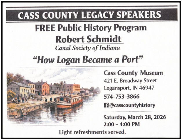
Robert (Bob) F. Schmidt, CSI treasurer, presented a PowerPoint program on Saturday March 28, 2026 at 2:00 p.m. at the Cass County Museum – Castaldi Family History Center, 421 E. Broadway, Logansport, Indiana. It was entitled “How Logan Became A Port” and was about the history of the Wabash & Erie Canal in Logansport.
Prior to his presentation 40 members and friends of the Cass County Historical Society were given a QR card with information about CSI and a 4-page handout that included “Why Build A Canal?, a map of the “Canal Systems of Indiana and Ohio, diagrams of a timber frame lock and a lock gate showing how it operated, and a diagram of a Canal Freight Boat showing a side-view and one looking down on it.
Bob talked about how the land was acquired on which to build the W & E Canal through the Treaty of Paradise Spring in October 1826 and the Land Grant of March 2, 1827. He said John Tipton, who was the Indian agent, influenced the growth of Logansport by moving the Indian Agency from Fort Wayne to Logansport in 1828 followed by the bringing of the intersection of the Michigan Road and the W & E Canal into the town. Logansport became a key toll collection point on the canal and that’s how “Logan became a port.” Within time the railroads followed the canal and made it a major rail transportation center.
During the question and answer period many people also told their own stories about what they had experienced or heard about the canal. One young boy was extremely interested and hopes to attend the CSI Symposium at the Forks of the Wabash.
Delphi News

All Things Delphi Canal Park
Click here for more detailed information
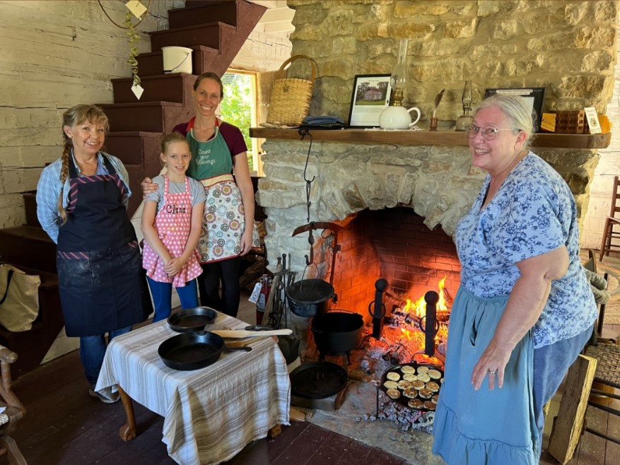
Deer-Crone Cabin Moved—Ready For Visitors
A log cabin built in 1830 by Urial Deer was restored in 1970 by the late Body Crone in Warren County. Crone donated it to Delphi’s Canal Park to preserve the legacy of the cabin in 2025. Over the winter, it was carefully loaded and moved to the park and placed on a new foundation in Pioneer Village.
Peter Cooper spearheaded the efforts of volunteers to add a new entry ramp for accessibility, a covered porch for outdoor demonstrations of historic trades, and a new cedar shingle roof. He oversaw the installation of a new electrical service, the reconstruction of the fireplace and chimney, and other interior projects. Now the cabin is ready for this spring’s historic trades classes, the opening of Canal Season 2026 and visitors who want a glimpse of Indiana’s early years along the Wabash & Erie Canal.
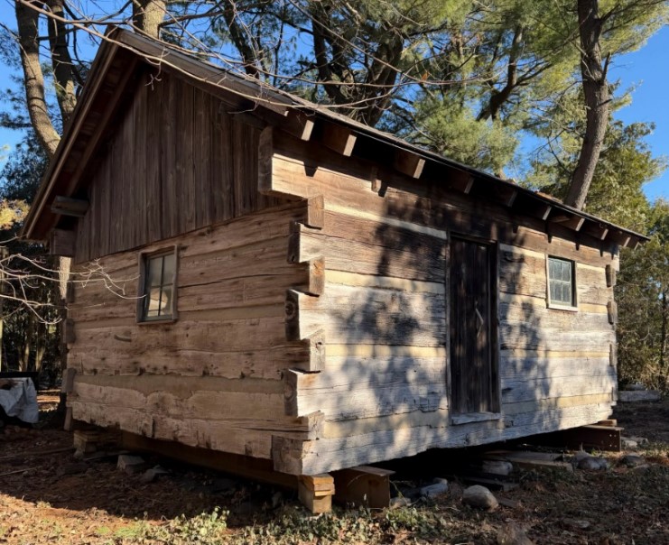
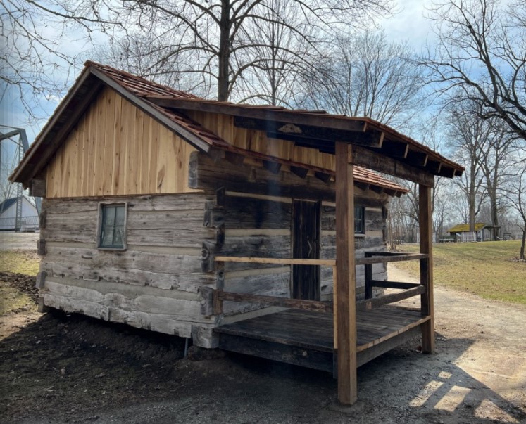
This ambitious project was made possible through a generous grant from North Central Health Services and administered by the Arts Federation, plus financial support from Peter and Linda Cooper.
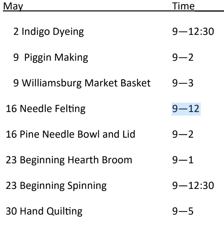
Historic Trade Classes Offered
Expert instructors are ready to teach you their craft. You will take home your creations after classes end. The classes range from all-day to just a few hours. They started in April and will continue in May and June.

Indiana Canals Revived
Wabash & Erie Canal Park has brought back a landmark work in Indiana history, thanks to donor support and the Purdue Research Foundation! Read below for more details:
Indiana Canals by the late Purdue professor Paul Fatout, recounts the complicated and unbelievable story of Indiana’s canal undertakings. With a delightful balance of humor and historic detail, readers can gain a great overview of Indiana’s canal era.
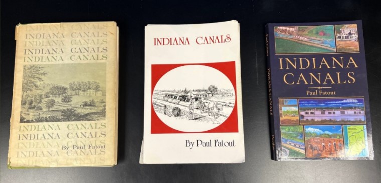
We have wanted to stock this book in the Canal Centers gift shop for years in an effort to promote education about canal history. Unfortunately, it was out of print with no new editions forthcoming. Only a few scattered copies were available secondhand online, so there weren’t many options for eager learners to dive in.
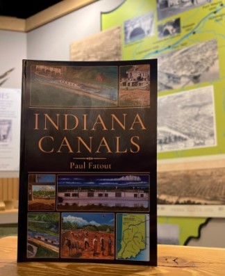
Thankfully, the Purdue Research Foundation generously granted permission for us to print a new version! We have copies available at the park or you may purchase the book online.
The new cover showcases artwork from the lobby mural of Wabash & Erie Canal Park, painted by artist Terry Lacy. We are proud to add our version to the former editions of the 1970s and 1990s. We are ecstatic that new audiences can experience Indiana’s canal history in a new way!
From the Whitewater Valley
All Things Whitewater Canal Valley
Metamora’s 1838 Days
In 1838 David Mount and William Holland platted 42 lots along the proposed course of the Whitewater Canal thus founding Metamora, Indiana. Historic Metamora is commemorating 1838 by organizing a celebration to educate visitors about life in the town during the 19th century through reenactments, demonstrations of period arts and crafts, and educational demonstrations. On February 21, 2026, Cassie Garrett sent out a casting call for actors to perform a series of short, outdoor living history skits she was directing as part of the Saturday, May 2, 2026 event showcasing Metamora’s history and heritage.
Heavy Flooding Destroys Whitewater Canal Equipment
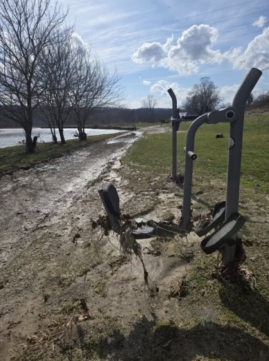
The heavy storms we had in March led to flooding in many places in Indiana and caused much damage. The above picture was taken by Gail Ginther, who lives in Metamora, Indiana. The Whitewater River flooded the Whitewater Canal Trail and destroyed some of its trailside exercise equipment.
Lt. Governor Micah Beckwith Tours Metamora
State Representative Lindsay Patterson and her husband invited Lt. Governor Micah Beckwith and other officials including State Senator Jeff Rense to tour Metamora on Thursday March 19, 2026. They saw the old grist mill, the Whitewater Canal and Duck Creek Aqueduct. This visit gave Beckwith an opportunity to see what could qualify for state funding. Beckwith’s remarks were videoed and appeared on The 812 on FaceBook. He encouraged people of all ages including school groups and home schoolers to visit Metamora, see the exhibits and learn more about Indiana’s history.
Judge Rules The Public May Continue To Access
The Laurel Feeder Dam In Franklin County
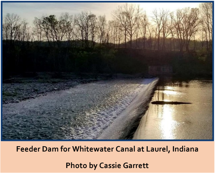
On March 25, 2026 Cassie Garrett wrote an article entitled “Judge rules for state in Franklin County land dispute; public access unchanged at Laurel feeder dam.” In it she said that about two years ago Tina Barnes filed a lawsuit concerning approximately 7 acres along the Whitewater Canal claiming that she and previous owners had maintained and paid taxes on the land; state agencies and partners entered the property without permission, constructed improvements and allowed public use; and that she had superior title to the property.
As of March 24, 2026 Franklin Circuit Court Judge Alex J. Dudley ruled in favor of the Indiana Department of Natural Resources, Indiana State Museum and Historic Sites, Indiana State Museum Foundation and Whitewater Canal Trail in the property dispute. “This property is used for recreation and historic purposes, including the Whitewater Canal Trail. Access to the feeder dam is also necessary for maintenance that helps regulate water flow to the canal,” according to Garrett.
Canal Society of Indiana
News and Upcoming Programs
CSI’s Mascot: The Frog
Carolyn I. Schmidt
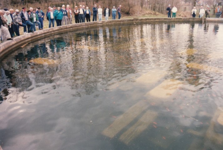
On Saturday April 5, 1997, one hundred eighteen canawlers boarded three coaches in a pouring down rain for a tour of the Wabash & Erie Canal in and around Fort Wayne, Indiana. By the time they reached their second to last stop late that afternoon the rain had ended, but a cold blustery wind just about blew them over as they climbed the banks surrounding the old sewage treatment basins in New Haven, Indiana where the remaining timbers and planking from the Gronauer Lock # 2 awaited beneath the water.
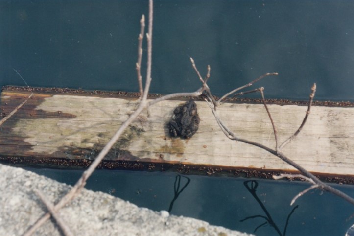
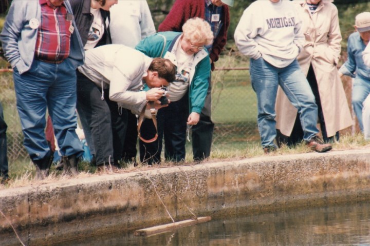
There they were met by Craig Leonard, historic preservation consultant from Bluffton and member of the CSI Advisory Board, who was going to explain how some timbers were removed from the lock and placed in the basin, while others were sent to be curated. However, before he even had a chance to begin his presentation, the canawlers noticed a bullfrog sitting atop a floating plank from the lock that took them by surprise.
This little guy was a true prince, riding atop the plank and surveying his domain. Usually when frogs are approached they immediately jump into the water for safety, but not this guy. He probably couldn’t believe all the people he saw circling the basin. As the plank floated to the side of the basin he just sat still with his eyes bulging as Brian Migliore took his picture.
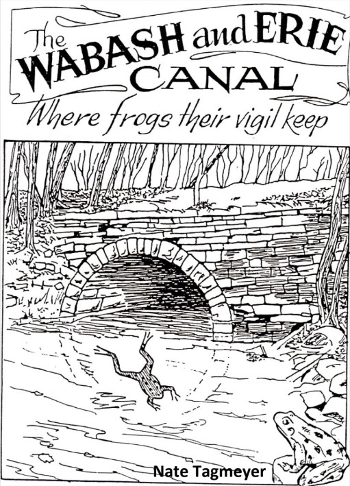
Canawlers knew that CSI had made the frog its mascot since it lived in Indiana’s canals from the time they were first built and frogs were still there today. We had produced a video entitled The Wabash and Erie Canal: Where frogs their vigil keep in 1994 and had used the official song of the Royal Navy, “A Life On The Raging Canal” since its words so perfectly fit our theme.
A Life On The Raging Canal
A life on the raging canawl,
A home on its muddy deep,
Where through summer, spring or fall,
The frogs their vigils keep.
Verse
Like a fish on the hook I pine,
On this dull unchanging shore,
Oh give me the packet line,
And the muddy canawl’s dull roar.
Refrain
Once more on the deck I stand,
Of my own swift gliding craft,
The horses trot off the land,
And the boat follows close abaft.
We shoot through the turbid foam,
Like a bullfrog in a squall,
And like the frogs, our home,
We’ll find on the muddy canawl.
Refrain
The sun is no longer in view,
The clouds have begun to frown,
But with a bumper or two,
We’ll say, “Let the storm come down.”
And this song we’ll sing, one and all,
White the storm around us pelts,
A life on the muddy canawl,
Oh, we don’t want nothing else.
Refrain
A life on the raging canawl,
A home on its muddy deep,
Where through summer, spring or fall,
The frogs their vigils keep.
The frogs, the frogs,
The frogs their vigils keep.
The frogs, the frogs,
The frogs their vigils keep.
CSI members sing this song at our meetings and on bus trips much to the chagrin of Canal Society of Ohio members, who love to poke fun at us. I’ll admit we’re not a glee club, but what we lack in musicality, we make up with vigor and joy. We have fun while learning the history of our canals.
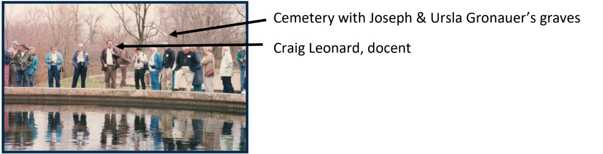
Finally Craig Leonard took over the spotlight. He explained how Lock #2 of the Wabash and Erie Canal was called the Gronauer Lock since the Gronauer’s, who rest in the cemetery just over the gully that was behind him, were the lock tenders.
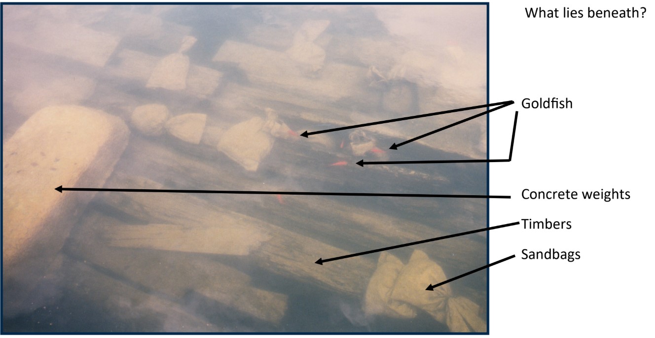
Craig was responsible for the paper work, charts, grant applications, and logistics of saving the Gronauer Lock. He talked for about half an hour on the luck that took place in unearthing the lock, getting political backing, having New Haven accept the initial responsibility for the project, finding businesses to support the project with trucks, equipment and food for workers, finding the basin in which to store it, having huge concrete weights nearby to keep the timbers from floating and receiving an offer from the State Museum to exhibit the remains.
As we stood listening to this talk, hundreds of goldfish swam among the timbers eating the algae and keeping the tanks clean.
Canal Men Word Search
Two ways to play:
- Download/print: Click on the “Download” print it off
- Online (here): Click the high lighter icon and being highlighting the names in the word puzzle with your mouse (for touch screen use your finger to highlight the names)
Wabash Erie Canal
Aqueduct
Packet
Members’ Milestones

Tom Castaldi has been named Allen County Historian Emeritus, an honorary designation in recognition of his 24 years of service and dedication as former county historian. The County Historian Program was started in 1981 to improve the historical communication network in Indiana by the Indiana Historical Society and the Indiana Historical Bureau. Tom was Indiana’s second county historian. Congratulations Tom! Thanks for your help with CSI over the years and for writing W & E Canal books.
Randy Harter has been appointed as the new Allen County Historian. Randy has written four books on the history of Fort Wayne, dozens of articles and research papers about the city’s past, spoken to area groups about its rich history and founded the Fort Wayne History Roundtable. CSI looks forward to working with Randy in the future. Congratulations Randy!
Welcome New Members
The following persons joined the Canal Society of Indiana at the $20 membership level or recieved a gift membership unless otherwise noted.
| Cass County Historical Society | Logansport, IN | $50 Contributor |
| Ed Fujawa | Indianapolis, IN | $50 Contributor |
| Keith George | Owens Cross Roads, AL |
Memorials Received
The Canal Society of Indiana has received the following memorials in honor of its deceased members:
| Gene A. Paschka | Nov. 15, 1954—Jan. 22, 2026 | From Bob & Carolyn Schmidt |
| Gerald (Gerry) Hulslander | Aug. 12, 1925—Jan. 25, 2026 | From Bob & Carolyn Schmidt |
| Ruth A. Ellis | May 31, 1938—Apr. 5, 2026 | From Bob & Carolyn Schmidt |

In Memoriam
Let us remember those we have lost
Ruth Ann (Gass) Ellis

Ruth Ann (Gass) Ellis, 87, of Fort Wayne, Ind., passed away on April 5, 2026, at Lincolnshire Place. Born May 31, 1938 in Arcola, Ind., she was a daughter of the late Herbert and Erma (Walker) Gass. She was quality control with Ellison Bakery for over 30 years, from which she retired.
Ruth is survived by her son, Kevin Ellis of Fort Wayne; daughters, Donna (Jim) Duncan of Fort Wayne, Annette (John) Radosevich of Roanoke, Ind., Dawn (Glenn) Osterman of Fort Wayne, and Renee Ellis of Orlando, Fla.; 10 grandchildren; 19 great-grandchildren; brother, Roy (Mary) Gass of Waynesville, N. C..
She was preceded in death by her husband, James Arthur Ellis; son, Trent (survived by his wife, Denise) Ellis; sister, Bernice Huggins; brothers, Arthur ,Carl, and James Gass; infant brother, Glen Gass.
Ruth’s late husband, Jim Ellis, was the treasurer of the Canal Society of Indiana from 1998-2012. Ruth and Jim could always be found among the attendees of CSI’s spring and fall tours of canal sites in Indiana, Ohio, and even on board the “Emita II’ to see New York’s Erie Canal from Syracuse to Lockport in October 2003.
A funeral service was held at 2 pm on Friday , April 10, 2026 at D. O. McComb & Sons Funeral Home-Covington Knolls, 8325 Covington Rd., with visitation two hours prior. Pastor Jon Moody officiating. Entombment at Greenlawn Memorial Park, Fort Wayne.
Memorials may be made to Anthony Wayne First Church of God, 6012 S. Bend Dr., Fort Wayne, IN (46804).
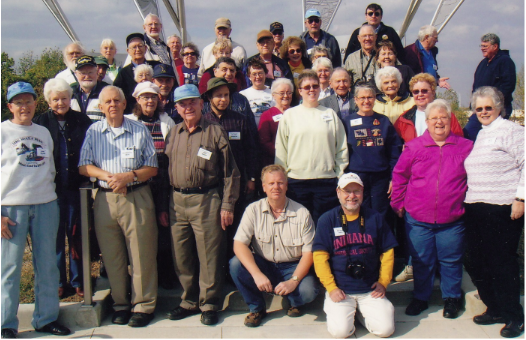
Indiana & Kentucky with Ruth (far right) at Evansville, Indiana.
Next Time
The July 2026 issue of “The Tumble” will include information on CSI’s Annual Meeting, Election of Directors and Officers, and CSI’s Spring Symposium held at the Forks of the Wabash.