John Cunningham’s Canal Inn At Americus – Yesterday & Today
By Carolyn Schmidt with new information from Melissa Cain Bender
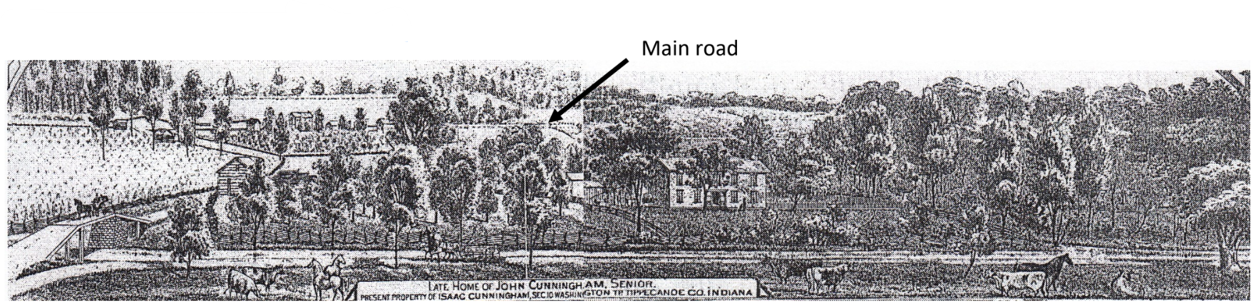
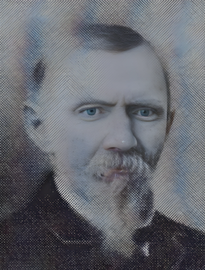
LATE HOME OF JOHN CUNNINGHAN
PRESENT PROPERTY OF ISAAC CUNNINGHAM, SEC. 10 WASHINGTON TP, TIPPECANOE CO, INDIANA
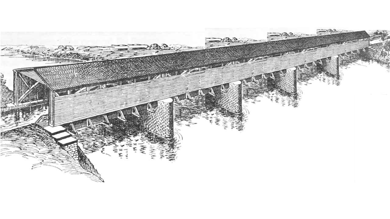
The drawing of John Cunningham’s home built in the 1830s was found in the 1878 Kingman Bros. Atlas on page 102. John, who had five canal boats on the Miami & Erie Canal before coming to Indiana, had purchased 142 acres on October 6, 1830 in township 24 N Range 3 W in the southwest fraction of Section This was located west of Highway 25, approximately 1/5 mile south of the highway’s junction with County Road 800 North, about four miles south on the Wabash & Erie Canal from Deer Creek and near Americus. There he built his homestead. Later, this house was converted for use as an inn on the canal and survived until it was razed in 1994.
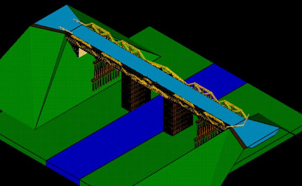
Note the bridge over the Wabash & Erie Canal on the left. A horse is pulling a carriage on a road bridge over the canal. A stone pier, shaped much like a fulcrum, supports the bridge high above the water. Two additional timber bridge piers serve as secondary supports. Also note the canal passing in front of the residence, the crops and the wooded areas.
The inn was hard to see from the main road that ran behind it since it was hidden by a hill. Another road led back to the inn and then proceeded on to the springiness (small spring house) where it went under an overhanging porch and stopped.
The inn was made of brick, two stories tall and measured approximately 40 by 80 feet. In the rear of the inn was a small addition, which extended back another 15 to 20 feet and was one story tall. The springiness was built after 1840 when the canal reached Americus and when the house was converted into an inn. Its bricks were an unusual shade of red, but would not have been shipped in by canal boat as some people suggested since the canal had not yet reached this point. Next to the springhouse was a large concrete dam, which apparently fed water into the springhouse trough.
On January 27, 1836 Americus had its hopes of becoming the canal terminus dashed when Indiana Governor Noah Noble signed the Indiana Mammoth Internal Improvement Bill that terminated the canal at Lafayette. It became a mere hamlet and the inn did not prosper. By 1909 Americus’ population was about forty people.
Three members of the Tippecanoe County Historical Association took a field trip to assess the condition of the canal and the Americus Inn in 1974. They found the glass was broken out of the windows, holes or openings were found in the walls, the ceiling was sagging making it dangerous to enter the building, and only some was left of a circular stairway in the entrance hall leading to a hall on the second story. The banister was removed, but the stubs of the railings were visible.
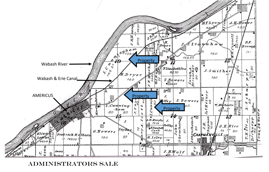
MAP OR WASHINGTON TOWNSHIP, TIPPECANOE COUNTY, INDIANA
From 1878 Kingman Bros. Atlas
Showing property owned by Isaac Cunningham
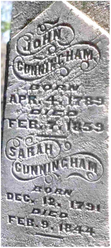
Isaac Cunningham was the third son of John and Sarah Cunningham’s 11 children. At age 40 he purchased the property on which the Americus Inn was located from his parents at the Administrators’ sale.
The undersigned, Administrators with the will annexed, of the estate of John Cunningham, deceased, will on Thursday, the 7th day of April, A.D. 1859, at the late residence of said John Cunningham, near Americus, Tippecanoe county, Indiana, sell at public auction to the highest bidder, the personal property of said decedent, consisting of horses, cattle, hogs, farming utensils, household furniture, grain in the crib, etc., and also a quantity of corn, wheat, beef and pork in barrels, lard, tallow, hides, etc, in the warehouse in Americus aforesaid. Terms, all sums under five dollars, cash, all over that amount, nine months credit with approved security waiving valuation and appraisement laws.
JOHN CUNNINGHAM, ISAAC CUNNINGHAM, Administrators.
Death From a Headache.
Daily Courier, Friday, September 22, 1844 [Reprint after she died on February 9, 1844]
On last Tuesday Mrs. [John] Cunningham, a widow residing south of the city, came to town in her buggy, to do necessary shopping. Shortly after her arrival in town she was seized with headache, which became so violent as she was driving on North Sixth street that she was compelled to stop at the home of Mrs. C. T. Blackwell to procure some kind of relief. The pain grew worse and worse, and the lady was forced to remain in the house, the resident prevailing upon her to do so. At 5 o’clock Wednesday morning, Drs. Hopper and Lairy were called, finding her unconscious and suffering from a severe attack of congestion of the brain. Since that time she has not been conscious and is rapidly sinking. The physicians despair of her recovery, and expect to hear of her death at any time. It is a particularly sad case, dying among strangers and away from home, and in such an unforeseen manner. The harmless headache developed into the worst form of congestion, and the patient is left to the care of strangers, everything being done for her, however, by the inmates of the home whose lot it is to shield the sick woman. Her relatives in the country were notified and are here, but she can not be moved. This morning the doctors expected her to die at any time.
LATER. —Mrs. Sarah E. Cunningham died last Thursday at 1 o-clock, never having regained consciousness. Her body was removed to Lancaster’s undertaking establishment and prepared for burial. She owned a small farm south of the city and was moved to her late home Thursday evening.
The funeral of the late Mrs. Sarah Cunningham will occur Sunday at 2 o’clock from the family residence on the Wea. The remains were taken to the home from Lancaster’s establishment this morning.
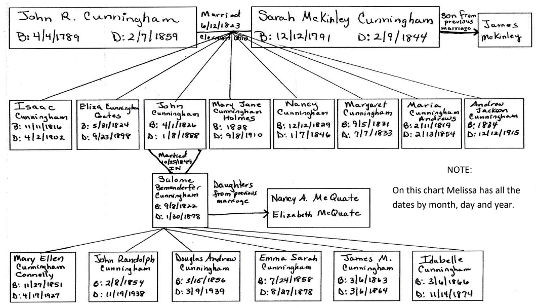
Genealogy of John & Sarah Cunningham, owners of the Americus Inn
Chart made by Melissa Cain Bender
Note: Not all eleven of their children were found.
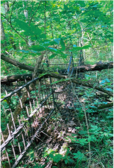
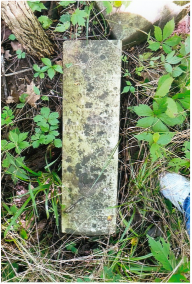
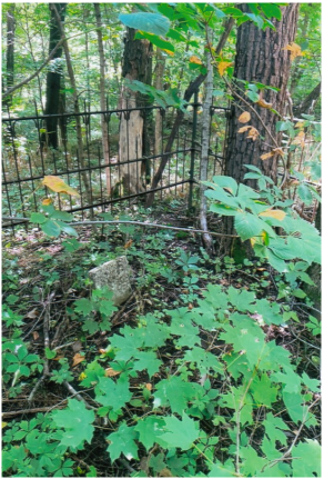
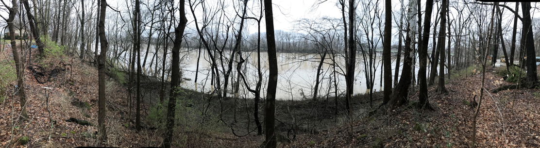
John & Sarah Cunningham are buried in a tiny cemetery near Buck Creek one-half mile east of Americus on a little knoll on the south bank of the Wabash & Erie Canal in a little family burial plot 20ft. X 30 ft., enclosed by a strong iron fence. Within the enclosure are seven monuments and eight graves— he and his wife, four children and two near relatives. There is also the grave of Michael Taylor, an Irish laborer on the canal, who was born in 1829 and died December 18, 1871 at 42 years of age.
Melissa Cain Bender contacted CSI Headquarters asking for the earliest picture of the Americus Inn that we had. She was working on the history of the Americus Inn and the Cunningham genealogy.
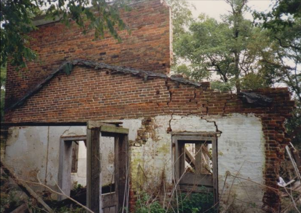
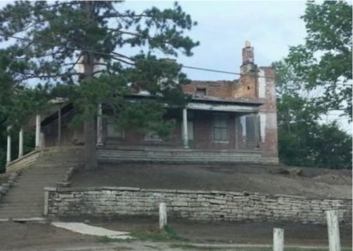
This picture taken in 1986 by Thomas Meek was found in the slide presentation that CSI made about Indiana’s Canals through a grant from the Indiana Humanities Council and the Indiana State Historical Society.
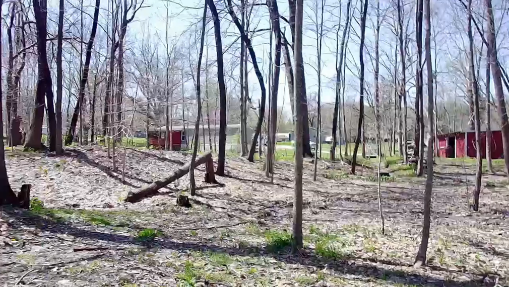
Melissa said her uncle, Gene Cain, was a close friend and neighbor of Larry Bosma, who owned the property on which the remains of the Americus Inn stood. When Gene was planning to build his new home, he contacted Larry for permission to use the bricks from the inn on it. Permission was granted and Gene even took the footers from the inn, which was is such a poor condition that its remains posed a danger to those living in the area.
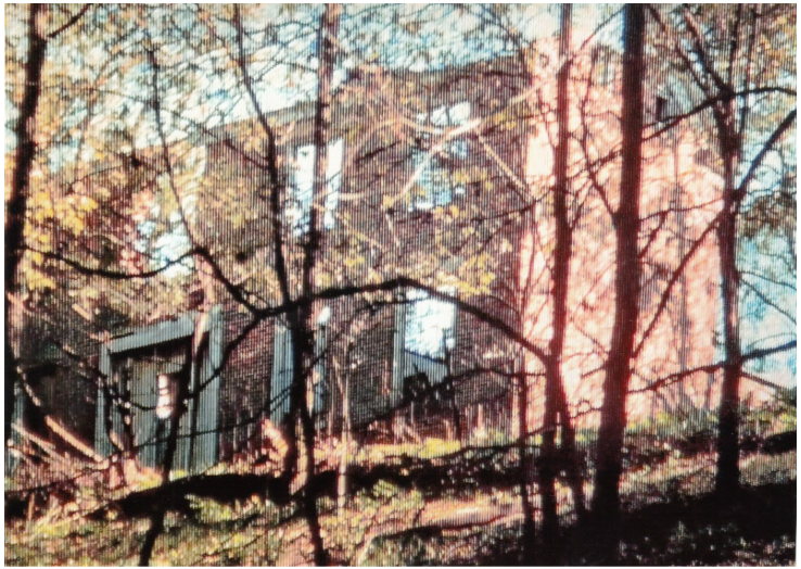
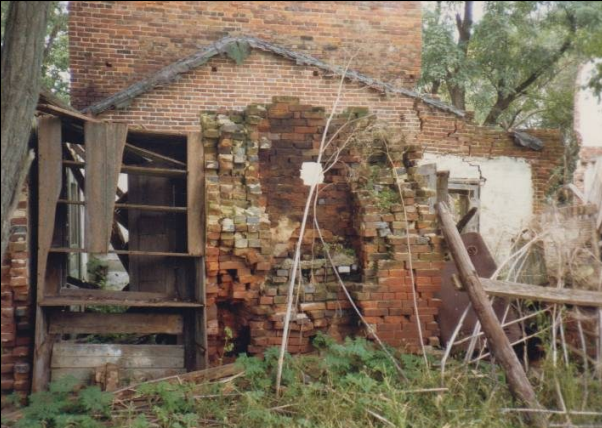
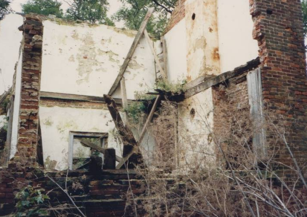
Canal Society of Indiana members Dan McCain and Bob and Carolyn Schmidt visited the site in 1991 and took the following photos of the remains of the Americus Inn.
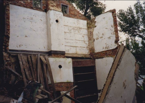
After Melissa received the 1986 picture from CSI Headquarters, she explained that after receiving permission to retrieve the bricks from the inn, her aunt and uncle (Cindy & Gene Cain) went to the site and took the following pictures.
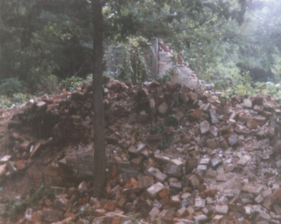
Some of the walls were standing and the footers of the building are shown before it was razed in 1994.
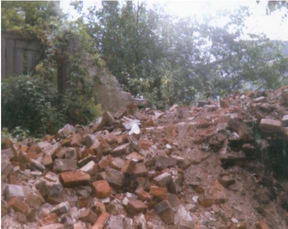
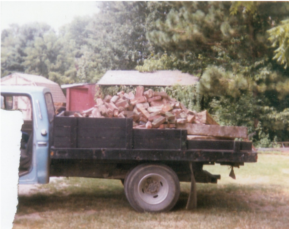
These piles of bricks remained after the Americus Inn was pushed over. The Cains gathered this bricks and took them to their new home site.
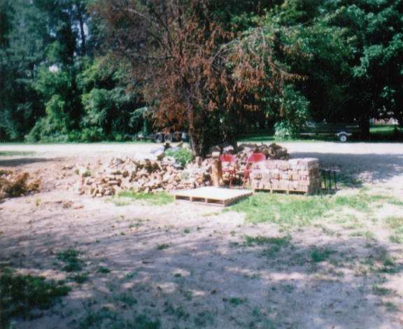
The Cains loaded the brick onto a truck, took them to their new home site, unloaded them and got ready to clean off the mortar. They got parts of old machinery from their barn and made their own cleaning machine, which knocked off the mortar when the brick was held up to it. Unfortunately, they did not take a picture of this contraption.
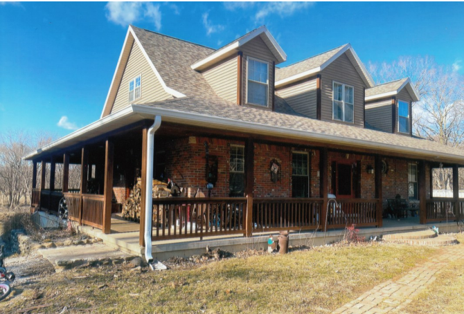
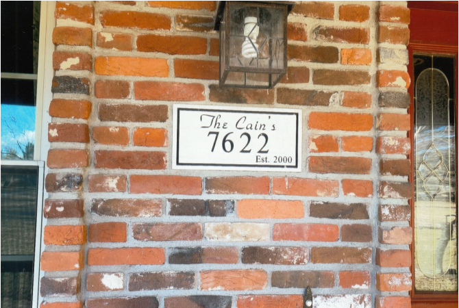
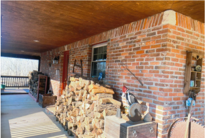
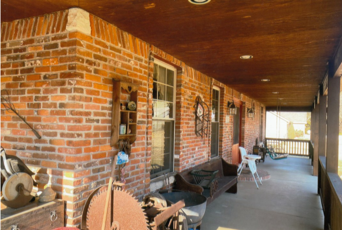
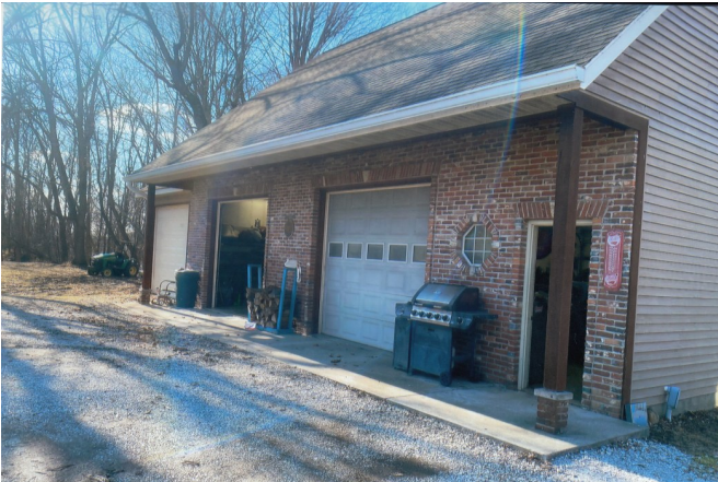
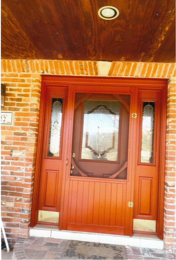
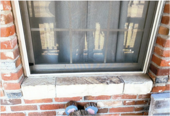
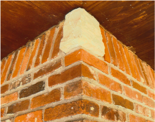
The Cain’s home was completed in 2000 using the bricks and stone footers from the Americus Inn. It is located along the Wabash River and near the Wabash & Erie Canal. Notice all of the bricks that had to be cleaned to build this home. Melissa took these pictures of the house in March 2025.
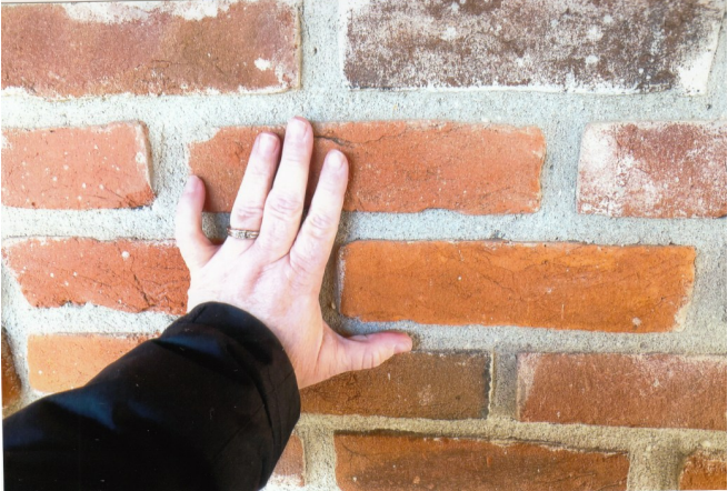
The Cain’s builder noticed that the bricks were smaller than normal size bricks. He said their bricks probably came from Skyler Mulvey’s, a masonry located off St. Rd. 25 between Lafayette and Delphi, Indiana. He also said the design over the door and around the house was called leaning soldiers.
Notice the use of the inn’s footers below the door and windows and as decoration on the upper corners. Photos by Melissa, March 2025.
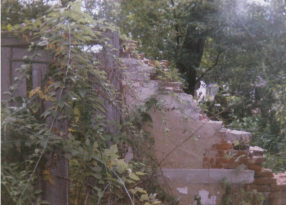
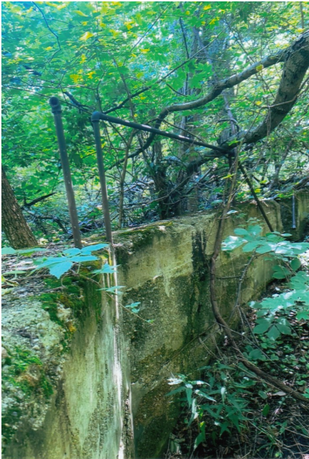
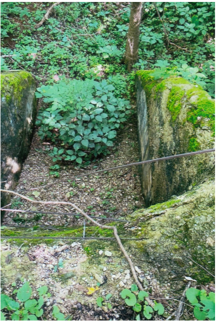
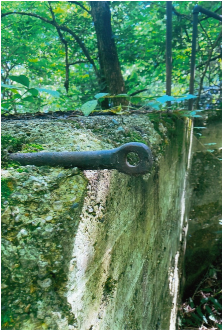
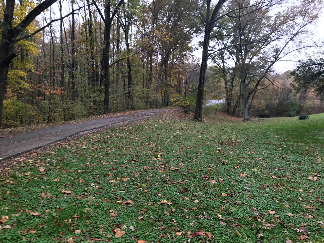
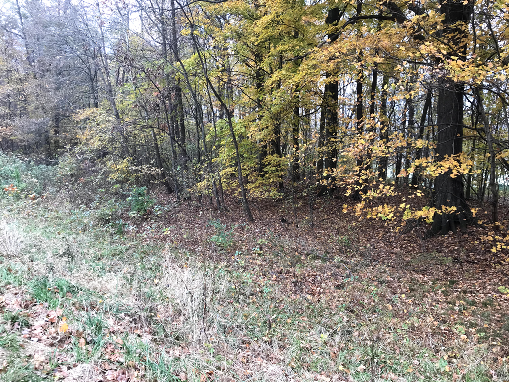
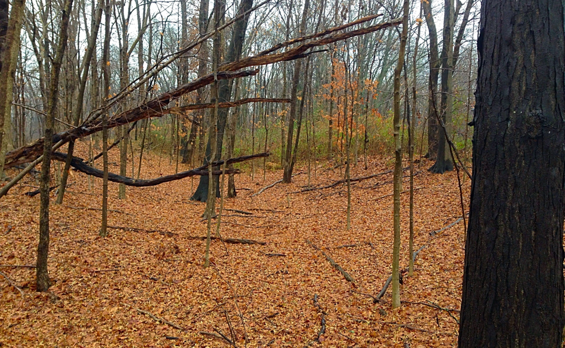
Melissa returned to the Americus Inn site to take more pictures of what remains.
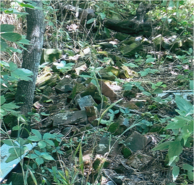
There are still some bricks scattered at the location of the inn on Larry Bosma’s property.
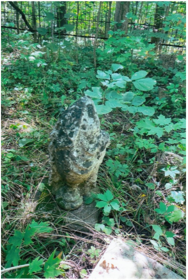
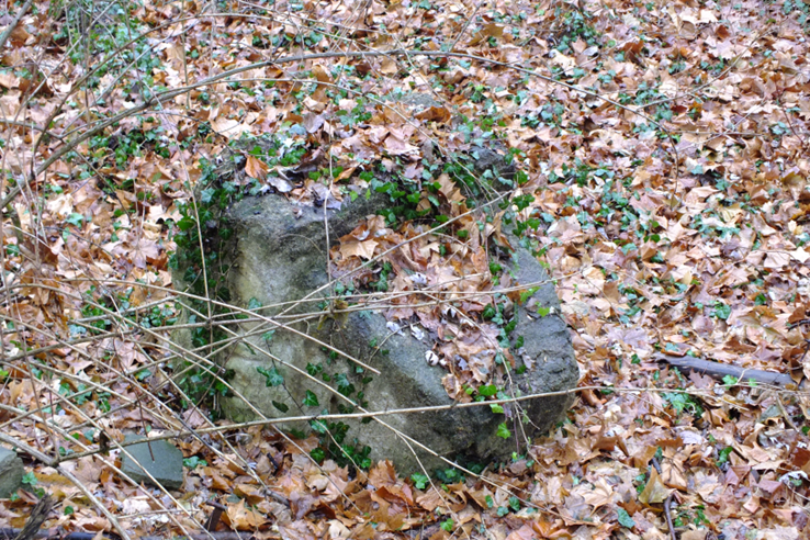
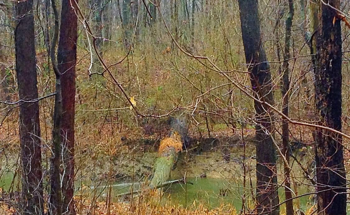
Melissa found this concrete structure between the inn and the cemetery. This was the dam, which apparently fed water into the springhouse trough. The springhouse was located by the over-hanging porch mentioned earlier.
Melissa said that doing research on the Americus/Cunningham Inn was fun for her whole family. She even got her younger nephews interested in the history of the canal. This summer they plan on walking the portion of the canal that lies between the Cain’s house and the Bosna farm. They also hope to dig out an old well near their home to see what artifacts they can find about those who once lived there.
*If any of our readers have information or pictures relating to Indiana’s canal remains today, please send them to indcanal@aol.com. We are doing a series about what can now be found.
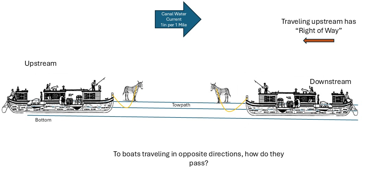
Canal engineers studied the hydraulics (the quantity of open-channel flow and the speed of water) in order to determine how much water the canal needed to operate. They considered loss of water through absorption, evaporation and lockage volume. The flow and speed also impacted how canal boats passed each other.
Pulled by gravity, water flows downhill from its highest to lowest level. In northern Indiana, Fort Wayne was the summit level of the Wabash & Erie Canal. Located 190 feet above Lake Erie, water from the summit flowed both east and west. A dam was built across the St. Joseph River 6 1⁄2 miles north of the main line summit. It backed up water that was then fed into the St. Joseph feeder canal that carried the water to the W & E main line. The feeder and main line elevation dropped about 1 inch per mile producing a slight current in the flow of water. The 15 1⁄2 mile summit level was terminated by the Taylor lock near today’s Anthony Boulevard on the east end. On its west end the terminus was the Dickey Lock at Roanoke.
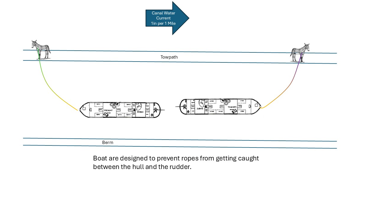
Canal boats were pulled by heavy ropes connected to towing animals both using the same towpath while traveling in either direction. These ropes produced an interesting dilemma. There was room for the animals to pass on the towpath, but how were they able to keep the boats and animals from being “caught up in the ropes”?
There were rules on the canal such as packets were given preference over freight boats when passing through a lock. Sometimes the boat whose crew was stronger fighters would settle disputes as to who would go first. Boats were not to succeed 4 miles an hour to keep their wake from washing out the canal bank. However, the rope dilemma was not an administrative rule or a courtesy, it was caused by the impact of water hydraulics.
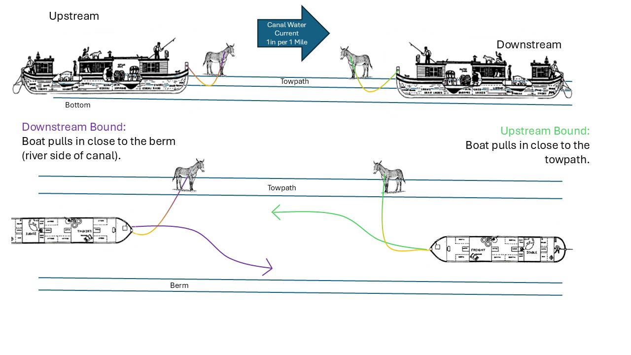
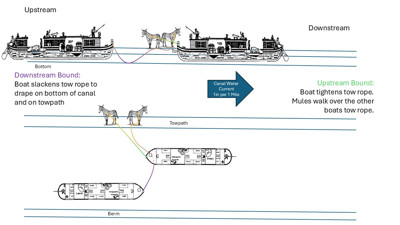
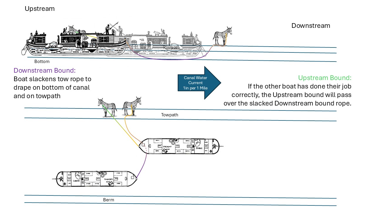
The flow of water in the canal produced a slight current that would push both boats in the direction of the water flow. When the horses/mules that pulled a boat with the downstream current stopped, their boat would continue to be pushed along downstream. And when the mules pulling upstream against the current stopped, their rope would be pulled tight as their boat began pulling them backwards. Therefore, hydraulics determined how boats passed.
The boat coming down with the current would have its animals turn towards the far side of the towpath away from the canal and stop. The steersman would guide his boat to the berm bank side. The towline would slacken and fall to the bottom of the canal as the boat drifted. The mules of the approaching boat pulling against the current would merely walk over the other boats tow rope that was laying on the towpath and continue pulling their boat along the canal. This boat would then cross over the other boats towline that was in the bottom of the canal. Once the boat going upstream was completely over the towline, the boat going downstream could once again proceed along its way.
Use the arrows to scroll through the diagrams
Classroom Demonstration: When explaining this procedure to students, have a student representing a boat tied with a rope to another student representing the mule heading downstream at one side of the room, and a student representing a boat tied with a rope to another student representing the mules heading upstream at the other side. Have the students walk toward each other. The downstream mule (student) stops and drops his/her line onto the floor but the boat continues to move along so that the rope falls to the floor representing the bottom of the canal. The other mule (student) does not stop but continues to pull his/her boat until their boat crosses over the dropped line. Students will sooner remember how boats passed and were not “caught up in the ropes” if they are involved in acting out this procedure. Here you only need two 8-10 foot ropes and four willing students.
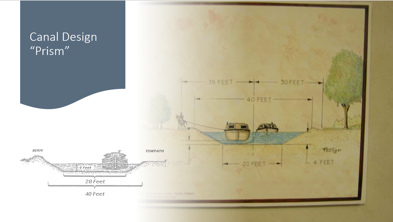
Mules pulling boats along a waterway sounds relatively simple but on 19th century canals it was just a little more complicated. The dimensions of the boats vs the size of the canal created some problems. The Erie Canal dimensions were used originally in both Ohio and then Indiana. The channel or prism was to be a minimum of 40 feet wide by 4 feet deep. The aqueducts were narrowed to about one-half of this width which meant one-way travel by the boats. Locks were to be a standard dimension of 90 feet long and 15 feet wide. This allowed the maximum boat size through a lock to be only 14 feet, allowing transfer of one full size boat at a time.
Two full size boats (14 x 2 = 28 feet) in a channel could pass using the 40 foot of channel width but this only left 12 extra feet. The banks of the channel on both sides sloped inward about 6 foot where the depth of the channel was less than 4 feet. That leaves about 2-3 feet between boats to pass, if the channel was filled. Loaded boats drafted about 3 feet of water. As stated earlier, when passing, the boat traveling down current always stopped. The boat coming up current slowed down to carefully pass the other stopped boat, to reduce the swell and to prevent a collision.
Why were the channels only 40 feet wide? The wider the channel the greater water requirement. Even though rivers had lots of water in the spring, by summer the flow was greatly reduced and the engineers had to determine the quantity of water available. Channel width was a matter of discussion between Ohio and Indiana. Both states originally adopted the original 40 foot Erie standard. Due to volume of boat traffic and the jam caused in passing, the Erie Canal began an expansion to 50 feet wide x 5 feet deep.
Both Indiana and Ohio soon made some changes. Indiana wanted a 60 foot x 6 foot channel from Fort Wayne to the state line and expected Ohio to follow. Ohio used a 50 foot x 5 foot dept on the Miami and Erie Canal extension to Junction. Ohio began building from Lake Erie to Junction using the 60 foot dimension, but when working from Junction to the Indiana state line they only used the 40 foot x 4 foot dimensions to the dismay of Indiana. Since the St Joseph Feeder could not provide enough water for the Wabash & Erie in Ohio, that state decided she would not create a greater problem by going with the larger 60 foot prior agreement. In all of these decisions the amount of water available determined the channel width. (See the November 2024 issue of “The Tumble”)
It was time for my friends and I to make our annual pilgrimage to Maryland for our fall trek on the Chesapeake and Ohio Canal towpath. We started this tradition several years ago at Cumberland, Maryland and expect to finish in Washington, D.C. This camping and hiking trip featured extremely warm weather for a November weekend, but our traditional evening campfires was extinguished by Smokey the Bear. It was so dry that Maryland had a burn ban in effect. The stars put on quite a show the first clear night after the moon set. The quiet campground had only the sounds of the wind blowing down the Potomac River and a distant train to break the stillness.
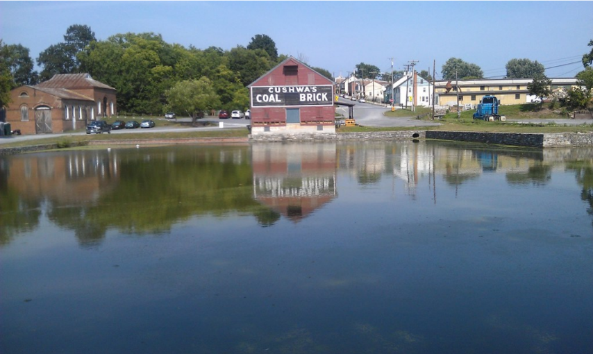
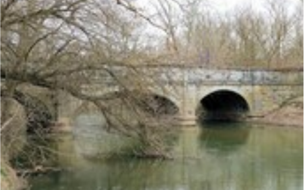
C & O Canal Cushwa Basin at Williamsport
The first hike was from the Cushwa Basin at Williamsport east along the canal and Potomac River. The National Park Service visitor center was open so we visited. My favorite artifact inside the visitor center was a former barrel of cement that had been soaked and the resulting hardened mass was discarded barrel and all into the canal. By the time it was retrieved the barrel had dissolved leaving a perfect barrel of cement fossil. About 1917 a video was made of the Chesapeake and Ohio Canal at work showing mules pulling boats through a lock, passing the Paw Paw Tunnel, and life along the canal. The shadowy black and white images flickered across the screen as I watched seeing visuals I never imagined existed (1917 Chesapeake & Ohio Canal – “Down the Old Potomac”) . Charles Kuralt also did a video about life along the canal in the 1980s.
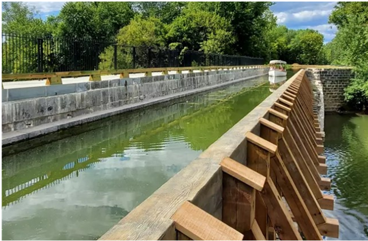
Restored Conococheaque Creek Aqueduct Courtesy NPS, Tim Ware
Then there was a last look at the Conococheague Creek Aqueduct, and we were off. The very first lock we visited still had its iron wicket gate poles shoved into the mud at the base of the extant lock doors at both ends of the lock. Nearly every lock had it lock tender’s home. Many of these families were Civil War veterans, and all of them had to supplement their income by farming, practicing a trade, or retail enterprises. We walked to the midpoint of the Chesapeake and Ohio Canal trail halfway from Cumberland to Washington.
Killiansburg Cave
Antietam Creek Aqueduct
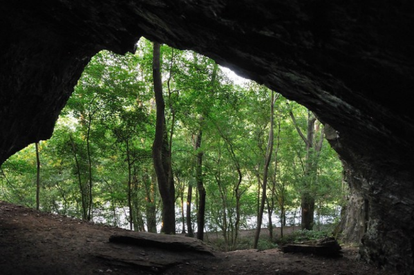
This was a part of the Potomac called Big Slackwater which was a still pool created behind Dam Number Four. In a major restoration project the National Park Service recreated the section with a series of concreate bridges because the tow path had been flooded away leaving only sheer cliffs and river. Before Dam Number Four the canal boat entered the canal again. The towering Guard Lock let the canalboat travel the Potomac and the mule followed along the bank of the river. In case of flooding the guard lock and banks would seal the raging Potomac from damaging the canal. The surrounding guard banks were equally as impressive as the guard lock and the effort to build it with hand tools and horses was phenomenal.
The next day on the trail we picked up where we stopped at Dam Number Four and passed Killiansburg Cave in the cliffs behind the canal. The Ferry Hill Visitor Center was an old plantation house that had been used as park headquarters. It was standing empty now waiting for maintenance and a new interpretive use. We walked the last of the fifteen miles right into our campground between the Potomac River and the Chesapeake and Ohio Canal prism, but we went a few more feet to see the stately Antietam Creek aqueduct. All the aqueducts looked like they were designed by Roman Architects in stately blocks of classical features with extra pillars and details we would never think of adding in the Midwest.
The third day of the hike was only ten miles, but the Potomac had changed. The first difference was that the rock broke the surface of the water parallel to the flow of the stream, by lunch the rock were perpendicular to the stream again. Also, by lunch the Potomac started falling fast and became noisy. Lock 38 was another river lock; it went straight to the Potomac so river boats could be poled across the stream to Shepherdstown, West Virginia. The remains of a dam and several locks bunched around Harper’s Ferry, and we left the trail for the old streets and structures of the arsenal town. This left us some time for celebratory ice cream and a visit to Antietam. We were not in Washington yet, but we were already looking forward to more future adventure along the Chesapeake and Ohio Canal next year.
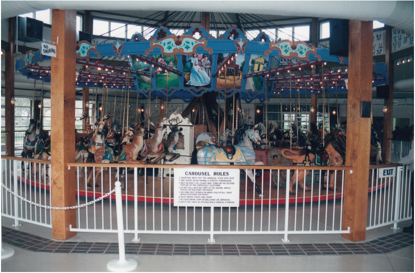
The dam on the St. Joseph River six-and-a-half miles north of Fort Wayne, Indiana that provided the first water making possible the Wabash & Erie Canal, later enjoyed a second career. Rails had put the canal out of business by 1895 when the Fort Wayne Consolidated Railway Company laid tracks of top of the old towpath to encourage travel by electric trolley.
On the river near present-day North Pointe Woods subdivision, the old 230-foot long and 161⁄2-foot-deep canal dam caused a lake to be formed on which Robison Park was created. Trolley officials connected downtown Fort Wayne with what became one of the finest amusement parks in the mid-west. The park flourished featuring water sports, circus acts and rides including a Dentzel-built carousel.
In 1918, visitors arriving free by automobile avoided paying the $1.00 trolley fare and caused the park’s revenue to drop until it was forced to close in 1919. Just a rails overook the canal, cars exterminated Robison’s trolley.
Eighty-five miles west on the old canal route, the town of Logansport, Indiana, acquired a Dentzel Carousel. Curiously, it came from Fort Wayne in the year 1919.
In Logansport, the carousel was placed in Spencer Park and later moved west down the Eel River to Riverside Park. Since then it has became a tradition that every kid, who grew up or visited their grandmother in Logansport, ride the Merry-go-Round. The most fortunate riders reach for and grab the prize winning brass ring.
During all these years, the carousel stood near the old Wabash & Erie Canal. First at the St. Joe River Dam and today within sight of Aqueduct No. 5, where canal boats crossed over the Eel river with passengers reaching out. The fortunate ones found their brass ring in the canal’s prize…markets to the east or opportunities in the west.
From papers written by Mrs. Naomi Clark Moffett, “The Hoosier Listening Post,” Indianapolis Star, Jan. 24, 1934 reprinted in Indiana Waterways, Vol. 5, Winter 1988.
“…My first memory of anything is of boarding a [Whitewater Canal] packet at Brookville [Indiana] bound for Laurel [Indiana]. It was a remarkable soft, warm day in December. But about half seas over, between Brookville and Metamora, a blizzard struck us nor’west, broadside I reckon, and there that boat stuck till April.
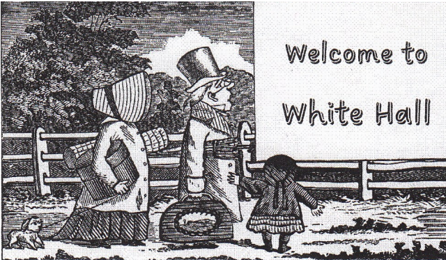
Captain Tom McCarty — Peace be to his ashes — seemed to enjoy the predicament. The boat was loaded with passengers and freight, and we had two cows and several pigs aboard. The cold was intense, snow very deep, and to avoid opening the cabin door too often, the fuel was dropped down the stove pipe into the stove from on deck. Peace and plenty and a good time was had by all, for our quarters were as pretty and home-like as anywhere else could be, and the situation, especially to four or five little ones like myself, was an event. We were on the boat several days when the mail stage, with it own passengers, called for the boat’s load. Dark as Egypt and black as the North Pole was the night when we filed out to the stage. We were packed in irregular on the inside, women and children, bombazine and bandboxes; all over the outside was mankind and baggage. The four-in-hand waited not on the order of their going, but went — flew over the frozen knobs — and above the grating of the springs, the cracking of the whip and tooting of the stage horn I could hear remarks from those men outside which made me conclude they were not church members. We were at the end of our journey when we rumbled up to the door of the White Hall.
Whitehall Tavern remains Photo courtesy Laurel High School website The Whitewater Canal ran across the bottom of the photo.
The kind, gentlemanly, model landlord, “Squire Clements,” came forth, his kind good face looking out under a perforated tin lantern which he held aloft. Here we found every comfort of the times, bountiful tables, great glazing wood fires in the fireplaces of long ago, and the association and friendship of one of the most charming families we have found in a life time — the Clements family.
“The White Hall”* was the popular tavern and stopping place for travelers and business people, and it had no bar. But it had a ghost.
We remained at the White Hall till the showers and sun of April thawed the boat from its icy mooring and brought down our furniture, cows, pigs, etc., and then we went to live in the home that had been finished and waiting for us over four months.”
*The legend of White Hall Tavern is that “…One winter, before the completion of the [Whitewater] canal, a young lady, stopped at the tavern on her way west to join her husband. While there, she gave birth to their first child. Both mother and child were frightfully frail and the mother suffered what seemed to be pneumonia. Unable to travel further, her husband was notified, he hurried to Laurel by the quickest means available in the time, but mother and child had passed away before he arrived. The young mother was heavily distressed at being away from her husband, and her child cried almost continuously in the days before their death. Their lonely spirits are said to have haunted Whitehall since that time.”
The Clements made sure both were properly buried with a small stone, bearing the mother’s name and one carved merely “baby.” Waiting for her husband to arrive, the woman had not named the baby.
Even after the canal was no longer use, Whitehall Tavern continued to provide room and board to travelers. Many of the guests told stories concerning the ghost of Whitehall. Their accounts said they had heard the unmistakable sound of a baby crying within the house when none was present. The sounds were heard most frequently around midnight. There are no recent incidents of this happening, as Paul Baudendistel of Metamora has interviewed the previous owners and neighbors.
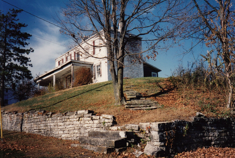
Whitehall Tavern is located at the intersection of Franklin and Baltimore Street in Laurel, Indiana. It was still standing as of 12-18-1986 when this article was published. Its terraced lawn was surrounded by an old stone retaining wall that was beside the Whitewater Canal and its towpath. Time has not been kind to Whitehall. A fire destroyed the inn. At one time an attempt was made to restore it. Its remains stood for many years.
Remains of Whitehall Tavern 10-11-2024 Photo by Bob Schmidt
Whitehall Tavern in 1995 Photo by Bob Schmidt
The Whitewater Canal ran along the bottom of the photo.
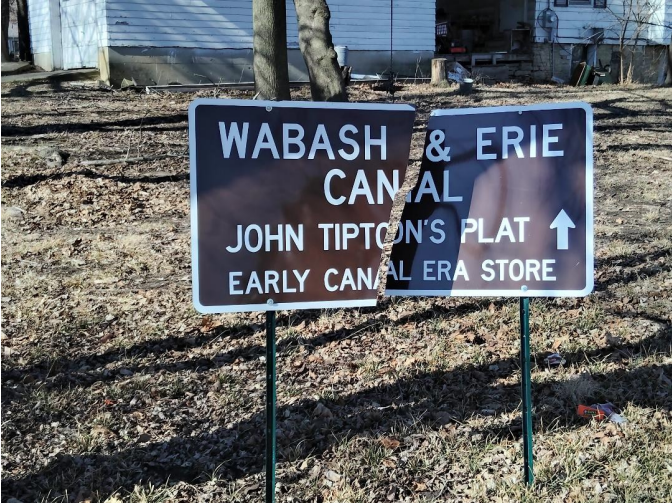
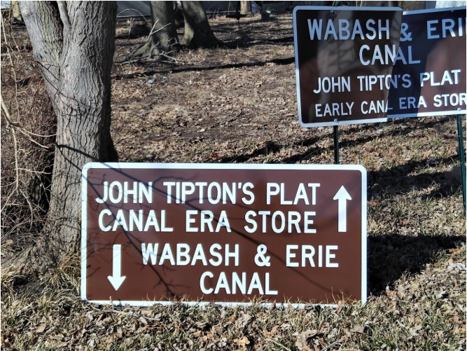
On New Year’s Eve the sign CSI had placed at the back of the home of Catherine Fitzgerald in Huntington, Indiana was destroyed when a car full of revelers slid on the ice and into the sign. The car sat there for several days before Catherine could get the sign set back up. She called CSI headquarters asking if we would get her a new sign.
When the replacement sign was ordered from CDS Signs in Sharonville, Ohio the wording was reversed to better note where the canal store was on Catherine’s property and where the W & E Canal had run.
On February 27, 2025 the new sign was picked up in Sharonville and delivered to Catherine on March 2, 2025.
At that time Bob Schmidt taped the two pieces of the original sign together and suggested that it be used until she had someone install the new one. Since the canal actually ran at the foot of her property and the store was under her house, she was pleased with the new design.
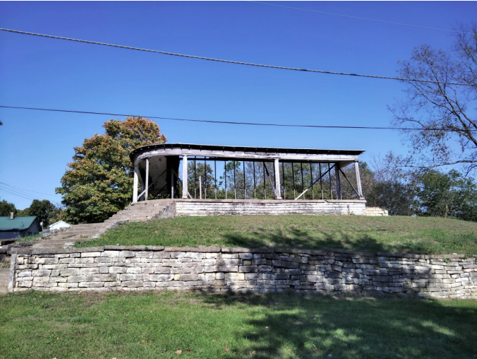
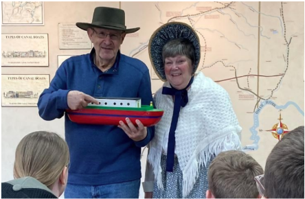
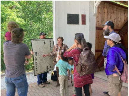
School age children learn about Indiana history in the elementary grade classrooms. Some school systems also provide visits to museums and others to outdoor historic sites. Several canal sites and museums in Indiana are part of this experience. Both the Wabash & Erie Canal Interpretive Center at Delphi and the Whitewater Canal Historic Site at Metamora provide great opportunities to see canals in action. In addition to these venues, the Canal Society of Indiana has two teams of dedicated couples donating hours of effort to explain the workings of the Wabash & Erie Canal in Huntington at the Forks of the Wabash and in Terre Haute at Fowler Park.
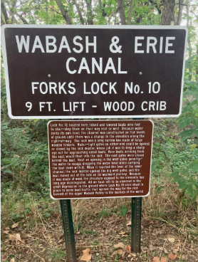
Margaret & Lowell Griffin work 3 days a week for an 8-week period each Spring greeting a couple hundred students a week at the Forks of the Wabash for a total of about 2,000 participants. This includes a brief program and then a visit to the site of Fork’s Lock No. 10.
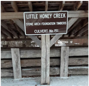
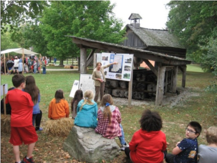
Sam & Jo Ligget present programs each Fall at “Mini-Pioneer Days” and “Pioneer Days” sponsored by Terre Haute’s Park Department. Over 1,000 students visit the timber remains of Culvert No. 151, Little Honey Creek. CSI has placed signage to mark the huge timbers placed under a shelter. The Ligget’s explain how the timbers supported the culvert and how it operated as well as showing the route of the W & E in Indiana.
The Canal Society really appreciates both couples who provide a tremendous boost to our educational program for young people. The outdoor classrooms really enable CSI to reach more students.
Our Board members have struggled with a way to provide more than just a brief encounter with canal history. We wanted something that generated excitement about our canals and something that the students could put in their hands, take home and share with their parents. If the students come home excited after their canal experience, then maybe the parents will follow up with further canal visits, etc. .
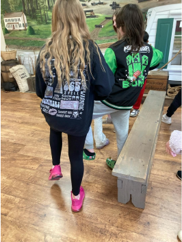
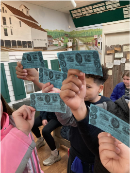
The Griffins conducted a short experiment and discovered that kids liked to pretend to be canal diggers and were excited when they were paid in facsimile canal scrip for their work. The children found it interesting that Indiana printed its own canal “money.”
Students pretend to dig the canal by pushing down on invisible shovels.
Each student was excited to be paid for his or her help in digging the canal.
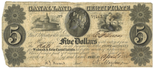
What is canal scrip? In the 1840s Indiana did not have the funds to continue the Wabash & Erie Canal beyond Lafayette. There was an additional land grant from the Federal Government to raise funds, but sales were slow and only paid in partial payment. To keep the canal going to Terre Haute, the state issued a scrip that could be applied to the purchase of granted canal lands. It was printed on blue paper and described by the workers receiving it as a “dog” [worthless]. Forty acres of land cost about $120-$160. It took a lot of paper to buy the minimum site, as the workers only earned about $10-$15 per month. They could use their “Blue Dog” at the company store. However, storekeepers only offered about $1 in merchandise for a $5 Dog. There were also other denominations of this practically worthless currency. Smaller ones were called “Blue Pup.” Larger ones were not as common.
The “Blue Dog” shown here was paid at Peru, Indiana in April 1845 and sent to Wabash & Erie Canal headquarters in Terre Haute. It is owned by the Vigo County History Center.
Kids love Blue Dog. It gives them excitement about the canal and is an inexpensive gift from the Canal Society of Indiana. It is a gift of history from us to them.
Second graders from Ellettsville usually take a field trip to McCormick’s Creek State Park, but a tornado ripped though the park and the damage has not been completely repaired, so for the past two years they couldn’t go there. One of their teachers had camped at Fowler Park in Terre Haute, seen the canal timbers and signs, and suggested they go there this spring.
On April 4 Sam and Jo Ligget spoke to 200 2nd graders, 2 teachers, 1 aide, 2 principals, and approximately 75 other adults/parents about the Wabash & Erie Canal and the timbers from Little Honey Creek Culvert. The children had studied the Erie Canal on a unit of Westward Expansion and, according to Jo, seemed to know more than some 4th graders about canals.
On Saturday June 21, I (Preston Richardt) presented a program to the Pike County Historical Society titled, “Pike County’s First Interstate”. The title was chosen because in 2012 Interstate 69 opened in the county and even though many think that it is the first interstate, I felt compelled to point out the previous mid-19th century interstate, the Wabash and Erie Canal. I presented to a group between 20-25 people, not all members of the Pike County Historical Society but people from the county and beyond attended the event. CSI had 7 members in attendance, Sam and Jo Liggett (Terre Haute), Bob and Carolyn Schmidt (Ft. Wayne), Troy Jones (Clinton), Gary Seibert (Buckskin) and presenter Preston Richardt (Buckskin).
So why Pike County? After completing a pretty thorough survey of Gibson County, I felt the next logical location to begin more research was my northerly neighbor, Pike County. Dave Kurvach (CSI – Warrick Co. Director) began field surveys of Pike County early in his studies of Indiana’s canals but in 2018 Dave and I visited the area from the southwest of Petersburg to SR 61. On that wet and cold day we walked six miles of canal path and photographed what was left of the canal in the area, all with the permission from the Mayor of Petersburg as we stayed on city easements and right-of-ways. This visit spurred me to truly dive into Pike County and this program is the result of that research and findings.
The program began with an overview of Indiana’s canal mania with a focus on the three canals that would eventually form the Wabash & Erie Canal: The Wabash & Erie, Central and Cross-Cut Canals. After the brief overview with animated maps, I transitioned to construction and terminology of canals. From this point I shifted to discuss the different tools that members of the Canal Society of Indiana and other historical organizations utilize to locate the engineering structures along canal pathways. After the basics of the canals, their construction and how historians (professional and amateur alike) locate the structures, I had the honor to take them on tour of the Wabash & Erie Canal in Pike County.
Image ofcanal workers in northern Gibson County, Image provided by Gibson County Highway Department
I chose to present the Pike County engineering structures in the same order as the 1853 State Audit lists them; so first up was Aqueduct 16. Instead of going straight into the location, construction and what’s left at the site, I first explained what an aqueduct is and the different types built on the canal. Every time a new engineering structure was introduced in the program, I would take a couple minutes to explain what the structures were, their purpose and locations. Utilizing Google Earth as the base map to pinpoint the location of all the structures in Pike County and beyond, I zoomed into the location of the White River Aqueduct and discussed it.
Compilation of the St. Mary’s Aqueduct rendering to create White River Aqueduct No.16.
After I discussed the White River Aqueduct but before moving onto the next structure I rabbit trailed to Robert Logan, the canal contractor from Pike County that not only oversaw construction of aqueduct 16 but was also responsible for the construction of Lock 46 and 47 in Lockport (Riley). Continuing my rabbit trail a little more, I discussed guarding the White River crossing during the Civil War as a result of Adam “Stovepipe” Johnson’s raid in 1862 and in July 1863 John Hunt Morgan’s raid.
After this I pulled back from the short biographical description of Robert Logan and the Civil War raids to move down the line to the next engineering structure, culverts. Like with the aqueduct, I explained what canal culverts did, their construction and how they worked. As part of the presentation I showed clippings from the engineer’s reports for every structure encountered along the way. I would have explained if able, not all structural sites have been visited due to property ownership, and described what was found if anything at that location. Unfortunately, many locations between the White River and the west side of the power plants are off limits due to this being railroad property. This issue arises again south of Petersburg between said town and Willisville.
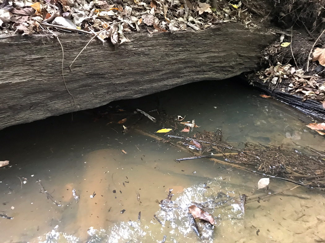
After showing several unvisited locations, I took the audience to the property of Christopher Rudolph (local farmer and canal enthusiast) where culvert 184, a partially intact functioning timber culvert, is located. I was able to show pictures of the culvert from his visit to the site several years ago. I also showed a picture of a stool made from canal timber taken from culvert 185 after the railroad company removed it and replaced it with a modern culvert.
Ferry Anchor Stone on the Bluffs
After this point I began to explain “The Bluffs” of the White River. This was the midpoint of the visit Dave and I completed in 2018. I showed where the road bridges were located on the map and showed an image of the 1876 atlas to collaborate his location of where the roads were as well as the river ferries said roads led to. In my slide presentation I showed what I believe to be a ferry anchor stone just downhill from where the canal was located. I showed pictures of the area and explained the structures there. I then proceeded to take the group on a photographical journey along the west side of Petersburg from River Road to SR57 on the south side of town.
As we got closer to town I stopped at the location of the old canal warehouse that was torn down in 1985. Then I talked about Petersburg very briefly after which I did two more biographical stories; Judge Matthew Foster and James Ralph Erskine “Goodlet” Morgan. I spent more time on Goodlet Morgan and his contributions not only to Pike County but also to the canal.
From here I entered the second area where I have not had as much luck visiting due to the railroad’s ownership. Because of this I skimmed through the area between SR57 at Petersburgh to Willisville which is the northern extent of the Patoka Deep Cut but not without talking about change bridges and how they worked.
Just above Willisville, I took the audience on a google earth flythrough of the Patoka Deep Cut where I paused the video occasionally to show pictures of what it looked like over the course of the past decade. There appears to be less watered section and the woods are thicker in this area than in years past.
As we exited the Patoka Deep Cut we entered the valley of Flat Creek where a reservoir was proposed but never built as the site was not as well suited as the location of Pigeon Reservoir in Gibson County; but nonetheless, I discussed what was proposed in 1849.
We then entered the town of Hosmer (Glezen), where we dove into a little history of the town and the man the town was originally named after, Stephan Rogers Hosmer. While we were in Hosmer, I showed them the location and what’s left of Pike County’s only lock, Lock No. 66. At this point I showed the elevation map of the entire canal and explained why the locks were built and how they worked.
From here I led them down “the cheap line” on to Patoka River National Wildlife Refuge property (public access) where a watered section of the Wabash-Erie Canal still exists. I continued across private property back toward SR57 where the modern state road was built on top of and adjacent to the canal except elevated areas where the canal went around the hills and the highway cut through them. I eventually got my guests down to the Patoka River Aqueduct, Aqueduct No. 17.
In summary I took the attendees on a 2 hour long virtual tour through their county stopping at several locations along the canal’s route through Pike County. I provided them with information about canal engineering and how structures along its route worked and why they were built. I also provided information about some of the communities and four influential people who had a great impact on Pike County as we know it today. I finished the presentation discussing how the Wabash & Erie Canal was a missing link to a greater commerce system for the country.
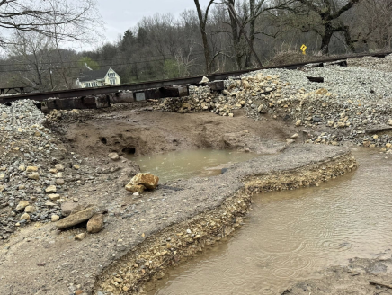
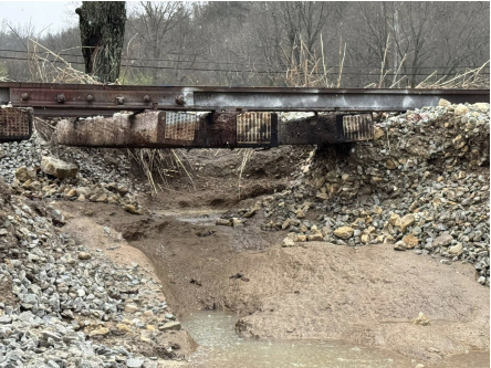
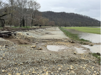
Heavy Rains Wipe Out Whitewater Canal Trail and Railroad
The following pictures taken after the heavy rains in the Whitewater Valley near Metamora, Indiana, were posted on Facebook on April 5, 2025. They show that the heavy flood waters completely washed out the ground beneath the tracks of the Whitewater Valley Scenic Railroad. Also, huge chunks of the Whitewater Canal Trail are gone.
Not only do the railroad and trail groups have tons of work ahead of them in repairs, others such as the owners of Duck Creek Farm & Inn were greatly impacted when the Whitewater River floodwaters turned their backyard into a lake trapping the animals on their farm. The water had backed the pigs into a fence and their little shelter was completely underwater. Tim Harness, the owner, was able to get out the male hog, which was going into hypothermia, and a sow. He knew he needed help and posted on the Metamora Chatter Facebook Page seeking a small boat. Before long he and his wife had two boats, several residents and members of the Metamora Volunteer Fire Department to help them save the two pot belly pigs and the chickens from their coop. They lost two goats and their turkeys as reported by Cassie Garrett, reporter for The Brookville American.
“Franklin County’s own Mick Wilz has been named the Outstanding Trail Advocate by the Greenways Foundation for his decades of visionary work on the Whitewater Canal Trail. From preserving canal history to building community partnerships and biking Indiana’s top trails for inspiration, Wilz’s impact has transformed the WCT into a regional gem,” according to a report on The 76 by reporter Cassie Garrett.
After setting up the Whitewater Canal Trail organization, Mick Wilz served on the Canal Society of Indiana’s board of directors from 2005-2012. He worked with CSI headquarters to plan the CSI “Canal Passages” fall tour on October 20-22, 2006, where we ate at Mr. Jim’s Steakhouse in West Harrison, Indiana. He is currently a member of CSI and has offered to host our directors to tell them about his plans for the Whitewater Valley including its trails in the future.
Ronald Craig Yurcak, 63, of Metamora, Indiana, passed away on June 13, 2025. Born on March 9, 1962, to Joseph and Betty Lou (Spurlock) Yurcak in Dearborn, Michigan, he was the youngest of their four children. Ron grew up in Lincoln Park and lived in Woodhaven. He developed a deep love for hockey and became a die-hard Detroit Red Wings fan. He began roofing with his dad at the age of 15, and by 18, he had hit the open road as an over-the-road truck driver, starting with Sandbear. He spent many years behind the wheel doing what he loved, collecting wild stories along the way.
Ron moved to Metamora in 1989 and made it his home. On November 23, 1990, he married Candy (Hendricks) Yurcak and became “Papaw” to her children, Josh and Cassie Roth. Ron and Candy did everything together. Some of their favorite moments were spent traveling together or with their family.
Ron loved drag racing. He was a member of Frank Bradley’s Top Fuel Dragster crew in the National Hot Rod Association (NHRA) when Bradley won the title of “Top Fuel Dragster” in 1991. Later, he ran the tire service truck for Mickey Thompson, which supported racers with his mechanical expertise at tracks across the country.
After retiring from trucking, Ron taught himself the art of copper smithing and sold his works in a small Metamora shop along with Candy’s art. He went on to make handmade copper pieces shipping them worldwide. Nationally one of his moonshine stills appeared on the TV show Moonshiners, and another custom copper piece was featured in a Transformers movie. For the past 25 years, Ron served as the coppersmith and resident comedian in the Pioneer Village at the Indiana State Fair. Recently he made copper cookie cutters for the Drag Racing Association of Women’s booth.
Ron contributed stories to The Brookville American, a local newspaper. His stories show his wit, insight, and love for his community. He also was the man to call when something broke. He could put a transmission in a car, fix plumbing or electrical issues, or figure out how to make something work with zip ties and a little WD-40.
Ron served his community for many years on the Metamora Volunteer Fire Department/Rescue 24. He played a leading role with the Whitewater Canal Byway Association from its beginning in 2004. He was burned while working on a boiler at the Old Depot in Gateway Park when it exploded. He worked diligently every time (5) the depot flooded often scraping layers of mud from its floor. He spent hours caring for the park in his bib overalls with headphones on and singing (off-key) at the top of his lungs while weed-eating and mowing grass. He was the acting president of WCBA at the time of death.
He is survived by his wife, Candy; children, Josh (Kathy) Roth and Cassie (Nate) Garrett; and grandchildren, Grace, Ben, and Bailey Roth, and Sophie, Savannah, and Scarlett Garrett; father, Joseph Yurcak; sister, Jacqueline Schermesser; brothers, Richard Yurcak and David Yurcak; and several nieces and nephews and great-nieces and nephews. He was preceded in death by his mother, Betty Lou (Spurlock) Yurcak.
Ron was a devoted Christian, which helped him through his last few weeks. He was a beloved husband, father, grandfather, brother, and friend whose presence brought warmth and laughter to all who knew him. His stepdaughter Cassie Roth Garrett described him as “strong, selfless, funny, fiercely protective, loyal, and full of love”.
Visitation: Phillips & Meyers Funeral Home in Brookville, Thursday, June 19, from 4 to 7 p.m.. Funeral service: United Methodist Church in Brookville, Friday, June 20, at 11 a.m., with burial in Maple Grove Cemetery. A lunch and time to share memories followed at the church.
Memorial contributions may be directed to the Whitewater Canal Byway Association. Phillips & Meyers Funeral Home provided an online guest book and place to send personal condolences at www.phillipsandmeyers.com.
“Summit Canals” Symposium and CSI Annual Meeting Was Exciting
By Robert Schmidt, CSI Treasurer
The Canal Society held its 4th Symposium at the Vigo County History Center in Terre Haute on Saturday March 29th. Throughout the day there were 37 participants of which 16 were CSI members. The local participation was similar to our other symposiums. The colorful program guide was titled “Summit Canals” and had photos and biographies of our presenters.
Bob began the session recognizing the wonderful facilities of the History Center and thanking Director Marla Flowers and Curator Suzy Dunning for allowing us to use their 84-seat auditorium and their spacious conference area. He went on to talk about CSI and our programs of Signage, Education and Website. He announced that the Terre Haute History Center will now become the official headquarters for the Canal Society. As such CSI needs more members from the Terre Haute area. [We gained 5 new members at this event.] He also announced that the door prize tickets they received would be used for a book drawing at the end of each presentation.
Bob pointed out that a “Symposium” for the Greeks usually involved discussion and drinking of wine. We were not having any wine, but we did want a two-way exchange of ideas at the sessions. He noted that Webmaster Preston Richardt had brought camera equipment to video all of the presentations.
Bob then introduced the first speaker, CSI member Phil Rice of Jacksonville, Florida.
Phil has made an extensive search of archival records and on the ground exploration of the partially constructed Erie & Michigan Canal in northern Indiana. The Chief Engineer for this canal was William B. Mitchell, who explored several routes for the canal and identified the chief problem being access to a reliable water supply, especially at the summit level. Mitchell laid out a planned route from Ft. Wayne Spy Run Creek through Noble County and terminating in Michigan City at Fall Creek. This was to be a 187-mile-long canal linking the Wabash & Erie and perhaps eventually the Illinois & Michigan canals near Chicago.
A reservoir, Sylvan Lake, near Rome City, was completed along with a 6-mile feeder to the main canal. Most of the work was performed in 1838 , but by 1839 the financial crisis statewide brought an end to all canal construction here.
Phil has some nice photos and maps of the canal works. One very interesting point that he uncovered with his local exploration was that on one piece of land the water flowed 3 different directions. Some water flowed toward the Elkhart River and on to Lake Michigan, some flowed toward the Eel River that led to the Wabash, and some flowed toward Fort Wayne and the Maumee River to Lake Erie. This is a very unique spot because usually at summits water flows in only 2 directions.
Phil took questions followed by a book drawing. We then proceeded to the Conference Center for a sack lunch.
After lunch CSI members gathered to elect our 2026-2028 board members. Next the board members selected our officers for the coming year. Dr. Ron Morris will be our new President.
Our symposium then continued in the auditorium with Dr. James H. Speer of Indiana State presenting a study on the Culvert No. 151 timbers using the science of dendrology. Rings on trees not only tell us a lot about the local climate, they help identifying the type of tree and even give an indication of where the tree grew. First Dr. Speer told us quite a bit about the science of tree rings. A sample of multiple trees in an area can be completed without tree damage by using a drill. The drill hole is sealed up by the tree just like a woodpecker or beetle hole is sealed.
Dr. Speer and his students took a variety of samples from the foundation timbers of Culvert No. 151 that have been moved to Fowler Park in Vigo County. The natural conclusion would be that the timbers were just taken from the local area and cut to size for the culvert, but the actual results were quite different. By comparing the culvert timbers rings with others throughout Indiana, Dr. Speer concluded that the timbers came from trees that grew in southeast Indiana near Madison / Jeffersonville. That led to speculation as to how these timbers got to Terre Haute. Were they transported to the culvert site via the Ohio & Wabash Rivers by steamboat? Perhaps the timbers were just surplus from the Howard steamboat builders at Jeffersonville, perhaps they were surplus from the lock building at the Falls of the Ohio near Louisville, or could they have come from the deep railroad cut at Madison? Whatever the explanation, it is obvious that the timbers did talk and tell us their general point of origin.
Our next presenter was our Vice-President Sam Ligget. His topic was the Wabash & Erie Canal through Terre Haute with emphasis on the nadir level. Sam started at the north end of that level and proceeded south with photos of the key sites and aqueducts. He had a nice graphic showing water coming from the north meeting the waters coming from the Cross-Cut in the south near 1st Street, then combining and flowing together into the Wabash River. Another key feature in his presentation was how two locks shared a common center gate. The upper higher level lock is No.42 that brought water from the Cross-Cut lowering the water with its lower gate shared with the lower level lock No. 41, which then lowers water into the nadir level. These two locks lowered the canal water 19.2 feet to reach the nadir level. In Indiana this lockage configuration and the nadir level are unique to Terre Haute. Sam also prepared a listing of CSI sign locations for participants to visit later.
He was followed by CSI board member Jeff Koehler. Jeff talked about the importance of the Splunge Creek Reservoir from 1849-Present. His photo of the reservoir at flood stage that was taken from his plane was spectacular and really showed the 4,000 acre size of the structure. An interesting fact is that the boundary between Vigo and Clay counties runs right through Hickory Island located in the reservoir. This island was a popular picnic spot during canal times even though local residents felt the reservoir was a place of sickness. They were kind of correct, but it was the mosquitoes not the odors from the reservoir that was the cause of malaria. He told how the locals wanted to destroy it then and are still opposed to it today seen by our CSI sign, which only lasted less than 1 week after it was erected. Jeff used a a large photo map that he and his son prepared. It showed most of the canal area in Clay County with descriptive comments and pictures on it.
Our final presenter was Heather Cosme Milian from the Vigo County Park Department. She revealed the plans for future trail development at Riley Park. Today, one wall of stone of Lock No. 47 sits isolated in the woods with limited access. This stone lock was built from 1837-38 by Robert Logan of Pike County. Today there is a small parking area and a pathway under construction. They hope to have the pathway completed this summer. They also have a connecting trail from Terre Haute to Riley under construction. More information about Robert Logan as well as the Terre Haute canal era can be found on our CSI website under Biographies and Tour Guides.
Our Symposium concluded with our final book drawing. Suzy Dunning is planning a canal exhibit for the History Center and presented her ideas to CSI members.
We had lots of very favorable comments about this symposium. Thanks to all the CSI planners, presenters, and cookie bakers we had another successful event.
Symposium Stats and Info
Summit Canals” Symposium and CSI Annual Meeting Saturday, March 29, 2025 10:30 a.m.—4:00 p.m. Vigo County History Center, 929 Wabash Ave., Terre Haute, IN 47807
Presenter
Topic of Discussion
Bob Schmidt
Master of Ceremonies
Phil Rice
In Search of the Erie & Michigan Canal
Dr. James Speer
Dendrology of Culvert #151 Timbers
Samuel Ligget
W & E Through Terre Haute, Nadir Level
Jeff Koehler
Splunge Creek Reservoir 1849-Present
Heather Cosme Milian
Trail & Proposed Park at Riley Lock
Suzy Dunning
Plans for Canal Exhibit in the Vigo County History Center
Planning Committee: Suzy Dunning, Jo & Sam Ligget, Bob & Carolyn Schmidt
Cookie Bakers: Margaret Griffin, Jo Ligget, Carolyn Schmidt
Attendees: 37 including 16 CSI Members (x), 5 new CSI Members (N) from symposium
Canal Society of Indiana Annual Meeting & Election of Directors/Officers
Margaret Griffin, Recording Secretary
The Board of Directors of the Canal Society of Indiana met after lunch on Saturday, March 29, 2025, at the Vigo County History Center in Terre Haute.
Margaret Griffin read the list of directors to be voted on:
Name
Community
Name
Community
Margaret Griffin
Fort Wayne
David Kurvach
Newburgh
Ron Morris
Centerville
Carolyn Schmidt
Fort Wayne
Candy Yurcak
Metamora
Jo Ligget
Terre Haute
*Jo Ligget will take the place of Dan McCain, from Delphi, who is stepping down due to health issues. These will serve until the spring meeting in 2028.
Preston Richardt made a motion to accept the nominees and Ron Morris seconded. There was no discussion. Members of the CSI voted by “Ayes” and all were elected.
In election of officers, Robert Schmidt is stepping down from President but will continue as Treasurer and Director.
Roster of Officers to be voted on:
Name
Office
Ron Morris
President
Sam Ligget
Vice-President
Margaret Griffin
Recording Secretary
Bob Schmidt
Treasurer
Jo Ligget
Financial Secretary
Carolyn Schmidt
“The Tumble’ Coordinator
Preston Richardt
Web Master
David Kurvach made the motion to accept the officers’ names and Sam Ligget seconded. They passed unanimously.
The board adjourned to attend the rest of the presentations. Speakers for the symposium included Phil Rice, James Speer, Sam Ligget, Jeff Koehler and Heather Cosme Milian.
We are proud to announce that CSI Director Dr. Ron V. Morris was elected as CSI’s new president at the annual meeting. He is very qualified as you will see in his short biography below. Welcome Ron!
Ronald V. Morris, Ph.D. is the Chair of the Department of History at Ball State University where he is also a professor. He is the author of seven books and over ninety-five articles. He has administered over a million dollars in contracts and grants split between teacher in service and developing media projects for nonprofits. His students have worked with multiple educational, historical, and cultural groups to develop products for non-profit organizations. He presently serves as the President of the Canal Society of Indiana and the Vice President of the Brown County Art Guild. He is in the process of restoring his third historic house, and after twenty-five years he hopes to finish the Appalachian Trail in 2025.
The Canal Society of Indiana welcomes aboard the following new members who have joined at the single/family rate of $20 unless otherwise noted or who have been given gift memberships.