Index:
Theodore Sasse
Find-A-Grave #25244411
By Carolyn Schmidt
Theodore Sasse was born March 31, 1830 to the Reverend Christian and Louise (Kuestring) Sasse in Enger, Westphalen Germany. He had one brother, Emil Sasse, who was born three years later on March 29, 1833. Both of the young boys were educated in the schools of Germany.
In 1850, when Theodore was twenty years of age, he emigrated to America landing at New Orleans. He then came up the Mississippi and the Ohio rivers to settle in Evansville, Indiana. There he worked as a clerk in a drug store, saved his money, and within four years was in a position to open a general store at Buckskin, Barton township, Gibson county, Indiana about 25 miles northeast of Evansville on S.R. 57.
Theodore knew the village was a good trading point and would grow since the Chicago & Eastern Illinois Railroad was projected to run through the area. He became one of the promoters of the railroad, which was surveyed in 1854. However, the railroad was not built at that time due to financial reverses. This did not stop Theodore.
While his general store was becoming very successful he made money by buying and selling tobacco. At that time tobacco was an important commodity in southern Indiana. In fact, the Fendrich brothers, Joseph, Karl, Franz and Herrmann, who had learned the art of cigar making in the Germanic principalities, had started a tobacco and cigar business in the 1840s. They moved their H. Fendrich company’s headquarters to 21 Main Street in Evansville in 1855 and by 1912 had more than 15,000 employees. They were famous world wide for their brands: La Fendrich, Charles Denby, Diamond Joe, Little Fendrich, Smoke Dreams, Red Ruby, John Jenning, Lady Carmen, Mrs. Fiske, El Cuto, Five Brothers, Little Gun, Casa Nova, Globe-Democrat, Courier Journal, La Cubavana, Aaron Burr, Black Hawk and many more. They closed the Evansville factory in 1969.
Theodore also operated a tobacco press and was probably the largest shipper of tobacco in Gibson county. He shipped his tobacco to Evansville via the Wabash & Erie Canal. We do not know if he shipped it to H. Fendrich or one of several other tobacco companies. But the canal, which had been completed through Gibson county between 1851-53, was just a few miles west of Buckskin and provided easy transportation until it was closed in the 1860s.
When Emil Sasse emigrated to America in 1852, he entered into a partnership with Theodore in the general store. They were good businessmen. At one time they owned more than two thousand acres of land in Bartholomew township. In the 1870s Emil was Barton township trustee and later was elected county treasurer of Gibson county. At age 50, he married Caroline Dickmeyer in 1883.
Theodore Sasse was married twice. We know little about his first wife, Emma Schreiber. They had one daughter Albertine Sasse, who became a nurse at a Cincinnati, Ohio hospital.
On November 18, 1871, at age 41, he married Annette Buskuhl, the daughter of Frederick and Minna (Rieso) Buskuhl. Her father was a professor in the German schools.
Theodore and Annette had four daughters. Minnie Sasse married Dr. V. H. Marchand of Haubstadt, Indiana. Louisa Sasse, Freida H. Sasse, and Selma Sasse lived at home with their invalid mother and had charge of more than thirteen hundred acres left by Theodore upon his death.
Theodore Sasse died April 3, 1908, at age 78, of pneumonia and was laid to rest in the middle of Row 1, Saint Johns Cemetery, Buckskin, Gibson county, Indiana. When his wife, Annette, died in 1919, she was buried in Row 2 behind Theodore.
Theodore and Emil both supported the Democratic party. Theodore contributed heavily toward building the first church in Buckskin, the German Evangelical Church. He also took a great deal of interest in and contributed to all the new churches built afterwards. He was interested to the moral and educational interests of the community. He was a dignified, influential, energetic self-made man, a good judge of character, and a student of many subjects.
Tobacco was and still is grown in southern Indiana. In fact tobacco from Southern Indiana and Northern Kentucky is said to be as good or better quality as can be found anywhere.

Land Purchase, Canal Bridges, Loans and Mapping Canal Land
From The Revised Statutes of the State of Indiana, Adopted and Enacted by the General Assembly at Their Twenty-second Session, Indianapolis, In: Douglas & Noel, Printers, 1838.
An act was approved on February 19, 1838, by the General Assembly of Indiana for the protection of the Canals belonging to the State, the collection of tolls thereon, and for other purposes. In the last issue of The Tumble we covered the requirements for canal boats and passing through locks. In this issue we cover the purchase of land near a canal or canal structure, location of canal bridges on county or state roads, a loan to complete the Wabash & Erie Canal, and mapping canal lands donated to fund the canal. You will note that we have omitted Sections 26-51, which have earlier been included in other The Tumble articles about toll keepers and tolls.
Sec. 52. At any lock, dam, or other point on any canal of this state, which has been, or which may hereafter be located, where there will be surplus water, applicable to hydraulic purposes, and where the interests of the state and the public convenience may, in the opinion of the board of internal improvement, require the application of such water power to machinery, it shall be the duty of the board of internal improvement, or any member thereof, having charge of such canal, so soon as the same is permanently located, to ascertain the particular portion of ground required for the use of such water power at each point, whereupon the board, or any member thereof, shall in behalf of the state, propose to the owner or owners of such ground, or their agent, to purchase the same for the use of the state, at such price as the board may deem reasonable, estimating the ground at its full value for ordinary uses, independent of any additional value which may be given to it by the use of the water power on it, and without considering the benefits conferred by the canal upon other property, as an offset to the value of the lot in question; and if the owner or owners shall refuse to sell such ground to the state upon fair terms, the board of internal improvement shall thereupon proceed to appropriate such lot of ground to the state, for the use of the public as aforesaid, and in that event, the value of said lot of ground shall be determined by three disinterested appraisers, appointed by said board, subject, however, to the appeal of either party from the award of such appraisers to the circuit court, in the manner prescribed by the 17th section of “an act to provide for a general system of internal improvement,” approved January 27, 1836; and the payment of the award thus made by the board of internal improvement, shall vest in the state of Indiana, the title to said lot of ground for the purposes aforesaid, and in case the person entitled to said payment, will not receive the same it shall be deposited in the clerk’s office of the county in which the land lies, subject to his order, which shall be deemed a payment.
Sec. 53. That in case where the line of any canal or rail road, as permanently located, may cross any state or county road, and again cross the same within a short distance of the same point, requiring the construction of two bridges; or where the route of any canal or rail road, for any distance, occupies any state or county road, it shall be lawful for the board of internal improvement, or any member thereof, having charge of such line of canal, to alter the route of such state or county road, so as to place it wholly on one side of such canal, keeping the public convenience and economy in view.
Sec. 54. That in all cases where a state or county road crosses the line of any canal or rail road, where there is a high embankment, making a bridge or crossing place, expensive to the state, as well as inconvenient to the public, the board of internal improvement, or any member thereof, is authorized to make changes in the route of such state or county road, if in their opinion, economy and the public convenience require such change: Provided, that no public highway established by law, shall, in any case, be obstructed, until the new road, which is intended as a substitute, shall be opened and made passable.
Sec. 55. That where two existing state or county roads shall cross the route of any canal, as permanently located, near the same point, and where the location of such roads, or either of them, may, in the opinion of the board of internal improvement, be so changed, as that both roads shall cross on the same bridge, without material inconvenience to the public, it shall be lawful for the board to make such change.
Sec. 56. That in all cases where the route of any state or county road shall be changed, under the authority of the preceding sections, it shall be the duty of the acting commissioner having charge of the canal, when such change is made, to make out a plat or map, representing such change, with the courses and distances of the new road, and file the same in the proper office of the county in which such road may lie, which plat and courses of such new road, shall thereafter be received as the established location.
Sec. 57. That the fund commissioners be, and they are hereby authorized and directed, at such time as they may deem most conducive to the public interest, to negotiate a loan, not exceeding four hundred thousand dollars, in addition to the loan heretofore authorized by law, the proceeds of which shall be expended in the completion of the Wabash and Erie canal, east of Tippecanoe river; said loan to be on a credit of fifty years, but redeemable in whole or in part after the expiration of twenty-five years, at the option of the state, and to be at a rate of interest not exceeding six per cent per annum, and for the punctual payment of the interest, and the final redemption of the principal of all loans obtained under the authority of this act, there shall be, and are hereby irrevocably pledged, all the moneys arising from the sale of the lands which have been donated by the United States for the construction of this canal, and other profits arising therefrom; the sufficiency of which to pay the interest and principal, as the same may become due, the state of Indiana doth hereby irrevocable guarantee.
Sec. 58. That from time to time, as the lands of the Wabash and Erie canal, which were donated to the state of Indiana, by the act of congress of 2nd March, 1827, for the purpose of aiding the state in the construction of said canal, shall be surveyed, the state board of internal improvement shall proceed to, and shall select said lands, agreeable to the true intent and meaning of the aforesaid act of congress, omitting all reservations made by the treaty, and make three complete plats, maps, and descriptions of said lands, showing the numbers, townships, ranges, and other necessary descriptions, together with the aforesaid reservations, if any, which would have fallen to the state, had no such reservation been made; and shall immediately forward one of said plats to the commissioner of the general land office of the United States, and one to the auditor of public accounts of the state of Indiana, and retain in their own canal and office the other.
Erie Canal Stamps
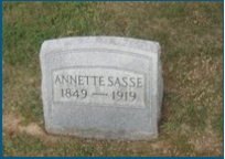
CSI member Troy Jones of Clinton, Indiana has purchased this envelope with Erie Canal stamps on it. It was from the Wabash Valley Stamp Club and was canceled October 31, 1987 in Terre Haute, Indiana. Although the stamps were for New York’s Erie Canal, the envelope also has a map of Indiana’s Wabash & Erie Canal showing how Terre Haute was connected to Lake Erie at Toledo, Ohio and the Ohio River at Evansville, Indiana.
Lagro Feeder Dam Marker
A marker for the Wabash & Erie Canal Feeder Dam No. 2 across the Wabash River in Lagro, Indiana is up. It was placed in a beautiful location in a small park overlooking the river.
The dam was constructed around 1835-36 to pool water that was fed into the main-line canal and kept it at a 4 foot depth from Lagro in Wabash county to Peru in Miami county, Indiana. There were four of these dams built across the Wabash River for that purpose. Feeder Dam, No. 1 was located at Huntington, Huntington county, Indiana; No. 3 was at Peru; and No. 4 was at Pittsburg in Carroll county, Indiana. Further down the canal creeks were used instead of the river as its flood plain was just too wide.
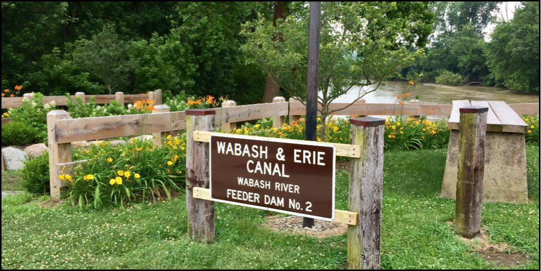
Tom Castaldi, CSI director from Fort Wayne and Allen County historian, spent hours trying to make contacts to get this marker placed. Beth Stein referred him to Jo Ellen Studio and then Amy Ford. With the help of Brian Haupert, Amy was contacted leading to Louis Studio. Lou operates the Interurban Ice Cream Shop in Lagro, a very busy place. Once Tom reached Lou, Lou was very enthusiastic. He met with Tom and was shown where the dam was once located. Lou then coordinated with Amy Ford and, after checking with local utilities before digging, the two got the sign installed. CSI thanks all who helped with this project.
Eel River Aqueduct Marker
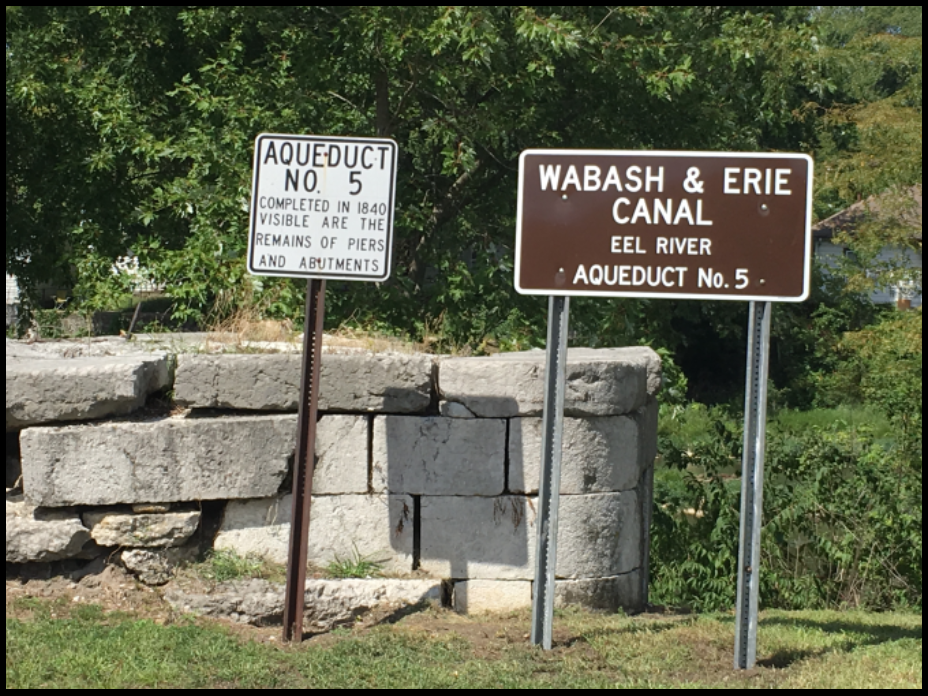
The CSI funded marker for Aqueduct No. 5 that carried the Wabash & Erie Canal across the Eel River in Cass County, Indiana, has been installed by Jim Crain, a member of the board of directors of the Cass County Historical Society. Tom Castaldi, CSI director, worked with Jim to get the marker erected. It was placed beside an older marker for the aqueduct and in front of one of its old south abutments that is located at the end of 5th street in Logansport.
The aqueduct had an open wooden trunk of 5 spans, 40-feet each for a total of 200 feet. It rested on stone abutments seen here and had piers, built on a solid rock foundation. The stone was of durable quality. When the river is low the locations of the stone piers are readily visible. The northern side of the aqueduct can be seen across the river.
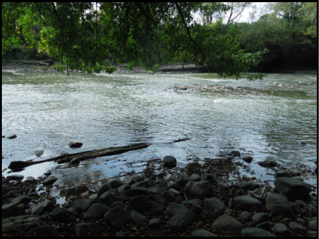
Feeder Dam No. 1 Marker
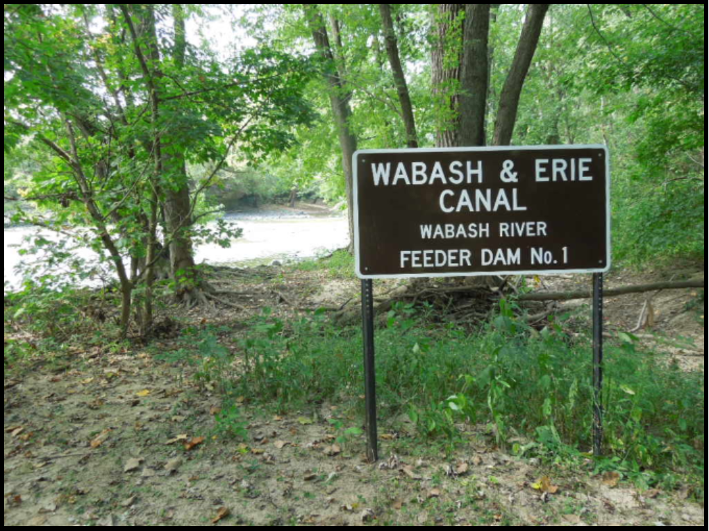 The marker for Feeder Dam No. 1, which was built across the Wabash River to back up water to feed into the Wabash & Erie Canal, has been erected. It is on the west end of an island that has formed in the Wabash River below where the Little River forks into the Wabash River.
Jesse Lynch Williams, Chief Engineer of the Wabash & Erie Canal, describes the dam in his 1847 report of mechanical structures: “Wabash dam No. 1, erected across this river one-half mile below the mouth of Little River, generally known as the “Forks”, for the purpose of a feeder. This dam is 220 feet long and 10 feet high, formed of cribs filled with stone, resting on a solid rock bottom. It is in a safe condition excepting the abutments, which being built of timber, are much decayed requiring renewal before the return of winter. The culvert and head gates by which the feeder is introduced into the canal, have just been re-built and are in good order. This feeder is three chains long.”
 To see the marker take U.S. 24 to 3011 West Park Drive, the Forks-of-the-Wabash park in Huntington, Indiana. Take the trail west, cross the bridge, and take the trail to the west.
The photos of the sign and the remains of the dam were taken by Bob Schmidt. The historic photo shows a man fishing below the dam.
CSI thanks Tom Castaldi for his work with the Forks park to get this marker erected.
Pigeon Reservoir Sign Erected
The CSI funded sign for the 1000 acre Pigeon Reservoir that was built to feed the Wabash & Erie Canal from Pigeon Creek at Port Gibson to Evansville, Indiana, has been erected by Preston Richardt and his crew. The sign is along County Road 4505 just west of Dongola, Indiana.
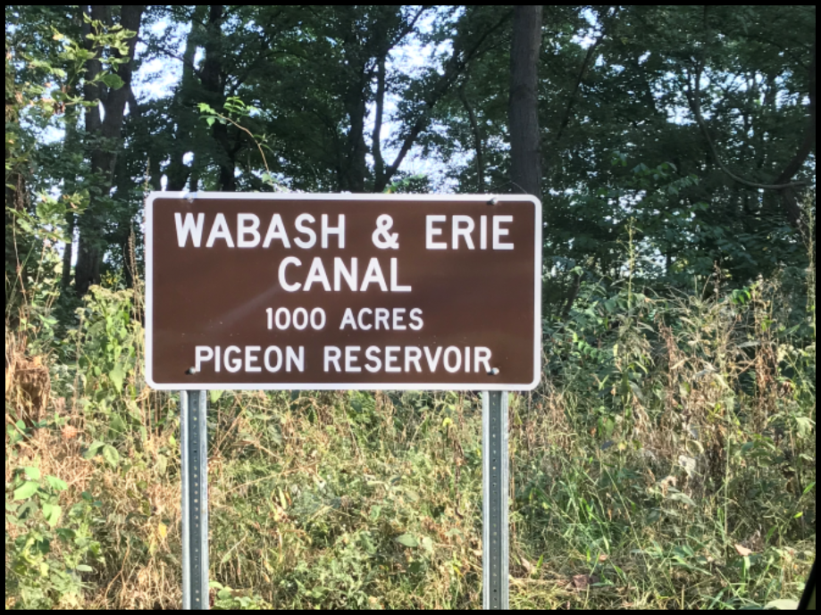 Canal construction crews built a dam across Pigeon Creek in the 1850s to create the reservoir. Today the land on the reservoir is farmed, but the dam still remains and the outline of the reservoir is seen in several places.
The Report of the Resident Engineer, William Ball, in 1853 describes the following about the reservoir: “The waste weir at the west end of the reservoir bank consists of timber abutments 66 feet apart, in the form of L’s with breast wall three feet high and longitudinal foundation timbers 2 feet apart filled in between and covered with stones. On the breast wall there are posts against which the plank rest, raising to top water line of the reservoir, and upon which there is a wide cap, on which a man may walk, to remove the plank when a large discharge is required. From the waste weir there is a ditch to convey the water gently down to the level of the creek bottom.”
Learning About the W & E Canal
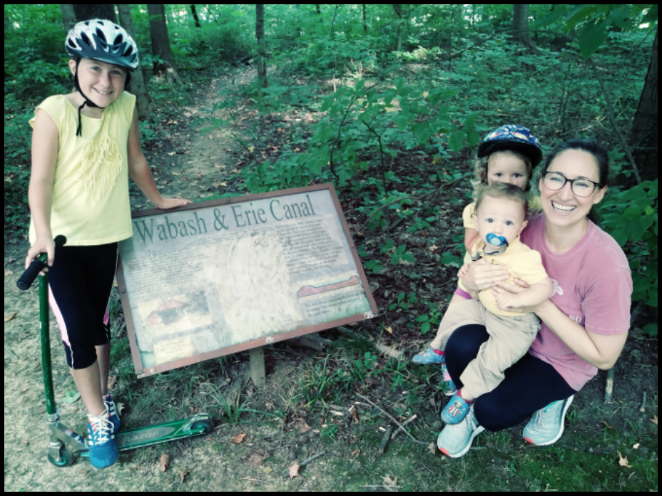
Katie Duerson of Lexington, Kentucky home schools her children. On Sunday September 1, 2019 she took Addison, Ada and Boone to Wesselman Park in Evansville, Indiana, to learn about the Wabash & Erie Canal. They are pictured here before a sign at the entrance to the canal towpath that runs along the north side of the park. Although very faded the sign shows a diagram of the canal bed and tells how horses pulled the canal boats. CSI hopes to place one of our new signs near this spot.
Bob and Carolyn Schmidt, CSI president and “The Tumble” coordinator, just happened to be in the park at the same time planning next spring’s tour. Addison was excited about having her picture on line in “The Tumble”. They encouraged her to visit the CSI website, learn more about canals, and write a report.
Remains of the Wabash & Erie Canal are very visible all along the park and further north along the Booneville-New Harmony Road. Portions of it are watered during the rainy season. A railroad track runs atop the old towpath.
Speakers Bureau
Fort Wayne – PEO
Bob Schmidt, CSI president, presented a PowerPoint program entitled “Exploring Indiana’s Canals” to 28 members of the Fort Wayne chapter of P.E.O., a philanthropic organization where women celebrate the advancement of women; educate women through scholarships, grants, awards, loans, and stewardship of Cottey College and motivate women to achieve their highest aspirations. They met in the conference room of the Lake City Bank at 1 p.m. on September 24. He talked about the Wabash & Erie Canal focusing on its structures, how they were built, and how they operated. He said Indiana’s canals greatly influenced the development of the state, especially the northern part of it.
He showed the ladies a 3-inch-thick slice of wood that had been part of the foundation of the Gronauer Lock. This was an unused slice of many slices that had been cut from a timber to decorate a wall of the new pavilion at Promenade Park in Fort Wayne. The Gronauer Lock was built in 1837-38. By counting the tree rings in the wood and adding that to the time the lock was built until today, they figured out that the tree was growing in the Black Swamp around the time of Jamestown, early 1600s.
Everyone received a map of Indiana’s canals, an article entitled “Why Build A Canal,” a diagram of a lock gate, and a diagram of a canal boat along with a CSI Q-card. Many questions were asked and answered by Bob. He encouraged everyone to take a canal boat ride either at Delphi or at Metamora.
Fort Wayne – Austin Family Reunion
Bob Schmidt presented his PowerPoint program “Gateway to the West: The Wabash & Erie Canal” to the Austin Families Association of American (AFAOA), a small family genealogical association focusing on Austin genealogies. He spoke in room Calhoun C/D of the Grand Wayne Convention Center in Fort Wayne, Indiana, on Saturday October 5, 2019 at 10:15 a.m. to 40 people. Everyone was given the CSI Q-card and the packet of material listed in the above article.
Although Bob had no records of Austins being involved with the canals, he talked about how many people from the east came to Indiana by canal boat to then take wagons trains further west and how important they were to the westward expansion of America. He told how the canal brought many great craftsmen to Fort Wayne and how it influenced the towns growth. He read the following from the Fort Wayne Times & People’s Press of August 16, 1845: The Canal. — Night before last some half a dozen boats arrived from the east, being the first arrivals since the water was let in. — They were loaded with immigrants, principally German and French.” He pointed out how many of the nation’s larger cities such as Chicago, Buffalo, Cleveland, Cincinnati, etc. grew up along canals.
Delphi’s Canal Days Festival
This year’s mid-summer Canal Days Festival in Delphi, Indiana was held on July 6th and 7th. It all started with the Lions Club street parade at 10 a.m. on Saturday morning and continued at Canal Park until 4 p.m. that day. It resumed on Sunday at 10 a.m. until 4 p.m..
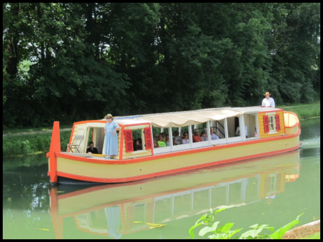
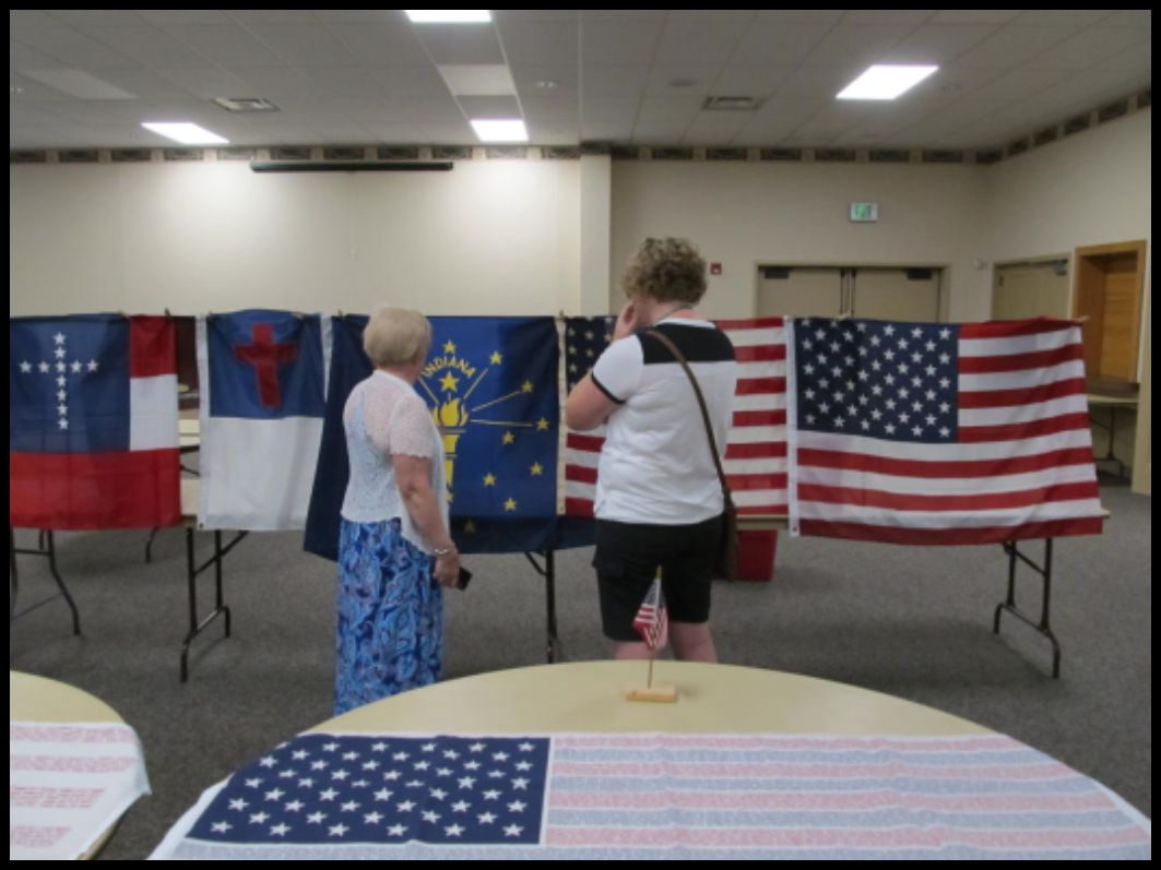
Activities included narrated rides on “The Delphi,” a replica canal boat; tours of the Case House and the Canal Museum; reenactors such as Daniel Boone; a display of historic flags; a bake sale booth and a beer garden; ponies, oxen and trolley rides; period craftsmen giving demonstrations and selling their wares in Pioneer Village; several new log buildings representing a bunk house and an Irish “shanty” used by canal construction workers; an 1880’s Post Office and a Railroad Depot; music; and lots and lots of delicious food.
You won’t want to miss next years Canal Days on July 4, 2020. There is always fun for all ages.
Photos by Mark Smith
Cleanup Day at Delphi’s Canal Park – Oct. 26, 2019
Many gardens in Delphi’s Canal Park and the adjacent “Historic Trails” need preparation before winter every year. A Fall Workday was held by the Canal’s Landscape and Trails team on Saturday, October 26th, from 9:00 a.m. to 12 noon to remove weeds and rake leaves before the snow falls. Volunteers of all ages came dressed appropriately in long pants, work gloves and heavy shoes. Some brought their own tools. Trail work included picking up sticks and trash and, in some places, removing downed limbs and pruning branches. They took pride in making trails look even better by raking the surface clear and exposing the crushed stone path. Following their work all volunteers were treated to a free lunch furnished by the Psi Lota Xi sorority.
In Memoriam: Albert Martin Auffart
 Albert “Al” Martin Auffart, (1948-2019), age 70 of Cutler, Indiana died unexpectedly Friday, July 10, 2019 near Delphi. He was born to the late Norbert and Delores (Uebelhor) Auffart on October 29, 1948 in Ireland, Indiana. Raised in Ireland, he was graduated from Ireland High School in 1966 and Purdue University in 1970. He married Martha Carroll Ault in 1970, who survives him.
Al lived with his family and worked in Illinois, Alabama, and Pennsylvania before moving to the Cutler area in 2006. Al was an executive in the transportation industry, retiring in 2005 from Great Lakes Transportation as Assistant Vice President of Finance and Treasurer.
Wherever Al lived he was very involved in his community. Before moving to Culter, he was president of a Jaycee Chapter, president and chairman of the Will County Historical Society, president of the Illinois Canal Society, president of Elizabeth Hanna Guild, and a member of Westmoreland County Historical Society. While living in Carroll County, Al was involved as vice president of Carroll County Wabash and Erie Canal Association, president of The Friends of Carroll County Parks, president and founder of Adams Mill, Inc. and member of Wildcat Creek Foundation. He was involved with the Carroll County Area Planning Commission, treasurer of Heartland Heritage, founding member of Promoting Wildcat Valley non-profit, and member of the Mid-West Tool Collectors Association, Carroll County Historical Society, National Trust for Historic Preservation, Canal Society of Indiana, and Indiana Landmarks.
Al is survived by his wife of 49 years, Martha. Two daughters: Theresia Auffart of Rossville and Megan Auffart of Cutler. Three sisters: Margie Staten, Marilyn Kunkler and Susie Brown, all of Indiana. Brother-in-law: Dan Reckelhoff. He is preceded in death by his parents and his sister, Joan Reckelhoff.
Visitation was held on Wednesday, July 24, 2019 from 4 pm to 8 pm at Wheeler Family Funeral Home-Baker Chapel, 204 South Center Street, Flora, IN 46929. A Celebration of his life will be held at a later date. The family requested no flowers. Donations may be given to Adams Mill or Wabash Erie Canal.
CSI & CSO Fall Tour:
“Going West – Exploring the National Roads in Western Ohio and Eastern Indiana”
By Carolyn I. Schmidt
Photos by Sue Simerman and Bob Schmidt
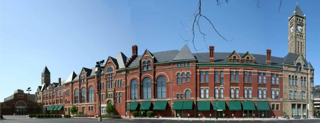
Canawlers from the Canal Society of Indiana and the Canal Society of Ohio met on Friday night at 5 p.m. at the Heritage Center of Clark County in Springfield, Ohio, for registration and a tour of the museum, which included excellent displays about the National Road and an old road mile marker. The museum is located in the beautifully restored 1890 Richardsonian Romanesque building that once served as Springfield’s City Hall/ City Market/ City Building. It is a block long, has an eight story clock tower, and was worth going to see on its own. It had many other outstanding exhibits and movies with one about George Rogers Clark, for whom the county was named.
At 7 p.m. Mike Morthorst, tour planner, showed slides of the sites to be visited on Saturday and explained how there were actually three National Roads. This tour would be of the main National Road and the Dayton Cutoff.
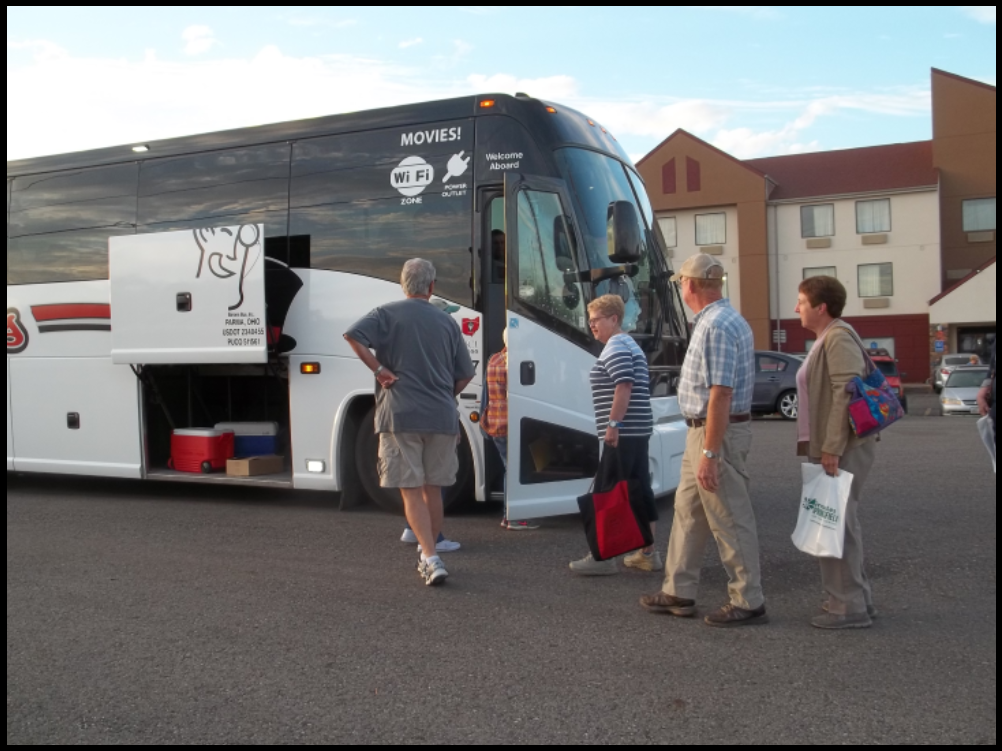
On Saturday morning canawlers boarded a coach at the Red Roof Inn and began an 84-mile-long journey from Springfield, Ohio to Cambridge City, Indiana. They stopped along the way at mile and historical markers, Madonna’s of the Trail, an Indian mound, covered bridges and canal sites. They learned the history of the towns that grew up along the National Road and Dayton Cutoff from Mike Morthorst and the tour guide book he wrote for the tour.
Springfield, Ohio
Stop 1 Wescott House
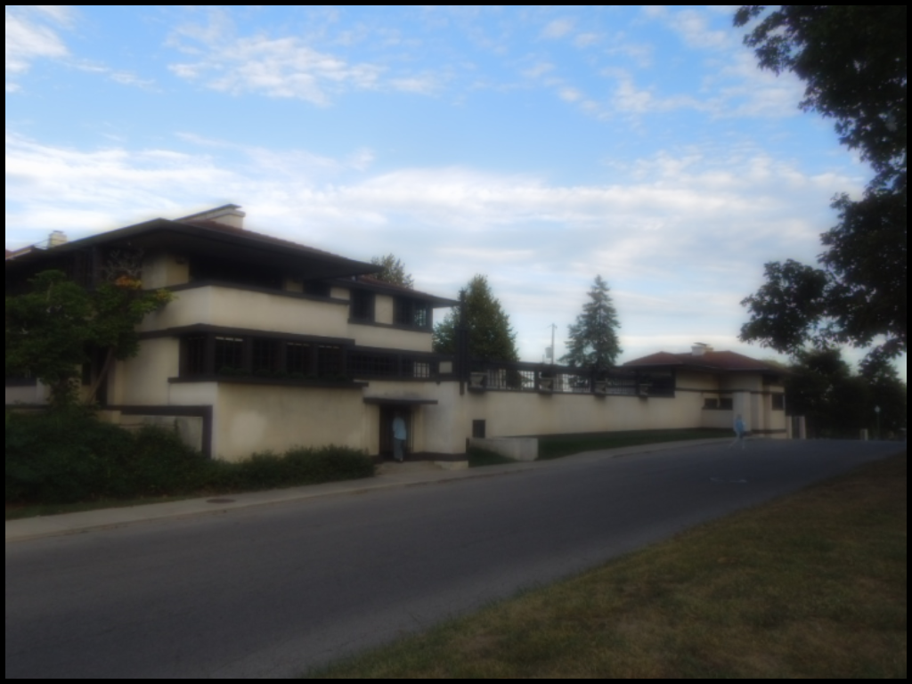 This Prairie Style home was designed by Frank Lloyd Wright for the Wescott family in 1907 and built for $15,000. Burton Wescott was born in Richmond, Indiana where he worked with the family’s carriage building business. He later ran the Hoosier Drill Company, which merged to form the American Seeding Machine Company that led to his move to Ohio. His home was restored in 2005 to Wright’s original design and is now a museum. Canawlers were encouraged to tour it on their own on Sunday afternoon.
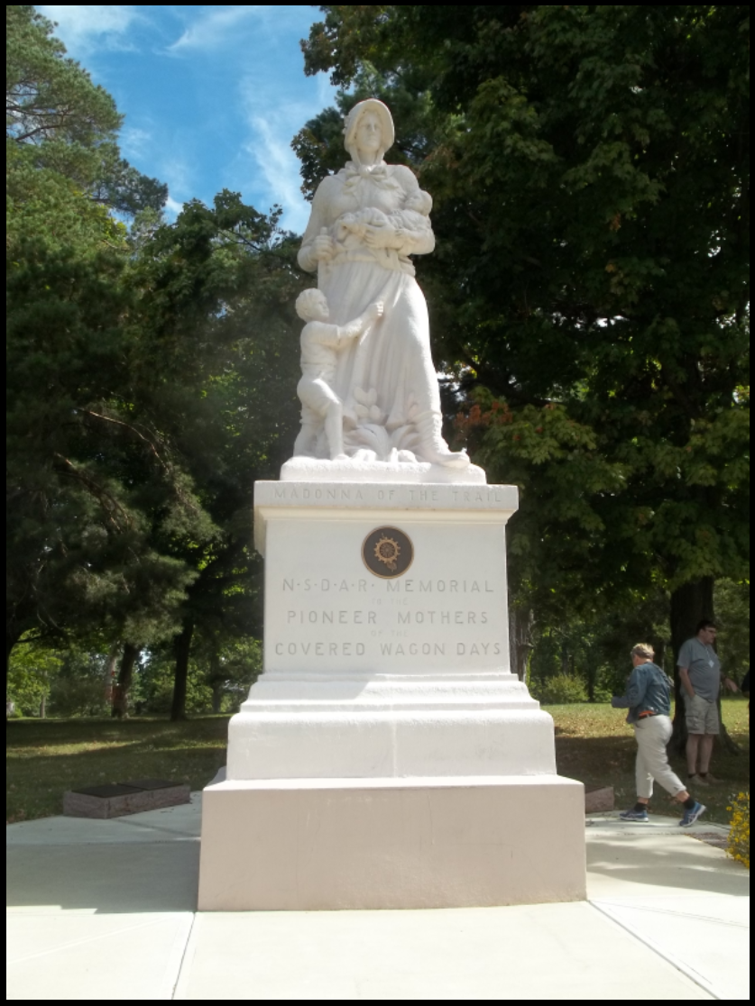
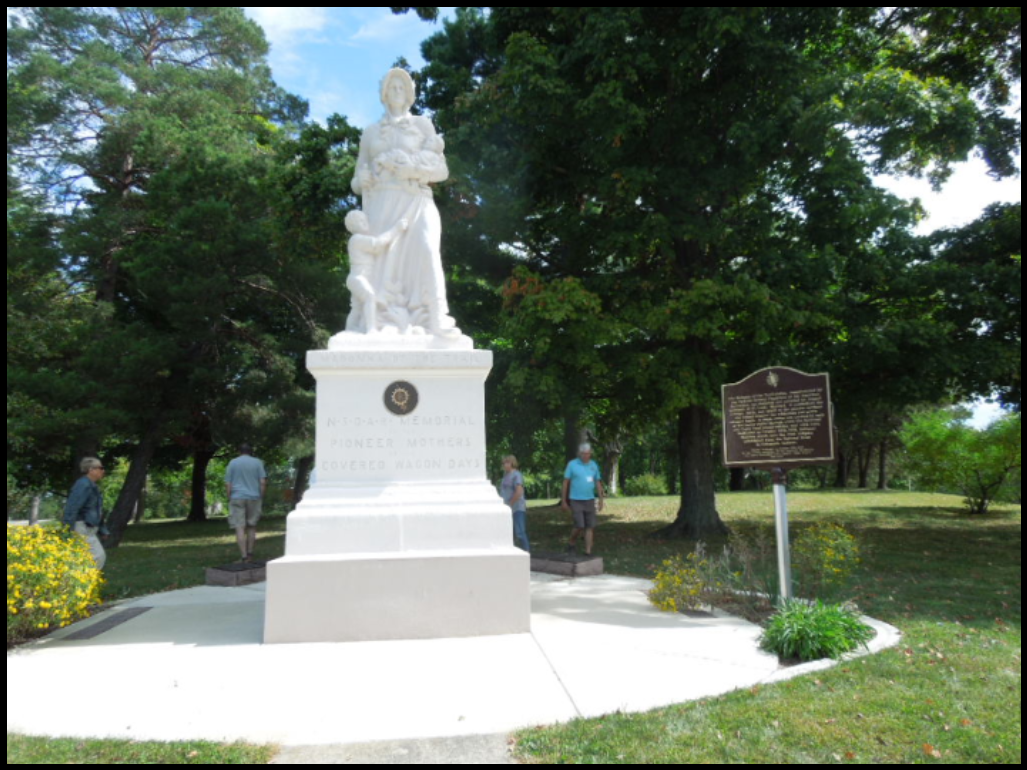
Stop 2 Madonna of the Trail
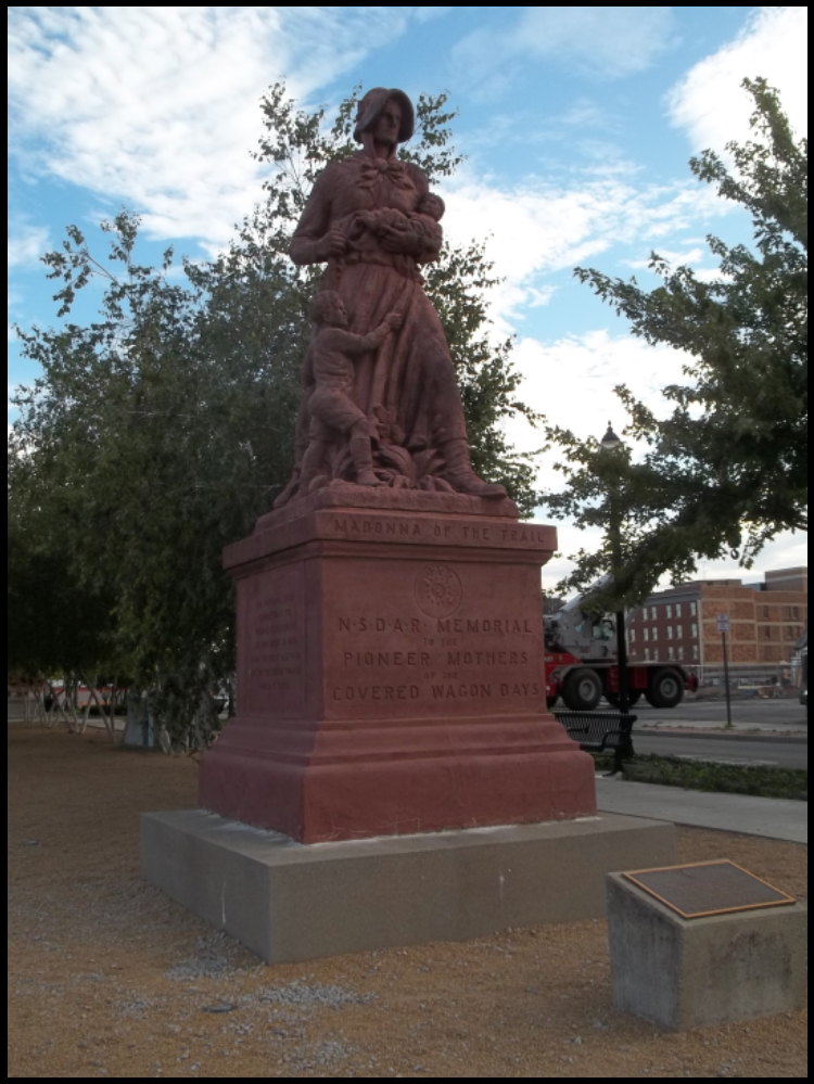 This statue was the first of twelve statues placed along what was to be called the National Old Trails Road. This road extended from Bethesda, Maryland to Los Angeles, California by combining the National Road with the Santa Fe Trail and Boone’s Lick Trail. It was developed by the Daughters of the American Revolution. A Madonna of the Trail was placed in each state through which it passed to replace the smaller mile markers. The statues can be seen in Bethesda, MD; Bealsville, PA; Wheeling, WV; Springfield, OH; Richmond, IN; Vandalia, IL; Lexington, MO; Council Grove, KS; Lamar, CO; Albequerque, NM; Springerville, AZ; and Upland, CA.
Inscriptions on the statue base say it was: “1. Memorial to the pioneer mothers of the covered wagon days., 2. The National Road completed by the Federal Government to this point in 1839. From this point westward built by the states through which it passes., and 3. Three miles southwest of here General George Rogers Clark commanding Kentucky frontiersmen vanquished the Shawnee Confederacy August 8, 1780 resulting in opening the Northwest Territory.”
The historical marker at the site says:
“Madonna of the Trail —In 1912 Congress appropriated funds for a new highway, the National Old Trails Road, or Ocean-to-Ocean Highway. The route crossed 12 states from Maryland to California following much of the National Road and the Sante Fe Trail. To celebrate the designation of the National Old Trails Road, the Daughters of the American Revolution commissioned 12 statues as a tribute to the pioneer women who braved the uncertainties of the great journey west. The sculpture depicts a pioneer mother with an infant on her left arm and a young boy at her feet, while holding a rifle in her right hand.
“Conceived by Arlene B. Moss of St. Louis, Missouri, the statue was sculptured by August Linebach. This specific monument, the first to be placed, was dedicated on July 4, 1928. In attendance was Harry S. Truman, President of the National Old Trails Association and future U. S. President.
“The original National Road extended from Cumberland, MD to Vandalia, IL. Often referred to as the Cumberland Road, it was constructed between 1811 and 1839. The road reached Springfield, Ohio in 1839.”
Also at the site was a Madonna of the Trail Plaque that said:
“The Ohio Society DAR on July 4, 2003, placed this rededication marker to commemorate the 75th anniversary of the Madonna of the Trail Statue. The statue has been restored through the efforts of Ohio Society Daughters of the American Revolution. Ohio Department of Transportation, City of Springfield, Ohio, National Trails Park and Recreation Department, Preservation support was also provided by: Target Stores and the National Endowment for the Arts, a Federal agency, as part of Save Outdoor Sculpture, a joint project of Heritage Preservation and the Smithsonian American Art Museum.”
The statue was moved on September 1, 2011 to a site at the newly developed National Road Commons Park in downtown Springfield. The Springfield Madonna originally stood near the Masonic Home at the west edge of Springfield, and then was moved to a site just to the east near the entrance of Snyder Park. The Snyder Park site was dangerous to access as there was no sidewalk and one had to park alongside a busy road and then jump a guardrail.
All of the Madonnas are identical. They were cast in an amalgam of crushed granite, stone, cement and lead ore known as “algonite.” A primary ingredient was a pinkish Missouri granite. The statue is 10 feet tall and sits on a 6 foot high base. A foundation of an additional 2 feet makes the monument 18 feet tall, weighing over 17 tons.
The coach then turned onto the Dayton Cutoff from the National Road. When the National Road was built, Dayton, Ohio didn’t like being bypassed, so its boosters privately financed a southern route through Dayton, which would reconnect with the National Road in Richmond, Indiana. The Pennsylvania House was between the National Road on its north side and the Dayton Cutoff on its south side.
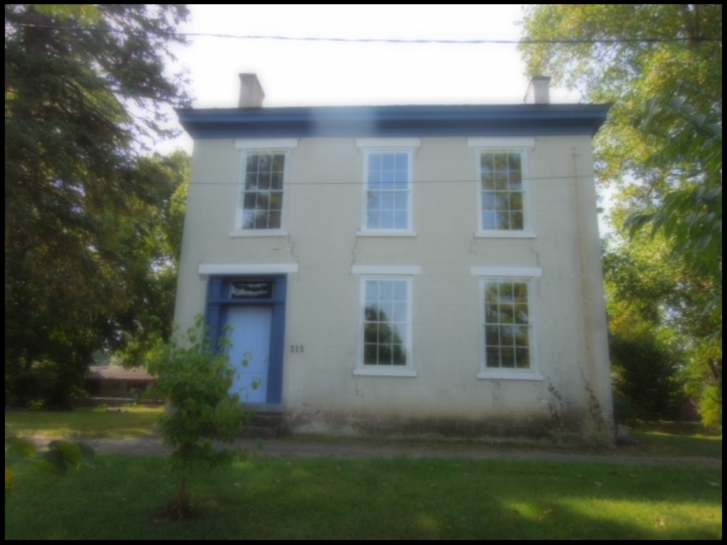
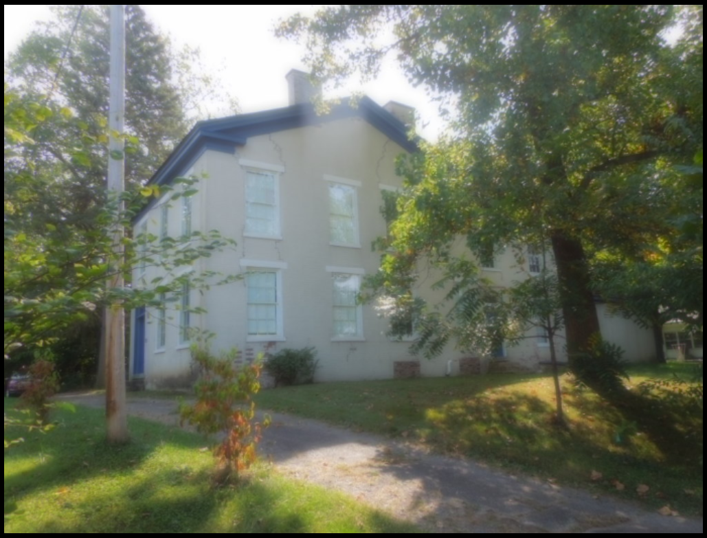
Stop 3 Pennsylvania House
The historical marker says: “David Snively built the Federal style Pennsylvania House in 1839 along the newly constructed National Road. This tavern and inn was an important stopover for livestock drovers and pioneers traveling by foot, on horseback, or in Conestoga wagons during the westward expansion of the United States in the nineteenth century. Dr. D. R. Issac K. Funk, of Funk and Wagnalls fame, lived in the house in the 1840s while his father served as its tavern keeper. Closed as an inn after the Civil War, it then served as a doctor’s clinic, boarding house, an second hand shop before falling into total disrepair. The Lagonda Chapter of the Daughters of the American Revolution saved it from demolition and has owned and operated it as a museum since 1941. The Pennsylvania House was put on the National Register of Historic Places in 1972.”
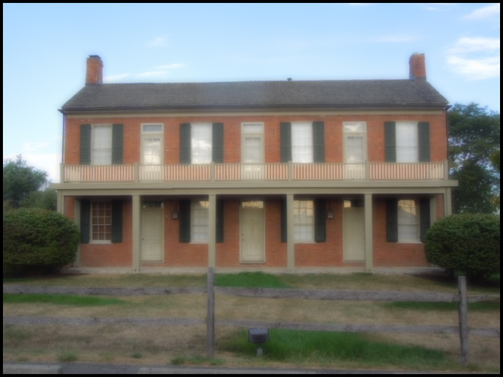
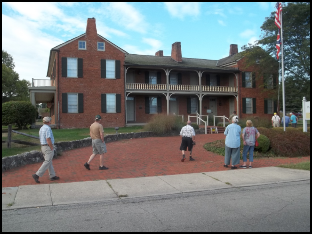
The reverse side of the marker says: “The National Road — Authorized by Congress in 1806, the National Road was the nation’s first federally funded interstate highway. National leaders desired an all-weather road across the Allegheny Mountains in order to develop close political and economic ties between the east and west. Considered to be a significant engineering feat, the Road opened Ohio and much of the Old Northwest Territory to settlement, provided access for Ohio goods to reach eastern markets and enable Ohio citizens to play important roles in the affairs of the new nation. The National Road was renowned for the number of quality inns and taverns during the heyday of the stagecoach. The Road declined after 1850 as railroads became the preferred method of travel. The automobile, however, brought new life to the Road. Reborn as U.S. 40, it became a busy twenty-four hour-a-day artery, with truck stops, motor courts, and diners until superseded by the interstate highways in the 1960s.”
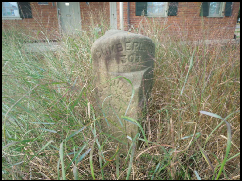
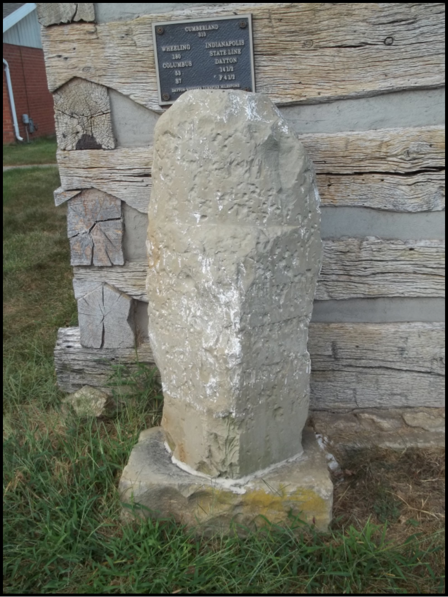
Mile marker 303 currently outside of the Pennsylvania House was originally 1 mile to the east at the Masonic home. It says Cumberland 303 and Columbus 44 and Springfield 2. Although similar to a Dayton Cutoff marker, we know it is for the National Road since it has no one half mile increments. Mile marker 302 that once stood across the road from the Pennsylvania House has been lost.
The coach then proceeded to Enon, Ohio to see the Indian mound.
Enon, Ohio
Stop 4 Enon
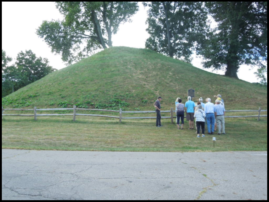 Several markers gave the history of the mound saying: “Enon Adena Mound —First settlers in the area were the Adena Native Americans, known for their mounds like the one in Enon, Ohio. Adena, Hopewell, and Fort Ancient cultures developed earthworks, circa 52 B.C.—1500 A.D., those three nations were located in much of the Ohio area.
“The Shawnee Native American Nation later moved into this area. One village was located north of Enon where George Rogers Clark Historical Park is located. The legend says General Clark’s troops climbed the Enon mound to reconnoiter the area, looking for the Shawnee. It is said in the 19th century young men dug into the mound and found a room of rock at the bottom. Nothing else was found.
“The mound was located on what was later known as Knob Prairie Mound Farm, in the early 1900’s. The mound became the center of a large dirt racetrack. The mound is over one acre and 574 feet in circumference and 40 feet high, the second tallest conical mound in Ohio.
“It took about one million trips with baskets of soil from the riverbed to construct the Enon
Mound.. Miamisburg-Mound in Miamisburg, Ohio is tallest at 65 feet.”
Another marker said: “Adena Mound Enon, Ohio: National Historic Site —This Adena Mound is the second largest conical mound in Ohio. These large conical mounds are believed to be Adena while the many small or effigy mounds are Hopewell, a later culture.
This mound is the property of the village of Enon. Twelve other Ohio mounds are the responsibility of The Ohio Historical Society. For further information contact the Enon Historical Society or The Enon Library. 1989”
At the Enon Historical Society’s log cabin museum a marker for the Dayton Cutoff was seen that was in extremely poor condition. Luckily a plaque had been placed on the side of the cabin which said:

The coach then passed through the town of Fairborn, which had originally been the towns of Fairfield and Osborn. Then on to Dayton. Today there is a large railroad overpass on Third Street that was the route of the Miami Extension Canal. The Miami Extension was completed in 1828. In 1845, the Cooper estate built a “Basin Extension” Canal from the Dayton Basin and canal boats had a choice of routes to use in Dayton. The later closed in 1872.
Several historic districts were passed in Dayton before driving about 5 miles to New Lebanon, which is made up from the towns of New Lebanon and Johnsonville. Then the coach arrived at the last large community on the Dayton Cutoff — Eaton.
Eaton, Ohio
The Dayton Cutoff marker 349 at Eaton is shaped differently from the National Road marker and has half mile increments.
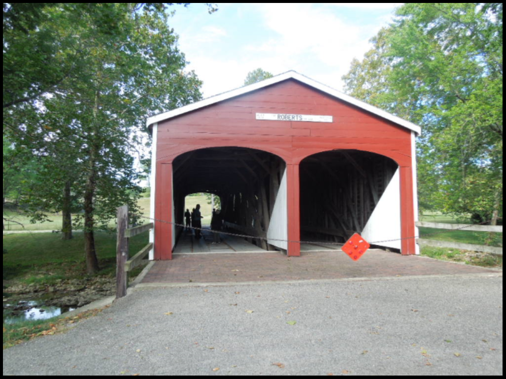
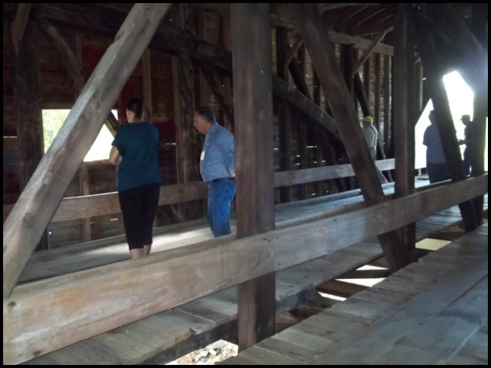
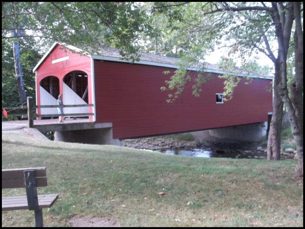
Stop 5 Roberts Double Barreled Covered Bridge at Eaton
The historical marker at this site said: “Roberts Bridge —This covered bridge is the oldest still [1962] standing in the state and the last of the “double-barreled” spans in Ohio. It was built across Seven Mile Creek on the old Camden Road in 1829-30 by Orlistus Roberts and J. L. Campbell. Its three burr-arch trusses built of native oak and poplar with a clear span of 73 feet, support the double roadway. This plaque has been erected to give due honor to the early timber covered bridge builders of Ohio and the important spans they constructed.
Burned by vandals in 1986, the heavily damaged bridge was restored and moved two and one half miles north into Eaton in 1991. Although not on the National Road or the Dayton Cutoff five of the Dayton Cutoff’s bridges were double barreled.
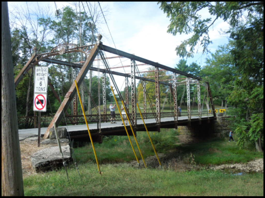
On the downstream side of the bridge was seen an iron bridge that was built by an Ohio bridge company and led to the country club. On the upstream side was a dam.
The coach crossed the Ohio/Indiana state line and proceeded into Richmond, Indiana.
Richmond, Indiana
Stop 6 Old National Road Welcome Center
National Road and Wayne county items could be purchased in the gift shop.
Stop 7 Madonna of the Trail
 The historical marker near the statue said: “The Madonna of the Trail statue, commissioned by the National Society Daughters of the American Revolution, was designed and sculptured by August Linebach of St. Louis, Missouri. It symbolizes the courage, faith, and spirit of the pioneer mothers who held conquer the wilderness and settled untamed lands. A single statue was created in each of the twelve states through which the National Old Trails Road passed uniting east with west.
The Indiana Madonna statue was painted a very light pink during its 2018 restoration. This makes its features more visible. The National Road was completed to this point in 1838. The Roads first toll gate in Indiana stood near this site. It is located in the 194 acre Glen Miller Park, named for Col. John F. Miller with “Glen” referring to the beauty of the park’s valleys.
Centerville, Indiana
Stop 8 Indiana’s Governor Oliver P. Morton’s home
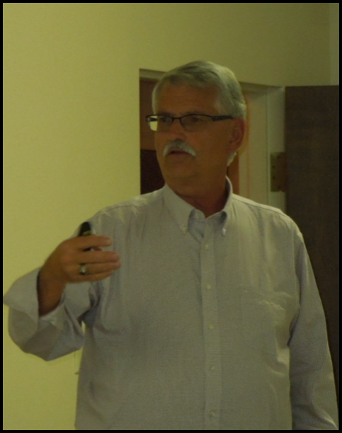
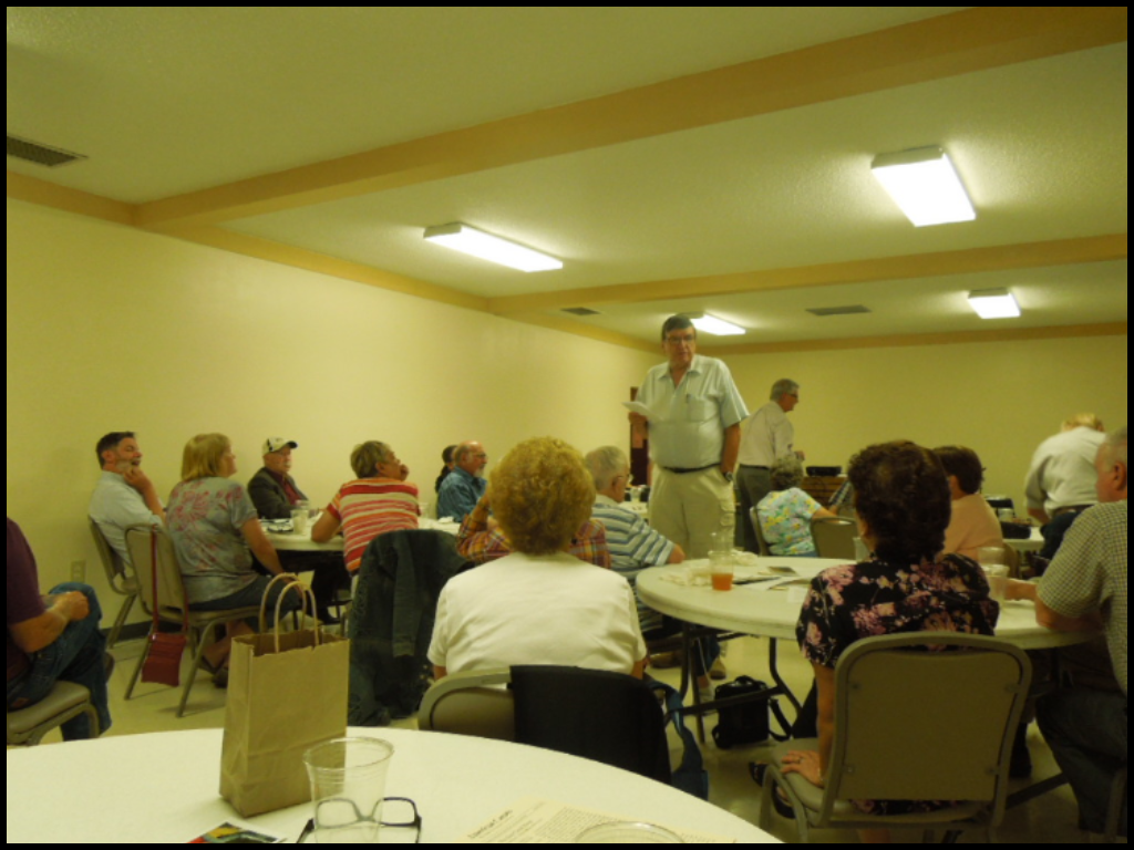
All the tour attendees were ready for a sit down lunch at Gov. Oliver Perry Morton’s home in Centerville. Barbeque sandwiches of pork and chicken, macaroni and cheese, coleslaw, potato chips and beverages were quickly eaten while Dr. Ron Morris, who is a History Professor at Ball State University and who is restoring the Morton home, talked about Governor Morton.
Known as Indiana’s great “War Governor,” just three days after the attack on Fort Sumter in July 1861, President Lincoln called for 75,000 men to crush the rebellion and the following day Governor Morton telegraphed Lincoln as follows: “On behalf of the state of Indiana, I tender you for the defense of the nation, and to uphold the authority of the Government, ten thousand men.”
Governor Morton lived in this home from 1857-1863. In 1867 he resigned as Governor to become a United States Senator, to which he had been elected by the Indiana Legislature. He was re-elected in 1873. Morton was born in Salisbury, Indiana in 1823 and died in Indianapolis in 1877. He is buried in Crown Hill Cemetery in Indianapolis.
Following lunch and the talk by Dr. Morris, canawlers had a chance to tour the Morton home. They saw the rooms that were restored and were told the restoration should be complete by April 2020.
The coach followed the National Road toward Cambridge City, but took a short trip south to the Ferris farm in Milton, Indiana
Milton, Indiana
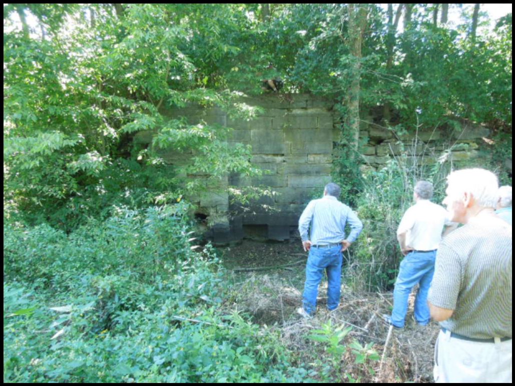
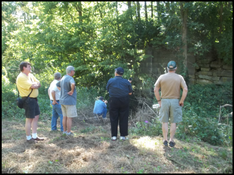
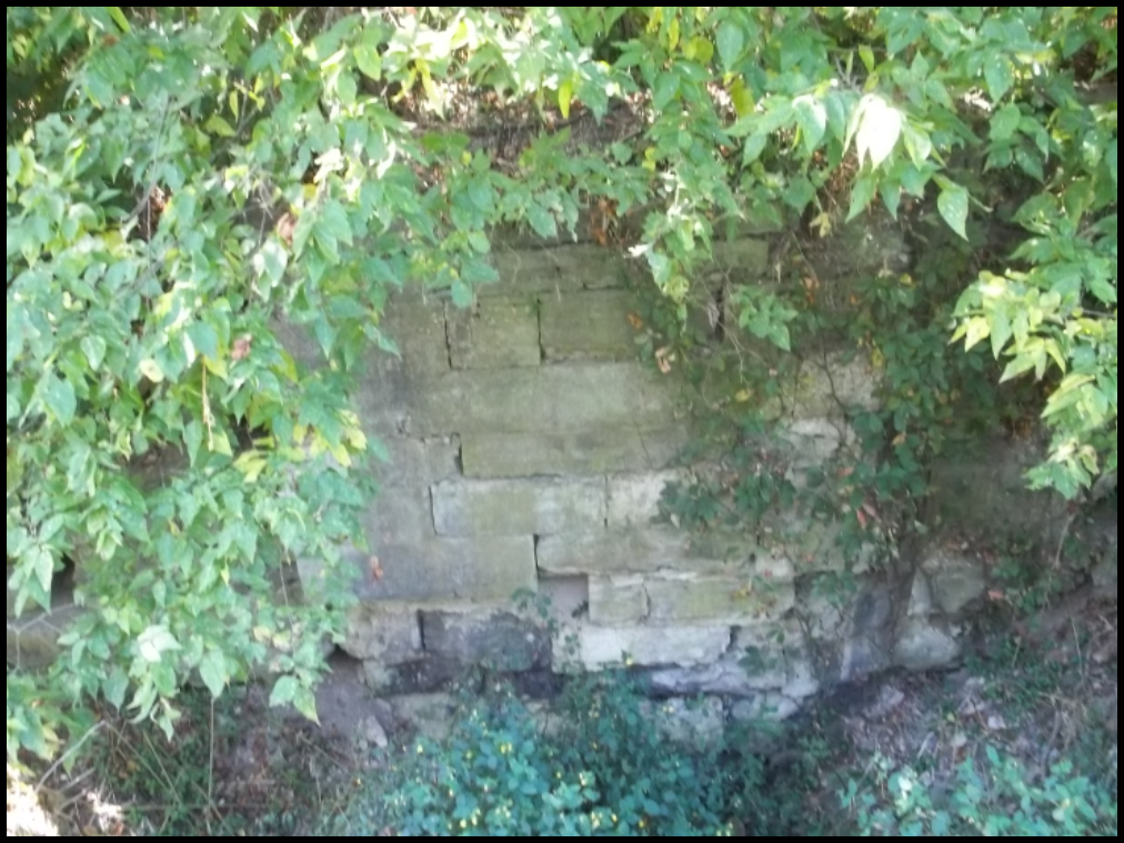
Stop 9 City Run Culvert & Lock 50
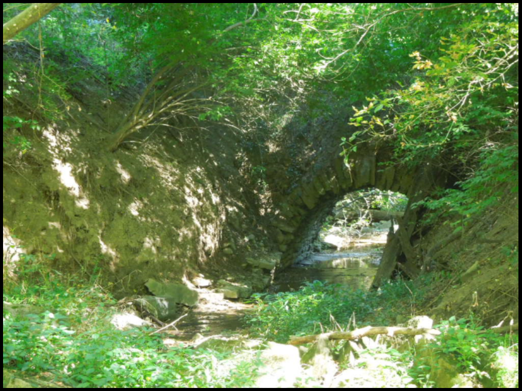
Mr. John Ferris lives on property owned by his mother that has two major structures of the Whitewater Canal—City Run Culvert and Lock 50. He had moved the grass in the canal prism, cut down brush to both the culvert and lock, and created paths by which to reach them. It was a rather long walk from the coach to both structures especially after a hearty lunch and the afternoon sun.
City Run Culvert carried the Whitewater Canal over City Run, a creek. Years ago a hole had been made in the canal prism above the culvert to drain the abandoned canal. Over the years the stones of the culvert began falling into the creek. Recently all of the culvert fell down except for the ends under the berm bank and the towpath. Canawlers scrambled down the banks to take pictures of it.
They then walked to the remains of Lock 50, a composite lock, which had cut stone abutments and a rubble stone chamber. The chamber was lined with wooden planks during canal times. Part of its tumble is still visible on the side opposite the west fork of the Whitewater River.
The Whitewater Canal was completed to Connersville, Indiana by June 1845 (9 years after ground was broken) and to Cambridge City by October 1845 at a cost of $473,000 to the canal company. The distance from Lawrenceburg to Cambridge City was sixty-eight miles. The merchants of Hagerstown banded together and completed it from Cambridge City to Hagerstown in 1847.
 The descent of the canal from Hagerstown to Lawrenceburg at the Ohio River, was 491 feet in 76 miles through 56 locks. Freshets (heavy spring rains) fell fast and furious washing out canal structures and embankments. Although the canal’s total cost was more than it ever received in tolls, it brought thousands of settlers into the state, furnished a cheap means of transporting produce to the Ohio River, and developed settlements along its course. As a hydraulic canal it furnished feeder-dam type water power to Connersville, Metamora and Brookville in Fayette County.
Cambridge City, Indiana
Stop 10 Vinton House
 The Vinton House was an old National Road and Whitewater Canal Inn. Its west wall ran diagonally along the basin of the Whitewater Canal. Nearby was a culvert under the National Road that was probably built later to join the Hagerstown portion of the canal to the main Whitewater Canal. It is likely that when the canal was in operation a bridge stood at this site.
Today a mural has been painted on the concrete block wall above the culvert showing how the canal basin once looked.
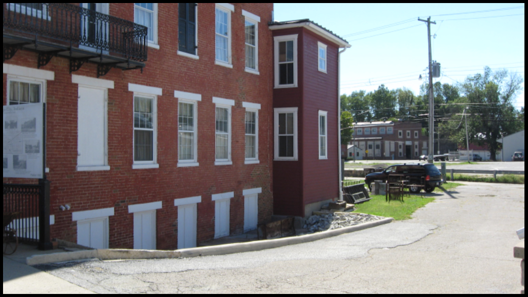
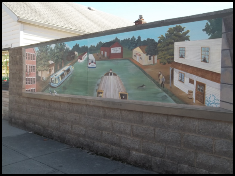
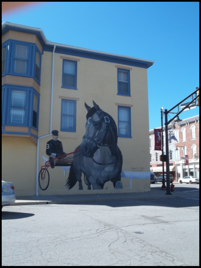
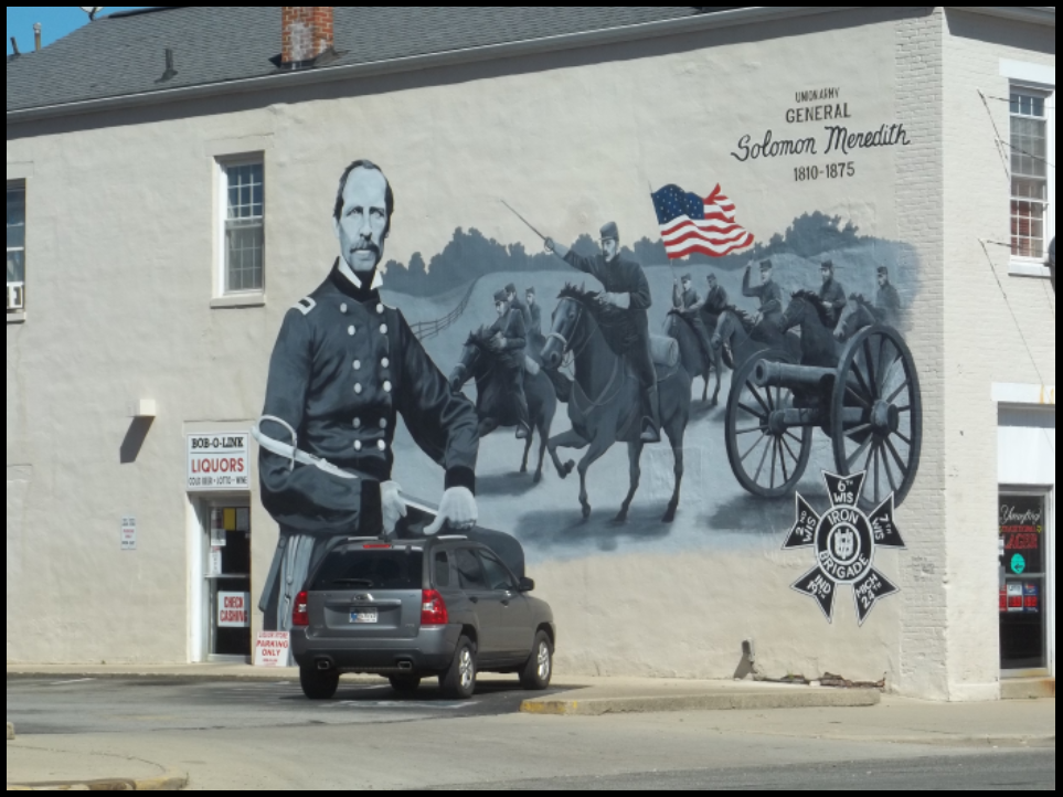
Canawlers visited the Whitewater Canal Museum on the third floor of the Vinton House. There they saw canal exhibits, as well as exhibits about the National Road, the Quaker Trace, the Underground Railroad, and the Republican Party that were prepared by Ball State University students. They also saw murals of Single G (a race horse), General Solomon Meredith (Iron Brigade) and the Lincoln Funeral Train along the National Road/U.S. 40.
It was time to head back to Springfield, Ohio. The coach followed the National Road and saw two National Road markers in Indiana before continuing onto the lonelier portion of the road that was not used as much due to the Dayton Cutoff. Along the way it stopped at Lewisberg.
Lewisburg, Ohio
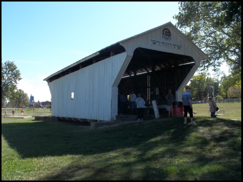
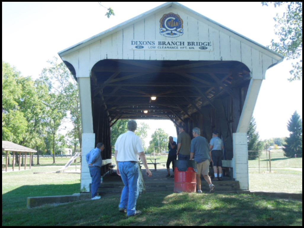
Stop 11 Dixon Branch Covered Bridge
Although not originally on the National Road this bridge was a good example of single-barreled bridges on the road. This type of bridge would have been found at Englewood and Tadmor but would have been much longer. It is now located in the Lewisberg Community Park.
The coach then took everyone across the Taylorsville Dam. At one time the ghost town of Tadmor was located 1.25 miles from the Taylorsville Dam. It was the junction of the National Road with the Miami & Erie Canal and the Dayton & Michigan Railroad. Then everyone returned safely to the Red Roof Inn where they had time to get ready for the banquet that night.
 Saturday evening’s banquet was held at the Knights of Columbus Hall in Springfield. After a meal consisting of a mixed fruit tray, meatballs, barbequed ribs and turkey, macaroni and cheese, a tossed green salad, rolls, garlic toast, iced tea and lemonade, everyone listened to and viewed slides of the restoration of Lock 1S at Lockington, Ohio by Andy Hite, site manager of the Johnson Farm and Piqua Historical Site.
Door prizes were won by Phyllis Hess and Sam Ligget. Bob Schmidt introduced the new president of the American Canal Society, Mike Riley, and its directors who were present, Bob Barth from New Jersey, Larry Turner and Mike Morthorst from Ohio, and himself from Indiana.
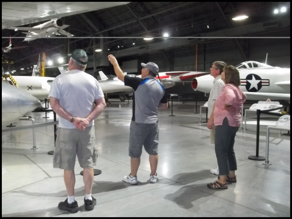
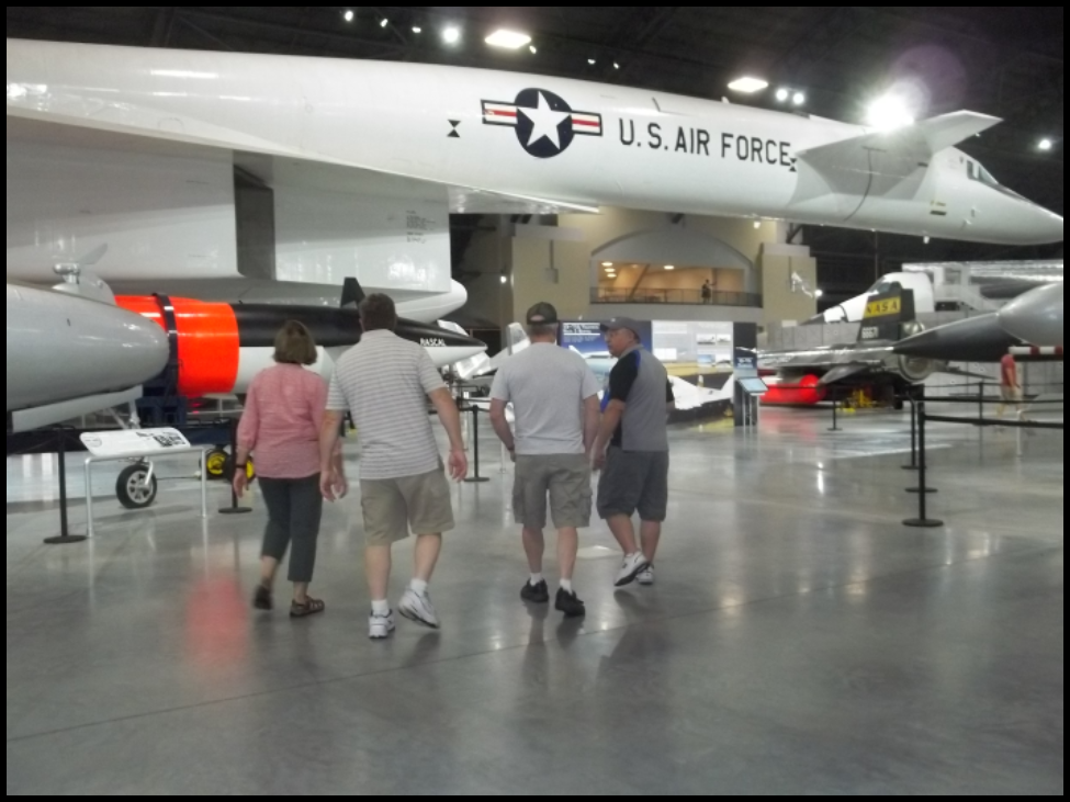
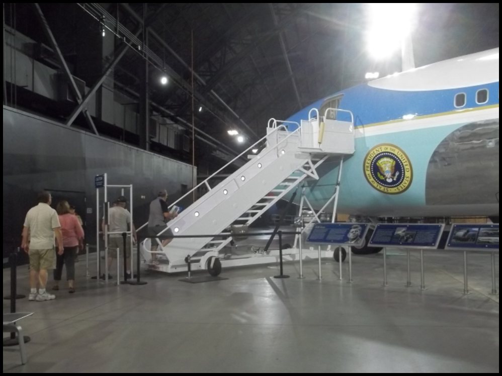
Mike Morthost thanked everyone for coming. He said canawlers had a choice of events for Sunday morning: A hike to Tadmor where the National Road intersected the Miami & Erie Canal or a guided tour of the National Museum of the U.S. Air Force in Dayton led by Mark Renwick.
 Sunday morning two couples met Mark Renwick at 9 a.m. to tour the Air Force Museum until 12:30 p.m. Besides learning the early history of aircraft, they got to go inside Air Force 1 (Eisenhower’s and JFK’s plane). While there they saw two charter buses of young people, who were dressed military style in dark blue pants and light blue shirts and spoke a foreign language, come into the museum. The huge museum had many other visitors as well.
This ended another successful tour. It was fun to meet old friends and explore new places.
Special thanks go to Mike Morthorst, CSI/CSO member, for planning the tour and writing the tour guide and his tour committee.